

Hike from Derborence to Ovronnaz: Variation of the Sanetsch-Muveran Trail
At the end of June, we spent two days in Ovronnaz to finally tackle the Grand Chavalard circuit – a tour that had been on my bucket list for a long time. Since stable mountain weather was also forecast for our travel day, we spontaneously decided to combine the trip with a sporty mountain hike. The idea: hike from Derborence to Ovronnaz via the Sanetsch-Muveran Trail. Said and done. You can read all about it in the following lines.
The Sanetsch-Muveran Trail
The Sanetsch-Muveran Trail is a challenging multi-day hike in three stages: it leads from Gsteig in the Saanenland over the Sanetsch Pass to the remote Derborence and further on to Ovronnaz. Over a total of 42 kilometers, more than 3,000 meters of elevation gain need to be tackled. The effort is richly rewarded – with impressive landscapes such as the bizarre limestone pavements of Tsanfleuron, the protected landslide area of Derborence, and many trail kilometers amidst a magnificent high-alpine backdrop.
The third and final stage, which we had planned for this day, also packs a punch: According to SchweizMobil, we can expect 17 kilometers, 1,350 meters of elevation gain, and 1,500 meters of descent. Will we manage it?
Starting the hike at Lac de Derborence
Our plan almost failed before we even started walking. Usually reliable public transport provided a dose of suspense: the transfer times in Bern, Visp, and Sion were tight – and the postal bus to the remote Derborence runs only every two hours. Not ideal, given that we already racked up a five-minute delay on the first leg from Zurich to Bern, which we «carried» all the way to Sion. In the end, a sprint saved us – we just barely caught the targeted postal bus.
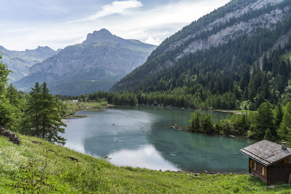
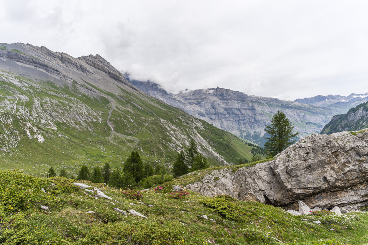
The last time I was in Derborence was in autumn 2013 – back then we took a leisurely loop through the protected mountain primeval forest. This time, the «Derborence» postal bus stop marks the starting point for our long ascent to the Col de la Forcle at 2,540 m a.s.l.

Long climb to Lac de la Forcle
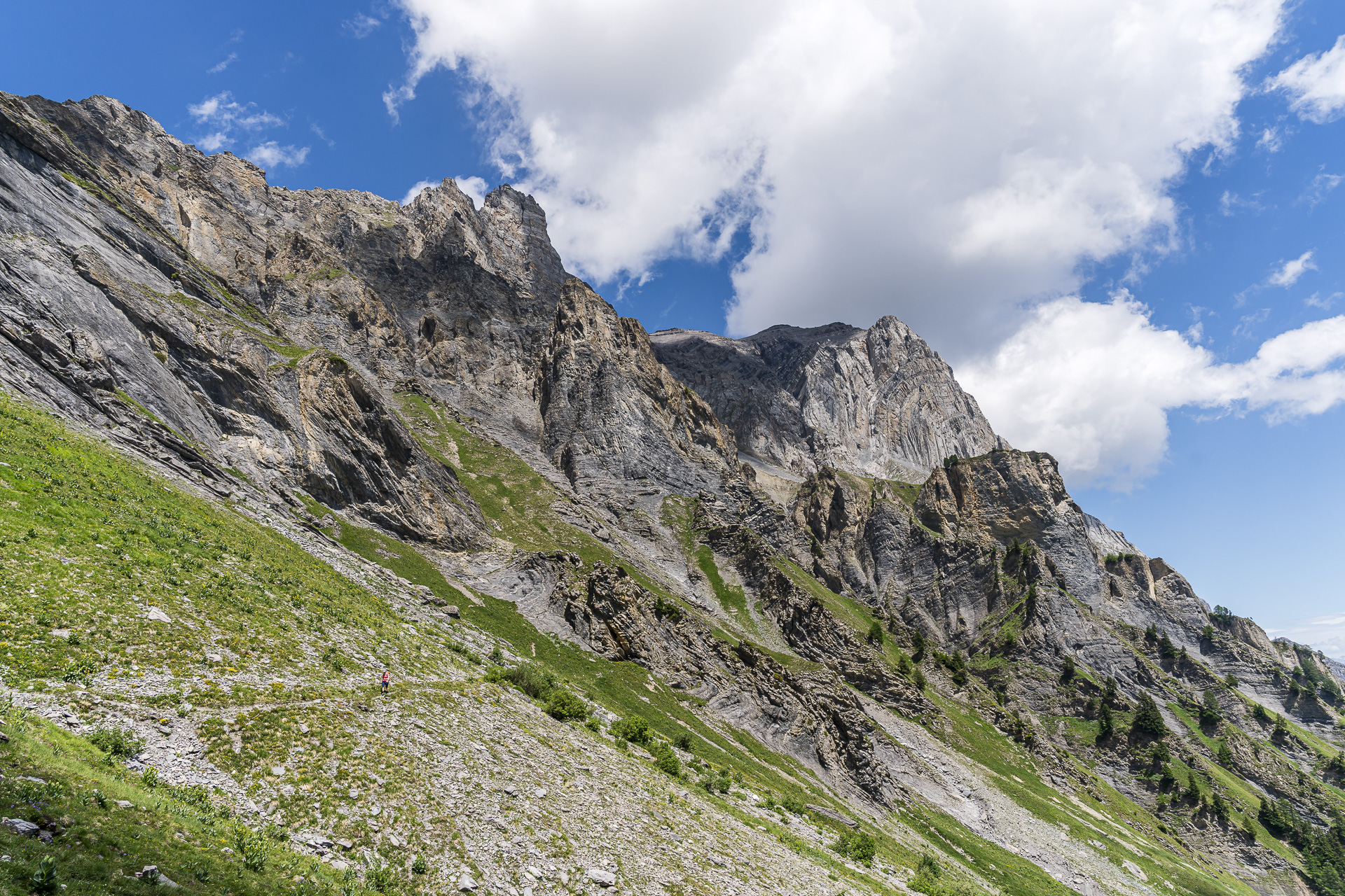
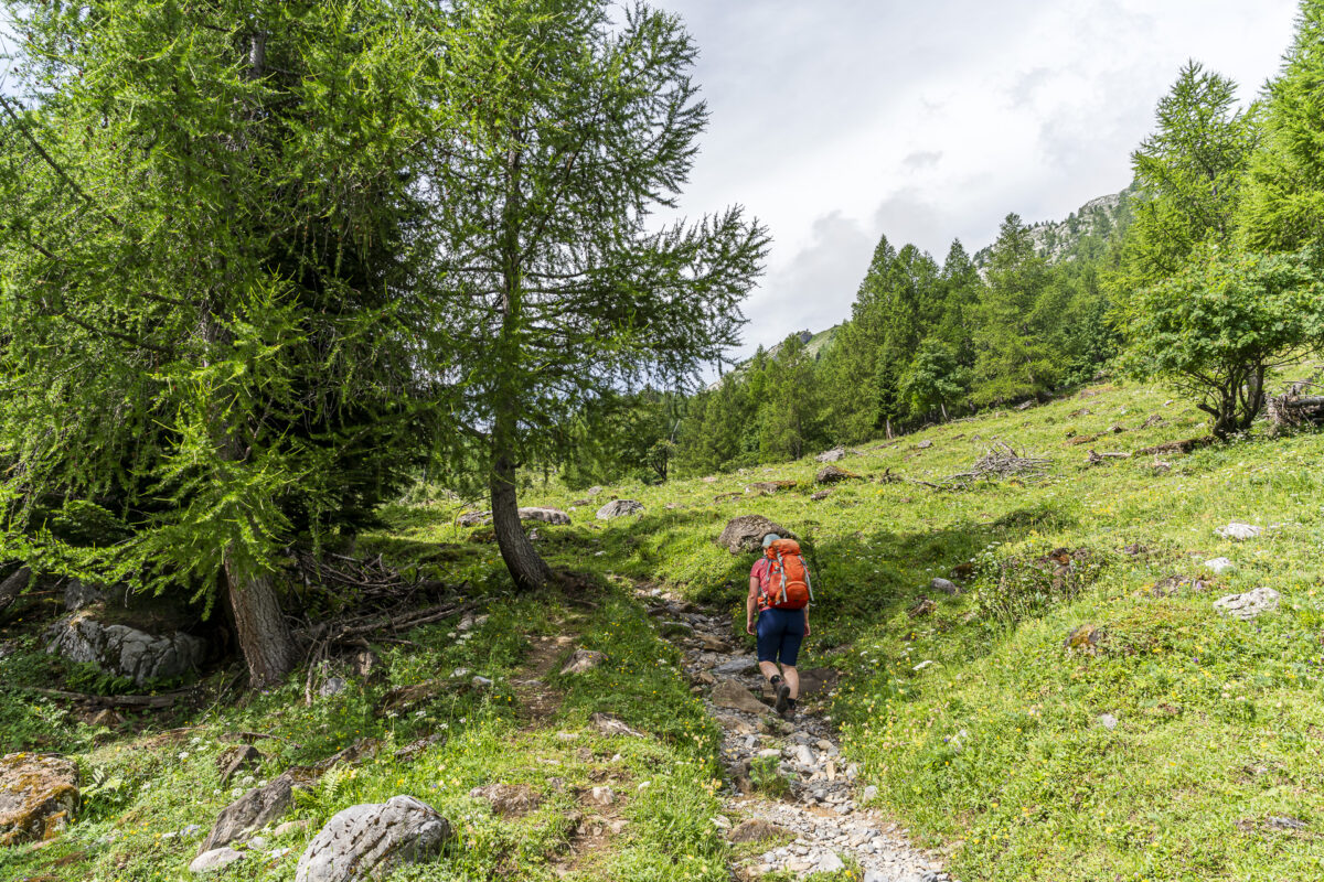
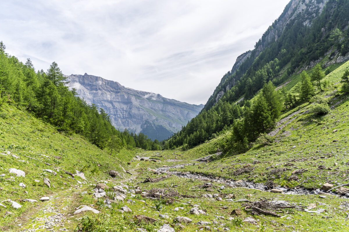
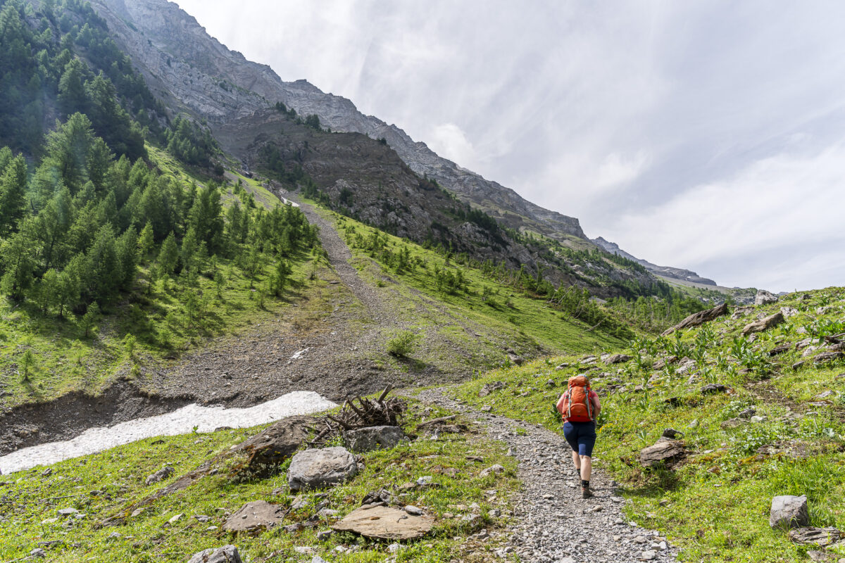
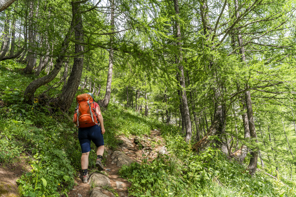
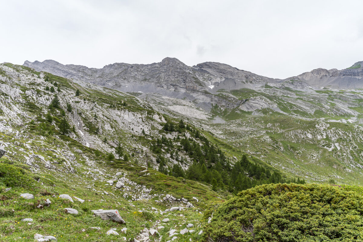
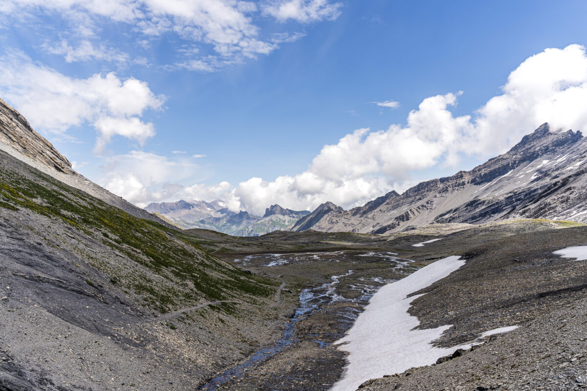
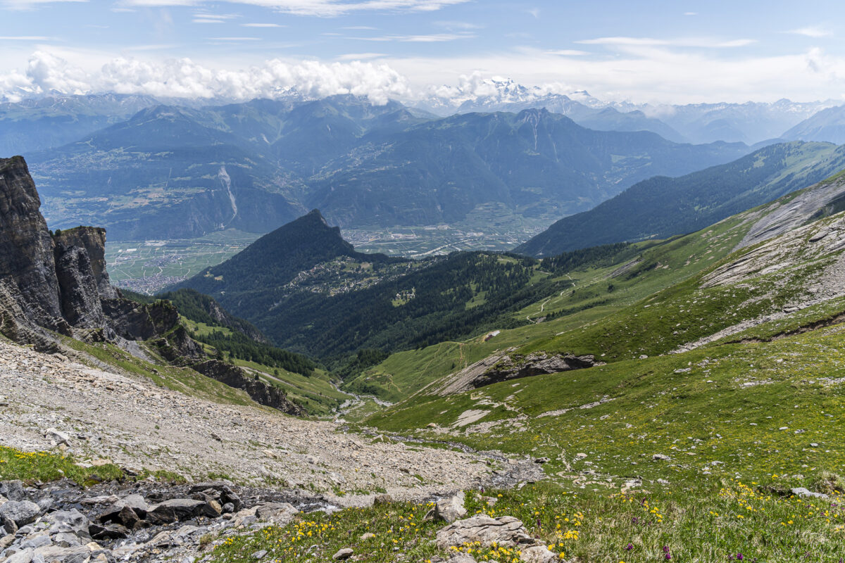
It’s 10:20 a.m. when we set off. Fortunately, the sky is overcast, but the air is already humid and oppressive. Our view for the next four hours: nothing but uphill! The mountain trail is well-marked and pleasant to walk – but still, the heat (and probably the travel stress) takes more of a toll on me than expected. For the next nearly nine kilometers and 1,100 meters of elevation gain, there are neither shortcuts nor alternatives. So, it’s a matter of step by step – steadily climbing through the barren, rocky valley of the Derbonne. And even though I’m battling the heat, it should be noted that the vastness of this remote mountain landscape is absolutely fascinating and beautiful.
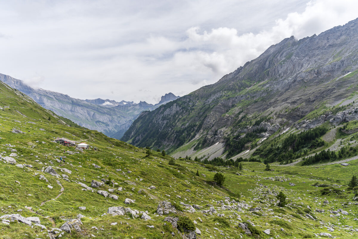
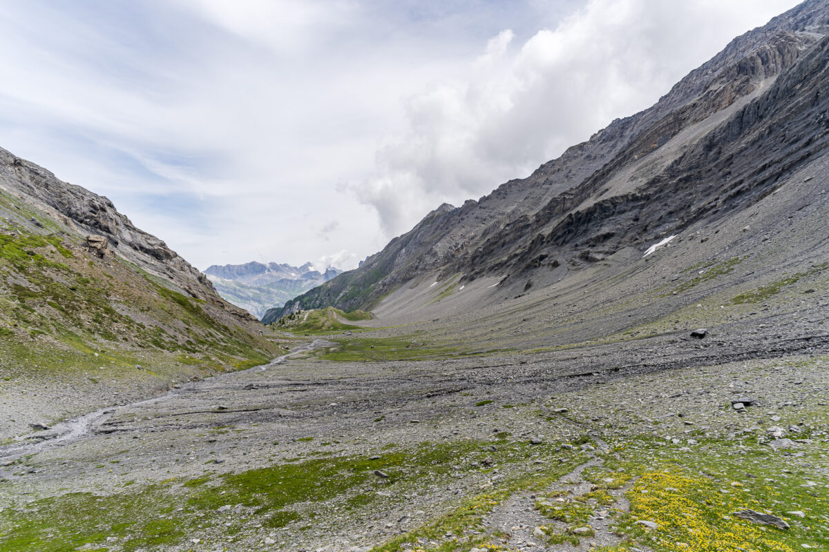
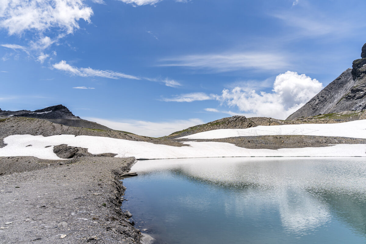
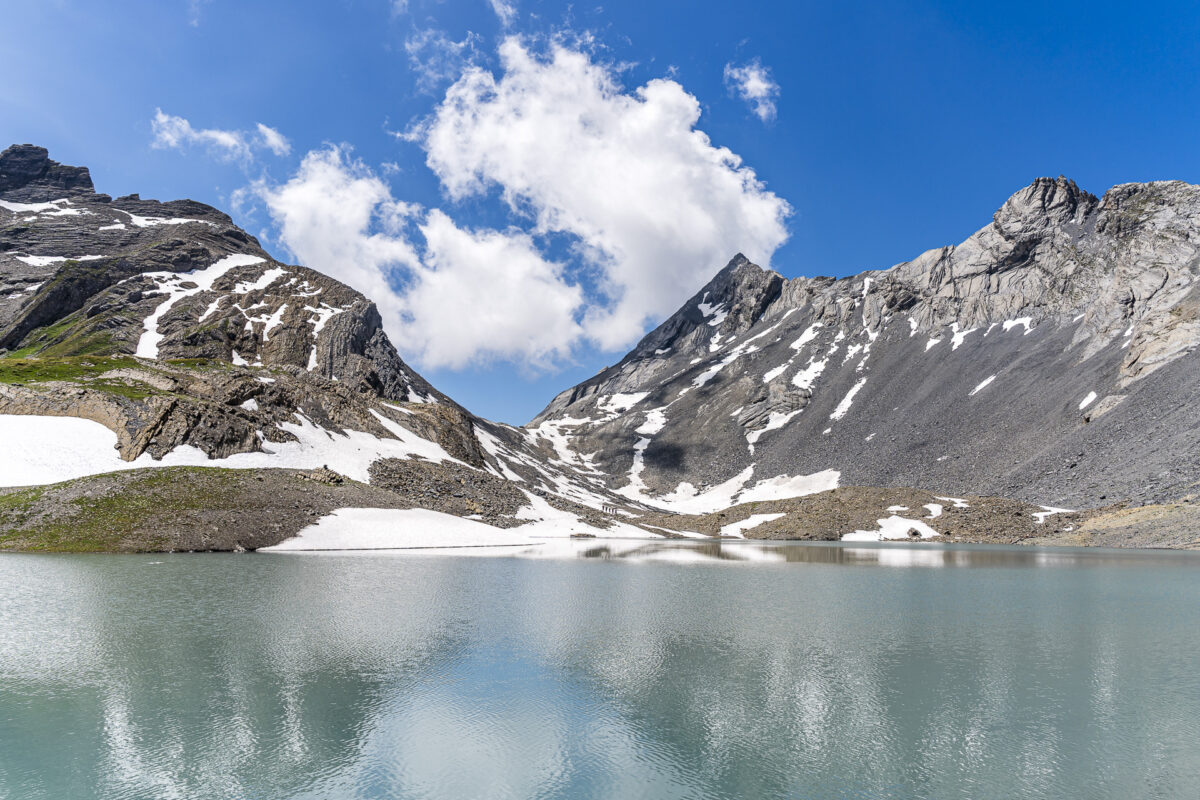
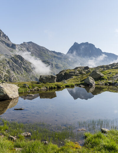
After about three hours, we reach the long-awaited intermediate destination at Lac de la Forcle. Just under 100 meters of elevation remain to the highest point. If you wish, you can shorten the route here and begin the descent to Ovronnaz via the Pas de Chamosentse. Looking at the north face of the Col de la Forcle, the decision is easy for me – I have no desire at all to cross snowfields.
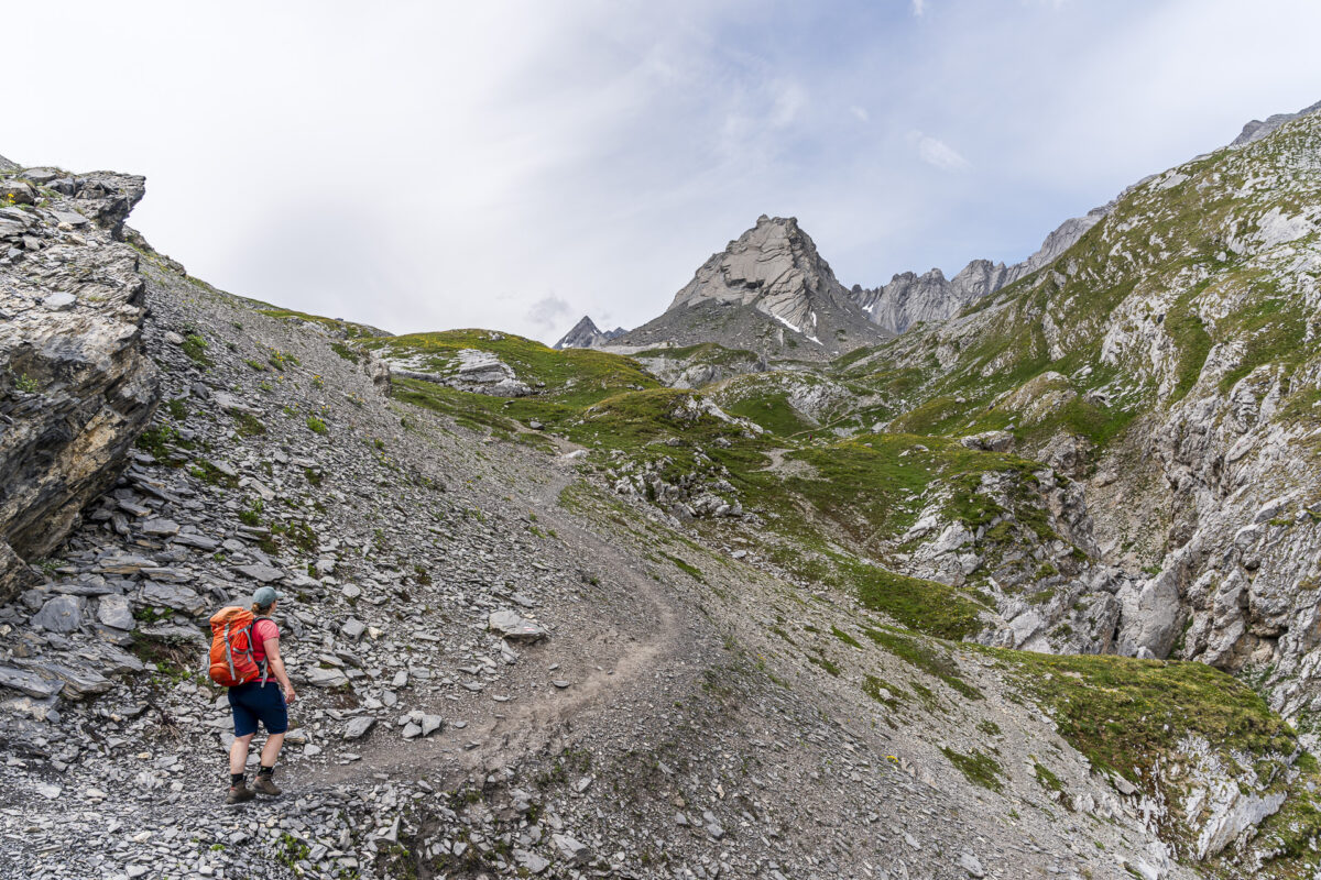
Over the Pas de la Chamosentse to Ovronnaz
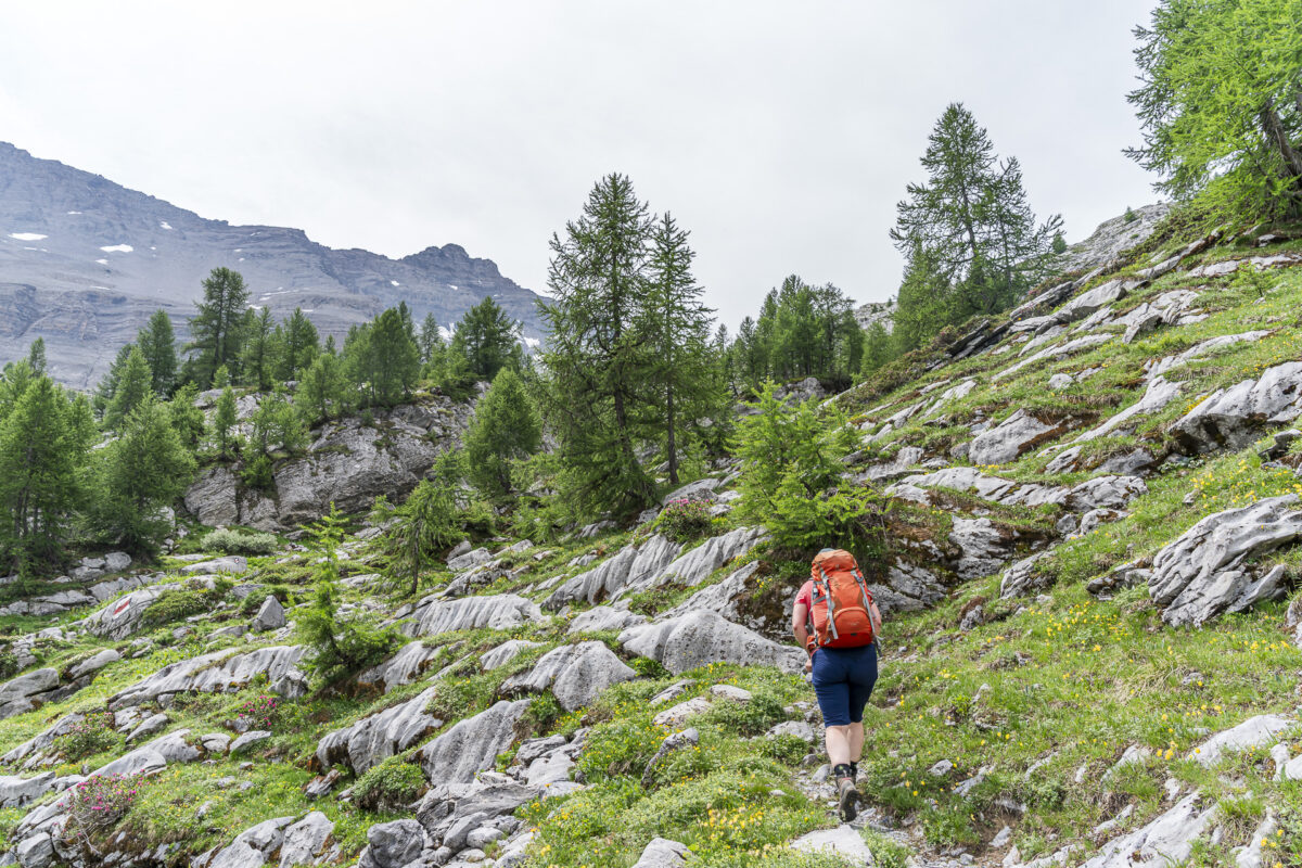
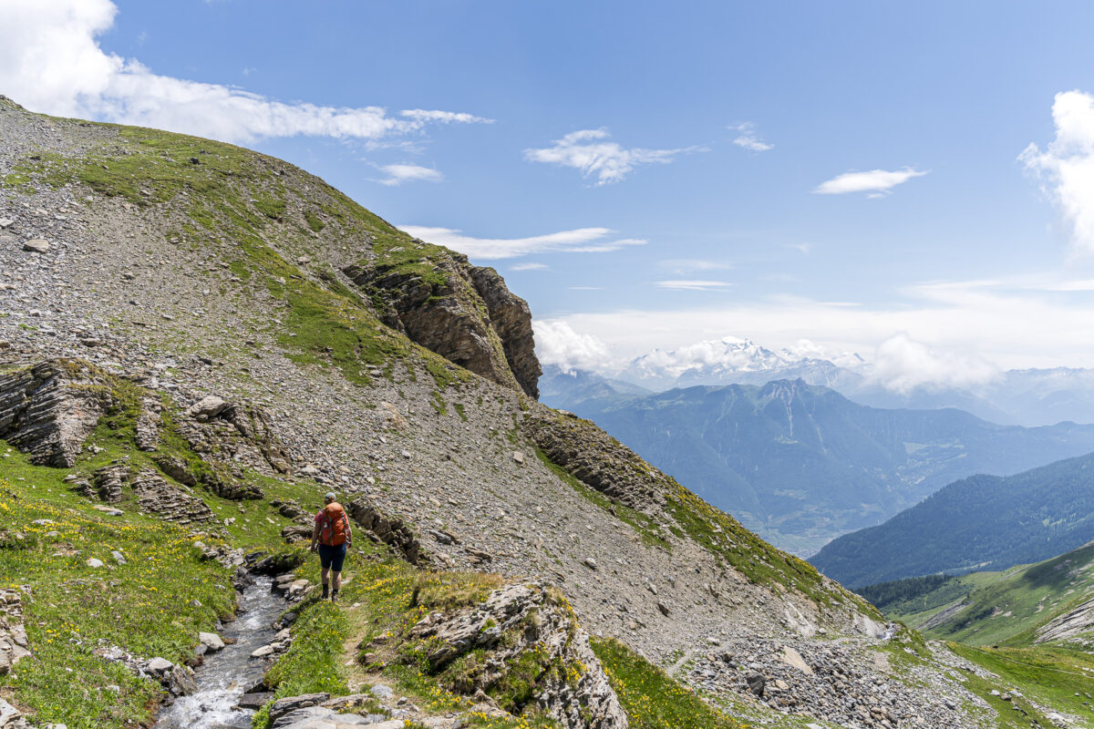
And so we follow the signpost toward Chamosentse and descend in steep switchbacks on a narrow mountain trail toward Ovronnaz. The first 300 meters of descent are tough and require concentration and surefootedness to avoid slipping. Crossing the Losentse also calls for a bit of agility. Afterwards, the terrain becomes more pleasant, and we can enjoy panoramic views of the four-thousanders of the Lower Valais along the remaining path via Loutze. Particularly striking: the snow-covered Grand Combin on the opposite side of the valley.


Key facts about the hike Derborence – Lac de la Forcle – Chamosentse – Ovronnaz
The following map shows the route of the hike from Derborence via Lac de la Forcle to Ovronnaz. It is consistently marked as a white-red-white mountain trail of difficulty level T2 to T3. The trail is well signposted and contains no technically difficult sections on the ascent. The descent is very steep and requires surefootedness. In addition, there are some sections that are somewhat more exposed. Due to the length and elevation gain, a good basic fitness level is recommended. I also recommend packing trekking poles.
| Starting point | Postal bus stop Derborence (1,465 m a.s.l.) |
| Accessibility | Accessible by public transport |
| Length | 16.6 kilometers |
| Elevation gain/loss | ↗ 1,159 m ↘ 1,282 m |
| Duration | 6:25 h |
| Destination | Postal bus stop Ovronnaz, croisée du centre (1,330 m a.s.l.) |
| Refreshments | Refuge du Lac Derborence, Gîte de la Chaux de Dorbon, and Buvette de Loutze (closed on Mondays) |
Practical tips for your hike on the Sanetsch-Muveran Trail
- You can reach the starting point of the hike by postal bus from Sion. The postal bus connection runs via Aven; i.e., at Sion station the bus is not labeled «Derborence» but «Aven». Note also that the section Aven – Derborence is served only during the summer months (from the end of June to the end of September) with three services per day.
- The Sanetsch-Muveran Trail on the ascent to Lac de la Forcle passes by the Gîte de la Chaux de Dorbon (approx. 1.5 h from Derborence). There you can get food and drinks.
- The best time for the Sanetsch-Muveran Trail hike is from late June/early July to mid-September. In higher elevations, snowfields can be expected until well into July.
Laisser un commentaire