

Vallée de Joux and Lac de Joux – excursion tips and ideas
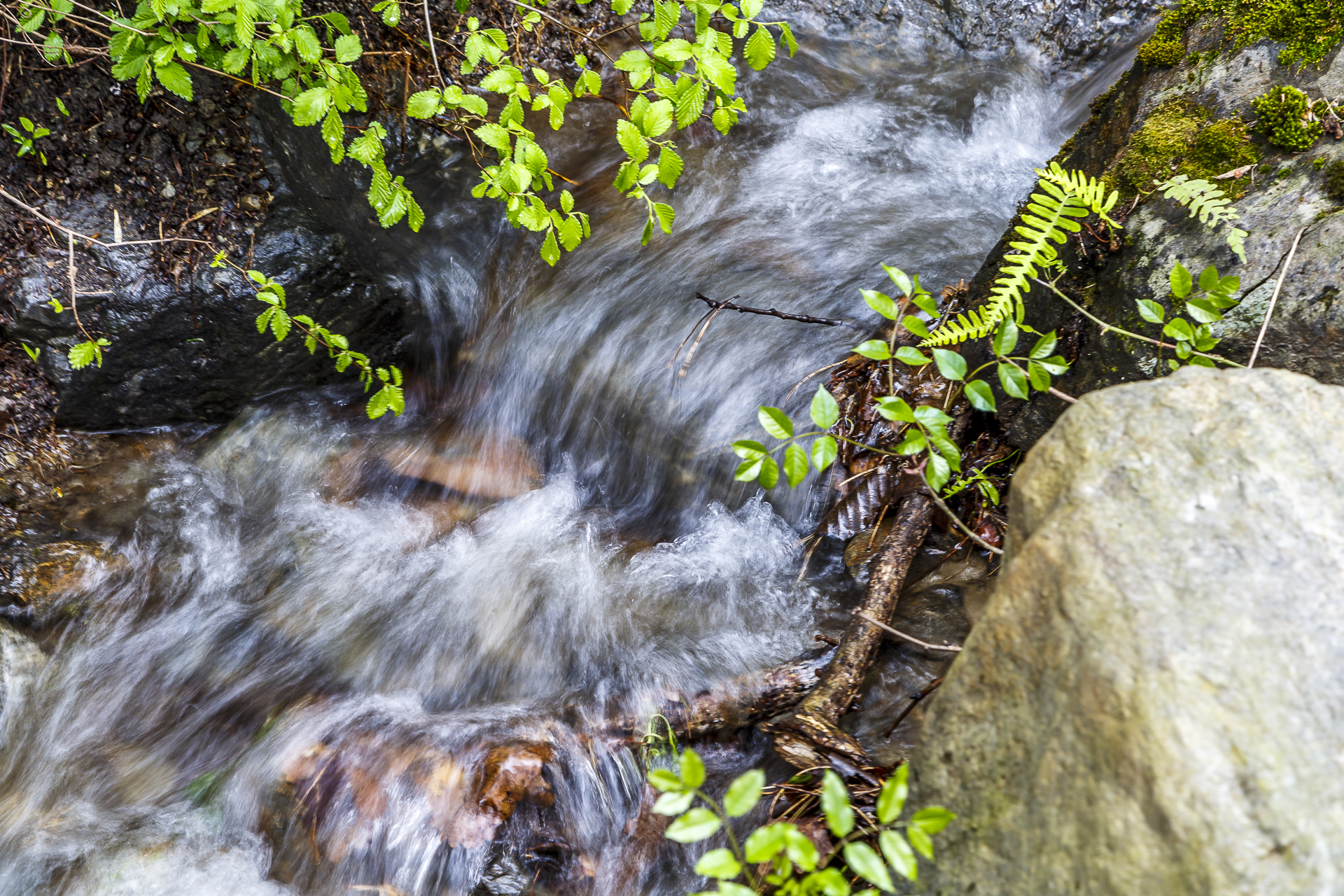
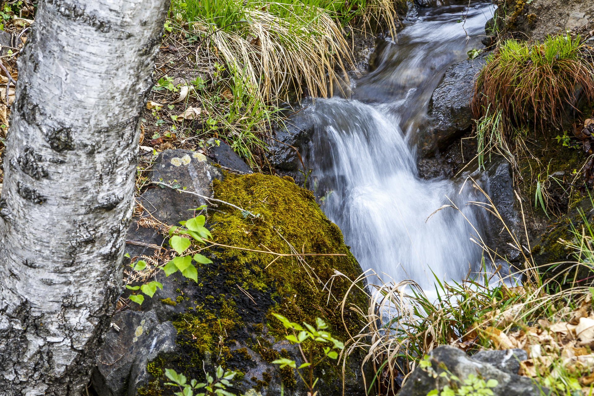
Bisses, bisses, irrigation channels. Three times the same, just called differently. Last weekend we learned that Val Venosta and Valais have striking similarities, not only in terms of their geographical orientation, but also in terms of their irrigation system. Both valleys are east-west facing, blessed with plenty of sunshine and surrounded by high mountain ranges. The Vinschgau Valley is bordered in the south by the Ortler Group, in the north by the Ötztal Alps and in the west by the Rhaetian Alps. In contrast to the mountain peaks with their snowfields and glacier tongues, which are saturated with precipitation year in and year out, only a few raindrops reach the valley floor. As in Valais, the mild weather with little precipitation has attracted people to the valley for thousands of years. And even then, they were innovative. In order to irrigate the dry fields with the meltwater, a unique system of ditches was created in both Valais and Vinschgau. The narrow watercourses – called “Waale” in Val Venosta – collect the meltwater and distribute it over the entire valley in a branching network of ditches. In earlier times, it was used to irrigate the grain fields, which earned the Vinschgau Valley the nickname “Tyrolean granary” and was the most important source of livelihood for the population.
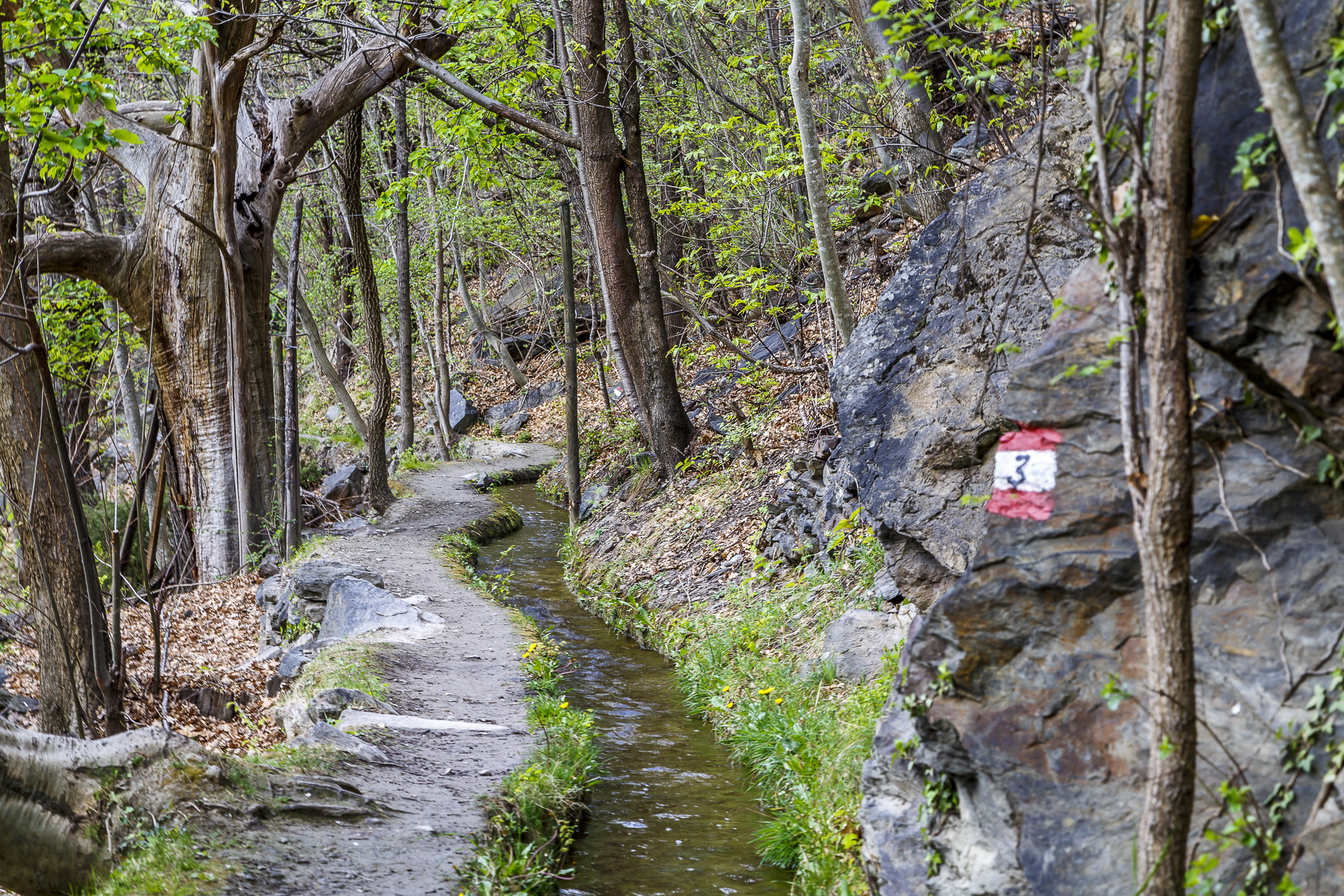
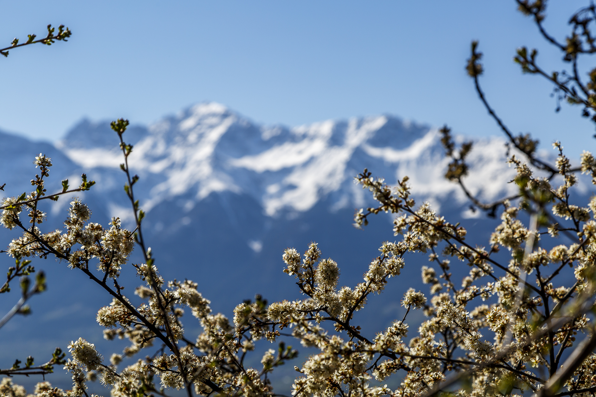
Today, fruit cultivation has replaced a large part of the cereal fields and irrigation is taken over by a sophisticated and high-tech sprinkler system. In this respect, too, Valais and Val Venosta have something in common. To my astonishment, the buds and flowers are sprayed with water as a frost protection measure. This is mainly due to the fact that in both valleys the flowering is so early due to the mild temperatures that the frosty nights are not yet over. However, the irrigation channels still play an important distribution role. And so people traditionally meet in spring to “open up”. The watercourses are shut down in autumn and fill with falling leaves and branches over the winter. To ensure that the water flows freely again in the next season, the irrigation channels must be cleaned before they are put into operation. This is a huge task that the communities would hardly be able to accomplish without the cooperation of the local population. In the past, this responsibility was in the hands of the Waaler. He had to ensure the function of the irrigation channel and therefore usually lived right next to the irrigation channel in a Waalerhütte. As a rule, paths – so-called Waalsteige – were laid out along the irrigation channel dams. These were intended exclusively for the Waaler.
There are no longer any irrigation channels left and the paths have been converted into attractive hiking trails – the Waalwege. Ideal routes to hike through the cultural landscape of Val Venosta on foot and thus experience a piece of cultural history.
An overview of the most beautiful irrigation channels can be found on the official Vinschgau website. The interactive map, which shows all irrigation channels including distance and approximate running time, is also helpful for route planning.
Senales and Latschanderwaal
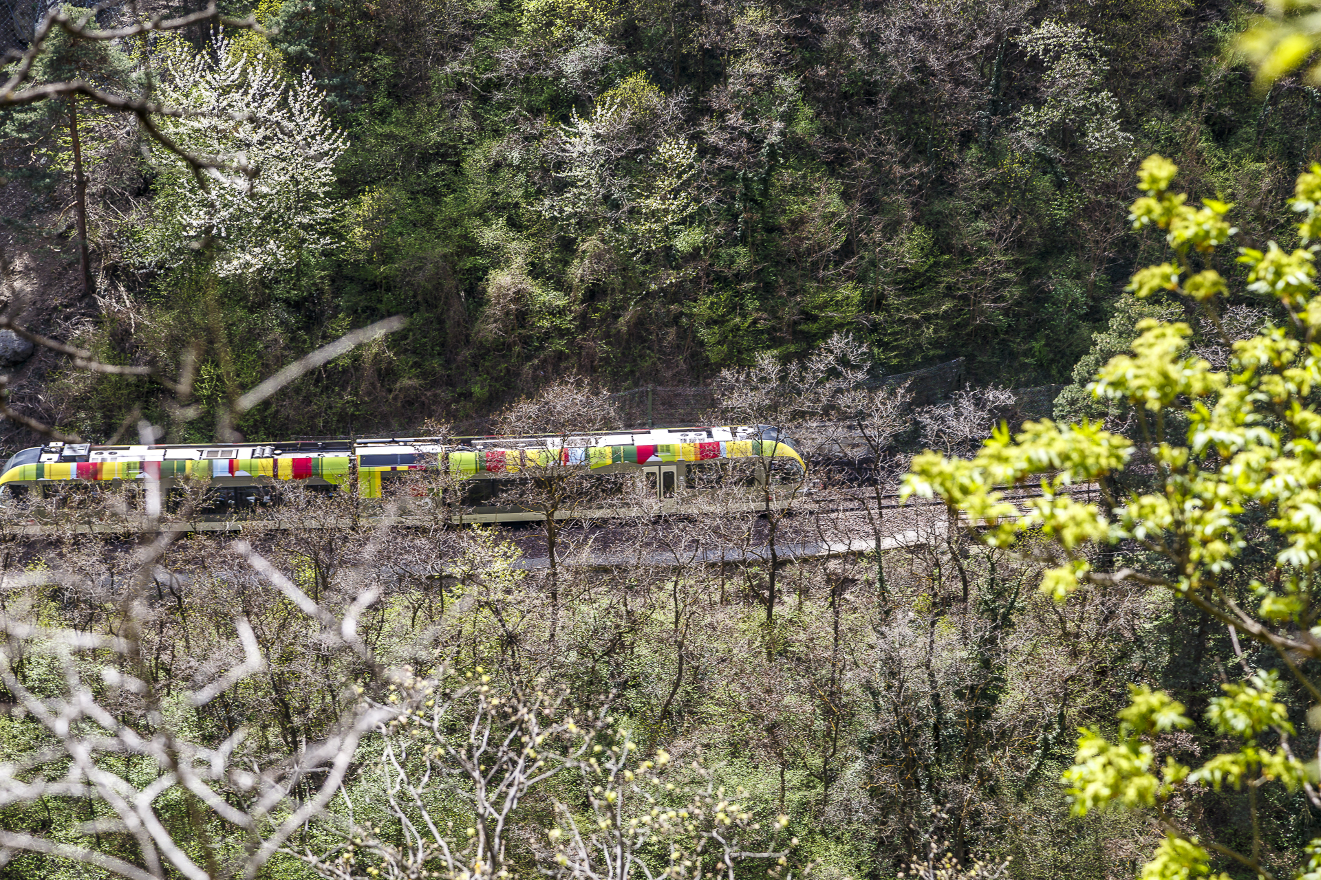
For our first tour, we first drive 45 minutes from the starting point in Mals in the direction of Lower Vinschgau to Ciardes. Thanks to the Val Venosta Railway, which is celebrating its tenth anniversary this year (after the resumption of operations – the railway itself has been around since the beginning of the 20th century) and is on the road with Swiss rolling stock, the villages in the Vinschgau Valley are easily accessible by public transport. Around 200 hotels, guesthouses and holiday apartments issue their guests with the VinschgauCard upon arrival, which includes free use of the Vinschgau railway and all other means of public transport. So you can safely leave the car at home.
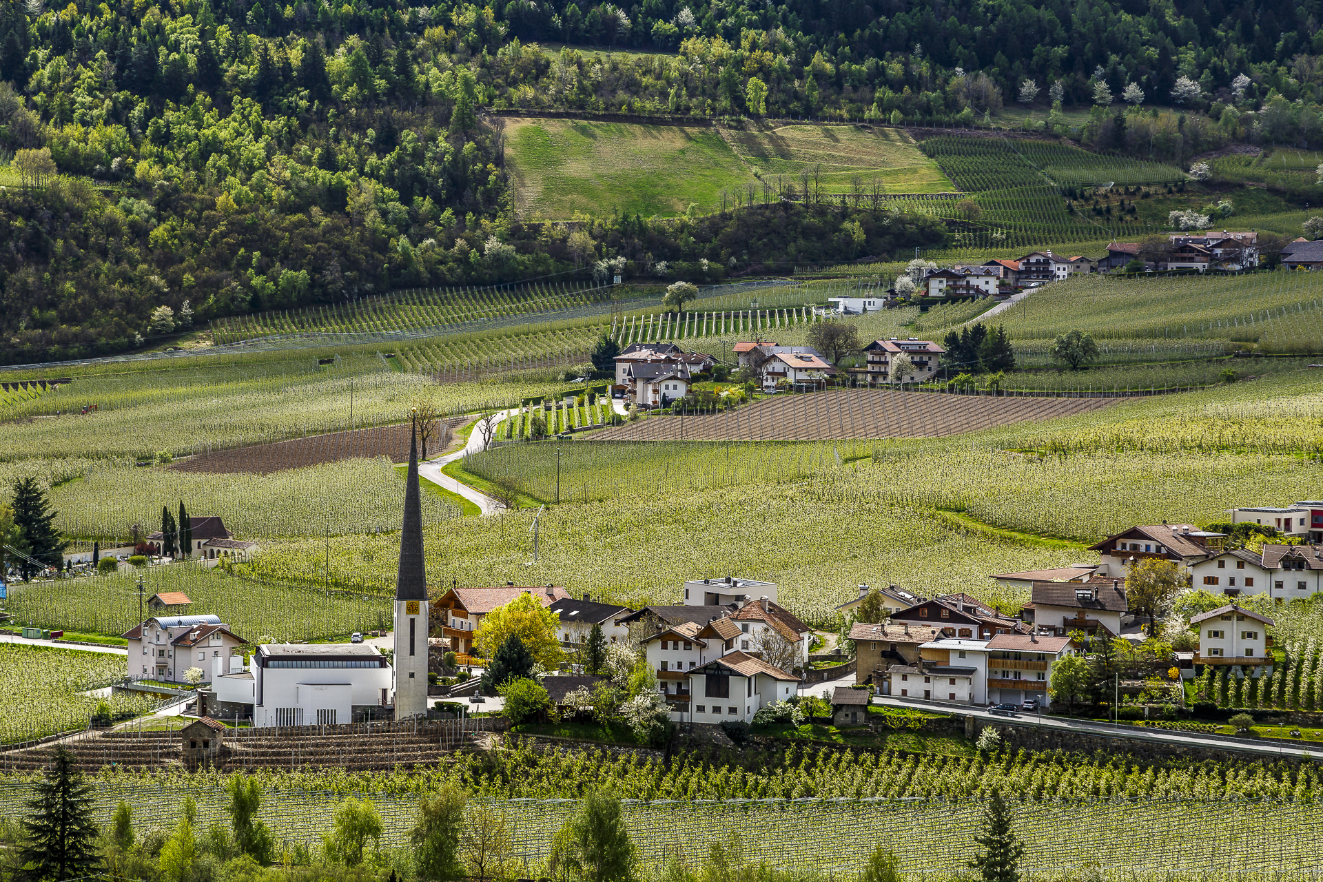
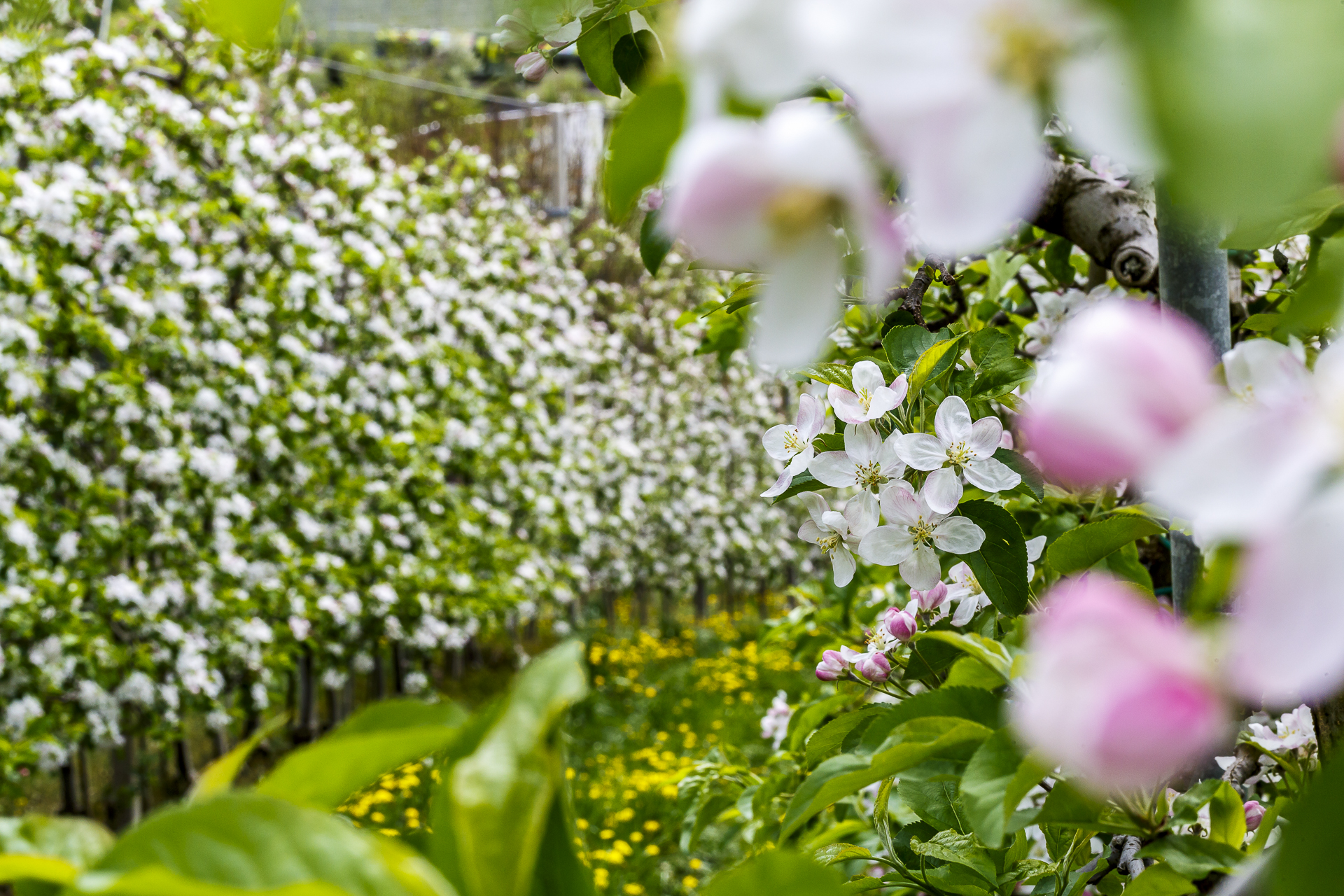
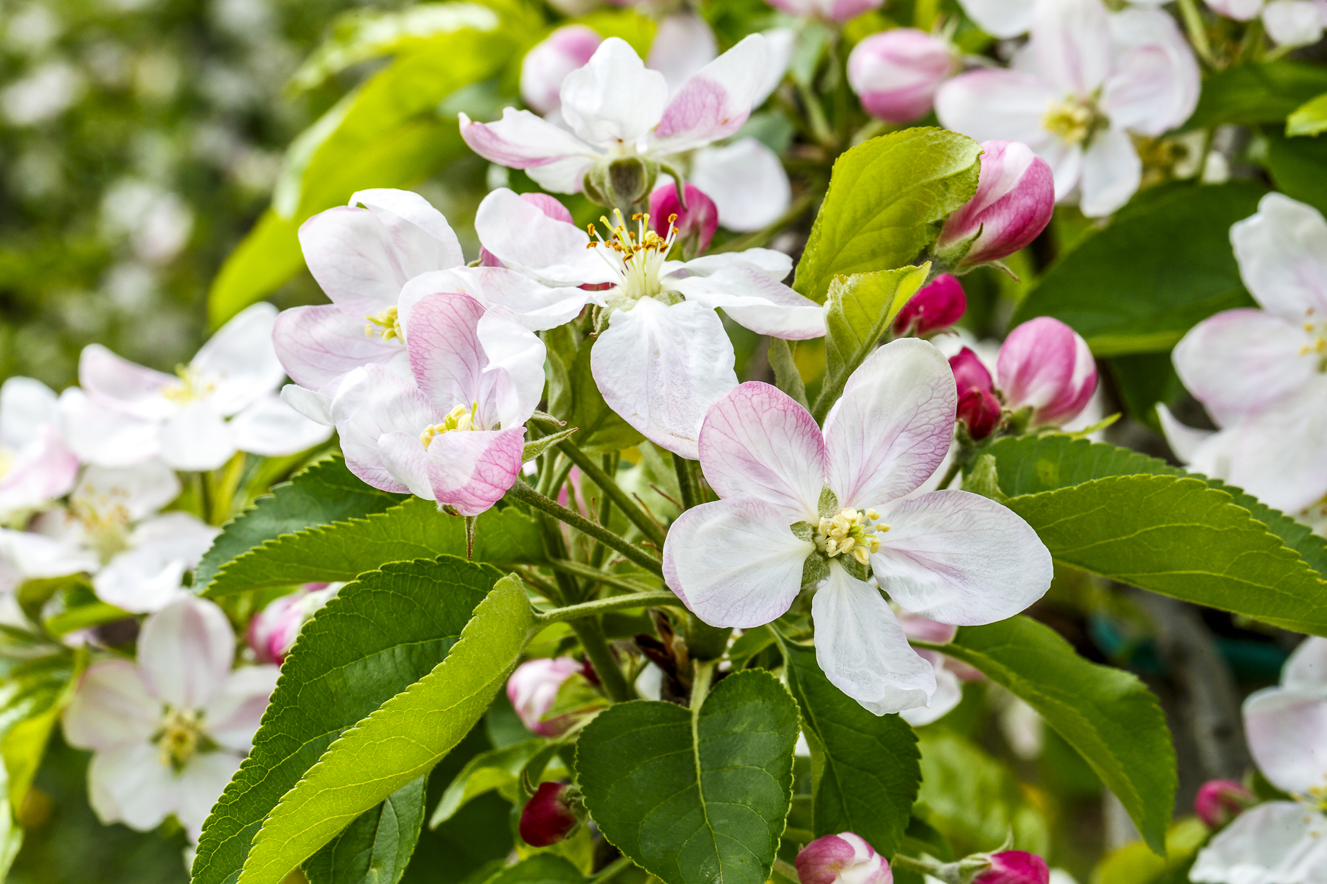
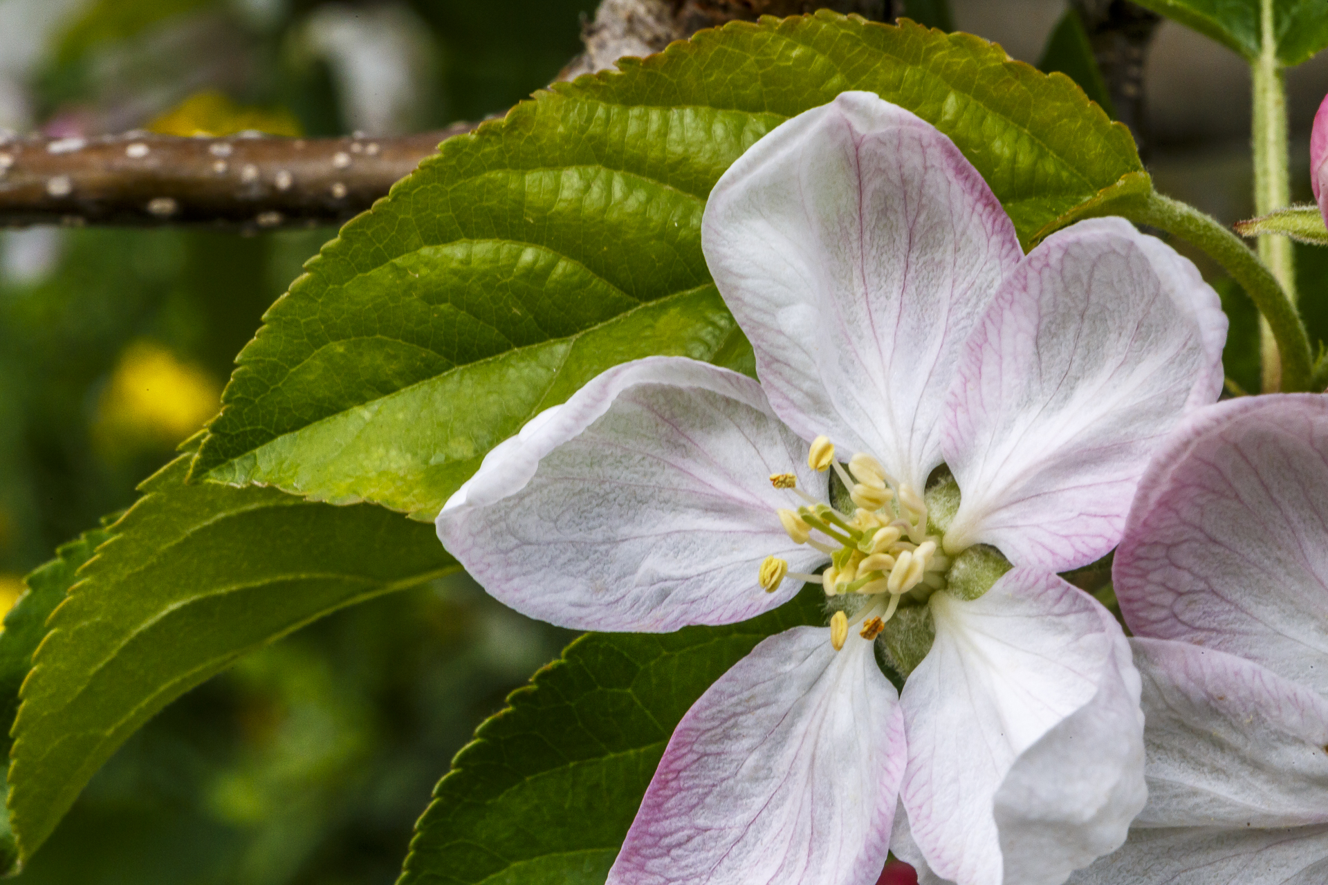
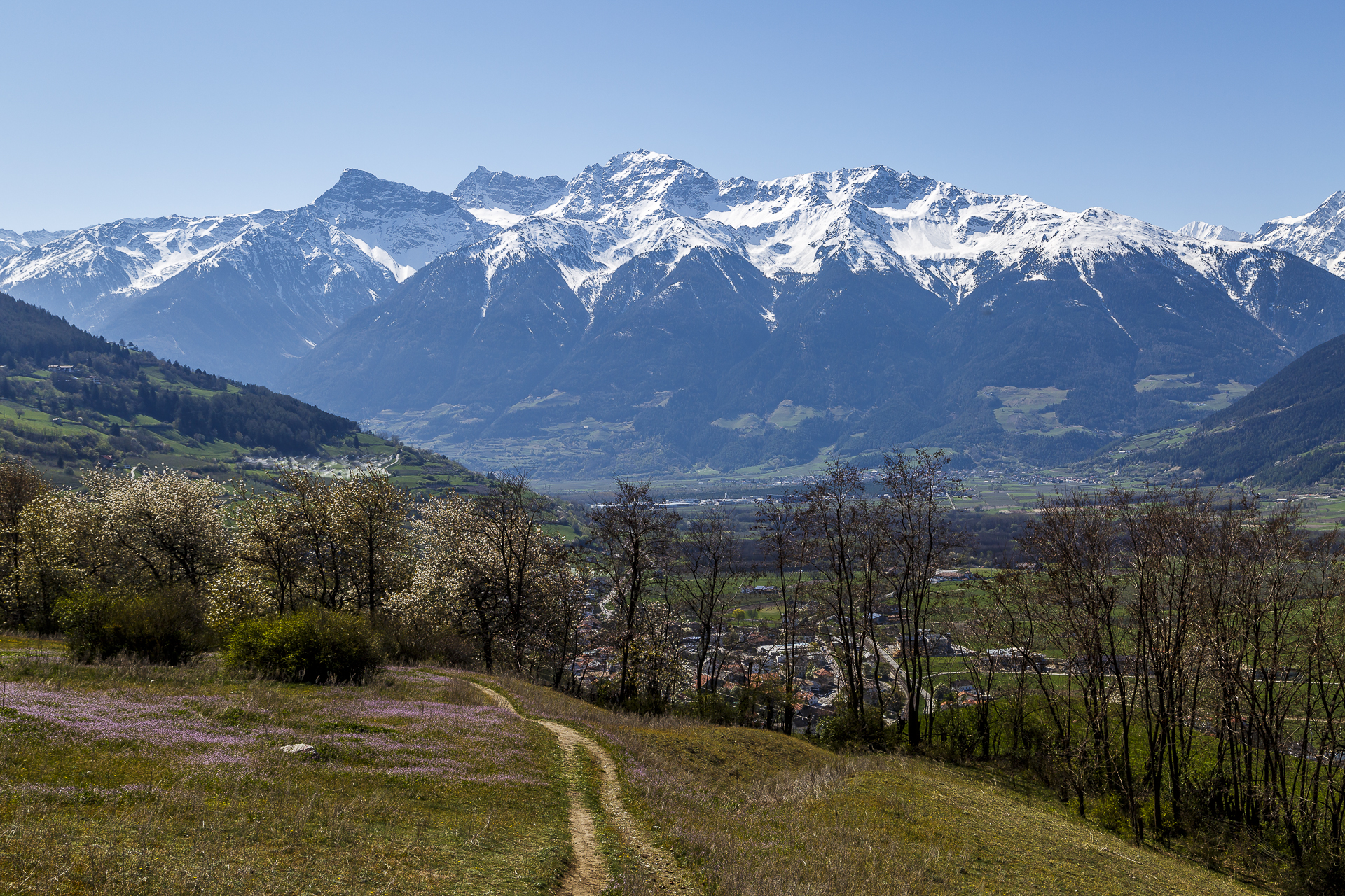
During these 45 minutes, we marvel at the countless apple trees that stand in rows and dominate the landscape of the valley floor. The further down the valley we go, the wider the vegetation. While the buds have only just formed in Mals, the apple trees in Ciardes are already blooming in full splendour.
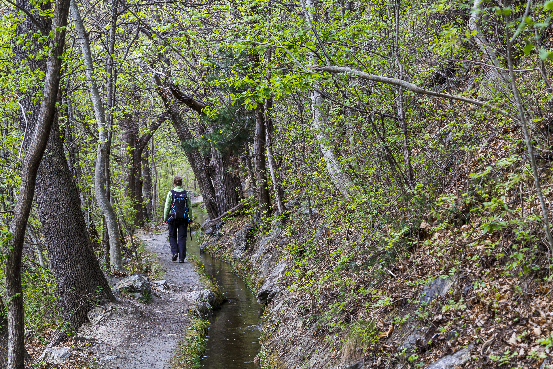
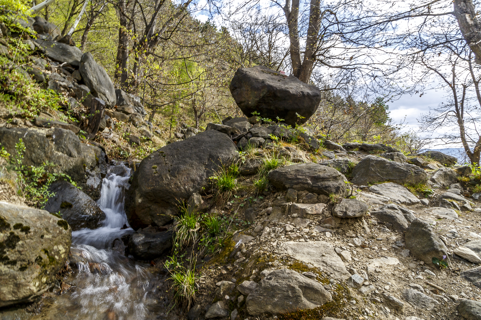
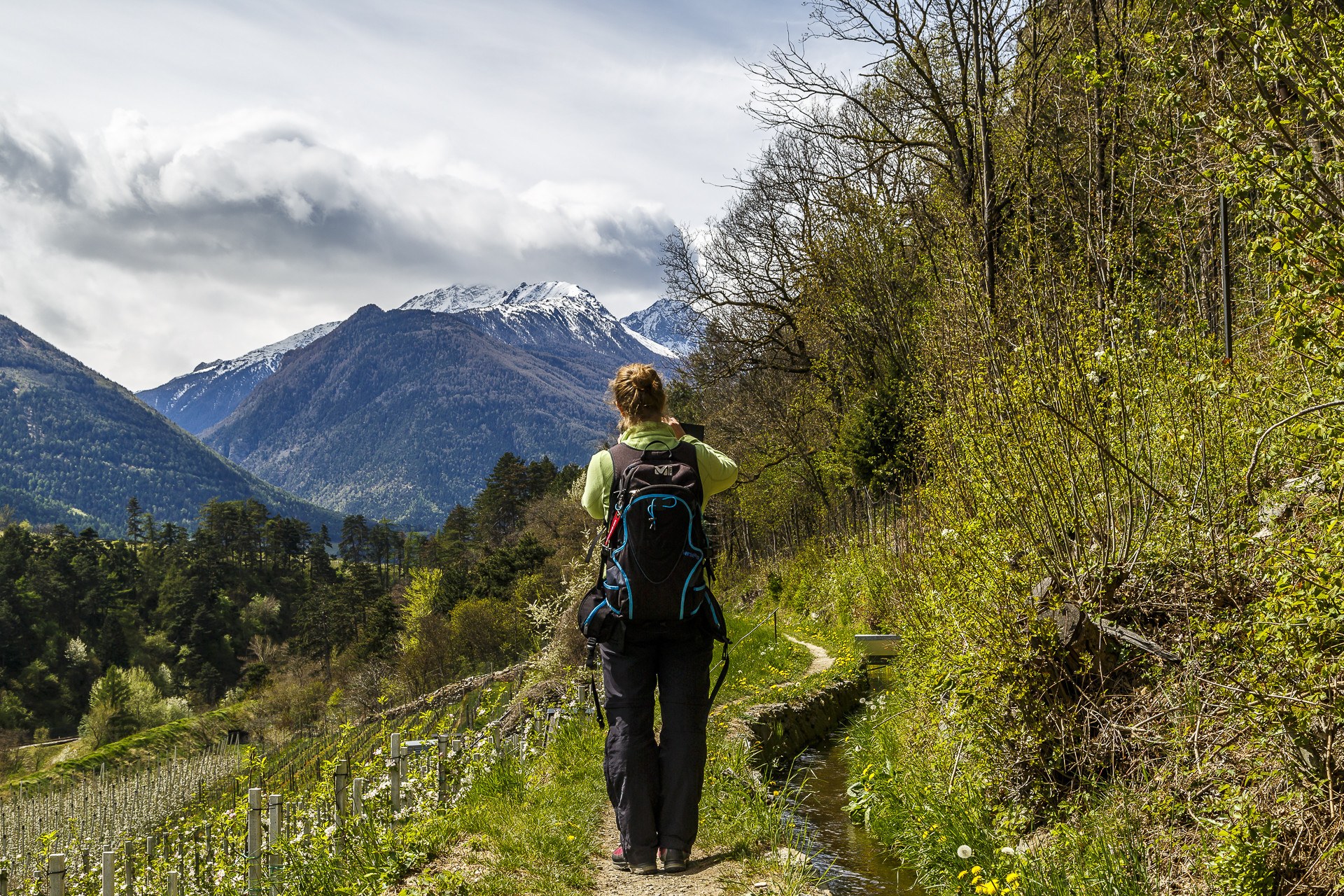
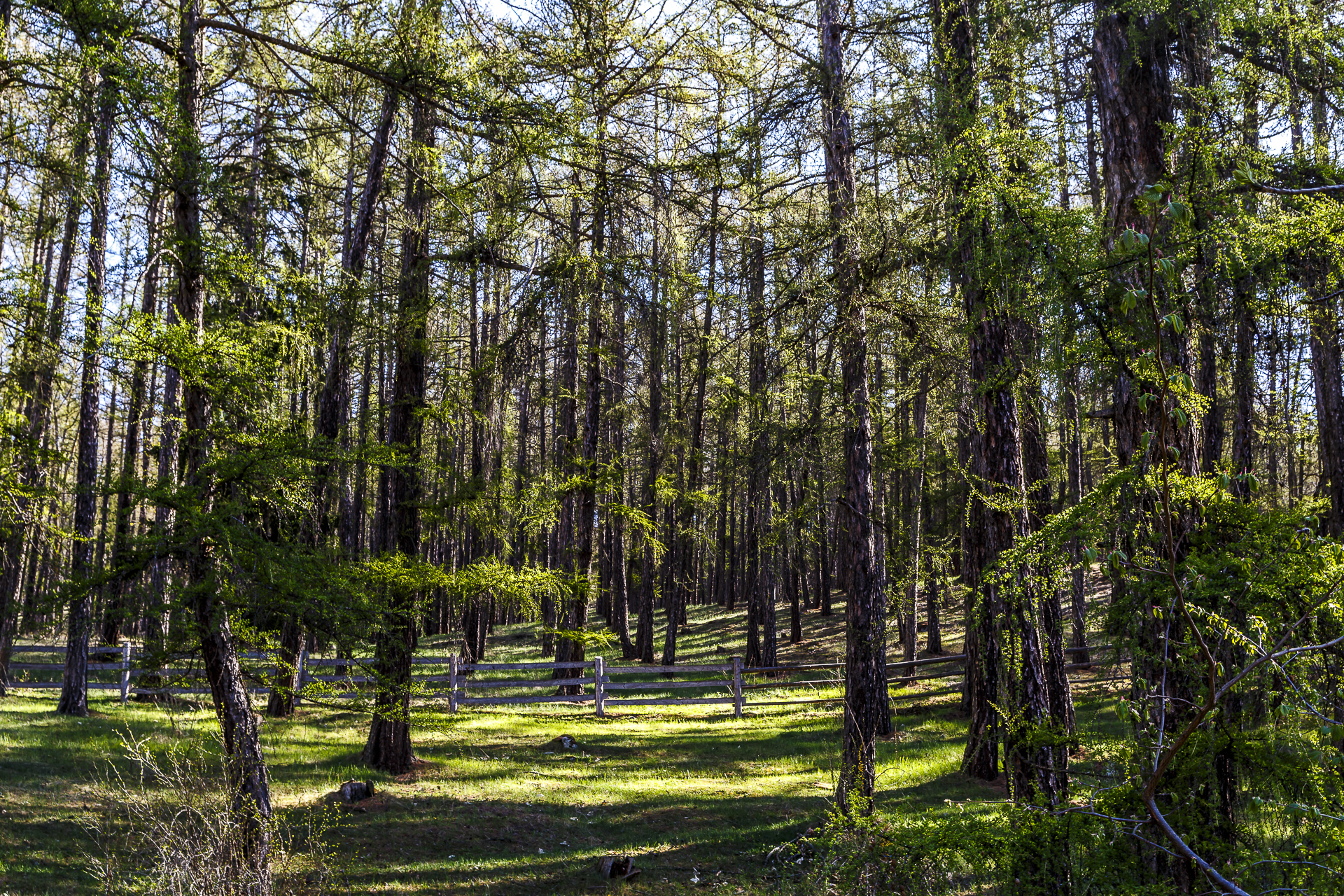
But after the leisurely outward journey, now comes the duty. First, you have to overcome a climb of about 300 m to reach the Senales Waal, which winds along the slope in the direction of Castelbello. Once these meters of altitude have been overcome, the path leads with a slight gradient through beautiful spring-green mixed forests along the Sonnenberg. In between, you catch a glimpse of the valley landscape through the thicket. At Castelbello, the forest thins out and the sea of flowers of the apple orchards spreads out in front of us. As magnificent as they are to look at, they also make me think at the same time. With this intensive form of agriculture, there is hardly any room left for high-stem farmers and the use of pesticides harms bees and butterflies. What about these little animals? But a rethink is underway. A part of the population of Mals is actively committed to making Mals the first pesticide-free village in the Val Venosta Valley. That would set an example.
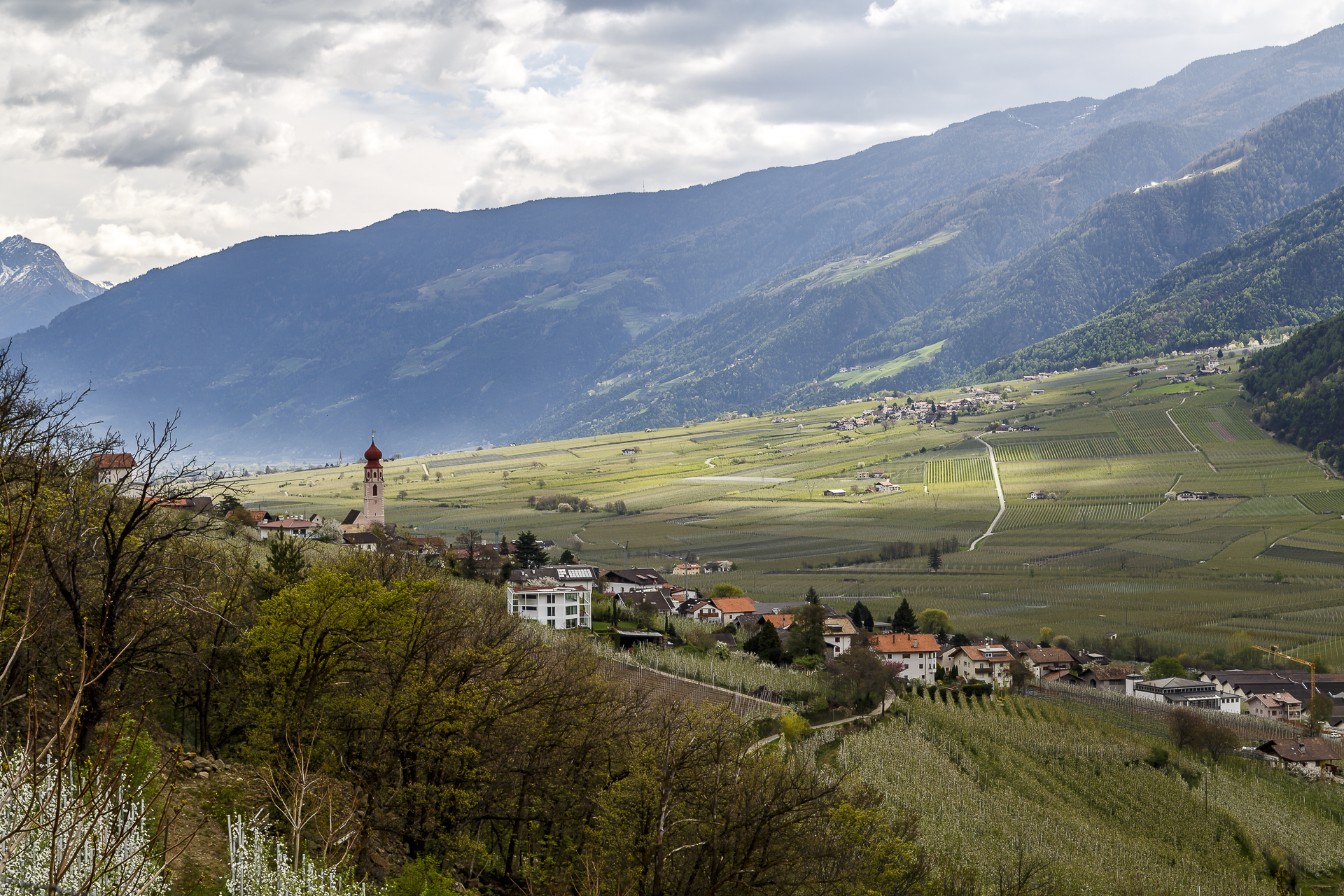
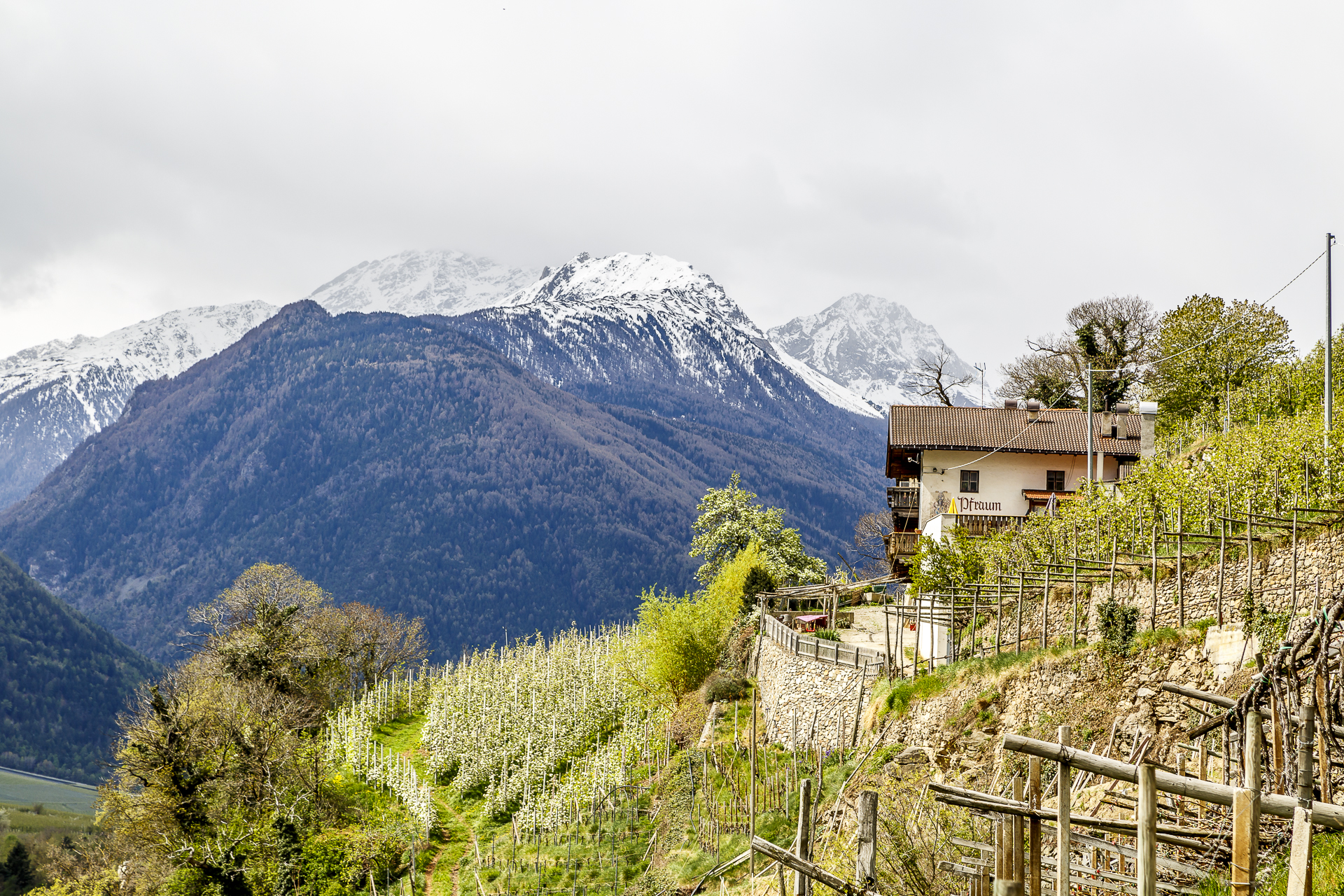
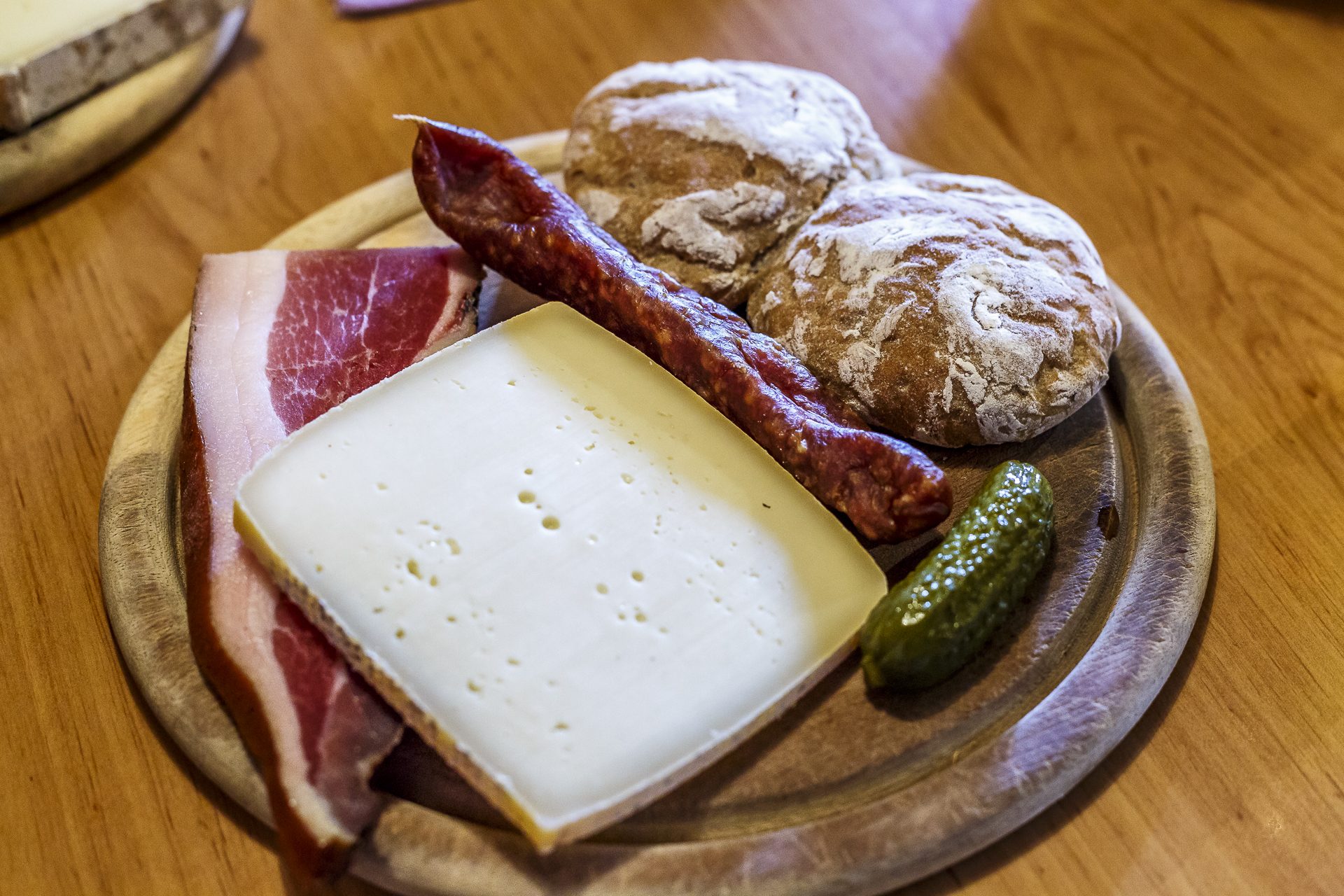
Between the apple orchards we also catch a glimpse of the stately Castelbello Castle. A few minutes later, a sign lures us away from the path to the Buschenschank Pfraum. Here in the parlour, hearty food is served. We opt for a mixed snack plate and are spoiled with bacon, sausage, cheese and the traditional Vinschger Paarl.

With fresh energy, we tackle the second stage along the Latschanderwaal to Latsch. The trail leads high above the Adige River, the railway tracks and the state road. The noise of the passing cars may echo through the canopy of the forest from time to time. Nevertheless, the landscape is a beautiful route that offers a variety of impressions along the way.

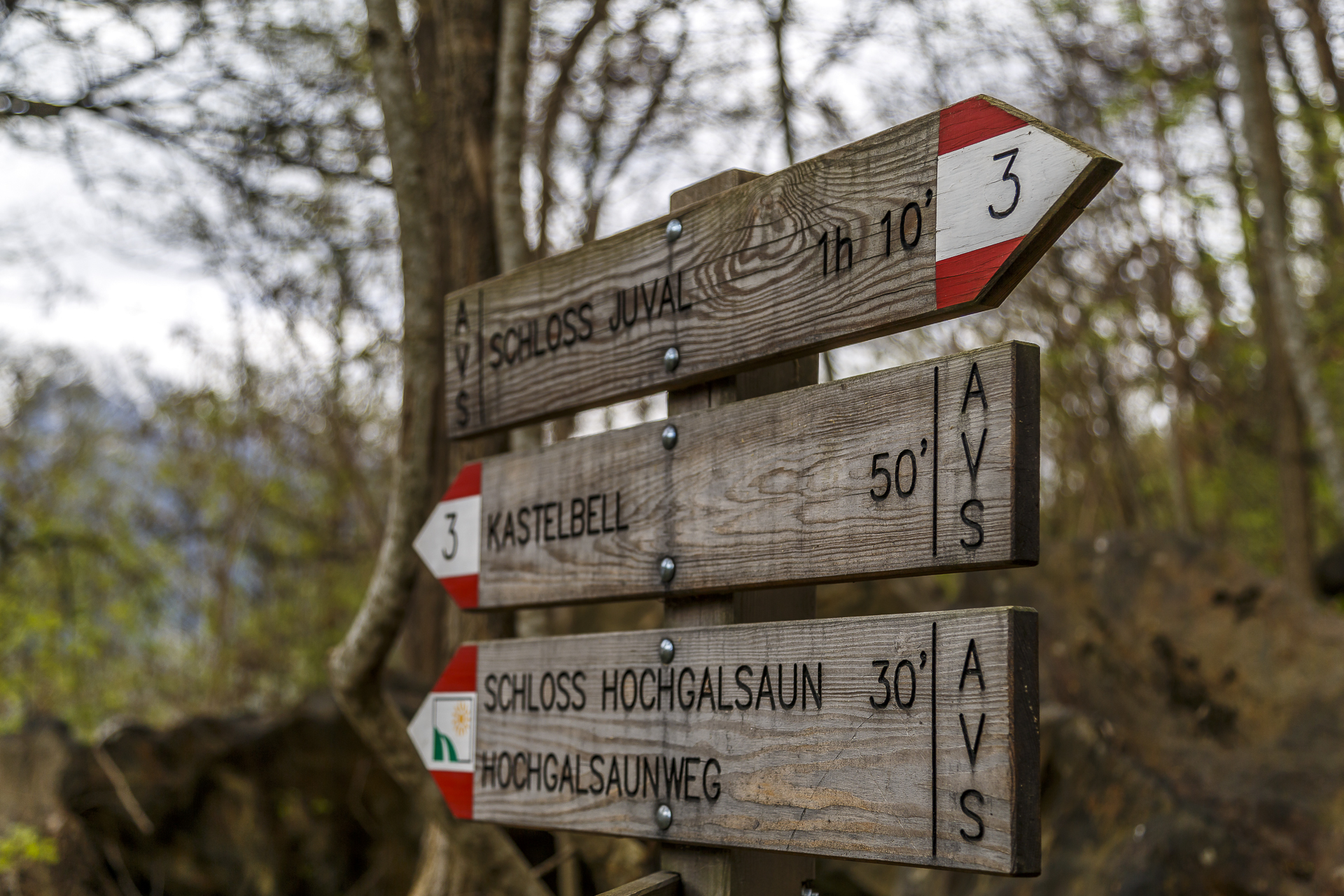
The Schnalser and Latschander irrigation channels lead from approx. Water from late March to September. From Ciardes to Laces, the hiking route is about 9 kilometres long. If you have enough time, you can start the hike in Latsch and then hike along the Senales irrigation channel to Reinhold Messner’s Juval Castle above Senales. The hiking time for this route is about 4 hours.
Malser Oberwaal and Sonnensteig
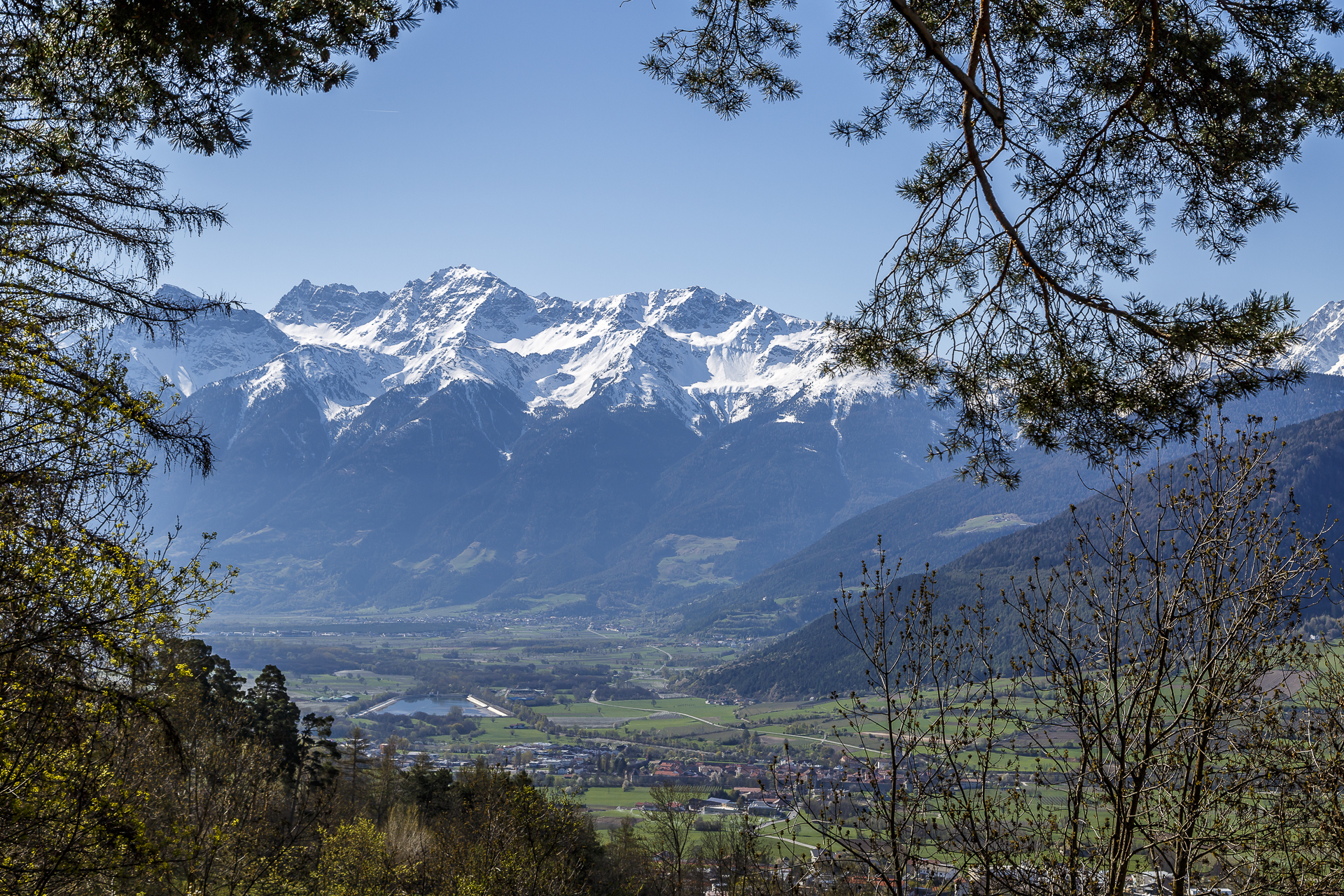
A little less traffic noise, but all the more panorama accompanies you on the Malser Oberwaal. The “opening” here does not happen until the end of April and is therefore one of the last irrigation channels to be filled with water. The hiking trail first leads through the idyllic centre of Mals and then climbs steeply 400 metres in altitude until you reach the Oberwaal. Once at the top, you can first enjoy the magnificent view of the Ortler Group. However, the Ortler itself hides behind another hilltop. The path leads along the edge of the forest in the direction of Tartsch, which can be seen from afar from the striking church of St. Vitus on the Tartscher Bichl.
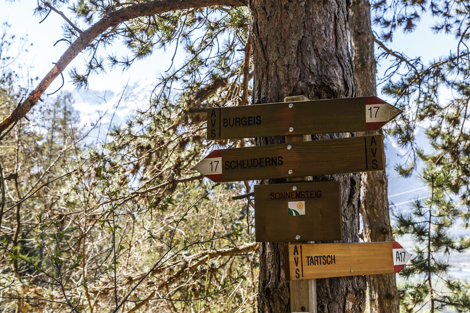
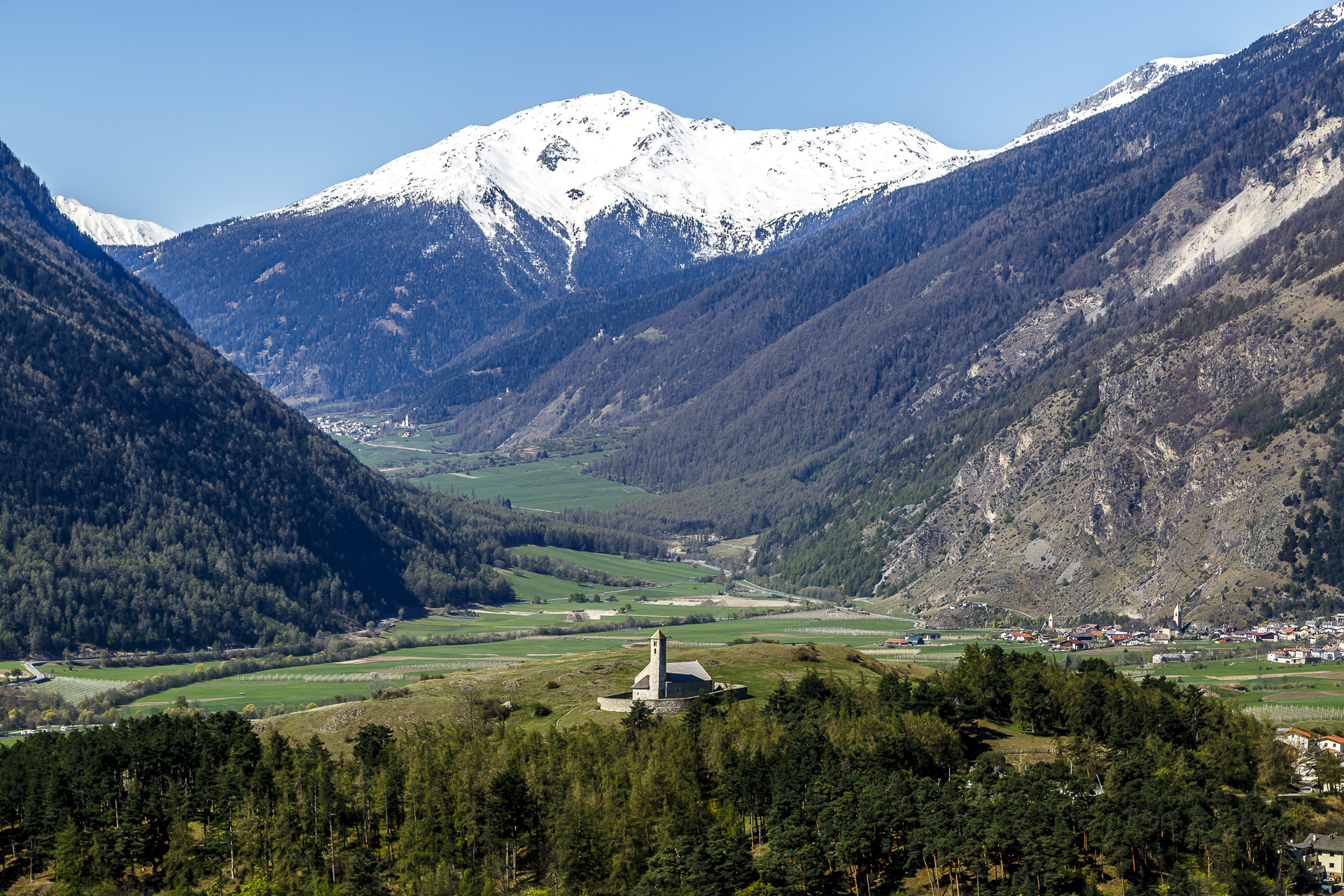
The irrigation channel path then merges smoothly into the so-called Sonnensteig. This leads along the sunny flank of the valley through dry meadows, which bloom wonderfully in these spring days, to Sluderno, where one of the best-preserved castles in South Tyrol – the Churburg – towers defiantly above the village. In between, benches with a panoramic view of South Tyrol’s highest elevation – the Ortler – tempt you to take a short break. This hike can also be combined with the Berg- und Leitenwaal in Sluderno.

From Mals to Sluderno, the hiking route is about 10 kilometres long and the hiking time is about 3 hours. Depending on the combination, the route can be extended as desired (it is best to simply plan it using the interactivemap).
This trip was supported by the Vinschgau Valley – thank you very much for this! As always, my readers can be sure that I always represent my views and enthusiasm.

Leave a Reply