

Kärpf Trek – in three promising stages through the Freiberg Kärpf
I’m sometimes a bit bored with social media. It seems that everyone is bustling around at the same hotspots, as if there was nothing exciting to discover all around. To counteract this, I set off on the Kärpf Trek in mid-July on paths that were not yet so well-worn and hiked across the oldest wildlife sanctuary in Europe in three days. What, that doesn’t mean anything to you? This beautiful circular hike is easily accessible in the middle of Glarus and offers everything a hiker’s heart desires.
1st hiking day: from Mettmen to the Leglerhütte
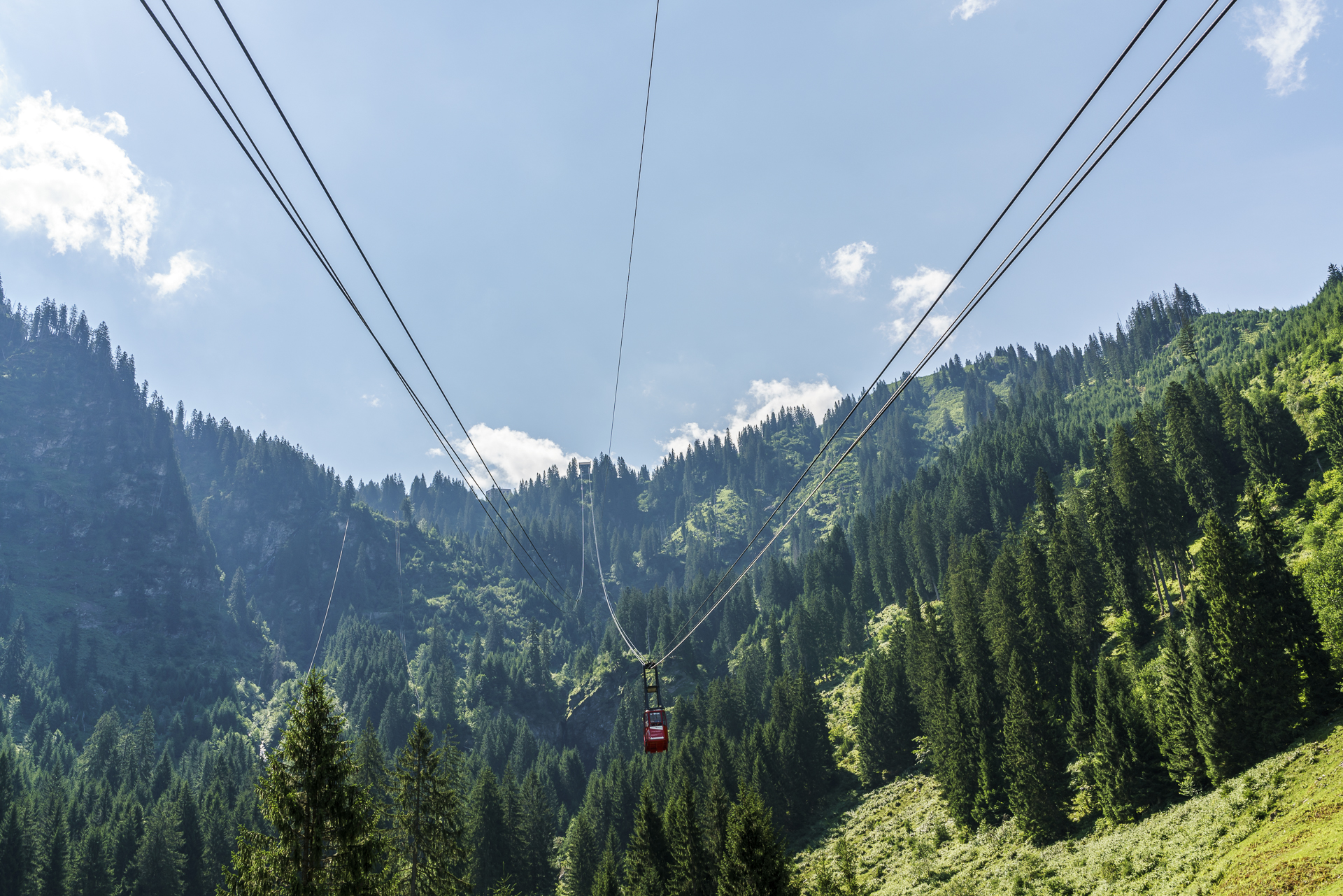
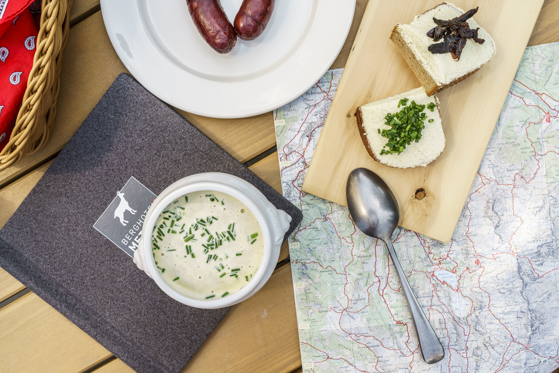
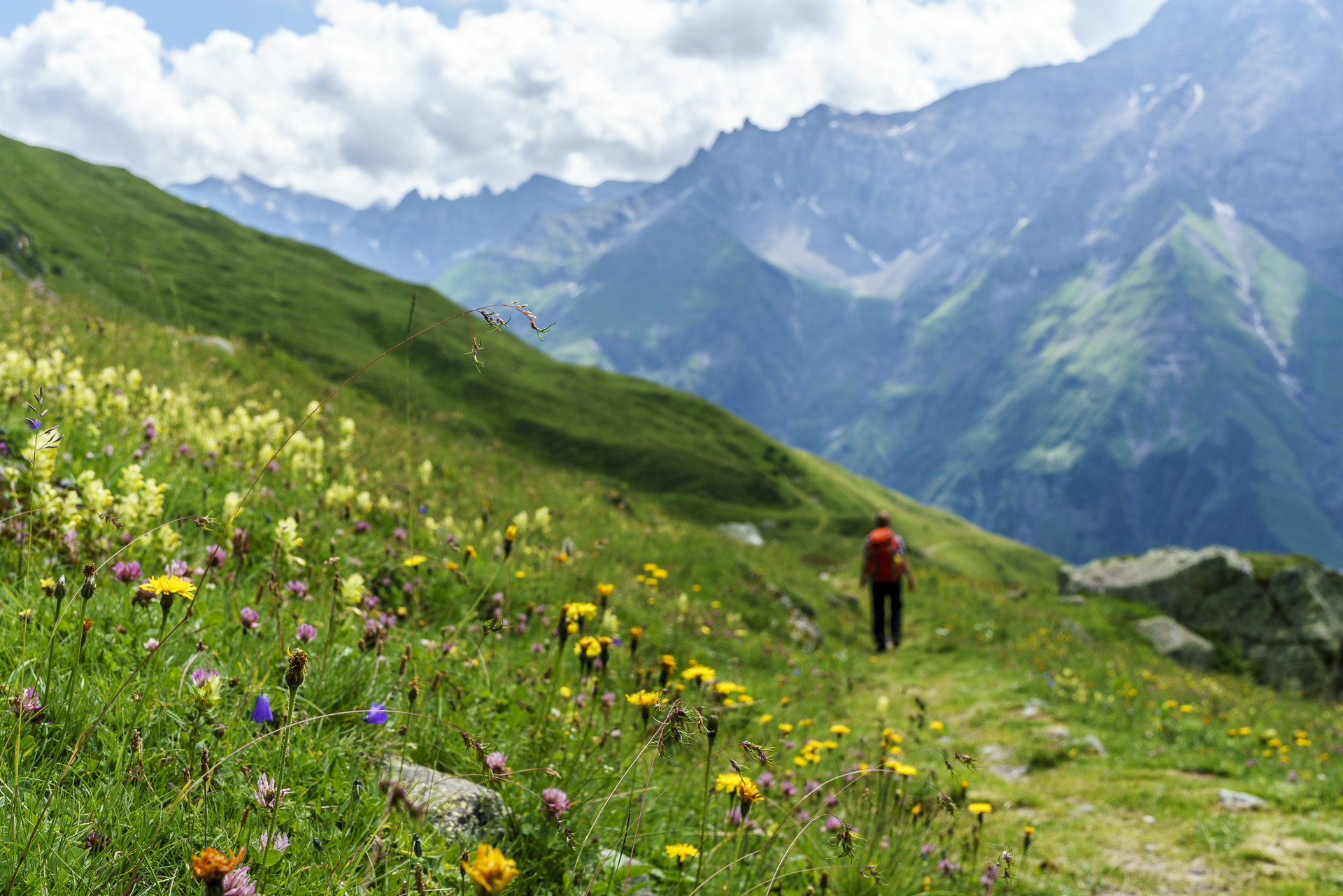
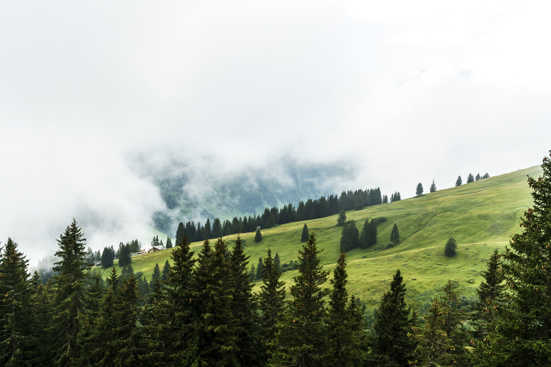
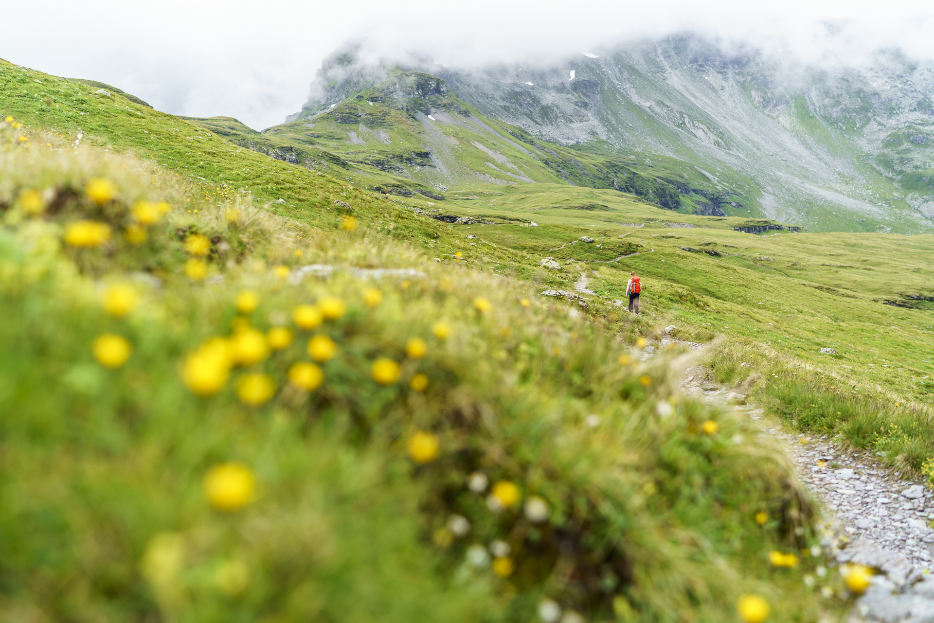
The starting point of our circular hike on the Kärpf Trek is the Kies cable car station above Schwanden. On this sunny Friday afternoon, the upcoming hikers fill the small cabin twice. And so we wait until we are transported up to Mettmen with the second load. Once at the top, the first thing we do is stop for a bite to eat on the sun terrace of the Berghotel Mettmen. The mountain hotel started operations at the end of 2016 and presents itself harmoniously both from the outside and from the inside. The soup of the day with Glarus-Schabziger Brötli and the regional smoked sausages are also convincing – a fine start to our hiking weekend.
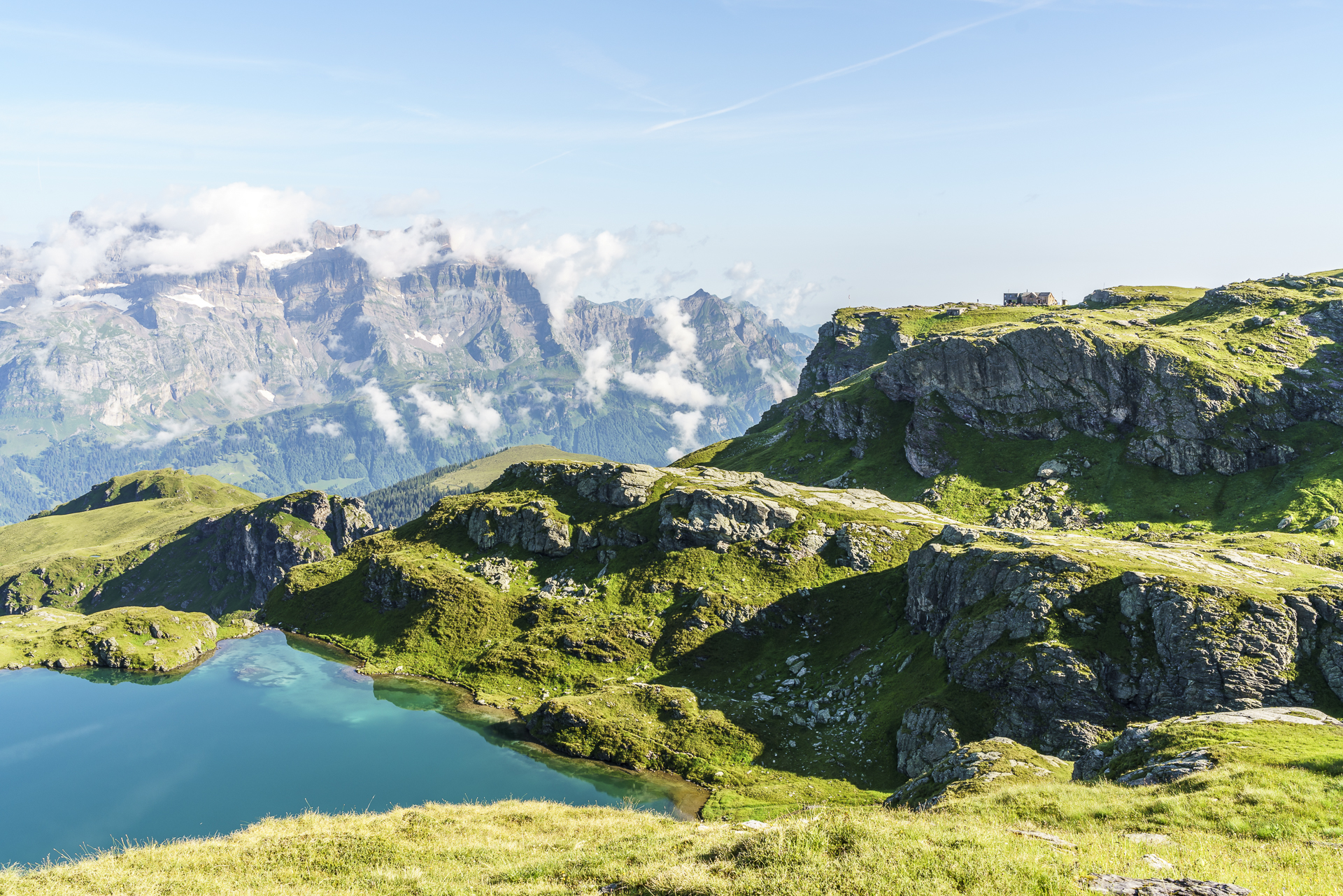
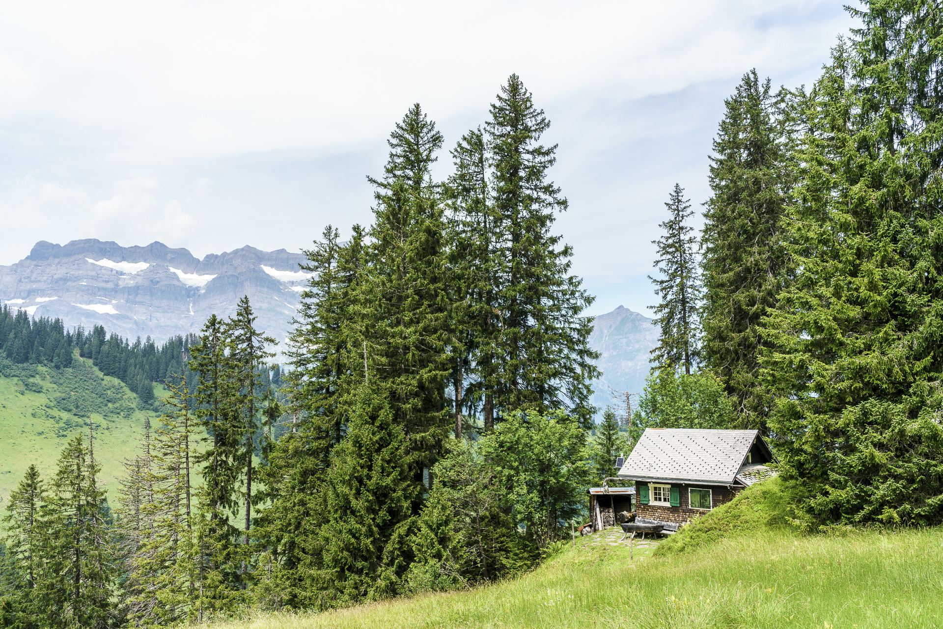
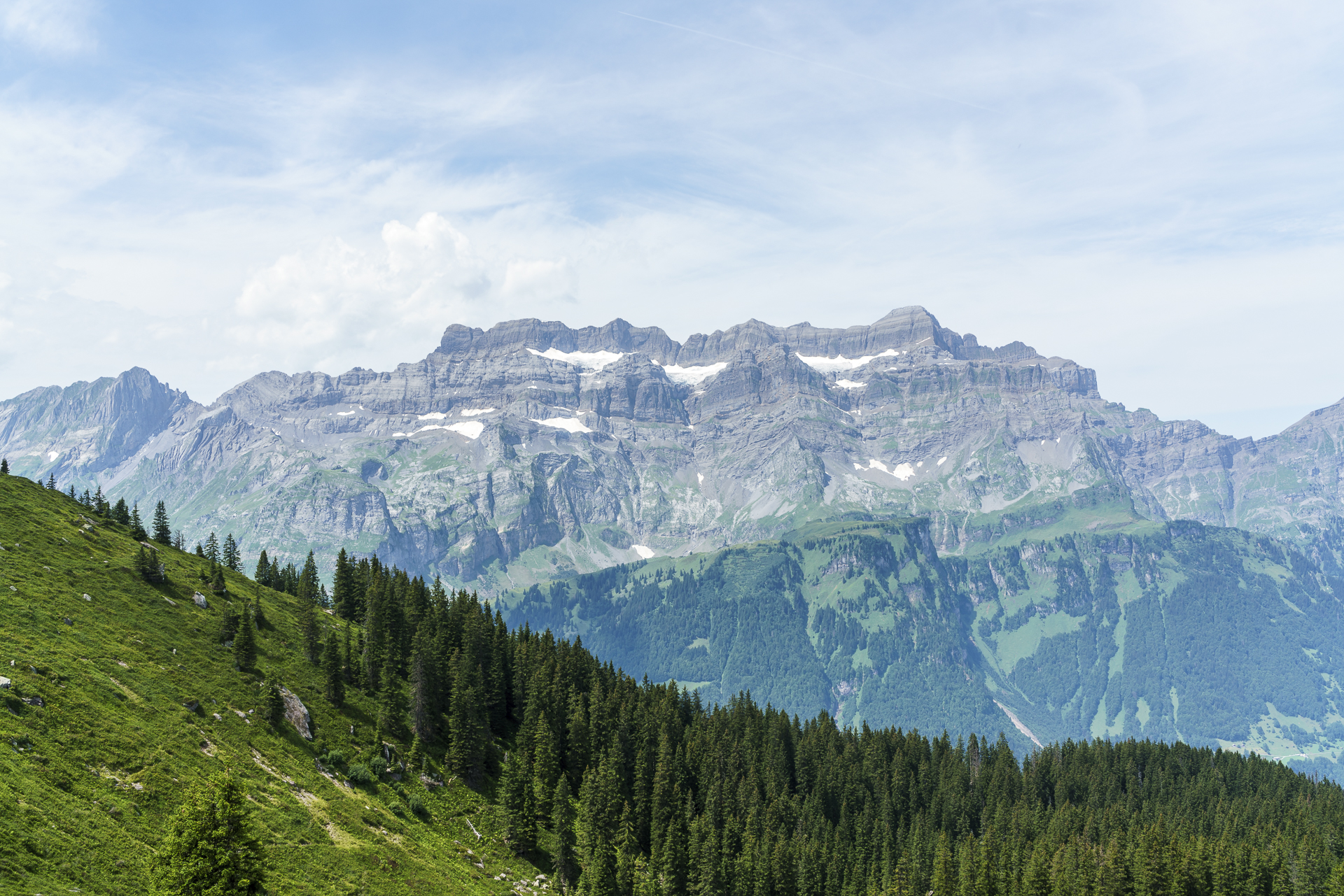
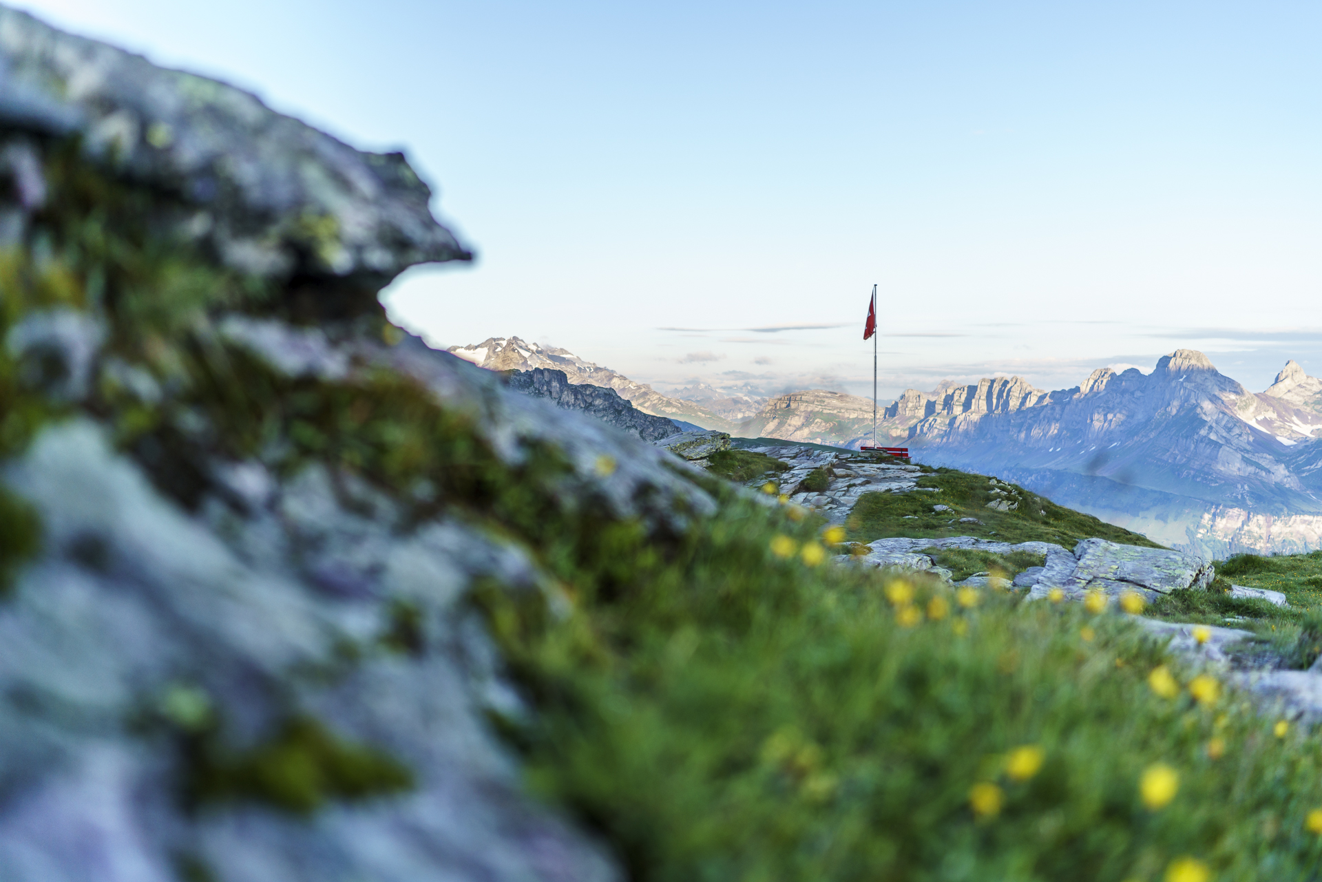
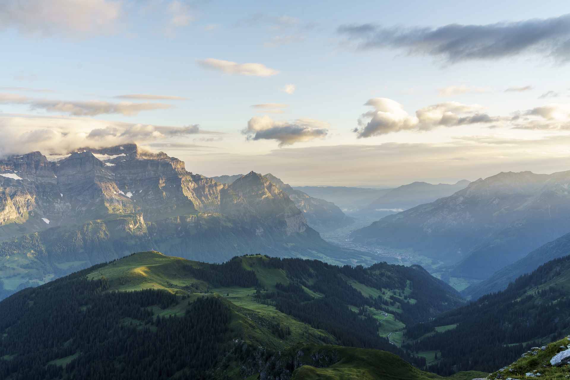
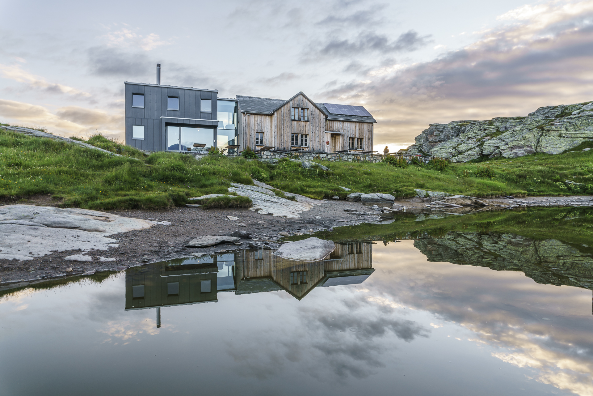
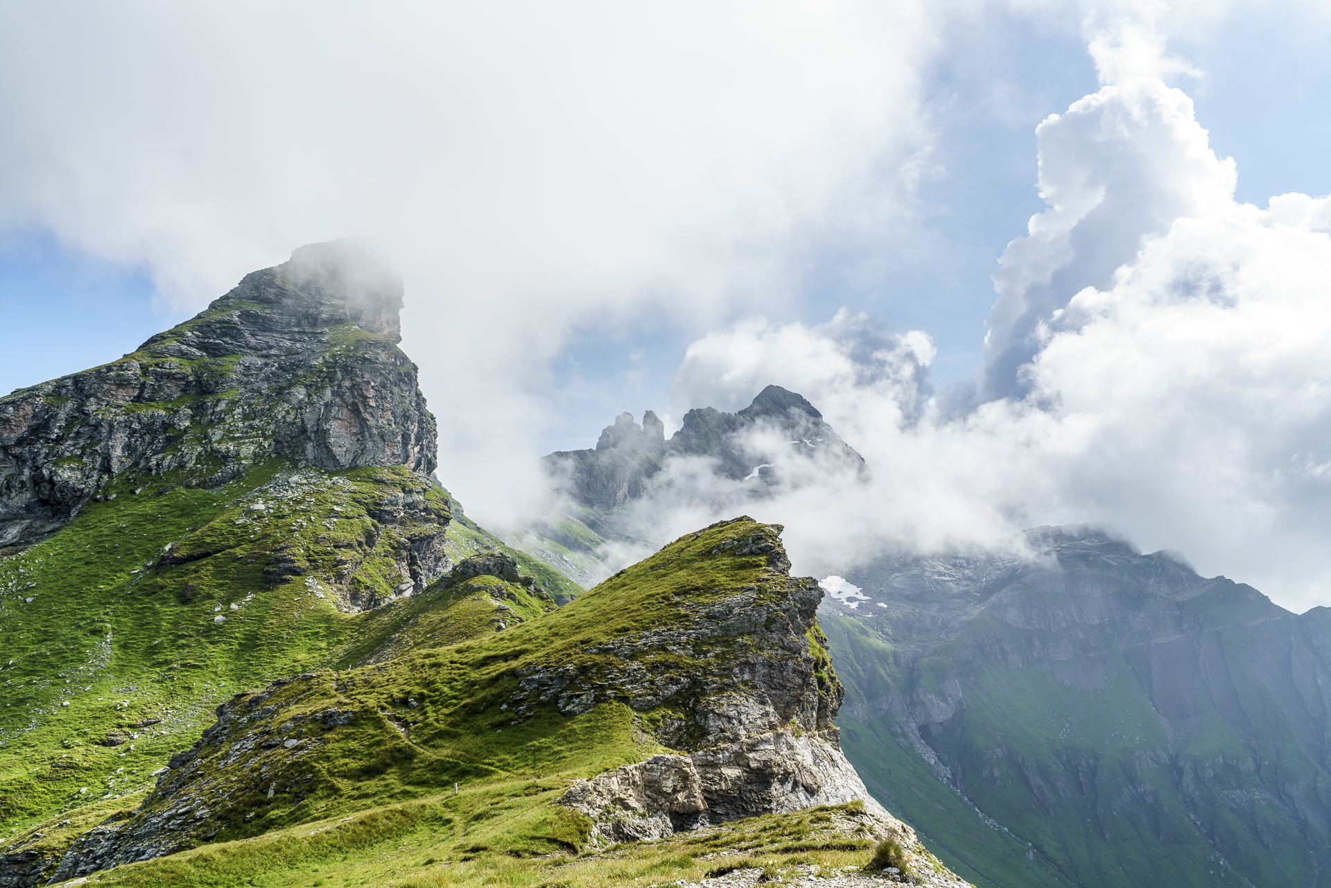
To our destination for the day, the Leglerhütte, there are various paths leading from Mettmen. On the Diretissima it takes just 2.5 hours. The Kärpf Trek, on the other hand, takes detours to the destination. With a last look at the shimmering green Garichti reservoir, we follow the signposted mountain path towards Aueren. And after a first short ascent, it goes steeply down again. “Somehow we have to get to the thousand meters of altitude,” says the friend, and I just think to myself, “we have to get it all up again.” The great thing about this detour is that no one but us hikes it and we march through the area alone on a wide field. Over beautiful high moor meadows, past idyllically situated alpine huts and along cheerfully babbling streams, we follow the mountain path from Aueren uphill again. Once at the top of the Schönaufurggeli, there is a magnificent view towards Linthal including Glärnisch. Following the ridge we enjoy the magnificent view and the short breather in terms of altitude. The last tough 400 metres of altitude up to the SAC hut await behind the idyllically situated mountain lakes in the depression between Fätschenhorn and Sunnenberg. The narrow path winds steeply between the rock flanks and does not want to end. “When will we finally be at the top?!” And then it’s done. Unfortunately, the day trippers have already eaten the whole apricot cake and we have to make do with a chocolate coconut slice as a reward. Also good. Our four-man loft with a view of the Kärpf massif and the Tödi is also very beautiful. I’m going to sleep very well today.
Stage 1:
9 kilometres | 1,100 metres uphill | approx. 4h walking time
2nd hiking day: via the Chalchstöckli to Bischofalp
The sleep prophecies were to come true. After a fine night in a hut and nice conversation with the Tischgschpänli, I fell asleep in no time. The first positive surprise the next morning is the sun’s rays illuminating the mountain peaks. The weather is far better than predicted. Good for us. Shortly before 8 a.m. we start the second stage. The “tenderloin”, so to speak, and the section that gave me the most headaches in the run-up. From the Leglerhütte, the Kärpf Trek follows a white-blue-white marked alpine hiking trail until it joins a white-red-white marked mountain hiking trail on the Richetli Pass.
Update 2023: The hiking trail from the Leglerhütte to the Richetli Pass is now marked with white-red-white throughout and no longer includes a white-blue-white passage. However, since the route is still the same, the following description is still valid.
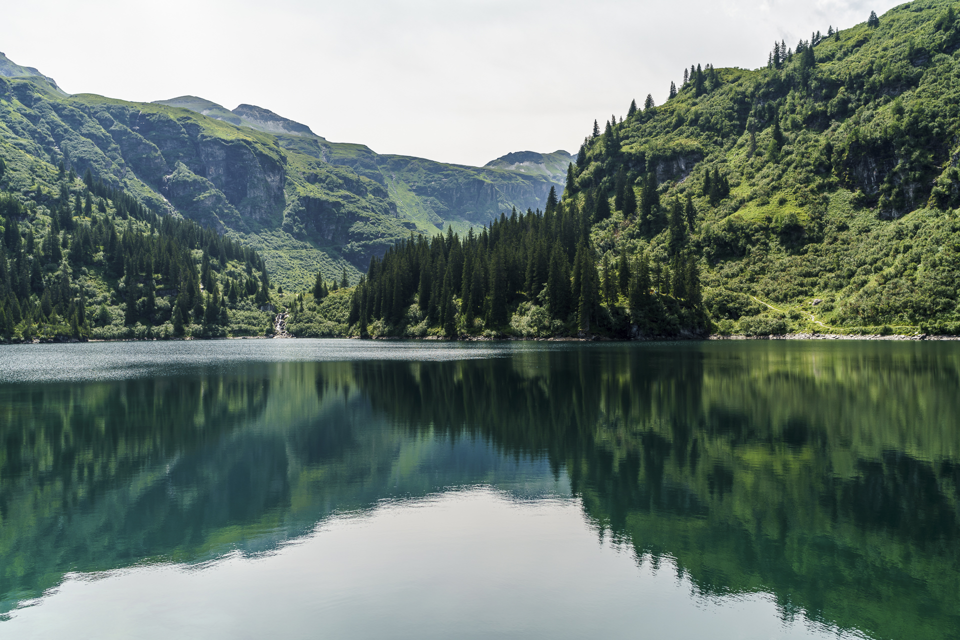
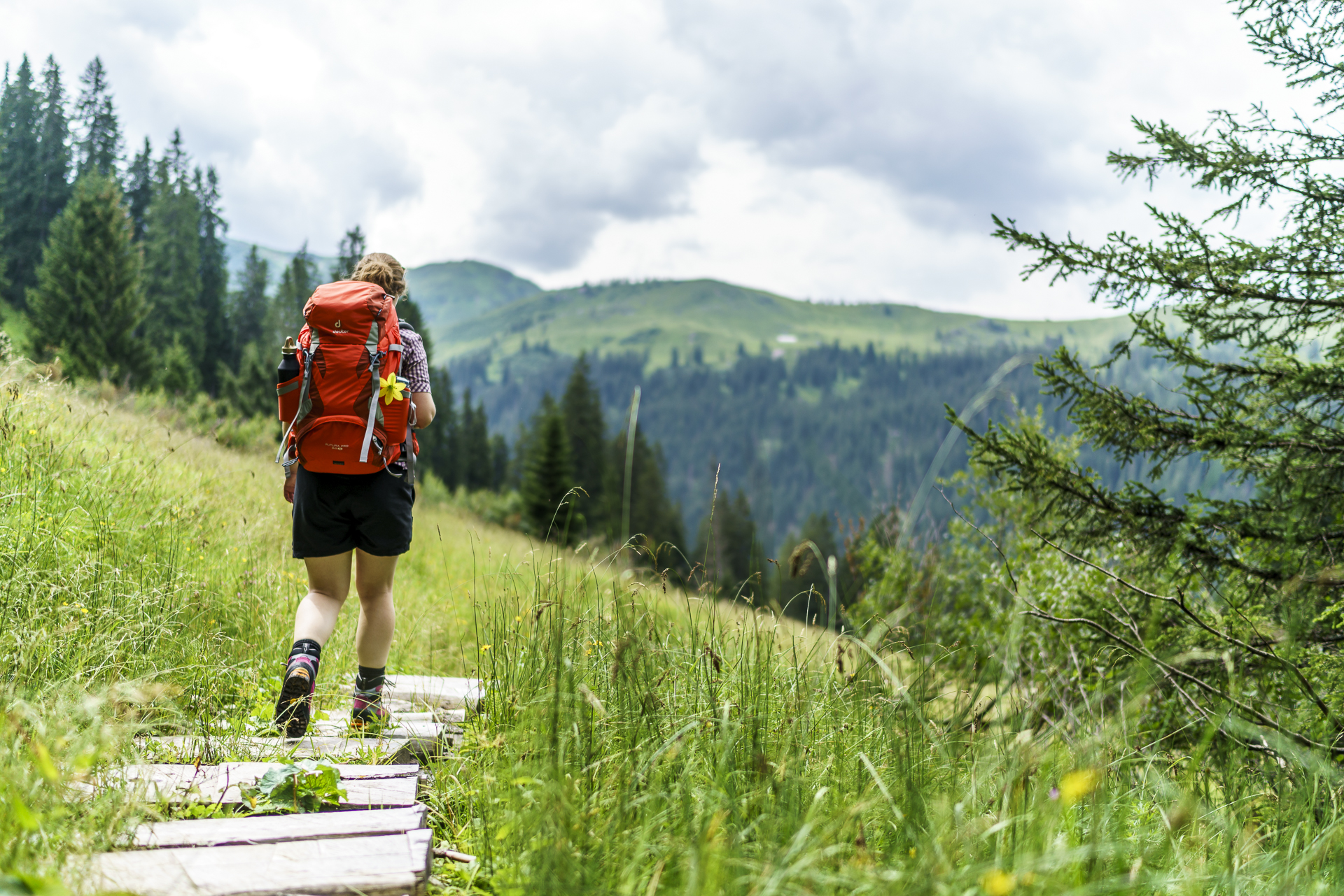
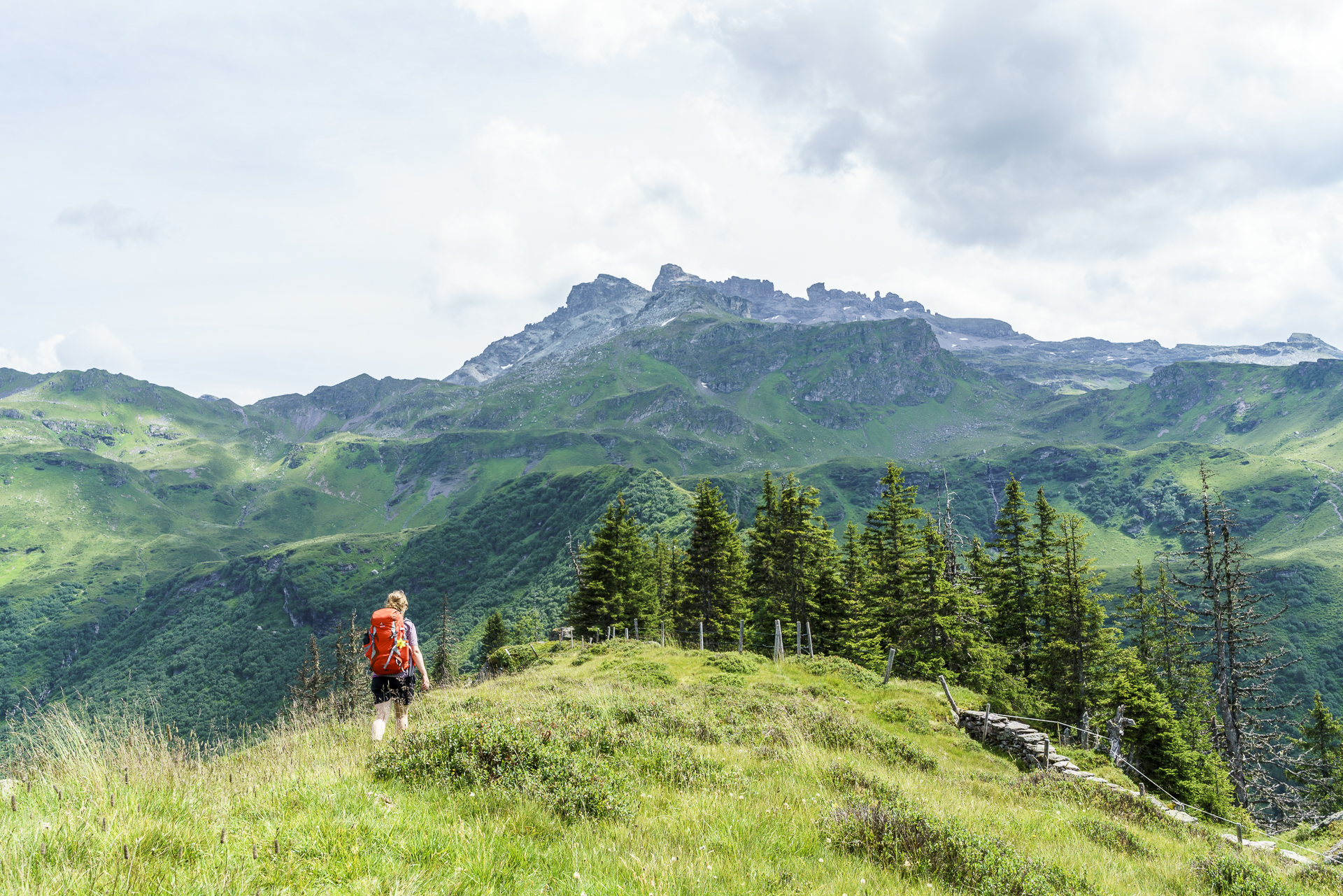
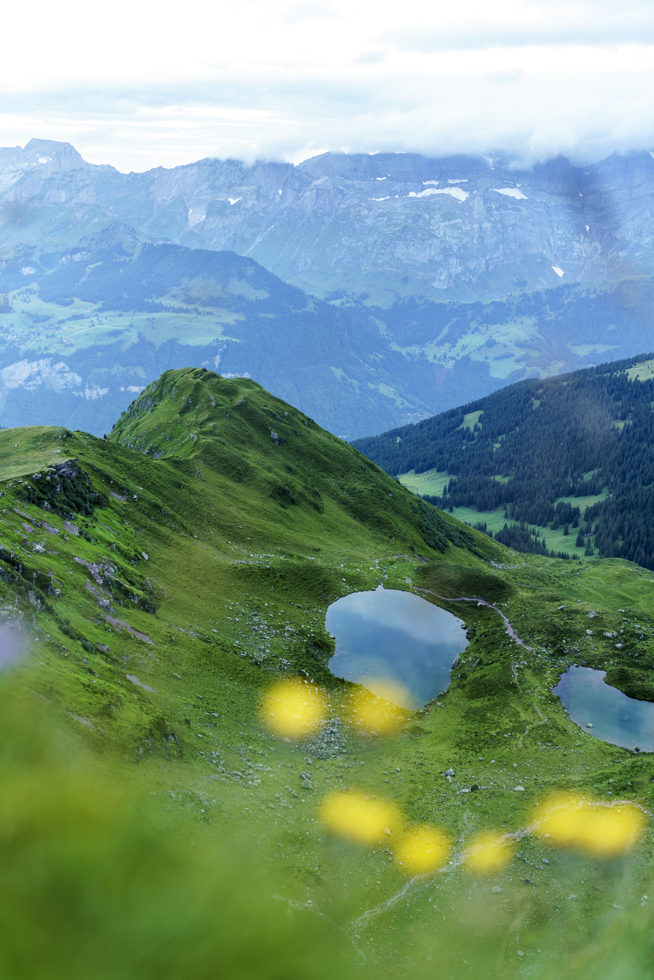
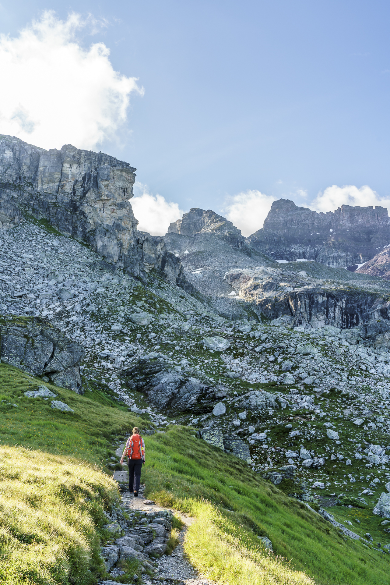
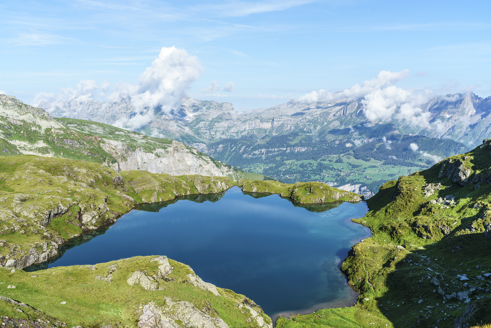
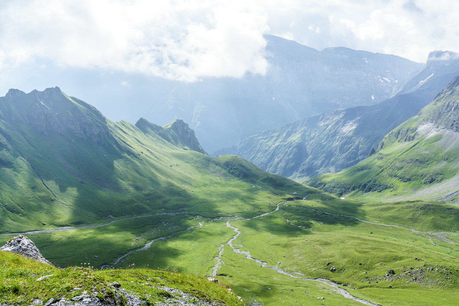
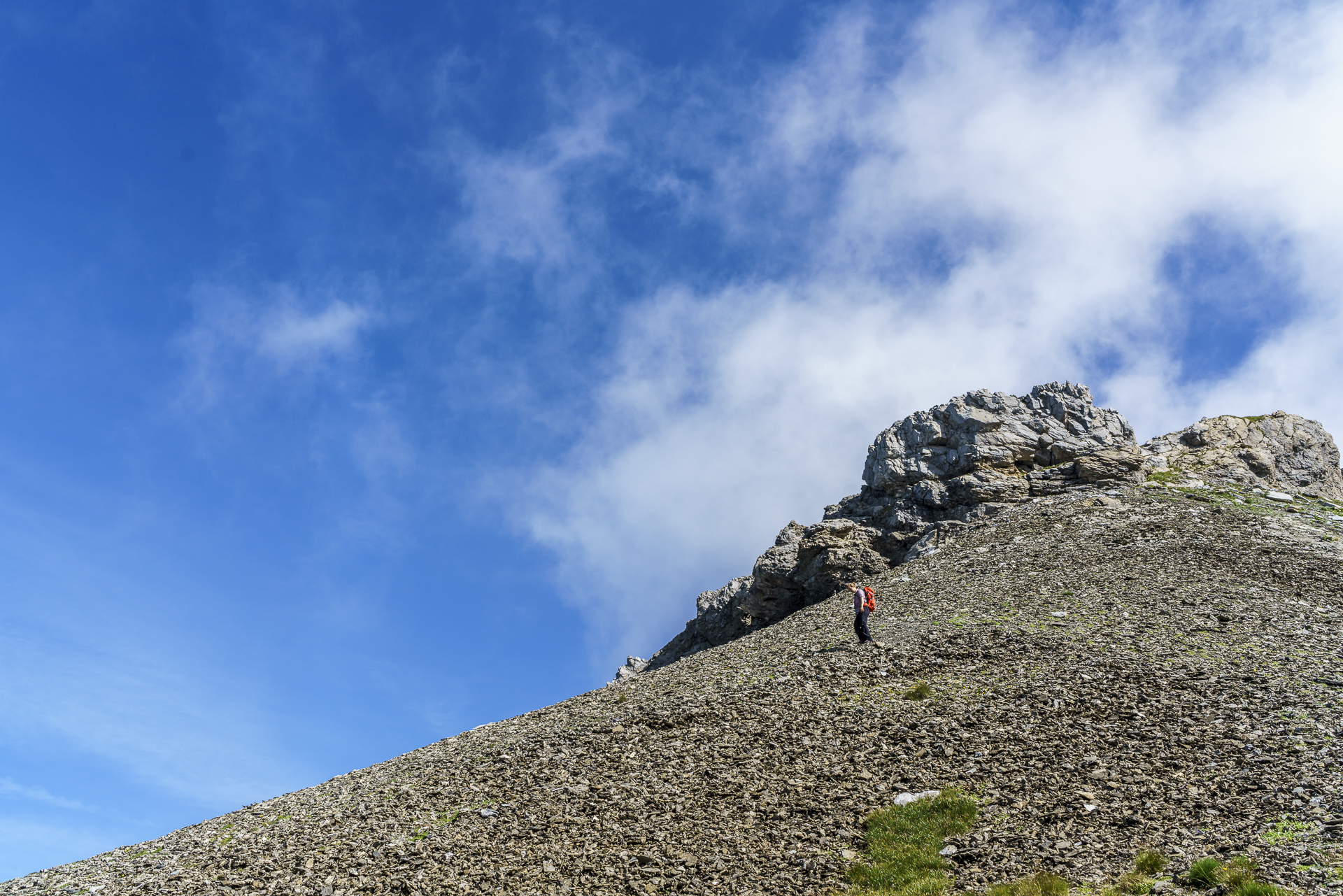
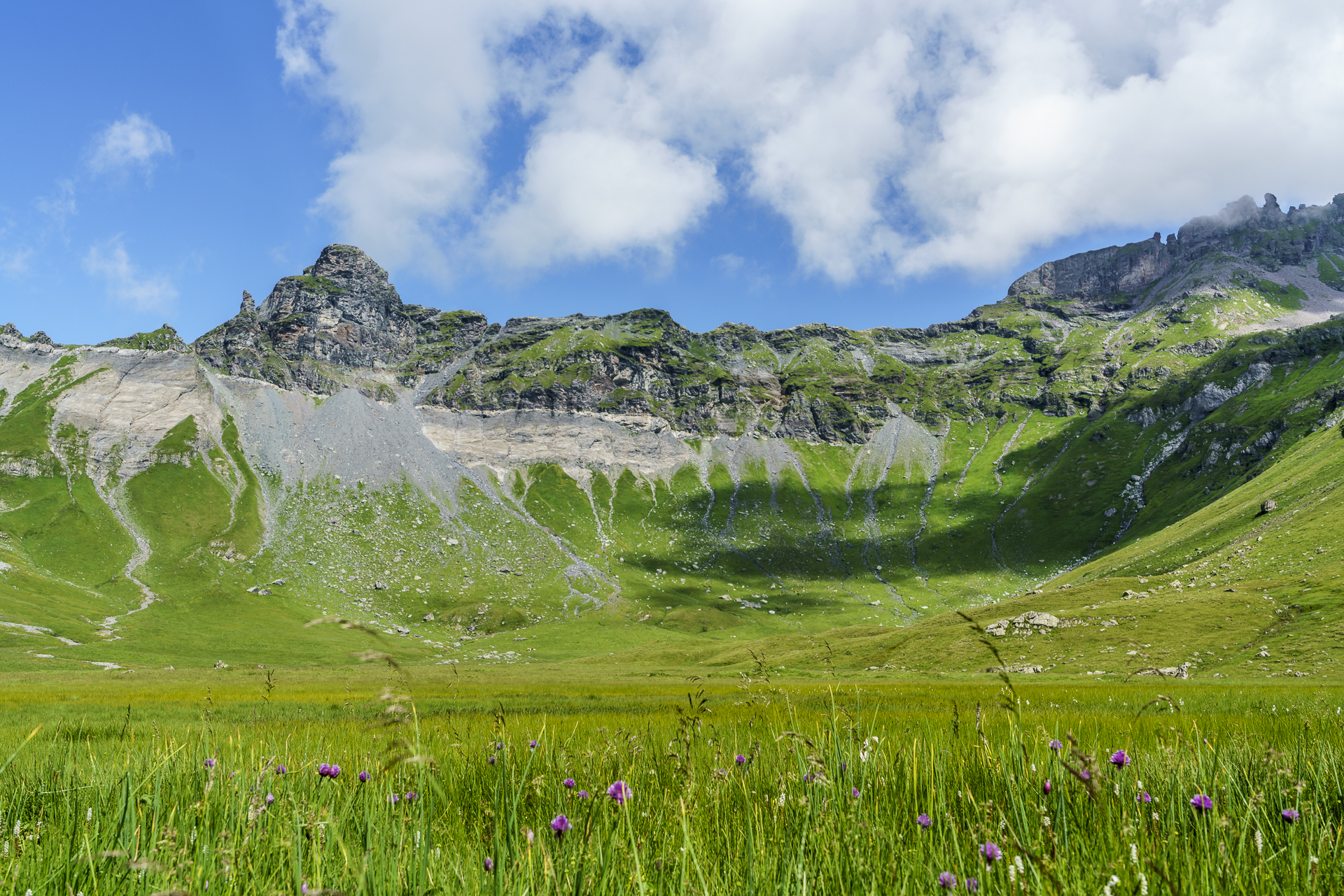
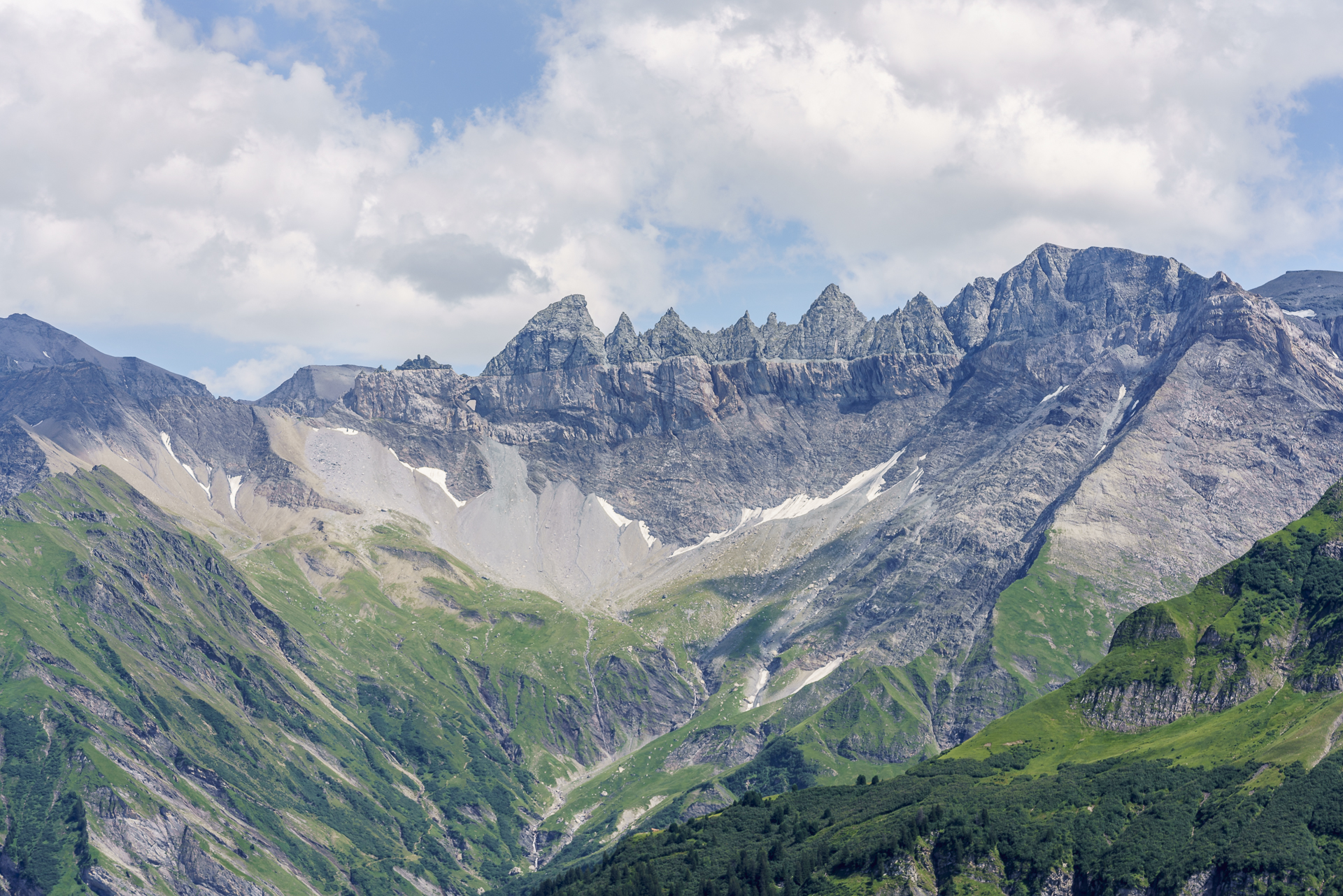
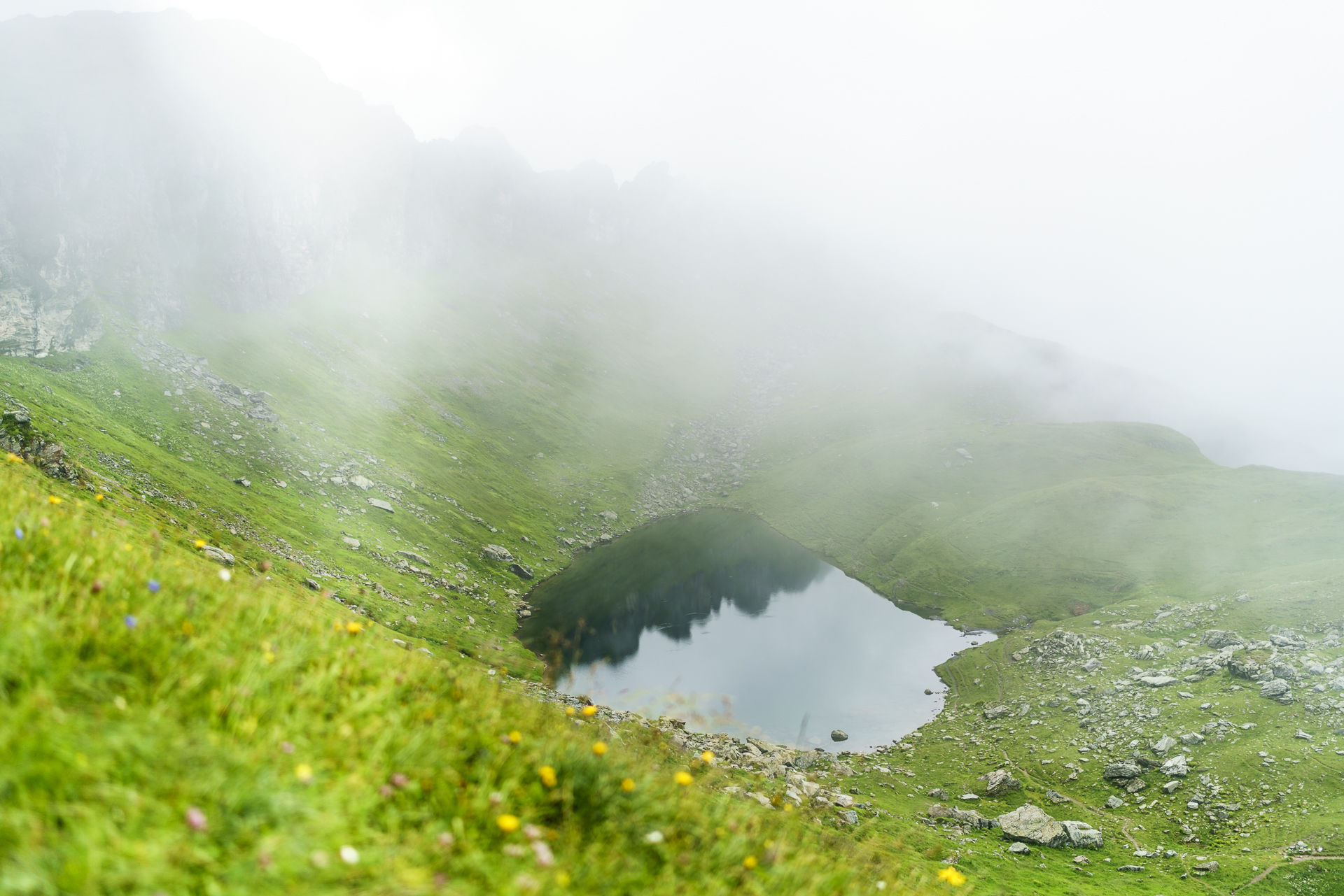
Up to the Chalchstöckli, the path is well signposted and in perfect “trail quality”. At one point I had to use my hands for a short “climb” during the ascent. I had the most respect for the descent from the Chalchstöckli to the Richetli Pass. However, the first steep section is well secured with ropes. The path then zigzags steeply down a scree slope down into the valley. It’s pretty your knees and poles are an advantage – but it’s not technically difficult. Apart from that, this section of the trail is simply phenomenal. The rugged rock flanks around which the shreds of clouds wind, the mirror-smooth Milchspüelersee on the precipice to the Linth Valley and the lush green plateau of the Wichlenmatt with the Glarus Vorab in the background. Wow! So insanely beautiful and so little used! We met exactly five people on the whole stage of the trail (and that was in the section Richetlipass – Elm). In addition to the five people, we discovered two fighting ibexes on the flanks of the Leiterberg thanks to the sound of colliding horns.
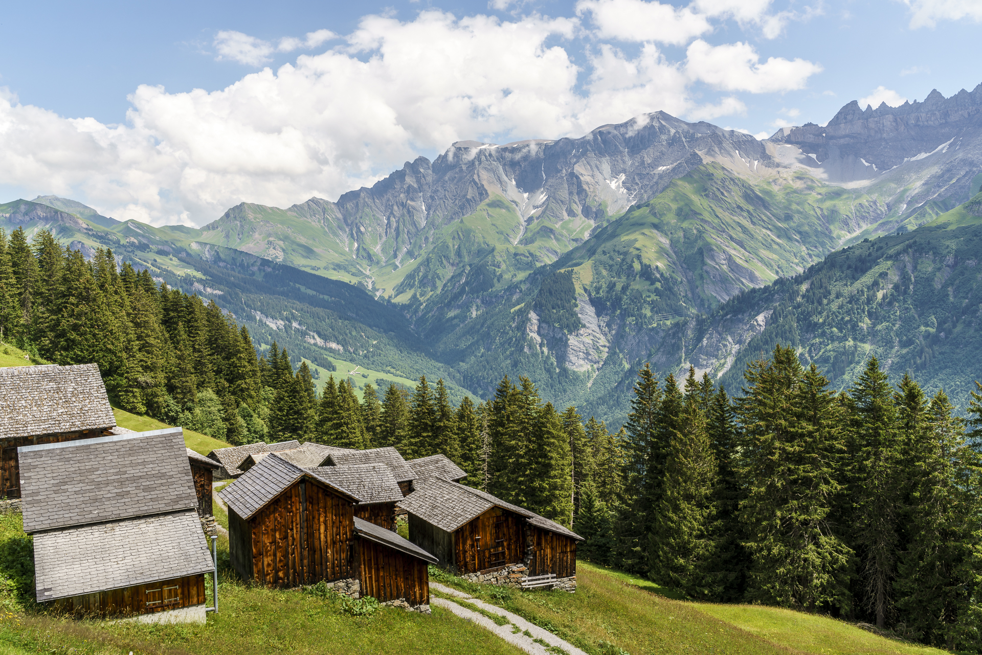
After a good four hours of hiking, we treat ourselves to a refreshment in the Obererbs ski hut. From here to the day’s destination, the Berghotel Bischofalp, the hiking trail follows the Elmer Höhenweg for a good hour, which leads from Obererbs to Ämpächli. The second positive surprise of the day is our room at the Berghotel Bischofalp. We have our own shower! And a view of the Tschingelhörner! Later, in a conversation with the initiator of the Berghotel Bischofalp, Samuel Hefti, we learn what kind of perseverance was necessary until the realization. There is no shortage of ideas for the busy Elmer. Barefoot hiking trail, holidays in the hay warehouse… We are excited to see what great attractions Bischofalp will have to offer in the coming years. Until then, guests will be royally pampered by hostess Silvia Hefti on the sun terrace with a view of the peaks of the Sardona Tectonic Arena. To my delight, there is also a piece of apricot cake left over. With its seven spacious and bright rooms including bath/WC, the Berghotel Bischofalp is just the right thing for all those who don’t want to miss out on the comfort of a wonderful environment after a mountain tour. If you arrive at the stage destination in the early afternoon, like we did, you have the option of following the Wildheuerweg (a route where, according to Samuel Hefti, you often see chamois or deer) or taking a trip to the Elm Giant Forest, which is only a twenty-minute walk away in Ämpächli.
Stage 2:
13.5 kilometres | 645 m uphill – 1,300m downhill | approx. 5h walking time

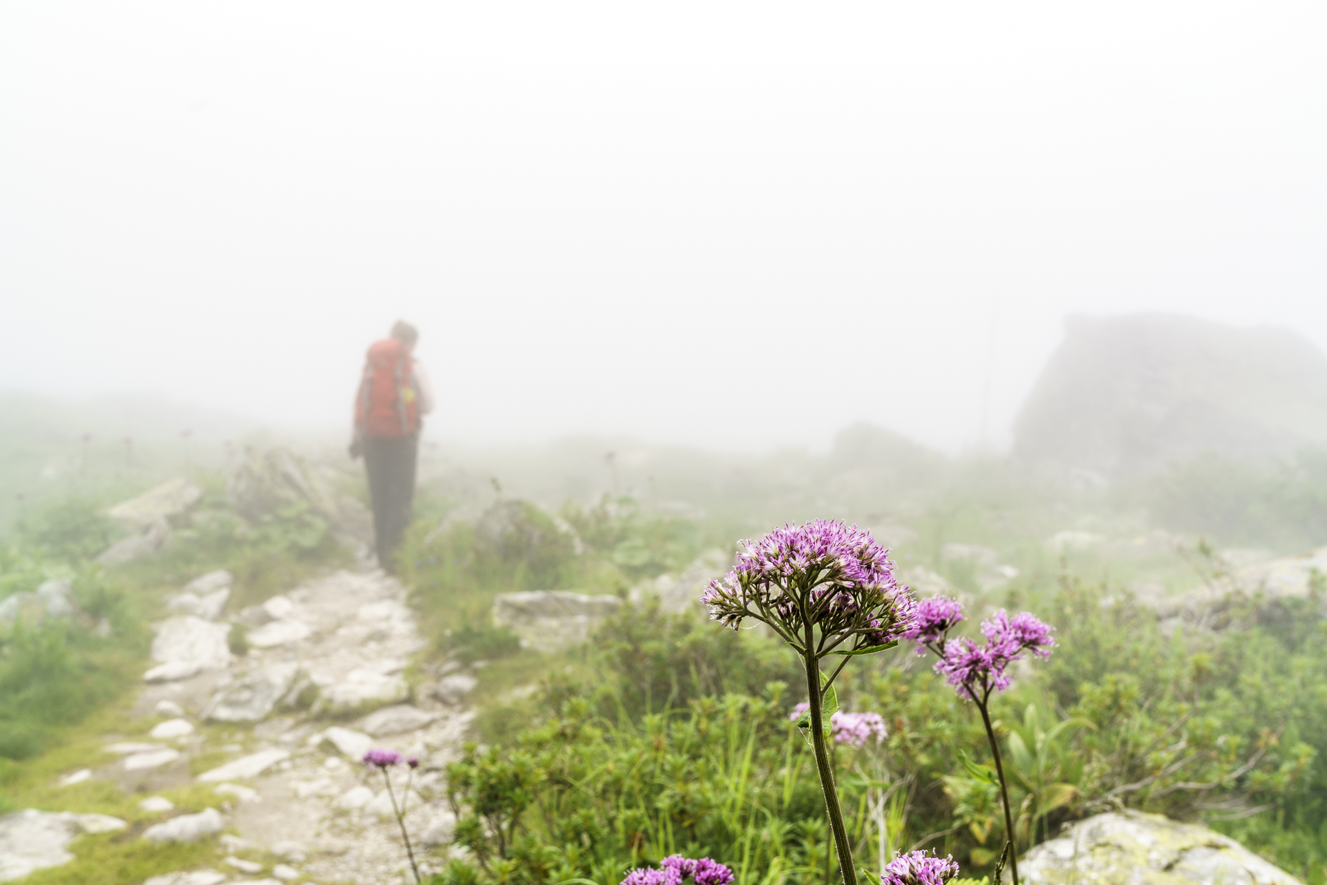
3rd hiking day: via Wildmadfurggeli back to Mettmen
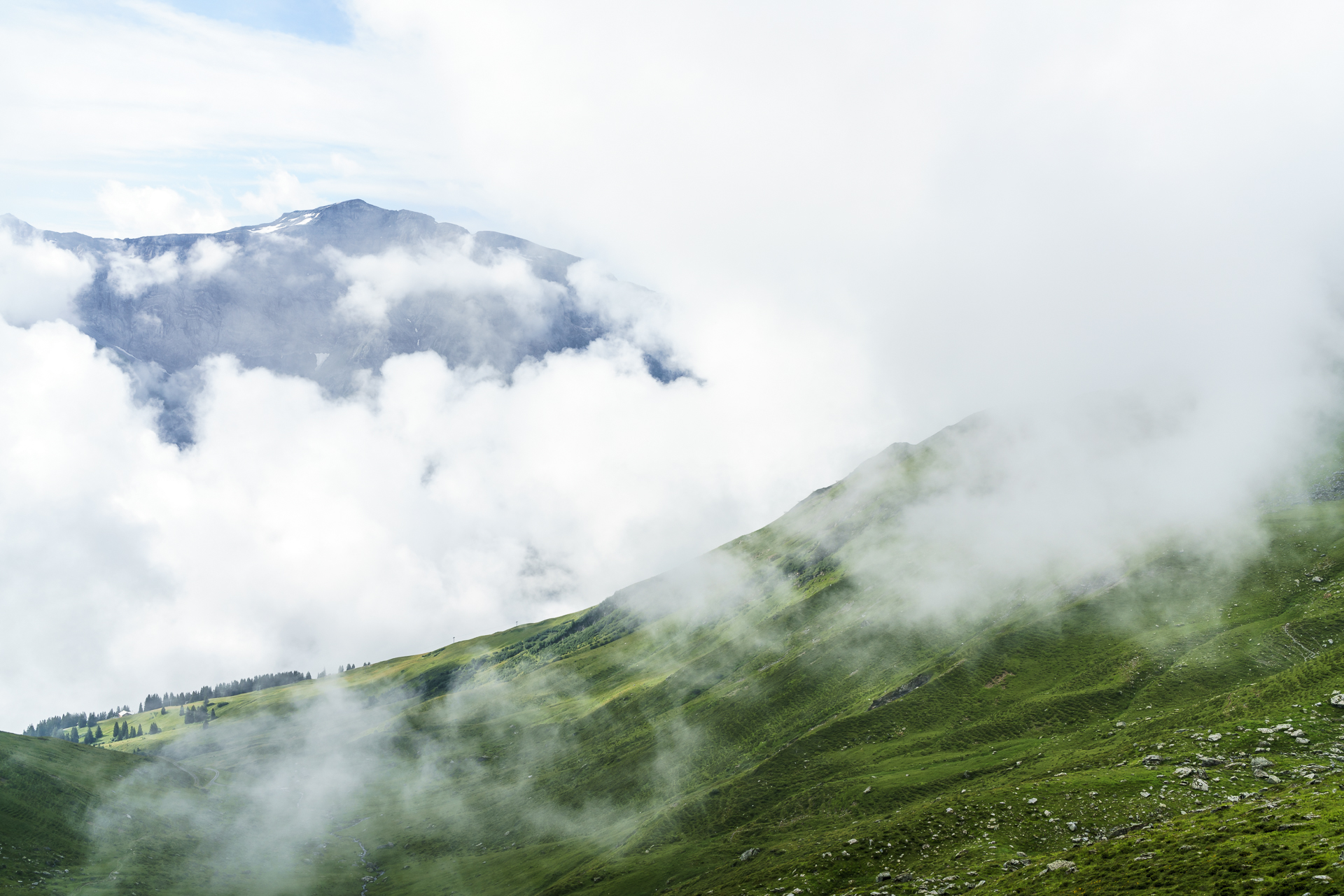
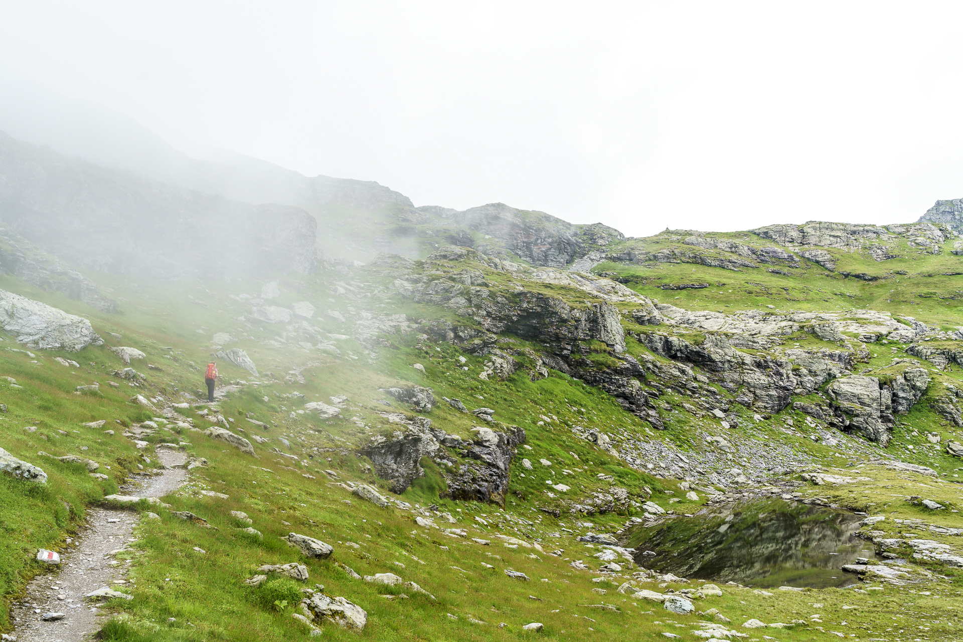
In terms of weather, the last day of hiking is like a lottery. The mountain slopes are cloudy this morning. But at least the announced rain is a long time coming. The last stage leads us from the Bischofalp first steeply uphill again to the Chüebodenseeli. The temperatures are really pleasant and we quickly overcome the altitude. At the top of the Chüebodenseeli there is another highlight: we discover two chamois down by the lake. Unfortunately, the zoom lens stayed at home on this tour – so it was only enough to take a shot of the mystical fog all around. It didn’t get any nicer that day. On the descent towards Mettmen, we suddenly find ourselves in thick fog and leave the Kärpfbrücke (a natural bridge that is one of the main attractions of the Glarus main thrust) on the left. Thanks to good signposting, we catch the right turn-off to the Naturfreundehaus shortly before Mettmen. There we have a very welcome piece of cake and a drink (I order tea to suit the weather). A beautiful end to an absolutely fantastic three day tour. You should have heard me on the way – every few meters a “so beautiful!” slipped out of me.
Stage 3:
11.5 kilometres | 750 m uphill – 800m downhill | approx. 4.15h walking time

Practical information and tips for the Kärpf Trek
The Kärpf Trek leads in three stages across the Freiberg Kärpf. The total distance of the circular hike is 35 kilometres. An ascent of 2,500 metres in altitude has to be overcome. The pure hiking time of the individual stages varies between four and five hours (the details can be found under the individual stages). For the most part, the Kärpf Trek follows well-signposted mountain trails. The section Leglerhütte – Richetlipass follows a blue-white-blue marked alpine hiking trail. You can spend the night in the Leglerhütte, in the Berghotel Bischofalp and in the Obererbs ski hut (closed this summer due to renovation work).
The Elm holiday region offers the Kärpf Trek as a package deal for CHF 250 per adult. This includes 2 nights with half board, packed lunches as well as the bus ride Schwanden-Kies and the cable car ride Kies-Mettmen (return). More information about Europe’s oldest wildlife sanctuary can be found here: Freiberg Kärpf
Note: This trip was supported by Ferienregion Elm – Thank you very much for that. All opinions and impressions are, as always, ours.

Leave a Reply