

Monte Bar – Monte Boglia: Multi-day hike on the Sentiero Lago di Lugano
Sometimes it’s not worth blogging everything right away, but letting time pass between what you’ve experienced and writing it down. So now, in this rainy week of the old year, I can remember three all-round perfect autumn hiking days on the Sentiero Lago di Lugano.
After spending three autumnal hiking days with the family in Val Puschlav last year, this time we took a closer look at the Val Colla. The sparsely populated valley is one of the most pristine in the Lugano. Popular with bikers and climbing fans, the Val Colla with its beautiful panoramic peaks is also a worthwhile destination for multi-day hikes with overnight stays in huts.
The Sentiero Lago di Lugano at a glance
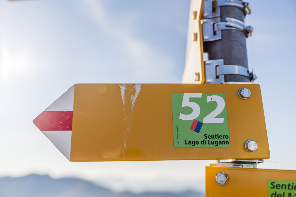
Signposted with the route number “52”, the Sentiero Lago di Lugano leads through the Sottoceneri in nine stages. The multi-day hike leads from the panoramic foothills of the Alps over legendary ridge hikes to the Mediterranean lakeside promenades of Lake Lugano. Almost every stage of the 130-kilometre tour passes one or more of the most popular destinations in Ticino or the Lugano region. The sections of the Sentiero Lago di Lugano are designed as follows:
Stage 1: From Lugano (Magliosa) to Miglieglia Stage 2: From Miglieglia to Cap. Tamaro (Monte Tamaro – Monte Lema High Trail)Stage 3: From Cap. Tamaro to Medeglia Stage 4: From Medeglia
to Cap. Monte Bar Stage 5: From Cap. Monte Bar
to Cap. Pairolo
Stage 6: From Cap. Pairolo to Lugano (M. Brè)
Stage 7: From Lugano (Paradiso) to Morcote Stage 8: From Morcote
to Riva. S. Vitale (via Monte San Giorgio)Stage 9: From Riva S. Vitale (M. Generoso)
to Mendrisio
Each stage has to cover between 11 and 22 kilometres of route and 700 to 1800 metres in altitude. As already written in the introduction, many sections can alternatively be completed as a day hike. If you want to save on altitude, you can also use cable cars for some stages (e.g. stages 2, 3 and 7). In the overview above, I have linked you to those tours that we have already portrayed here on the blog as day hikes. During our three-day autumn hikes, we focused on the following sections:
Stage 4: From Medeglia to Capanna Monte Bar Stage 5: Via Monte Bar
and Gazzirola to Capanna Pairolo
Stage 6: Over Monte Boglia to Lugano
Day 1 – from Medeglia to Capanna Monte Bar
What luck! Just for the period of our three-day family hike, three wonderfully golden October days are predicted. It’s hard to believe that we’re doing so well with the weather again. The journey to the starting point of the tour takes us by train via Lugano to Rivera-Bironico and from there by post bus to Medeglia Paese. Now it’s time to shoulder backpacks and tackle the first meters of altitude up into the heights of the Val Colla. Some of our “hiking group” would have loved to fortify themselves with an espresso at this point – but the places to stop for refreshments are limited in this sleepy village. And the option to “cheat” for coffee for ten minutes in the wrong direction fell on deaf ears with the majority.
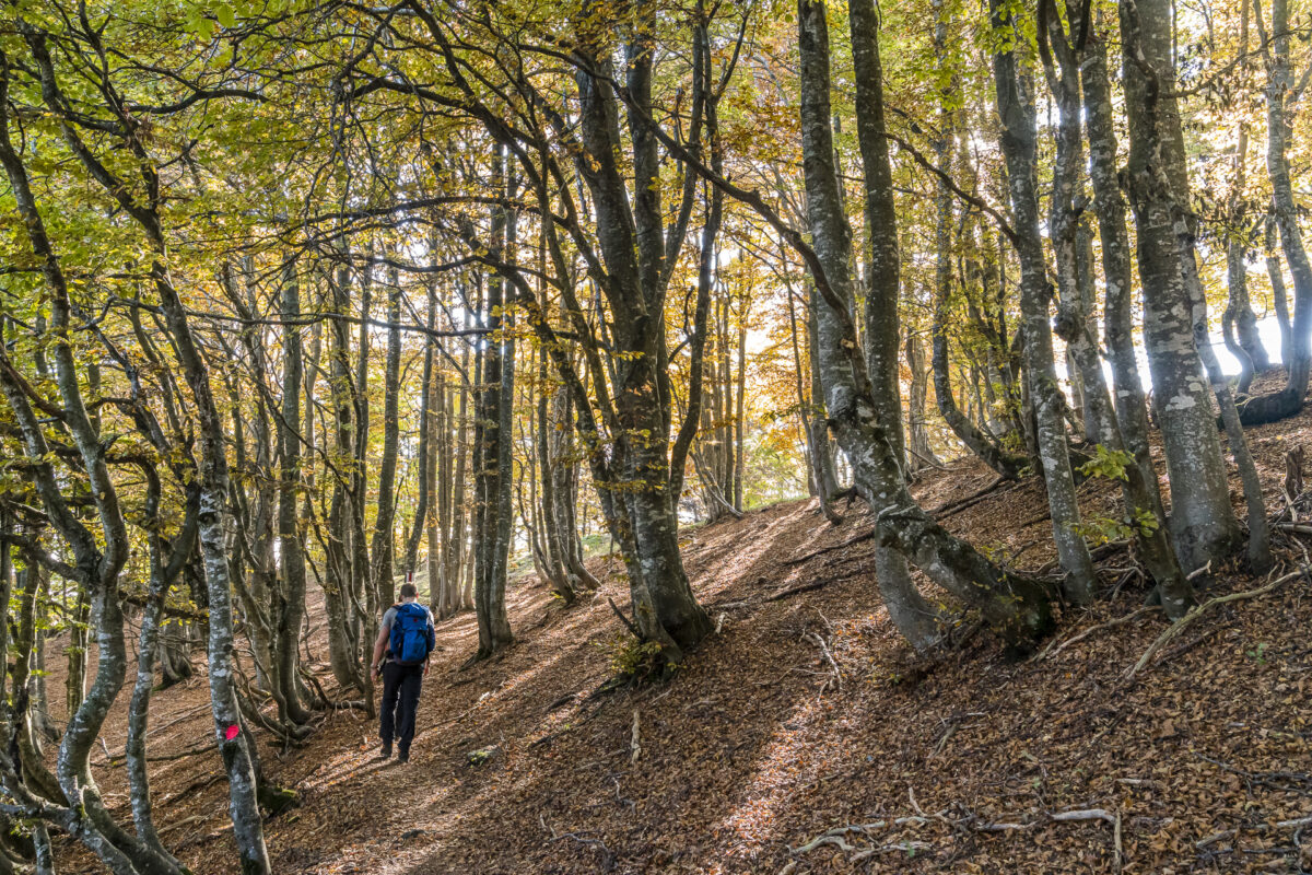
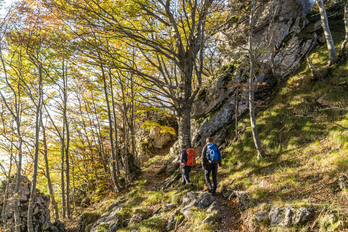
And so, without caffeine infusion, we followed the hiking trail signs over the Vedeggio, uphill through a mixed forest to the peat bog of the Gola di Lago.
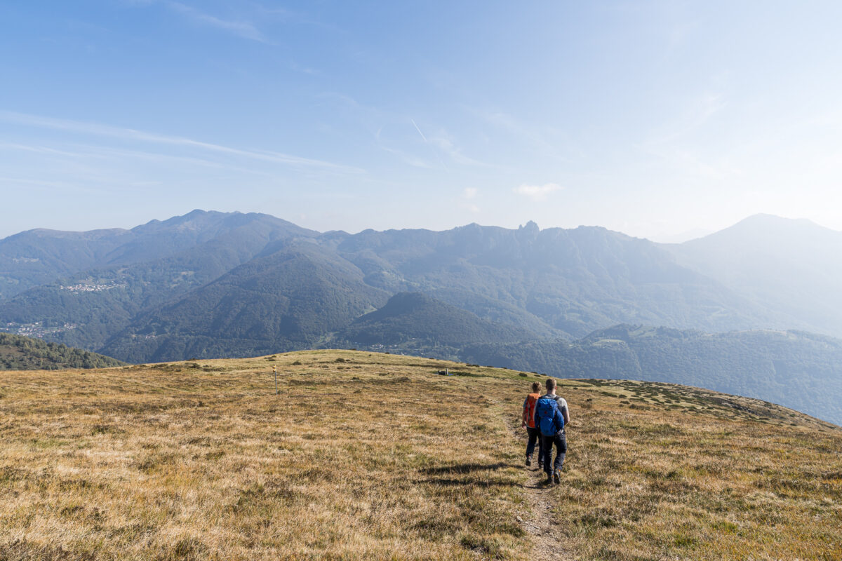
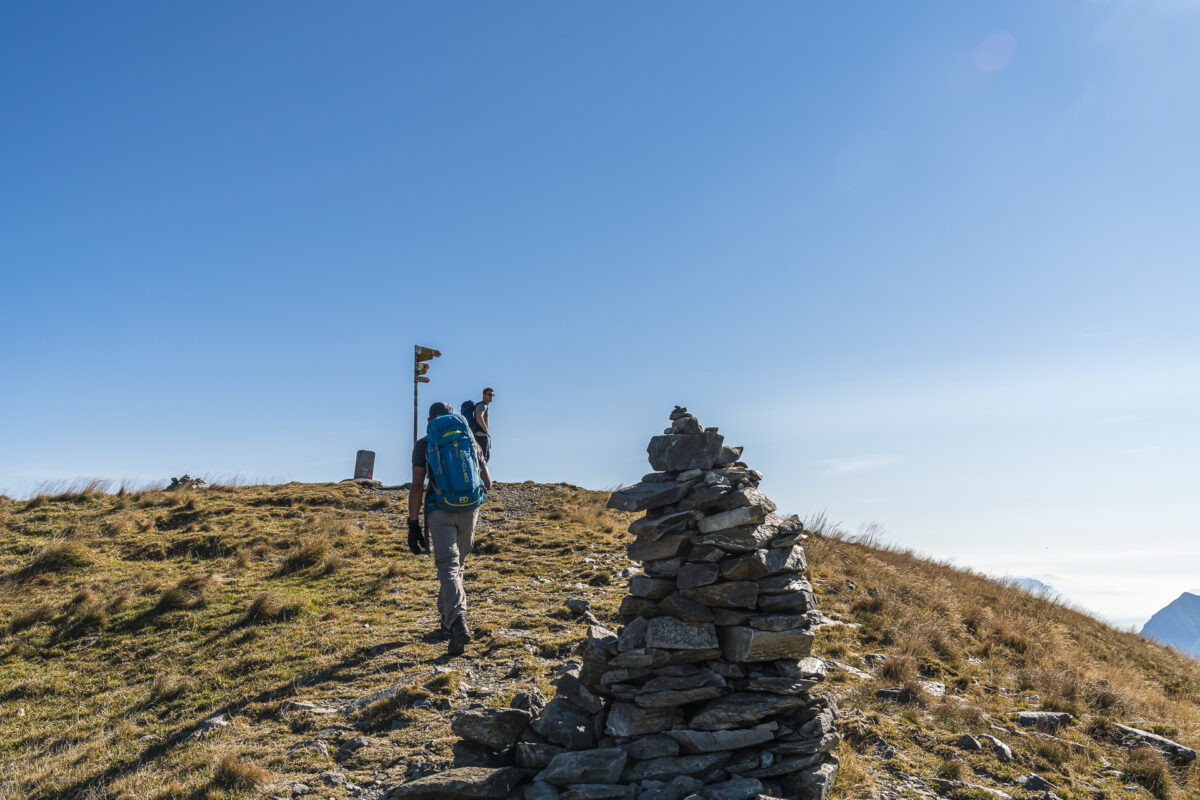
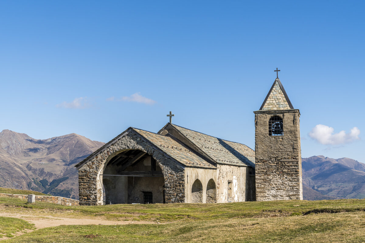
The path leads continuously uphill in a pleasant zigzag. Soon the woods thin out and the bare slopes of Monte Bar appear in front of us. These can be traced back to the clear-cutting carried out in the 19th century due to scarce resources. The alpine farming, which continues to this day, contributes to the fact that the forest above 1,000 metres above sea level has not yet reclaimed any significant areas. Past the Alps – orphaned at this time of year except for a few cheeky horses – the Sentiero Lago di Lugano leads us to the striking cross “Motto della Croce”, which can be seen from afar.
From here we have our destination – the Capanna Monte Bar – in sight. And thanks to a lively debate about the effects of self-driving cars on our road spaces (the fellow hikers and discussants may certainly smile at this point), we also leave the last few kilometers behind us quickly.
Today’s destination: Capanna Monte Bar
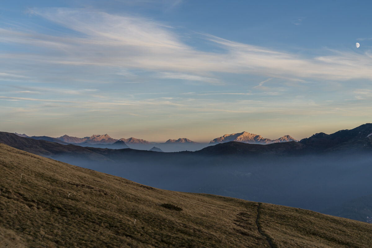
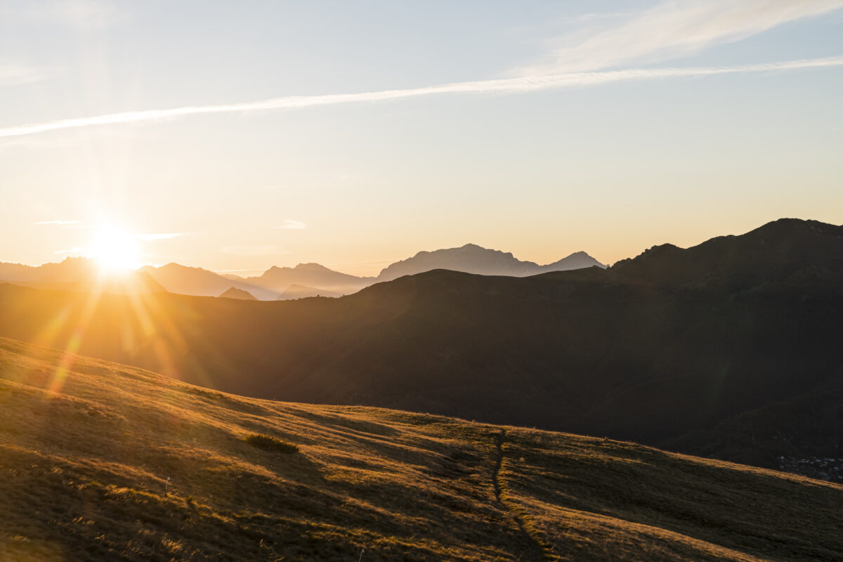
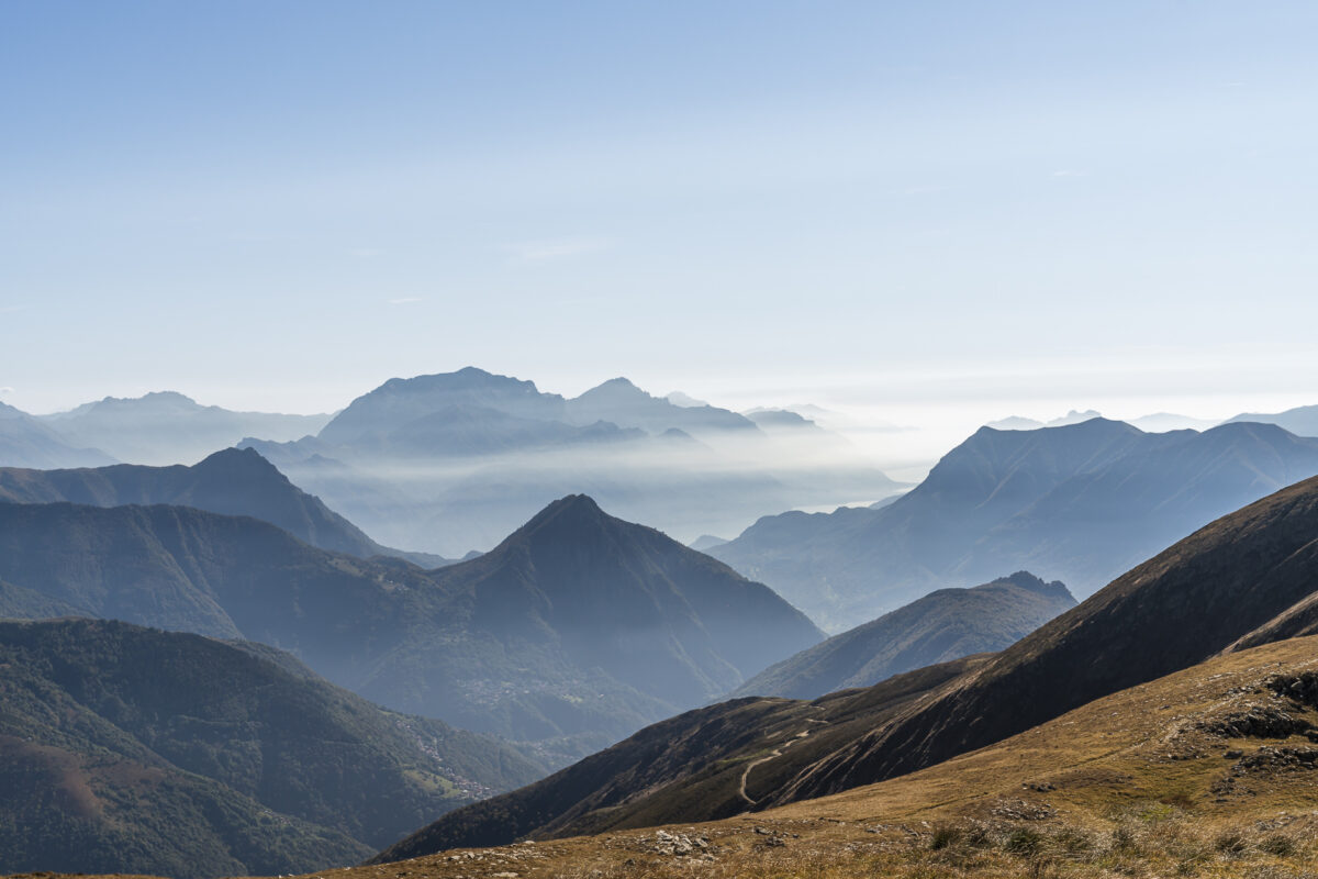
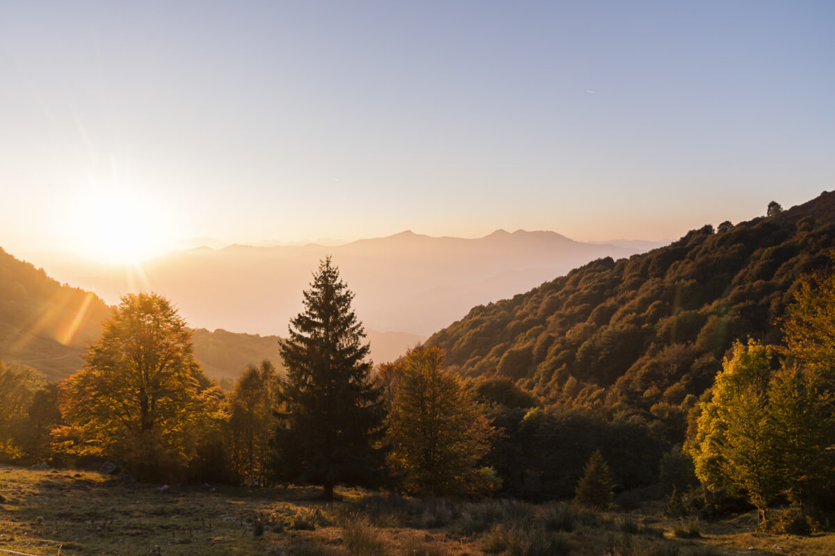
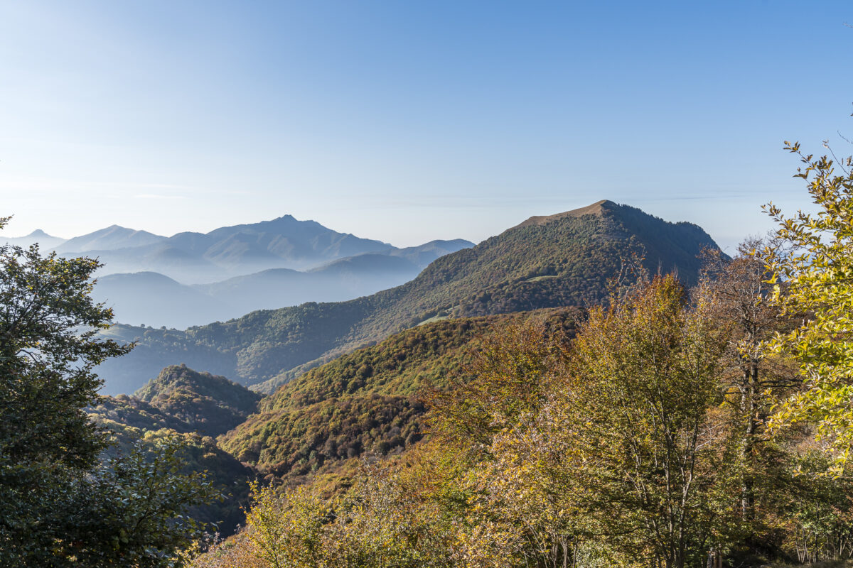
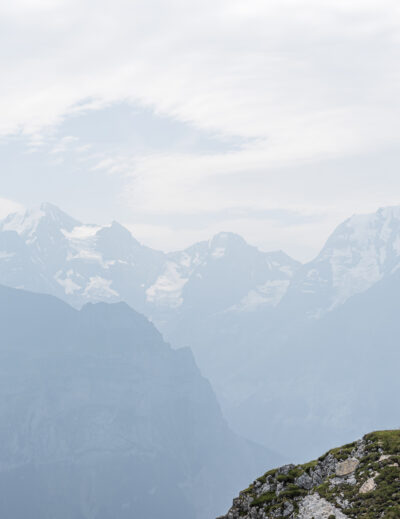
Arriving at the day’s destination, we let the sun shine on our faces in a sheltered location and enjoy the phenomenal view. The impressive mountain panorama ranges from the Italian peaks to the striking Denti della Vecchia (where we will pass on the third day of the tour) to the Valais four-thousand-metre peaks with the Monte Rosa massif and the Mischabel Group.
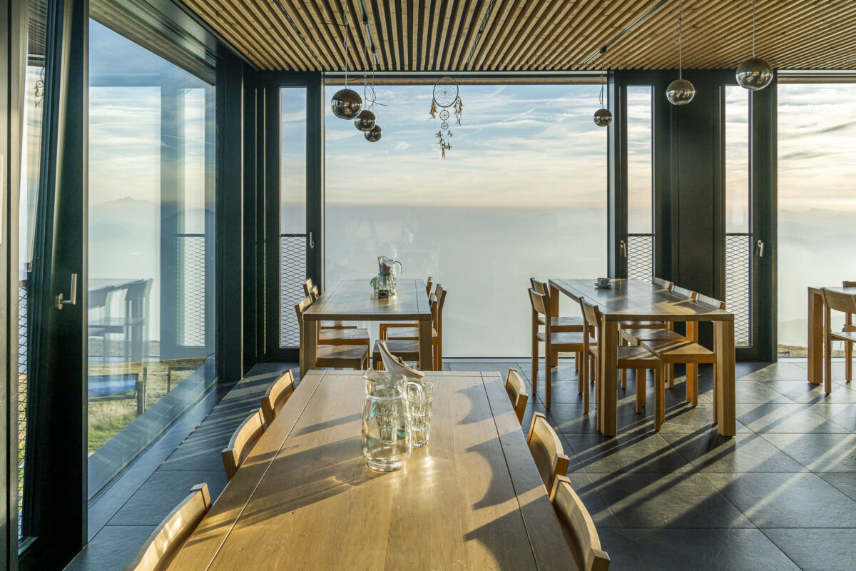
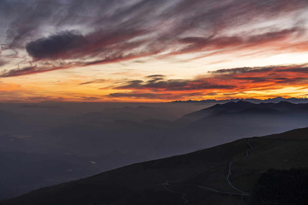
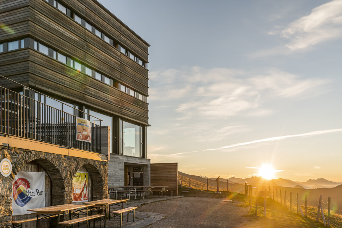
Exactly 80 years after the construction of the first mountain hut, the new SAC hut was inaugurated in 2016. The Capanna Monte Bar not only offers contemporary comfort (in addition to the incomparable view), but is also designed to minimize the negative environmental impact. A great stage destination, where an overnight stay is worthwhile even without the ambitions of a multi-day hike on the Sentiero Lago di Lugano. I mean, look at this play of colors!
Key data of the hike Medeglia – Capanna Monte Bar
| Starting point | Medeglia, Paese (702 m ü. M.) |
| Reachability | Accessible by public transport |
| Length | 12.1 kilometres |
| Elevation gain | ↗ 1,236 m 340 m ↘ |
| Duration | 4:45 p.m. |
| Destination | Capanna Monte Bar (1,608 m a.s.l.) |
| Catering | No refreshment stops on the way in the low season |
2nd hiking day – from the Capanna Monte Bar to the Capanna Pairolo
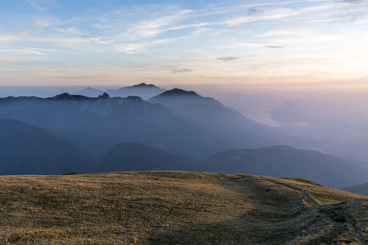
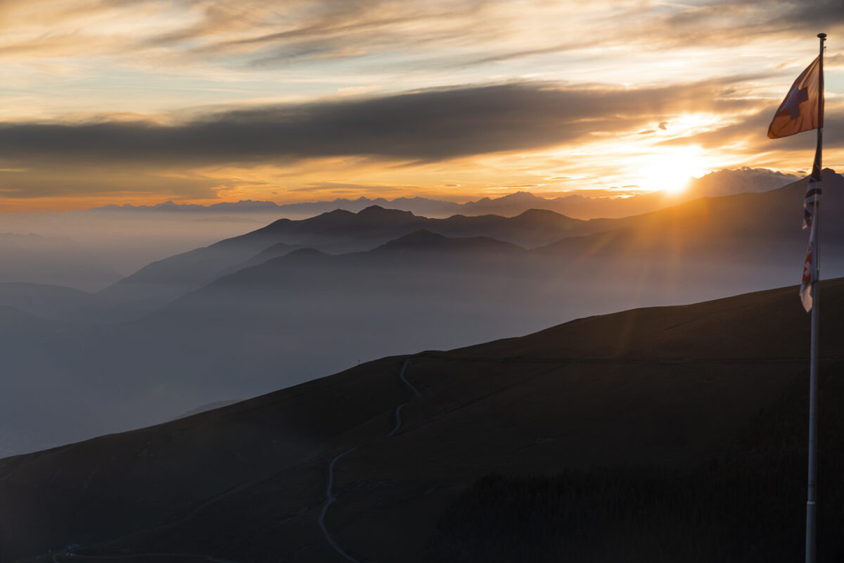
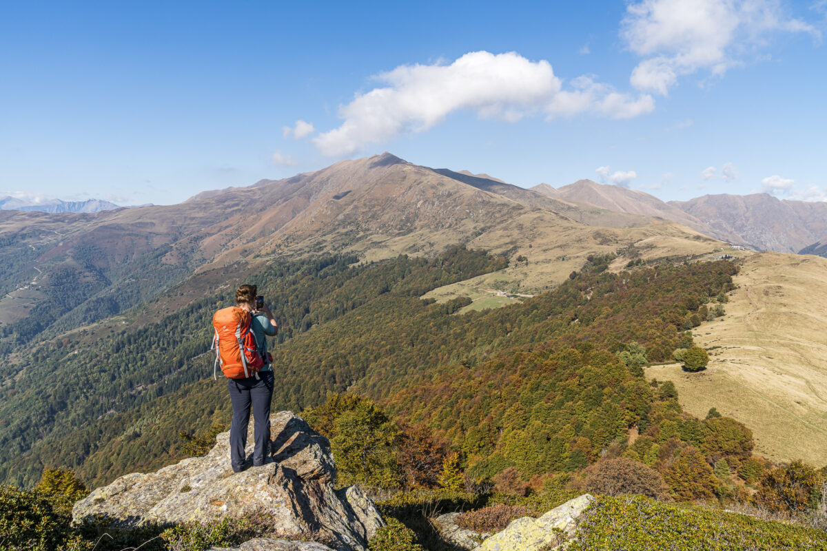
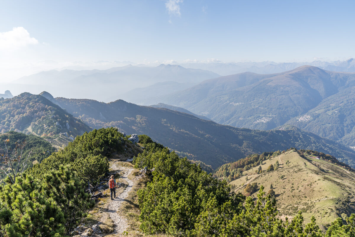
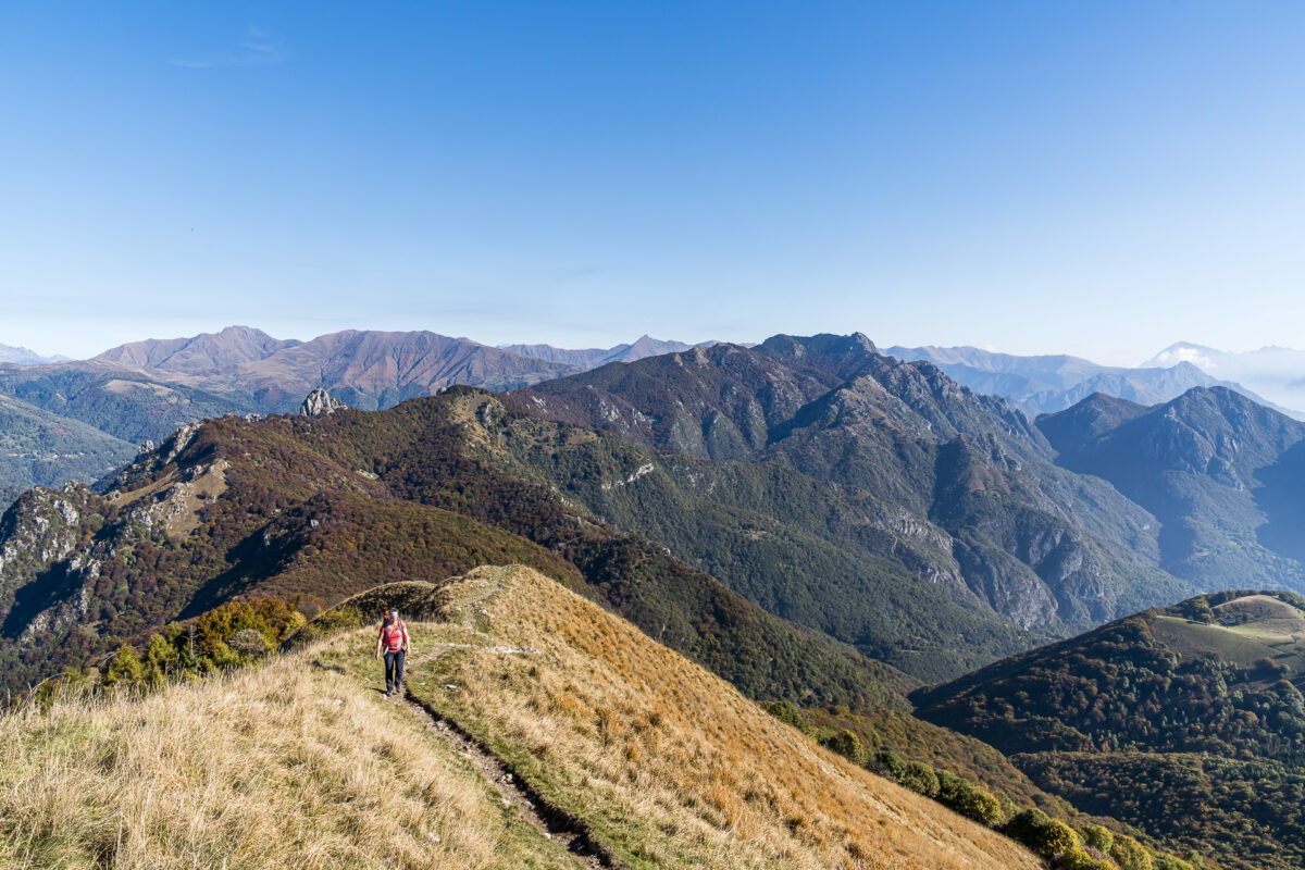
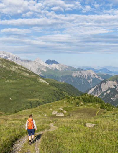
The second day of hiking starts the same way as the first ended: with a magnificent view over the Ticino mountain peaks. In the warming light of the first rays of sunshine, we tackle our first summit of the day. Today’s stage has it all. In a constant up and down, the Sentiero Lago di Lugano, the Swiss-Italian border, will lead us around the head of the Val Colla valley to the destination directly opposite us at the foot of the Denti della Vecchia.
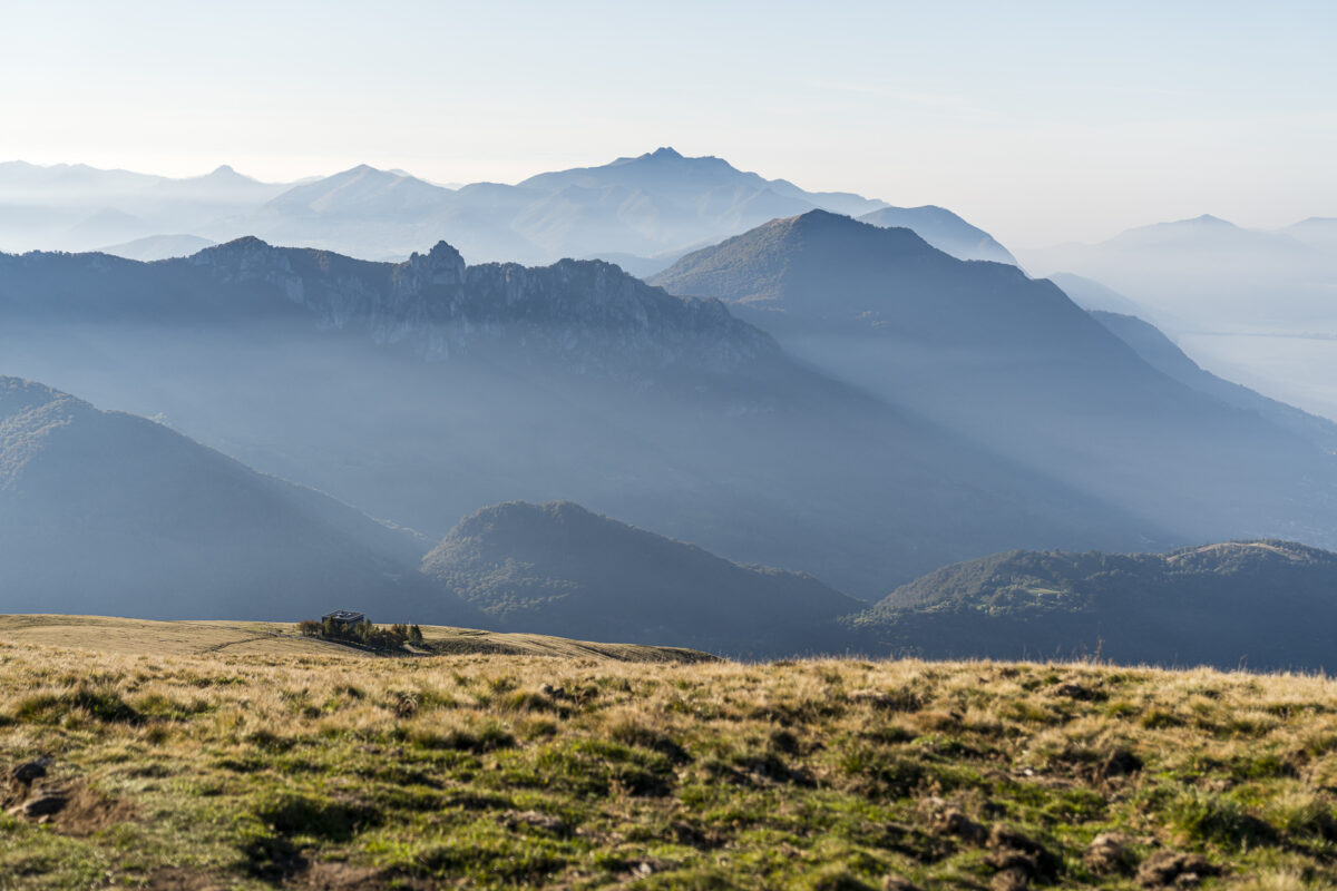
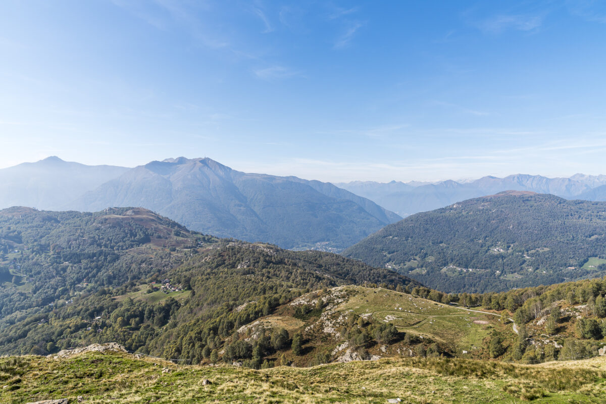
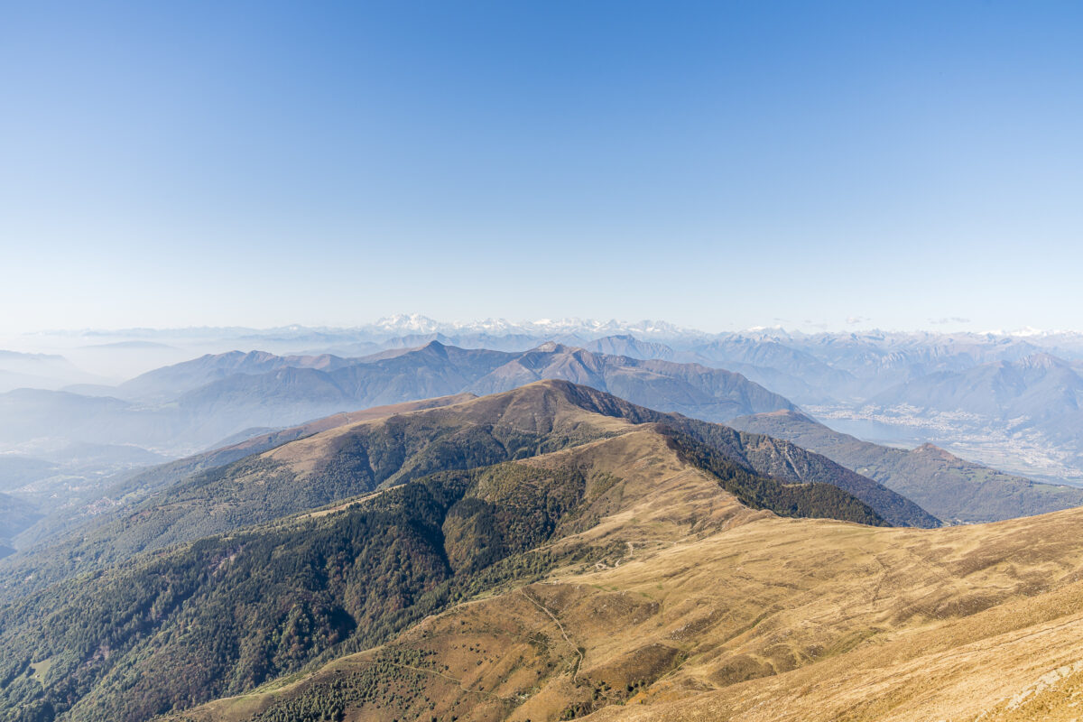
The temperature, the visibility, the terrain – it couldn’t be more perfect! And so, after a short photo stop on Monte Bar, we enjoy the panoramic view over the plateau towards Gazzirola.
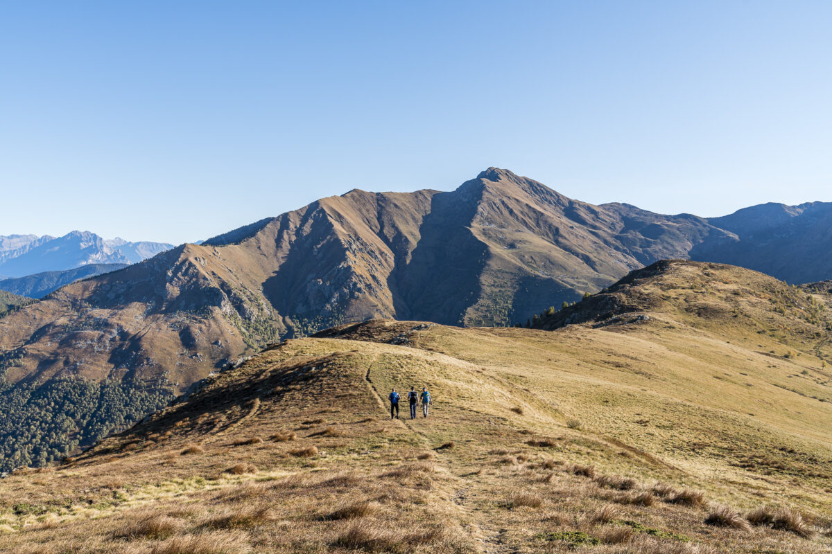
With a height of 2,115 metres above sea level, the Gazzirola is literally the “highlight” of our three-day tour. The view here is also – no surprise – amazing! Far-reaching and deep views in all directions. Not quite as “wow” is the following part of the path following the ridge down to the Passo di San Lucio. The paths are washed out, crisscrossed with coarser gravel stones and therefore a bit tedious to walk on – at least in comparison with the previous paths. And yes, that’s complaining at a high level. Especially since the following stop at the Capanna San Lucio (we decide on the Swiss side) quickly makes us conciliatory. The daily specials are really good here!
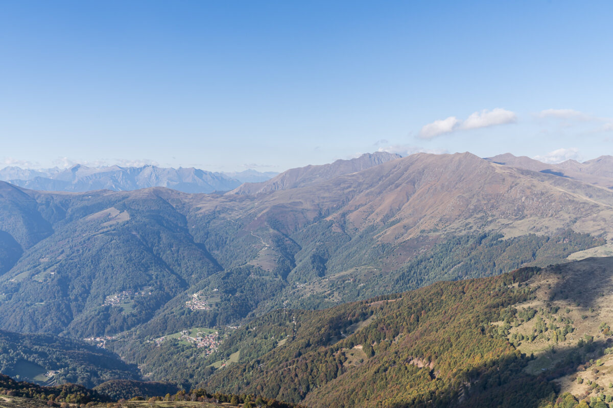
On the other hand, the outlook is somewhat more skeptical. “Are you sure we still have to cross that peak in the distance?” Yes I am! And be forewarned at this point – every descent is followed by a new ascent. But now the perspective changes and we look back on the already mastered route. Either way, with the weather and the scenery, a few meters of altitude doesn’t matter anymore, does it?

Today’s destination: Capanna Pairolo
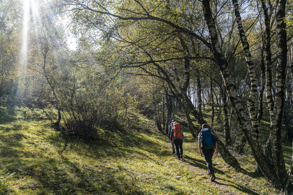
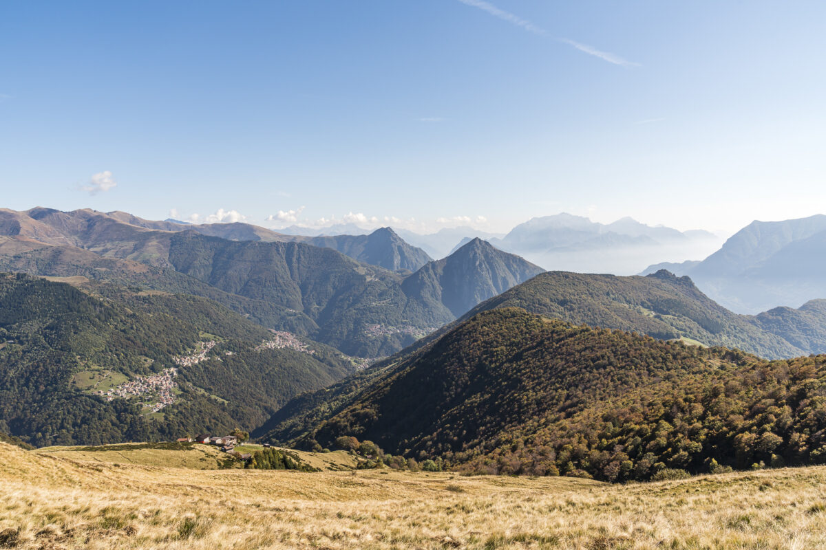
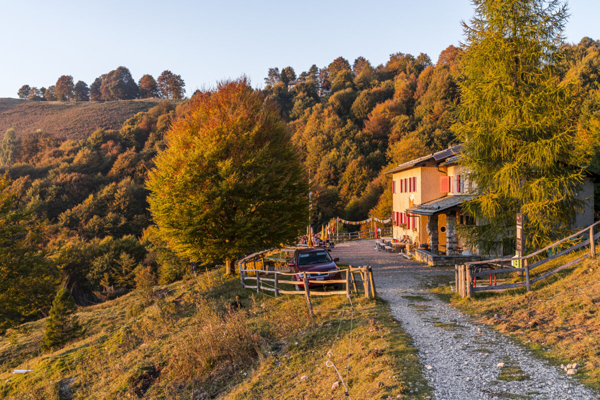
After leaving the bare slopes of Monte Bar and Gazzirola behind us, we are greeted by the autumnal spectacle of colours on the opposite side of the valley. Golden shimmering birch leaves, yellow-orange sparkling beech trees, red shining chestnut trees – and in the middle of this autumnal blaze of colour, the Capanna Pairolo! Since the 1930s, it has served as a base for Lugano climbers. While the Capanna Monte Bar knows how to inspire with its modern architecture, comfort and also the far-reaching view, the Capanna Pairolo radiates nostalgic cosiness.
Key data of the hike Capanna Monte Bar – Capanna Pairolo
| Starting point | Capanna Monte Bar (1,608 m a.s.l.) |
| Reachability | Starting point/destination can only be reached on foot |
| Length | 16.5 kilometres |
| Elevation gain | ↗ 1,300 m 332 m ↘ |
| Duration | 7:00 a.m. |
| Destination | Capanna Pairolo (1,349 m above sea level) |
| Catering | Capanna San Lucio (CH) and Rifugio (IT) on the Passo di San |
3rd hiking day – over Monte Boglia to Lugano
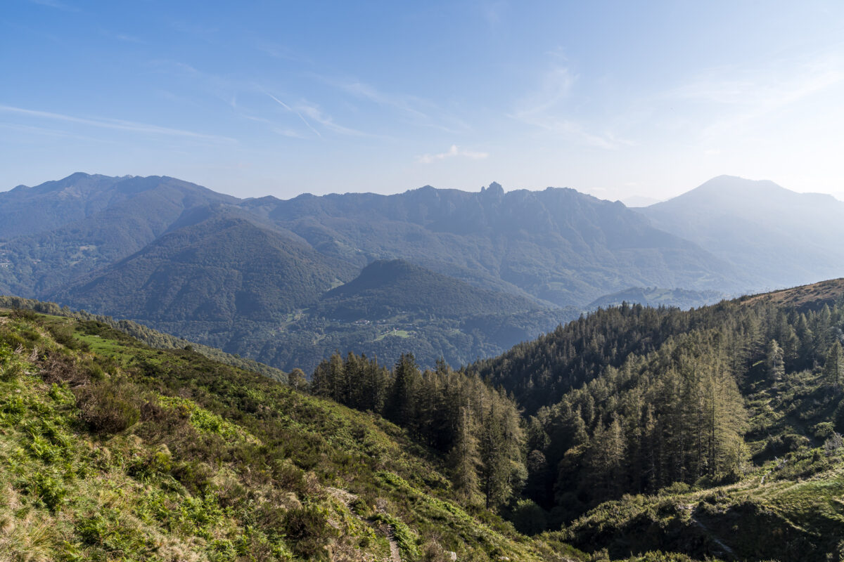
Today we follow winding smugglers’ paths and narrow paths through the stone mosaic of the Denti della Vecchia. The “teeth” consist largely of dolomite. We admire the popular, white shining climbing rocks from the hiking trail and at the same time enjoy the view over the brightly colored autumn forests. Here and there we also get to enjoy a short “scramble”. Nothing wild – but for all those who struggle with exposed areas or feel insecure as soon as their hands are used, there could well be one or two challenging spots lurking here.
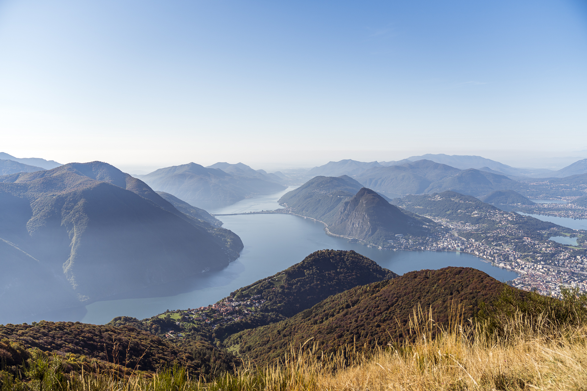
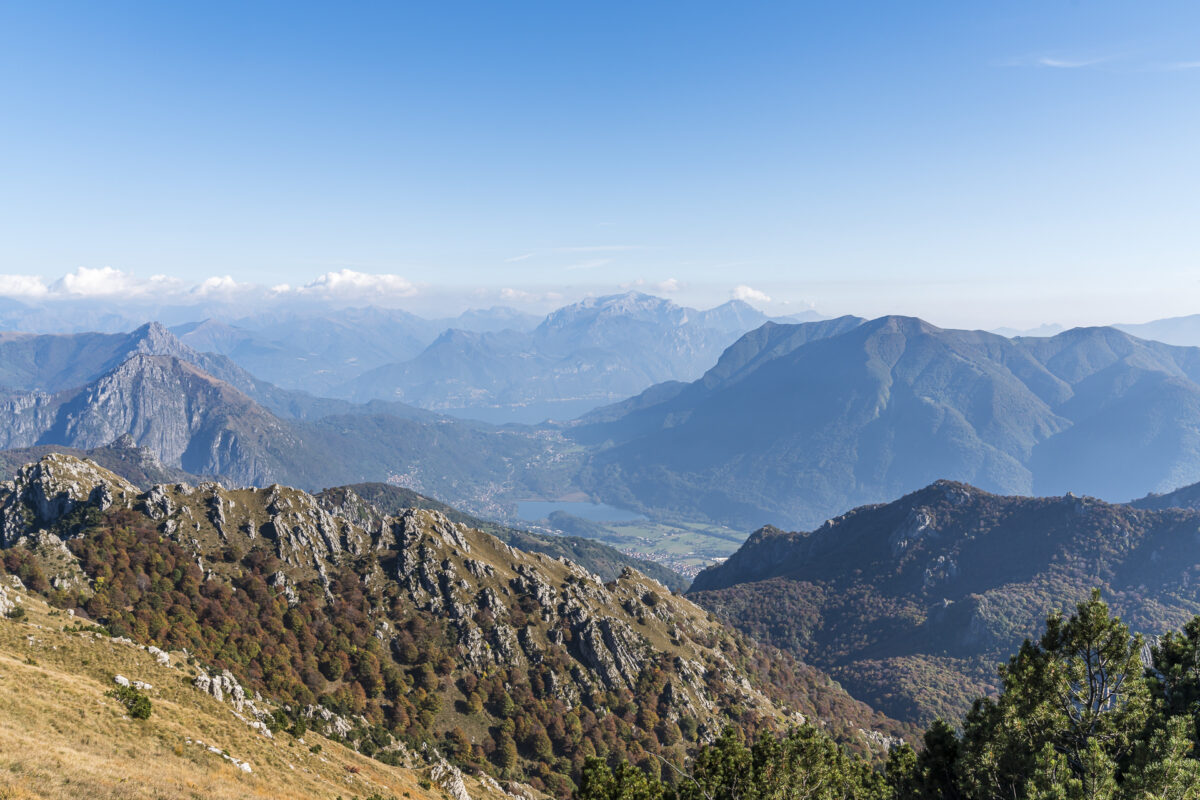
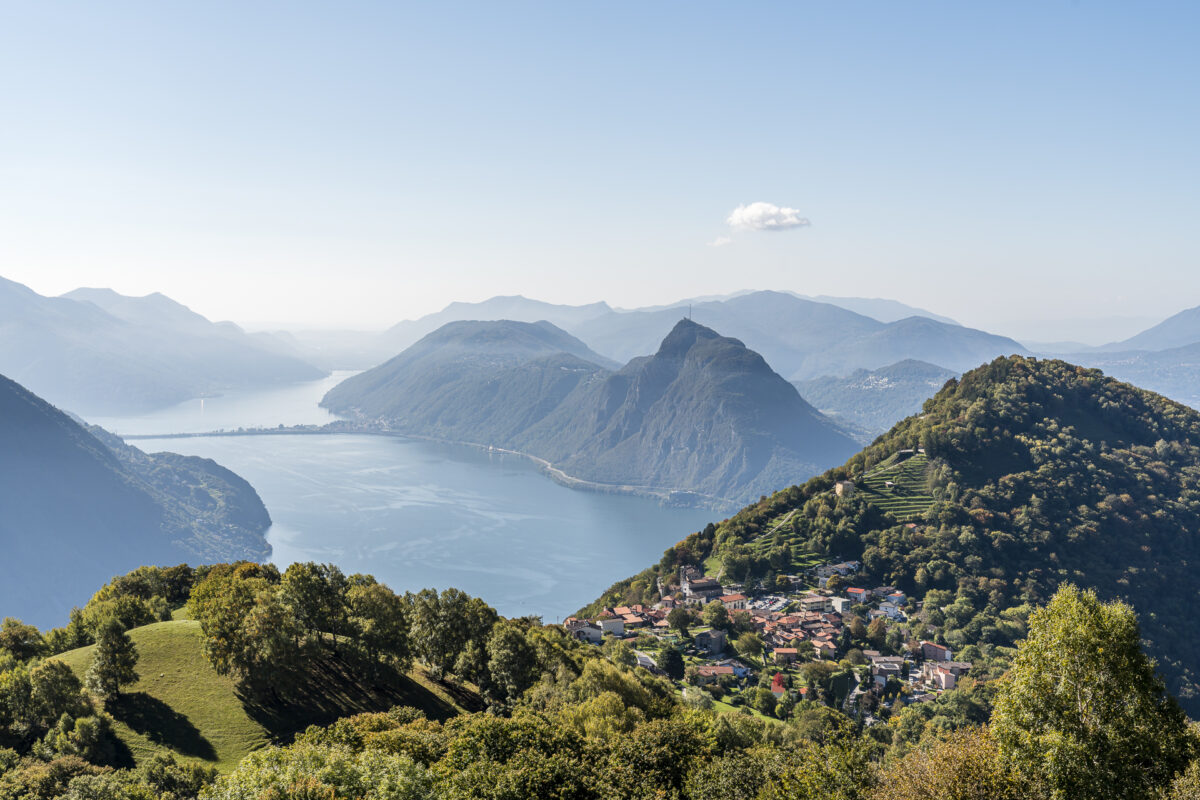
After a brisk first hour of hiking, we gather momentum for the jagged ascent to Monte Boglia on the descent to the Pian di Scagn. Thanks to a superbly prepared forest path that runs in a pleasant zigzag, we manage the 350 meters of altitude to the 1,516-meter-high panoramic summit in a good half hour (and thus twice as fast as signposted). This (very personal) sporting triumph is crowned with the following panoramic view over Lake Lugano.
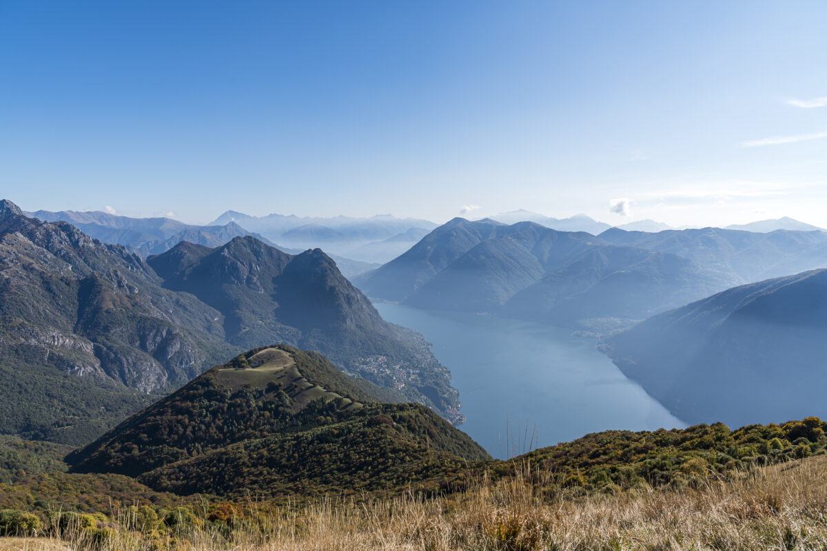
The postcard motif with the village of Brè in the foreground and Lake Lugano with Monte San Salvatore behind it accompanies us on the following descent towards Monte Brè. At the end, there is a nasty (interspersed with loose stones), extremely steep passage. But we also get this behind us and have definitely earned a pizza in Lugano (tip: in the Ristorante Cantinone, the terrace seats are still sunny until about 3:30 p.m. in mid-October and the pizzas are excellent!)
Key data of the hike Capanna Pairolo – Monte Brè
| Starting point | Capanna Pairolo (1,349 m above sea level) |
| Reachability | Starting point can only be reached on foot / destination can only be reached by public transport |
| Length | 10.6 kilometers |
| Elevation gain | ↗ 786 m 1,220 m ↘ |
| Duration | 4:30 p.m. |
| Destination | Monte Brè (928 m above sea level) |
| Catering | Grotto Alpe Bolla (at Pian di Scagn, about 5 minutes from the hiking trail) |
Practical tips for your hike on the Sentiero Lago di Lugano
- Thanks to the mild climate and moderate altitudes, the tour can be undertaken relatively early in spring or into late autumn. Find out in advance whether the huts are already (or still) open.
- Stages 4, 5 and 6 of the Sentiero Lago di Lugano are mostly mountain trails (difficulty T2/T3). In terms of fitness, it is a moderately difficult (second day of hiking) routes.
- The Capanna Monte Bar as well as the Capanna Pairolo can also be easily reached via alternative (easier/shorter) paths. The Capanna Monte Bar in particular is also very popular with bikers and families.
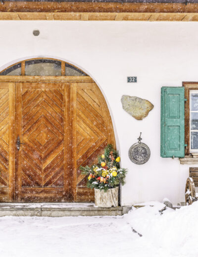
- The Capanna Monte Bar is open during the summer season from the beginning of May to the end of October. By the way, the hut is also open/in operation in winter (how about a snowshoe tour?). And there are also double rooms.
- The Capanna Pairolo is only open in the summer season (also from the beginning of May to the end of October). Bookings for the shared rooms are possible here by e-mail or phone (no online booking tool).
- Don’t forget to pack a silk sleeping bag for the overnight stay in the hut (unless you are staying at the Capanna Monte Bar in a double room, in which case this is not necessary).
Leave a Reply