

Iffigenalp – Cabane des Audannes – Sanetsch: top hut tour on the Röstigraben route
For this summer, numerous hut tours floated through my head. As is so often the case, I didn’t get around to implementing all the ideas. But behind one tour I can finally put the “completed” hoe: the 2-day hut tour from the Iffigenalp via the Schnidehore to the Cabane des Audannes and from there on to the Sanetsch Pass. A wonderful high alpine mountain hike far away from the much-frequented hotspots and for me one of the big highlights of this year’s mountain summer. I was accompanied on this tour by my mom: a not quite everyday mother-daughter hiking trip.
Hut tour along the Röstigraben route
The two-day mountain hike from Iffigenalp via Cabane des Audannes is not located on any of SwitzerlandMobility’s transalpine routes and is not marketed under a special label. However, passionate multi-day hikers may be familiar with the book “The Röstigraben Route” by Philippe Bachmann. The doctor of geography had the glorious idea of hiking through Switzerland along the German-French language border and summarized the 24 stages from the Jura to Zermatt in a book. Stages 17 and 18 of this route roughly describe the course of our hut tour. The fascinating thing about the Röstigraben route – and this can also be experienced beautifully on these two stages – is that you never know how to greet the oncoming hikers. “Grüessech”, “Bonjour” or a more neutral “Hello”? And while the French-speaking people always come out with a “Bonjour” in response to our “Grüessech” – the German-speaking Swiss conceals their true linguistic identity by answering in the form of an echo from the other person.
Tag 1: Iffigenalp – Iffigsee – Cabane des Audannes
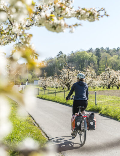
We are still a long way from such linguistic confusion on the Iffigenalp. The bus that takes us from Lenk train station to the Alp is packed to the last seat. We bravely mingle with a men’s club outing. The gentlemen toast each other with white wine in the early hours of the morning.
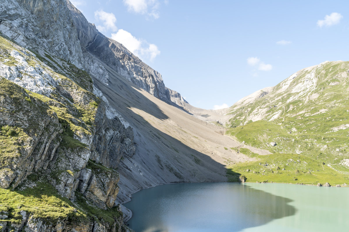
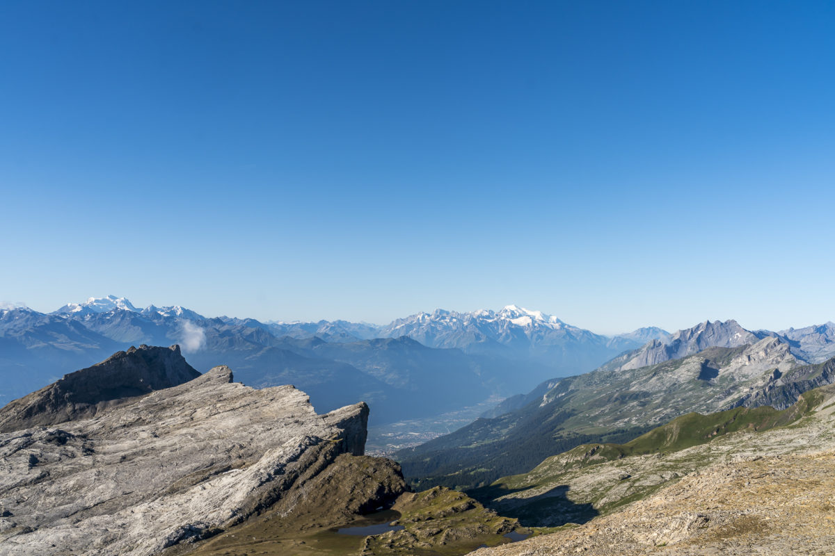
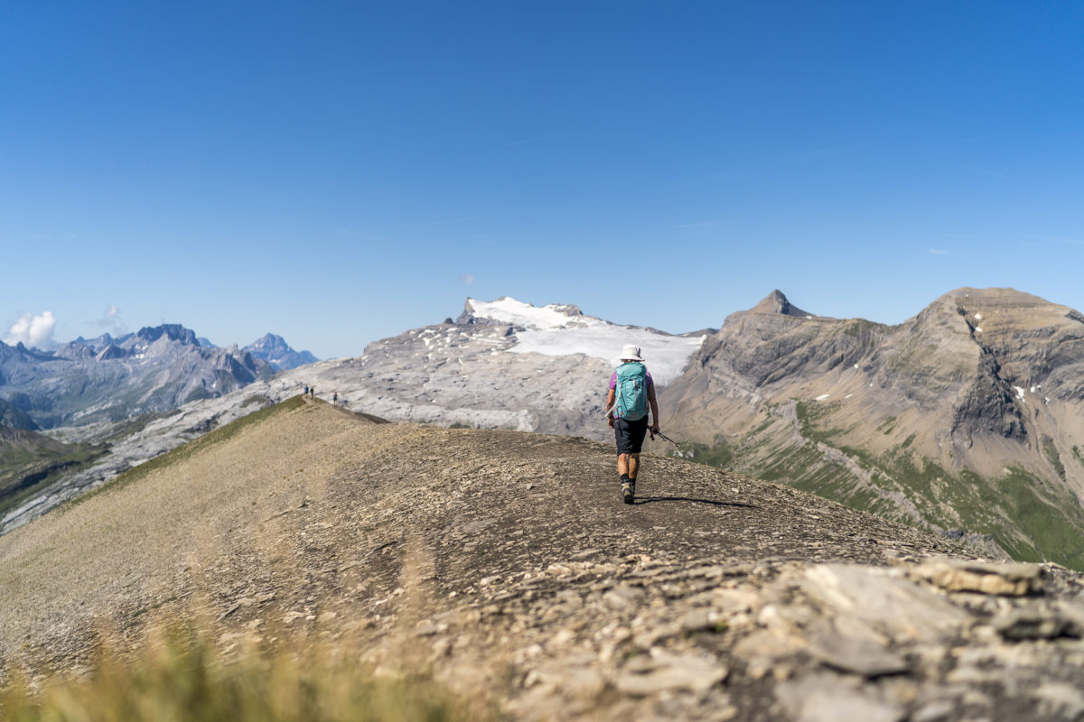
After a cheerful ride, we quickly leave the loud crowd of men on the Iffigenalp behind us. Most people start their hike with a coffee in the mountain restaurant. We, on the other hand, want to get the first meters of altitude behind us. We have to climb over 1,600 metres in altitude until we reach our camp for the night in the Cabane des Audannes. The entry is gentle. We follow the hiking trail uphill along the Iffigbach. From Groppi onwards, the terrain becomes steeper and quickly gains altitude. After about 1.5 hours we reach the beautifully embedded Iffigsee. Behind the lake we can already see our intermediate destination – the Wildhorn hut.
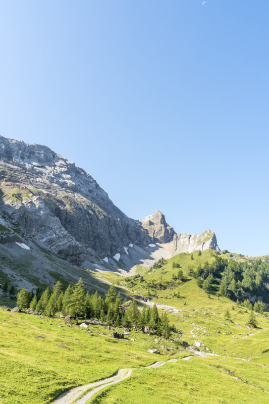
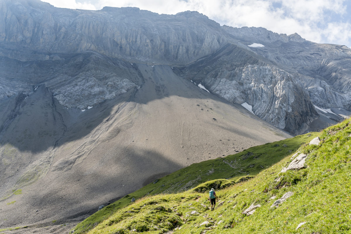
After the steep intermediate section over the “Egge”, the terrain flattens out a bit and we make rapid progress. After a good two hours we reach the sun terrace of the Wildhorn hut. Here we allow ourselves a short breather – the next 400 meters of altitude are tough. For a good 1.5 hours we follow a narrow path through scree and scree fields towards the Chilchli glacier.
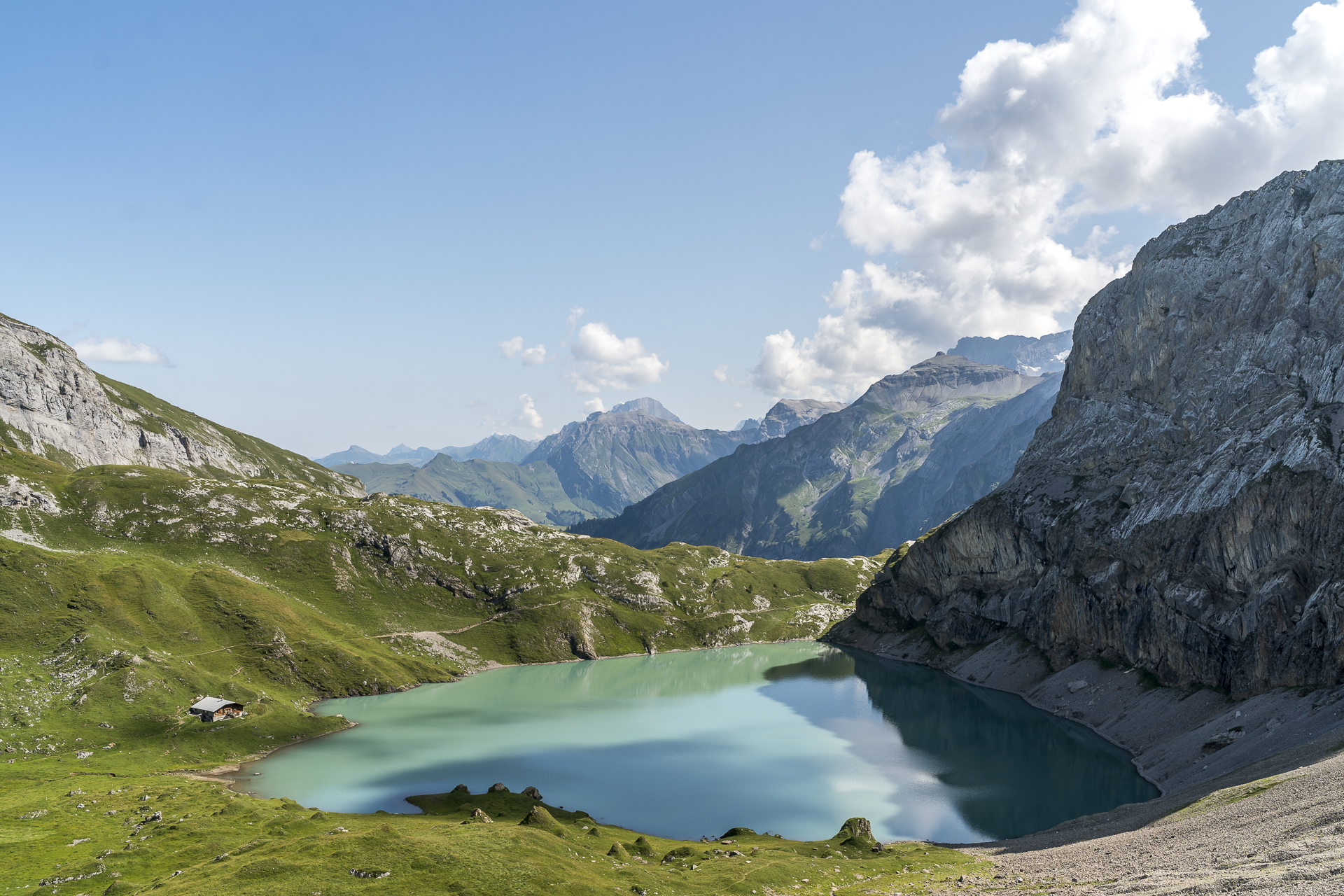
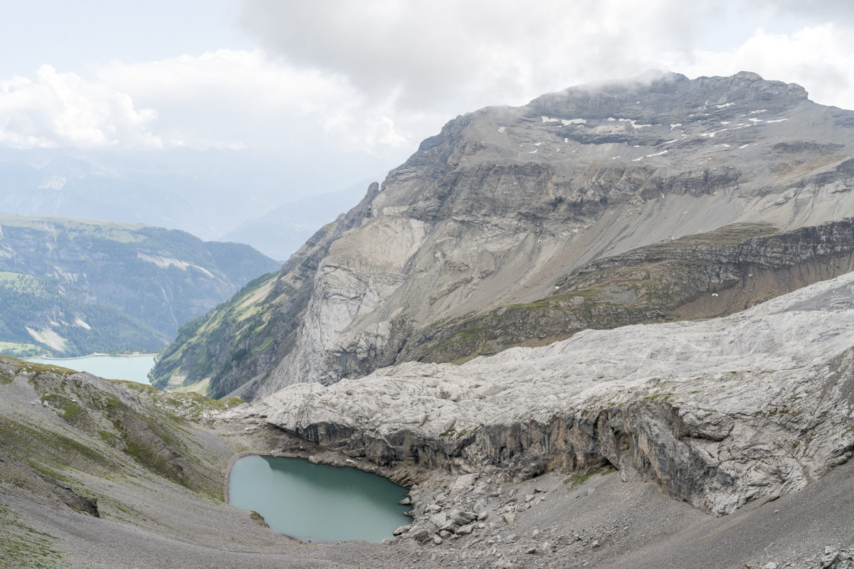
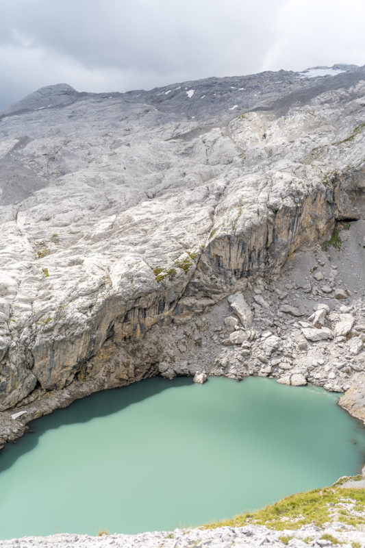
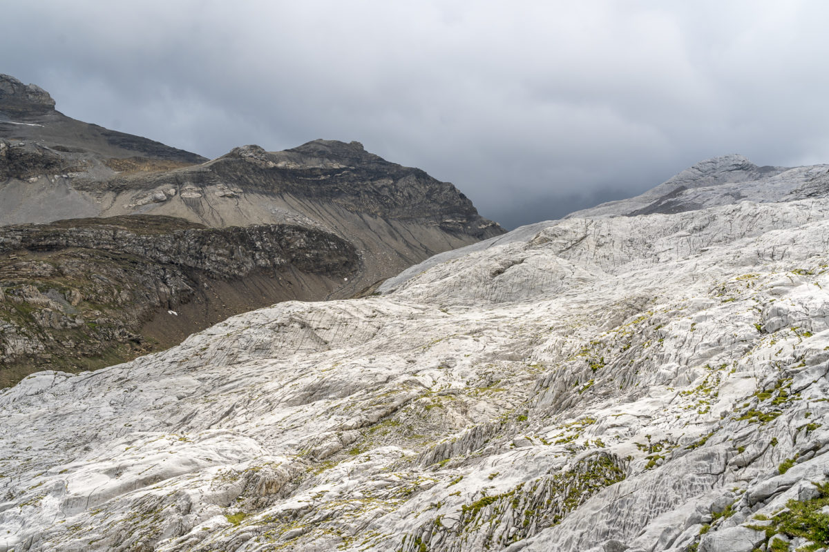
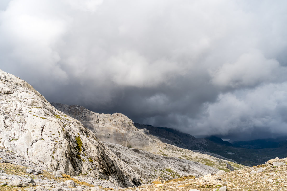
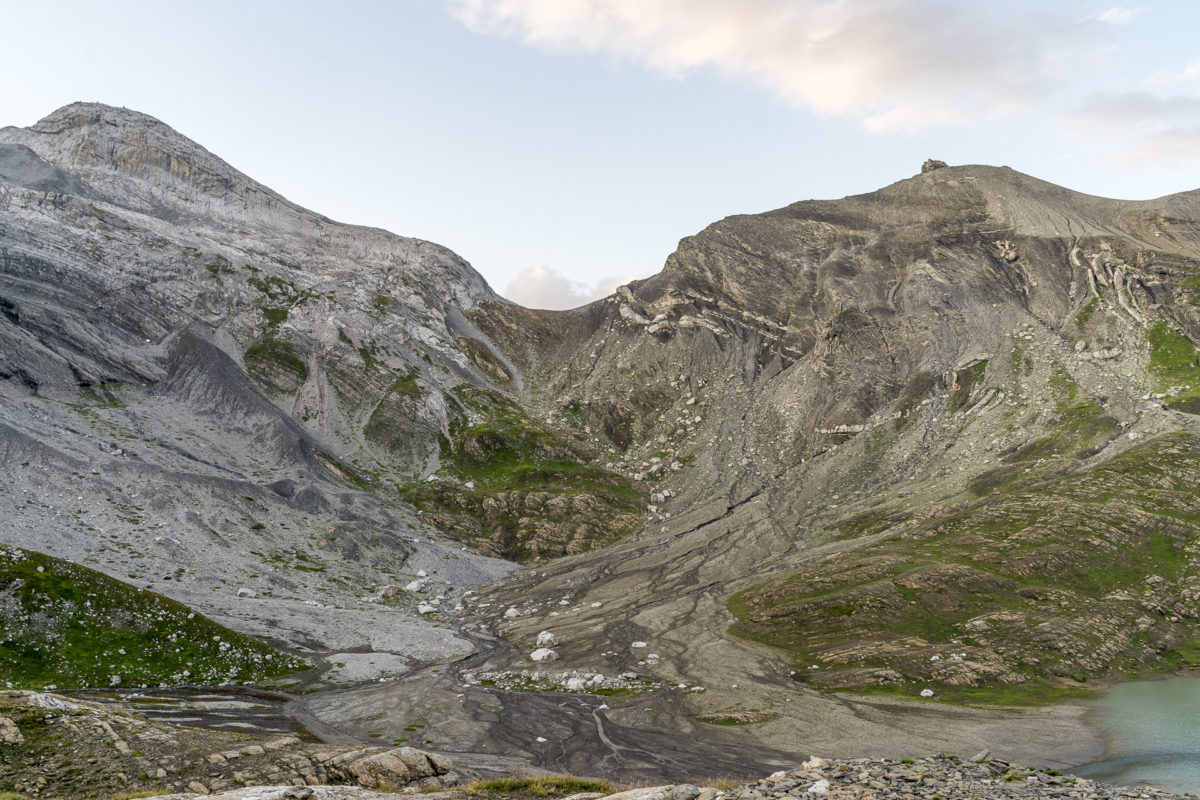
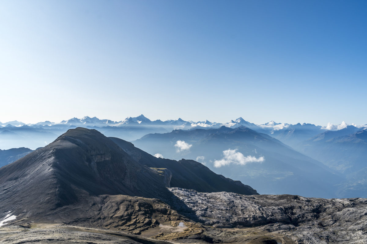
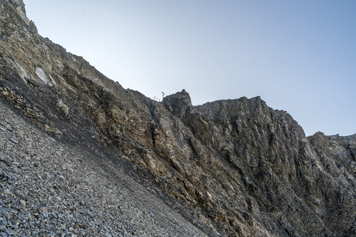
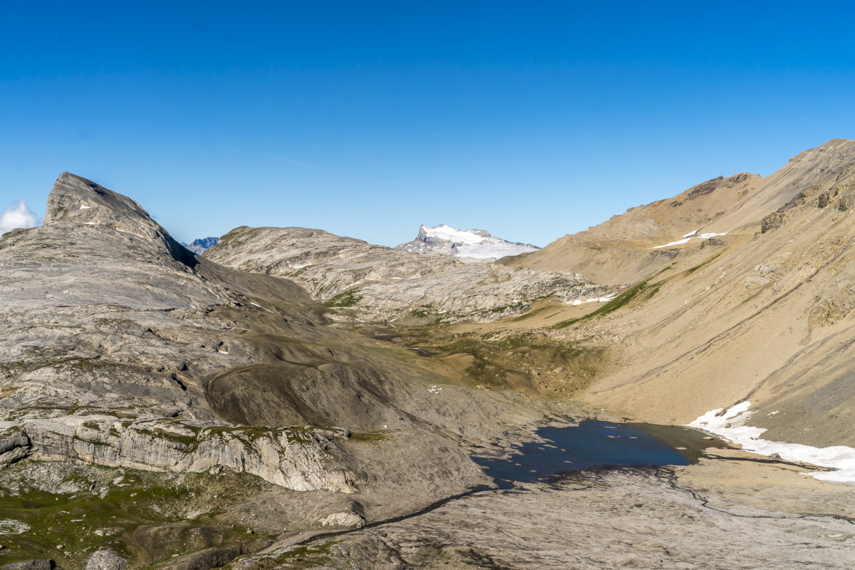
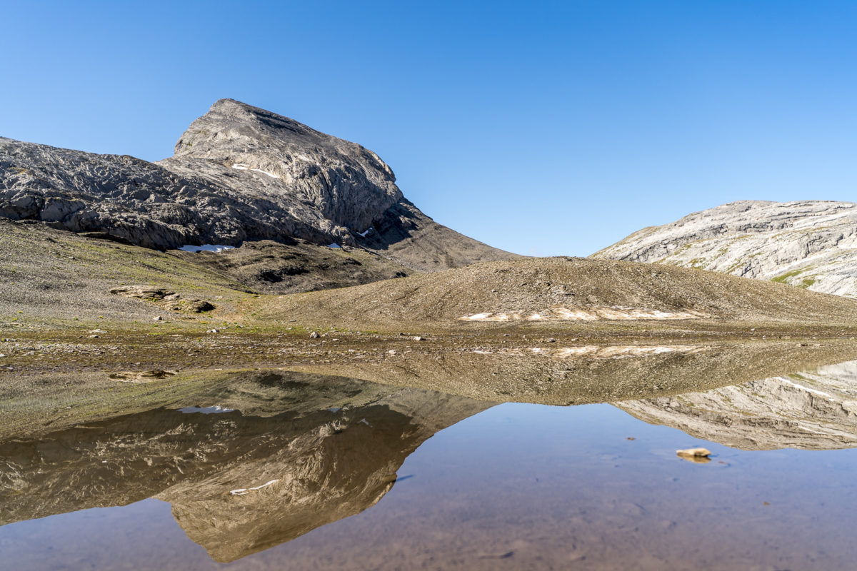
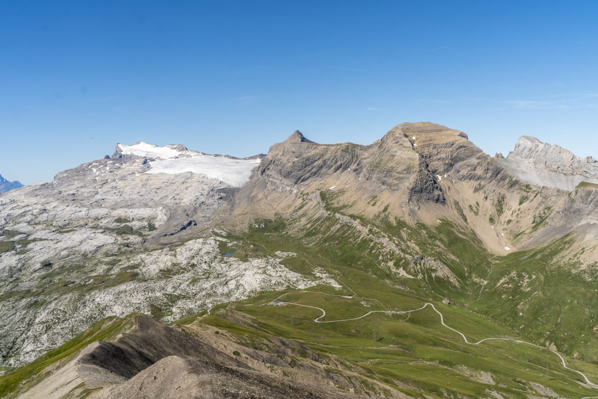
While we fight our way uphill, the rope teams that have tackled the Wildhorn are already on the descent. Finally, we reach the highest point of today’s stage: the Schnidejoch at 2,755 m above sea level. Now we head over scree fields down to the Lac de Téné, which together with the cart fields towering behind it make a surreal picture. We are concerned about the ever-darkening sky. Wasn’t the rain announced for the evening?
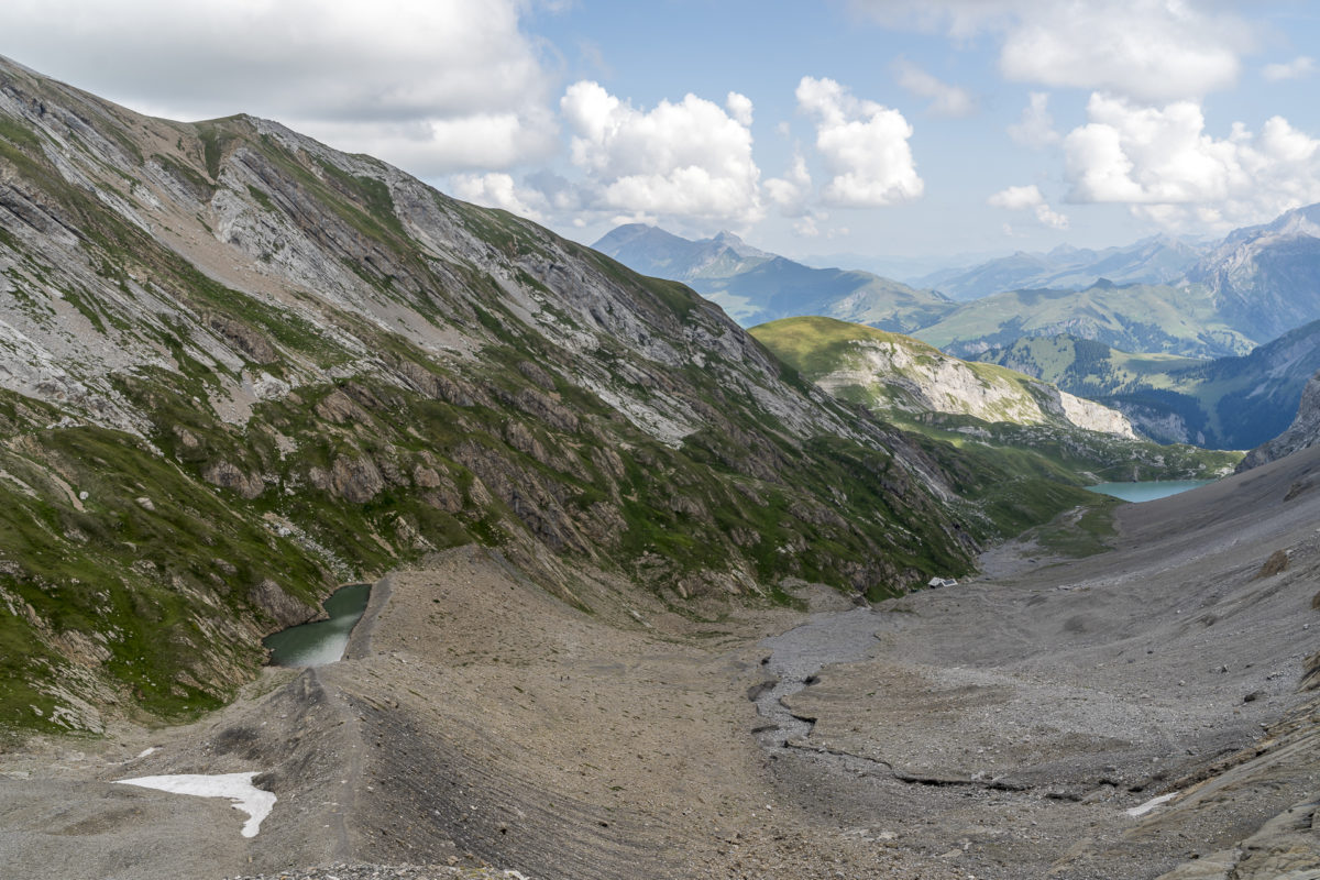
We make good progress to the Lac de Téné. But then the hiking trail signs on the stones become fainter and fainter and we realize that we have to balance across the cart fields. It has mounted an auxiliary step from time to time – but the markings are sometimes difficult to see and it is enough to deviate one or two meters from the path to manoeuvre yourself between the rugged and steep crevices into tricky situations. This section demands far more energy from me than originally thought and to make matters worse, my trousers get stuck on a sharp edge: “Ratch!” And my butt is suddenly well ventilated. Well, luckily I had packed a spare pair of pants at the last moment.
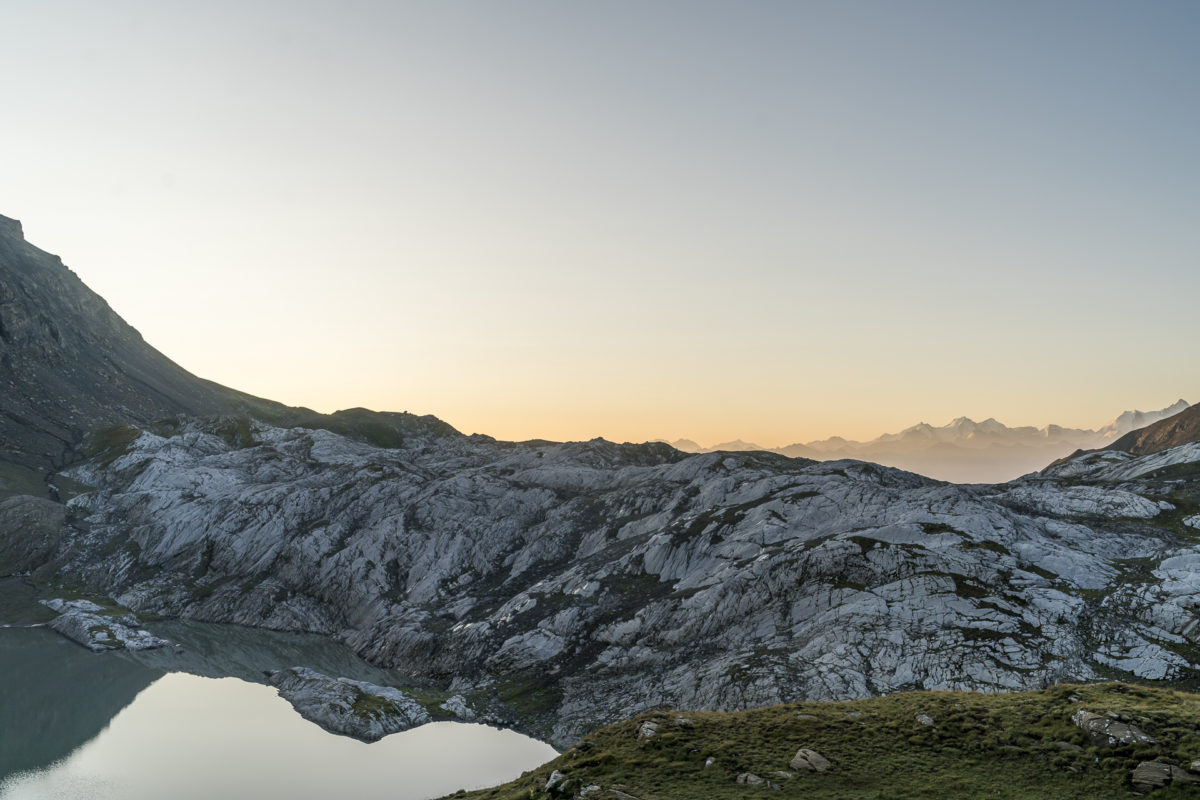
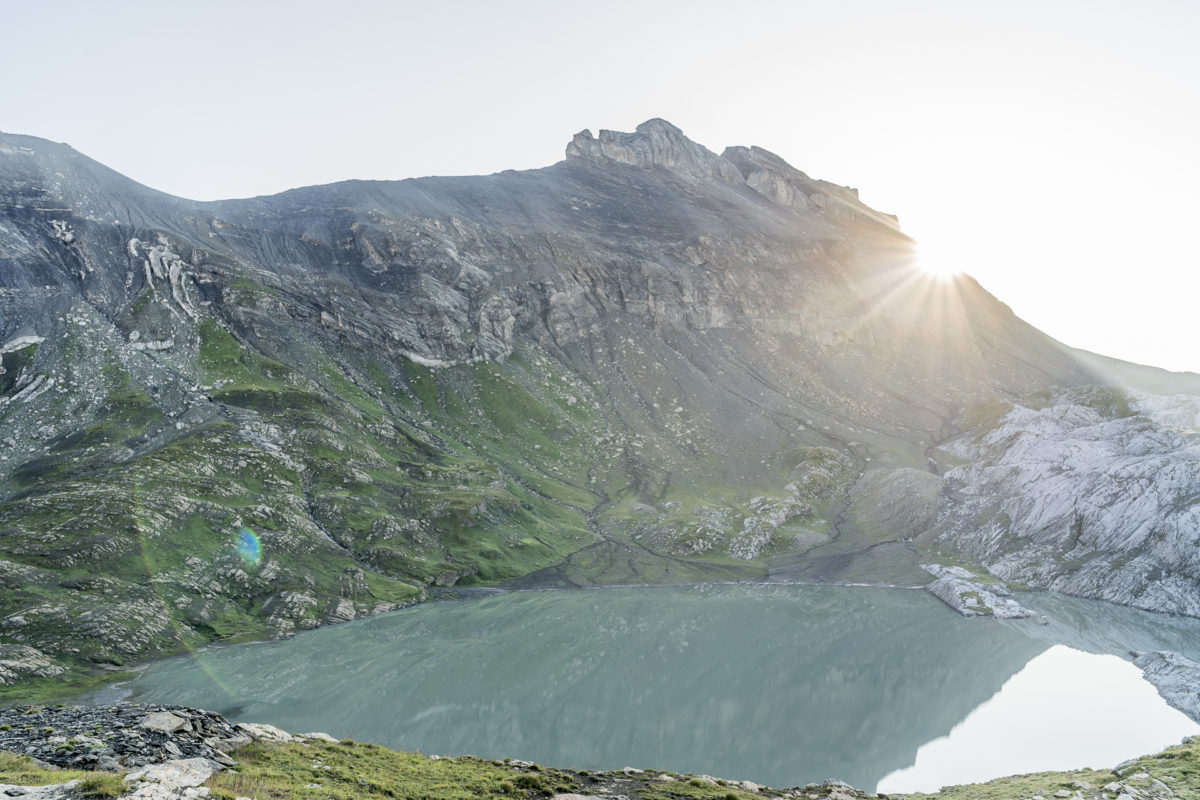
As soon as we have mastered the cart fields, the rain sets in. And that too! But after the pitfalls of the cart fields, the rain doesn’t bother me much. On the way, marmots and ibexes cross our path. The other hikers we meet on this section can be counted on one hand. Shortly before we reach the Col des Eaux Froides, the rain subsides and at the top the panoramic view opens up towards the Cabane des Audannes. What a wild, enchanting landscape!
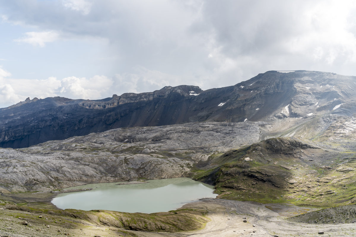
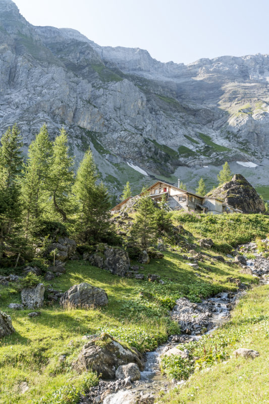
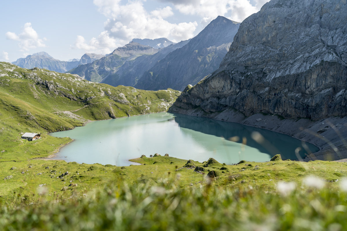
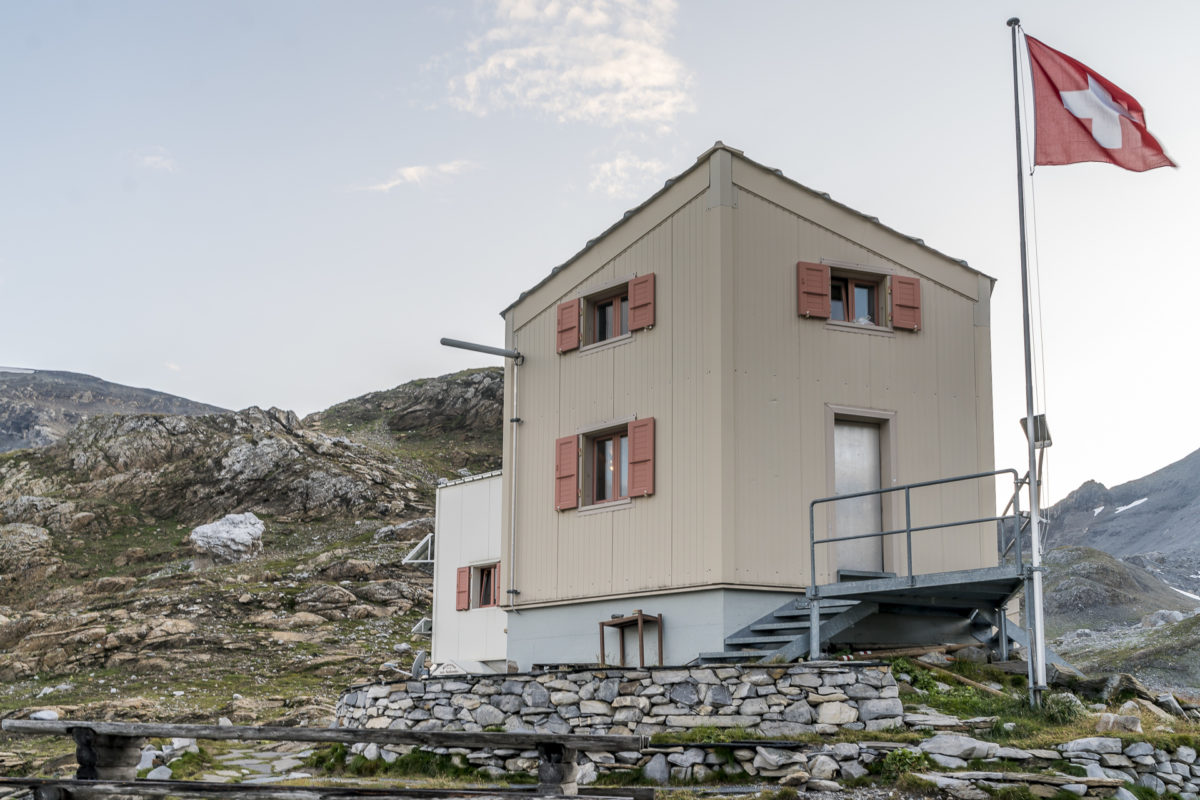
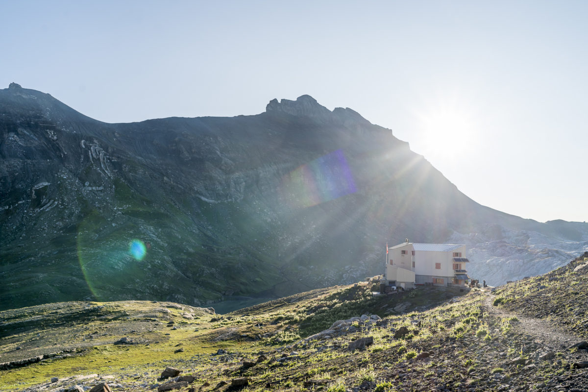
The Cabane des Audannes is a privately run hut and, like the Wildhorn hut, a popular base for those who want to tackle the Wildhorn. The shortest and easiest route to the hut is from les Rousses (stop on the Ayent – Barrage du Ravil post bus line) via Serin to the destination in 2.5 hours.
Although we hardly met anyone on the way, the hut is already filled to the last seat when we arrive. We have knowingly reserved our sleeping places a good two weeks in advance and are now looking forward to exchanging the wet, clammy clothes for a dry layer. The hut has around 50 beds, which are spread over two dormitories – the sleeping places are relatively spacious and comfortably arranged and it also has enough storage space. The toilets are located in a separate container in front of the cabin. For dinner, on the other hand, I don’t have any hymns of praise left – it was okay. Nothing more, nothing less.
Day 2: over the Col des Audannes to the Sanetsch Pass
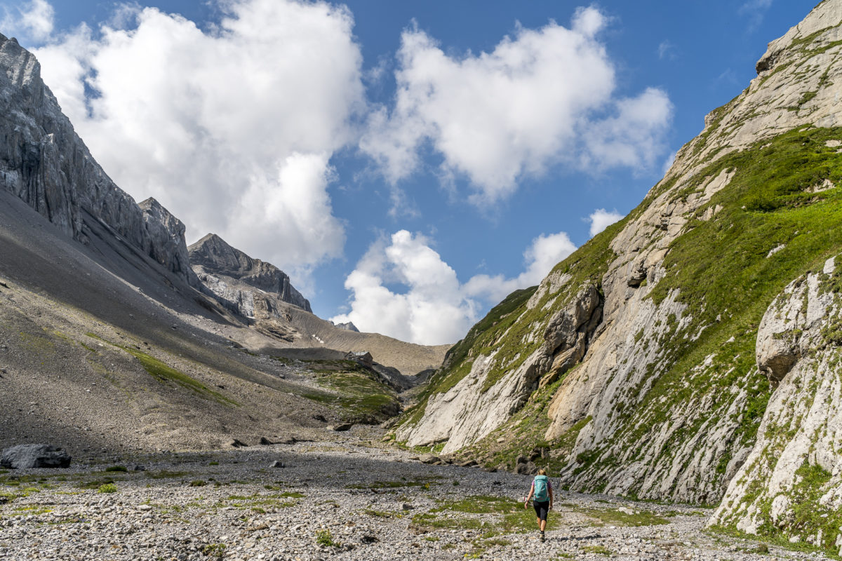
The next morning we start the day together with the rising sun. Breakfast is served at 7 a.m. Shortly before 8 o’clock we start marching. First of all, we have to climb the 400 meters of altitude via La Selle up to the Col des Audannes. Especially the last section is quite tough! On the other hand, the view becomes more magnificent with every meter of altitude. Every now and then we have to pause and marvel at the phenomenal panorama from the Bietschhorn to Mont Blanc. While I secretly assumed that we had done the worst at the highest point of the tour, I was taught better when I arrived at the top of the pass. At the back, the path leads steeply down the cliff edge: ladders, rock steps, narrow couloirs: a head for heights is an advantage here. However, the view over the wild Grand Gouilles plain to the Les Diablerets mountain range compensates for the nerve-wracking route. That’s nice!
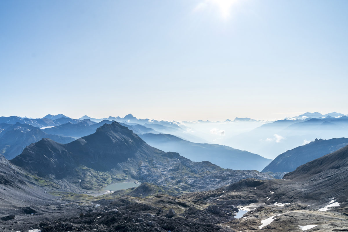
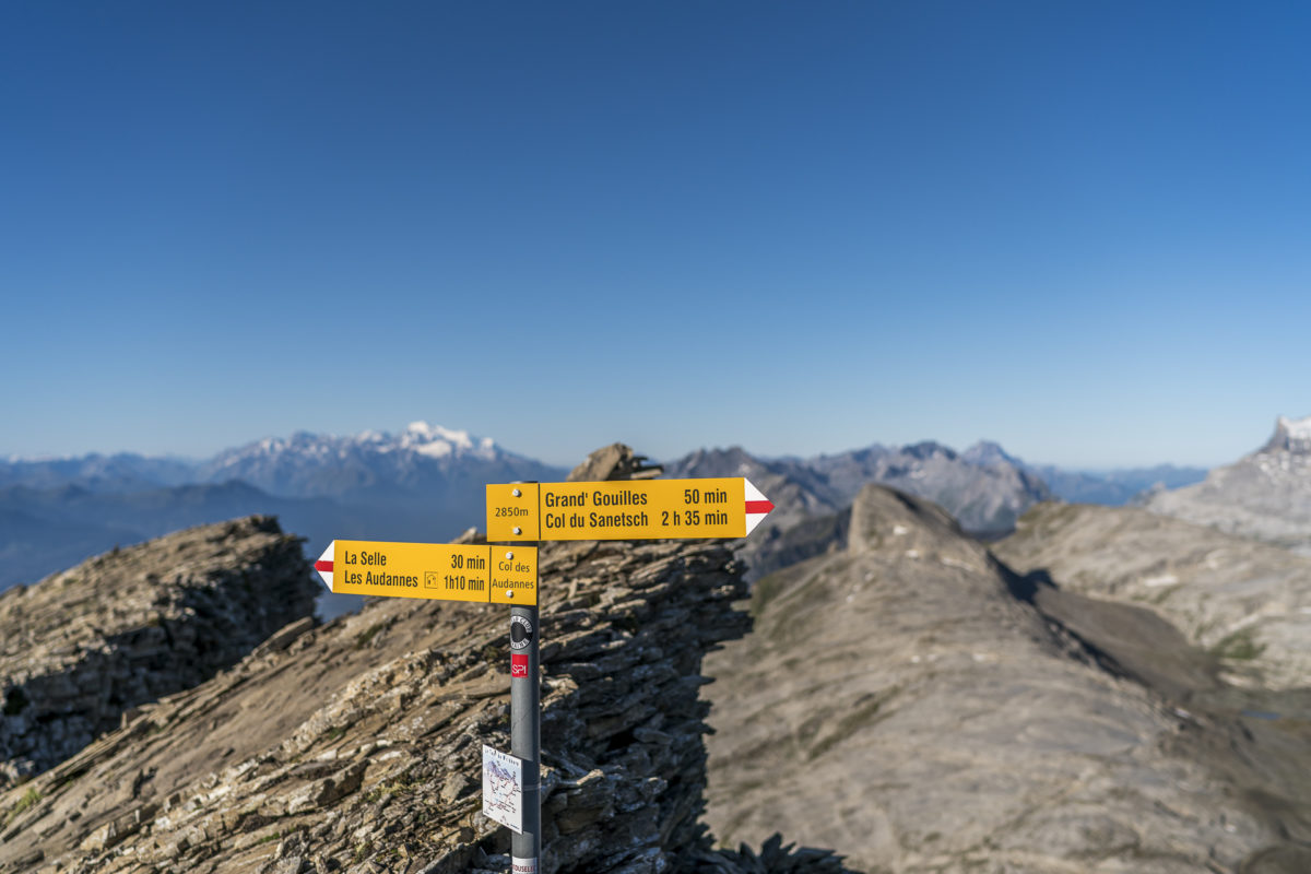
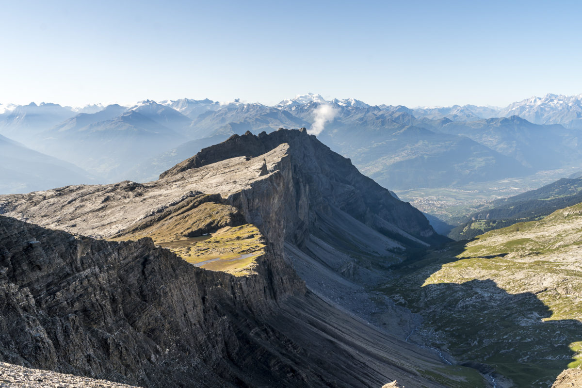
And even though we have to climb significantly less altitude today than the day before, this second stage should not be underestimated. The last section over the narrow, 2-kilometre-long ridge of the “Arête de l’Arpilles” once again requires my full attention. Poles are definitely an advantage in this sometimes slippery terrain.
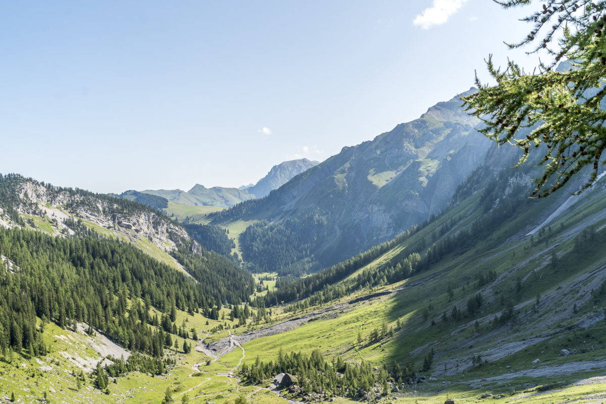
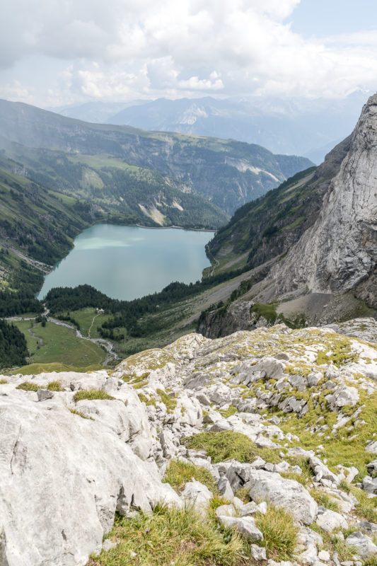
Shortly after noon we reach our destination: the cable car station at the Sanetsch reservoir. After two wonderful days in the mountains, you can return to everyday life via Gsteig. We agree: A great hut tour through a fantastic mountain landscape with some unexpected pitfalls (the cart fields at Lac de Téné and the descent from the Col des Audannes towards Grand Gouilles). For all those who are used to alpine mountain trails and do not fight against the fear of heights on narrow, sloping sections, this is an absolutely recommendable hut tour!
Practical tips for our 2-day hut tour
Stage 1:
The two-day hut tour starts at the Iffigenalp, which can be reached by bus from Lenk. The first stage includes 1,632 metres of altitude uphill and 714 metres of downhill over a length of almost 13 kilometres. The hiking time is between 6 and 7 hours, depending on speed and breaks. Alternatively, you can descend from Lac de Téné to Lac de Tseuzier/Barrage du Rawil with a post bus connection. The difficulty of this stage is in the T3/T4 area – everything is marked red-white-red, whereas the section over the cart fields would rather require a white-blue-white marking.
Stage 2:
The distance from the Cabane des Audannes to Sanetsch is 14 kilometres and includes an ascent of 736 metres and a descent of 1,184 metres. The hiking time for this stage is a good 5 hours. From Sanetsch, a cable car leads down to Gsteig. It should be noted that the valley station of the cable car is about a 20-minute walk from the village centre with the post bus stop. Since the Postbus only runs every hour, it is worthwhile to coordinate the times a bit (note: you cannot rely on the connection displayed in the SBB app per se – it is better to plan 15 additional minutes).
The overnight stay in the Cabane des Audannes costs 66 CHF for adults including half board (prices as of summer season 2019).
Leave a Reply