

Over the Chasseron to Vallorbe: 2-day hike on the Jura High Trail
Actually, I didn’t have any plans for Ascension Day this year – because early in the year it became apparent that the weeks before were packed with appointments, deadlines and short trips, so a gap in the agenda was absolutely welcome. Then – for well-known reasons – the thicket of deadlines thinned out from one blow to the next and I was confronted with another challenge in terms of ascent. Where to go when everyone is flocking their hooves at the same time and the wonderful weather lures even convinced couch potatoes outside? Fortunately, I usually already have a handful of ideas up my sleeve for such situations – so this 2-day hike along a rather unknown section of the Jura High Trail has been in my head for a long time. It quickly became clear: pack your backpack, lace up your hiking boots and head for the Vaud Jura.
The Jura High Trail at a glance
The Jura High Trail is one of the classics of Swiss long-distance hiking trails and leads 320 kilometres from Dielsdorf to Geneva along the arc-shaped mountain range of the Swiss Jura. Due to its high altitude, hikes on the Jura High Trail are particularly suitable in late spring/early summer and autumn – in the times when there is still snow in the Alps. And it is precisely for this off-season that I have had the Jura High Trail on my radar for a long time. In spring 2016, I hiked one of the 16 stages for the first time – number 5 from Weissenstein to Balsthal. Last autumn I tackled a section of the first stage from Dielsdorf to Brugg.
2-day hike through the Vaud Jura
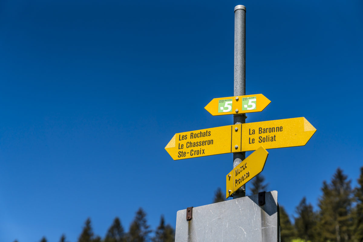
This time, the choice fell on stages 11 and 12 of the Jura High Trail, which lead from the alpine inn Les Rochats (which I know from my Creux du Van bike tour) always along the Jura ridges via the once flourishing watchmaking town of Sainte-Croix to Vallorbe. Sporty 47 kilometres of hiking trail, which we enriched or “adapted” by a few kilometres.
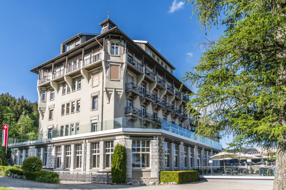
The reason why I chose these two stages was on the one hand that the starting point of Les Rochats is not directly accessible by public transport and hardly anyone travels by car for a long-distance hike. On the other hand, the Jura High Trail leads over the Chasseron in this section, which is the third highest Swiss Jura peak with a great view. All good things come in threes – and this is no exception: in addition to a predictable crowd of people and a promising panoramic view, it quickly became clear to me where we would spend the night. With a small additional detour, a new addition to the Swiss Historic Hotels is located here – the Grand Hôtel des Rasses on the way.
Day 1: via the Chasseron to Les Rasses
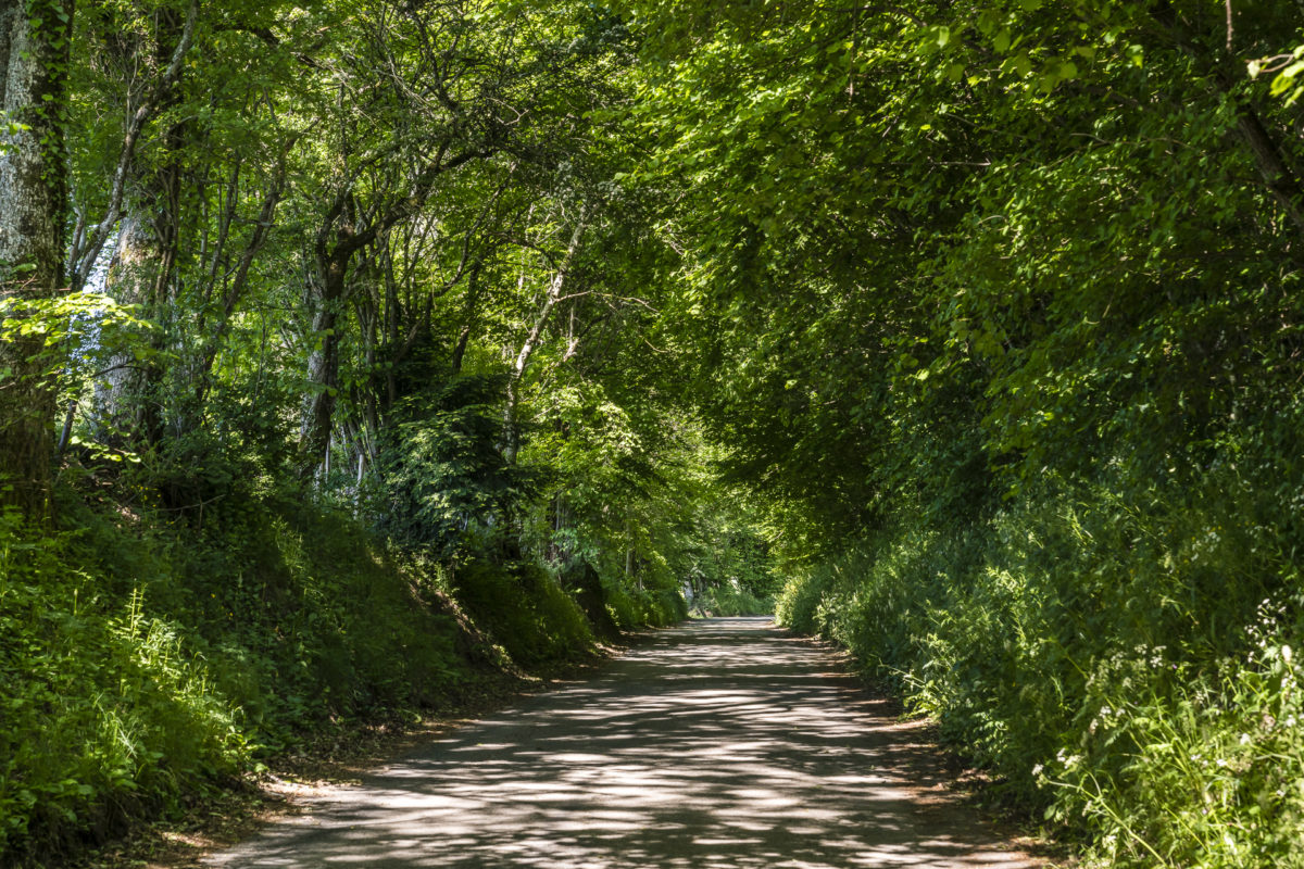
We start the hike in the small village of Provence above Lake Neuchâtel. To get to the Jura High Trail, we must first overcome 400 meters of altitude. To do this, we follow the narrow road uphill, lined with wonderfully shady rows of trees. The incline is pleasant and ideal for “warming up”. Soon we catch our first glimpse of the fantastic alpine panorama, which will be our faithful companion for the next two days.
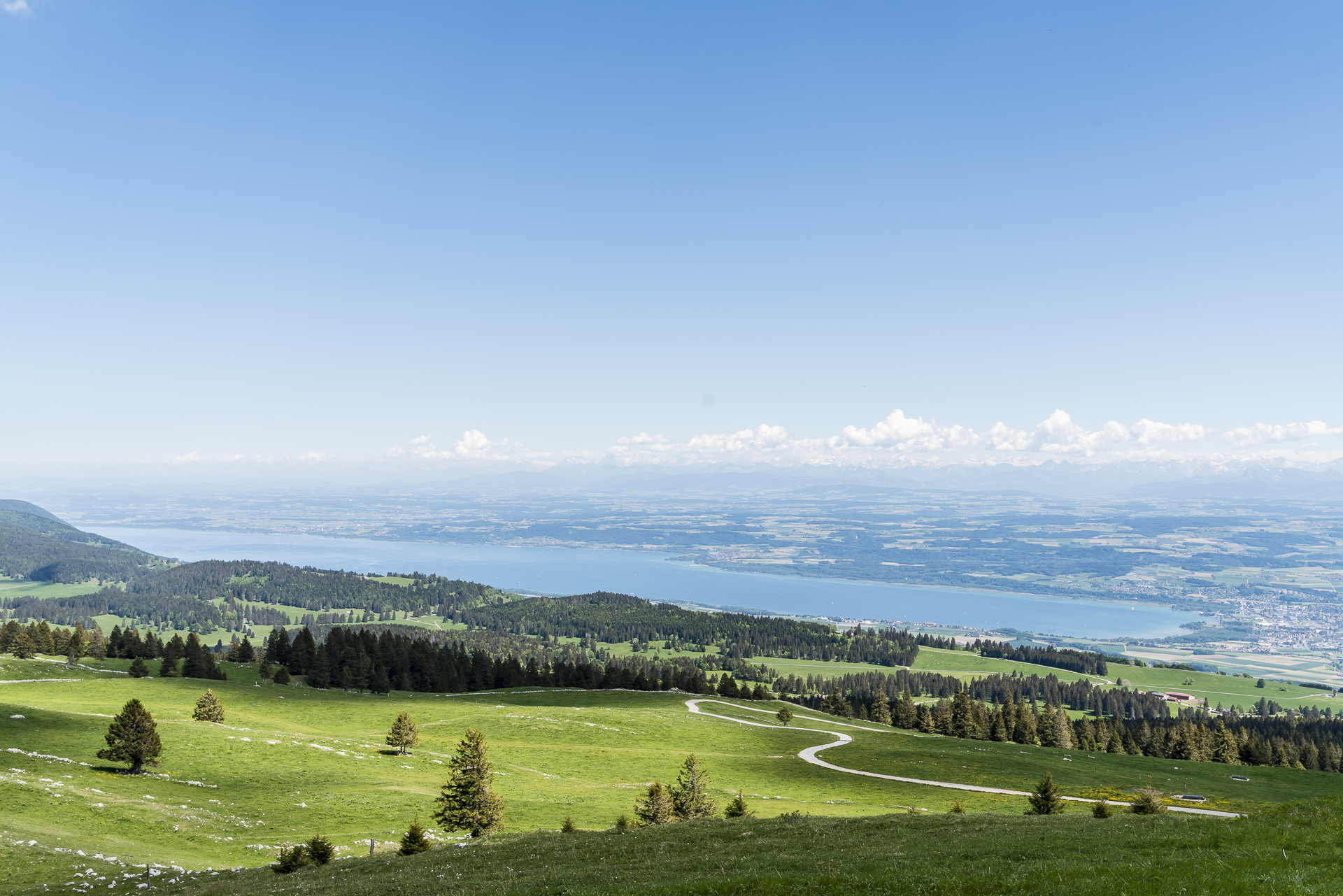
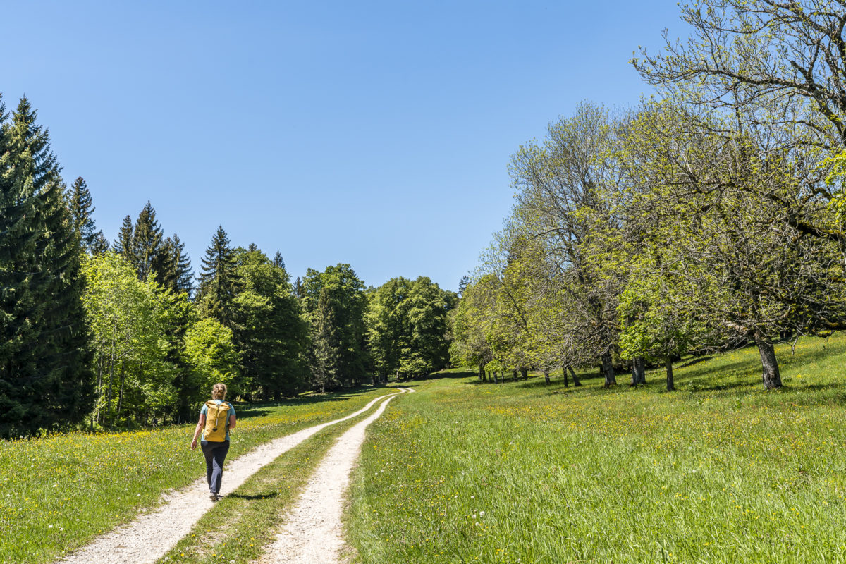
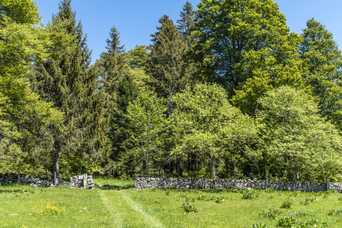
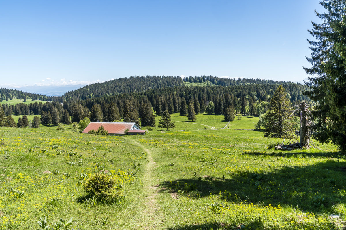
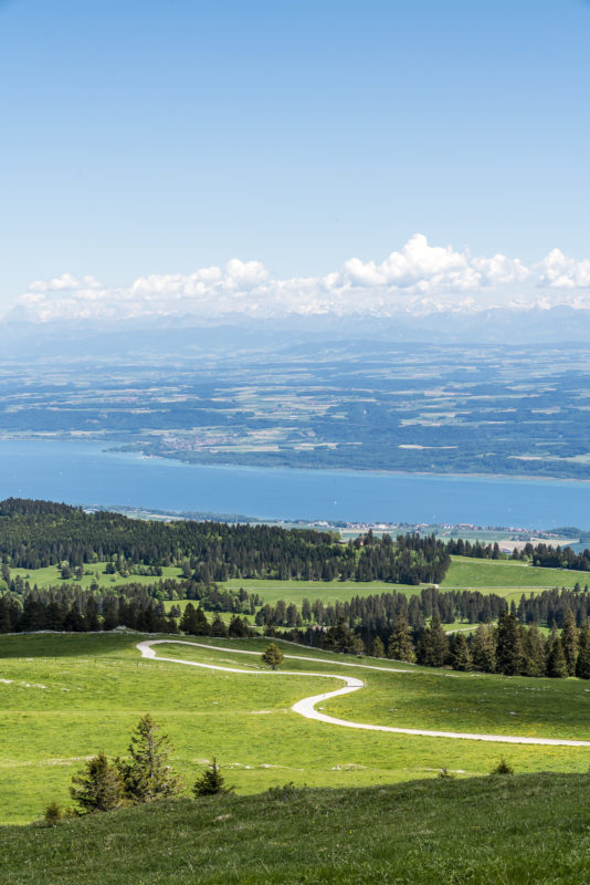
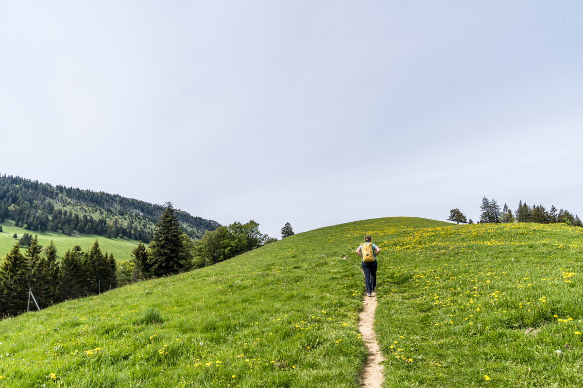
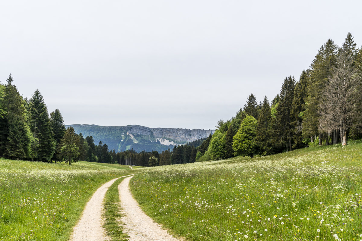
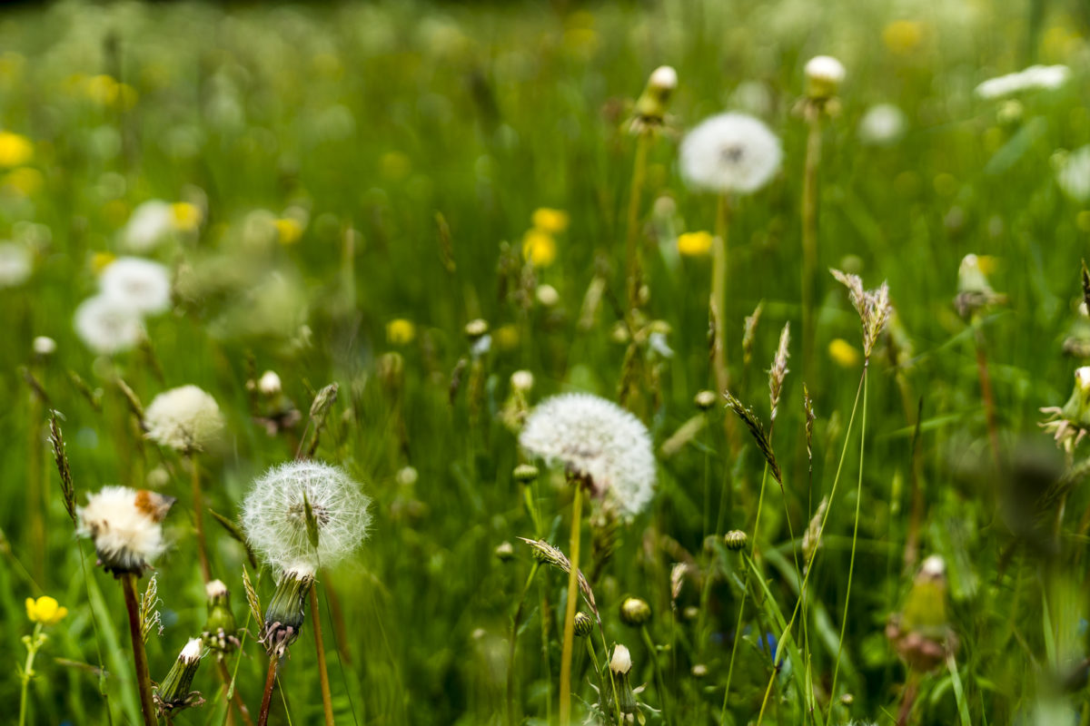
After a good 1.5 hours of ascent, we reach the Jura plateau with its typical extensive pastures interspersed with interspersed groups of trees and dry stone walls. In Les Rochats we take a short breather including a stop at the alpine restaurant.
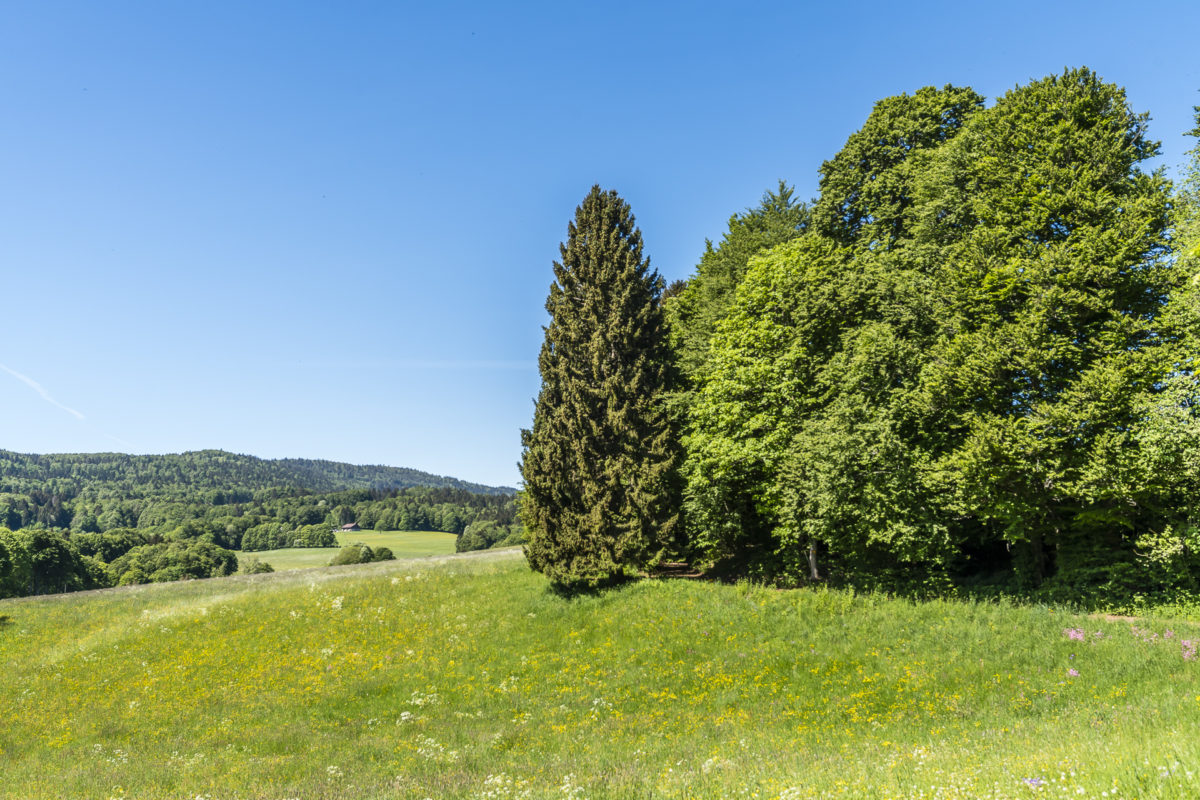
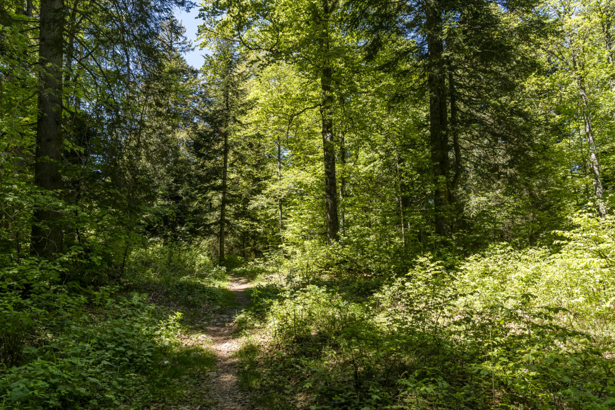
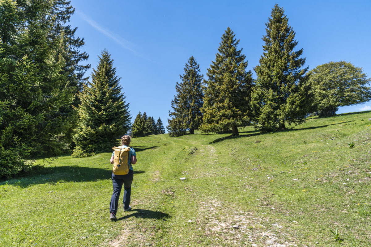
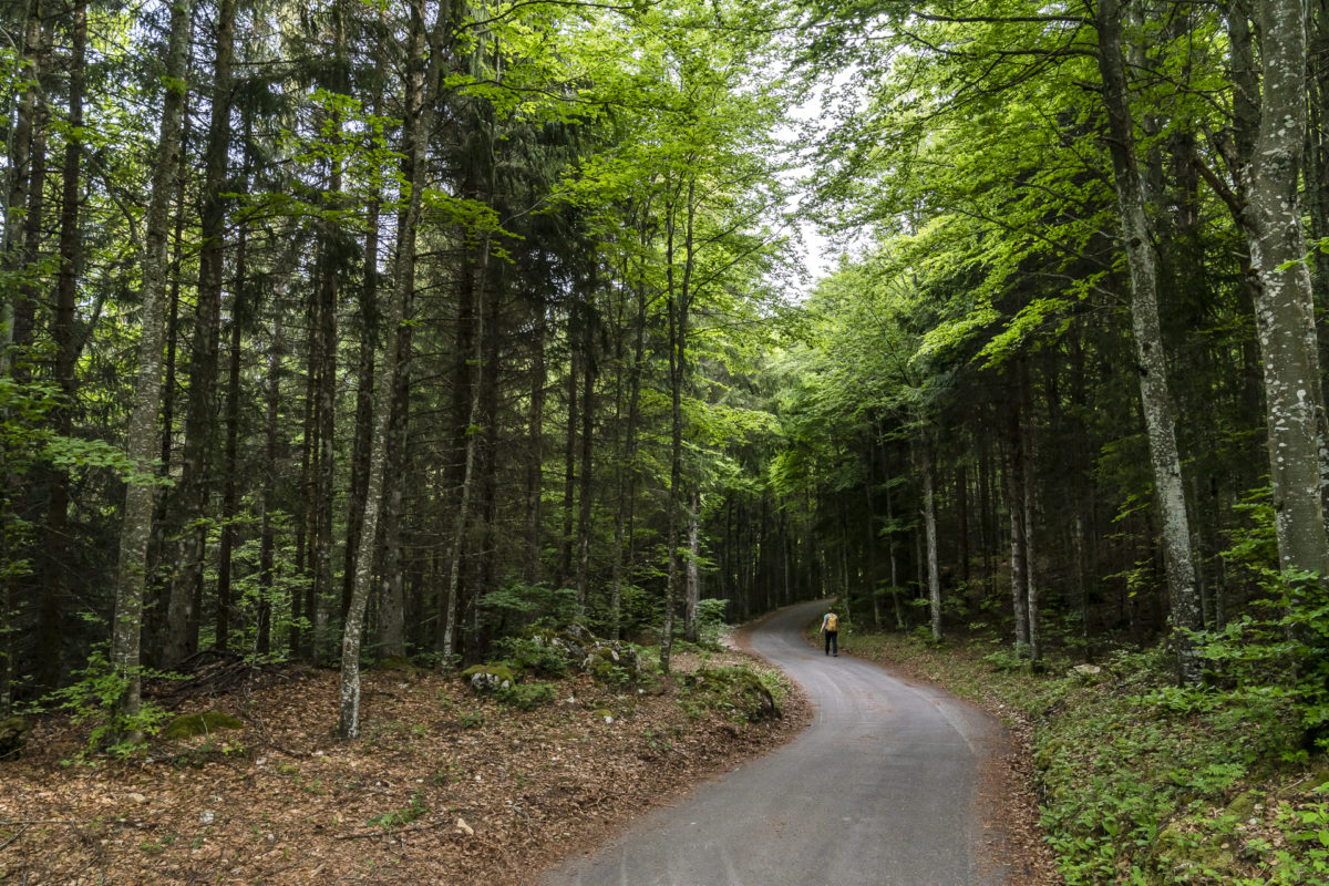
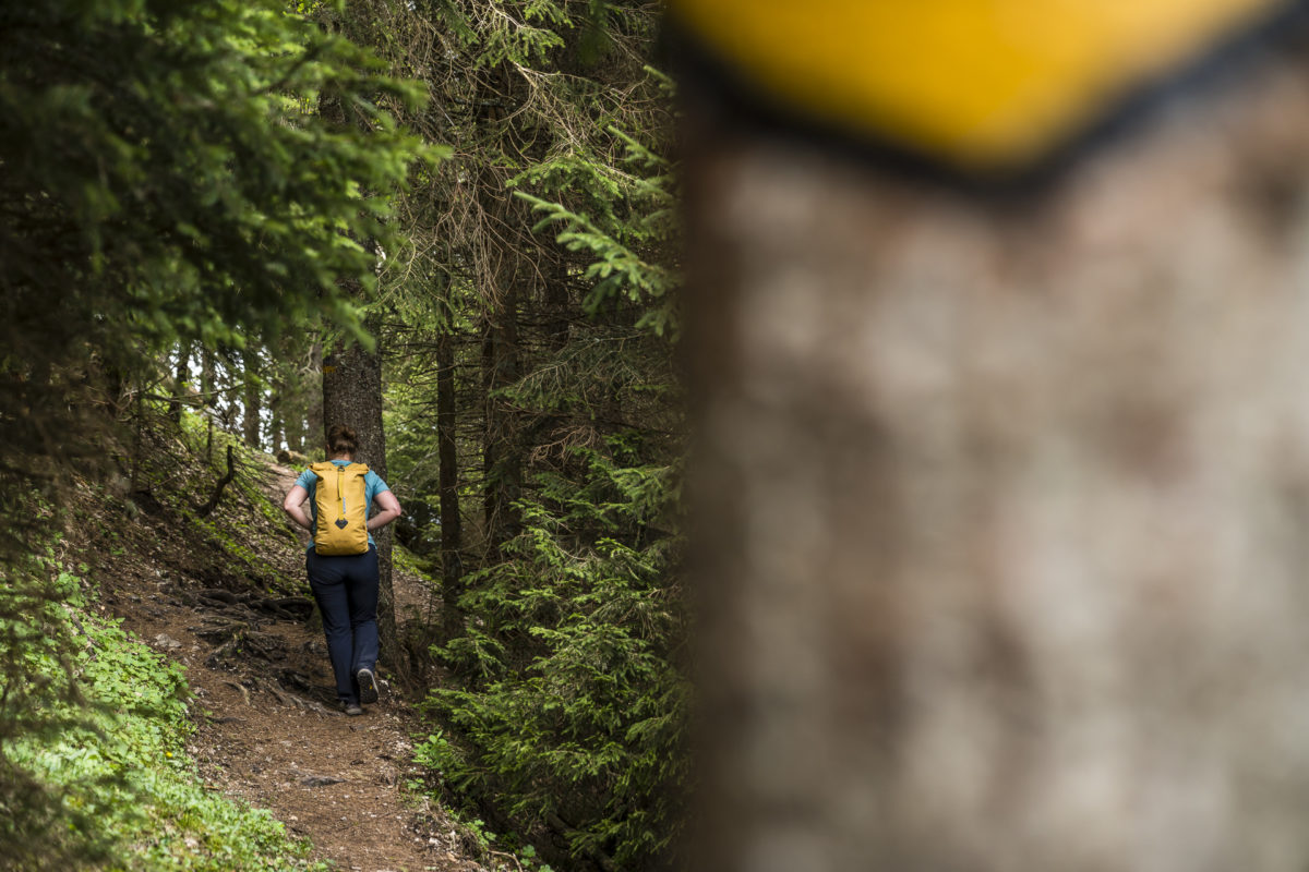
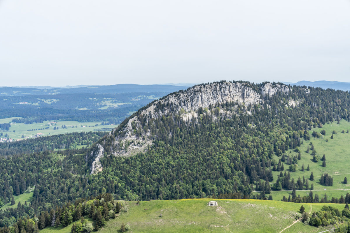
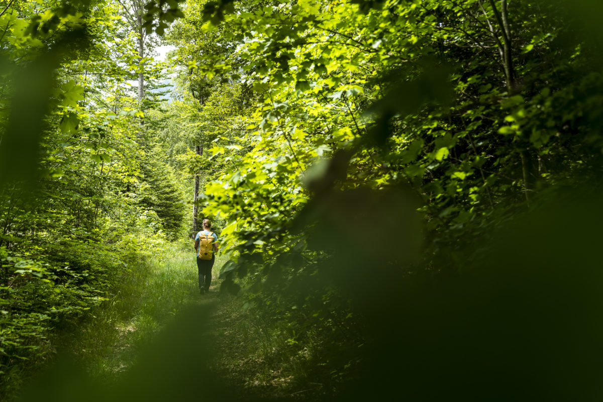
The warm-up phase is over – now the “real” Jura High Trail begins. The route is varied. Wooded sections with wide gravel paths alternate with cross-country stretches over Jura pastures. In between, there are also paved sections of road from time to time and here and there you are unfortunately also exposed to the driving skills of motorized individual traffic. Overall, however, the beautiful, varied nature trails predominate on the way to Chasseron. It only gets really sweaty after La Cruchaude.
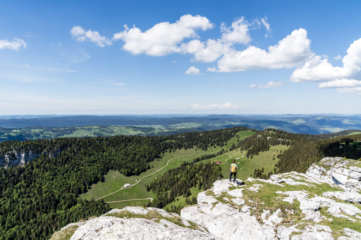
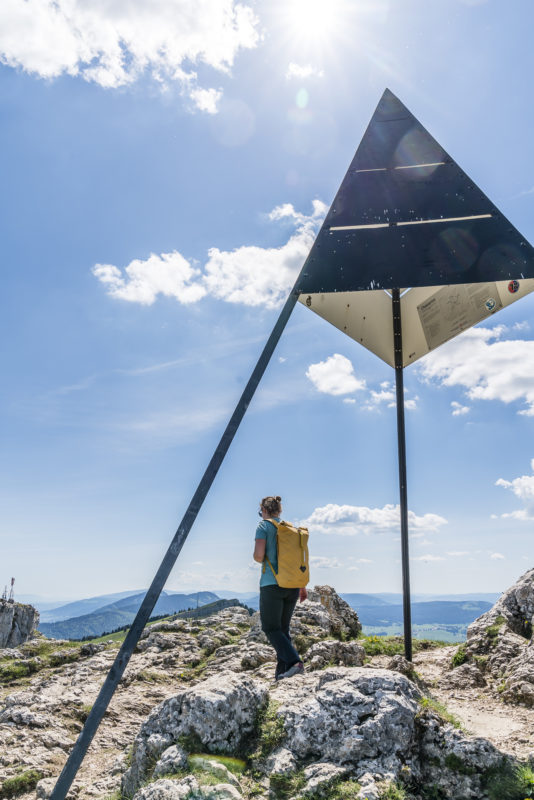
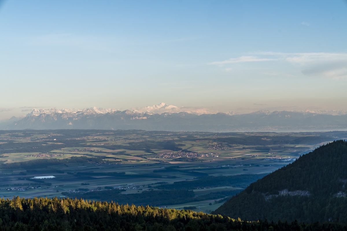
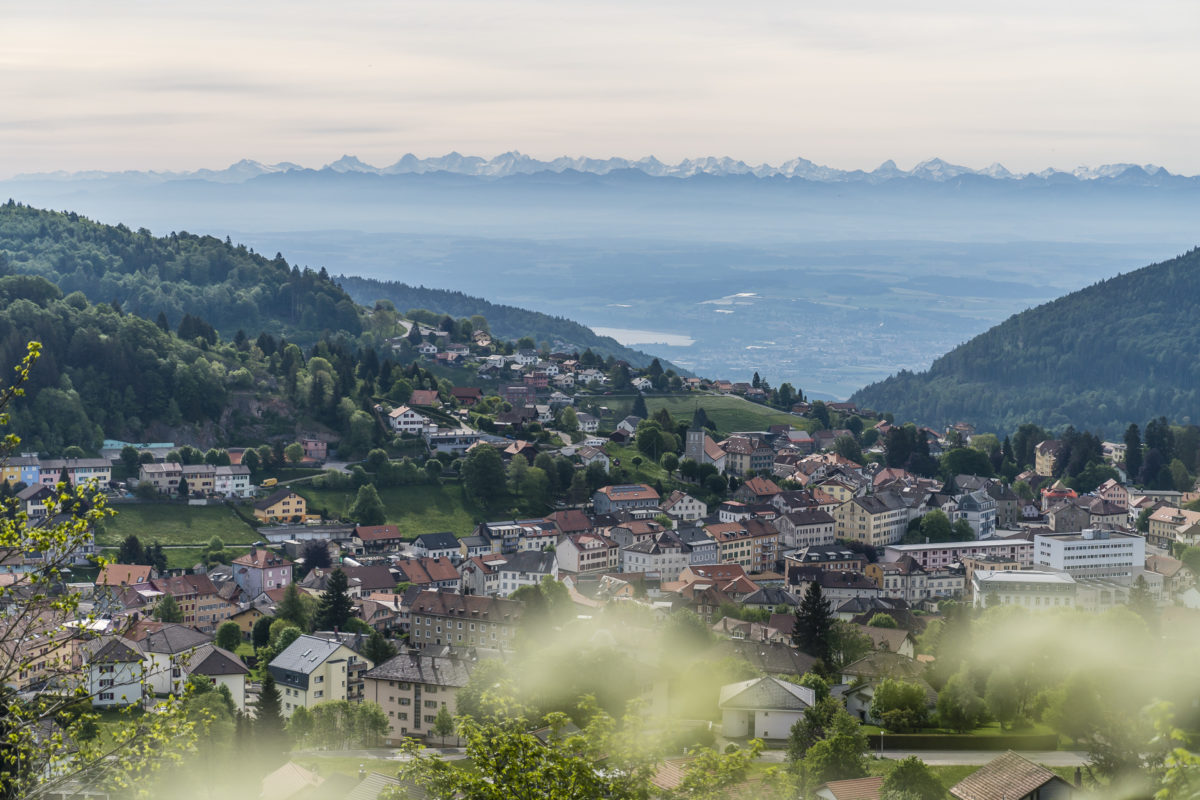
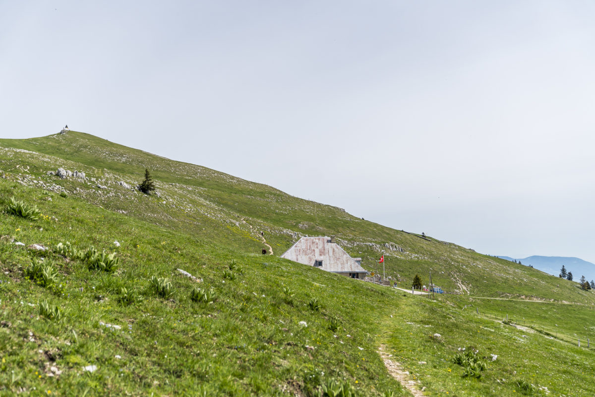
Whereas previously there was a balance between climbs and flat sections, the path now climbs steeply towards Chasseron. The perseverance is worth it – at the top of the summit, a phenomenal panoramic view awaits us. While the Jura flanks slope gently to the south, rugged rock faces plunge into the depths on the north side. An impressive backdrop! Before we start the descent to les Rasses, we treat ourselves to a refreshment in the form of a well-deserved apple spritzer at the Berghotel Chasseron.
Pit stop in Les Rasses
Theoretically, you could also spend the night at the Berghotel Chasseron – the advantage: the hotel is located directly on the Jura High Trail. The disadvantage: the next day’s stage, which already pours in a lot of 25 kilometers, will be almost 6 kilometers longer. That’s why we chose a hotel that is a little closer to the actual stage destination Sainte-Croix and can keep up well with the mountain hotel Chasseron in terms of views. To do this, we leave the signposted Jura High Trail and instead hike 400 meters down from the Chasseron to Les Rasses. On the western outskirts of the village is the Grand Hôtel des Rasses*. Today’s 3-star hotel was built at the end of the 19th century as a stately Belle Epoque palace on this sunny terrace of the Vaud Jura.
When booking, I had made sure to reserve a “mountain view” room and the first glance out of the window confirms that I have paid attention to this detail. The view, including the highest mountain in the Alps – Mont Blanc – is simply “wow”! The newly built sun terrace and the historic “Belle Époque” room, where dinner is served, are also very nice.
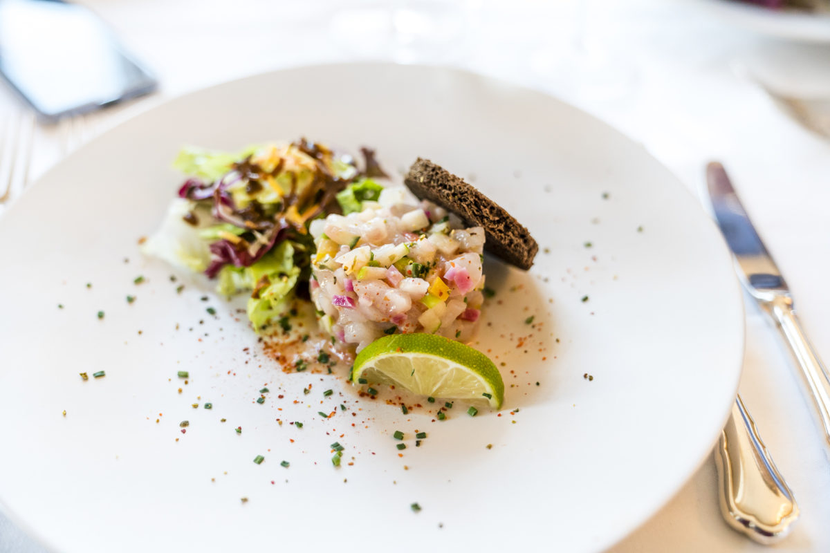
We were positively surprised by the quality of the food, to be honest I didn’t have any great expectations. However, the 3-course evening menu was coherent and fairly priced at 58 CHF. The only “fail” in this regard was that we didn’t actually want to eat the dinner menu, but à la carte. When I asked if there was no other menu than the one with the dinner menu, I was told “no, that’s the only menu tonight”. Unfortunately, something went wrong in the internal communication, so that the first evening guests, to which we belonged, were served this story. Those who came later were then served the à la carte menu in addition to the evening menu. It can happen and they apologized to us by offering the glass of red wine – nevertheless: don’t let yourself be brushed off with a “no”.
Day 2: from Sainte-Croix to Vallorbe
After an early breakfast and a last look towards Mont Blanc, we tackle the second stage of our 2-day hike on the Jura High Trail the next day. The first three kilometres to Sainte-Croix can theoretically be shortened by a short bus ride. However, we refrain from coordinating our departure time with the bus timetable and see this section of the way as an easy run-in.
In the 19th century, the small town of Sainte-Croix held the position of world leader in the manufacture of music boxes and music automatons. Unfortunately, there is little left of this international charisma today. Many once stately buildings that line the main streets seem abandoned. Crumbling plaster, unused ground floors and abandoned factories – it always makes me a little sad! Sainte-Croix would definitely be beautifully situated (although in today’s terminology at the same time schampar «secluded)!
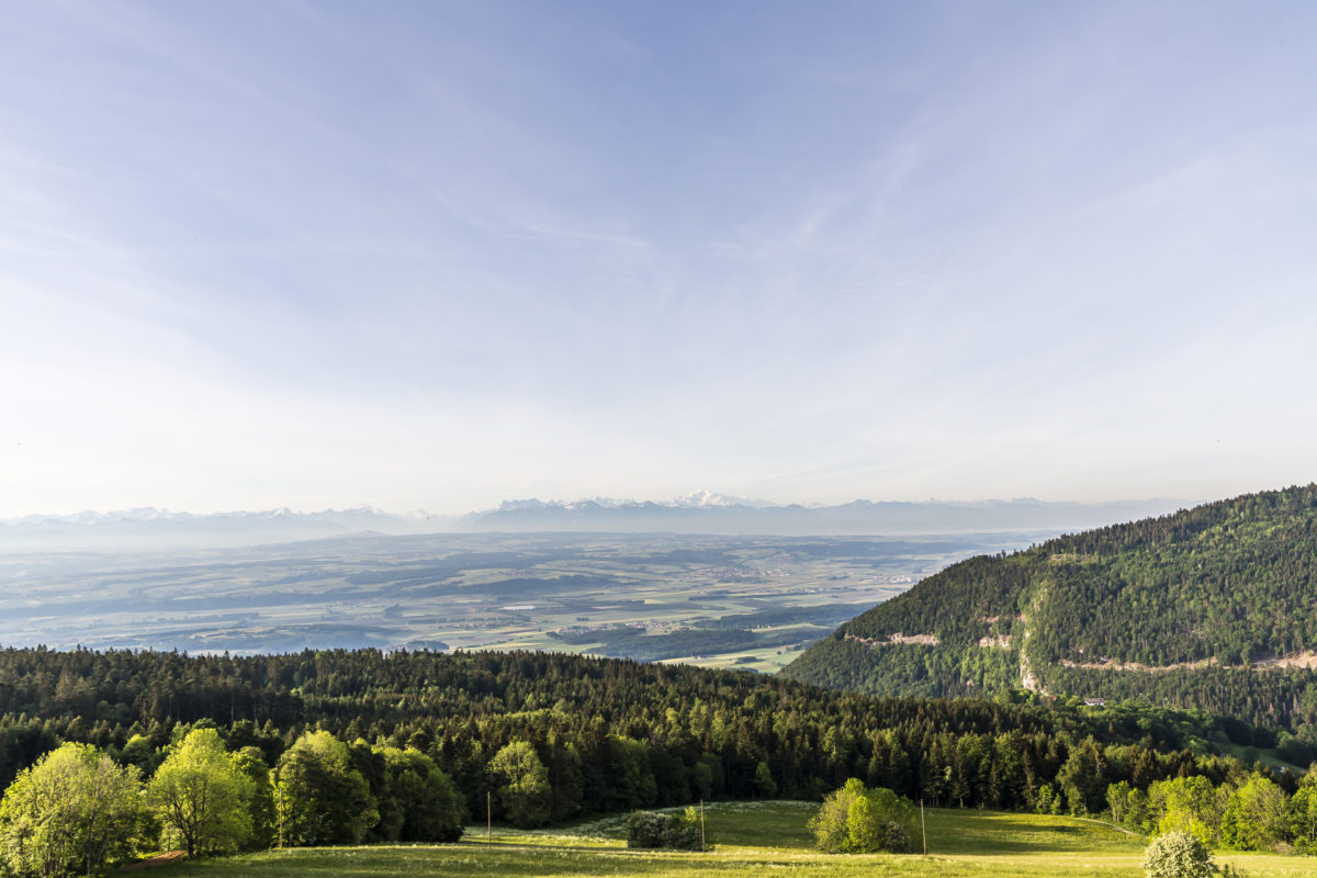
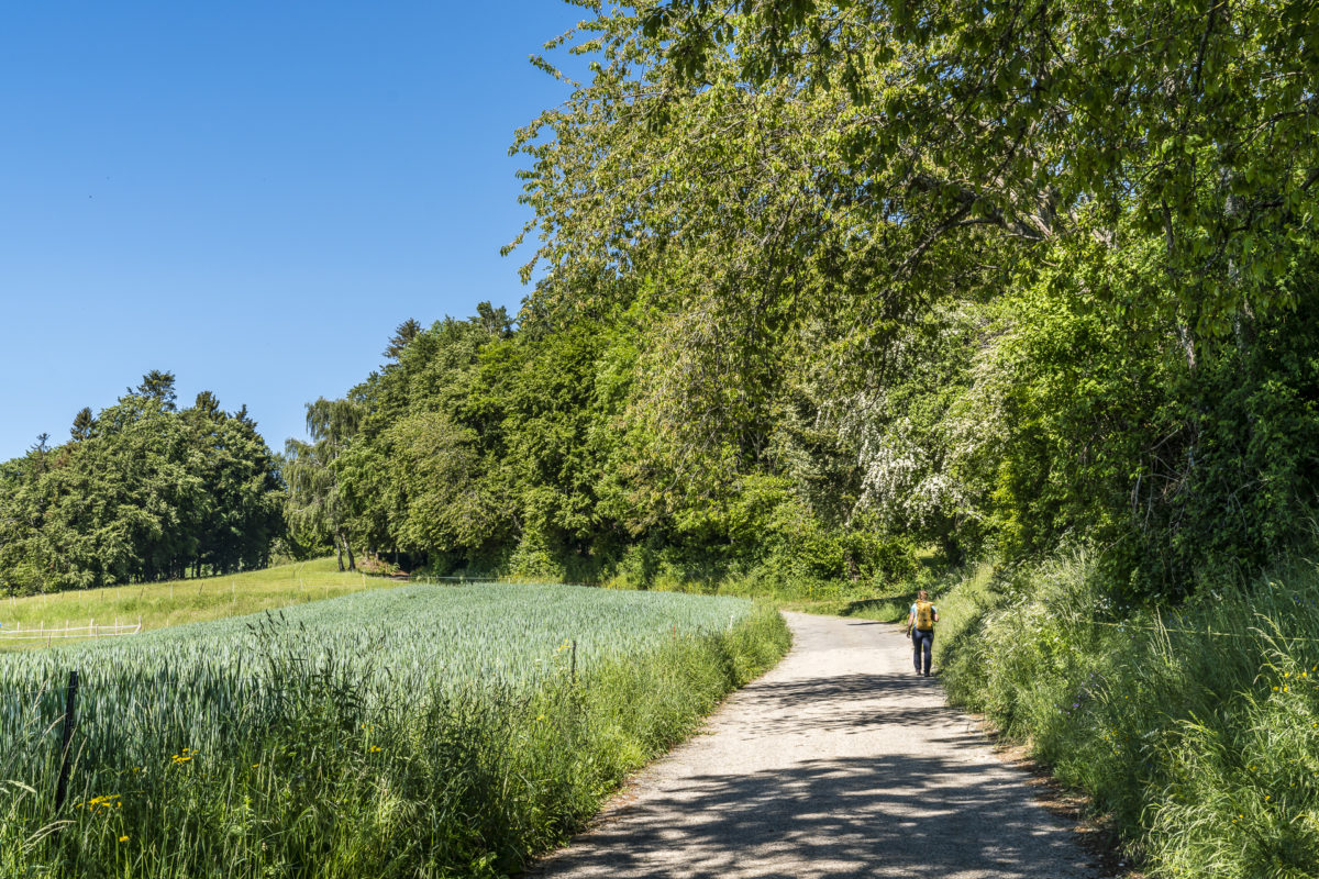
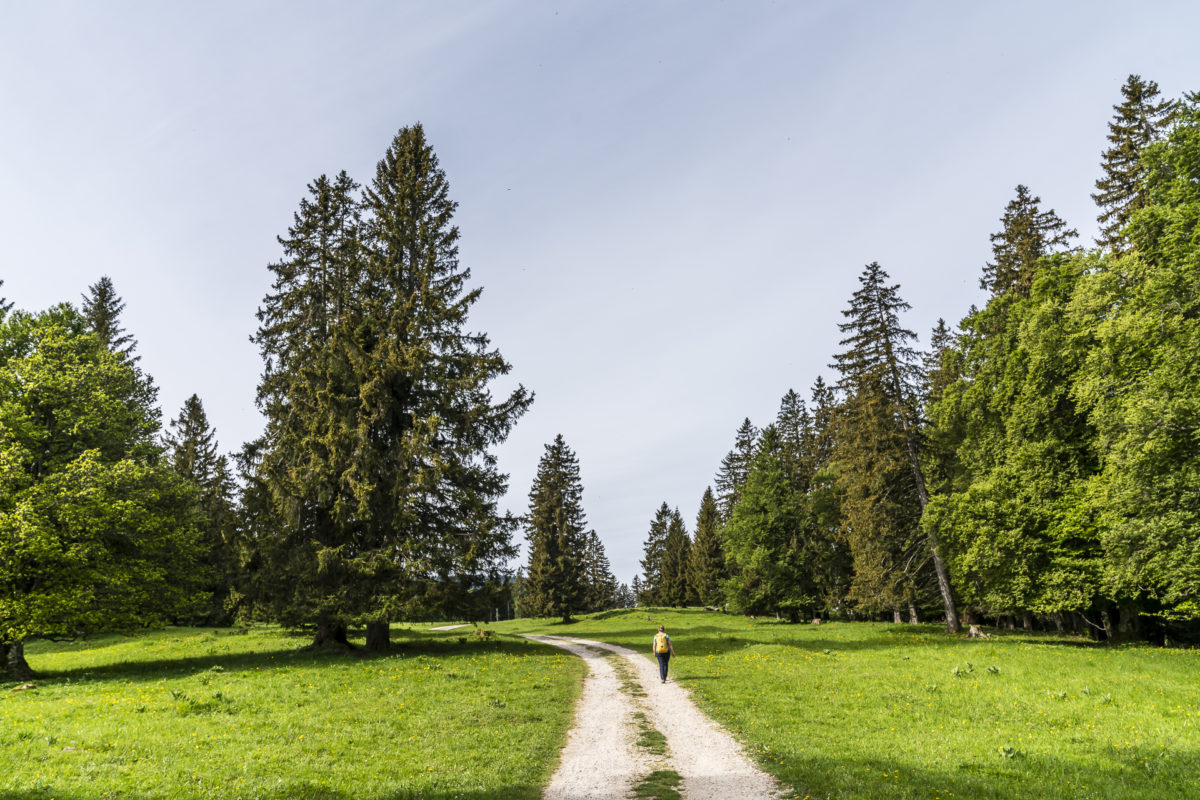
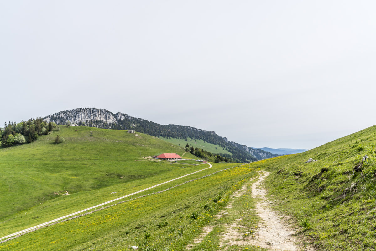
We walk uphill towards the Col des Etroits and then turn left onto a forest path. This leads us steadily and gently uphill over Jura pastures to Gittaz lingerie. There follows a tarred road that leads us further into the hills to the Col de l’Aiguillon. While on one side – less than a kilometre away – lies the French border, on the Swiss side, daring climbers scramble around the steep rock faces of the Aiguilles de Baulmes in the early hours of the morning.
Unfortunately, the end of the tarred road is still a long way off. Only shortly before Les Praz we continue on natural ground.
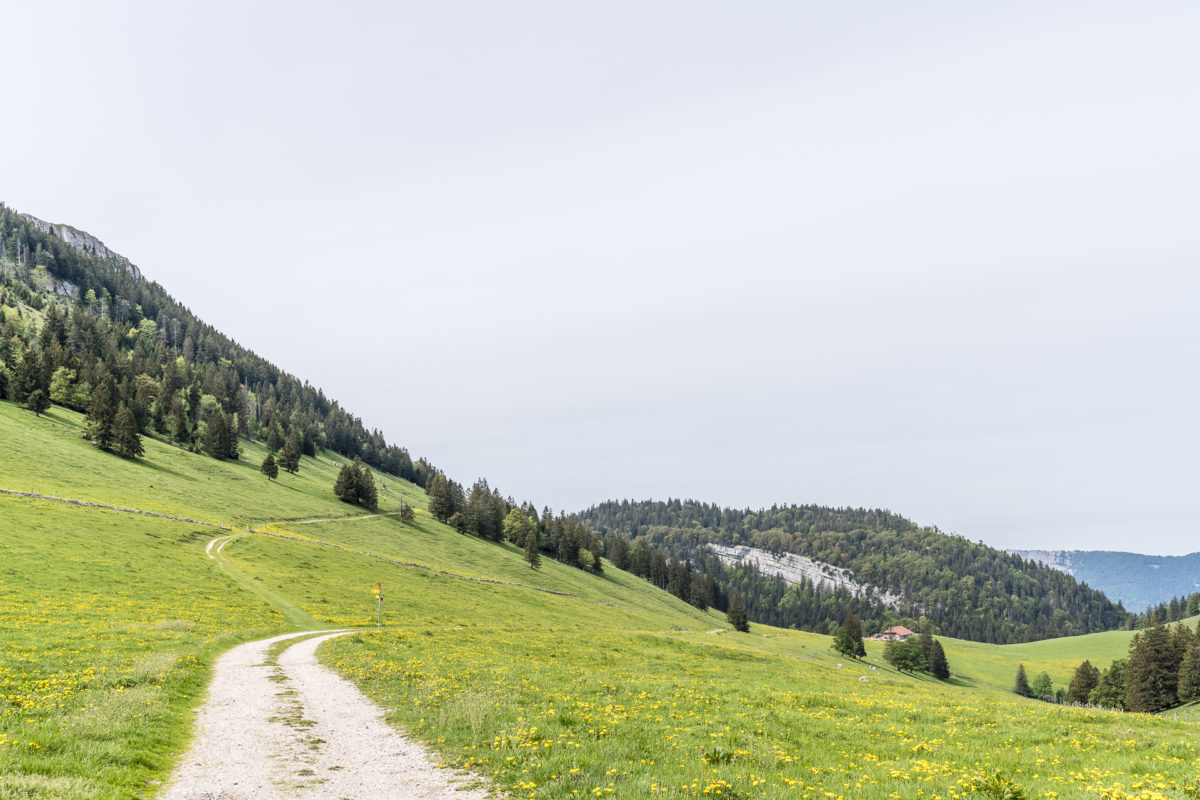
If you are prepared to pass the highest point of this stage at the Col de l’Aiguillon, you will have to fight with morale on the ascent to “Le Suchet”. I had prepared myself for a nasty climb through the forest – but the section behind Grange Neuve made me sweat a lot. A motivational boost was provided by the chamois that crossed our path. Unfortunately, she was too fast (or we were too slow), so the photo evidence fails at this point.
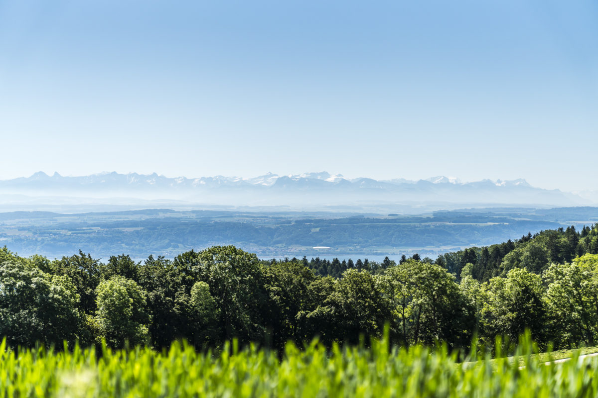
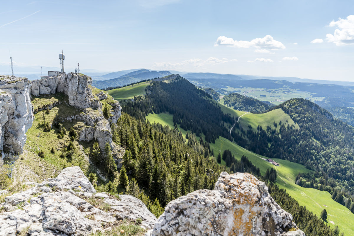
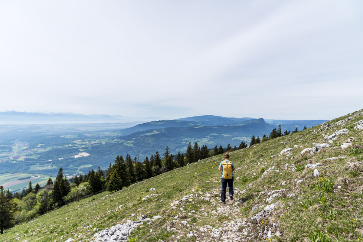
Once at the top, it’s worth adding the extra five minutes to the summit cross – from there there’s a great view back to the peaks that the Jura High Trail passes, including a “wow, I hiked all that” moment.
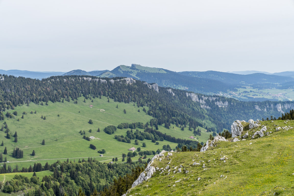
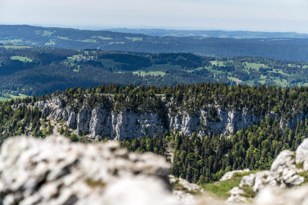
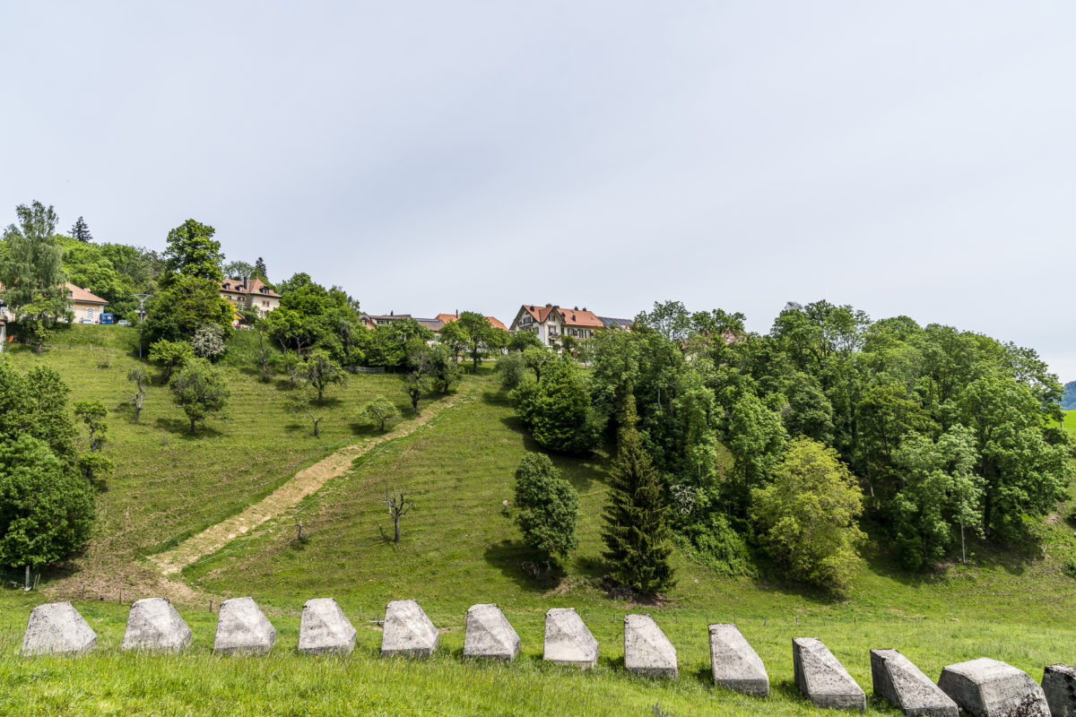
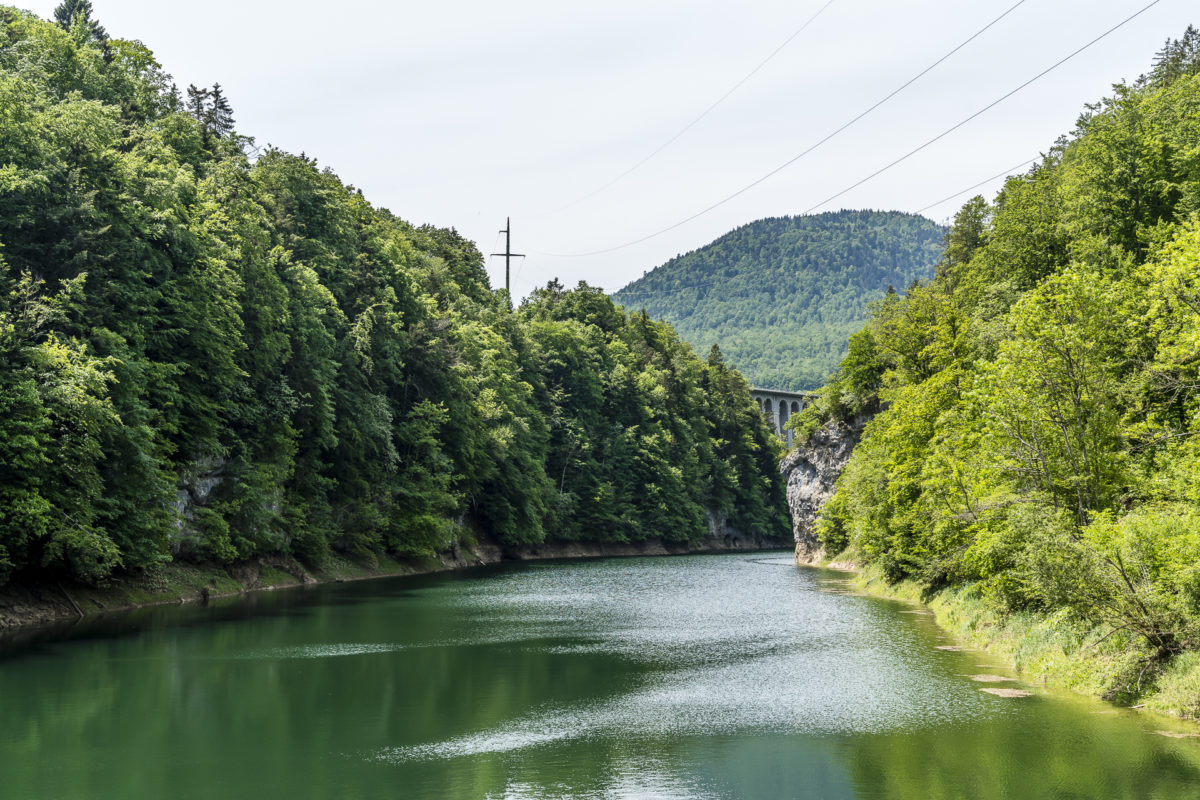
Now we have to descend via Jura pastures to Ballaigues. Unfortunately, the view is a bit hazy on this day. However, the striking rock faces of the Mont d’Or directly in front of us stand out despite the overcast sky. Also unmissable are the numerous anti-tank barriers and abandoned bunkers – contemporary witnesses of the first half of the 20th century.
After 25 kilometres of walking, our feet slowly but surely make themselves felt as we cross the Gorges de l’Orbe. And so, without further ado, we decide to skip the last three kilometers to Vallorbe station and head for Le Day station (which is also located in the municipality of Vallorbe) instead.
On the subsequent drive home, we review the two days and the kilometers we have mastered – with the Chasseron there was definitely a scenic highlight for me. And even if not all sections of the trail caused loud exclamations of enthusiasm, all in all it was two extremely multifaceted days!
Practical tips for your tour on the Jura High Trail (along one of the two most beautiful stages 11 and 12)
The route of our 2-day hike along the Jura High Trail can be found on the map below. We started the tour in the village of Provence, which you can reach by post bus from Yverdon-les-Bains. From there we hiked for almost 1.5 hours (5.75 kilometers / 400 meters in altitude) up to the actual starting point of stage 11 in Les Rochats. An alternative entry to stage 11 would be at the bus stop “Romairon, Les Rochats bif.”, which is located about 3 kilometres from Les Rochats directly on the Jura High Trail, thus shortening the first stage to 12.5 kilometres. In our version, the total distance from Provence via Les Rochats to Les Rasses is 22 kilometres and 1,130 metres in altitude (uphill). The second stage has 25 kilometres and 735 metres of altitude difference (uphill) from Les Rasses to Le Day station.
The walking time for both hiking stages is between 5.5 and 7 hours – depending on your pace and the number of breaks.
The Jura High Trail leads past numerous alpine pubs/buvettes and thus you regularly have the opportunity to stop for a bite to eat. For the overnight stay in the double room standard (mountain view) at the Grand Hôtel des Rasses, we paid around 350 CHF including dinner for two.
Impressions of other stages of the Jura High Trail can be found at Fräulein Draussen and IDNU. In her tour report, Fräulein Draussen describes stages 7 to 9 (Frinvillier – Chasseral – Vue des Alpes – Noiraigue). At IDNU there are impressions of the stages 13 and 14 following stage 12 (Vallorbe – Le Pont – Col du Marchairuz)
Another beautiful multi-day hike in the Jura can be done along the Chemin au Fil du Doubs. And if you’re in the mood for a detour to the Jura, but a long-distance hike isn’t your thing, then you’ll find more excursion tips for the Jura here: 5 beautiful excursion destinations in the Jura/3 Lakes Region
Leave a Reply