

Hut hiking in the Aosta Valley: 2 summit highlights on Alta Via 1
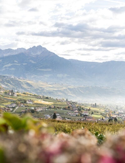
Just 20 kilometres as the crow flies separate us from Zermatt and yet we feel like a trip around the world from the Swiss holiday resort. Here in the Val d’Ayas, a side valley of the Aosta Valley, we are at the southern foot of the Monte Rosa massif. In order to get directly to Zermatt from here, knowledge of high-altitude tours and mountain experience are required. We’ll save this adventure for another time.
For the time being, we have opted for the convenient way of arriving via Great St. Bernard. It takes just under two hours by car from Martigny to the farthest tip of the Val d’Ayas. Connections with public transport are patchy on this route, so a car or a local taxi is essential, at least on some of the routes. But once you have reached this remote corner of northern Italy, you will be rewarded with a magnificent high alpine backdrop. And on top of that, the Val d’Ayas also knows how to inspire with regional delicacies and traditional village structures.
The legendary high-altitude trails of Valle d’Aosta
The idea of going on a hut hike along one of the two legendary high-altitude trails of the Aosta Valley in early summer was already mature when Corona came and upended almost all our travel plans. For a long time, I assumed that our hike in the Aosta Valley would also have to be declared a Corona victim. But with the borders reopening, the protective measures and in view of the fact that the majority of us will be outside with a lot of distance, we decided at the end of June to implement the tour as planned.
The Aosta Valley is considered by connoisseurs to be an unparalleled hiking paradise and offers the Alta Via 1 and 2, a 31-day high-altitude trail spanning the region.
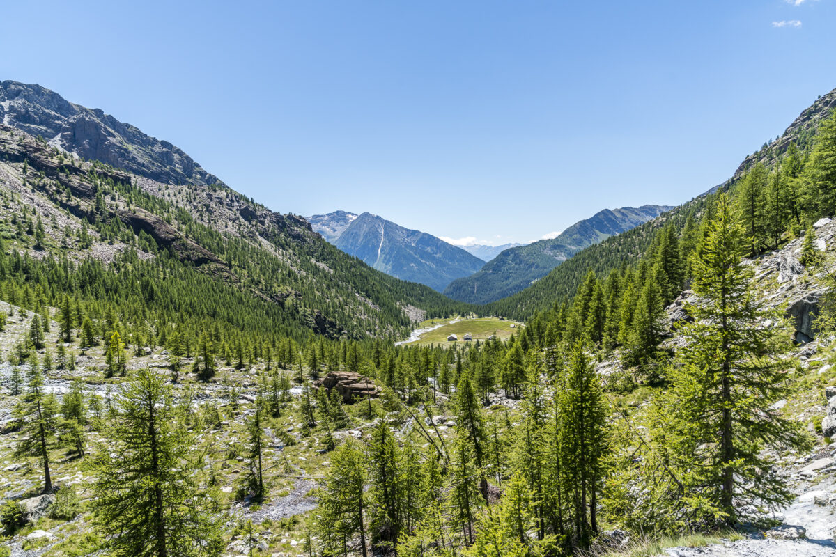
The Alta Via 1 starts in Donnas and leads from there via Val d’Ayas and Valtournenche along the foot of the mighty four-thousand-metre peaks to Courmayeur. This is where the Alta Via 2 begins, which leads back to Donnas on the other side of the valley through Italy’s oldest national park, Gran Paradiso. All stages sound extremely “happy” and accordingly I was glad that I could fall back on the local tips of hiking guide Anna Ravizza for the start. To get started, we took on stages 7 and 8 of the Alta Via 1 and enriched them with two summit experiences. The result: two absolutely fantastic days of hiking! Imitation is expressly recommended – but as you will see in a moment, we were also blessed with a dream weather.
Hüttenübernachtung Nr. 1: Ferraro Hut
For the transfer to our starting point in Champoluc in the Val d’Ayas, we use the local taxi company 7 Alps. Taxis are the usual means of transport for mountaineers and ski tourers who move between the remote Alpine valleys in the border region of Italy and Valais and do not want to travel by car and do not want to wait ages for suitable public transport connections.
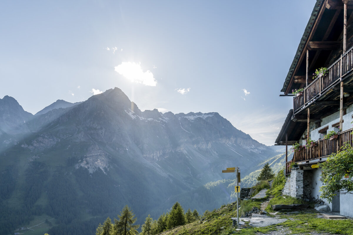
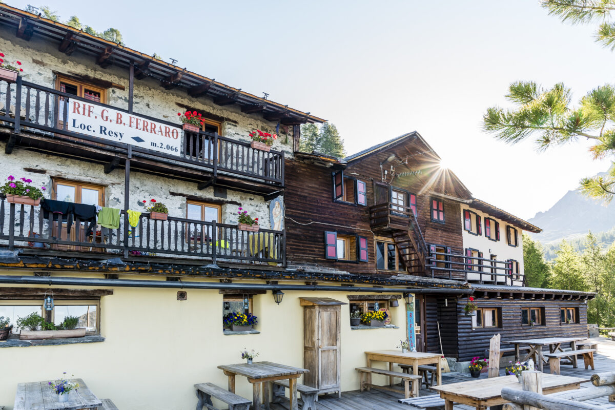
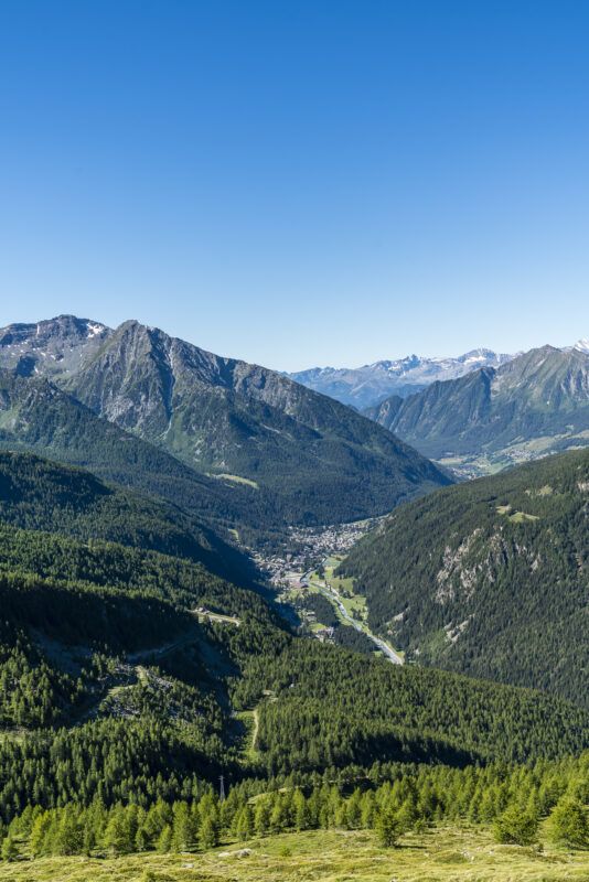
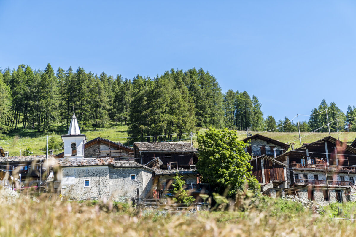
We spend the first night in the Rifugio Ferraro, which is located just under an hour’s hike above St-Jacques at the end of the Val d’Ayas and is still very easy to reach on foot even if you arrive later. The Rifugio Ferraro is part of a historic Walser settlement. As in Valais, the Walsers also settled in the Val d’Ayas in the early Middle Ages, and so there are also some typical tanned and sometimes crooked Spychers here.
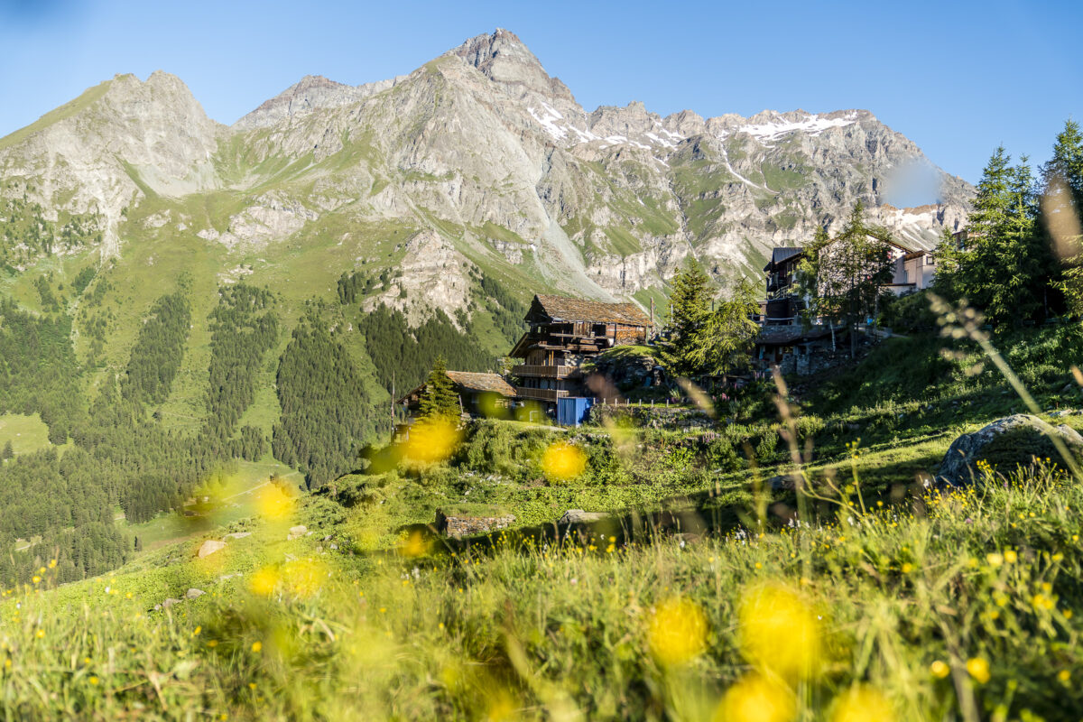
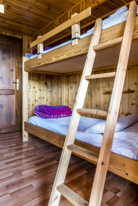
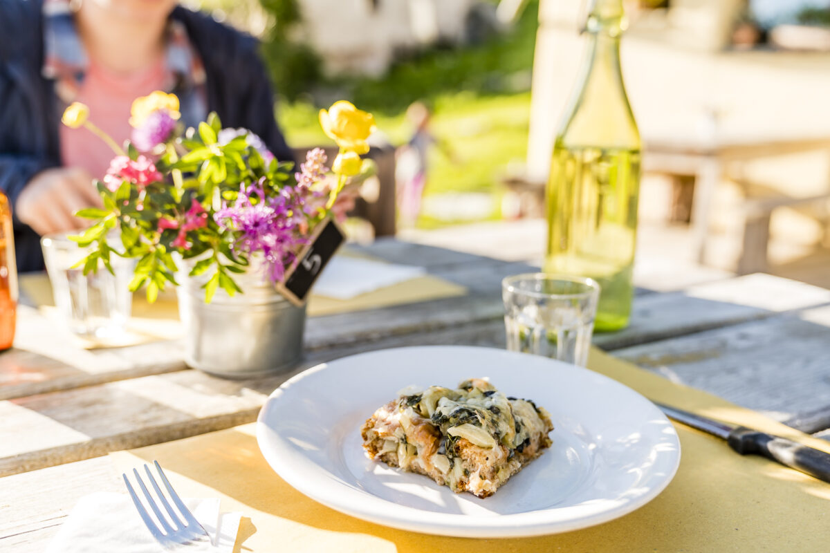
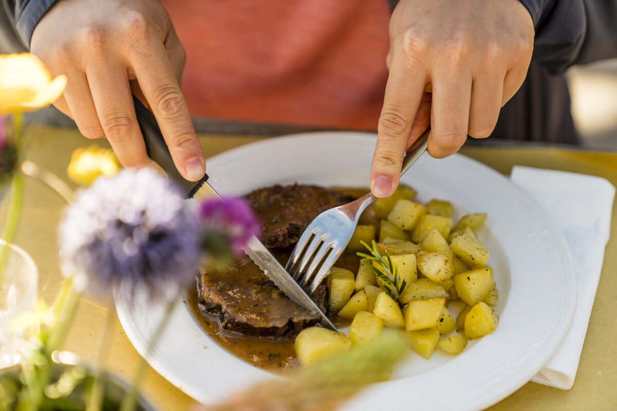
We like the Rifugio Ferraro right away. There are no large crowds here, but smaller room structures. We get a 4 bed room with valley view to ourselves and are thrilled that there are even several smaller bathrooms with showers. It’s almost luxury. Equally convincing is the dinner. As usual in huts, a 3-course menu consisting of starter, main course and dessert is served here. At lunchtime, however, the Rifugio Ferraro is also a popular day trip destination due to its well-known cuisine.
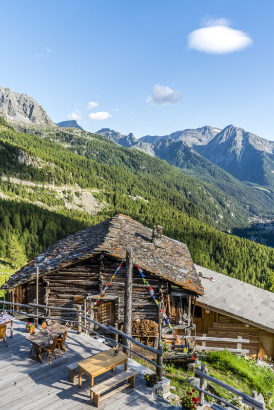
Both the food and the panoramic view over the Val d’Ayas are first-class here – if you follow the high trail, you should think twice about adapting the route so that you spend the night here.
Via Palon de Résy and Lago Blu to St-Jacques
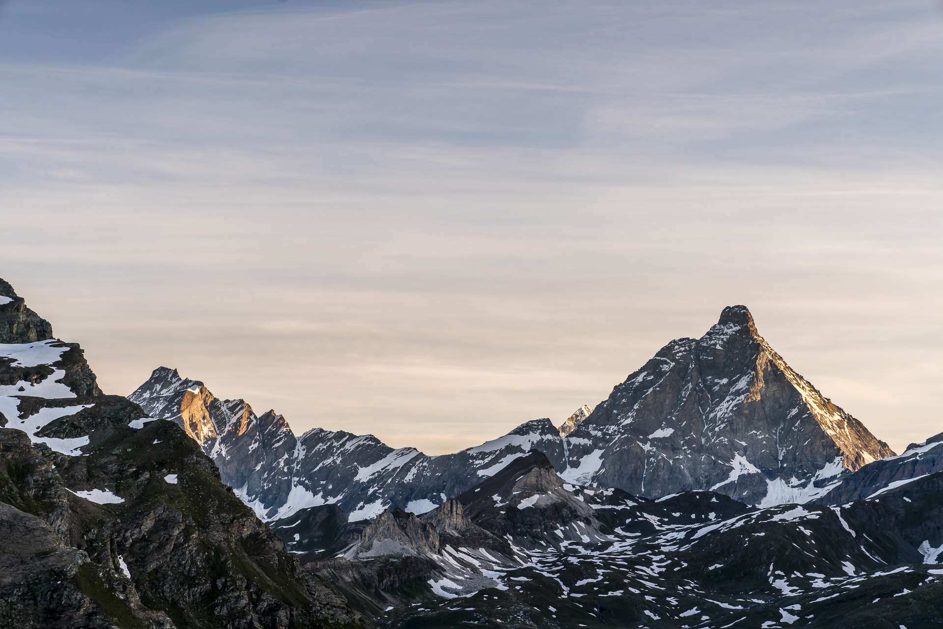
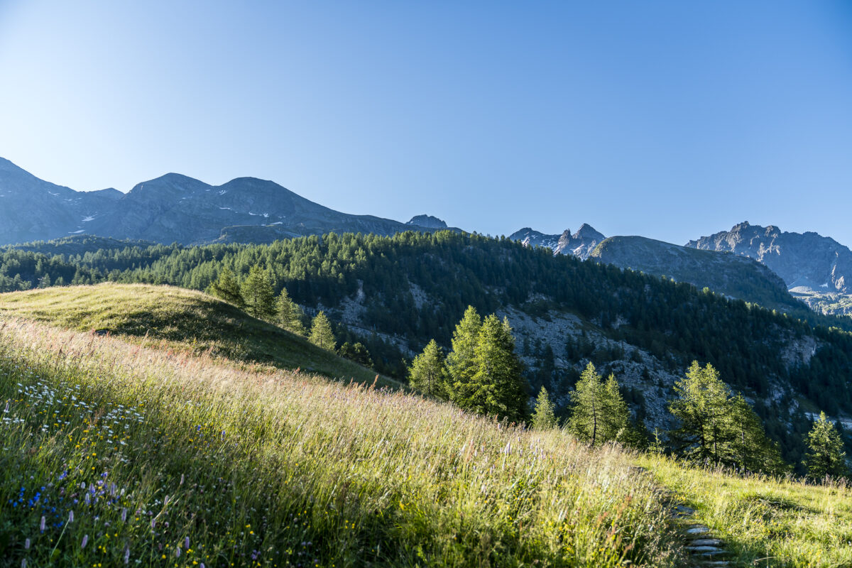
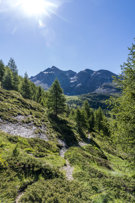
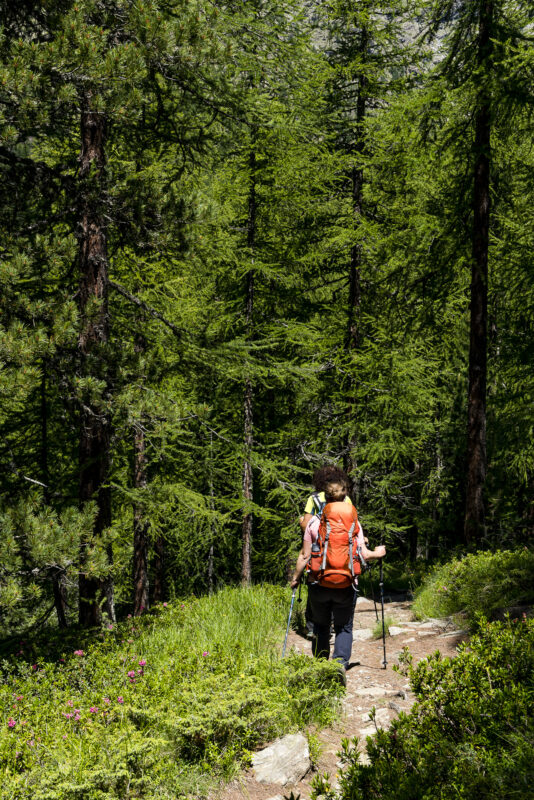
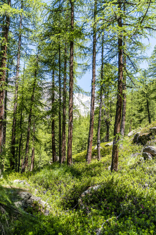
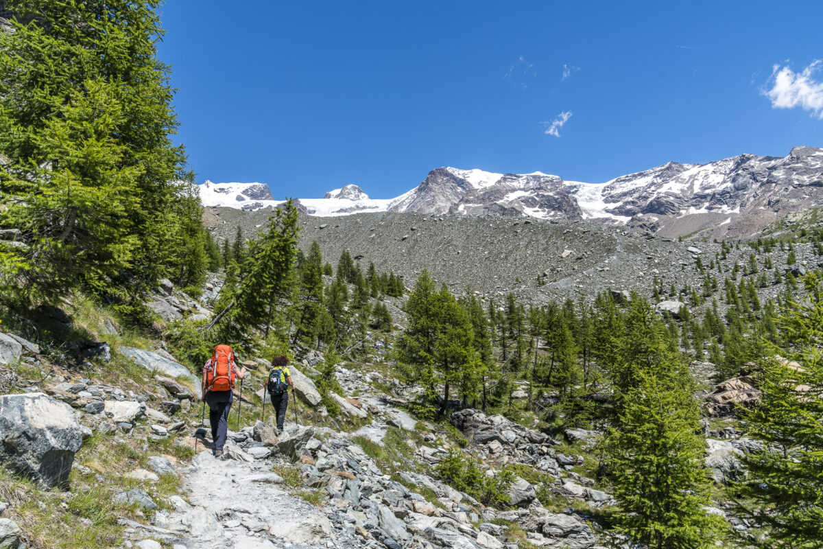
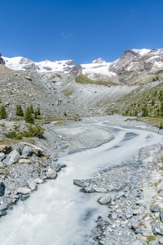
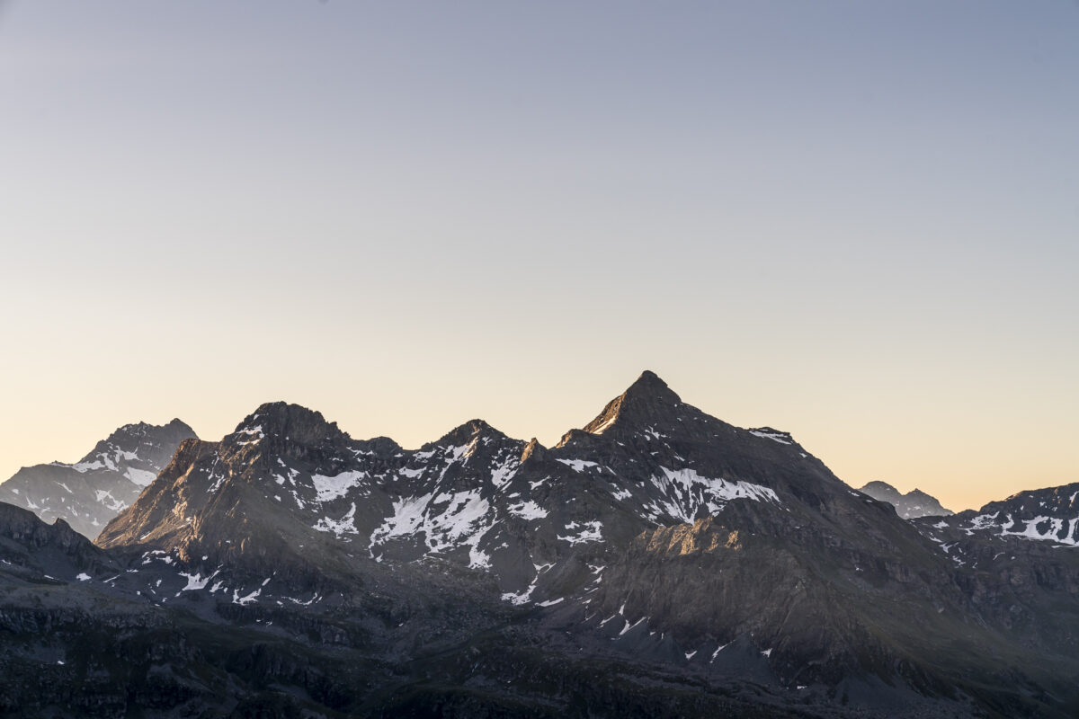
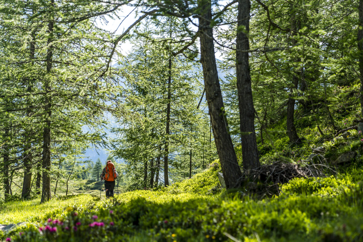
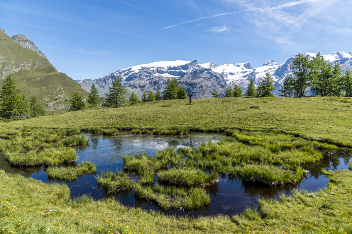
From the Rifugio Ferraro, the Alta Via 1 leads down the valley to St. Jacques and then on the other side of the valley again a good 800 meters up to the Rifugio Grand Tournalin. But before we head in this direction, we want to tackle the house summit of the Rifugio Ferraro – the Palon de Résy at 2,675 m above sea level. The almost two-hour ascent over a narrow mountain path, which leads through a larch forest in the first part, which later turns into an alpine grassland, is rewarded with a phenomenal panoramic view from the Breithorn over the Dufourspitze to far into the Aosta Valley. Terrific!
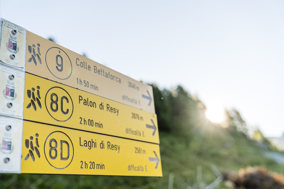
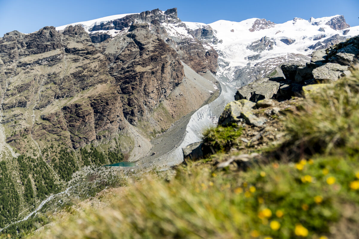
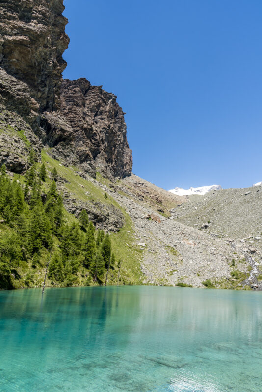
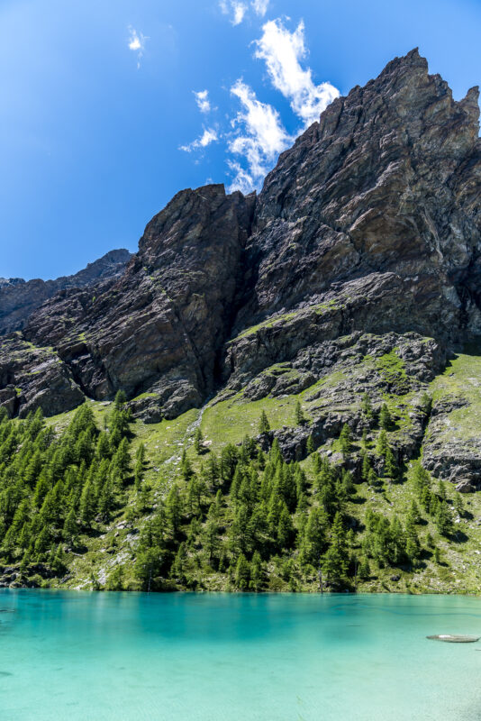
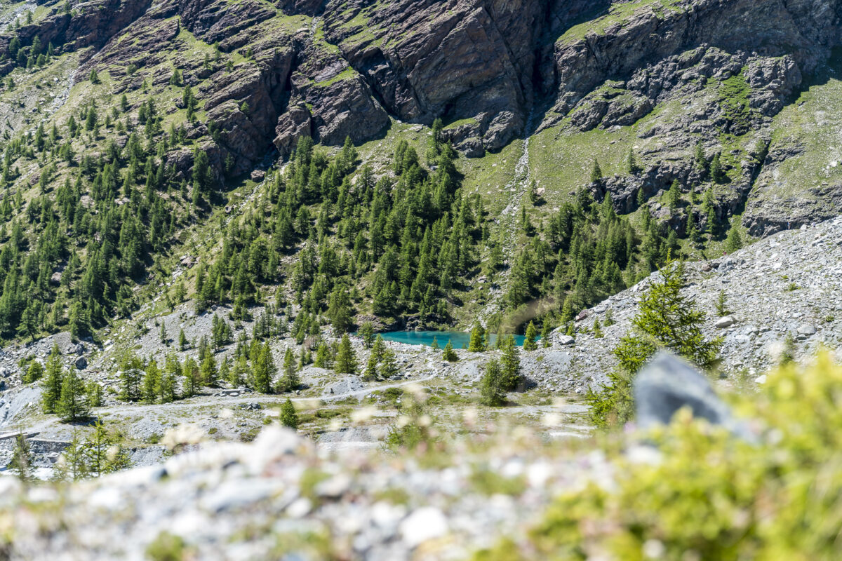
On the way back, it is worth taking a short detour to the Lacs de Résy. Afterwards, we return to the Rifugio Ferraro on the same path, where the panoramic terrace has been filled with day-trippers in the meantime. We now continue downhill. At the top of the Palon de Résy, the shimmering turquoise Lago Blu at the end of the Grand Glacier de Véraz has made us so curious that we spontaneously add a second detour to this tour and accept the one-hour additional loop to Lago Blu/Lac Bleu via Plan Véraz.
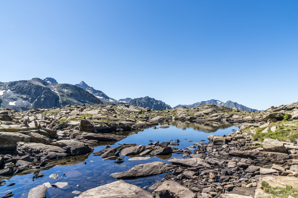
Due to its easy accessibility and spectacular location, Lago Blu is also a popular hiking destination for day trippers. You shouldn’t expect loneliness back here on a beautiful summer Sunday – but the detour is still very worthwhile. In any case, I was completely thrilled from this ruggedly beautiful end of the valley.
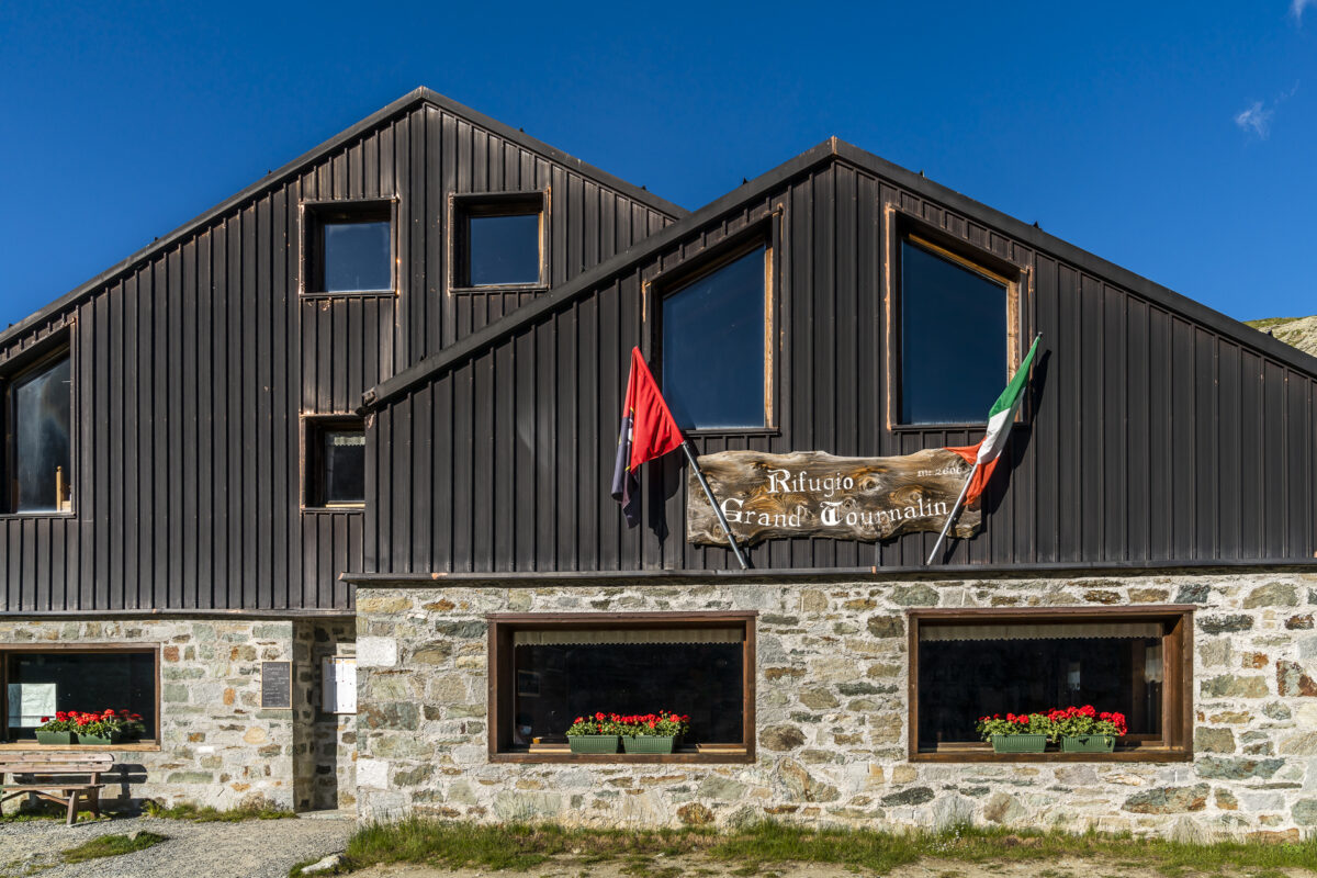
Hüttenübernachtung Nr. 2: Grand Tournalin Hut
It is a good hour’s walk from Lago Blu to the Walser village of St-Jacques. According to the route description of the Alta Via, it takes another 2.5 hours from here up to the Rifugio Grand Tournalin. We are lucky enough to be able to ride with the hut warden. The Rifugio Grand Tournalin is reached by a gravel road, which can be used by 4×4. The hut team regularly uses the route for shopping and disposal – and this can result in spontaneous carpooling opportunities.
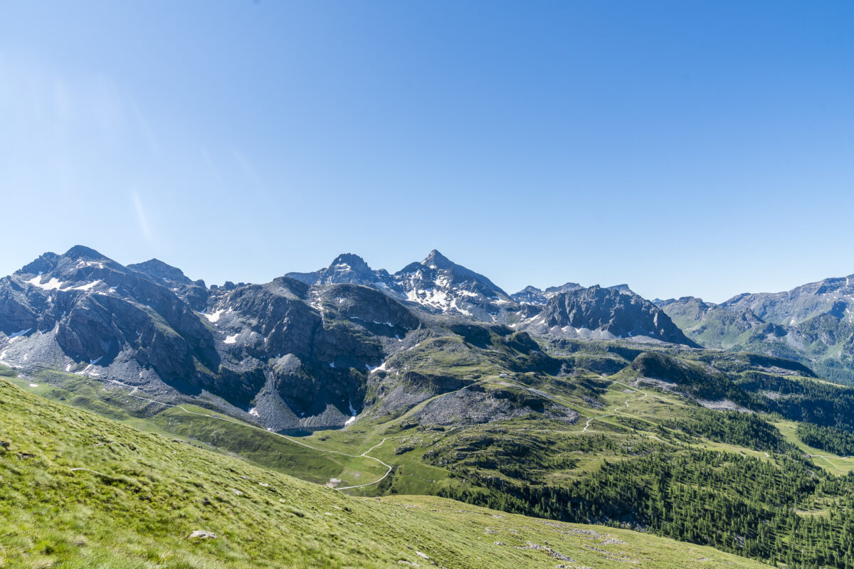
The Rifugio Grand Tournalin is located in a basin surrounded by a chain of three-thousand-metre peaks, including the Grand Tournalin as the crowning finale. In contrast to the Rifugio Ferraro, the classic hut feeling is clearly noticeable here. The rooms are also smaller (we are again in a 4-person room) and showers are also available – but in the Rifugio Grand Tournalin chips are required and the time is limited to 3 minutes (which is of course absolutely sensible at this height with limited source connection).
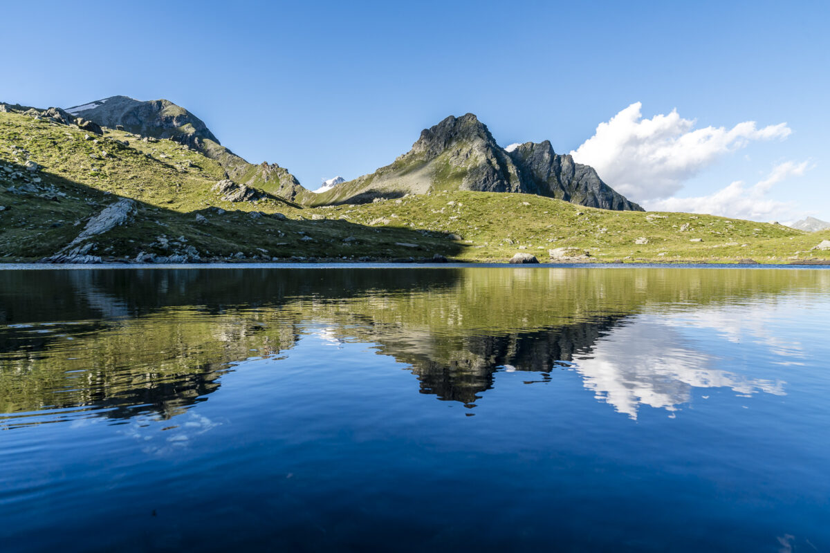
Directly behind the hut hides a small mountain lake, which is a worthwhile destination for an evening digestive walk.
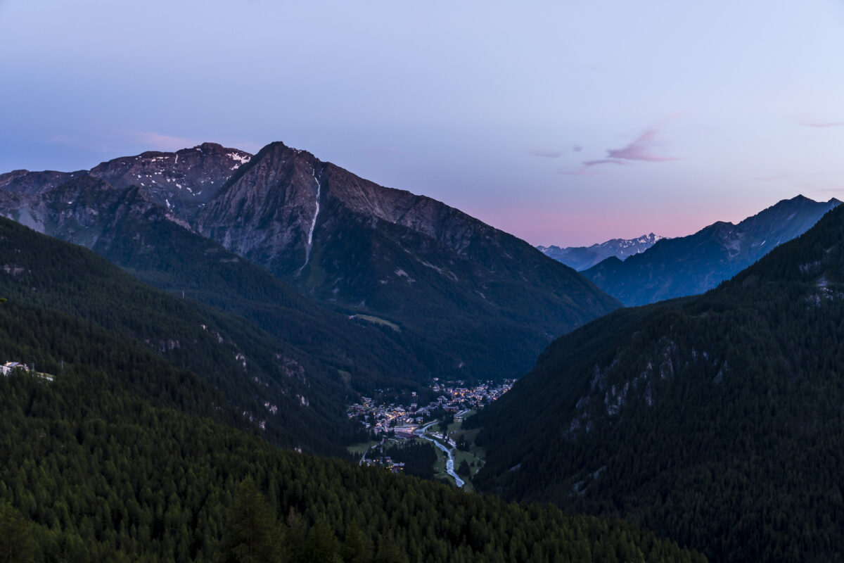
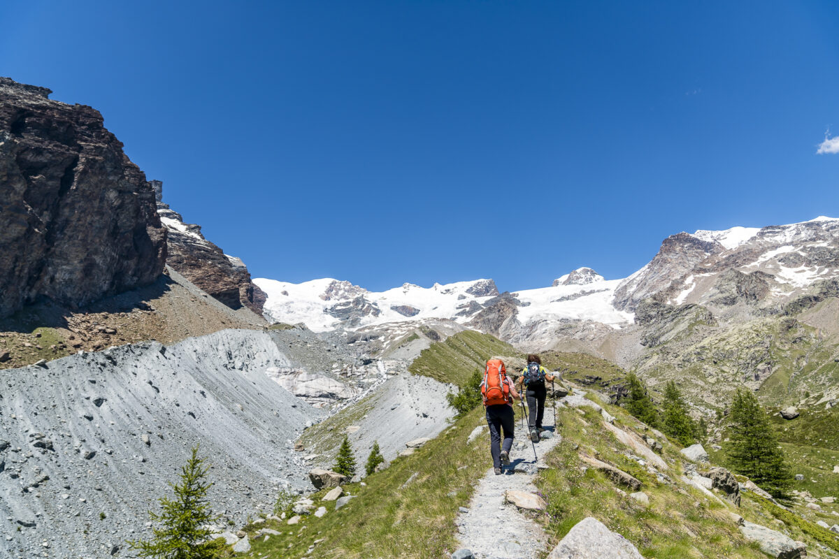
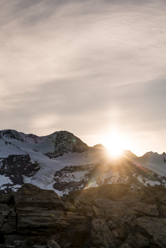
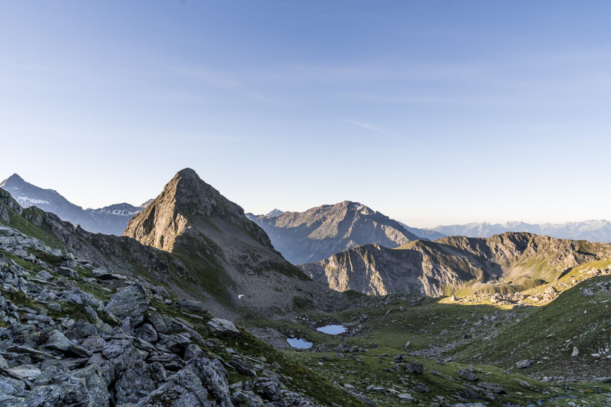
Sunrise tour of Mont Brun/Monte Croce
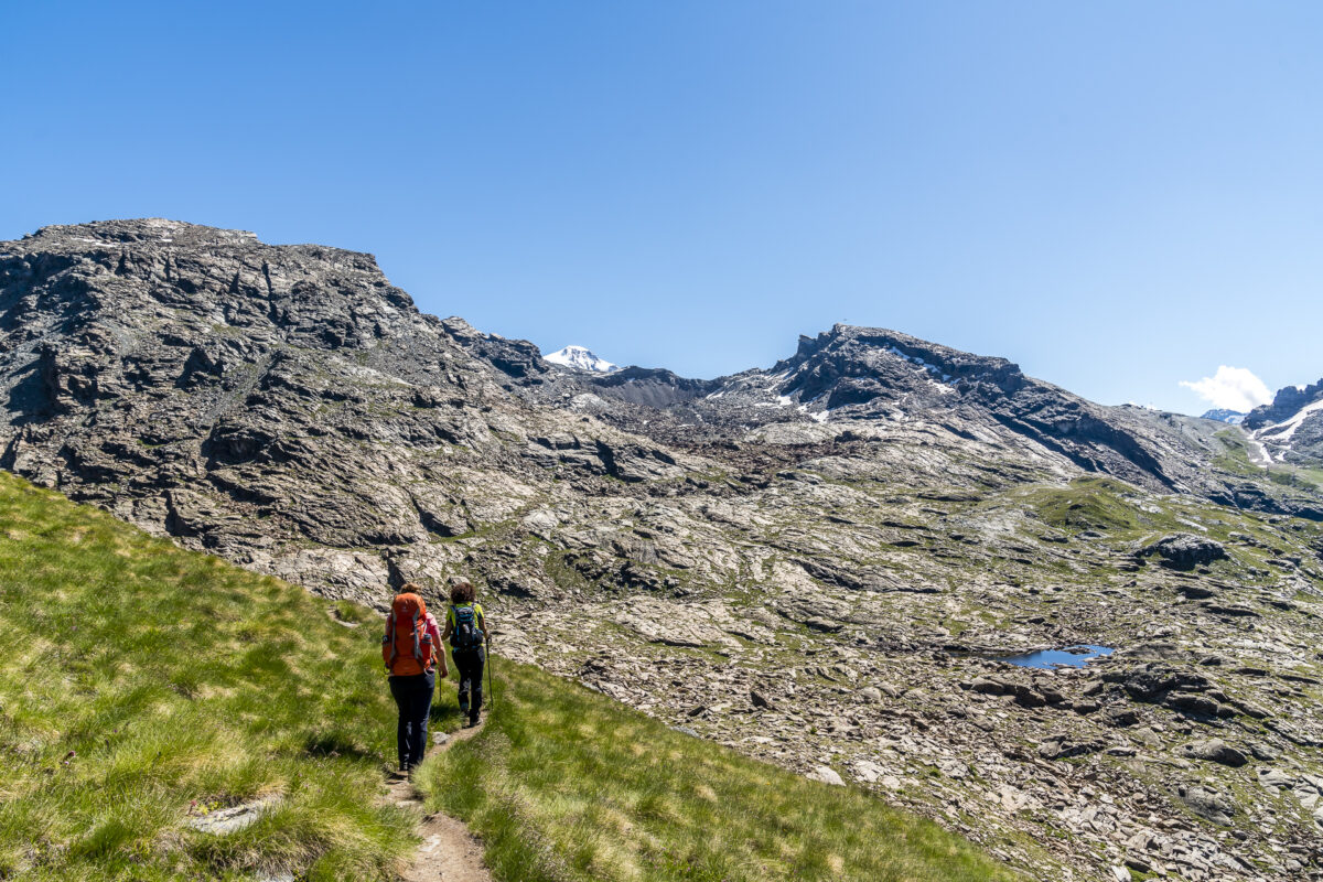
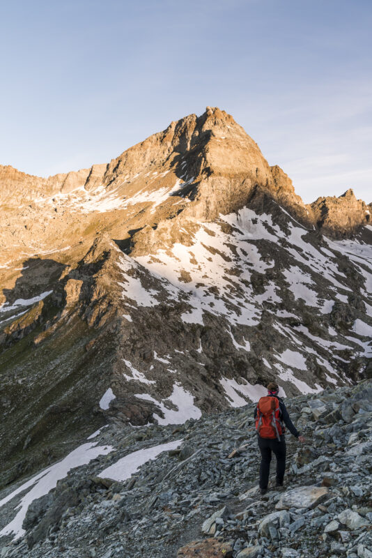
The big plus of overnight stays in huts near the summit are the sunrise tours. The ascent from the Rifugio Grand Tournalin to Mont Brun at 2,895 m above sea level takes just under an hour (depending on the map, Mont Brun is also called Monte Croce). The ascent is steep, but the path is well developed throughout and there were only a few places where I had to use my hands briefly (difficulty T3).
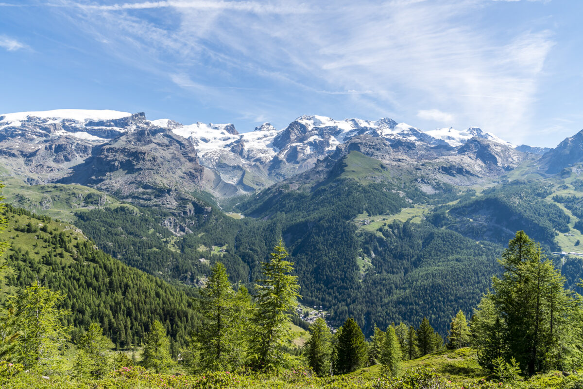
Once you reach the summit, you can look out over a mountain panorama that is virtually the “who’s who” of the Valais Alps. Matterhorn – Breithorn – Monte Rosa – Dufourspitze. You name it! An absolutely worthwhile start to the day – and if you start at 5 a.m. like us, you’ll be back at the hut at 7 a.m. in time for breakfast.
Via the “Alta Via No. 1” back to Champoluc
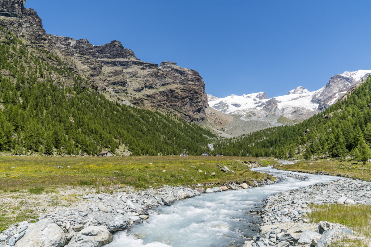
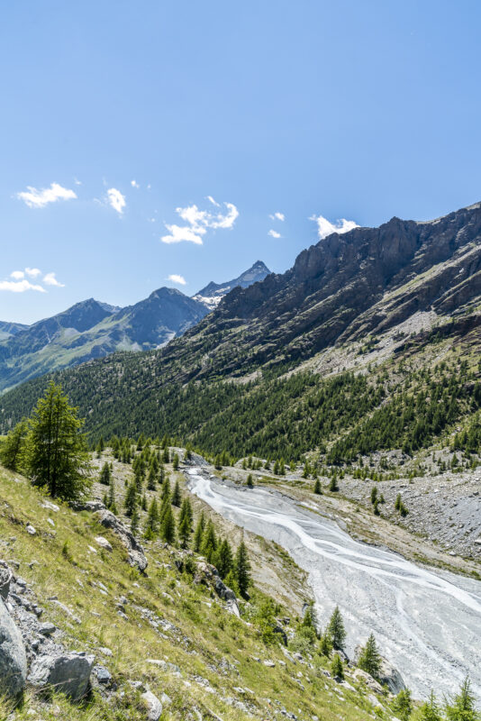
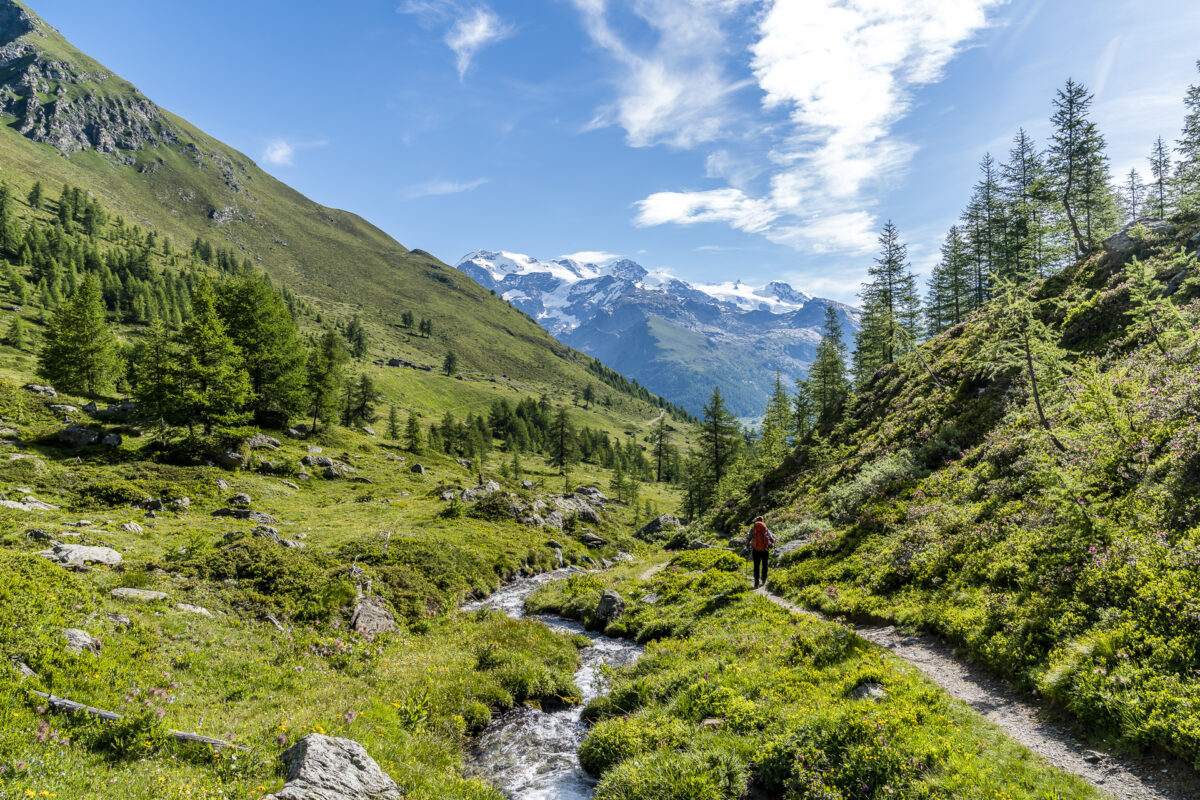
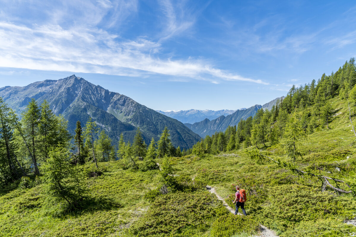
While I thought on the summit of Mont Brun that this would have been my highlight of the day, I am taught better on the subsequent hike along the Alta Via downhill towards St-Jacques/Champoluc. Wow, that’s an enchanting section of the trail. We cross blooming alpine meadows, follow a bubbling mountain stream, pass wet meadows and can’t stop being amazed.
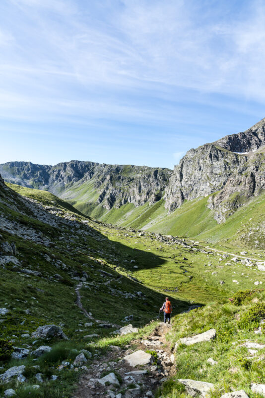
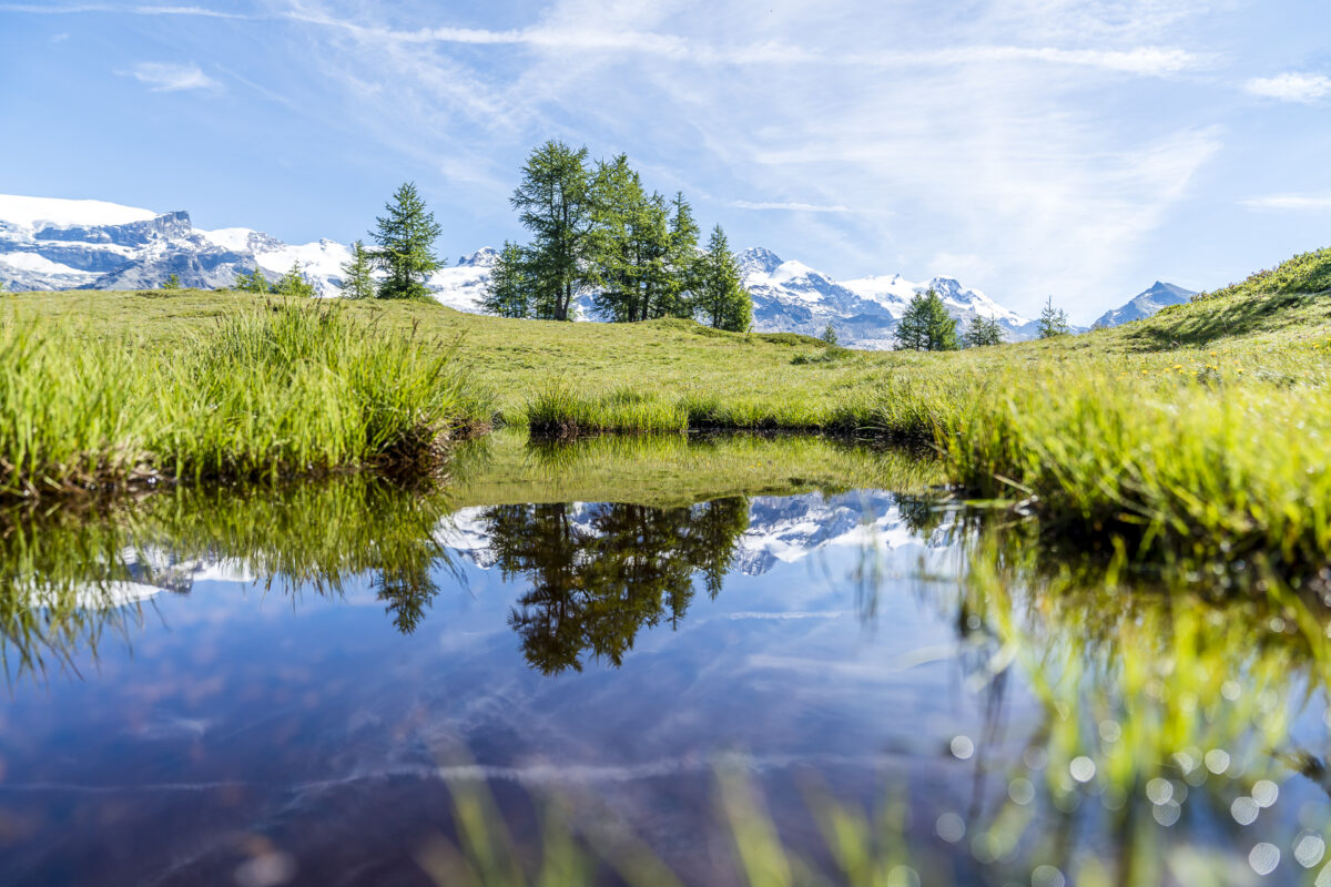
Analogous to the previous day, we decide once again to install an additional loop and choose the junction towards Metsan (route number 31) and only then set off via Mandriou downhill to Champoluc. The nice thing about this route variant is that on the one hand you can enjoy a great view of the Monte Rosa massif at Lago Lochien (a small “swamp lake”) and on the other hand you get a view of the water channels typical of the valley (similar to the bisse in Valais) at the level of Alpe Metsan (an agriturismo).
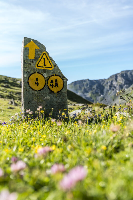
Either way, the hiking opportunities in the Val d’Ayas are incredibly diverse and the paths are also well signposted. In an emergency, thanks to Switzerland’s proximity, you can also use the SwitzerlandMobility app to find your way around. In any case, we are already toying with the idea of making another hiking detour to the Aosta Valley – but then in the direction of Grand Paradiso.
Practical tips for hiking in Valle d’Aosta
- There are direct postbus connections from Martigny once or twice a day (with surcharge) via the Great St. Bernard to Aosta. From there you can take the train to Chatillon. From Chatillon at the latest, a taxi is recommended. Alternatively, there are various taxi companies that offer cross-border transfers for those who do not travel by private car.
- In Val d’Ayas there are two free bus circuits (every 40′) that connect the villages well.
- An overview of the two Alta Via 1 and 2 trails can be found on the website of Valle d’Aosta Tourism: Trekking on the Alta Via
- The overnight stay at the Rifugio Ferraro costs 55 euros per person including half board. At Rifugio Grand Tournalin, the price varies between 48 and 50 euros per person, depending on the season. Both huts can be reached by phone or e-mail.
- Unfortunately, it is not so easy to find good maps/route descriptions online. Hiking maps are available on site at the Tourist Office (Route Varasc, 16 in Champoluc). However, the signposting of the hiking trails is very good.
- If you want to use a local guide (for a wide variety of activities from hiking and trekking to biking and kayaking), you are in good hands with the local agency Patta Libra. On the first day, hiking guide Anna Ravizza accompanied us to the Palon de Résy and gave us a great overview of the hiking opportunities in the valley. On the website of Patta Libra you will also find various hiking suggestions with time information.
- Most of the locals in the Val d’Ayas understand French very well.
- If you want to get an insight into the local cuisine before or after the hut hike, you are in good hands at the Ristorante Le Petit Coq.
Our trip to the Aosta Valley was supported by the Valle d’Aosta Tourism Organization. As always, all impressions and opinions are ours.
Leave a Reply