

Clariden Ridge Trail: Hike from Klausen Pass to Fisetengrat
The Clariden Höhenweg is a rewarding summer hike: from Klausen Pass, this mountain trail leads past the turquoise-blue Gletscherseeli over scenic high-altitude paths to the Fisetengrat – a delightful day tour amidst an impressive alpine landscape.Starting the Hike at Klausen Pass
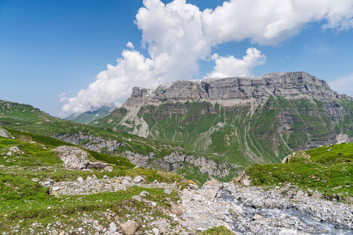
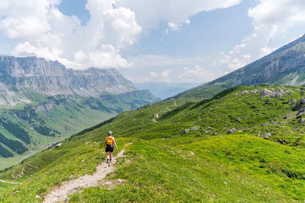
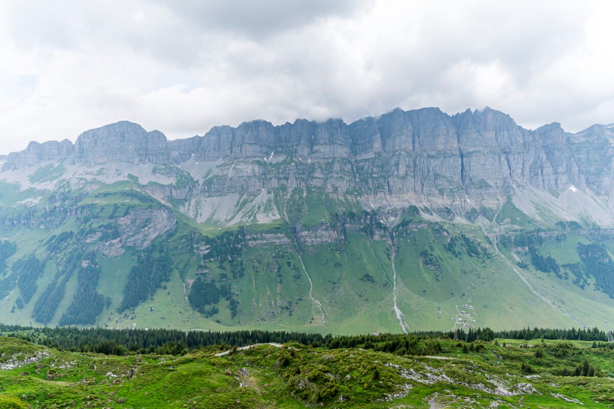
The Clariden Höhenweg (SchweizMobil route number 588) runs from Klausen Pass to Fisetengrat high above Switzerland’s largest alpine pasture – the Urnerboden. This point-to-point trail can be hiked in either direction. And although it’s always worth looking back, this direction offers an impressive panoramic view of the Jegerstöcke, Urnerboden, and the Linth Valley – a panorama that makes this hike especially appealing.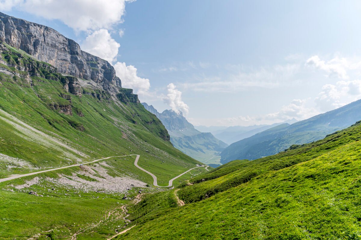
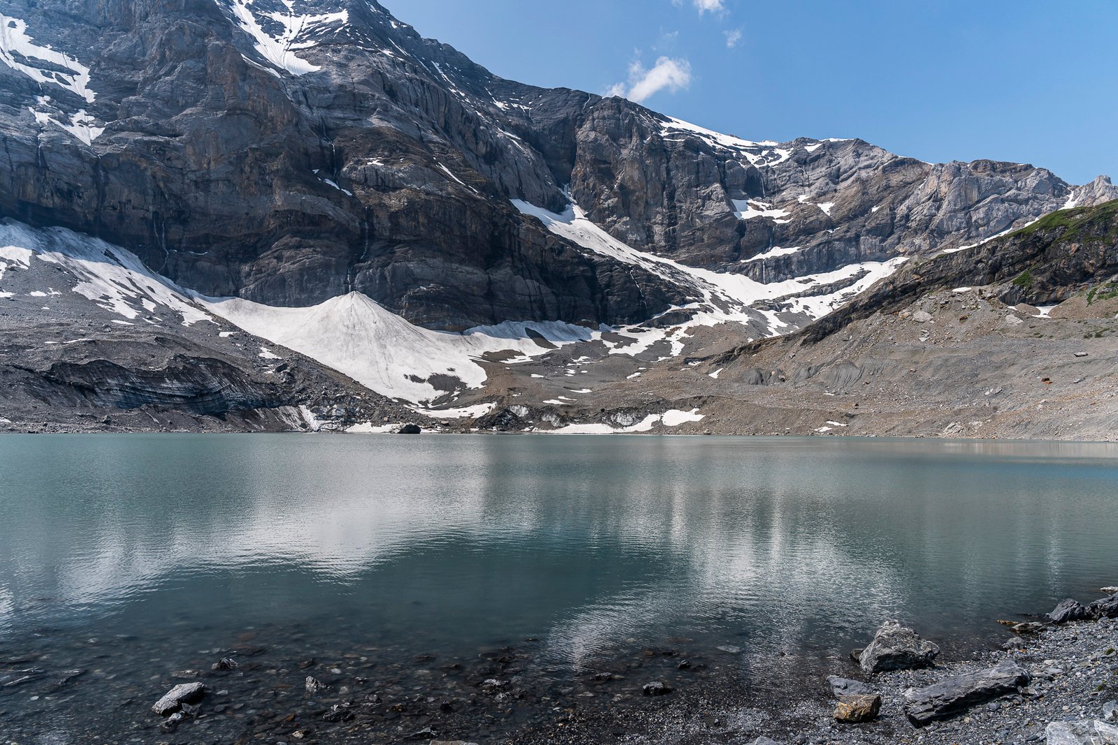
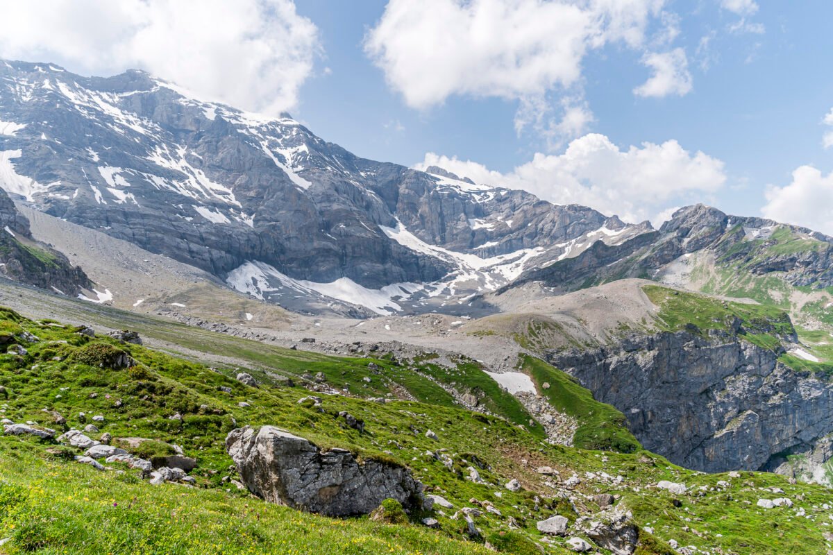
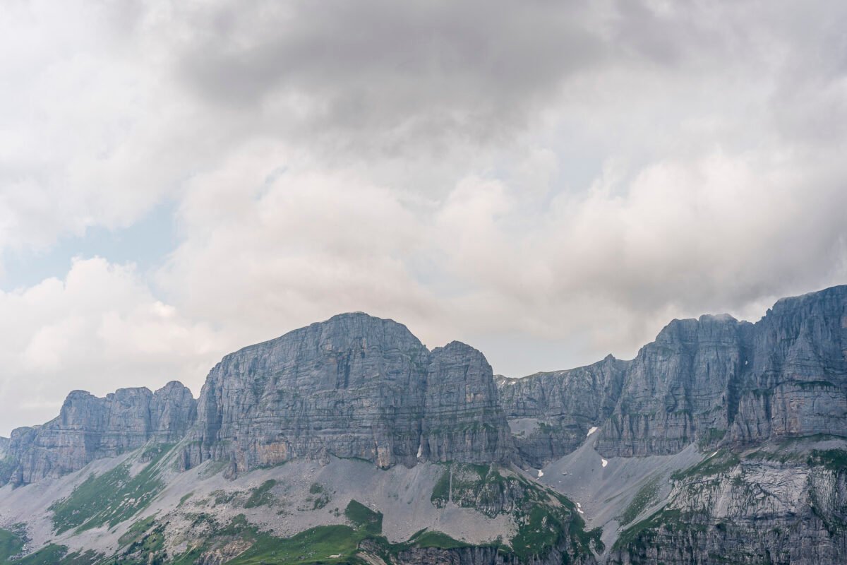
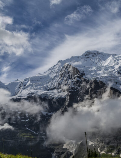
Ascent to the Gletscherseeli at the Foot of the Clariden North Face
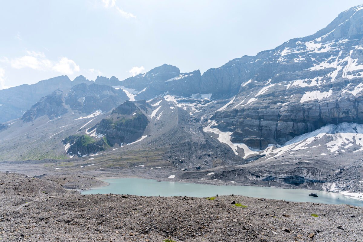
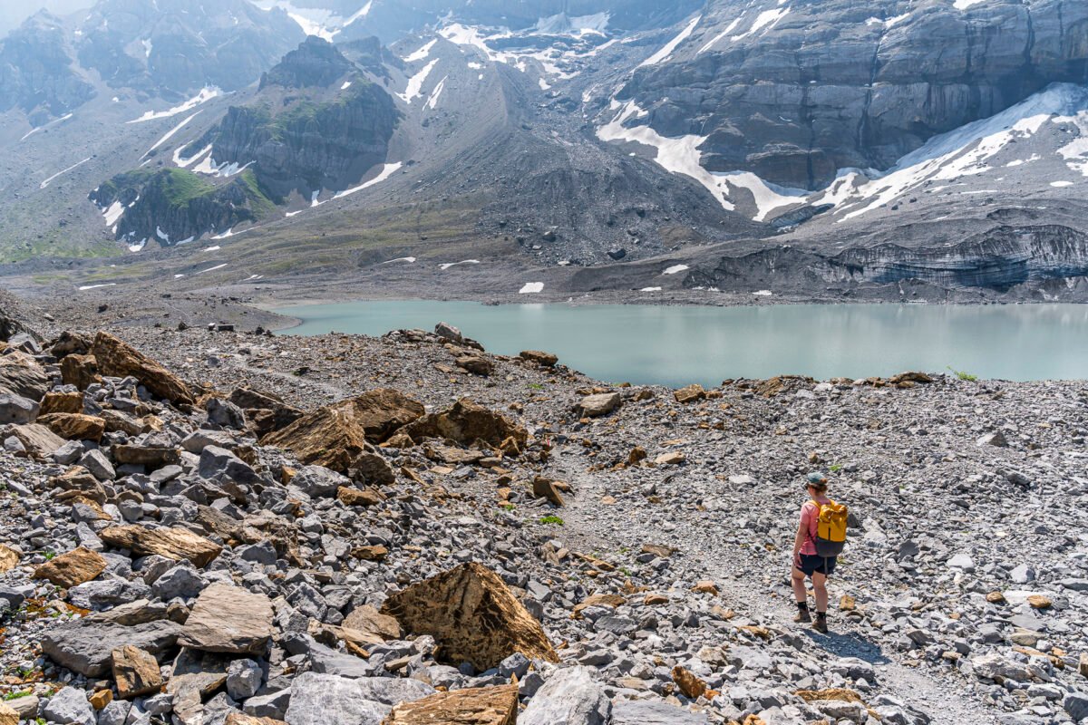
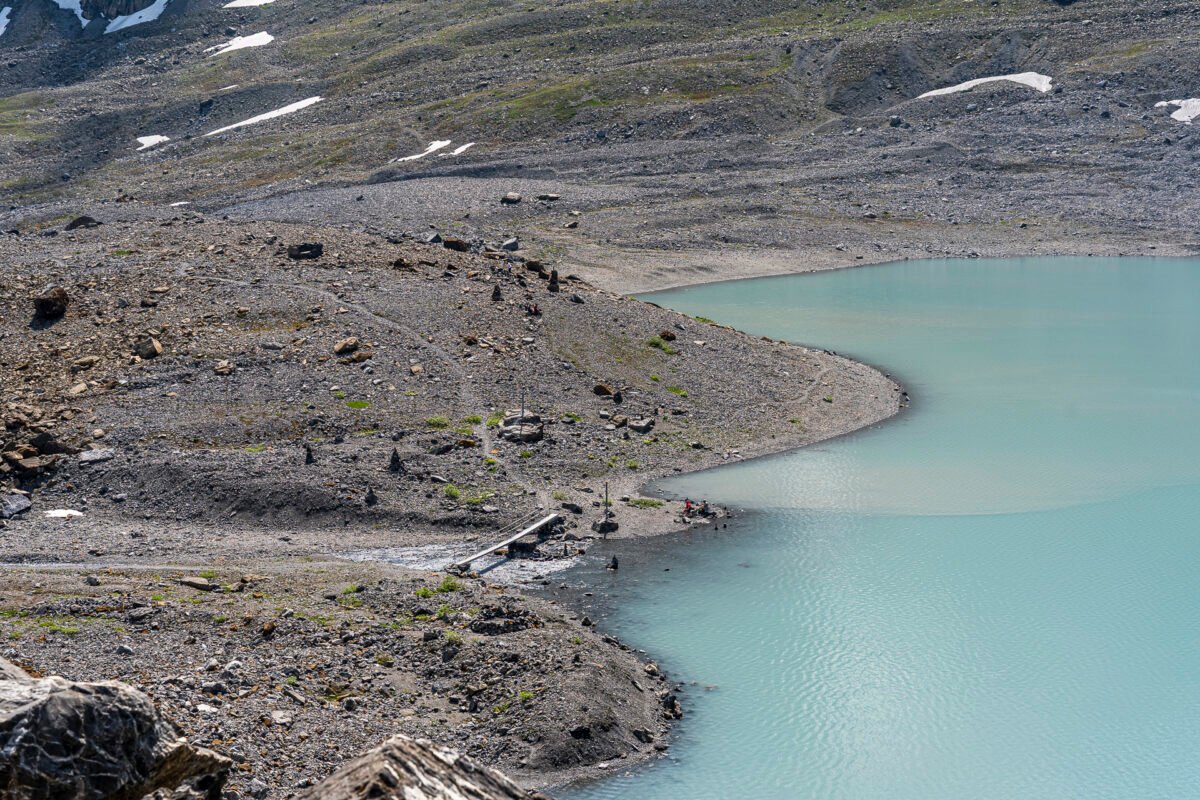
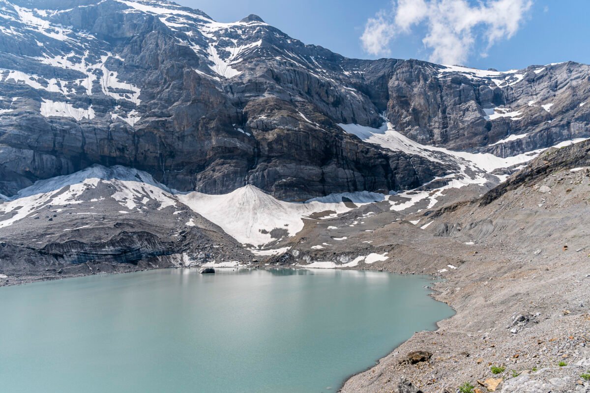
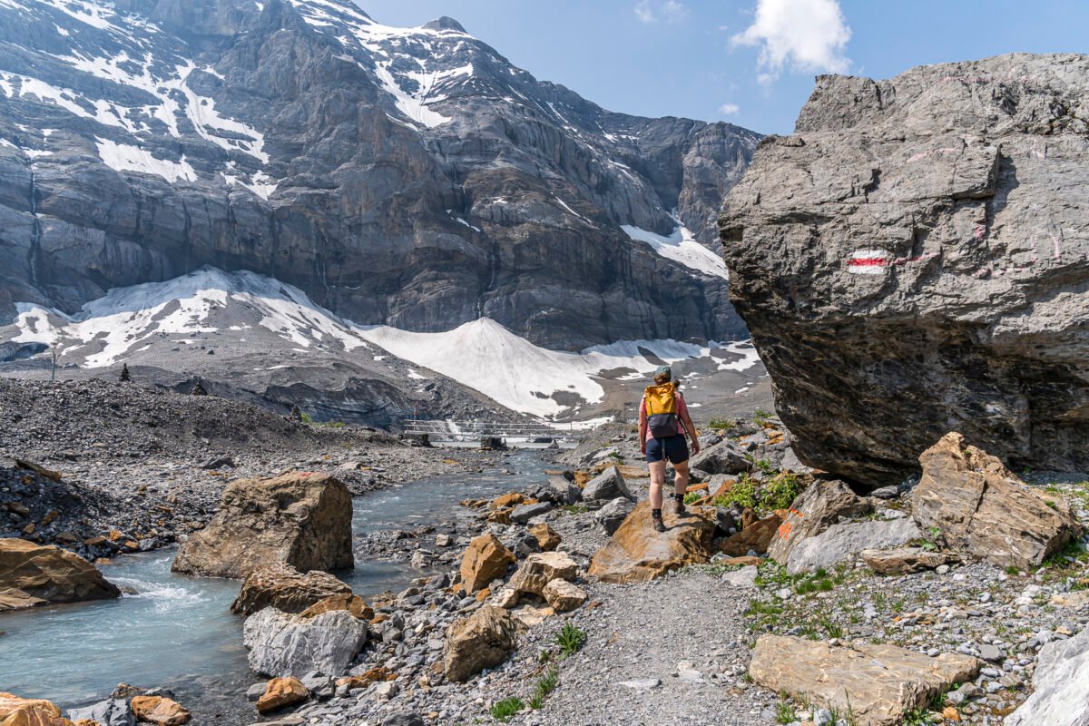
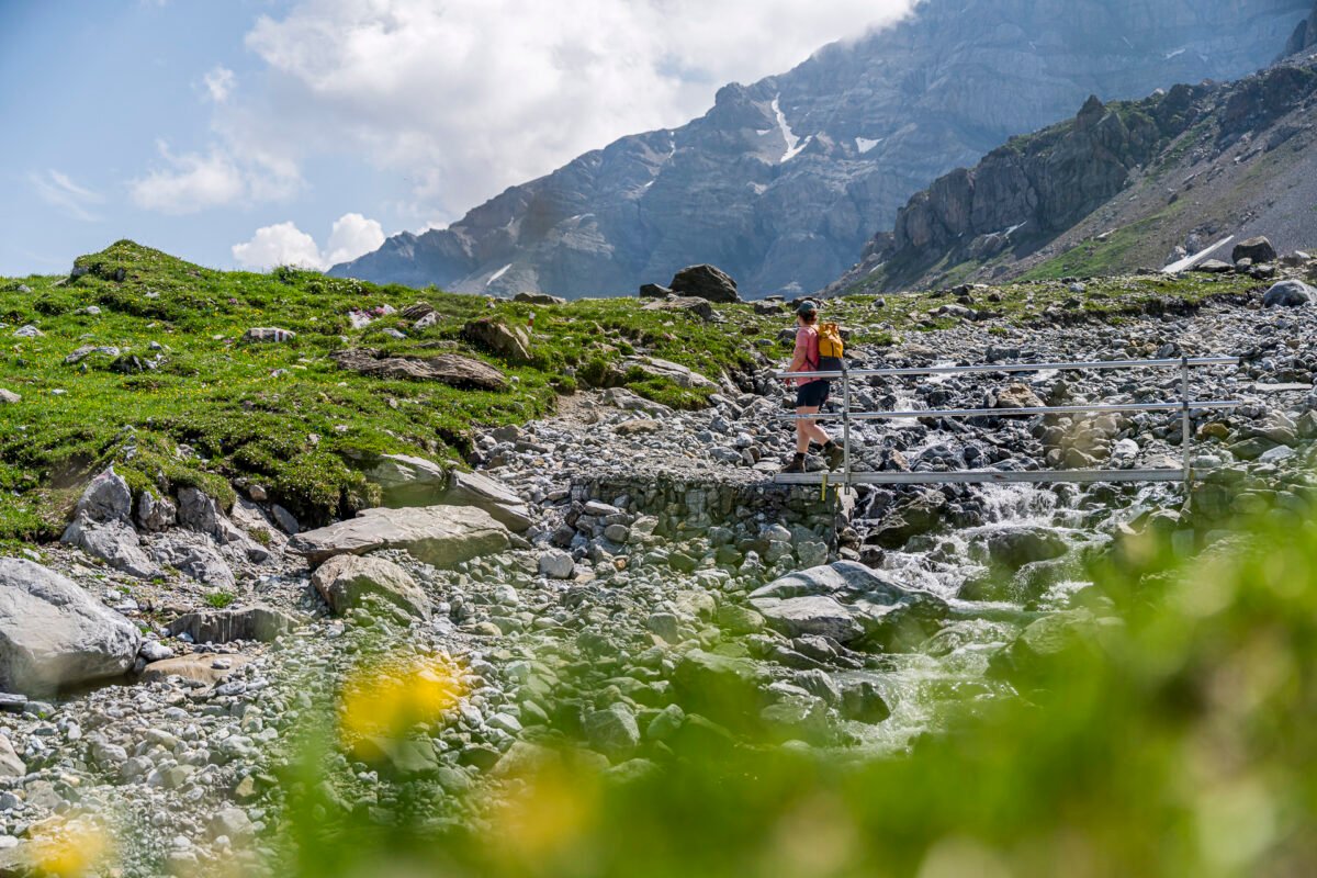
The tour starts right at the pass summit. We weave our way past motorbikes and cars and follow the signpost onto a gravel path that zigzags uphill towards the mighty north face of the Clariden. Soon, the gravel road turns into a narrow mountain trail. After about 45 minutes and 250 meters of elevation gain, we reach the firn field and catch our first glimpse of the milky-turquoise shimmering mountain lake.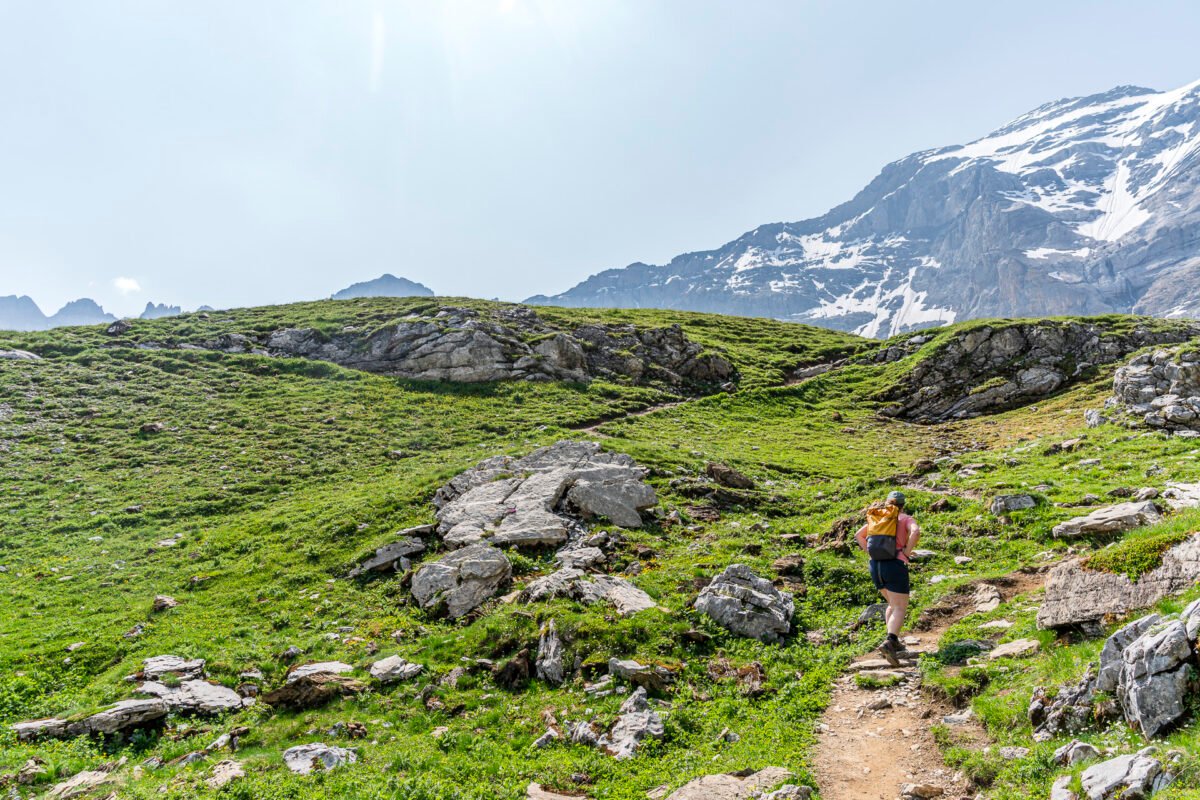

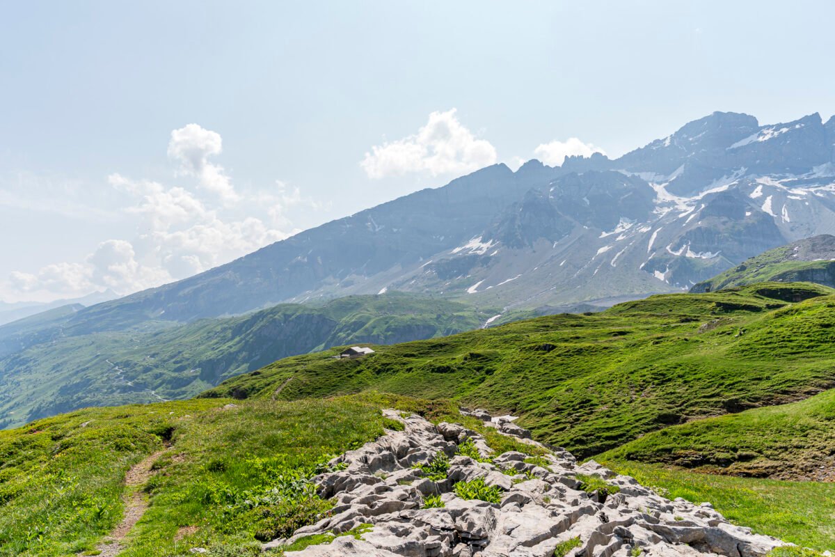
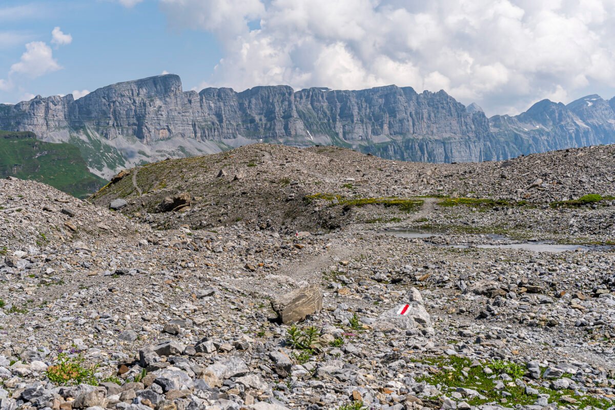
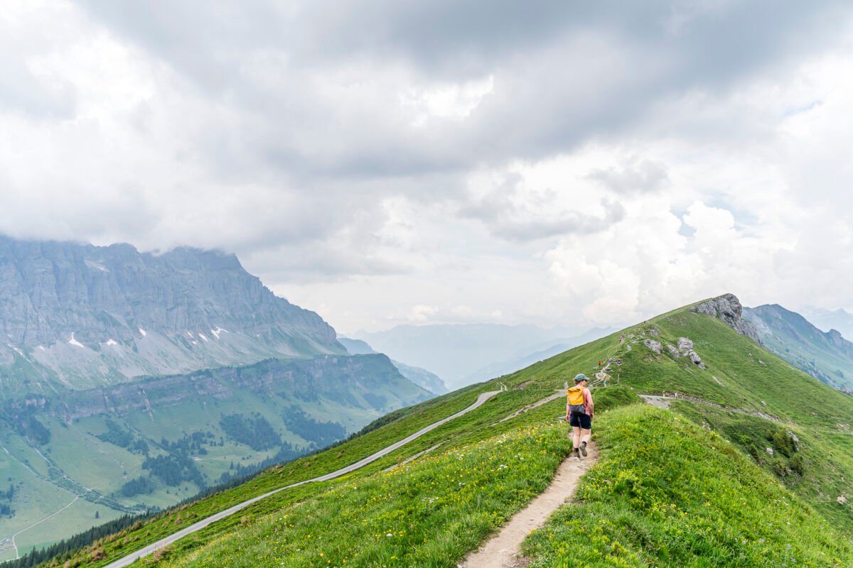
Scenic High Trail to the Gemsfairen Hüttli
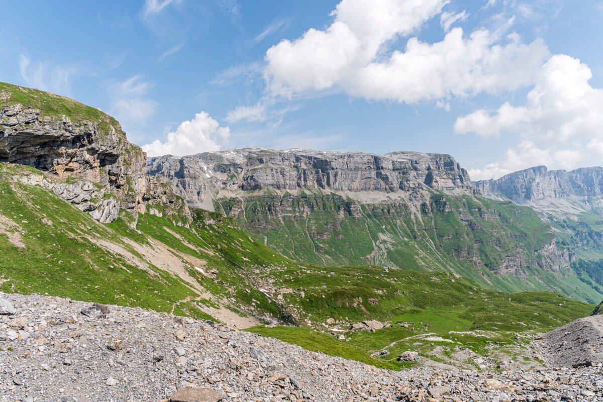
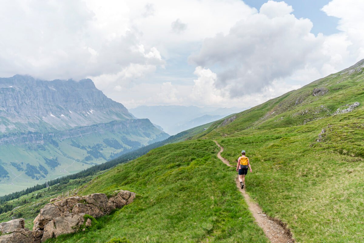
The next section across the Griessbödemli along the edge to the Gemsfairenboden is a true panoramic trail. The views, the varied trail routing, and the rich alpine flora make for an enjoyable hiking experience. But my personal highlight is the Gemsfairen Hüttli, which sweetens the hike halfway through. This small alpine eatery is tucked behind a large boulder – but the hiking trail passes right by, so you won’t miss it. We hadn’t checked in advance whether there were food options along the Clariden Höhenweg and were pleasantly surprised. The small menu includes homemade daily soups, pasta, platters with regional cheese and meat specialties, and freshly baked cakes. The food is delicious, the staff friendly – what more could you want?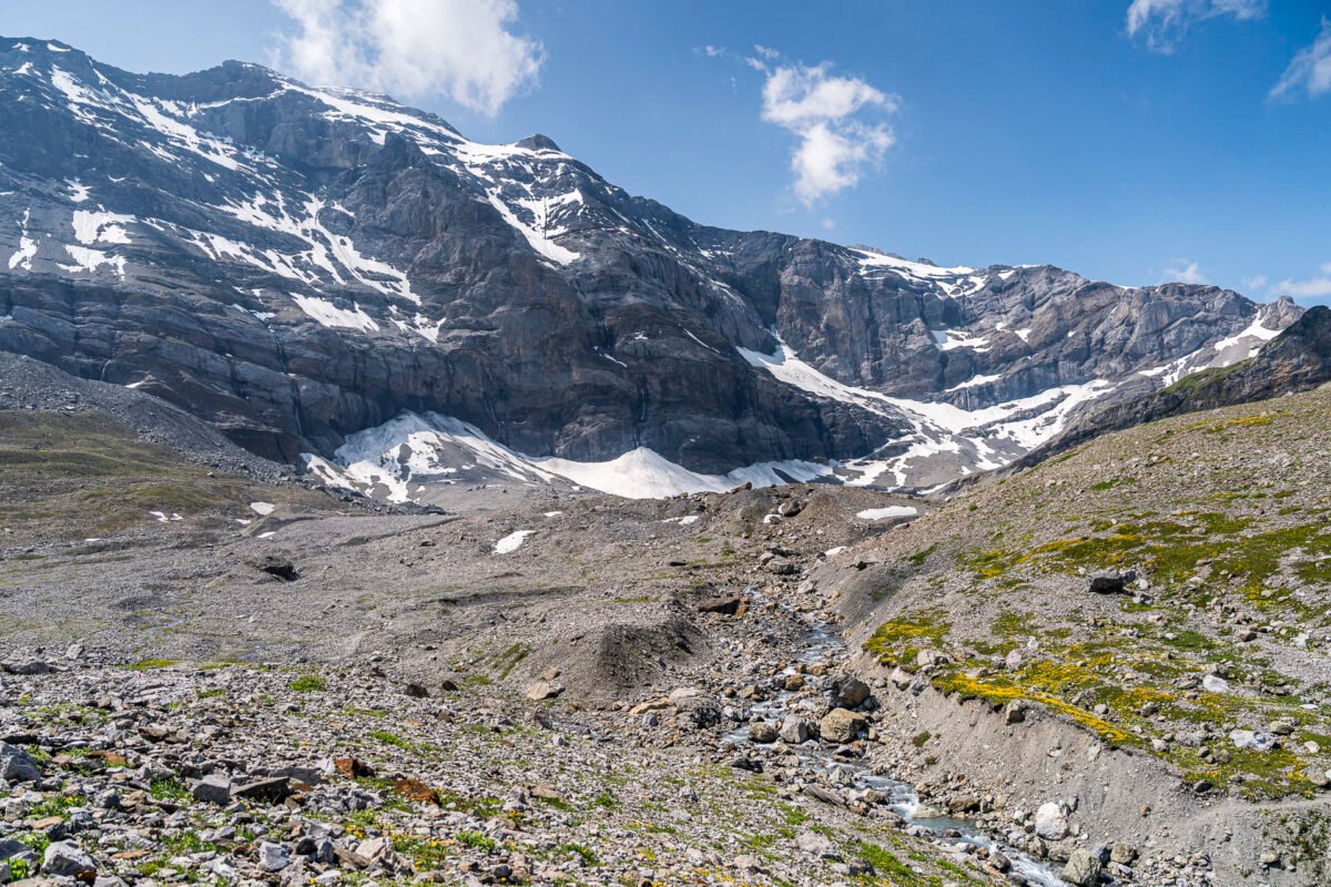
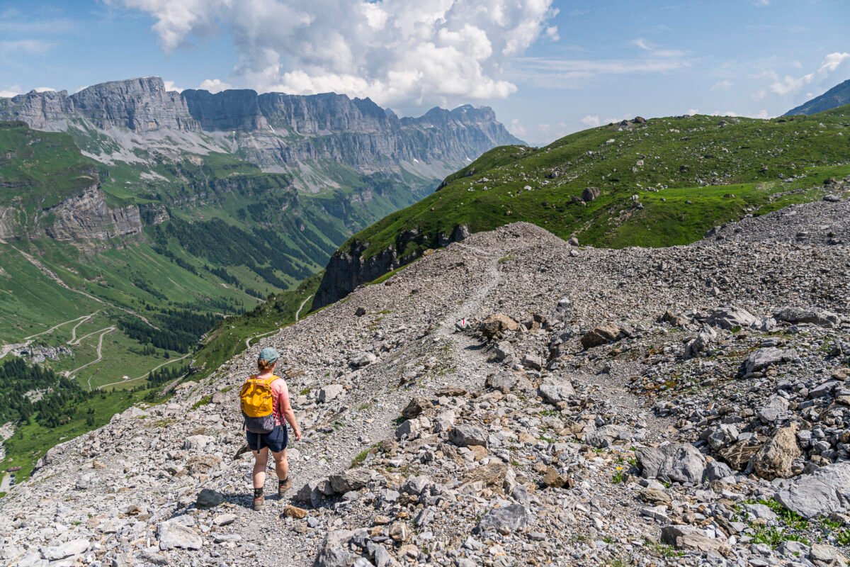
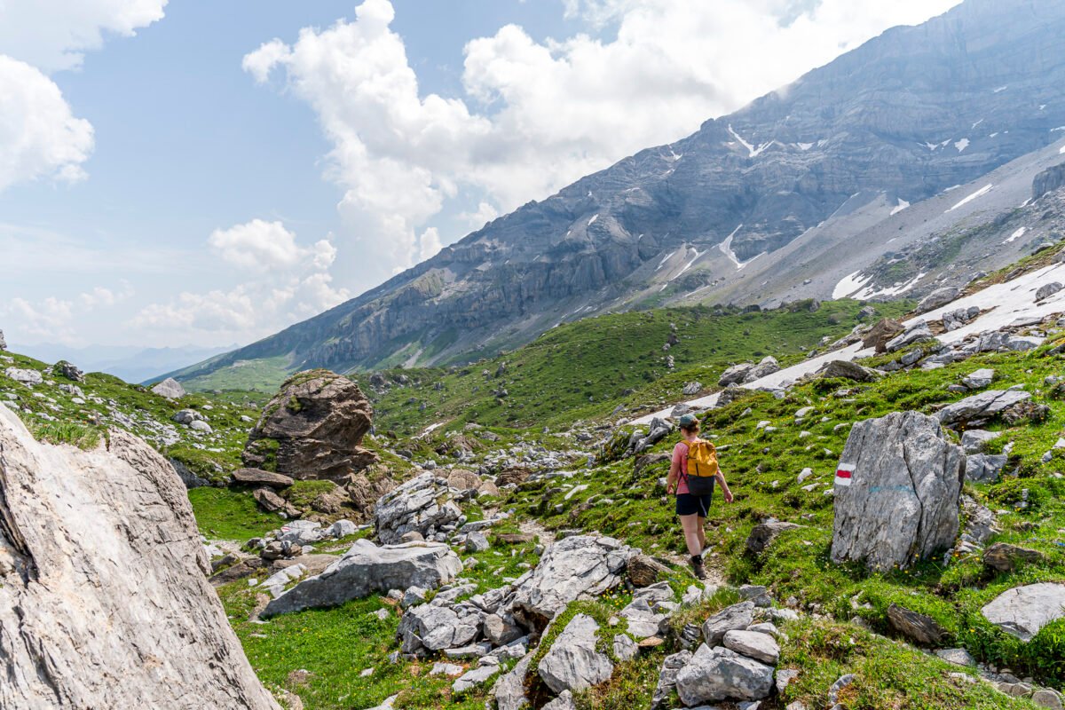
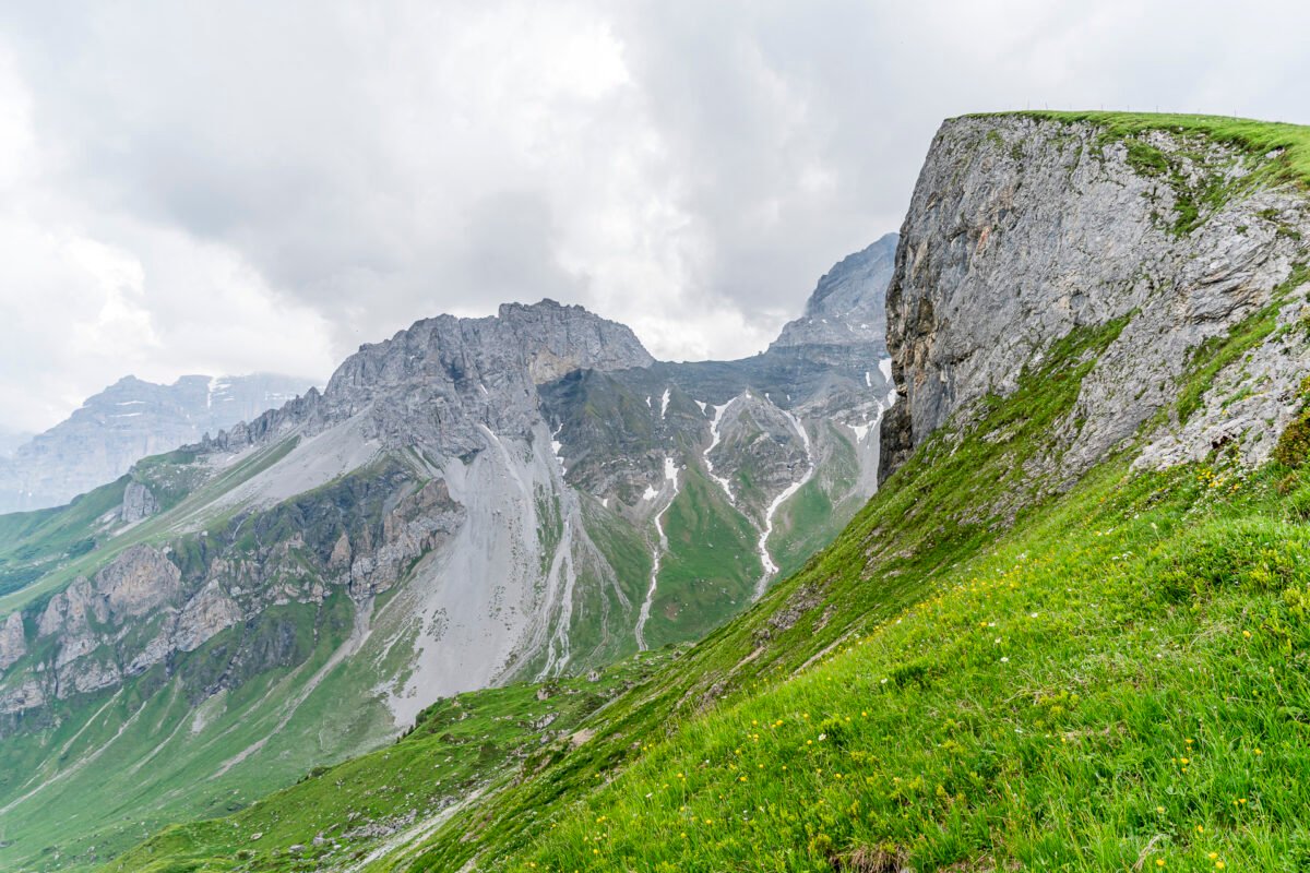
Varied Final Stretch to Fisetengrat
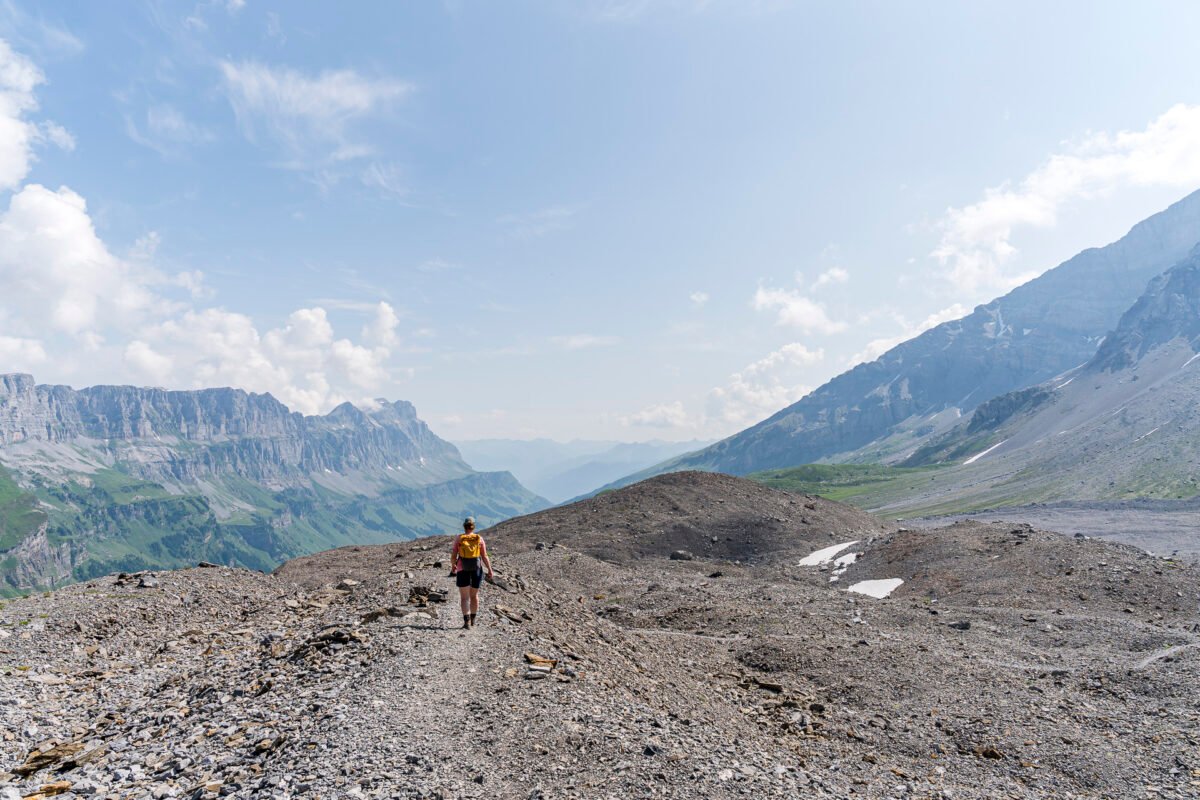
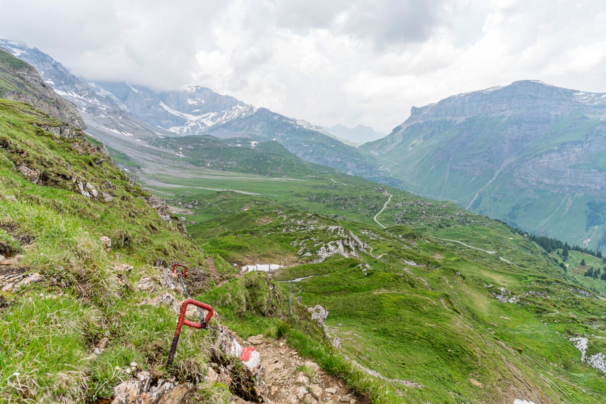
The final third of the Clariden Höhenweg is anything but boring. First, the trail crosses the plateau of the Gemsfairenboden. Then, the mountain path climbs another 200 meters or so towards Hasentrittli. There, we encounter the most adventurous section of the hike: a short (about 10 to 15 meters) steep and rocky ascent. A railway sleeper serves as a step, and chains along the rock face provide additional security. You may need to use your hands once or twice here.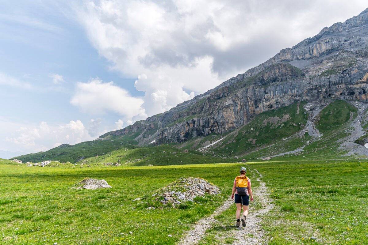
Key Facts: Klausen Pass – Gletscherseeli – Fisetengrat
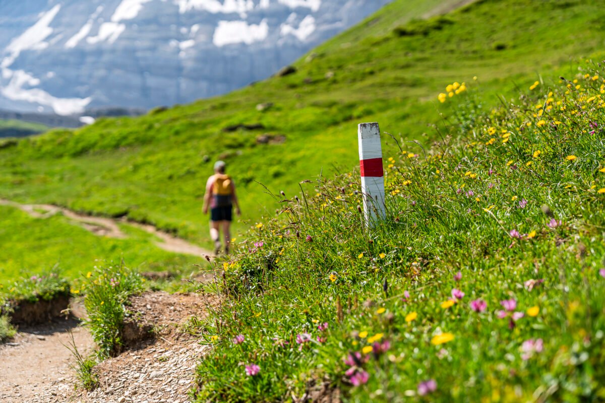
The route map below shows the trail course of the Clariden Höhenweg. It’s consistently marked as a red-white-red mountain trail (T2/T3). Aside from the Hasentrittli section, there are no particular technical difficulties, and the path is not exposed. However, the rocky or occasionally gravelly terrain can be slightly slippery in parts on the descent. If you usually hike with poles, make sure to bring them along.
If you’re uncomfortable with sections where you may briefly need to use your hands, you can bypass Hasentrittli. Between Fiseten Pass and the Gemsfairen Hüttli, there’s an alternative route along a service road running slightly lower down.
| Starting Point | Bus stop Klausen Passhöhe (1948 m a.s.l.) |
| Accessibility | Accessible by public transport |
| Distance | 9.5 kilometers |
| Elevation | ↗ 570 m ↘ 510 m |
| Duration | 3:10 h |
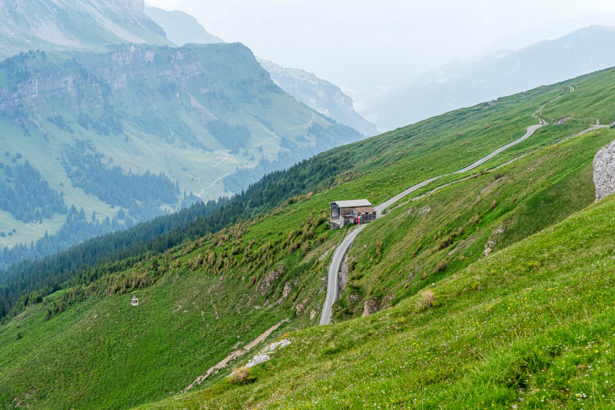
| End Point | Top station of the Urnerboden – Fisetengrat cable car (2043 m a.s.l.) |
| Food Options | Restaurant Mattestübli / Alpenland |
Practical Tips for Your Hike on the Clariden Höhenweg
- The bus route over Klausen Pass operates from June to October. During peak season from mid-June to mid-September, four scheduled bus pairs run daily over the pass to Linthal station.
- Check public transport connections in advance to avoid long waits. The fastest connection to and from Zurich is via S25 directly to Linthal, then continuing by bus to Klausen Pass (travel time: approx. 2h 30min).
- Unfortunately, the Urnerboden, Dorf bus stop does not have a weather-protected waiting area. In case of rain, you can find shelter inside the shop at the Urnerboden alpine cheese dairy.
- The Urnerboden – Fisetengrat cable car runs daily from June to September between 07:00–12:00 and 13:00–18:00. The gondola holds six people and the ride takes about 10 minutes. A one-way ticket costs 12 CHF for adults (GA/Halbtax not valid). More information about operations and prices is available here: Urnerboden – Fisetengrat cable car
- The Gemsfairen Hüttli is open daily during the summer season (from mid-June). Table reservations are available for larger groups. More info: Alpine hut Gemsfairen
Leave a Reply