

The fascination of Puna: a journey of discovery through Argentina’s northwest
“I don’t know – why don’t you travel to the Puna instead?” my brother asked me when I asked him for advice on a good Salar de Uyuni tour operator. “The Puna? Where is that?” For me, it seemed logical that the journey would take us from San Pedro de Atacama via Salar de Uyuni to Bolivia. Searching left and right for possible alternatives off the beaten track – no. Luckily, my younger brother traveled to South America several times together with locals and therefore knows the lesser-known corners. And so he couldn’t name a good Uyuni tour provider, but he had a brilliant tip for the Argentine counterpart in store. The “Puna” in Argentina forms a geographical unit with the Bolivian Altiplano (including Uyuni) and the Atacama Desert. This recommendation of my brother confirmed once again that it is always worthwhile to take small detours into lesser-known realms. Our six-day tour through the fascinating landscapes of the Puna offered highlights on the running meter.
«from another world»
After receiving the tip from my brother, I wrote to the tour provider Socompa directly and asked for availability and prices for the Puna Exp Tour. Since we wanted to cross the border to Bolivia in la Quiaca afterwards, the tour should ideally take us directly to the border. Socompa processed my request within one working day and surprised me with the following answer: «Dear Anita, based on your name, I assume that you are from Switzerland :-) I’m Swiss myself and I work here at Socompa in Salta (…)”. Of course, this immediately created trust, even if I flinched briefly when looking at the price offered. The offer included a private tour in a 4×4 pick-up of six travel days/five nights including meals with a driver and cost USD 1,980 per person. Since I have to divide our travel budget of 150 CHF per day/person over six months, this means a hefty budget item.
The reason why we looked for a tour operator for the Puna (or also for the Salar de Uyuni) and did not approach this analogous to Patagonia and San Pedro de Atacama as self-driven, was that after more than a month of constantly sitting behind the wheel, I just wanted to make myself comfortable in the passenger seat. In addition, we traveled the area during the rainy season, which requires very good knowledge of the terrain as a self-driver.
Our decision was quickly made: Yes, we book this tour! The cost is absolutely justified in my opinion. Socompa tailors each tour to the needs of the customers and responds to special requests (such as our request to be driven to the border crossing on the last day). I can’t draw a comparison with Salar de Uyuni, because unfortunately we didn’t have the time for two tours. But if you’re tempted to discover the lesser-known corners of the highlands between Chile, Argentina and Bolivia, then you’ve come to the right place in Puna. And there is definitely something for the eye. Nowhere else had we taken as many photos as on this tour. And it was really hard work to sort out the photos to a tolerable blog post size.
Day 1: From Salta to Puna
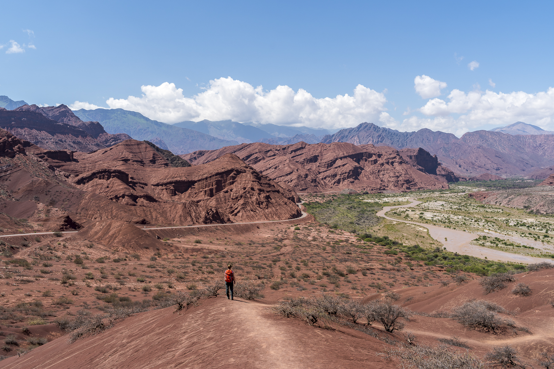
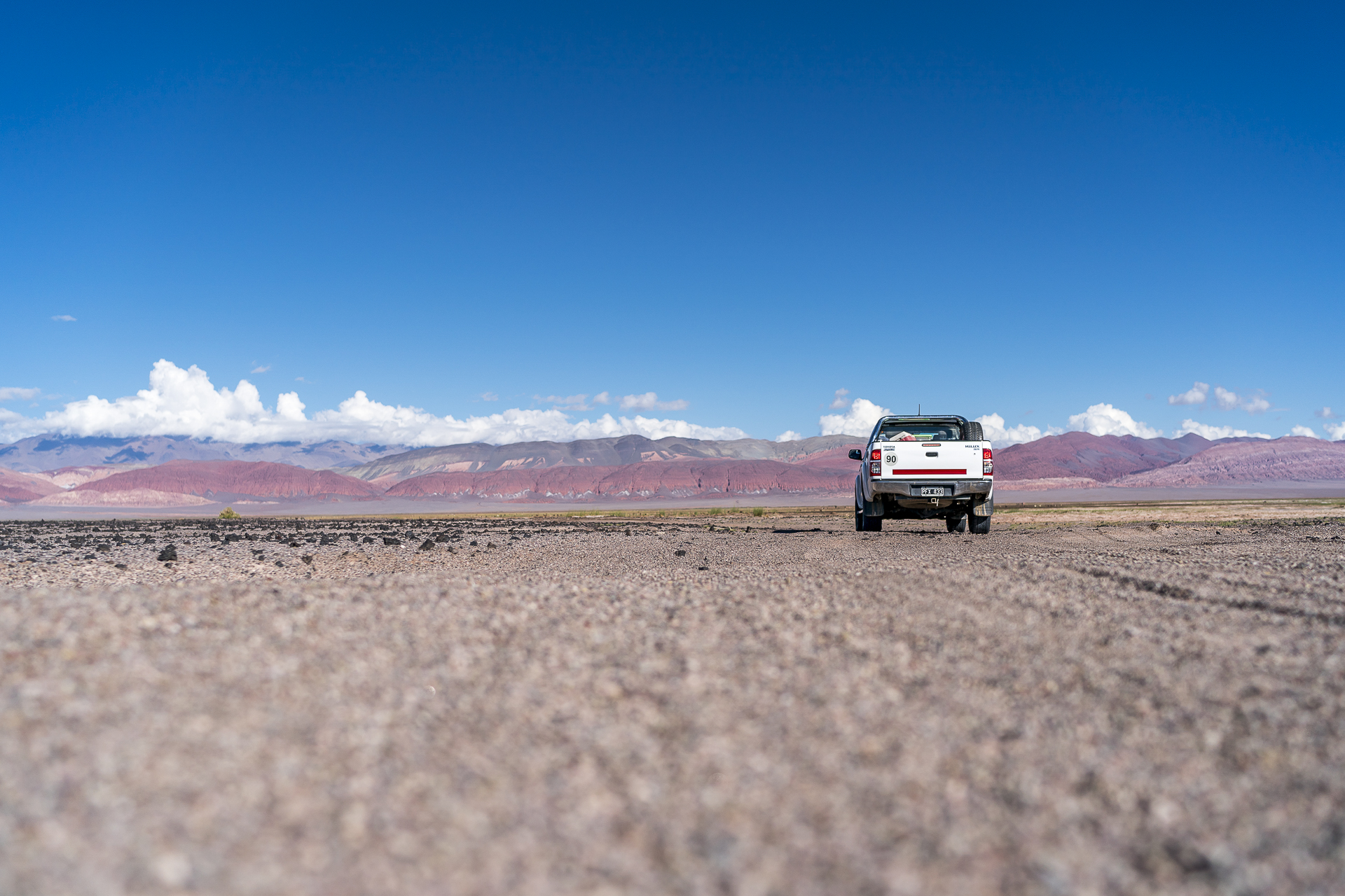
The starting point for our journey of discovery through the Puna is the Argentine provincial capital Salta – 12 (worthwhile) bus hours from San Pedro de Atacama. We had planned a reserve day in advance, which we are now using for a city tour through Salta. This includes a trip to Cerro San Bernardo and trying different empanadas at the Patio de La Empanada. The next morning, our driver picks us up punctually at the hotel, stows the luggage waterproof on the back of the pick-up and off we go. “Colo” – that’s what our driver and guide calls himself – is a level-headed guy, who seems a bit taciturn at first, but always answers my many questions in detail and precisely in the coming days. The first day of the trip takes us through the Valles Calchaquíes in a southerly direction to Cafayte – one of the most famous wine regions in Argentina. The wines of the valley are marketed under the name “Vinos de Altura”, as the vines are grown here up to 3,000 m above sea level.

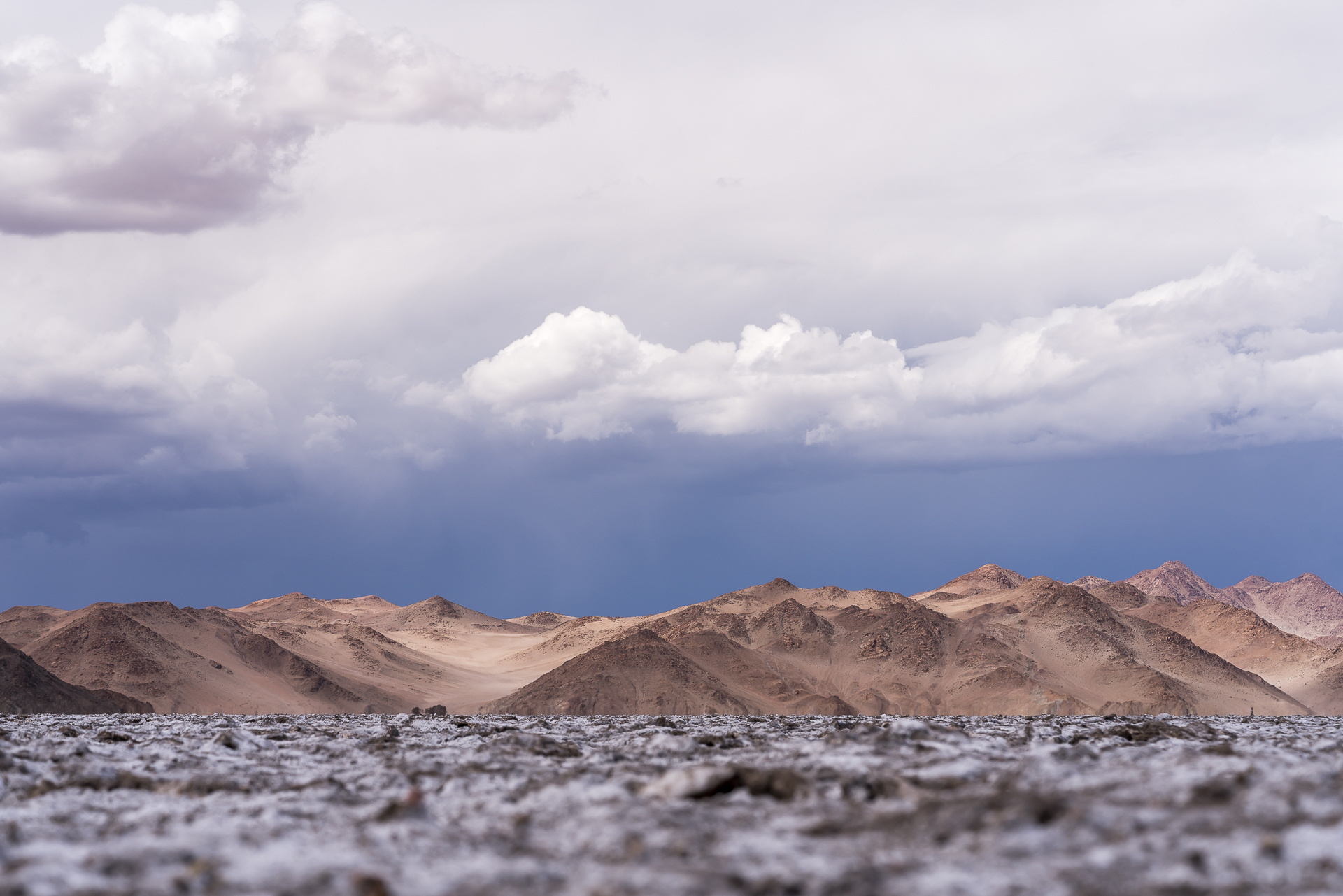
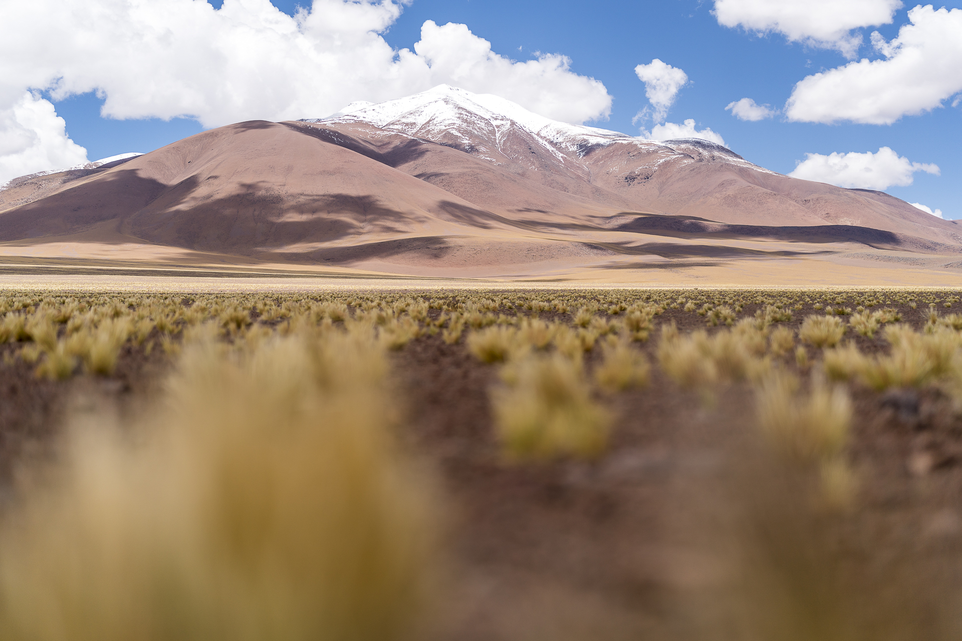
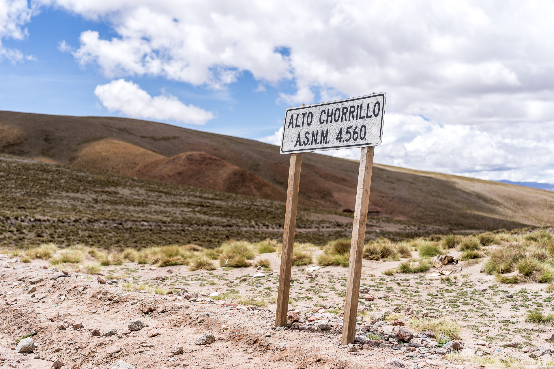
Before the lunch break, we cross the imposing Quebrada de las Conchas and then have time to stroll through Cafayte. After a fine lunch at the Terruño restaurant, we follow Ruta 40 (which, by the way, leads to Patagonia) further south and turn right at la Juntas. We are now on Ruta 43, which leads us to the first stop, El Peñón. What at first looks like snow in the mountain valleys from a distance turns out to be huge sand dunes as you drive by. This is where the wind blows the fine, sandy subsoil of the valley plains. “Now we’re in the Puna,” says Colo after a bend. And indeed, less than five minutes pass and we already see the first vicuñas at the roadside. After a good seven hours of driving, we reach the tranquil village of El Peñón, where Socompa runs a hosteria of the same name. This forms our basis for the next two nights. We are now at 3,500 m above sea level and feel fit thanks to the acclimatization days in San Pedro de Atacama.
Day 2: «off road» through volcanic worlds
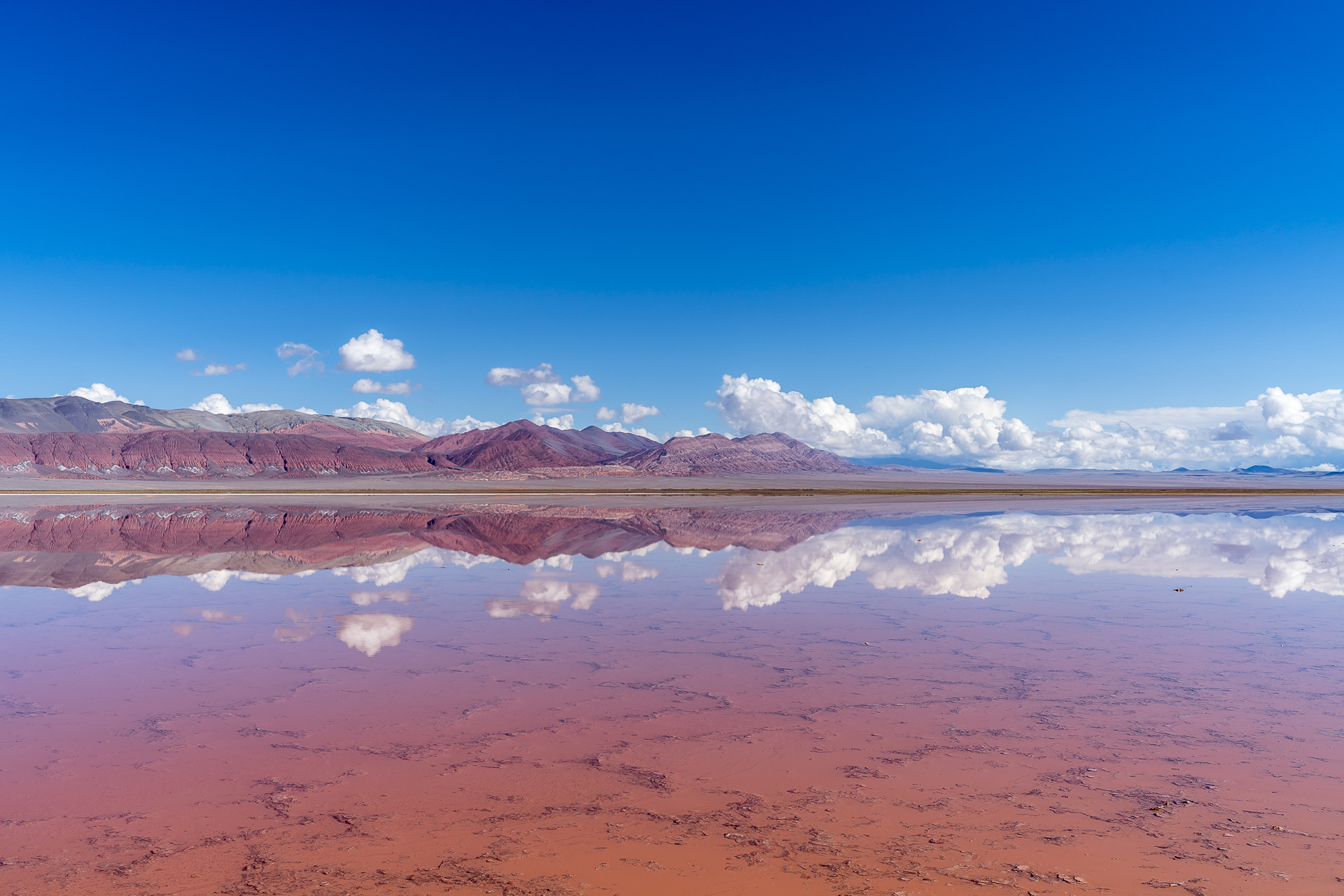
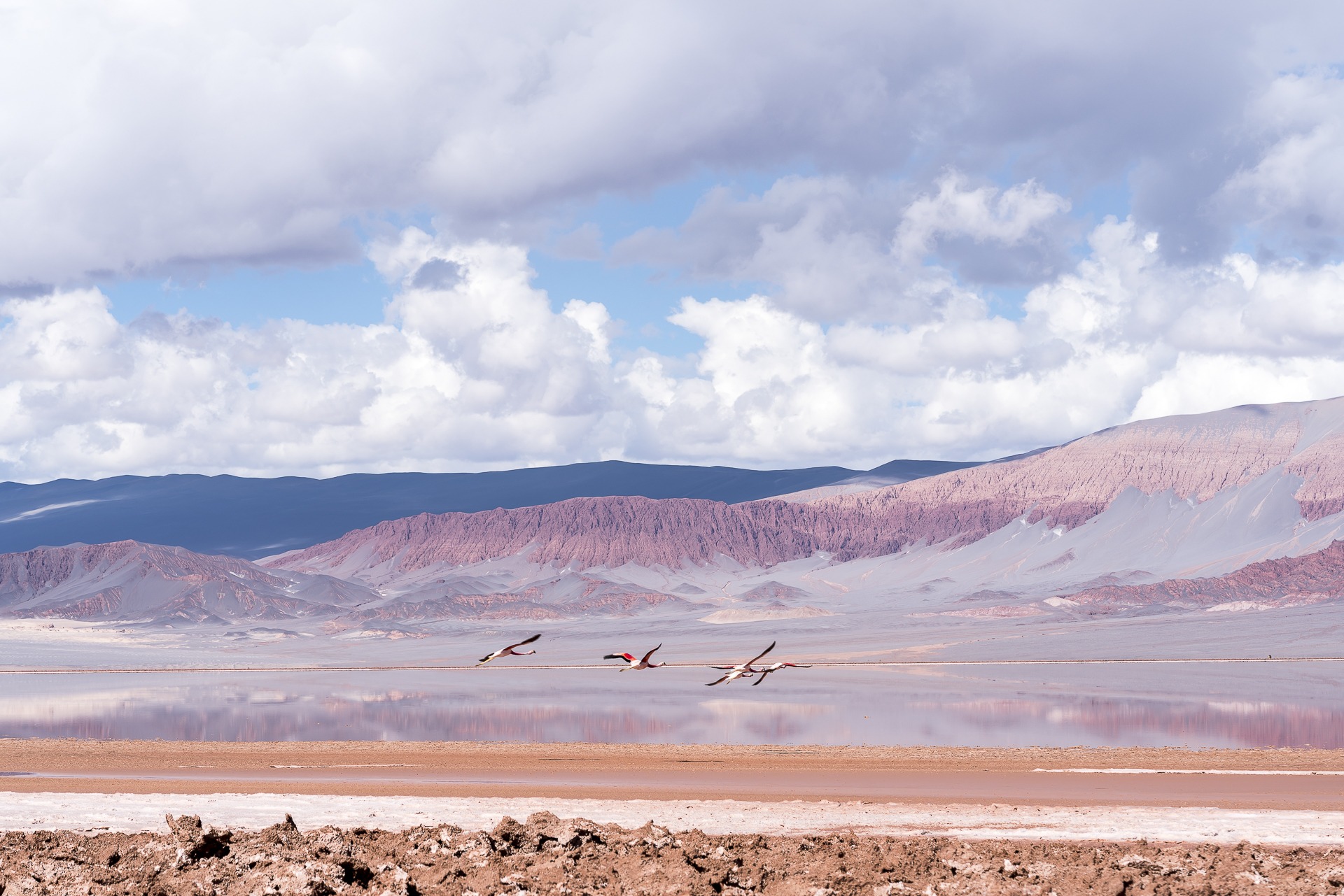
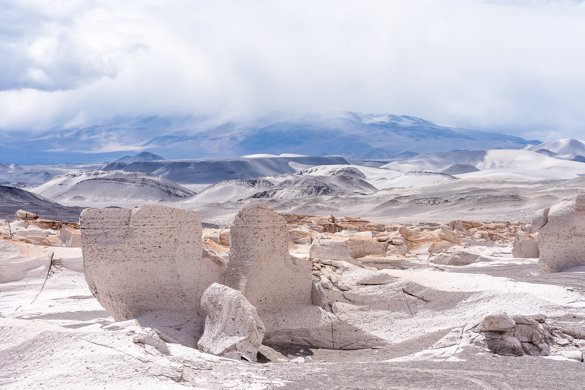
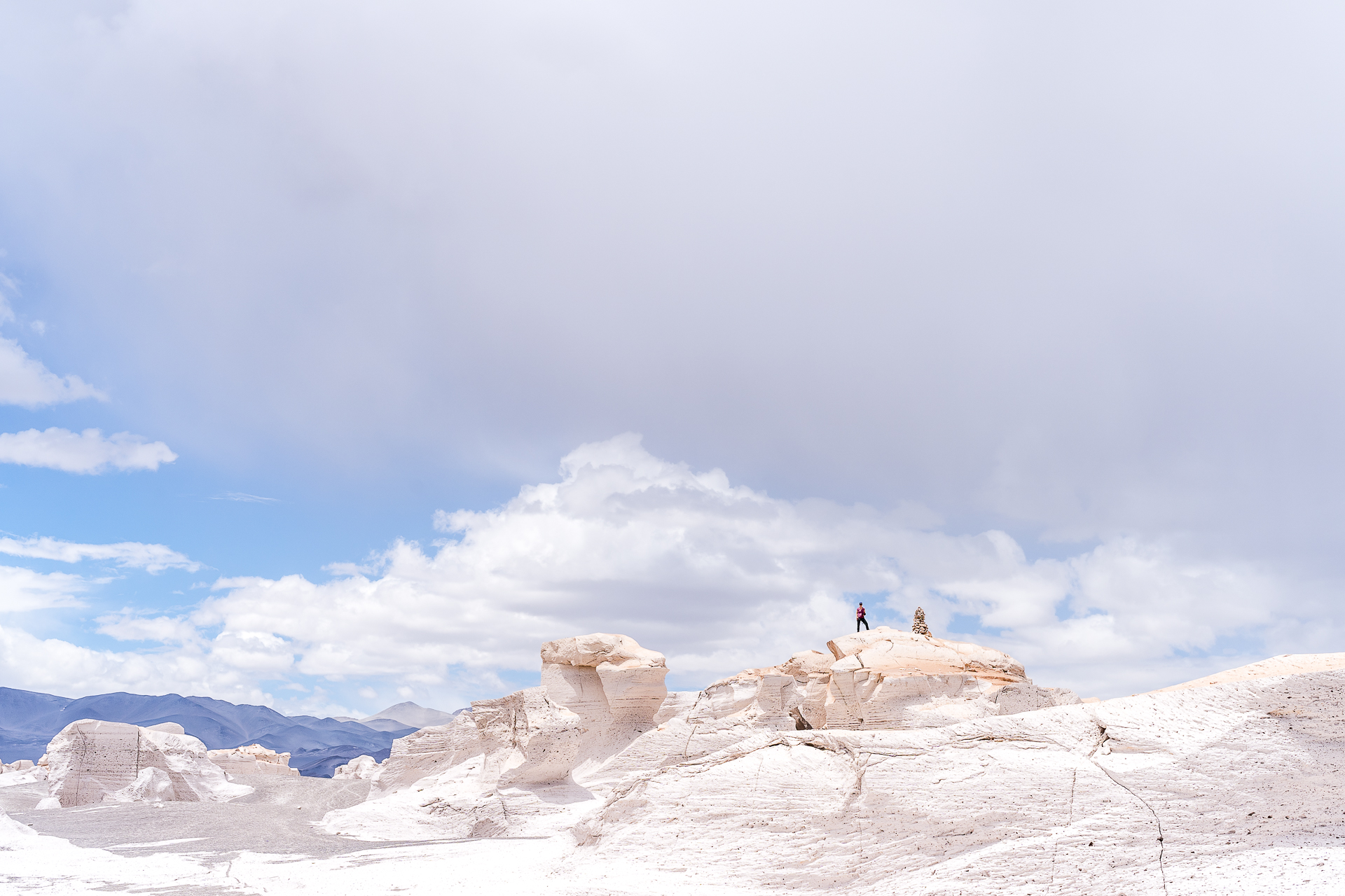
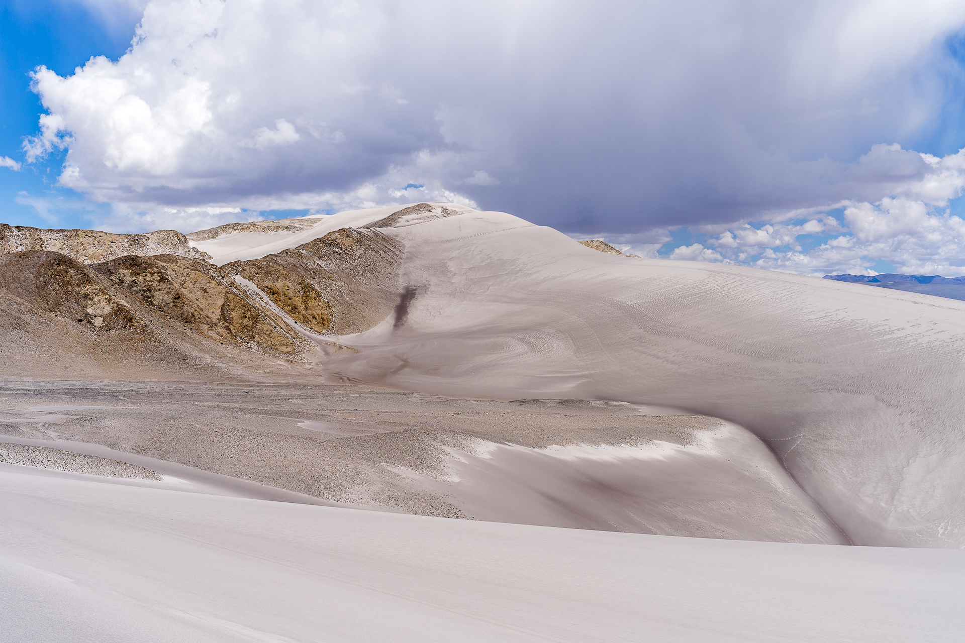
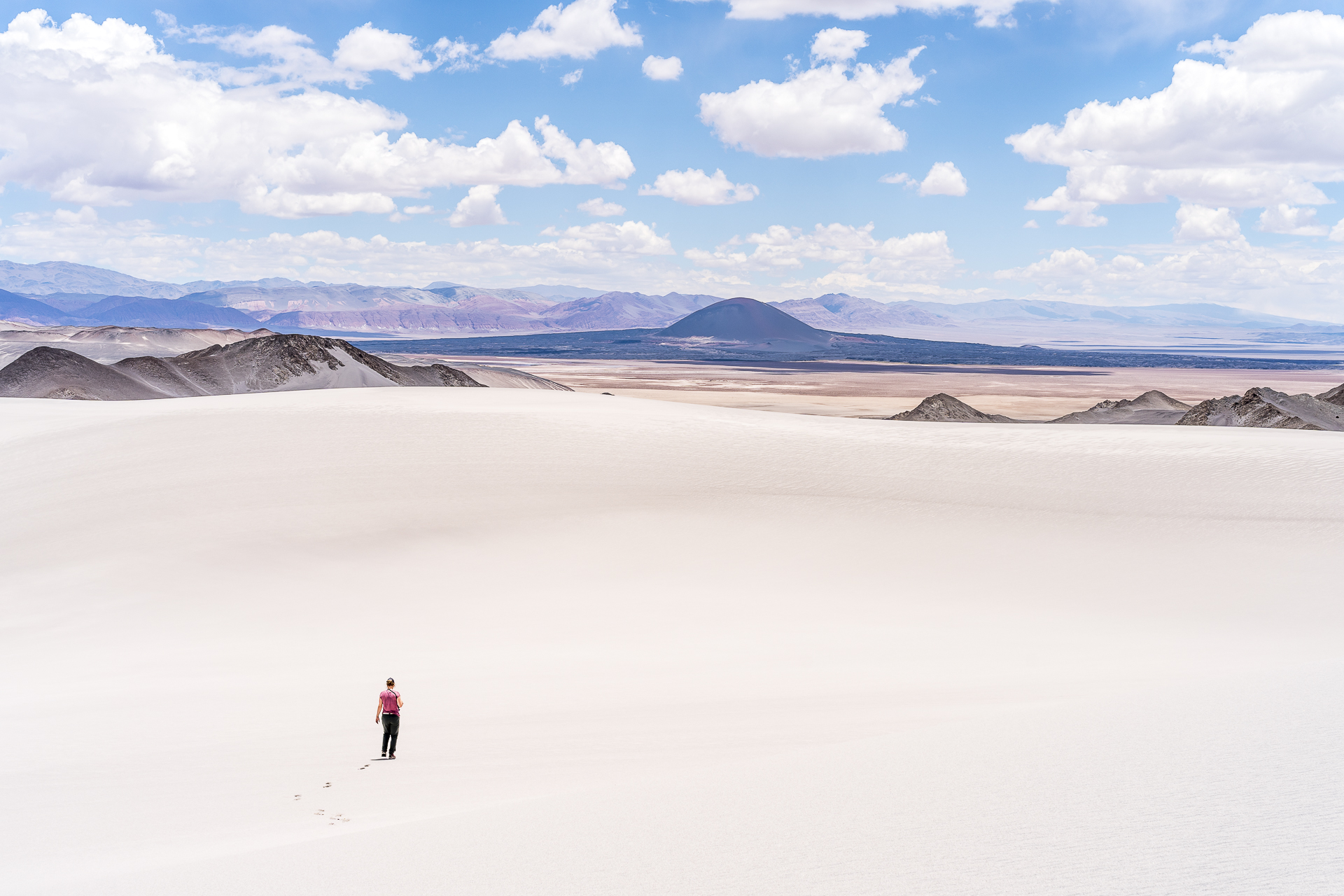
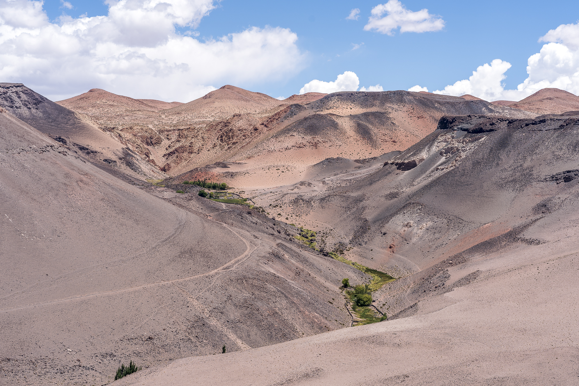
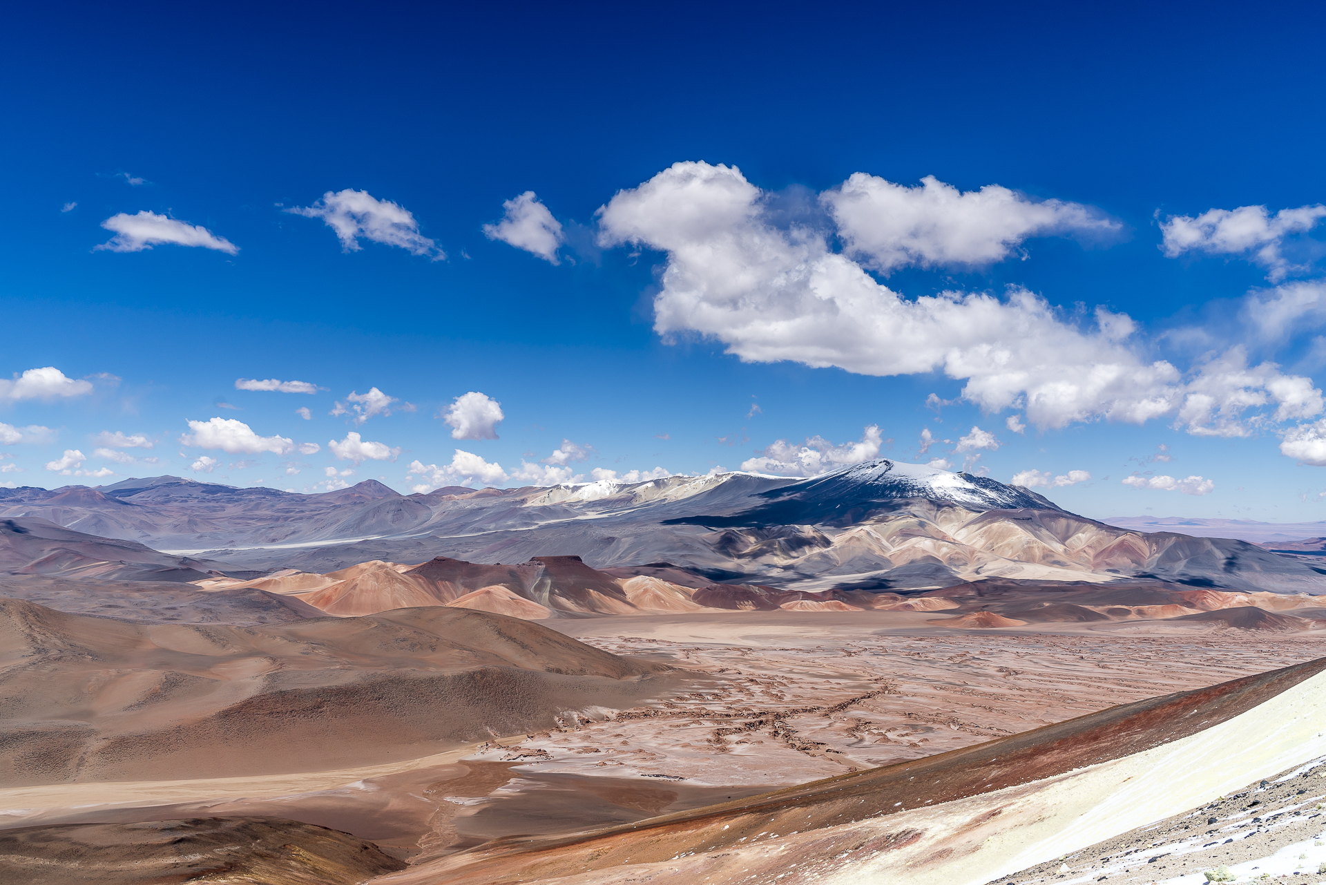
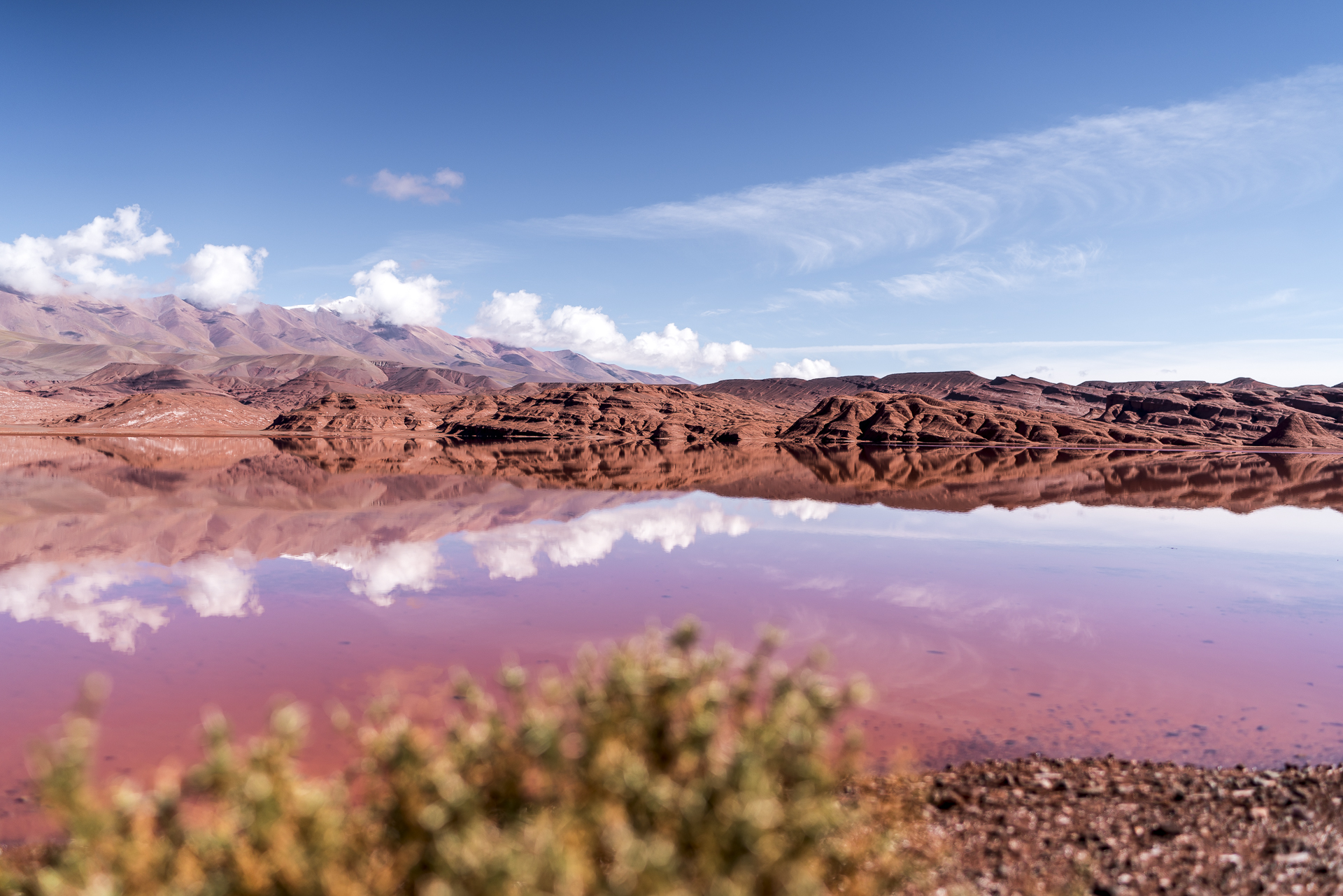
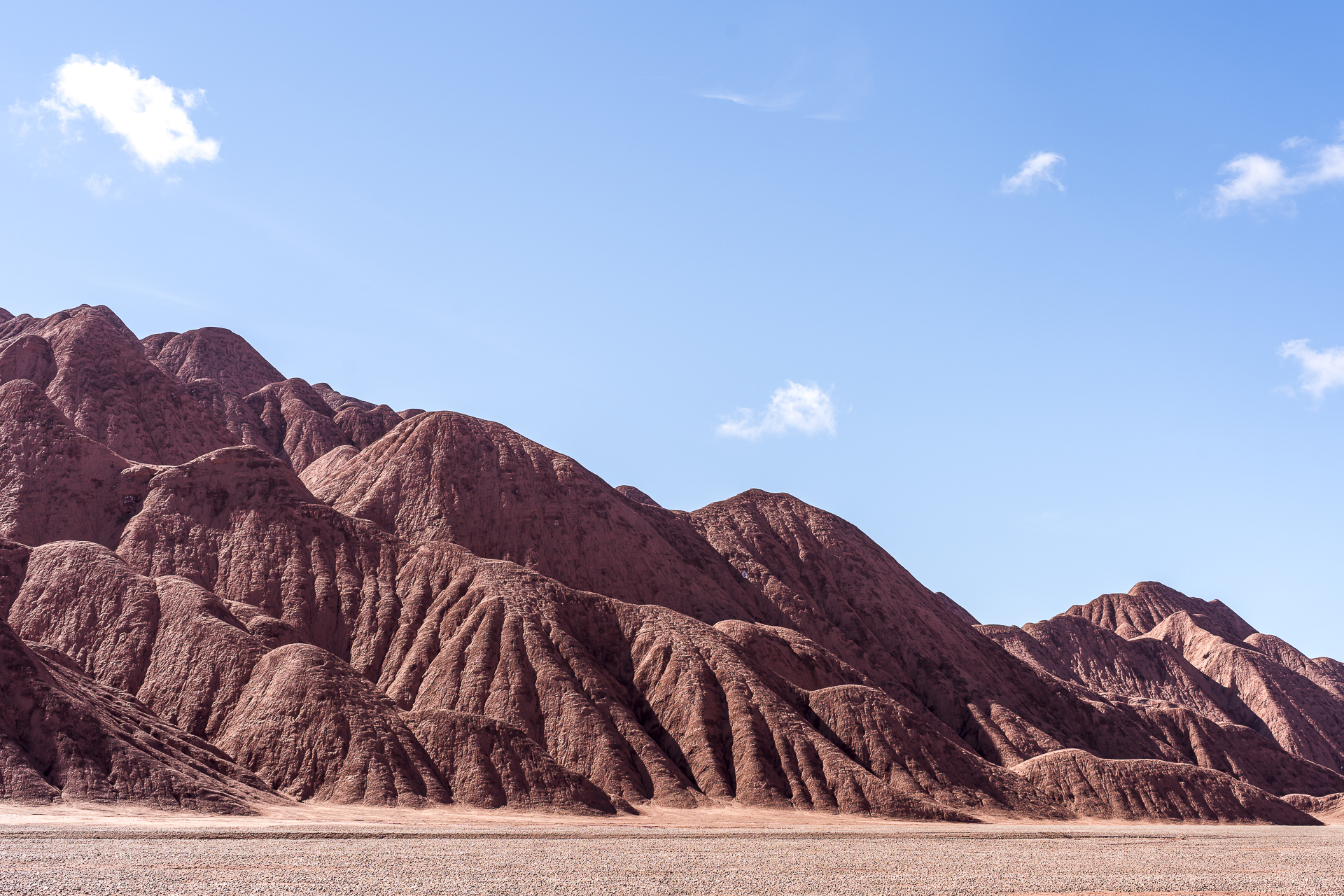
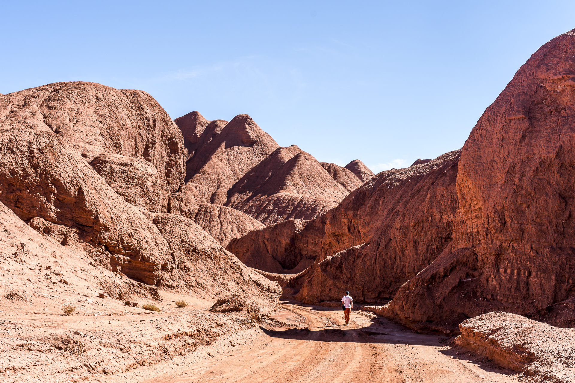
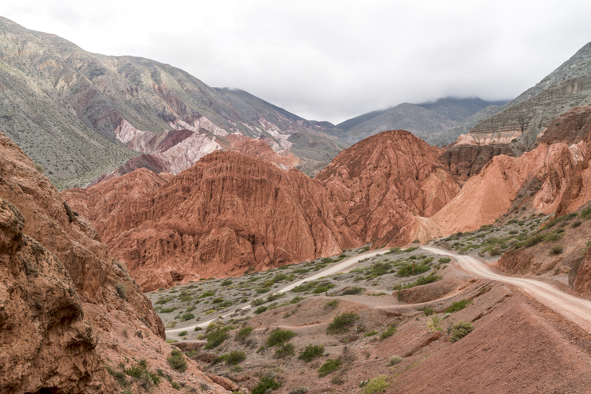
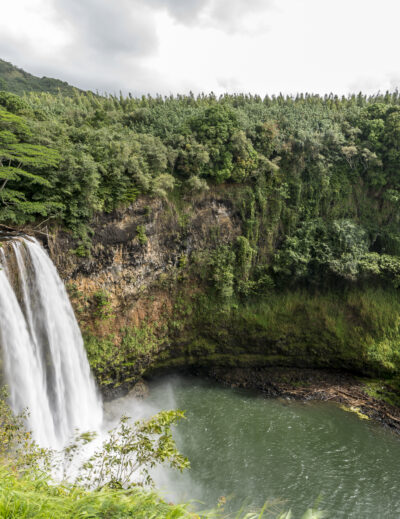
Day 2 is all about the magnificent landscapes around El Peñón. Colo suggests an off-road tour that takes us behind a striking black volcano to a reddish shimmering lagoon. Even though I do have some off-road driving skills, on this day I’m glad I’m not behind the wheel. Individual lanes give us indications of where the route leads, but in detail the ground (partly volcanic rock, partly coarse-grained sand) is really tricky to drive. The scenery we find behind the volcano is difficult to put into words. Even the pictures do not reproduce the impressive color spectrum (from deep black to bright green to bright red) 1:1. Unlike the lagoons around San Pedro de Atacama, the flamingos here are not at all thrilled when someone approaches you. A sign that there are significantly fewer tourists on the road in this area – we only meet three other pick-ups that day. What fascinates me again and again in the next few days is the variety of rock formations and their colors. The red of the lagoon (which is nameless, if I remember Colo’s explanations correctly) is followed by a shimmering white pumice field of almost unbelievable proportions. The Campo de Piedra Pomez is of surreal beauty. And while the wind is constantly working on the rock formations, further back on the mountain slopes, blown stone dust is deposited to form imposing dune landscapes.
Day 3: Across Argentina’s largest salar
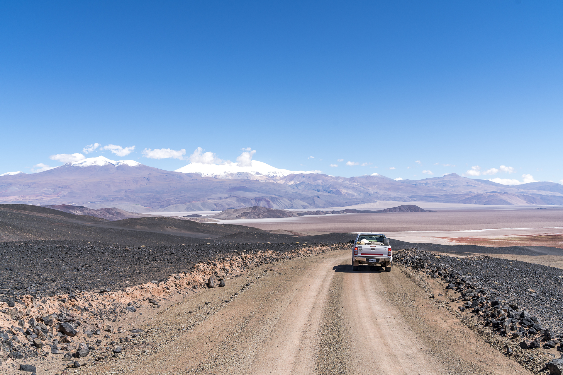
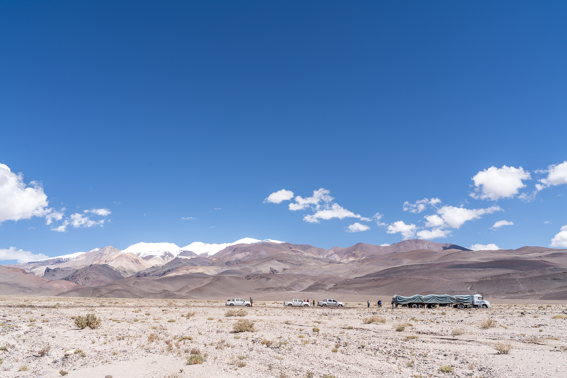
While El Peñón is located in the province of Catamarca, on the third day we drive north through the Puna back to the province of Salta. The stage takes us past one of the youngest volcanic cones in the Puna region. The next village (the largest village in this part of the Puna) bears the same name as the volcano – Antofagasta de la Sierra – and the open wifi networks of the various mining companies give us short internet happiness. Telephone reception is non-existent in the Puna outside the villages and the wifi network is very modest. In El Peñón it worked in between, in Tolar Grande, where we also spent two nights, nothing worked. Due to the persistent rainfall, Colo navigates us on this day over a different route than originally planned towards Tolar Grande – but no less interesting, as he promises us.
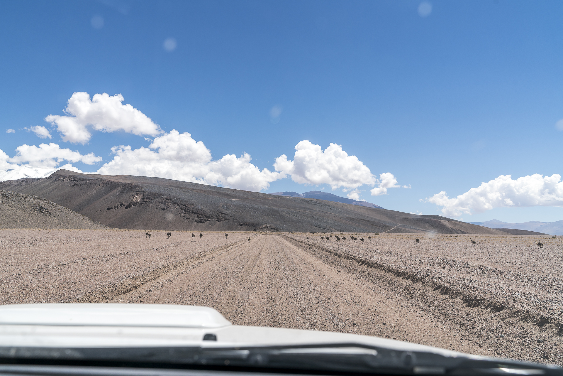
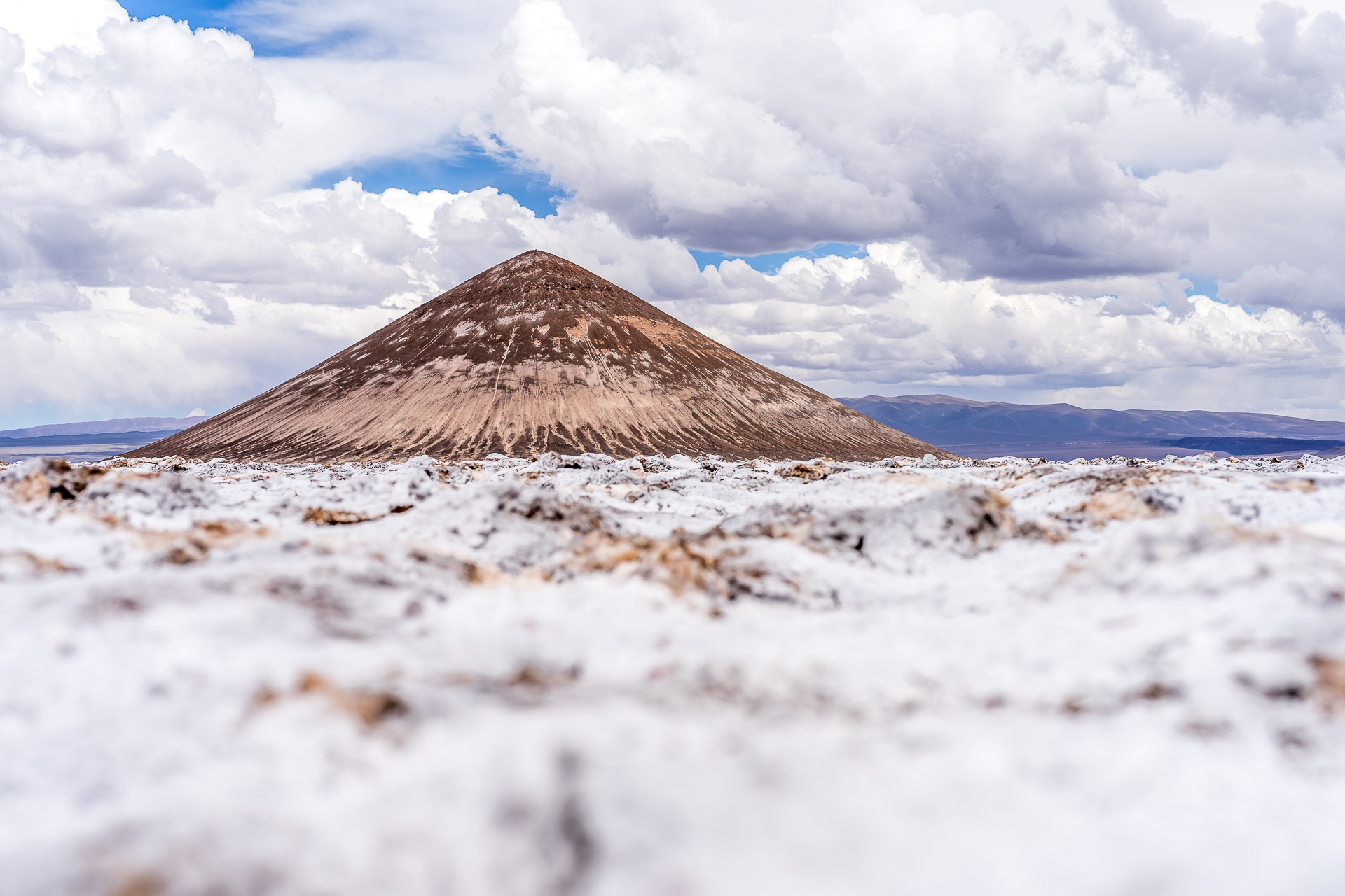
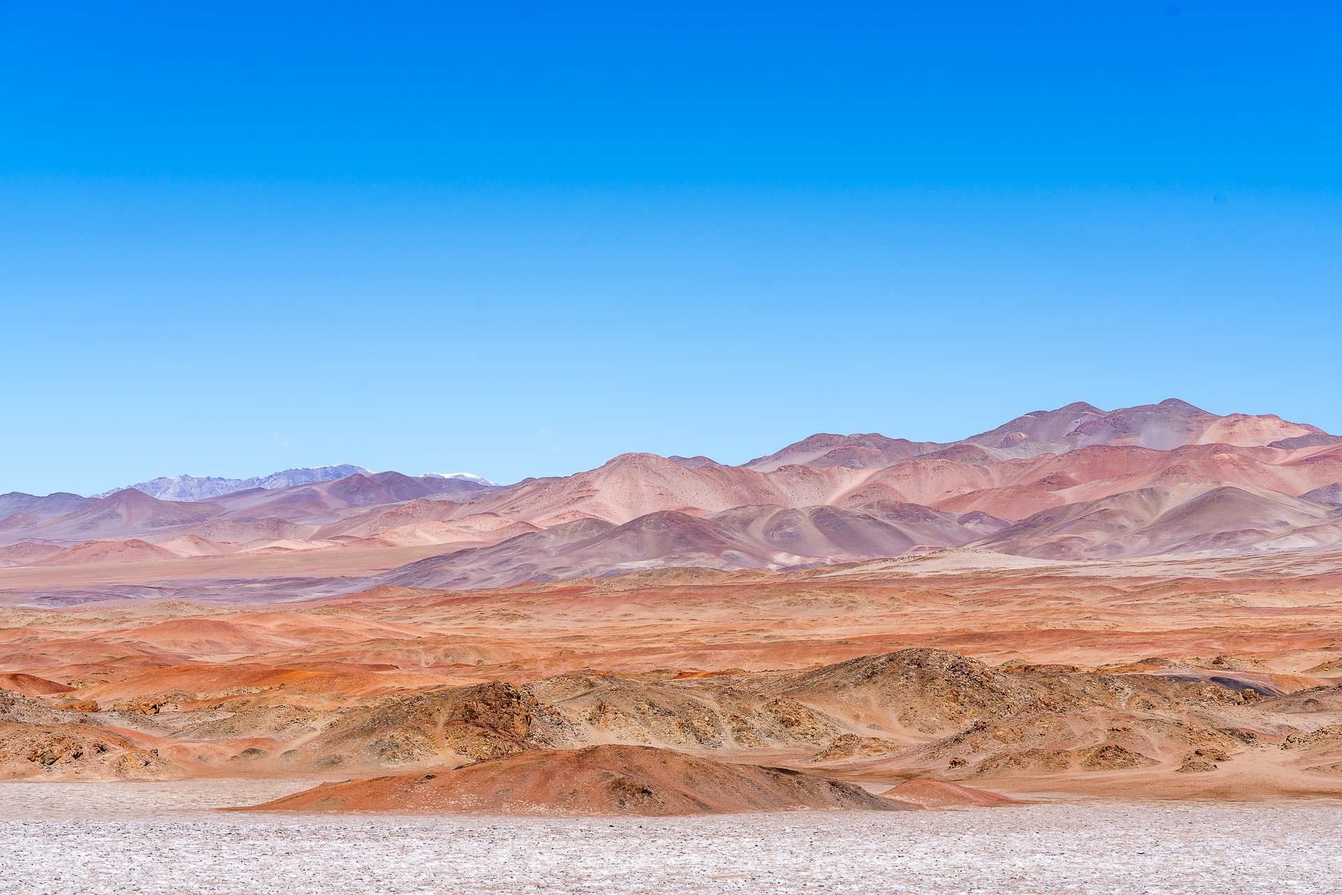
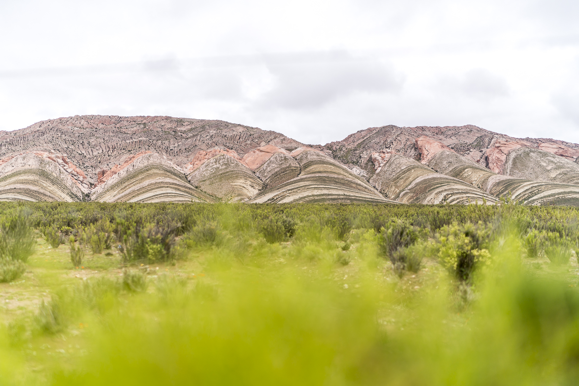
On a winding road west of Antofagasta de la Sierra, we reach the longest salar in Argentina – the Salar de Antofalla – and thanks to Colo’s driving skills, we can drive around a truck stuck in the mud. Even if the ground to the left and right of the road makes a dry impression at first glance, you should first examine possible alternative routes on foot. Behind the oass village of Antofalla, where we fortify ourselves with a picnic in the shade of the trees, Colo follows an old pass road that winds its way up along the mountain slopes. We have to cross this ridge to reach the largest salar in Argentina – the Salar de Arizaro – on the other side. Even though the desert landscape makes a barren impression at first glance, we discover all kinds of exciting plants and animals. A Puna-Nandu, who crosses our path with a good twenty young animals, makes us cheat. It is normal for a male Nandu to be on the road with two to three cubs, as Colo explains to us. But he has never seen so many at once during his numerous Puna tours. Shortly before Tolar Grande, another natural wonder awaits us. Anyone who sees the Cono de Arita from a distance first thinks of an illusion of the senses. Or why does such a perfectly symmetrical pyramid rise from a salt desert?

Day 4: Lost Places at 5,000 m above sea level
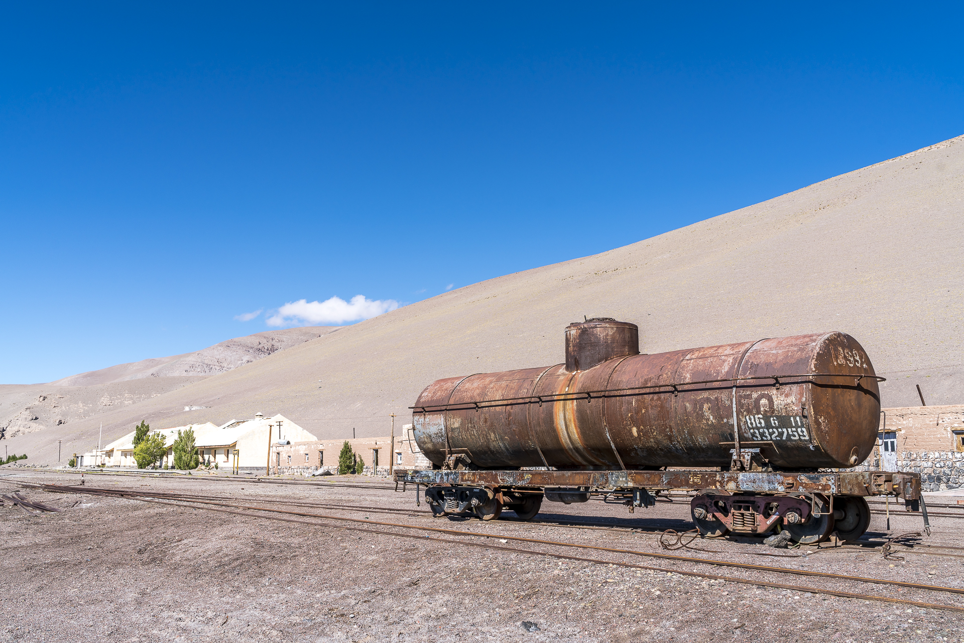
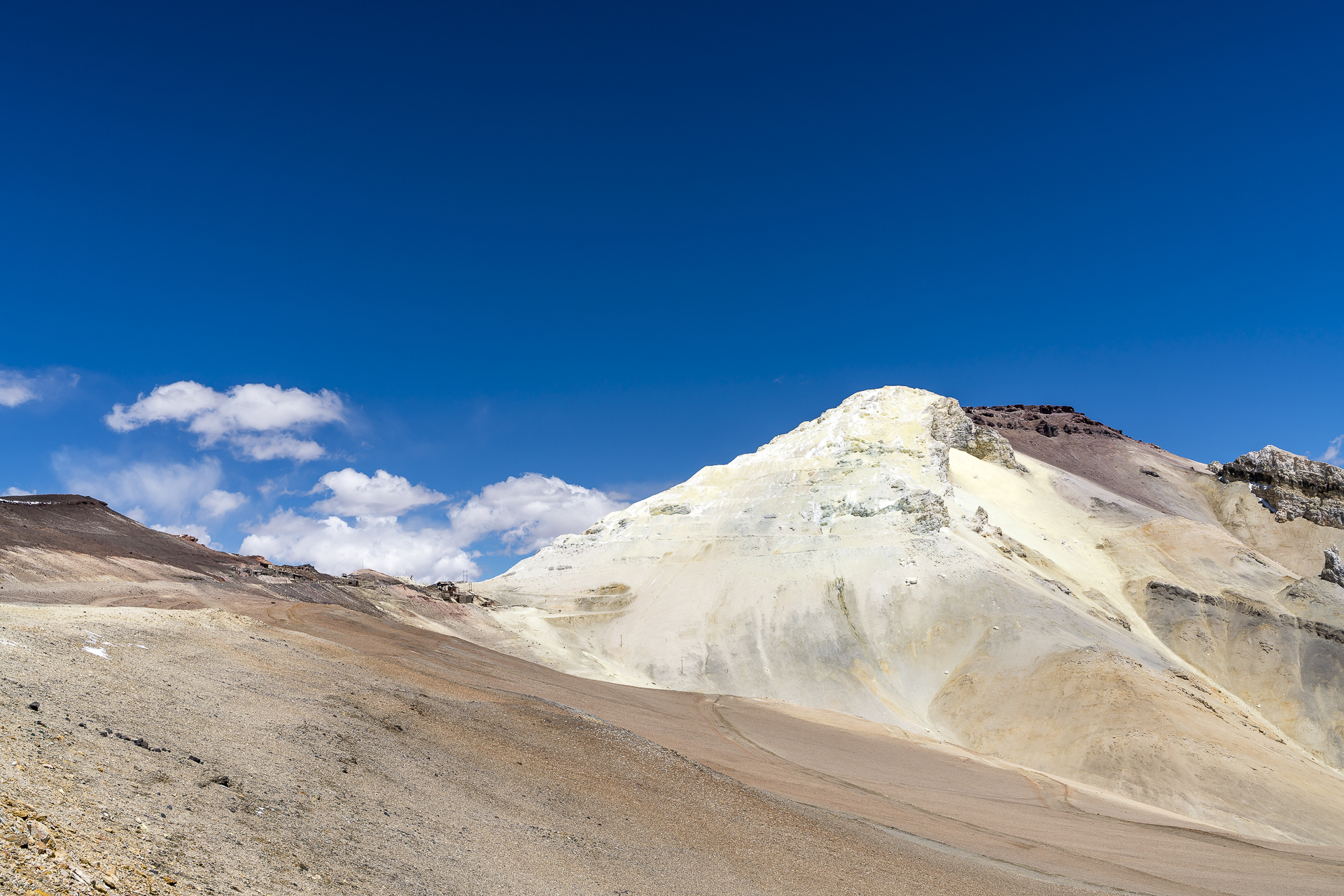
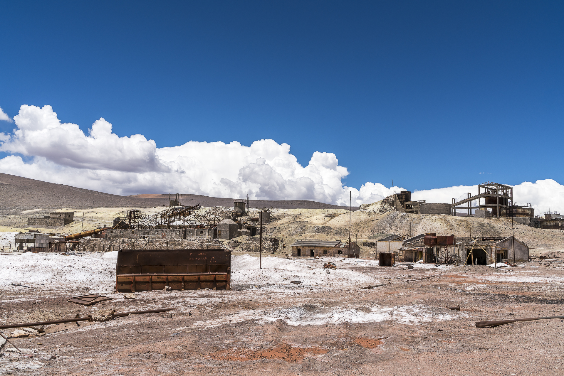
Is it the altitude, the food or is it the many impressions that rain down on us? My stomach has always been my physical weak point and unfortunately threw a spanner in the works this morning. Today, while I stay near a toilet, the friend, together with Colo, takes a solo tour to the abandoned Caipe station (somewhere in the middle of nowhere) and the Mina de Casualidad, which is also abandoned, where sulphur was mined for a long time. An excursion at altitudes of up to 5,000 m above sea level and a drive through deserted desert landscapes.
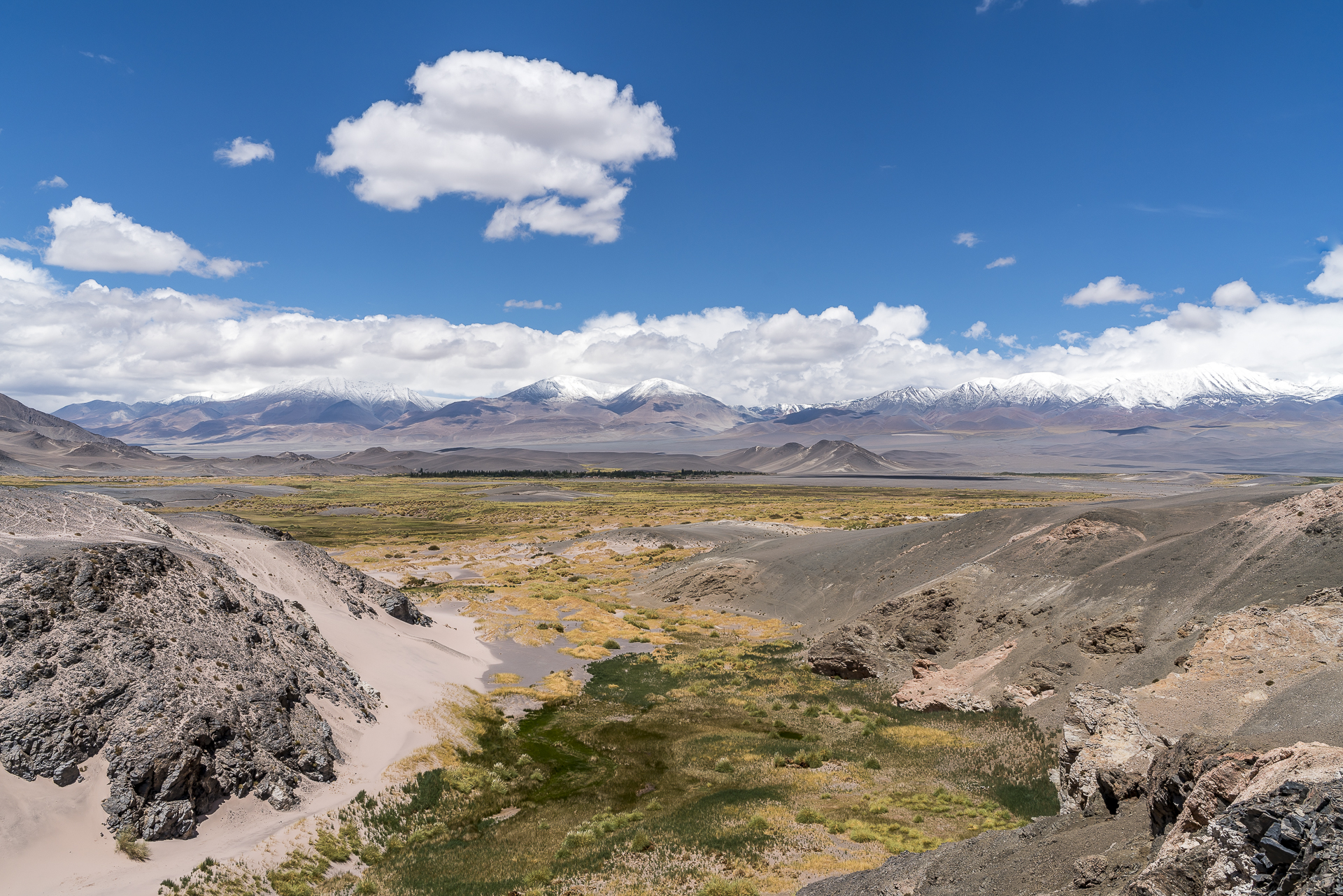
Day 5: When the desert fills with water
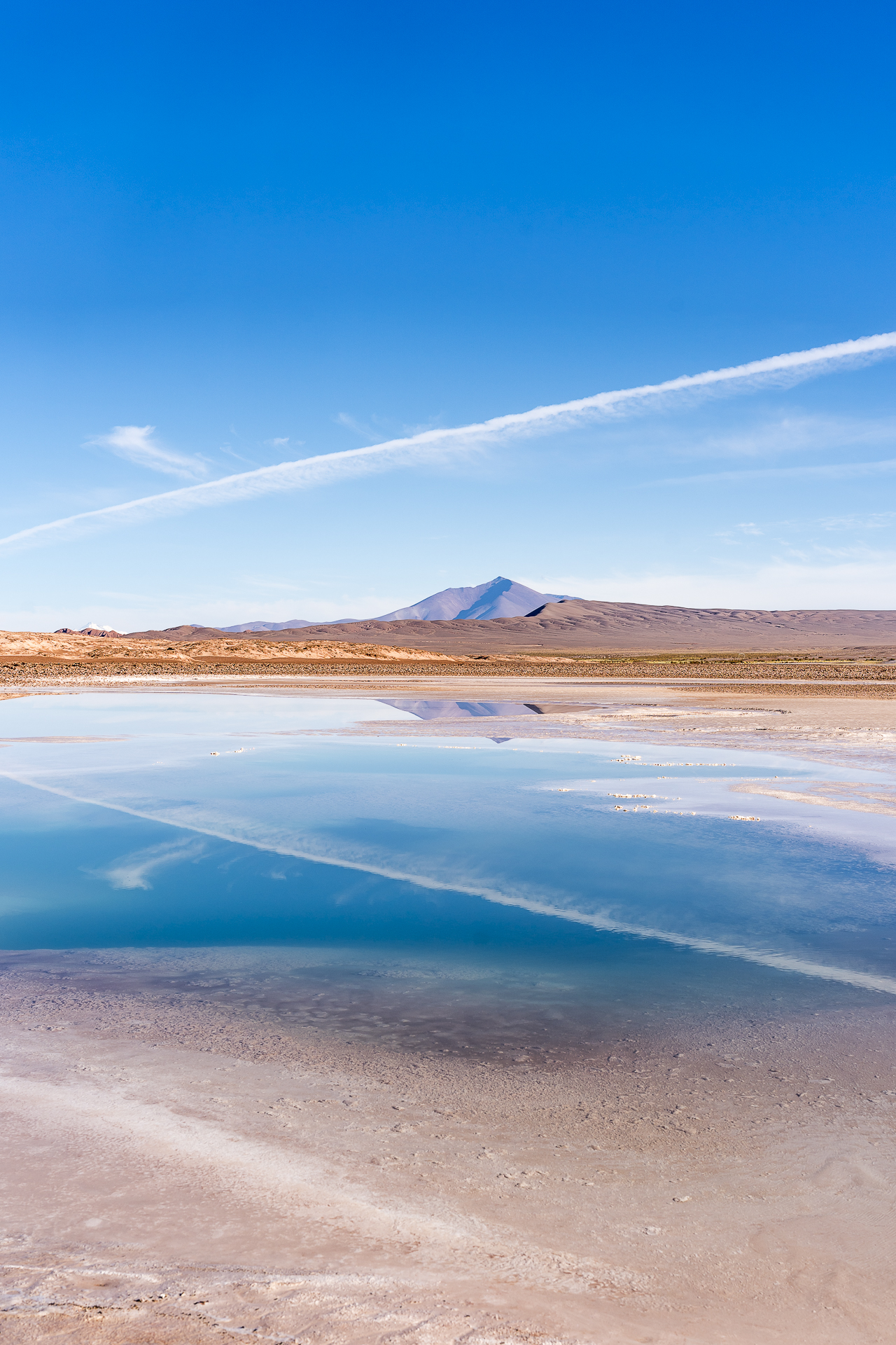
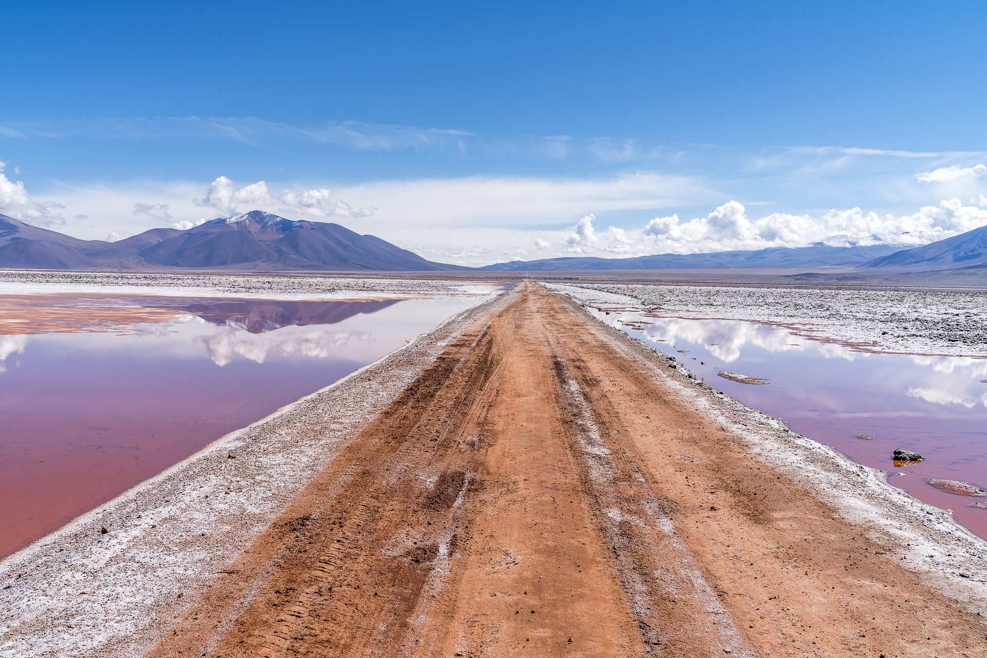
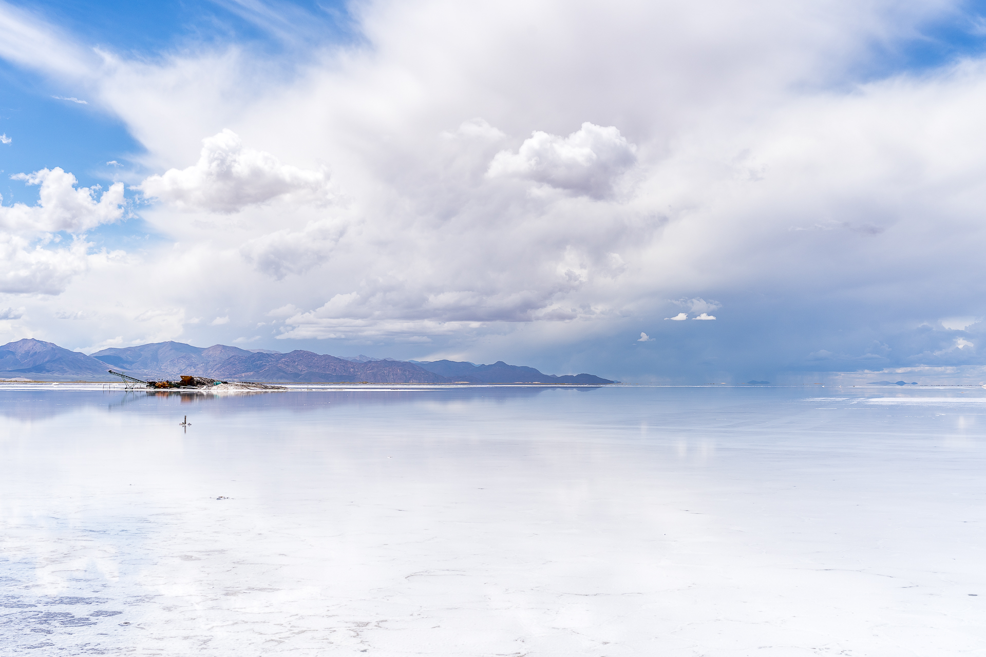
“It’s going to be swampy today,” says Colo shortly before we leave Tolar Grande for Purmamarca in the province of Jujuy. In the days before, intense rainfall in the northern part of Argentina and in the south of Bolivia had caused rivulets to swell into raging streams and partially flooded roads. With a GPS device, Colo regularly sends signals to the agency in Salta during our tour, so that they know that everything is going according to plan with us. Today, the agency would like to see a particularly large number of signals due to the somewhat delicate section of the route. However, from a photographic point of view, the rainy season is a blessing. The imposing cloud formations, the reflections in the water, the intense hues – none of this can be taken for granted in the dry season (from May to October). Shortly after Tolar Grande we stop at the «Ojos de Mar». In these deep lagoons, scientists have discovered living stromatolites – a sensation. Shortly afterwards, even Colo, who has been relatively sober up to this point, pulls out his smartphone full of excitement. “I’ve never seen that before,” he says as we look out over a lagoon in front of the red mountains just before the Labyrinth Desert. There is also significantly more water in the Salar de Pocitos than usual – the driveway protrudes out of the lagoon just barely. After a lunch stop in San Antonio de los Cobres – the largest town in the Puna – the Argentine counterpart of the Uyuni, the Salinas Grandes, follows. The last part of the way from the Salinas Grandes to Purmamarca we have already taken the bus once. Unfortunately, the weather doesn’t cooperate the second time around and covers the imposing pass road from the Puna down to the Quebrada de Humahuaca in clouds.
Day 6: Lots of colorful stones
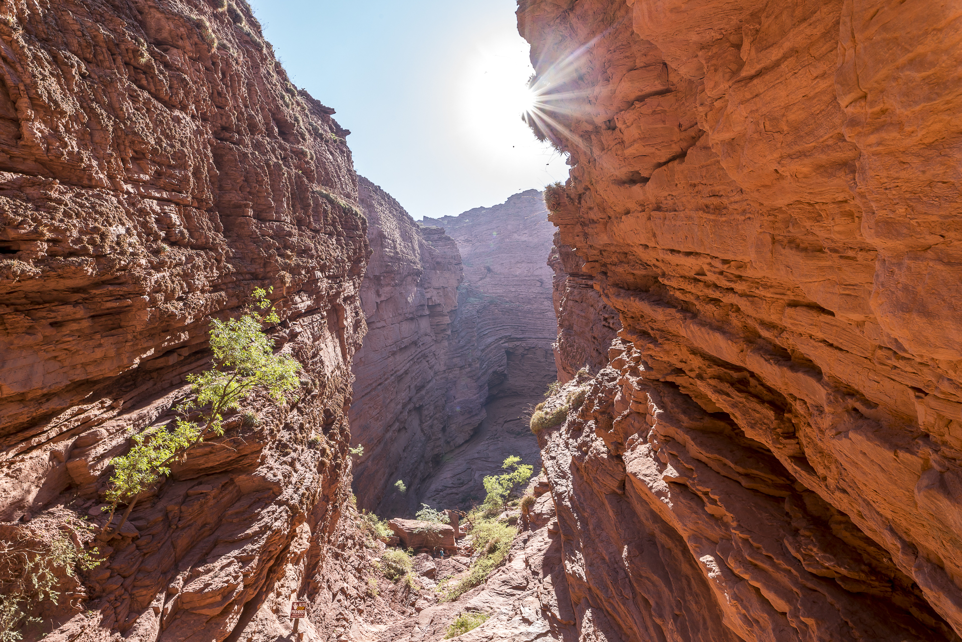
The last day of the trip is dedicated to the UNESCO World Heritage Site of the Quebrada de Humahuaca. The gorge is both a natural heritage and a cultural heritage, due to its importance as an important trade route for the Indians. You could easily add another day or two here in the valley. We have enough time for a hike around the Cerro de siete colores in Purmamarca and we look at the rest through the car window. I had unknowingly planned our border crossing from Argentina to Bolivia on Carnival Sunday and since carnival is celebrated in these valleys extremely excessively and this is often accompanied by traffic chaos, we want to reach the border early. But as I drive by, I make up my mind to return here one day. I was touched by the multifaceted landscape in the northwest of Argentina and the simple, traditional way of life of the locals. The Puna is a world of wonders that won’t let you go so quickly.
Practical tips for your discovery tour of the Puna
- You can reach the Puna from San Pedro de Atacama via Ruta 23 (Argentine side does not yet have a paved road) or Ruta 27 (this is where the bus passes).
- Salta is an ideal starting point for tours of the Valles Calchaquíes and the Puna.
- We stayed in Salta at the centrally located Hotel del Antiguo Convento.
- During the European winter months, it is the rainy season in the north of Argentina – the vegetation is much greener than in the dry season, but there can also be road interruptions due to intense rainfall.
- Socompa is a tour operator specializing in organizing tailor-made tours for individual travelers to the most remote corners of the Puna. We really appreciated the professional approach and the varied travel program.
- In the Puna you move at altitudes between 3,000 and 5,000 meters in altitude. Appropriate clothing (layers) and acclimatization will make it easier for you to travel at these altitudes.
- You should be prepared for the fact that you will not have telephone reception / internet connection for several days.
Note: Socompa kindly gave us a small discount on the cost of the private «Puna Exp» tour. As always, all impressions and opinions are ours.

Leave a Reply