

Easy circular hike through the Gasterntal near Kandersteg
The Gasterntal near Kandersteg is a worthwhile destination for all those who simply want to clear their heads on a beautiful late summer or autumn weekend. The hiking possibilities are diverse, not per se designed for altitude meters and above all in this natural high valley the path is effectively the goal for once. At least with our tour suggestion, which we had picked out in mid-August with a view to the uncertain weather forecasts. The proximity to Valais benefited us – to our surprise, perfect hiking weather awaited us in the Gastern Valley.
Click here to go directly to the hiking map and the key data of the tour
Starting point Selden
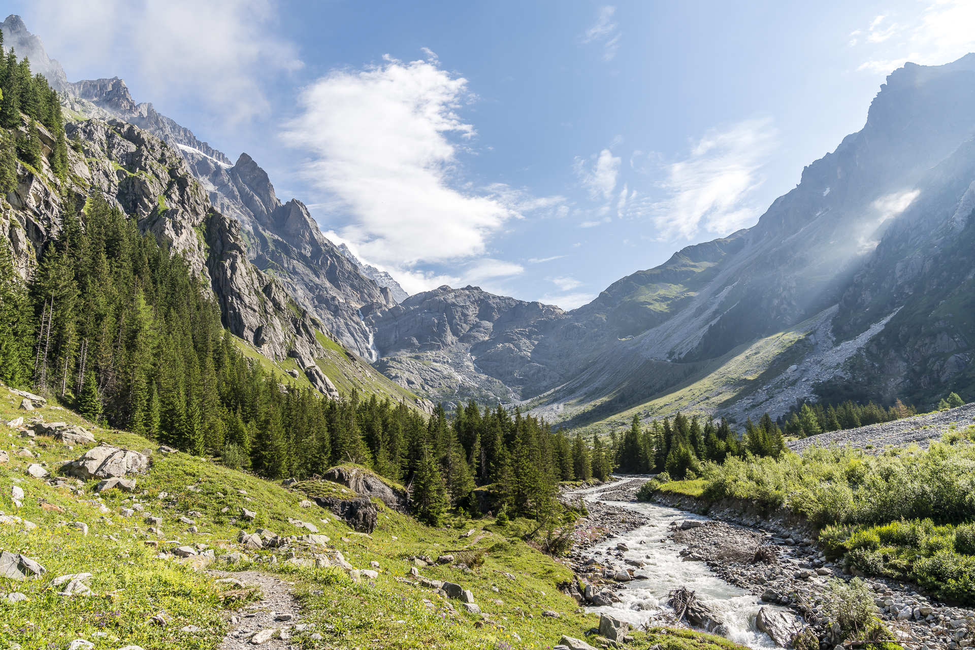
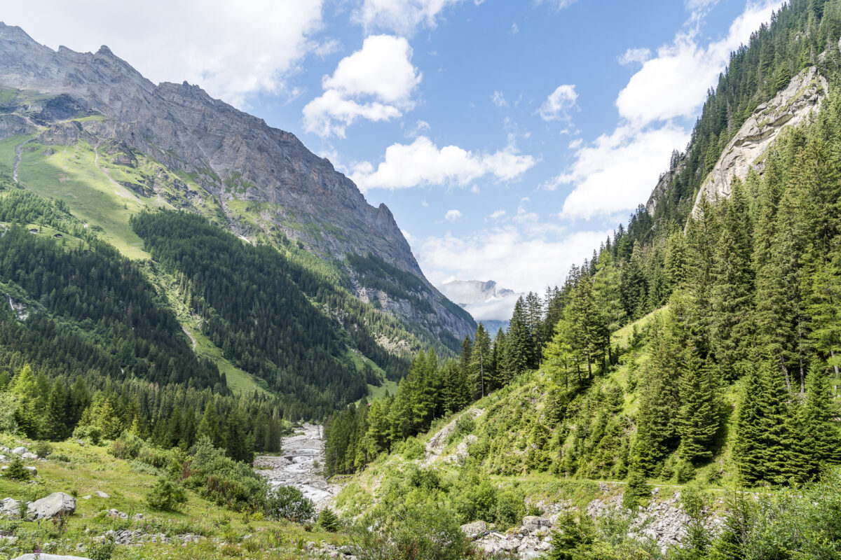
The high valley, which lies south-east of Kandersteg, stretches for about ten kilometres from the narrow Chluse Gorge to the Kanderfirn, where the Kander rises. Before the Gemmi Pass was built in the 18th century as a simpler connection between the Bernese Oberland and Valais, the Gastern Valley formed an important section of the route to the Lötschental. Today, stages 2 and 3 of the Lötschberg Panorama Trail lead from Kandersteg over these old mule tracks to the Lauchernalp. The stage stop between the second and third stages – Selden – is also an ideal starting point for circular hikes through the rear third of the Gastern Valley, which can be extended almost at will.
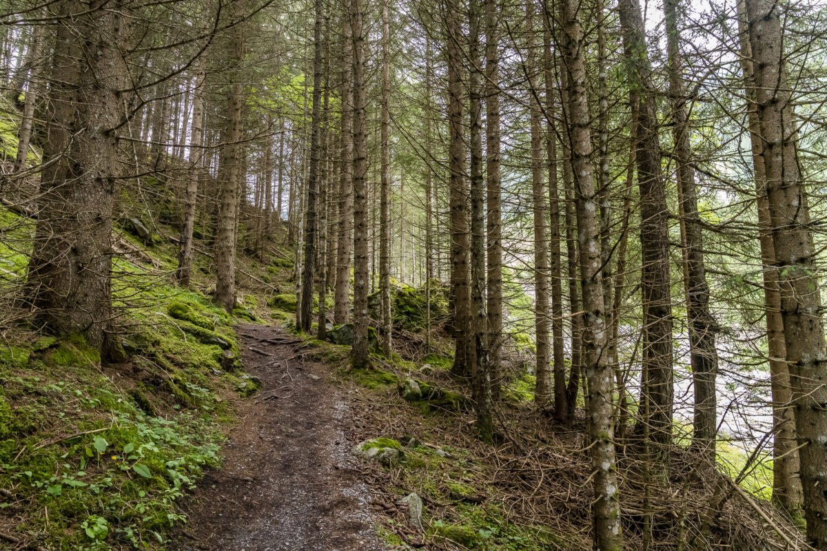
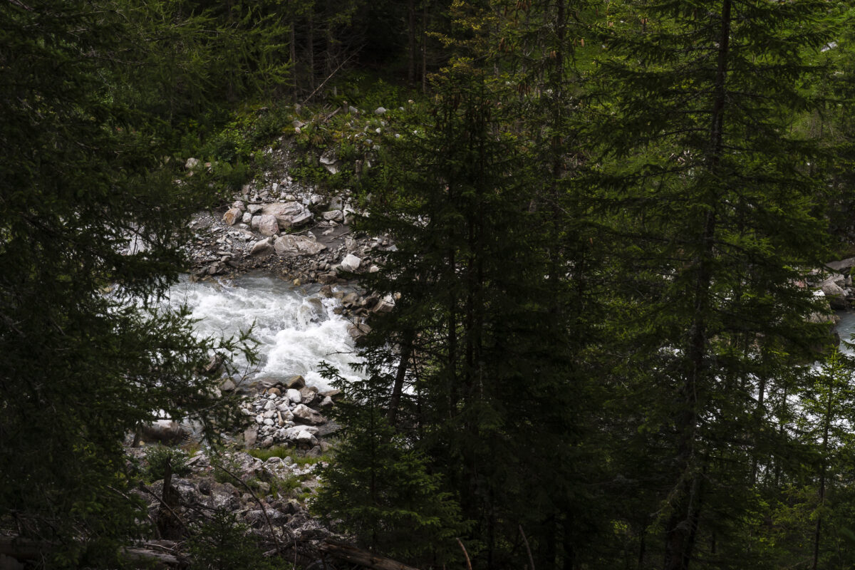
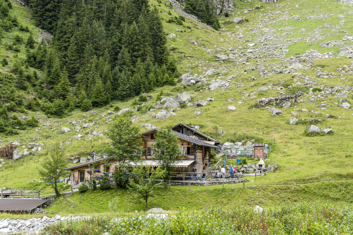
If you tackle the route over the Lötschen Pass in Selden, you cross the Kander and follow the Leitibach steeply uphill. Instead, we keep to the right side of the river and follow the signposted hiking trail through the wooded slope edge about 60 meters uphill to the Heimritz mountain inn. A constant acoustic companion is the Kander. Here and there, the riverbed of the wild mountain stream peeks through the thicket.
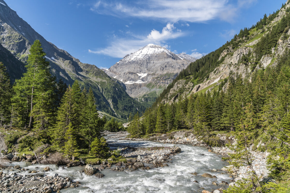
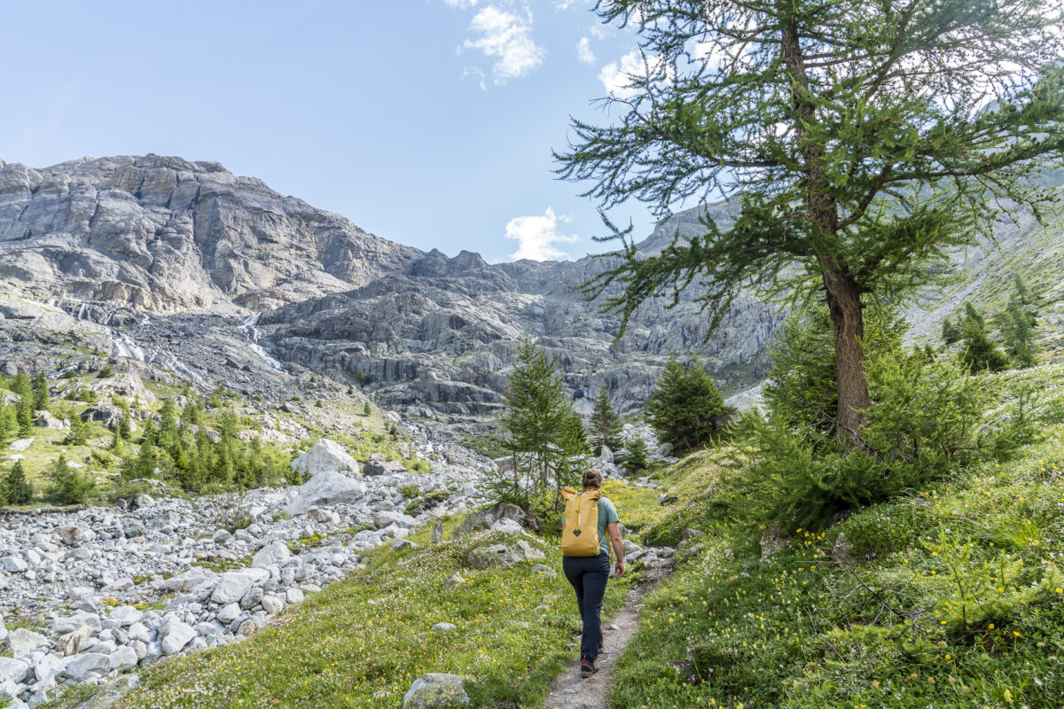
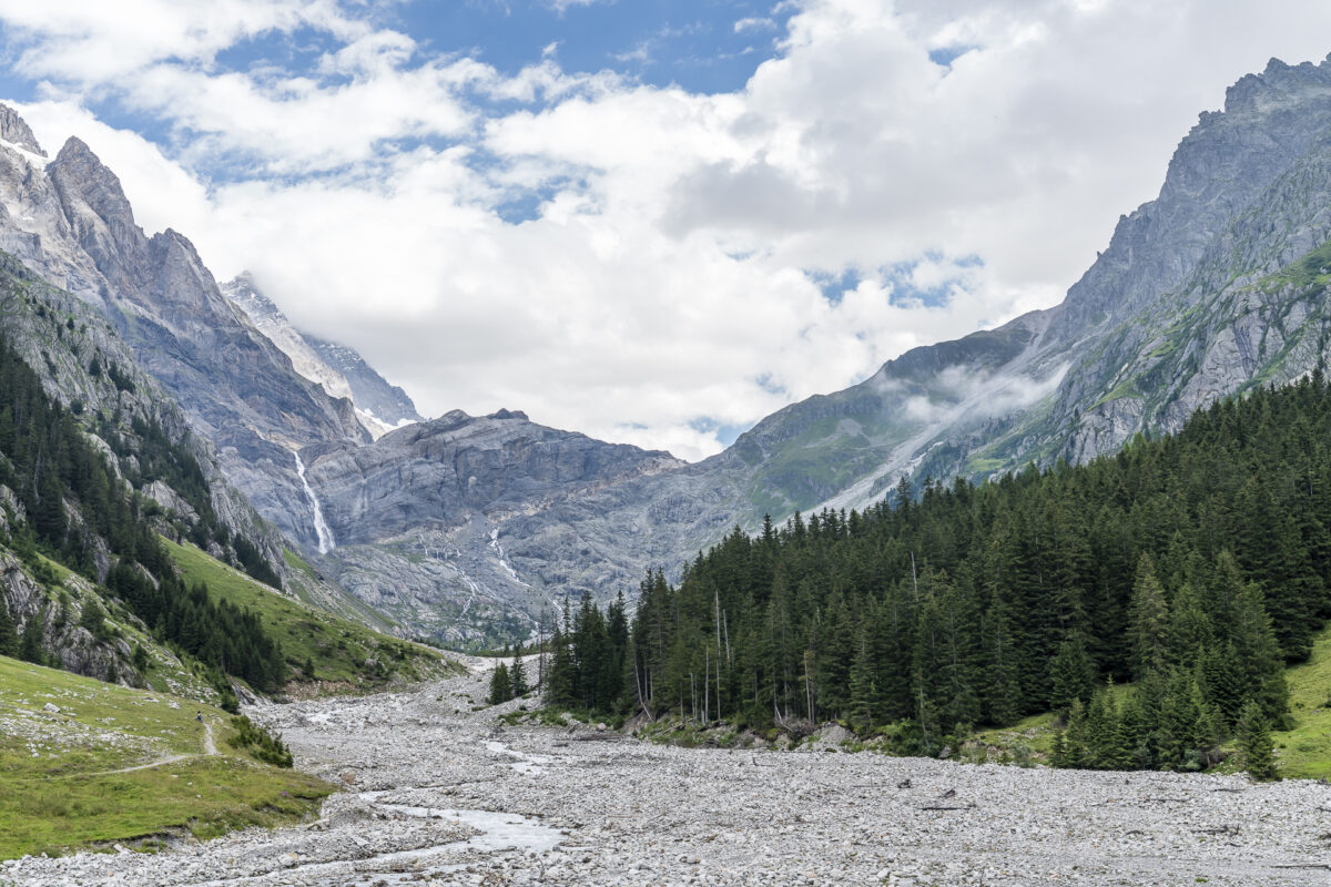
Along the Kander in the direction of Kanderfirn
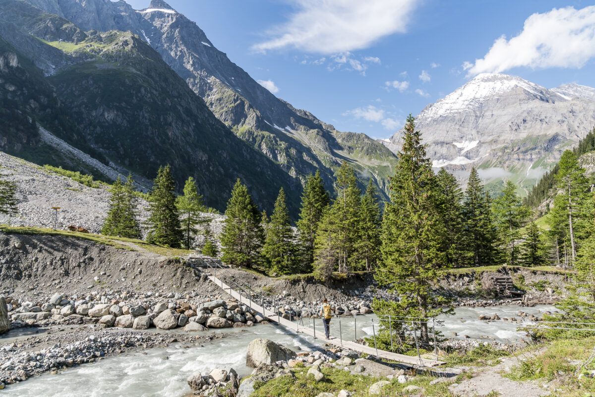
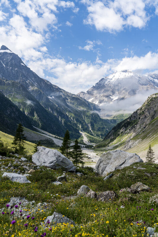
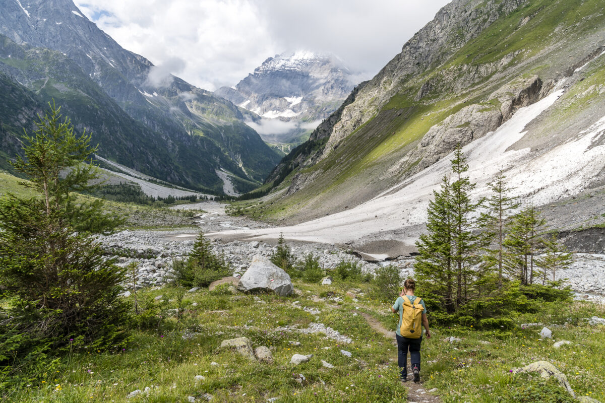
As soon as you have passed the mountain inn, the Gastern Valley widens towards the end of the valley. Surrounded by a magnificent alpine landscape, we follow the hiking trail over flower-rich alpine meadows and navigate through former rockfall areas. Nature up here is fragile and subject to constant change. Accordingly, the routing of the hiking trail is adapted to the current conditions from time to time. This is also the case with the suspension bridge, which leads us safely (but quite wobbly) over the roaring Kander after a walk of about 30 minutes from the alpine farm.
Impressive valley finish with two options
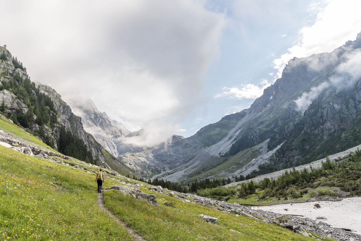
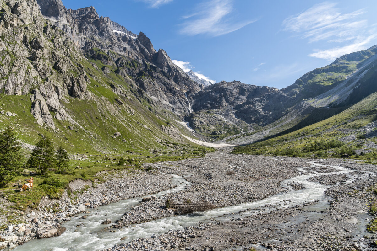
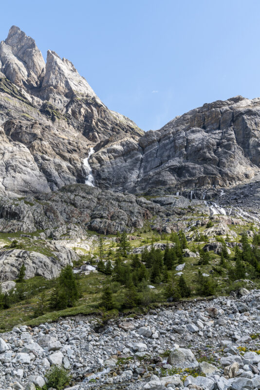
At the level of the suspension bridge, on the orographic right side of the river, there is a beautifully placed bench with a magnificent view towards the end of the valley. This is where the actual circular hike ends. But it is worthwhile to continue along the path a little further into the valley to the steeply rising rock faces below the Kanderfirn, which are criss-crossed by waterfalls. The technically demanding part and the really tough meters of altitude only begin directly below the Alpetligletscher (terminal moraine). If you walk from the suspension bridge for another thirty minutes into the valley, you will be rewarded with a magnificent view over the Gastern Valley. And the further autumn progresses, the more colourful the landscape will be.
Up to this point, the tour is also easy to manage with children or older people. Depending on your desire, mood and physical condition, you can of course follow the hiking trail further up. At 2,412 m above sea level at the latest, the white-red-white marked mountain trail “uf de Schafgrinde” ends. From here it continues as an alpine tour over the Kanderfirn to the Mutthorn hut.
If, like us, you opt for the leisurely tour option, you can hike back to the suspension bridge via the same path instead. Here we stay on the left side of the river and follow the path through the Tangel and Schärmewald forest until the Heimritz mountain inn appears again on the opposite side of the valley.
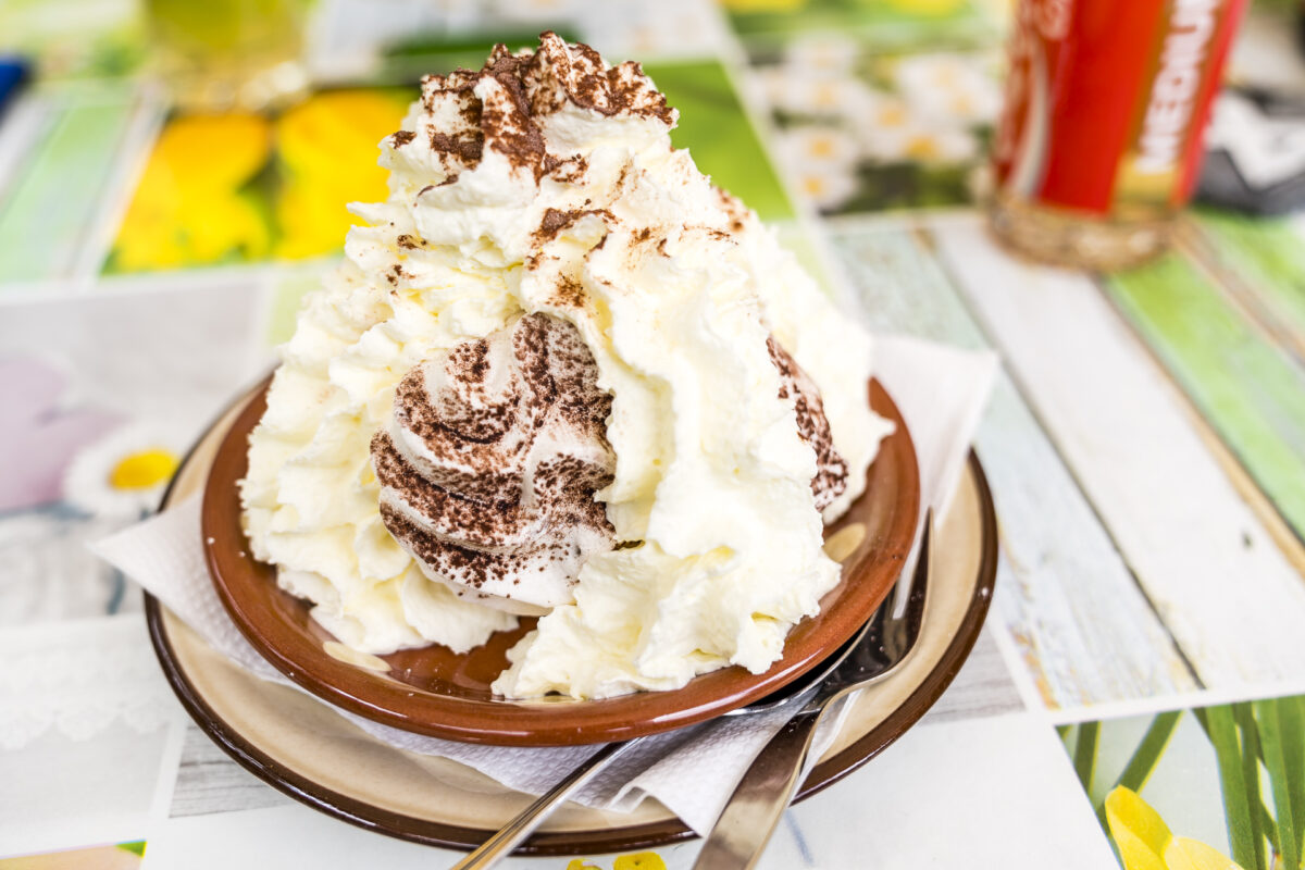
Delicious stop for refreshments at the end
The mountain inn, which has been run by the Rauber family for five generations, is a popular stop for refreshments in the Gastern Valley. And we don’t miss out on the well-deserved sweet refreshment on the sun terrace. The perfect end to a leisurely, enjoyable and surprisingly sunny half-day trip to the wonderful wild Gastern Valley.
ps. if you prefer to travel by bike / bike, you can also cycle from Kandersteg to the Heimritz mountain inn.

Practical tips for your hike through the Gastern Valley
On the following map you can see our route of the easy circular hike from Selden towards Kanderfirn and back. The route measures 7.9 kilometres and includes a moderate ascent of a good 370 metres in altitude. From the suspension bridge over the Kander there is only a one-way path, which is an easy-to-walk mountain path (difficulty T2) that first leads over the plateau to the end of the valley at around 1,800 m above sea level. From there, the path zigzags up another 600 metres in altitude to “uf de Schafgrinde”. If you like it a little more adventurous, are not averse to one or the other “scramble” and see the tour as altitude training, this is the right place for you. Everyone else can look for a nice spot on the flower-filled meadow at the end of our tour (see map) and enjoy the view over the natural, idyllic valley landscape.
You can reach the starting point of the hike from Kandersteg train station with the bus line 240 1 (seasonal bus service), which runs every hour until the beginning of October. The bus connection is subject to reservation. You can find the corresponding telephone number in the SBB timetable. Please note that you must call in advance to be guaranteed a seat. Alternatively, until mid-November, the Gastern Valley can also be reached by motorized private traffic via a toll (rather adventurous-looking) road. Please note that there is a timetable for the first section (rock gallery) and it is not possible for cars to cross. Further information on access times and costs can be found here: Gasterntal access road
Key data of the circular hike through the Gastern Valley
| Starting point | Bus stop Selden, Hotel Gasterntal (1,550 m above sea level) |
| Reachability | Accessible by public transport (until the beginning of October) |
| Length | 7.9 kilometres |
| Elevation gain | ↗ 371 m 371 m ↘ |
| Duration | 2:30 p.m. |
| Destination | Bus stop Selden, Hotel Gasterntal (1,550 m above sea level) |
| Catering | Berggasthaus Heimritz as well as Hotel Steinbock and Hotel Gasterntal in Selden |
Leave a Reply