

Belchenflue & Tüfelsschlucht: two worthwhile hiking destinations in the Mittelland
The Belchenflue is no stranger. With its impressive viewing platform on the Jura chain, it inspires with phenomenal atmospheric moments, especially on autumnal high fog days. Year after year, the “fog waves” images created here generate media enthusiasm. The detour to the Belchenflue can also be combined with a variety of hiking options. A particularly beautiful combination is offered by the Tüfelsschlucht-Belchen-Weg; quasi a “best-of” of the landscapes typical of the Jura that can be hiked in just under 4 hours.
You want to skip my impressions of the tour and study the practical information as well as the hiking map directly – then click here: to the practical tips
Morgenzauber in Ifenthal
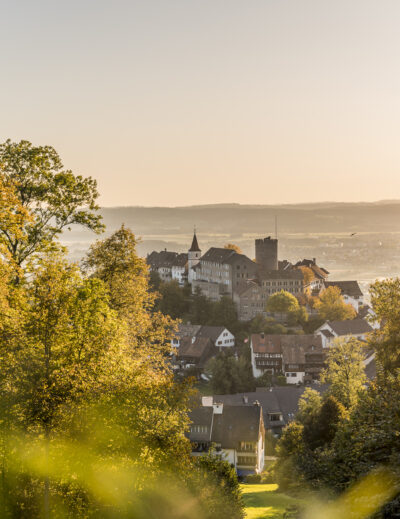
We made a conscious decision to get an early start on this Saturday morning. I love being outside when the day slowly awakens and the first rays of sunshine make their way down the hilltops into the valley. And we didn’t choose our starting point – the strikingly placed church in the hamlet of Ifenthal – without ulterior motives. This is the starting point for a sunrise hike on the Belchenflue, which can be reached earliest by public transport from Olten (arrival at 07:24). From here, the ascent to the Belchenflue takes between one and 1.5 hours (depending on your walking pace).
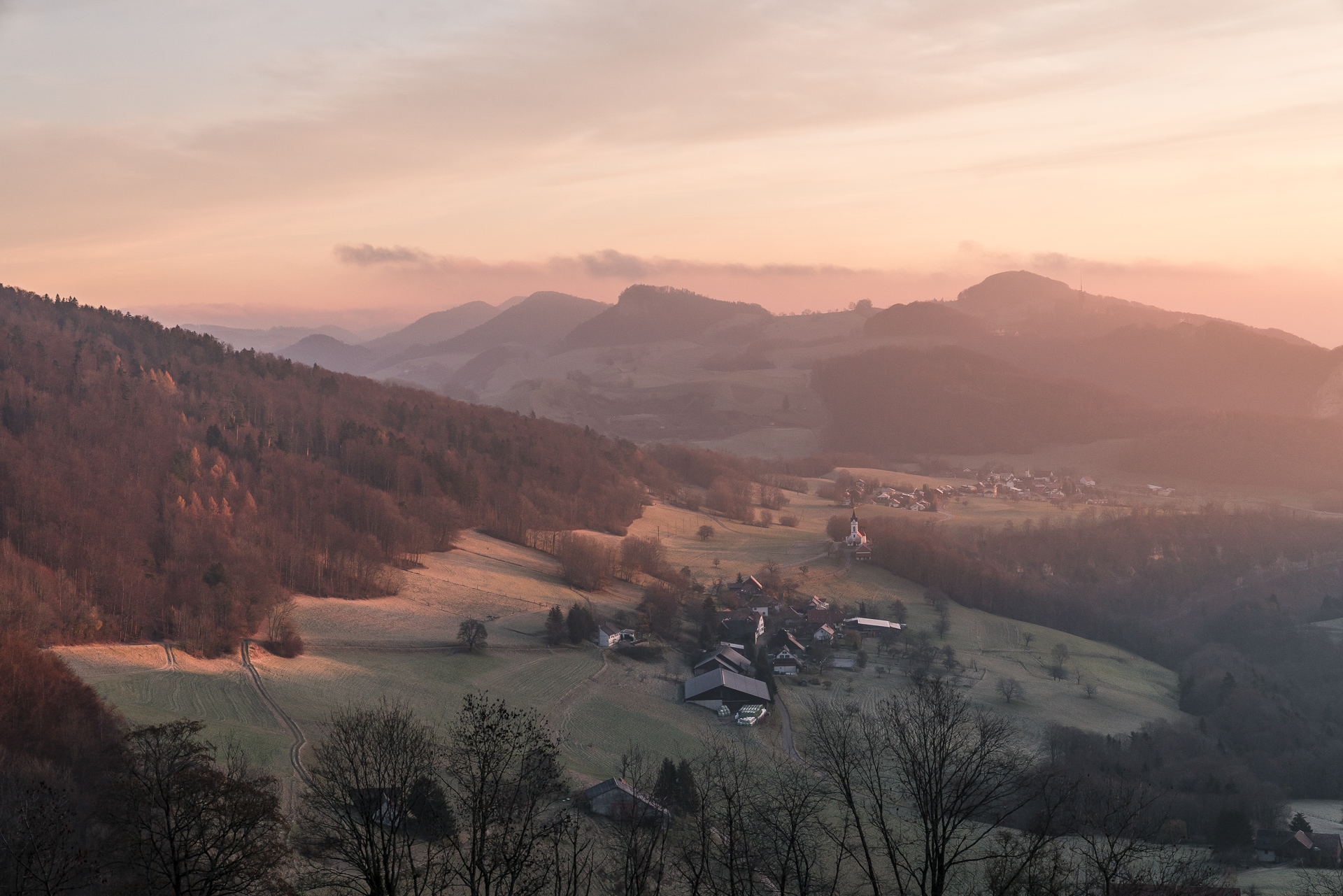
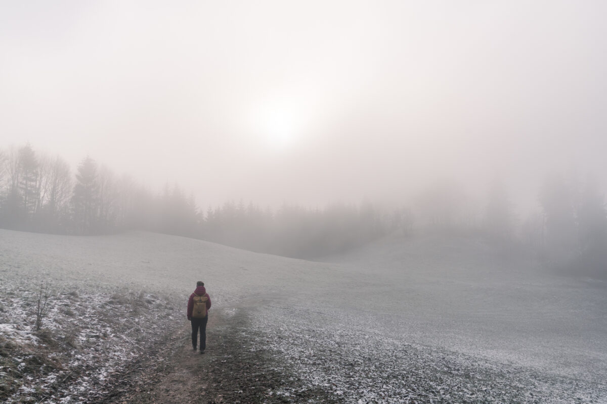
We are greeted this morning by a pastel-colored sky and a freezing cold. My phone reads -3° Celsius – and that’s exactly how it feels. The view into the valley is still clear. Here and there you can already make out wafts of fog, but nothing there with dense high fog. The weather still has a good hour to develop.
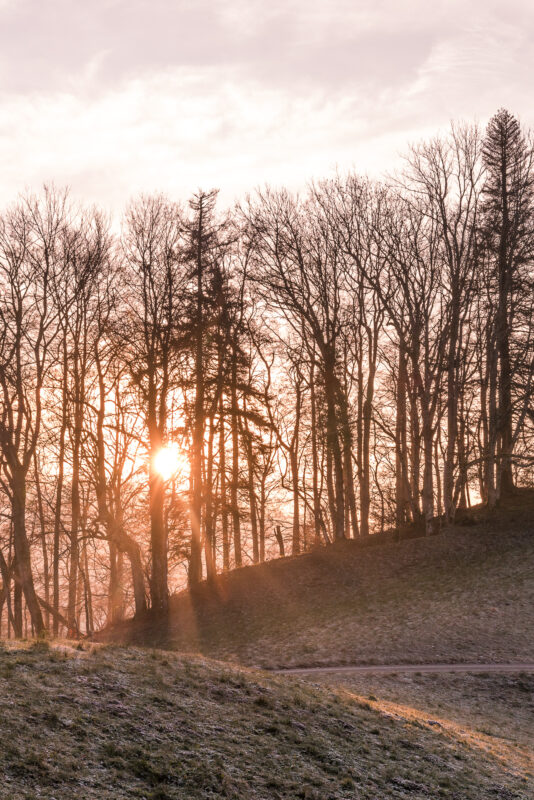
And we take what the weather has in store. Less than 30 minutes after the start of the hike in Ifenthal, we are at least offered a fabulously beautiful sunrise. Everything that comes now is to be booked as an encore anyway.
On the Jura High Trail to the Belchenflue
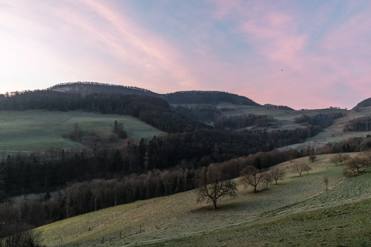
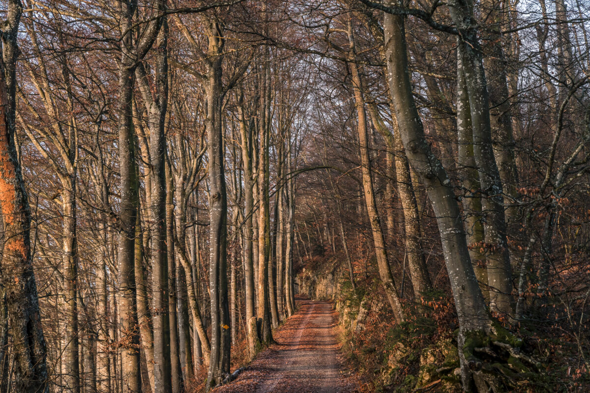
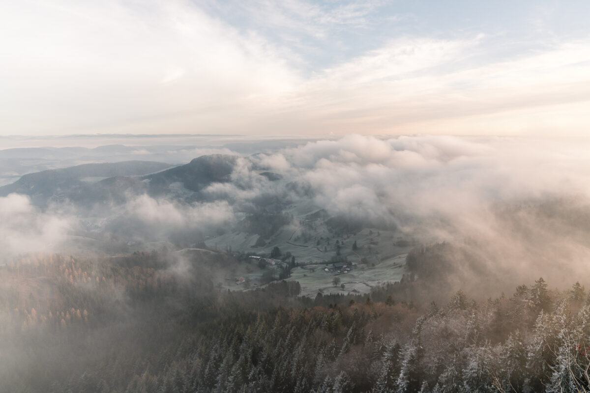
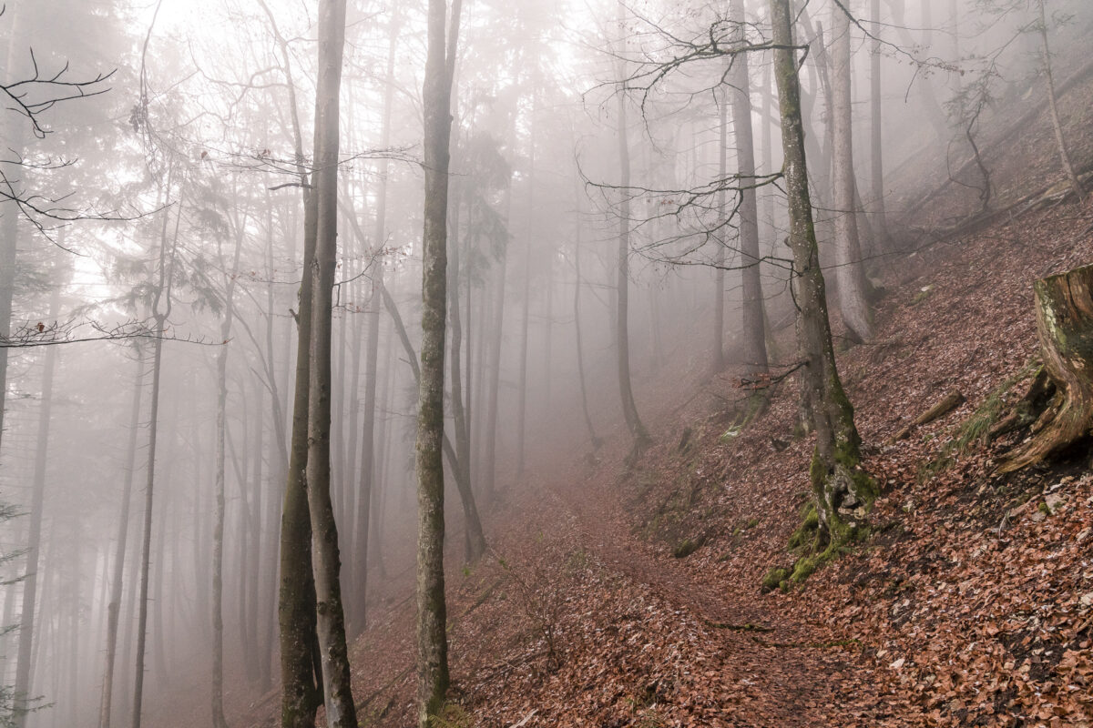
From Ifenthalt, the hiking trail first leads along a tarred road up to Challhöchi, where we reach the Jura High Trail. This leads us along a wide gravel path to the pass crossing below the Belchenflue, which is almost 1,100 metres above sea level. The trail itself is not particularly spectacular, but the late autumn light makes the forest glow wonderfully in a soft shade of orange.
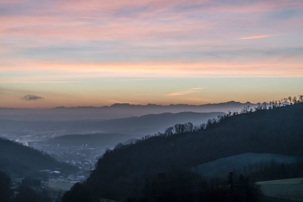
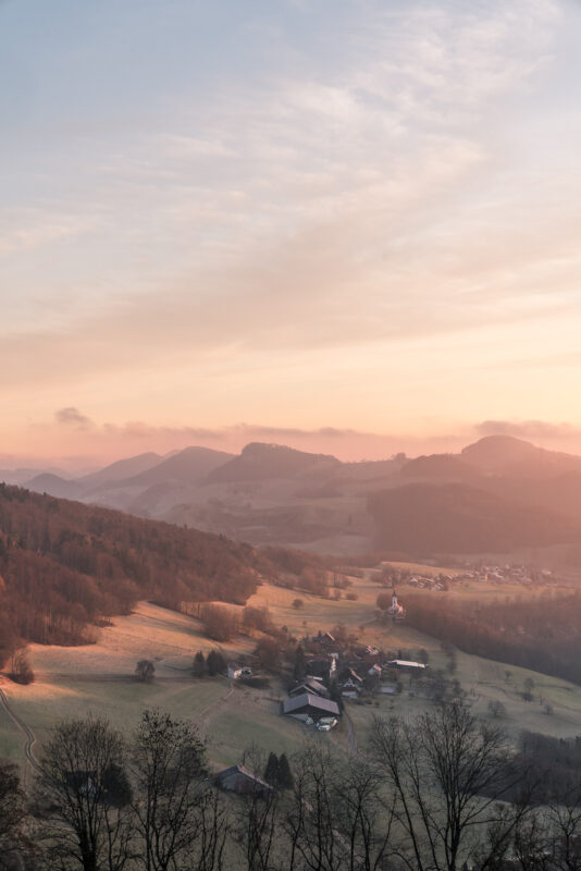
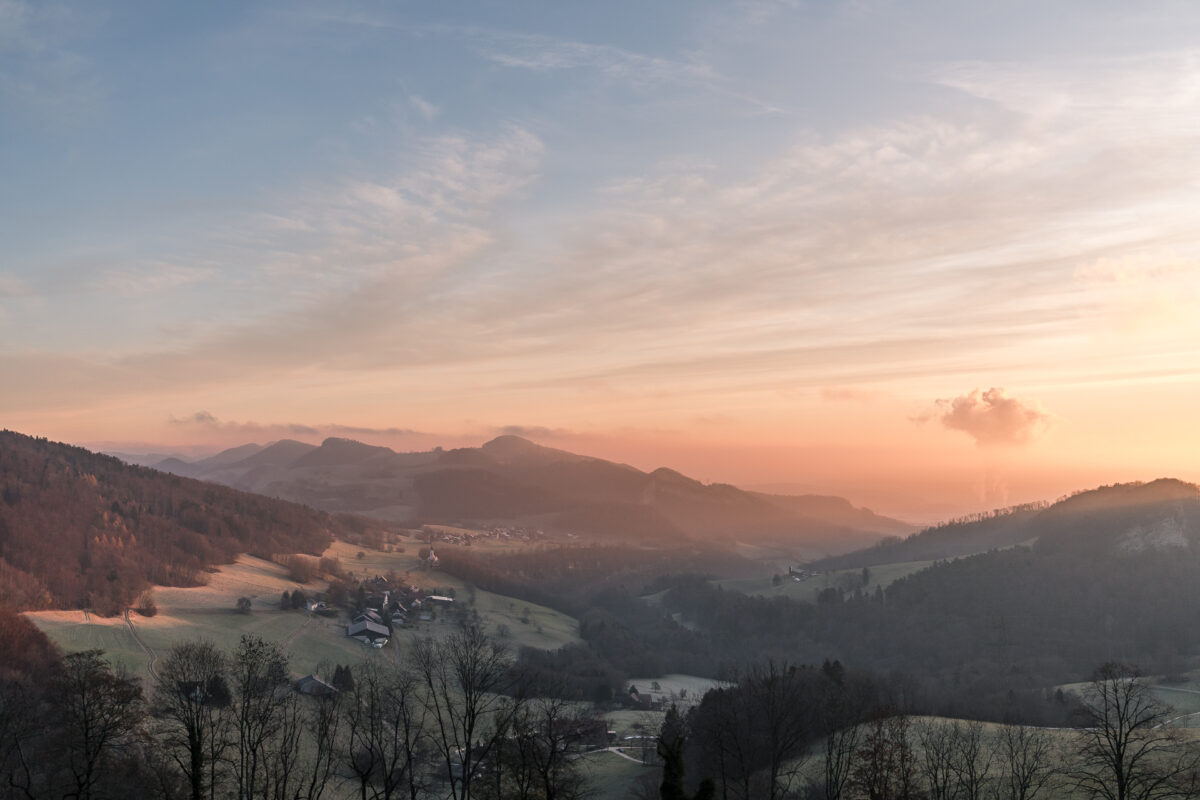
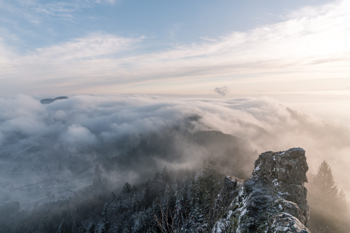
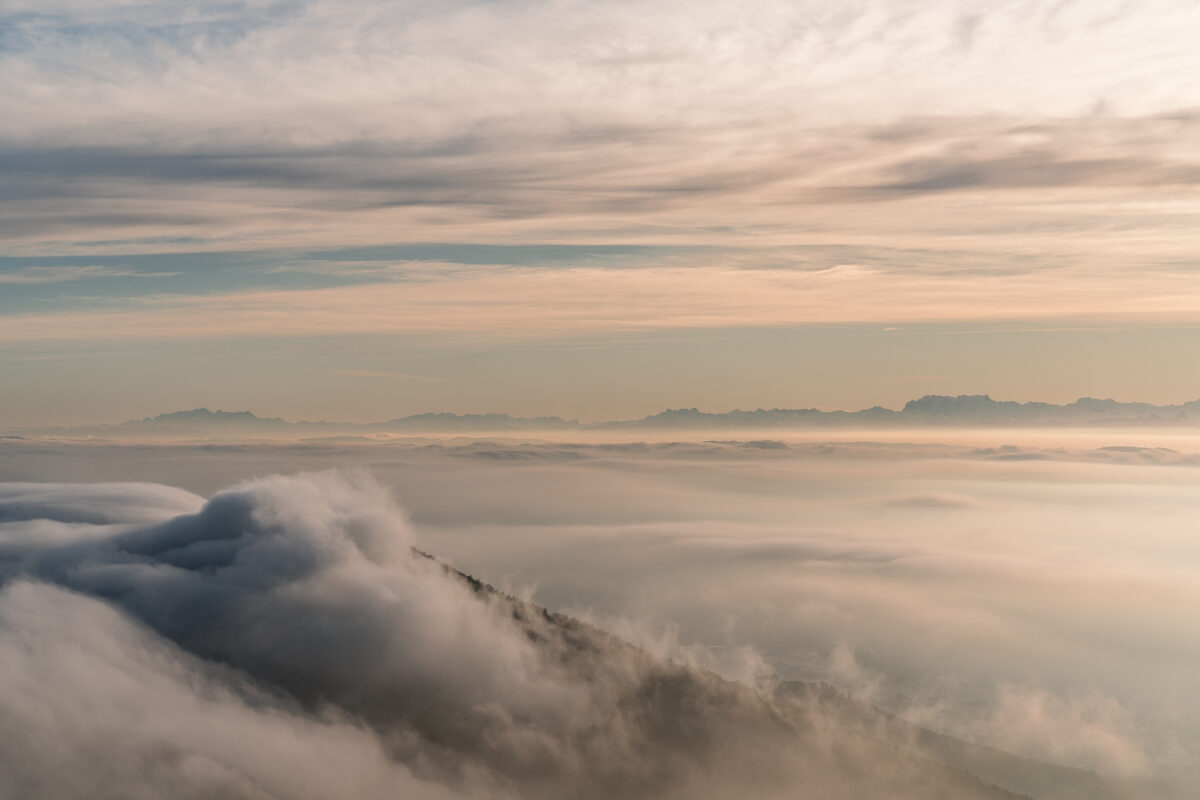
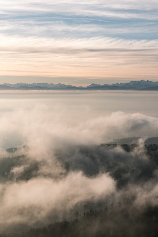
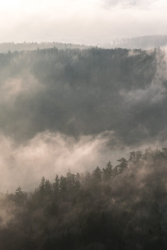
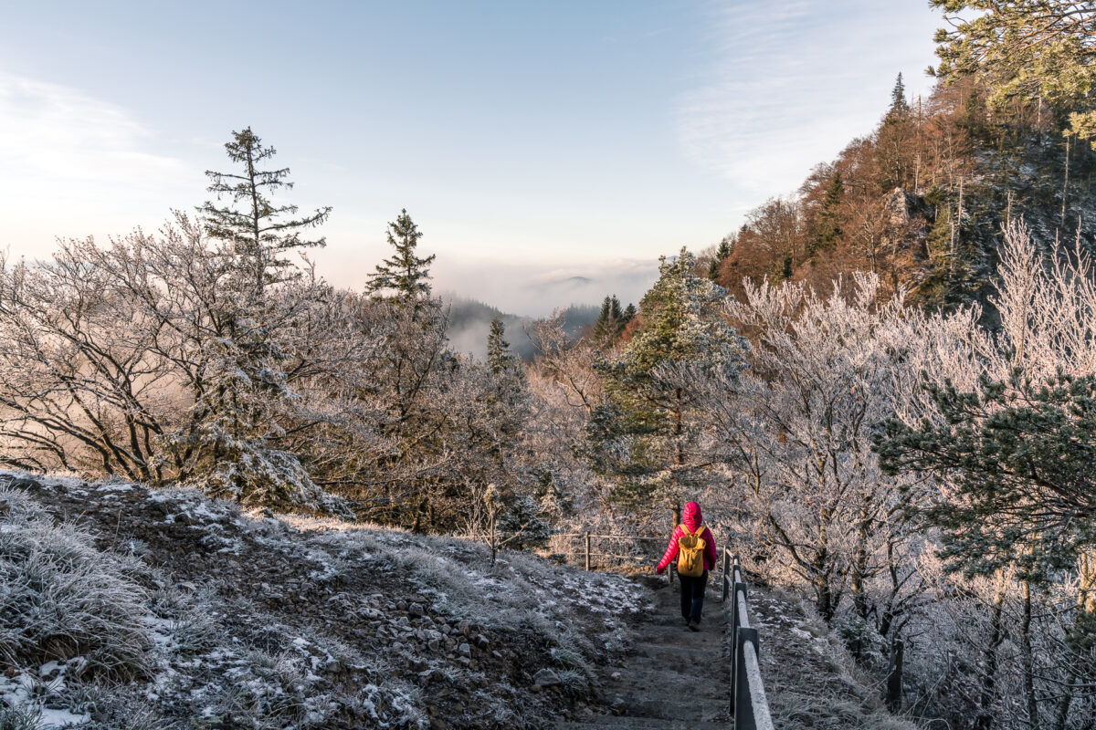
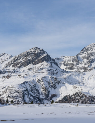
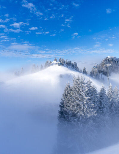
This warm orange turns into a frosty white just below the Belchenflue – autumn and winter pass the baton here. And as secretly hoped, a layer of fog has spread in the meantime in the Swiss Plateau. Our timing is so good this morning that we reach the viewpoint at the Belchenflue just as the first wave of fog flows from the Swiss Plateau into the Basel region. For perfect fog wave images, you need not only good weather, but also long-term lighting and a stable support surface for the camera (ideally a stable tripod). This morning it’s too windy (and frankly way too cold) to succeed with our lightweight Manfrotto tripod. But I’m also more than happy – I mean: isn’t that just amazing?!
Via Tüfelsschlucht-Belchen-Weg back to the Swiss Plateau
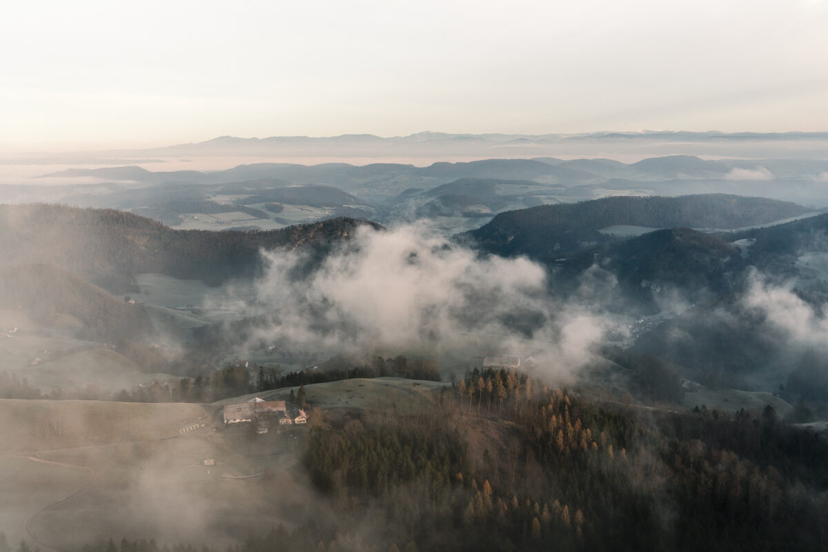
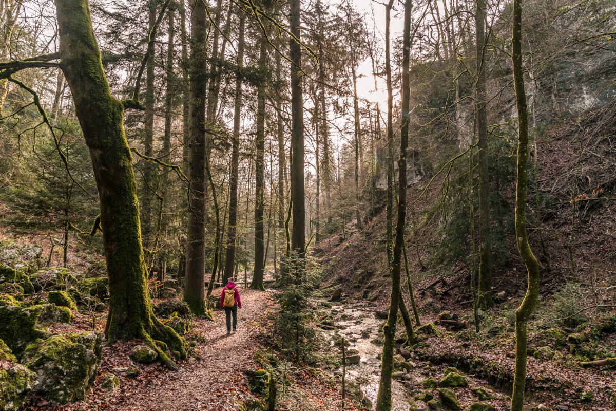
After a few minutes of amazement, we start to shiver. Time to move on. We descend from the Belchenflue back down on the Jura High Trail and follow it to the Wuesthöchi. Here we turn off in the direction of Allerheiligenberg and dive into the sea of fog. The abrupt change between mystical cloud forests and sun-drenched forest sections is fascinating and accompanies us on the way to the high-altitude clinic. According to the information on the website, the Bergwirtschaft Allerheiligenberg (the first stop option on this route) will remain closed at least until the end of the year.

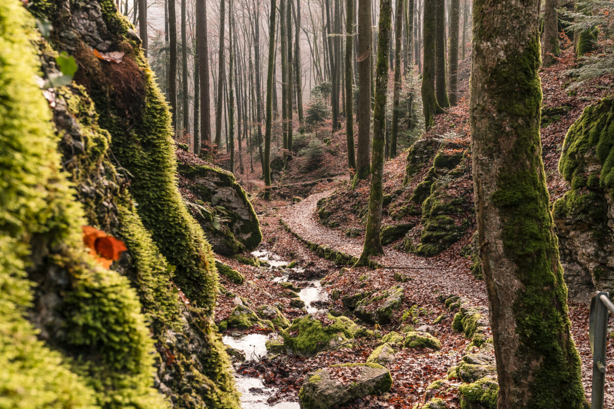
So we continue hiking without a break. The “Tüfelsschlucht” (Devil’s Gorge) is signposted from Allerheiligenberg and is easy to find. According to the self-declaration, the almost 3-kilometre-long gorge path from Allerheiligenberg along the Cholersbach to Hägendorf is one of the most beautiful of the numerous Jura gorges. In recent years, I have explored some of these gorge paths (including the Gorge de l’Areuse, Twannbach Gorge and Taubenloch Gorge near Biel) and can confirm in a cross-comparison that the Tüfels Gorge really doesn’t have to hide here.
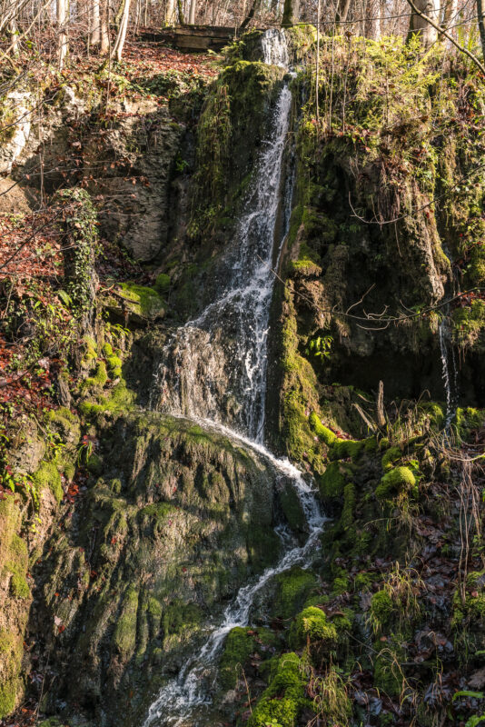
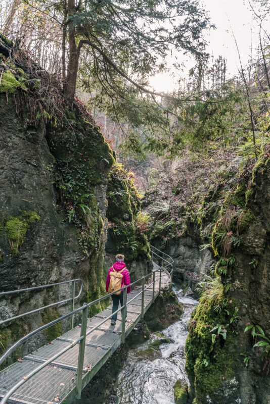
The gorge trail winds its way down the valley along the Cholersbach over 32 footbridges and bridges. Sometimes the gorge ravine presents itself lovely and wide, only to surprise behind the next bend with a narrow passage, narrow steps, moss-covered erratic blocks or a whirlpool hole. The gorge path is free of charge. In two places, however, it is possible to contribute to the maintenance of the trail with a collection. The gorge path leads to the centre of Hägendorf – from there it is only a stone’s throw to the train station.
Practical tips for your hike to the Belchenflue
The route of our hike from Isenthal to the Belchenflue and from there via the Tüfelsschlucht-Belchen-Weg to Hägendorf can be found on the following map. The trail runs continuously on yellow-marked hiking trails (difficulty T1). The first part of the trail (Isenthal – Belchenflue) leads continuously over wide, tarred or gravel paths and can therefore be classified as “suitable for prams”. The exposed vantage point of the Belchenflue, on the other hand, is only accessible via a (secured) stairway.
The subsequent route (from the Belchenflue via Allerheiligenberg and Tüfelsschlucht to Hägendorf) offers mostly nature trails. The gorge path is well maintained and all “sloping” passages are secured. You can find more information about the Schluchtenweg on the website of the Hägendorf Traffic and Beautification Association.
Key data of the tour Ifenthal – Belchenflue – Tüfelsschlucht – Hägendorf
| Starting point | Bus stop Ifenthal, church |
| Length | 12.3 kilometres |
| Elevation gain | ↗ 441 m 730 m ↘ |
| Duration | 3:50 p.m. |
| Destination | Hägendorf Railway Station |
Leave a Reply