

Mountain tour with a view of Lake Oeschinen: from Elsigenalp via the First to Allmenalp.
Advertisement: this post was created in collaboration with Elsigenalpbahnen AG.
From Elsigenalp over alpine meadows and scree slopes steeply up to First – the highest point of the “Allmegrat”! This attractive mountain hike rewards the challenging ascent with a breathtaking view of the UNESCO World Natural Heritage Swiss Alps Jungfrau-Aletsch including the turquoise-blue Lake Oeschinen.
All good things are five – or so
The steep valley sides of the Entschligental are still in the shade when we press the stop button on the bus from Frutigen to Adelboden just before the stop “Achseten, Church.” Once again, we are on our way to Elsigenalp. Over the last three summer seasons, we have already profiled four different hiking routes here. However, we deliberately saved a particularly scenic summit tour for this promising sunny late summer day.
Changing buses at Achseten, Church to the call bus that takes us to the valley station of the Elsigbach–Elsigenalp cable car, and the subsequent mountain ride have almost become routine for me. Yet, the view over the shadow-covered pine forests to the opposite side of the valley captivates me just as much the fifth time as if it were my first trip to Elsigenalp.
Comfortable warm-up towards Elsigseeli
Upon arrival, the obligatory starting coffee at the Berghaus Elsigenalp is a must. This time, a short “pit stop” will have to suffice – I want to start the ascent quickly to enjoy the pleasant morning freshness for as long as possible. It will be sweaty soon enough. Two hours and 15 minutes – the announcement on the signpost is clear, as is the direction to march.
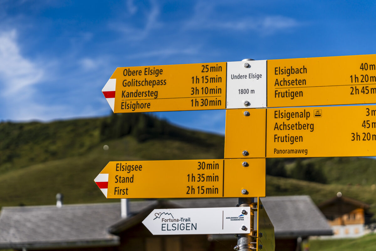
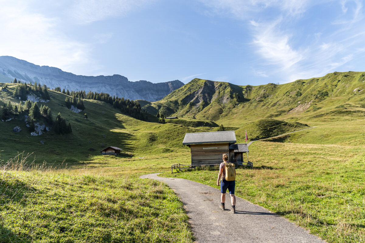
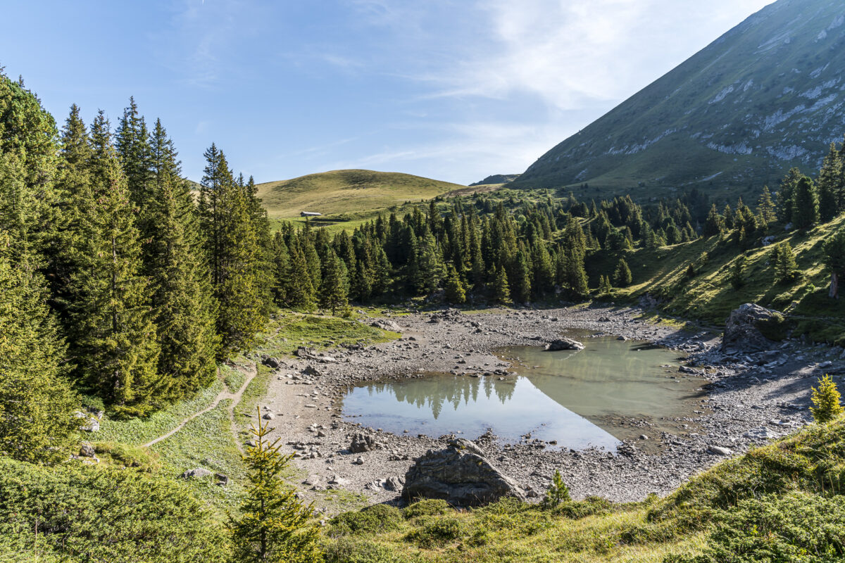
The first nearly twenty minutes we follow a paved road through the alpine area “Undere Elsige” and then are guided onto a truly “cool” nature path, where one could circle the small Elsigsee lake (Duration of this circular hike from the mountain station of the Elsigenalp cable car: one hour). The Elsigsee can dry up quickly during prolonged dry periods and summer temperatures. Accordingly, we are eager to see what scenery we will encounter. After just about five minutes, the somewhat hidden mountain lake appears before us. And behold: It even still has water in it!
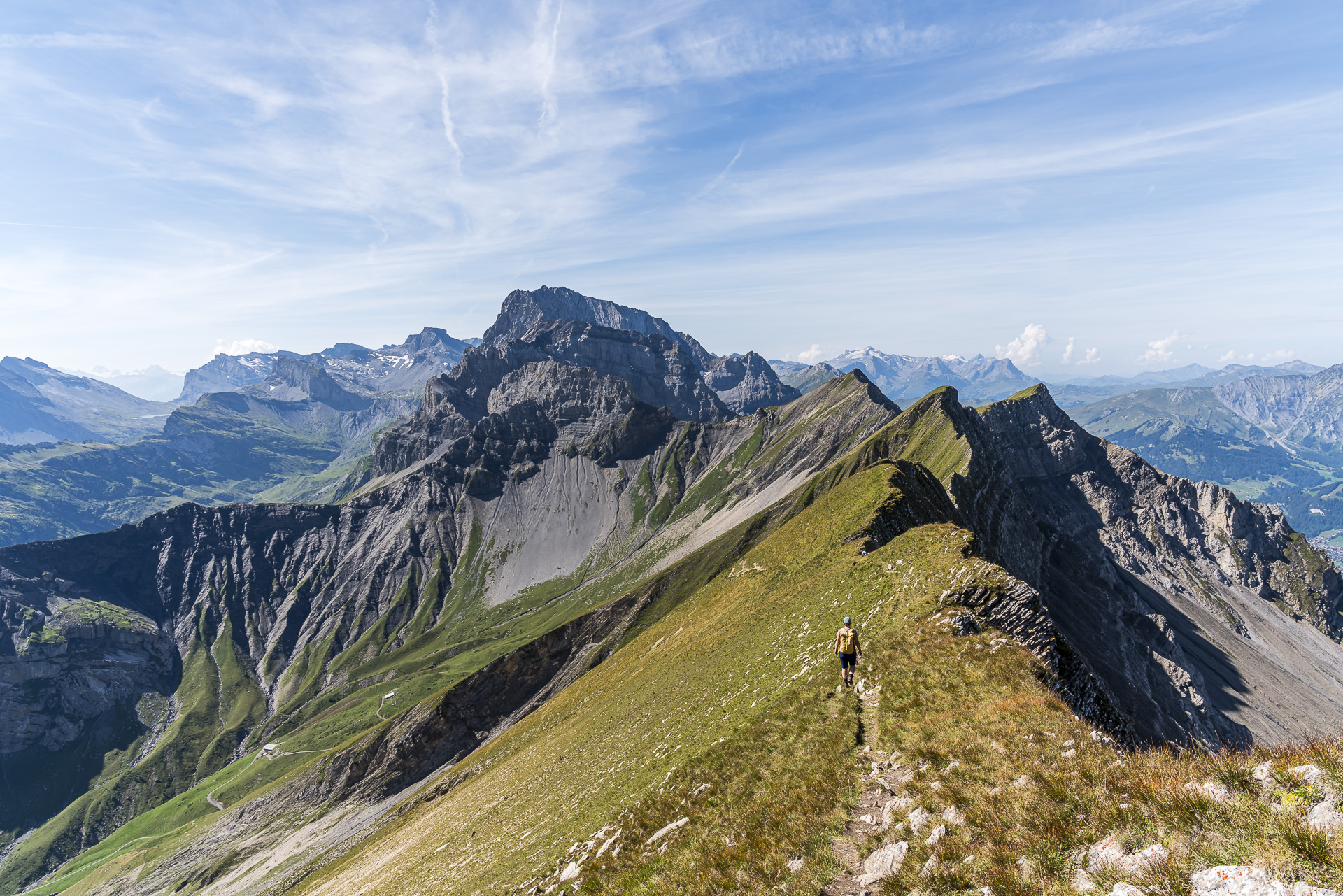
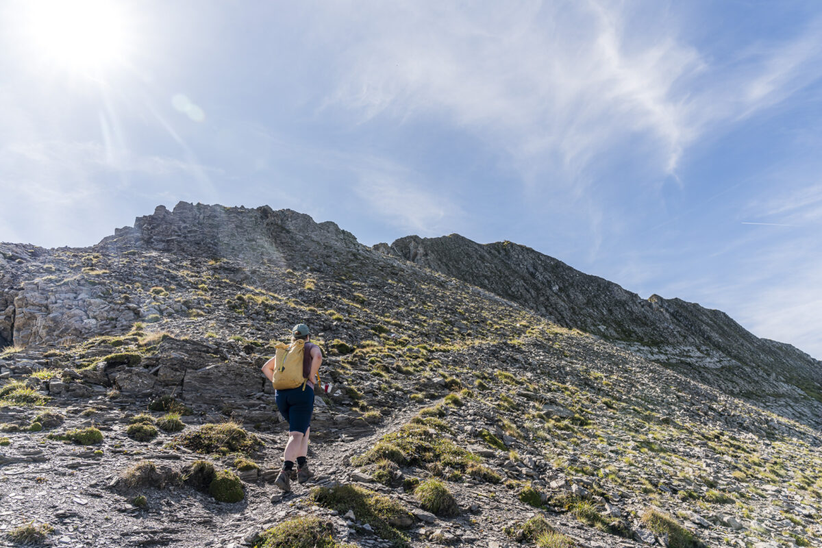
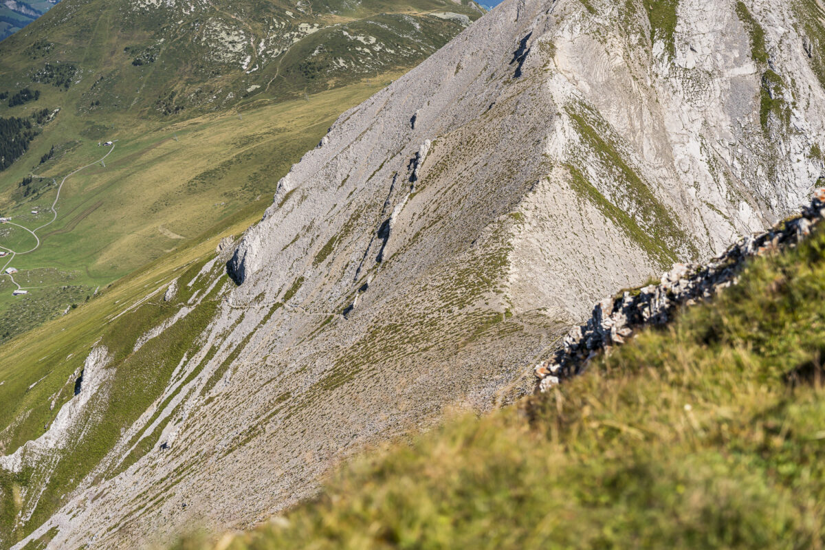
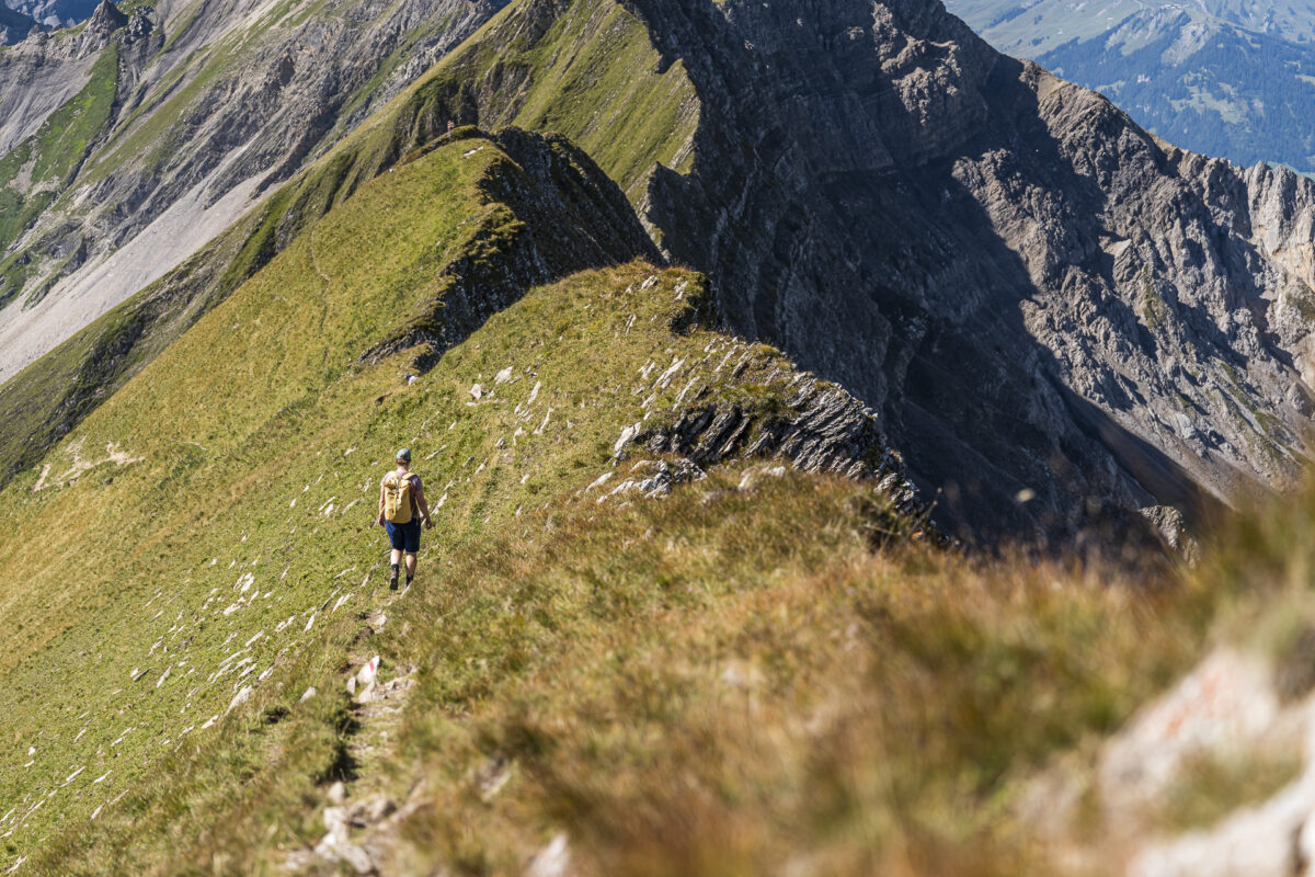
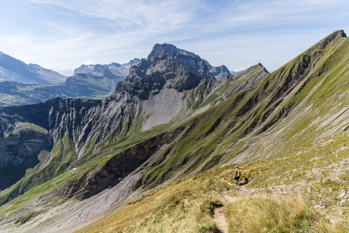
Steep, steeper, First!
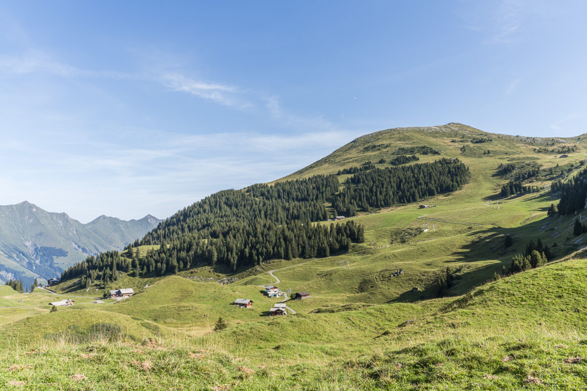
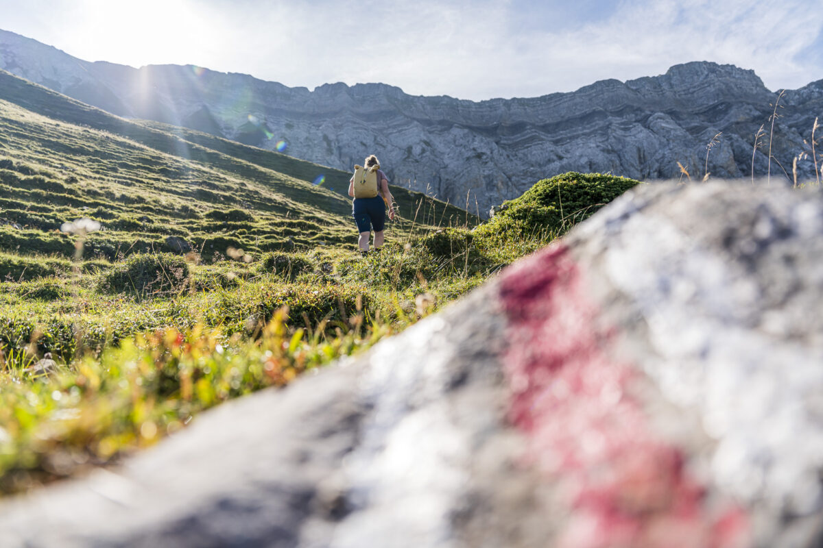
After about 25 minutes, the signpost leads us from the yellow-marked circular path around the small Elsigsee lake onto the red-white-red marked mountain hiking trail towards Stand/First. With the impressive rock faces of the Allmegrat before us, the path knows only one direction from now on: uphill. Apart from that, the path over the alpine meadows up to Stand is very pleasant and without technical difficulties.
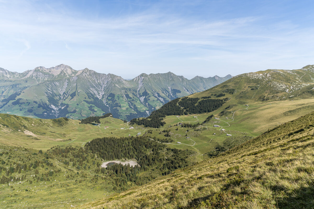
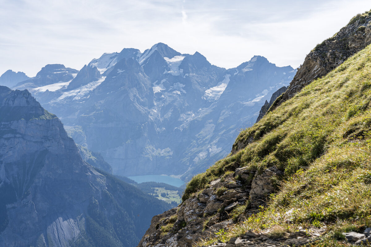
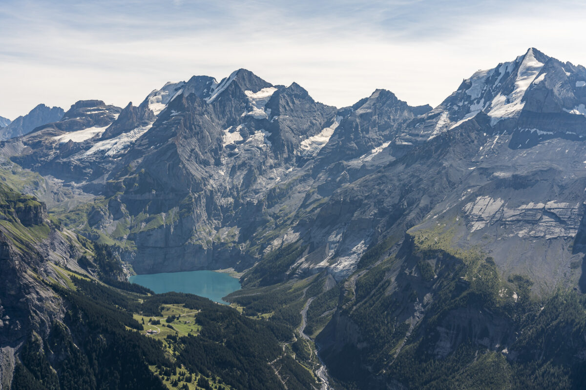
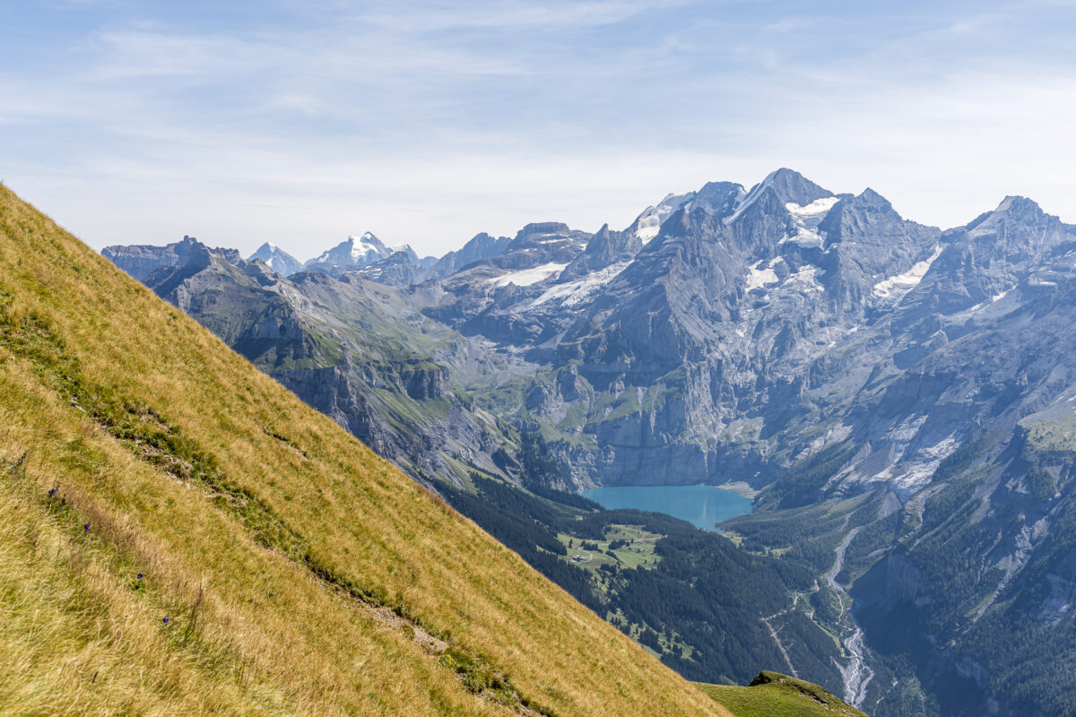
We make good progress and reach the signpost at Stand in just about an hour and 15 minutes. We have already “collected” 500 meters in altitude at this point. Time for a short breather. My gaze wanders from the Elsighorn, which we climbed last summer, across the deep below us lying Golitschenalp to the Blüemlisalp; and the Oeschinensee is also seen here for the first time on this hike.

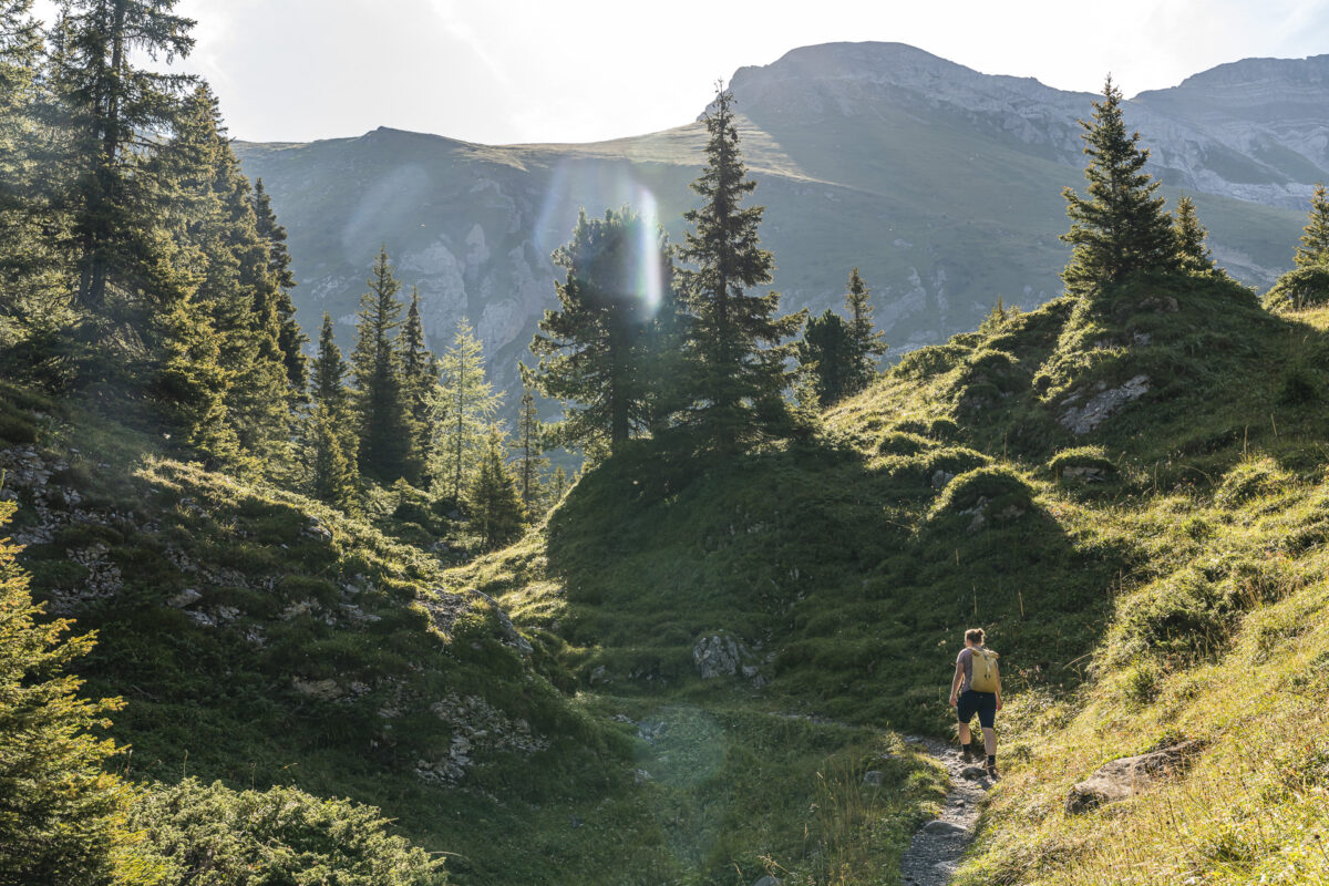
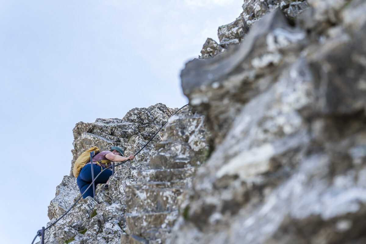
Motivated, we tackle the remaining good 250 meters of altitude up to First. The terrain increasingly changes. We follow the narrow path over steep grassy slopes below the Howang towards the rocky sections. Some spots are a bit more slippery, and here and there my hands come into play – these spots are also secured with wire ropes. However, there are also sections that are less challenging in between. Just before reaching the summit, a nearly 20 m high, wire-secured lime slate wall provides an adrenaline rush. Take a deep breath and then carefully take one step after another. I am so focused on the task ahead of me that the feeling of fear does not even arise. And then – exactly two hours after departing from the Berghaus Elsigenalp – the summit cross appears before me!
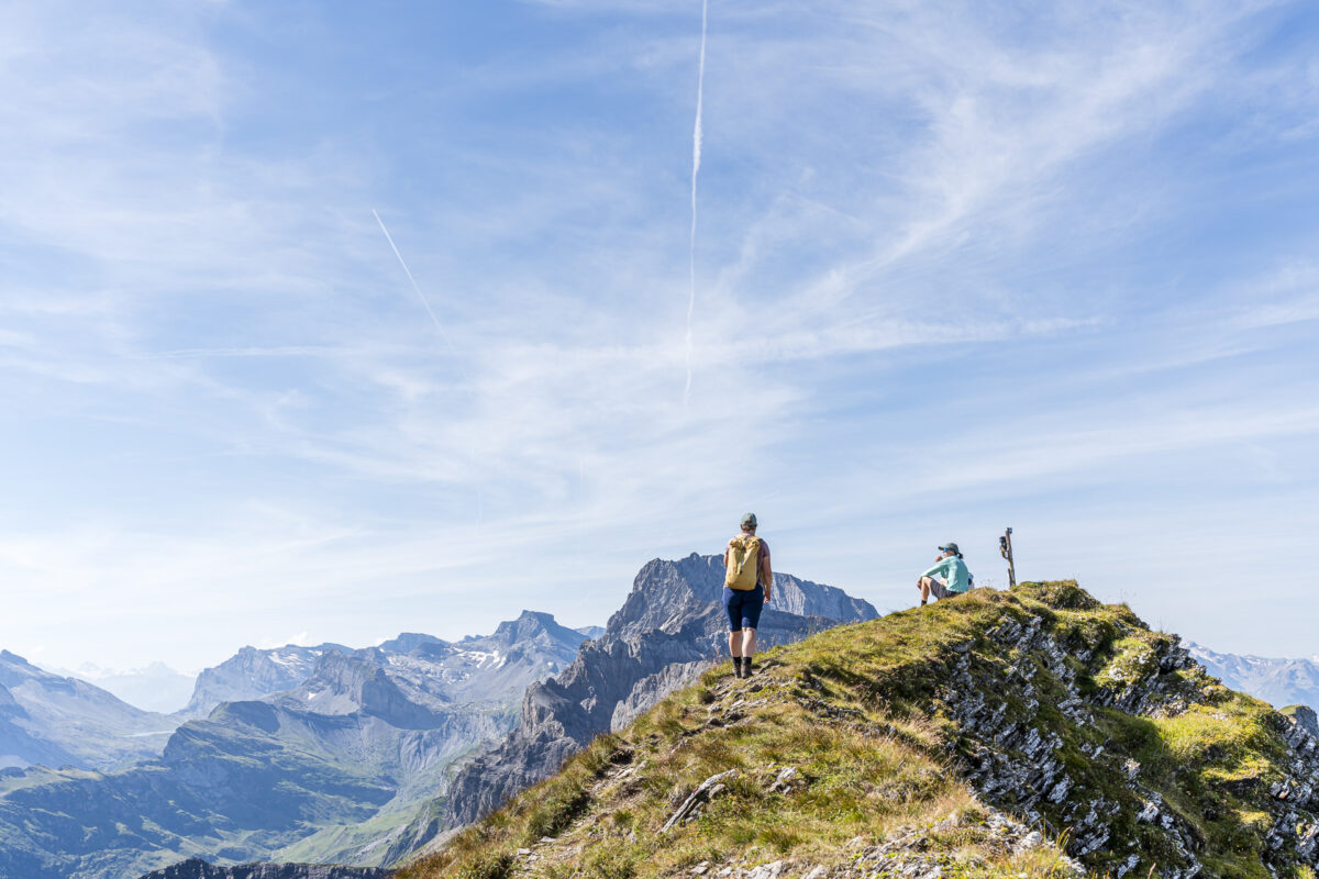
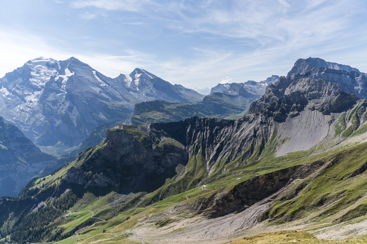
Magnificent panoramic view including Lake Oeschinensee and Blüemlisalp
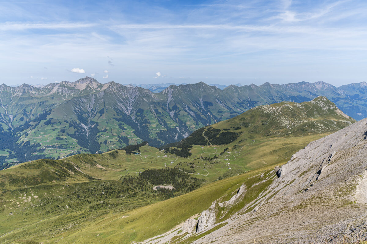
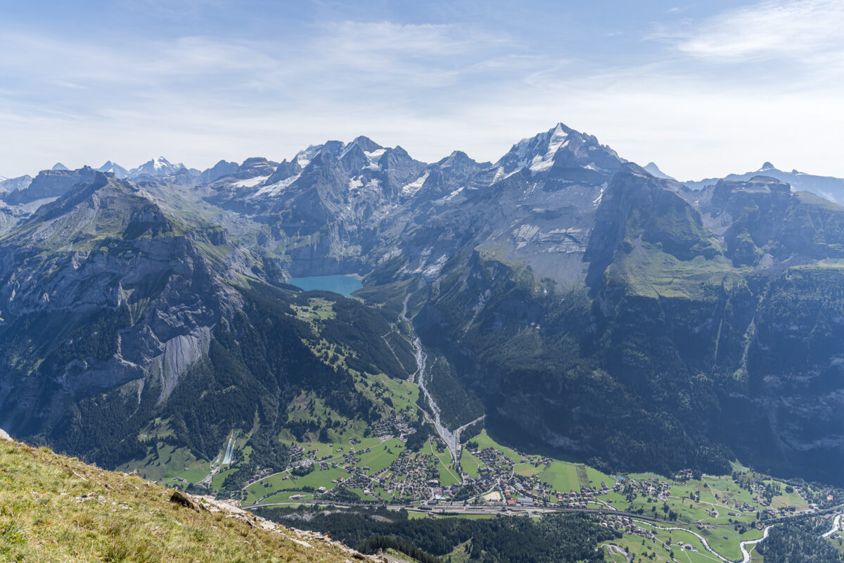
Here we sit in the grass and then let the gigantic panoramic view sink in for a while. From the summit cross, we have a good view of the ascent we just managed, as well as the opposite Lake Oeschinensee. In the distance, I can also see the Daubensee and the Gemmi Pass. And to the left of it the impressive pyramid of the Bietschhorn high above the Gasterntal. Instead of listing many other well-known peak names, I’ll just let the following pictures speak for themselves.
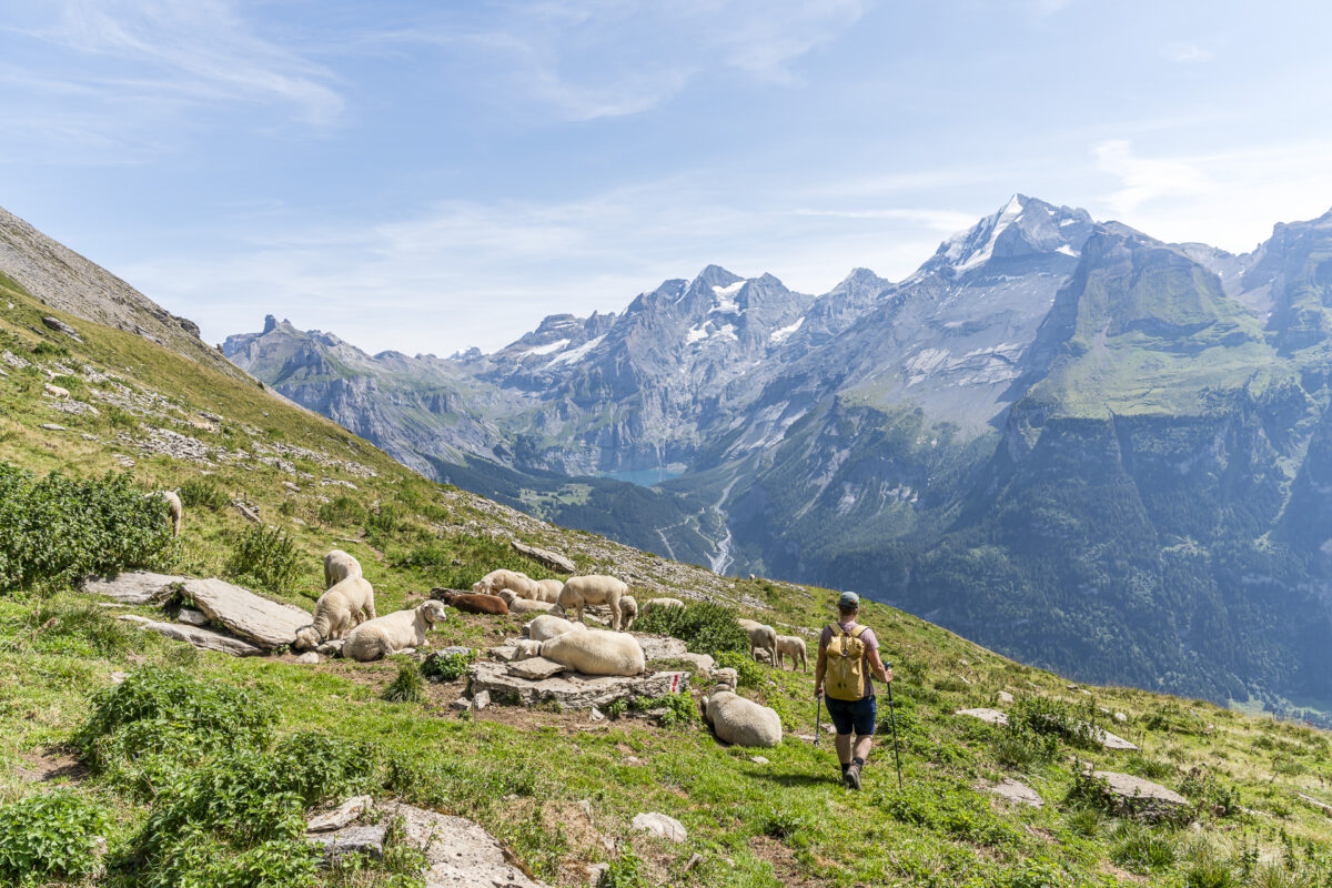
Zigzagging downhill to Allmenalp
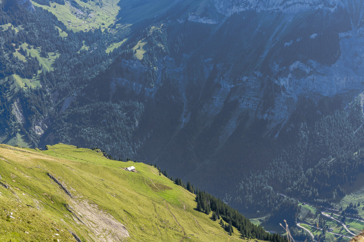
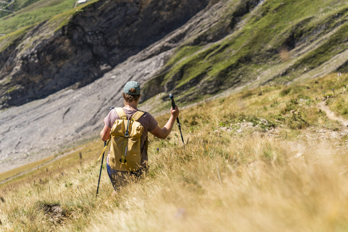
The mountain panorama also remains a faithful companion on the now following, approximately one and a half hour descent to Allmenalp. Knowing that a steep descent would follow the steep ascent, I had packed the poles. After just a few meters, I am glad about it. The first good 450 meters of altitude down to Steintal keep me busy with a few rather “slippery” sections with loose gravel. Definitely not my favorite terrain. Once the first thirty minutes of the descent are behind you, it gets more pleasant.
We follow the hiking trail over sheep pastures further to the alp “Obere Allme”. From there we are guided the last twenty minutes over a gravel road to the alp “Undere Allme”, where both the mountain station of the cable car Kandersteg-Allmenalp and the popular Allmen-Beizli are located. Stopping by the inviting sun terrace is, of course, something I cannot miss.
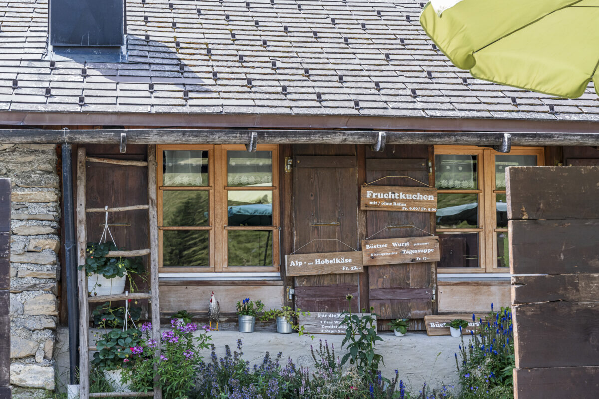
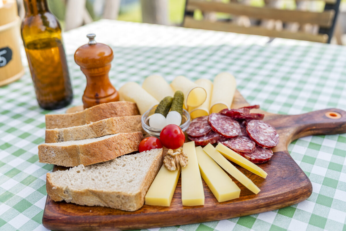

With a refreshing sip of non-alcoholic “Suure Moscht” (from a bottle cooled in the fountain), a platter with alpine cheese and sausage, and a piece of sweet apricot cake, we reflect on the mountain tour we just completed over First. Our conclusion: a crisp summit tour that definitely does not skimp on spectacular views of the surrounding mountain world and Lake Oeschinensee!
Key data of the hike Elsigenalp – First – Allmenalp
You can trace the route of our hike from Elsigenalp via First to Allmenalp using the following hiking map.
The trail is mostly marked white-red-white as a mountain hiking trail (T2/T3). The ascent up to Stand level runs over alpine meadows and is technically not difficult (T2). The subsequent section is partly quite exposed and requires surefootedness and a head for heights (T3). For the descent towards Allmenalp, I recommend packing poles.
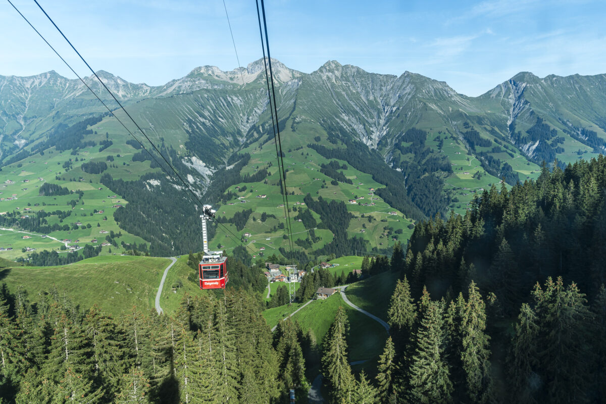
We ended our hike at Allmenalp and from there took the cable car (8-person cabin, runs every 15 minutes) down to Kandersteg. From the valley station of the cable car to Kandersteg station is a further 15 minutes on foot. Alternatively, you can also hike down to Kandersteg (Duration from Alp Obere Allme to Kandersteg station: approx. two hours).
| Starting point | Mountain station Elsigenalp (1’797 m above sea level) |
| Accessibility | Valley station mountain railway Elsigenalp accessible by call bus |
| Length | 8 kilometers |
| Altitude difference | ↗ 787 m ↘ 844 m |
| Duration | 3:45 h |
| Destination | Allmenalp (1’730 m above sea level) |
| Refreshment stop | Allmen-Beizli |
Practical tips for your hike from Elsigenalp to First
-
- The cable car to Elsigenalp operates in summer from the end of May to mid-October. Information on operating times and ticket prices can be found on the Elsigen-Metsch website. The hike from Elsigenalp via Fist to Allmenalp can be undertaken depending on snow conditions from about early/mid-July into the fall.
-
- The Allmenalp – Kandersteg cable car is also in daily operation from mid-May to mid-October. More information on operating times and ticket prices can be found here: LKA
-
- Note that the bus connection from Achseten Church to Achseten Elsigbach is a call bus. A telephone reservation is required. As a rule, however, you can also register with the bus personnel in Frutigen and point out that you would like to take the connecting bus (operating times according to SBB timetable).
-
- The mountain inn on the Allmenalp is in operation depending on weather conditions from June to September. Note that you can only pay with cash. Current information can be found here: Allmen-Beizli
-
- The hike over the First can also be undertaken in the opposite direction, but I found it more pleasant to manage the exposed sections between Stand and First uphill rather than downhill.
More hiking tips in the region
We have been able to profile several hiking routes around Elsigenalp in recent years. Here are some more tour tips:
-
- From Kandersteg over the Golitschenpass to Elsigenalp. From the Golitschenpass, you can also continue towards First.
-
- In the opposite direction over an equally scenic panoramic trail from Elsigenalp to Frutigen.
Leave a Reply