


Sardona World Heritage Trail: beautiful hike from Talalpsee to Aeugsten
A question I often ask is: How did you manage to build a well-known blog? My answer to this is always “consistency, personality and quality”. I’m currently struggling with consistency. Due to the fantastically exciting – but also time-consuming – book project, the time to research and prepare content for the blog has fallen by the wayside in the meantime. My goal is to continue to prepare at least one post per week for the blog. After all, there is enough to tell. For example, about the wonderful five days in Liguria that we have just completed. Or from the coming weekend in Champéry, where we have to fight our way through the capricious weather of the cold front. But first, I have a hiking tip in the pipeline in Glarus.
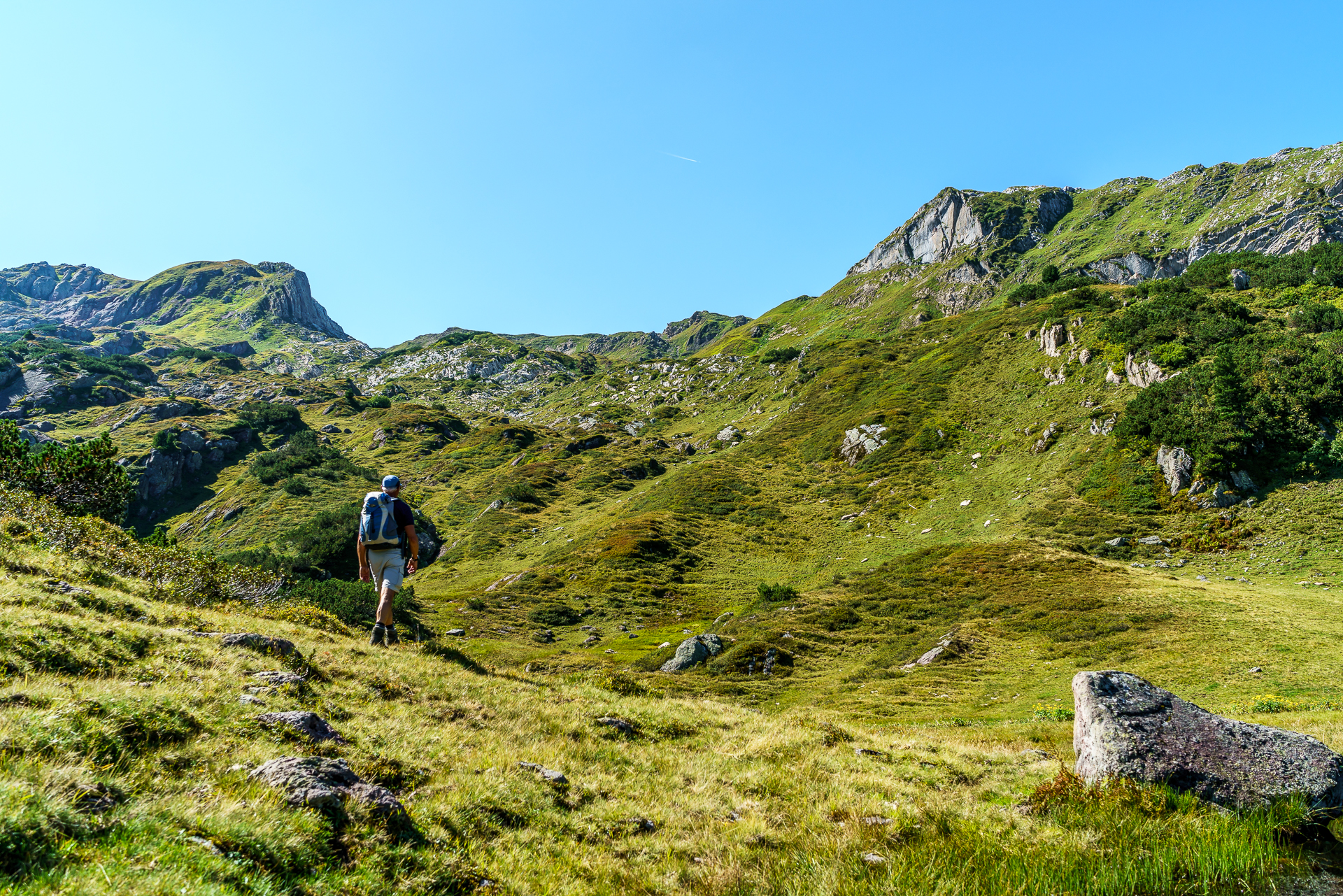
For the time being, I use the last beautiful hot summer day to tackle a hike from Habergschwänd near Filzbach to Bärenboden near Ennenda together with my father. In the first section, the hike follows the Sardona World Heritage Trail, which leads in a total of six stages and 84 kilometres through the core area of the Sardona Geopark. The Geopark with the Glarus main thrust has been a UNESCO World Heritage Site since 2008 and is a magnificent hiking area.
From Filzbach to the beautiful Talalpsee
We start leisurely and overcome the first meters of altitude with the chairlift from Filzbach to Habergschwänd. On foot, the ascent would take about 1.5 hours. At the top we fortify ourselves with coffee, cake and a hot Ovi, lace up our shoes tightly and start shaggy off. The first highlight follows after thirty minutes of hiking. We reach the idyllically situated Talalpsee, in which the surrounding peaks are reflected. What a beautiful landscape!


Along the Sardona World Heritage Trail to the Mürtschenfurggel
We follow the path steadily uphill and watch the sun slowly fight its way through the rugged rocks. Shortly after the Spaneggsee, we are also standing in the blazing sunlight.


Via Rotärd back to Glarus
At the Mürtschenfurggel we leave the Sardona World Heritage Trail, which leads to the Murg lakes on its first stage. We turn southwest and hike uphill through the wild Ober Chüetal towards Rotärd. We soon see the reddish-brown stone formations, which probably gave the place its name. In the meantime, we are looking for the hiking trail for this. This is not always immediately visible and we almost caught the wrong “track” in the direction of Fronalppass/Mollis. For refreshment, we puff on blueberries, which tempt us to stop along the way. In the Ober Chüetal and at Alp Begligen, the perennials are still full of juicy sweet berries.


After about three hours, we reach the highest point of the hike at Rotärd and treat ourselves to a short break with a wonderful view over the Linth valley. Then the trail continues steeply downhill, past Alp Begligen in the direction of Äugsten and Bärenboden. The last section of the hike runs along the Holzflueh circular trail. Before we go back down to the valley, we stop at the Äugstenhütte for cake and suure moscht.


Practical information and tips for hiking Filzbach – Talalpsee – Rotärd – Bärenboden
The route can be found on the map below. Our hike runs for the most part on the first stage of the Sardona World Heritage Trail from Filzbach to the Murg lakes as well as on the UNESCO Geo-Phenomena Trail. But then we turned off at the Mürtschenfurggel in the direction of Bärenboden/Ennenda. The distance from the Habergschwänd mountain station to the Bärenboden, where the Aeugstenbahn runs, is around 12.5 kilometres. There is an ascent of almost 1,200 meters in altitude and a descent of 900 meters in altitude to master. The hiking time is about 5.5 hours. If you have enough “Pfus” to spare, you can integrate a detour to the Schilt into the hike at Rotärd (plus an hour of hiking time).
The starting point, the Kerenzerbergbahn in Filzbach, can be reached by bus from Näfels-Mollis. The chairlift runs continuously from July to October from 9:00 a.m. to 4:30 p.m. (weekdays). From Bärenboden, take the Aeugstenbahn down to Enneda. The train runs every half hour and during the week an explicit telephone pre-registration is requested (more information here).
Further information and route details on the six stages of the Sardona World Heritage Trail from Filzbach to Flims can be found on wanderland.ch.
Leave a Reply