

Hiking Weekend in Valle di Muggio: Scenic Loop Hike from Scudellate
A detour to Valle di Muggio had been on my wish list for a long time. Last autumn, we took advantage of a sunny weekend to discover Ticino’s southernmost valley on two varied hikes. Since the journey from German-speaking Switzerland takes a bit of time, we stayed for two nights in the little village of Scudellate at the foot of Monte Generoso – the ideal base for a hiking weekend in Valle di Muggio.
Especially now in March, when the last patches of snow still linger elsewhere, Valle di Muggio often already shows its spring-like side. Mild temperatures, the first blossoms, and scenic trails make the valley the perfect destination for a spring hike.
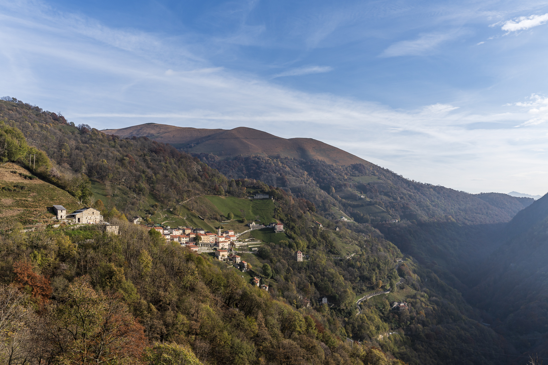
Base camp in Valle di Muggio at the foot of Monte Generoso
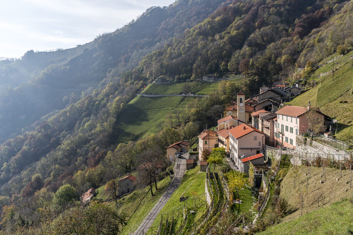
Similar to the village of Corippo in the Verzasca Valley, a so-called «Albergo Diffuso» has also been created in Scudellate. In this small former smuggler village, perched like an eagle’s nest on a steep slope above Valle di Muggio, a tourism project was developed in which the accommodations are spread across various existing buildings in the village.
The range extends from the simple hostel with shared rooms at Ostello di Scudellate to three cozy rooms at the tradition-rich Osteria Manciana and a modern renovated mountain hut. This decentralized concept strengthens local value creation in the valley and helps preserve village life in the long term.
We stayed in one of the three lovingly furnished rooms at Osteria Manciana. The panoramic double room «Zia Fulvia» lives up to its name in every way – the view out over the green hilly landscape of Valle di Muggio is simply dreamy.
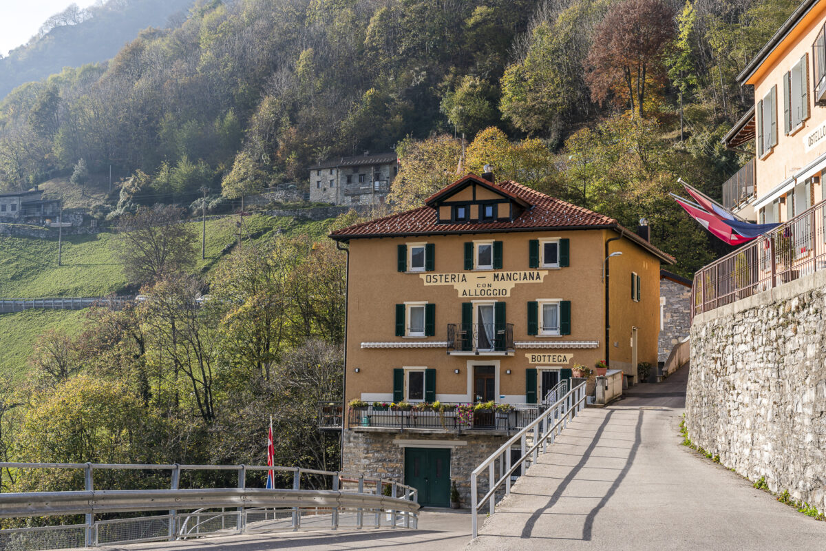

Room rates from CHF 170/night. More information: stay generous
Loop hike on Monte Generoso
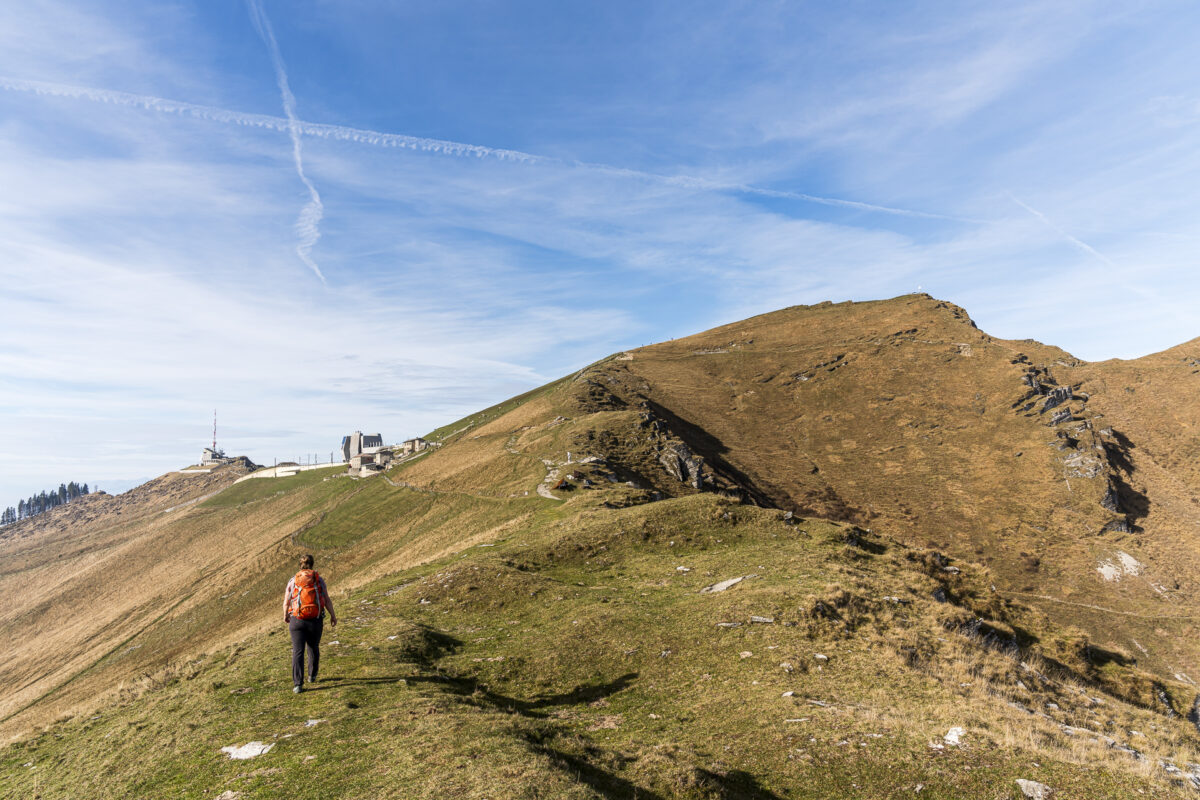
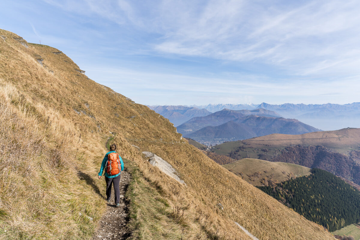
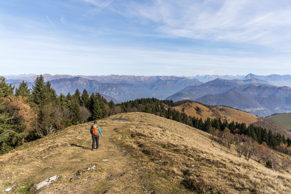
The hiking options in Valle di Muggio are diverse. Thanks to good public transport connections, the routes can be combined flexibly and also planned as point-to-point hikes. For our first day, however, we chose a loop hike starting right in the middle of Scudellate. We followed the Sentiero Lago di Lugano toward the summit of Monte Generoso, then crossed to the Italian side and returned to Scudellate along former smuggler trails.
The first four kilometers of this tour require a bit of stamina. You gain elevation quickly, and the roughly 700 meters of ascent to the summit are definitely noticeable. Still, the increasingly impressive panorama with every step provides the best excuse to stop for a quick breather again and again.
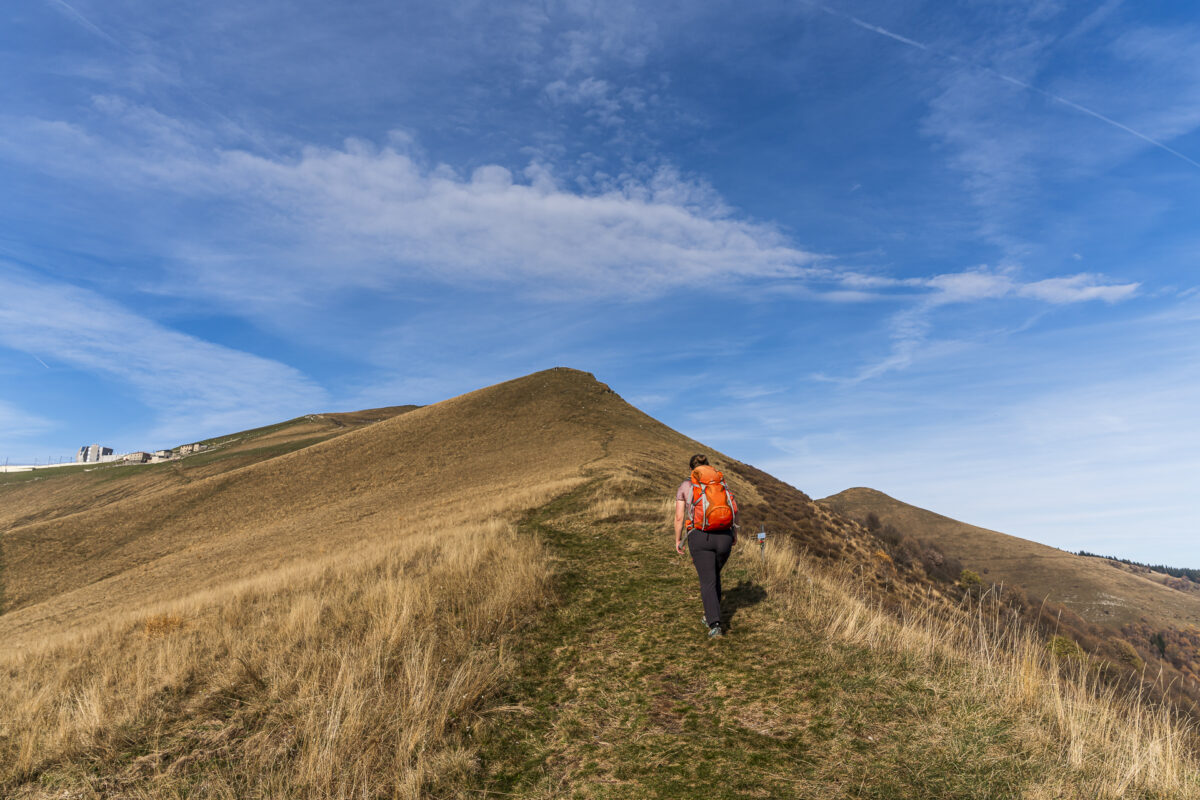
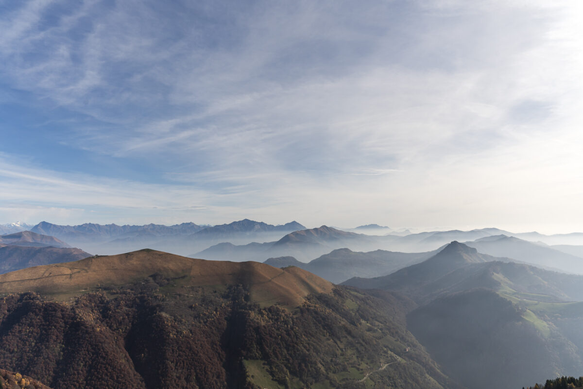
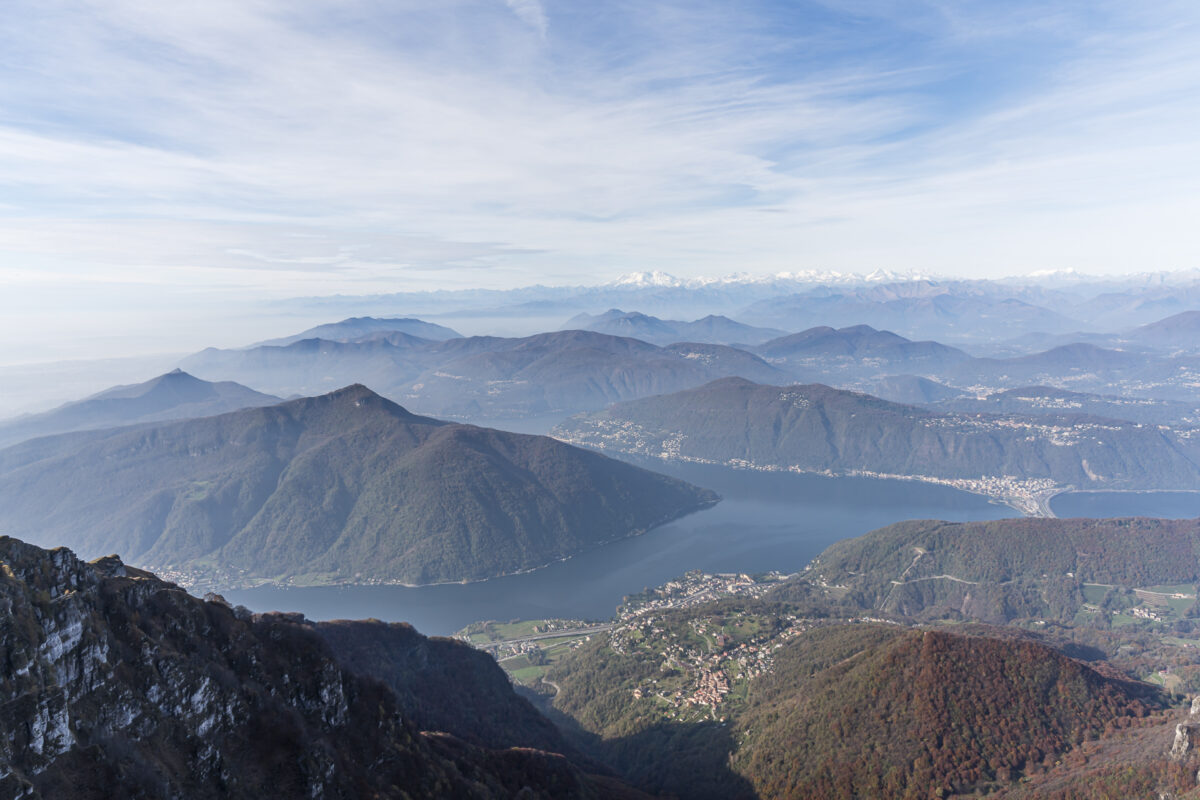
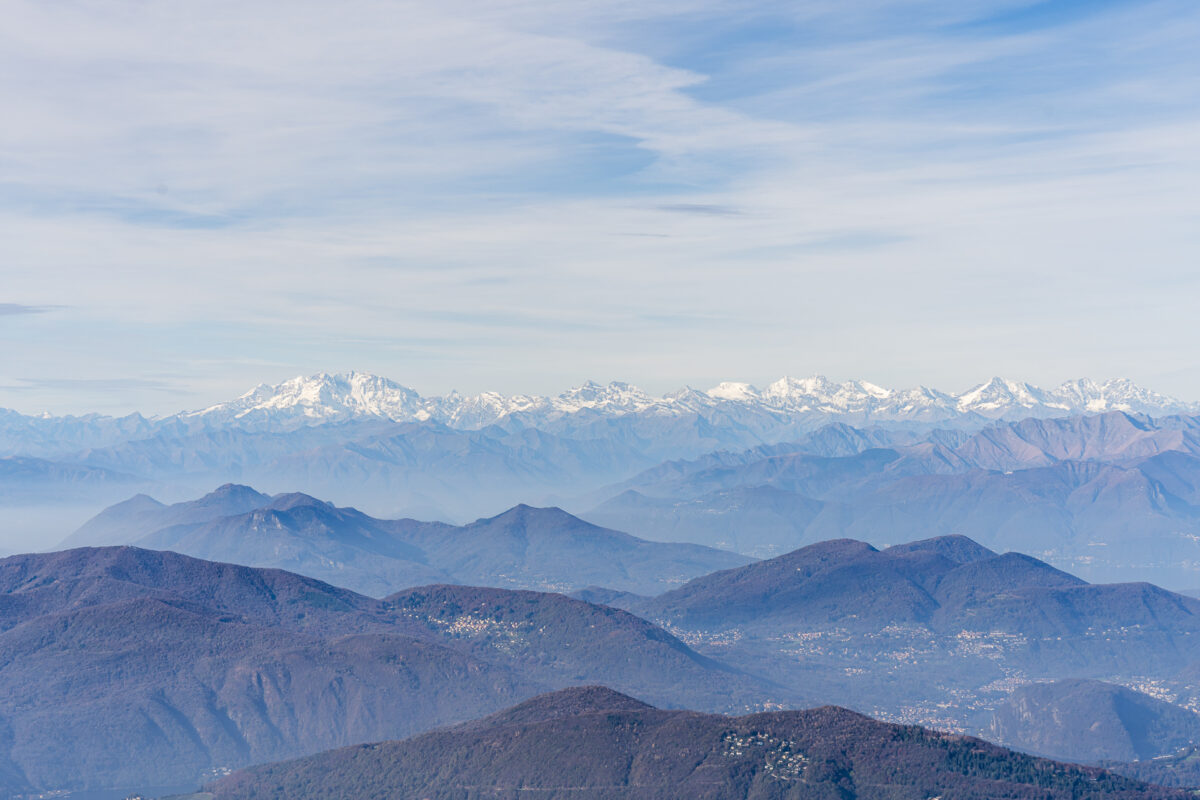
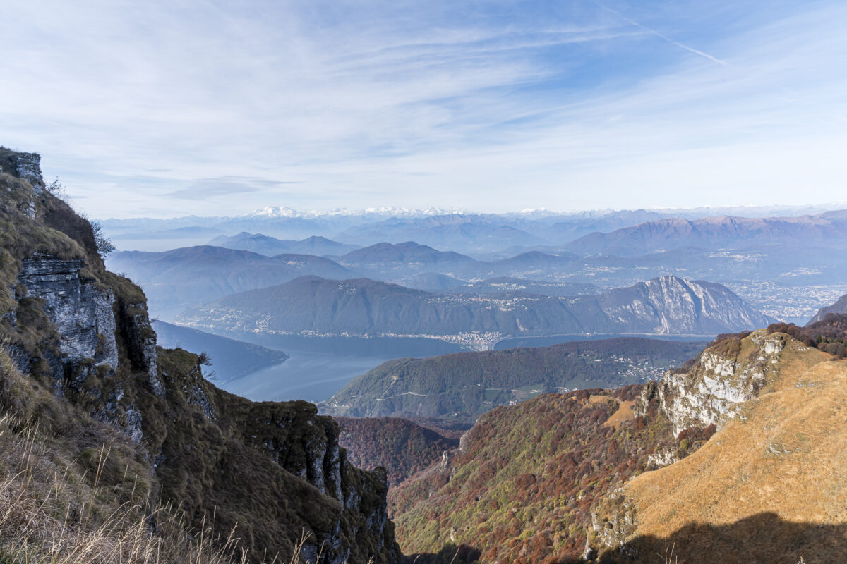
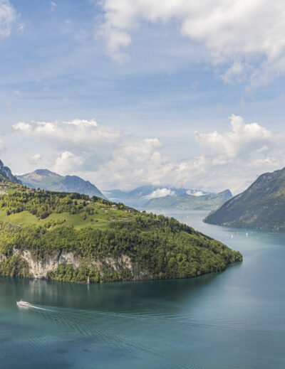
You definitely should not miss the short detour to the viewpoint near the summit of Monte Generoso. The 360-degree view is one of the most impressive in Switzerland and stretches far beyond Ticino’s rolling hills and mountain landscape all the way to the Alps and the Apennines.
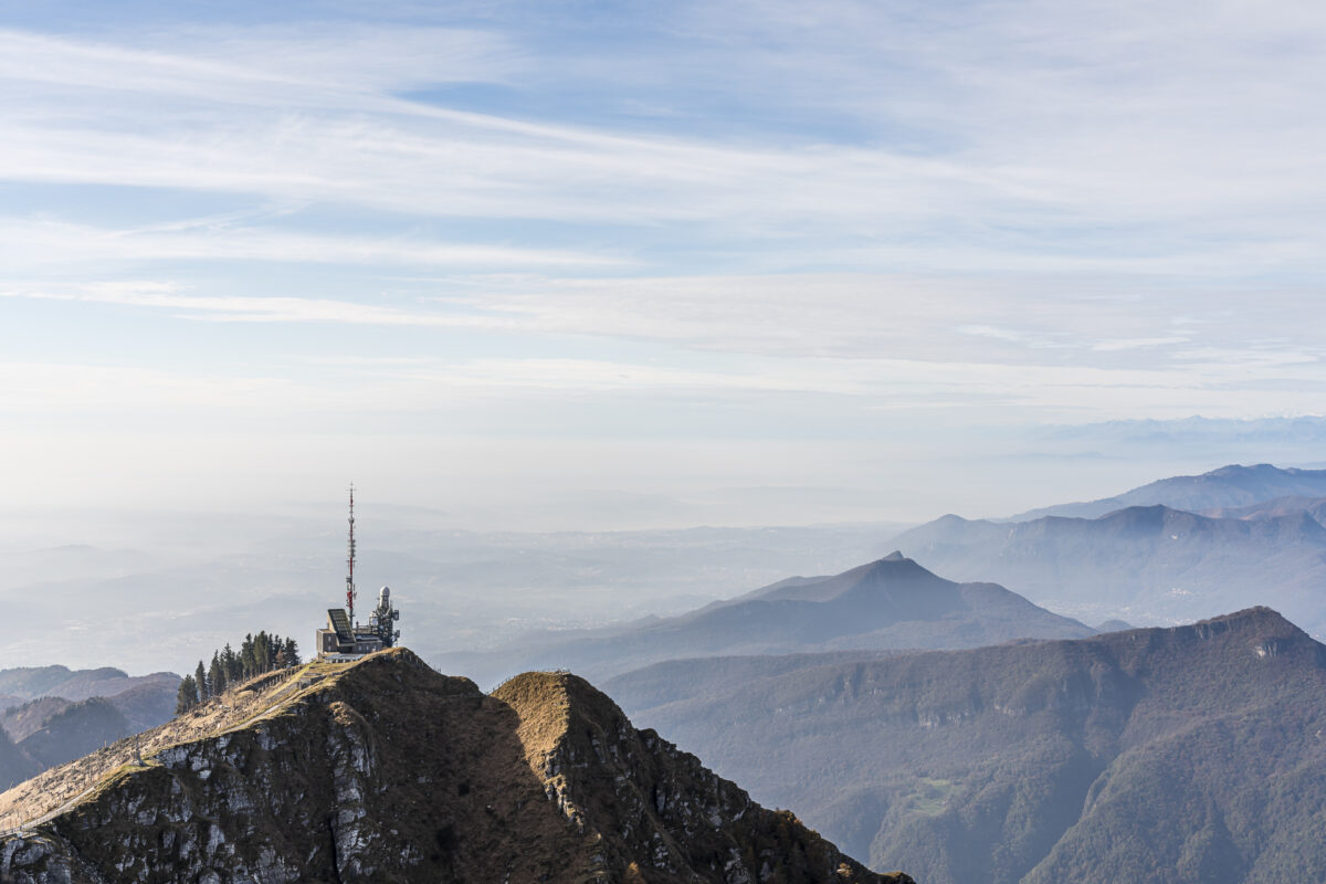
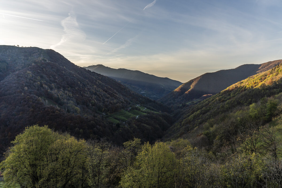
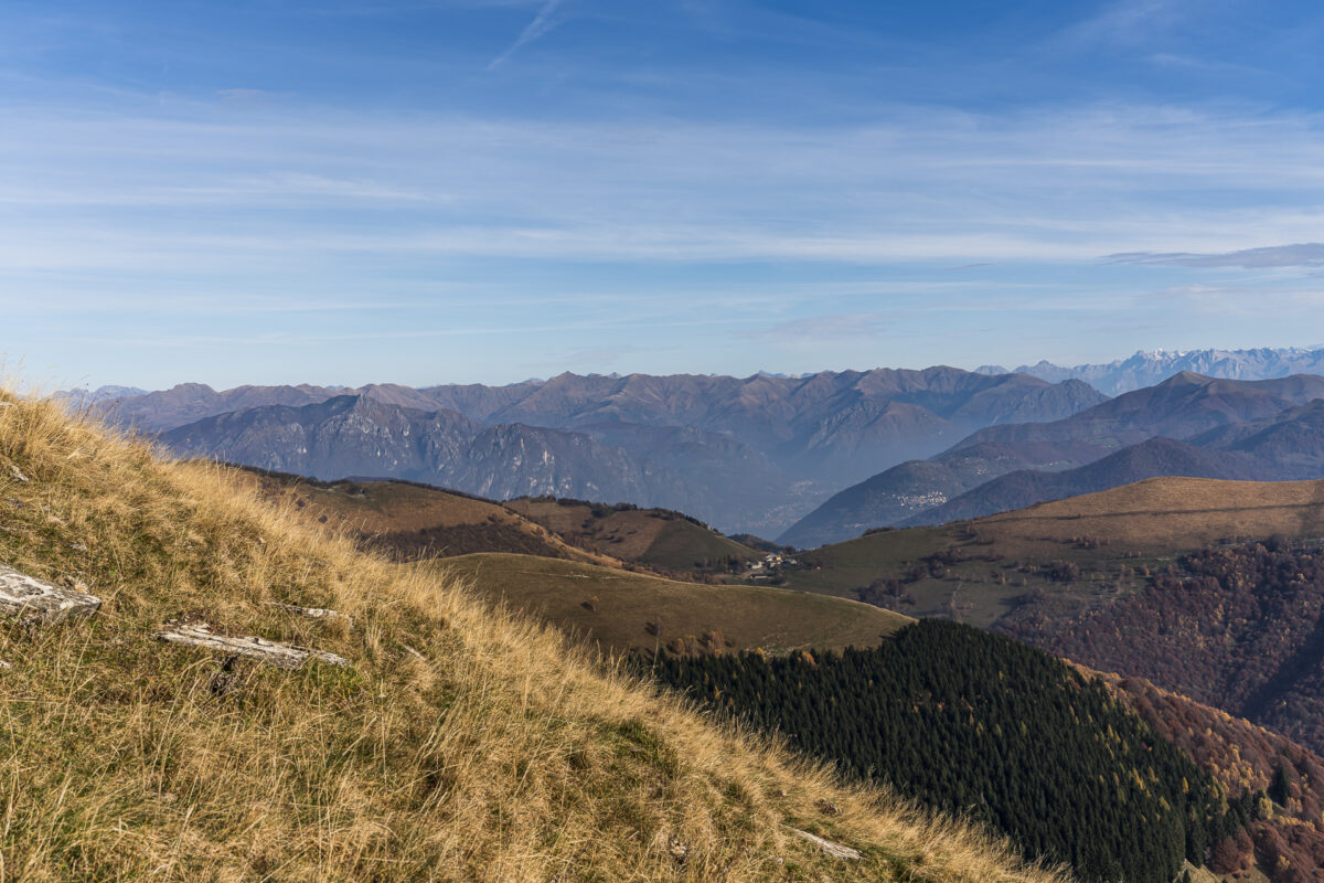
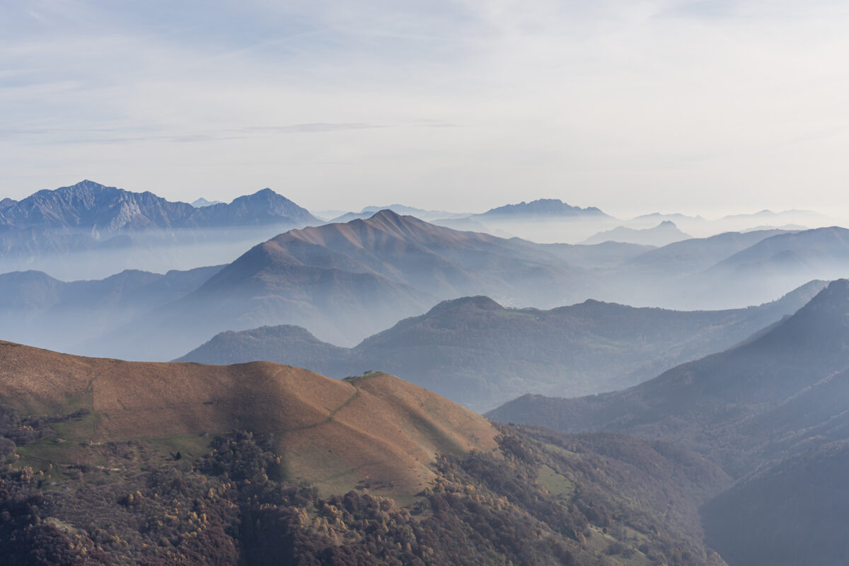
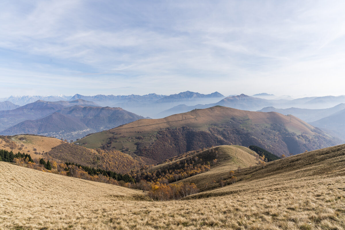
Scenic ridge trails high above Lake Lugano
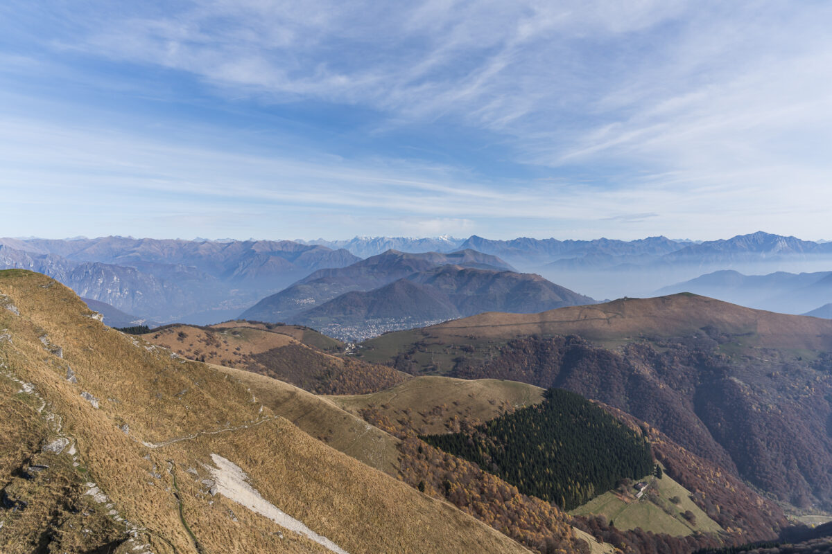
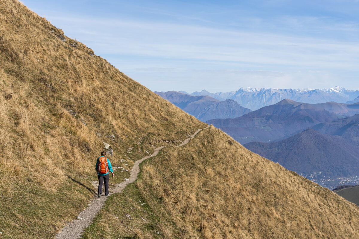
After the short but absolutely worthwhile extra loop to the summit, we follow scenic ridge trails on the Italian side toward Alpe di Orimento. This section is pure hiking pleasure and scores with magnificent long-distance views in every direction.
Once the toughest part of the loop hike is behind us, the panorama can now be enjoyed at a relaxed pace. With gentle ups and downs, mostly slightly downhill, we hike toward the next stage destination and soak up the vast landscape to the fullest.
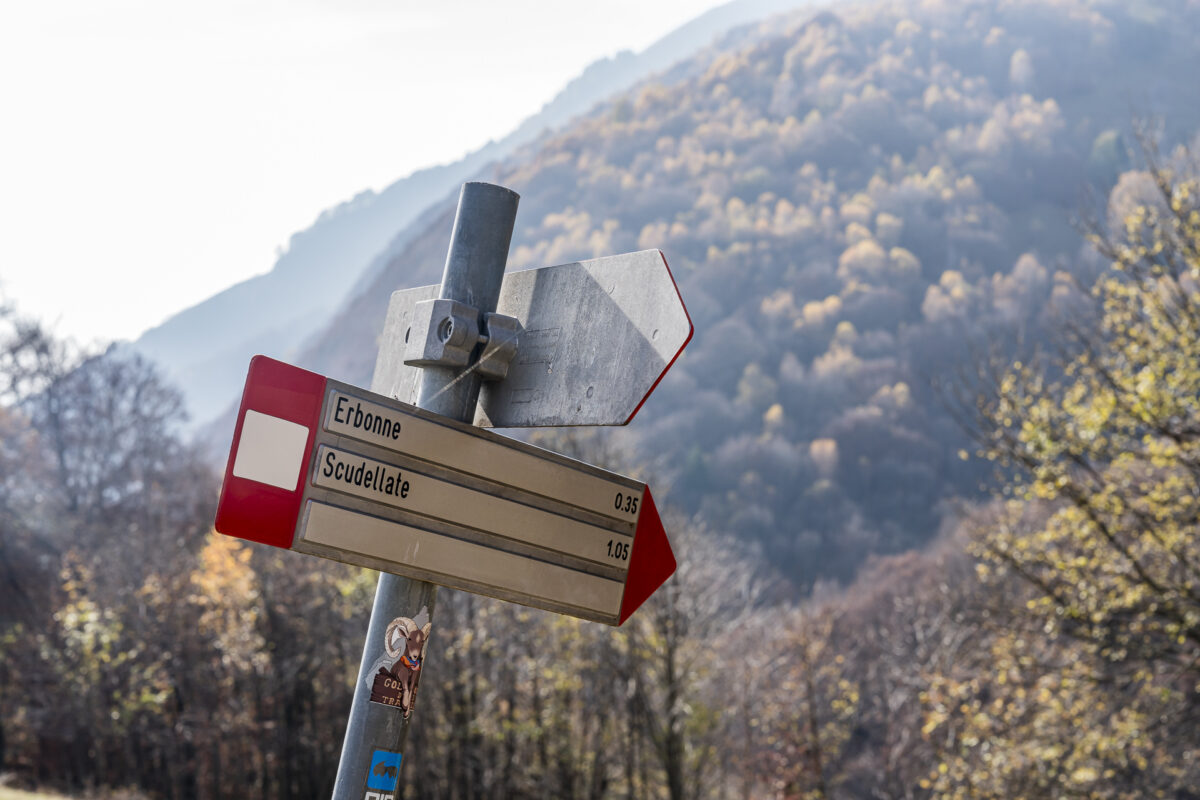
Back to Scudellate on old smuggler trails
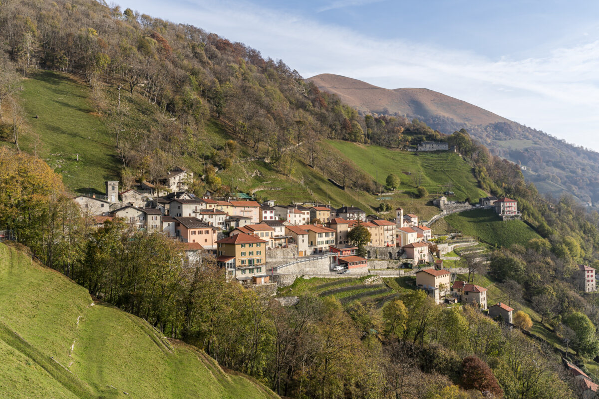
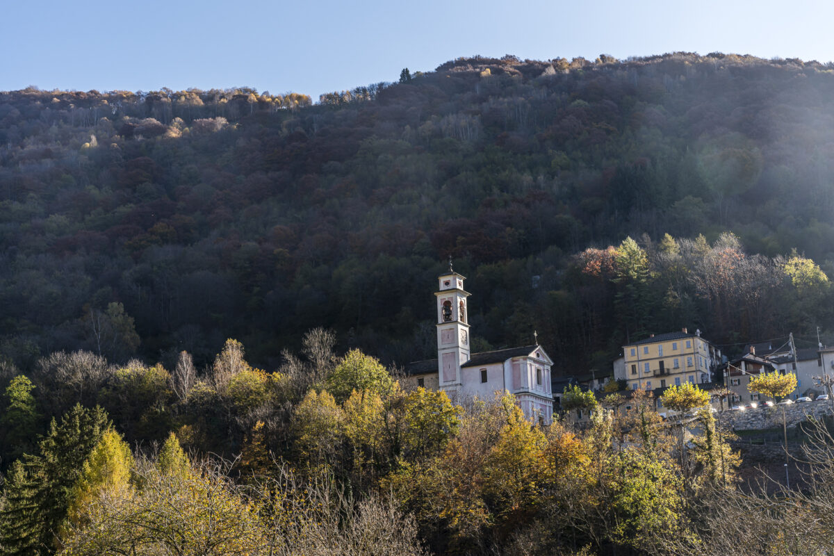
This next stage destination is the small mountain village of Orimento. There are simple inns here as well, though they were closed during our visit in the first half of November, presumably for seasonal reasons.
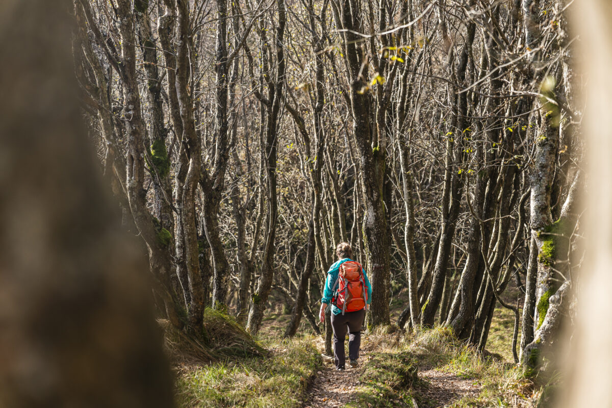
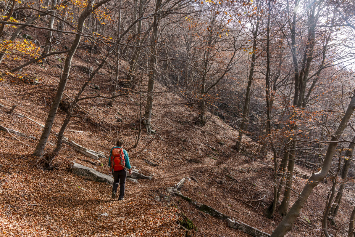
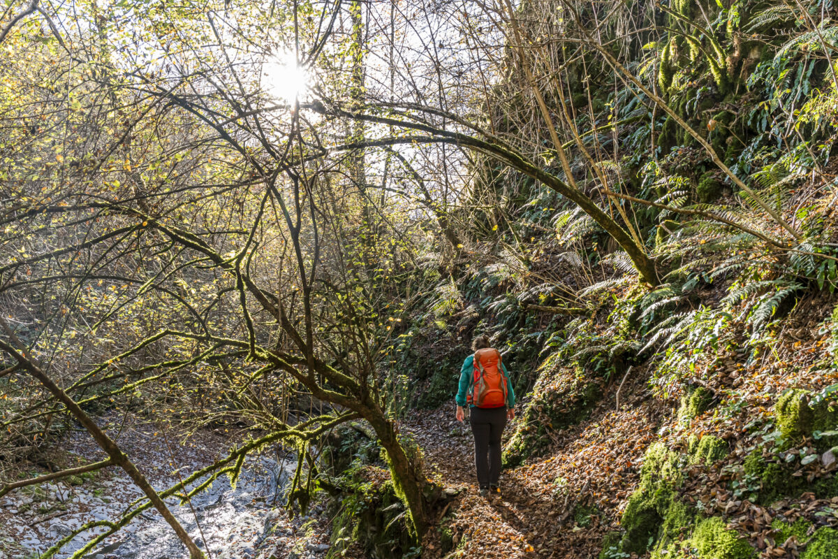
After scenic paths across alpine pastures dominated the first two-thirds of the loop hike, the scene now changes noticeably. From Orimento, the hiking trail descends through the forested Valle Breggia toward Erbonne. Here, in the farthest corner of Valle di Muggio, not far from the Swiss border, we feel for a moment far removed from civilization and enjoy the soothing silence of the forest.
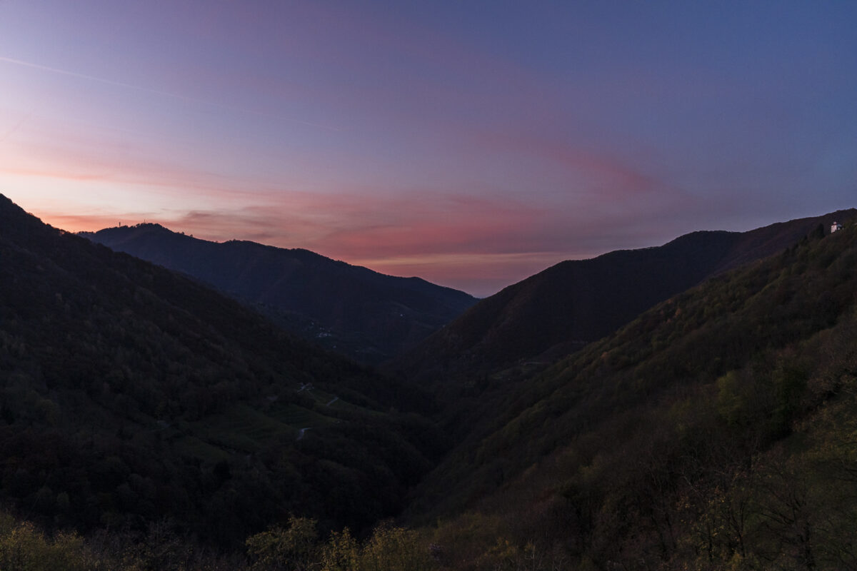
After around four and a half hours of walking, Scudellate finally comes back into view – perfectly timed for a delicious lunch at Osteria Manciana. We spend the rest of the afternoon relaxing with a book, letting the impressions of the tour sink in, and enjoying the late-autumn sun above the valley until the atmospheric sunset.
Key facts for the loop hike from Scudellate in Valle di Muggio
The hiking map below shows the route of the loop hike from Scudellate via Monte Generoso to the Italian side, to Alpe d’Orimento and Erbonne, before returning to Scudellate.
The first kilometer follows a paved little road to the small settlement of Roncapiano. If you like, you can also comfortably cover this section by bus. After that, follow the signposted Sentiero Lago di Lugano, route number 52, toward Monte Generoso.
From here, the tour continues entirely on a white-red-white marked mountain hiking trail rated T2. On the Italian side, the trails are also marked white and red. There, follow the signs toward Orimento and Erbonne.
| Starting point | Scudellate, Paese bus stop (907 m above sea level) |
| Accessibility | reachable by public transport |
| Length | 12.3 kilometers |
| Elevation gain/loss | ↗ 935 m ↘ 930 m |
| Duration | 4:45 h |
| Destination | Scudellate, Paese bus stop (907 m above sea level) |
| Refreshment stop | Osteria del Valico in Erbonne (phone reservation recommended: +390313311013) |
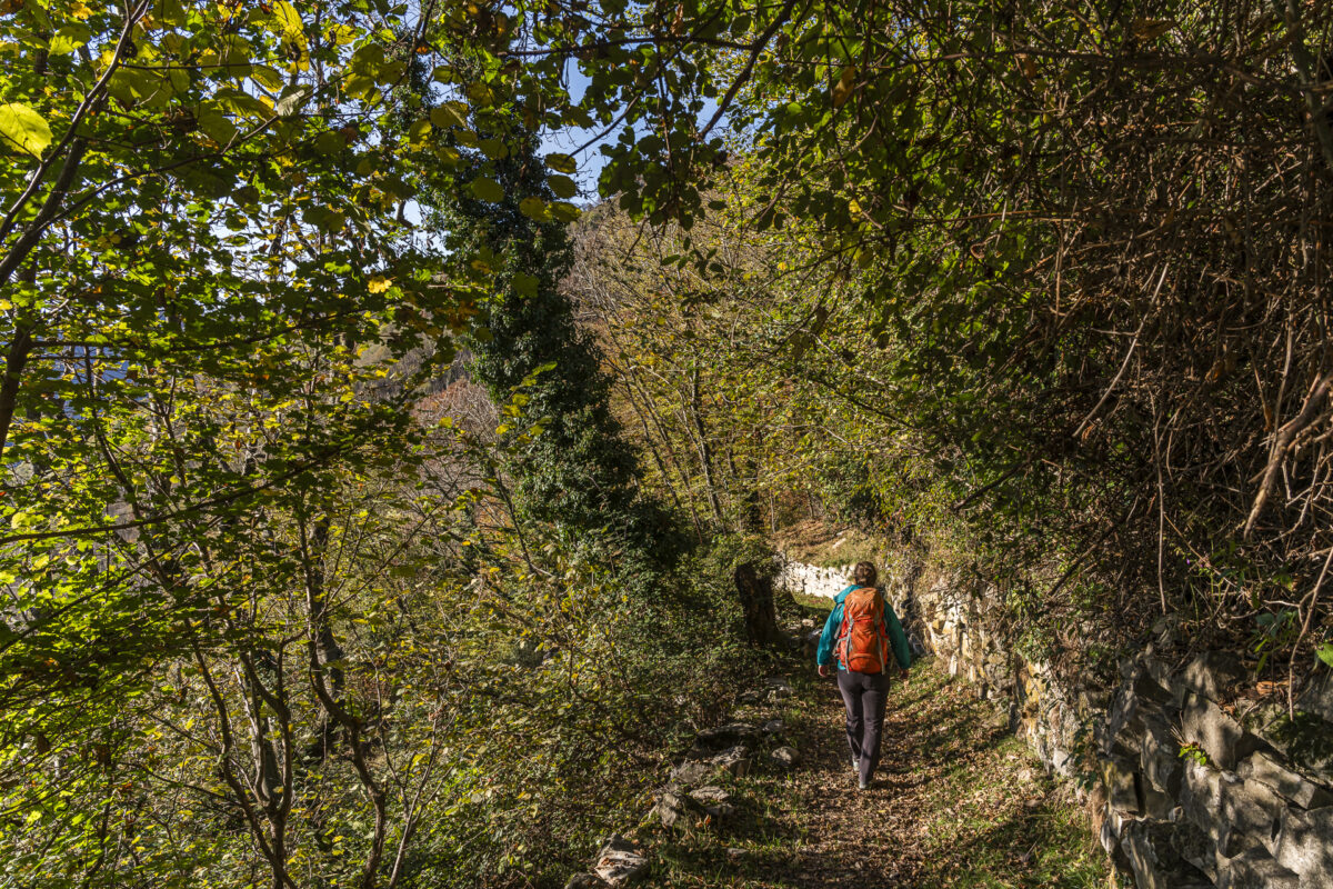
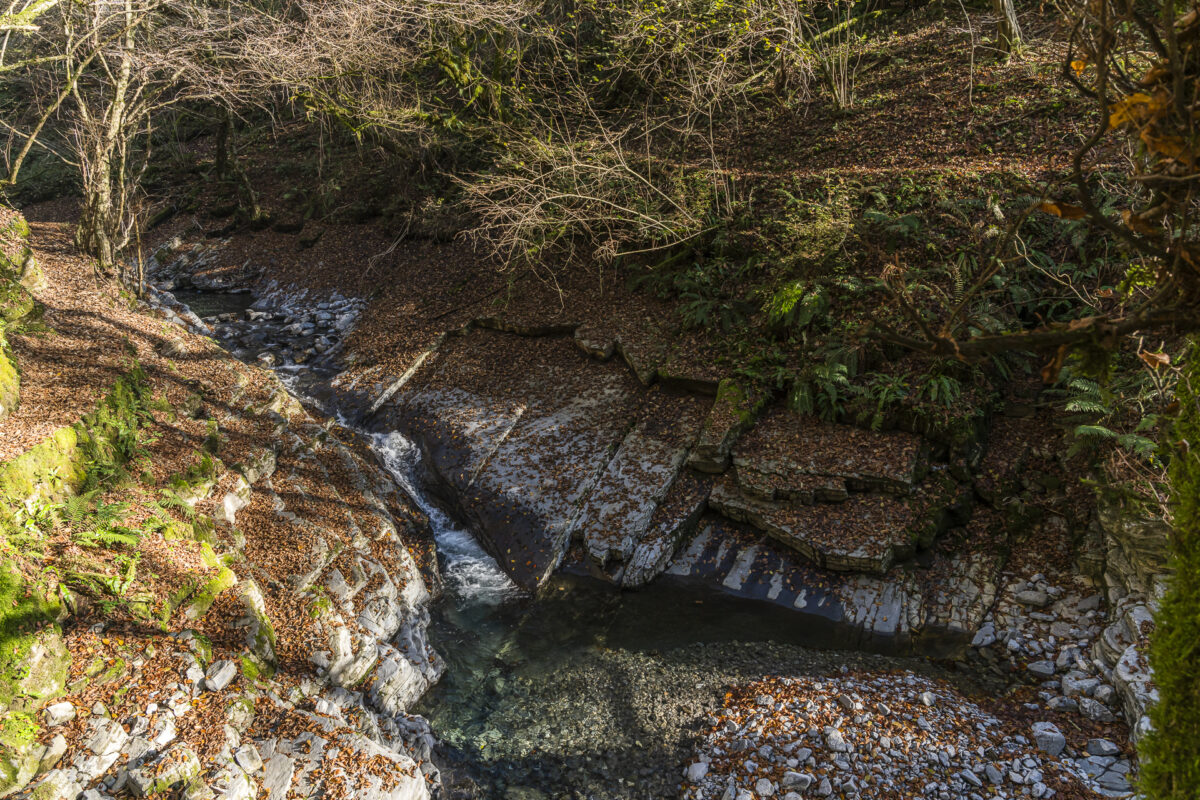
From Scudellate downhill to Muggio
Originally, we had planned to follow the valley trail through Valle di Muggio from Scudellate for around twelve kilometers downhill on the second day to the well-known Breggia Gorge Park (Parco delle Gole della Breggia). Switzerland’s first geopark can be explored on two different routes and offers exciting insights into the region’s geological history.
However, since a change in the weather was forecast, we postponed this plan for another time and chose a shorter stage to Muggio instead. On this section too, the softly babbling Breggia accompanies us downhill. Unlike the more heavily frequented trail through the geopark, you usually experience the impressive gorge landscape here in soothing peace and almost entirely to yourself.
Key facts for the Scudellate – Muggio hike
The hiking map below shows the route of the hike from Scudellate to Muggio. The trail first follows a historic mule track downhill through the forest to Molino, where it meets the Sentiero Lago di Lugano.
The first hundred meters are fairly steep downhill. Hiking poles are helpful here, especially on wet ground. After that, the trail becomes much more moderate and pleasant to walk. In autumn, when a lot of leaves cover the ground, a bit of extra attention is needed, as roots and uneven spots may be hidden.
The route is continuously marked as a white-red-white mountain hiking trail (difficulty T2). There are no exposed sections.
| Starting point | Scudellate, Paese bus stop (907 m above sea level) |
| Accessibility | reachable by public transport |
| Length | 3.2 kilometers |
| Elevation gain/loss | ↗ 82 m ↘ 345 m |
| Duration | 1:00 h |
| Destination | Muggio, Paese bus stop (650 m above sea level) |
| Refreshment stop | Ristorante Stella in Muggio |
Practical tips for your hiking weekend in Valle di Muggio
- Best time of year: The summit of Monte Generoso is located at 1,700 m above sea level. There is currently still snow there. The loop hike is usually doable from early April to mid-/late November. Still, check the snow conditions in advance. The valley trail through Valle di Muggio is generally doable year-round and is only very rarely snow-covered.
- Getting there by public transport: Zurich – Scudellate, Paese via Lugano and Mendrisiotto, travel time approx. 3.5 hours. In Valle di Muggio, PostBus connections run about every two hours. It is advisable to look up suitable connections in advance.
- Accommodation: The rooms at Osteria Manciana can be booked from early March to mid-/late November.

Leave a Reply