

Hirzli – Planggenstock: fantastic ridge walk above the sea of fog
“On Sunday, the high fog line will rise to over 1,400 metres above sea level,” said the weather forecast ahead of the last weekend in November. After a week under the thick Zurich fog soup, I felt a great desire for a few hours in the sunshine. At the same time, we wanted to keep our excursion radius as small as possible. The plan: a Sunday morning excursion with a maximum travel time of one hour. Not an easy task with such a high upper limit of high fog – until we discovered the Hirzli near Niederurnen.
An attractive circular hike leads to the 1,639-metre-high summit on the edge of the Linth plain and rewards sun-seekers with an impressive view over the autumnal sea of fog.
Ausflugstipp Niederurnertäli
The Niederurnertäli branches off so discreetly behind Niederurnen (Glarus Nord) that you can almost overlook it. The plateau between Hirzli and Planggenstock on the sunny north side of the valley and the imposing, shady rock faces from the Chöpfenberg to the Wageten on the south side are accessible all year round (with the exception of the revision windows) with the Niederurnen – Morgenholz cable car. Alternatively, you can also hike up from Niederurnen or cycle up a road by bike.
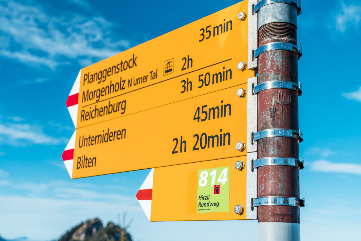
In addition to the Hirzli circular trail, there are other signposted hiking trails in Niederurnertäli. If the ascent to the Hirzli is too strenuous for you, you can follow the sculpture trail, for example. With a hiking time of around 1.5 to 2 hours, it is also suitable for families with children. At the valley station of the Niederurnen-Morgenholz cable car, you will receive a free brochure showing the route options.
Steep uphill: from Morgenholz to Hirzli
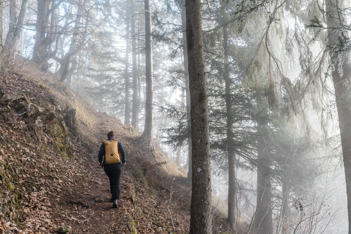
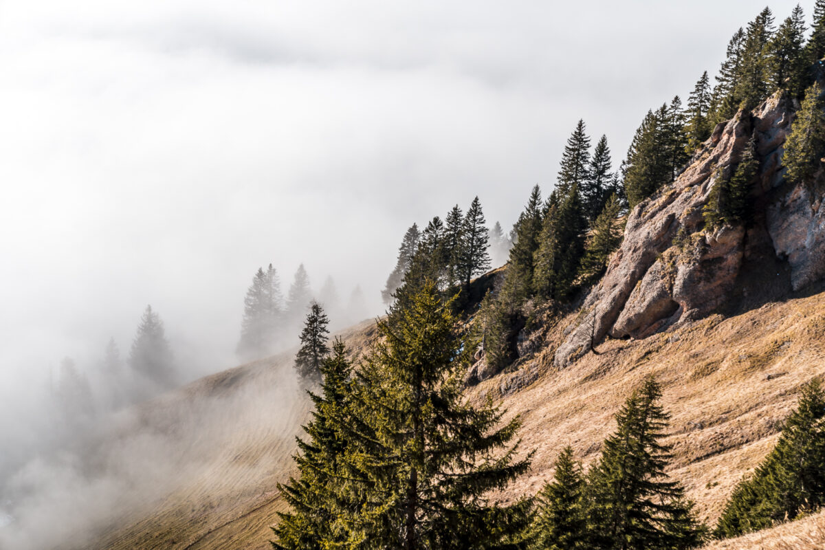
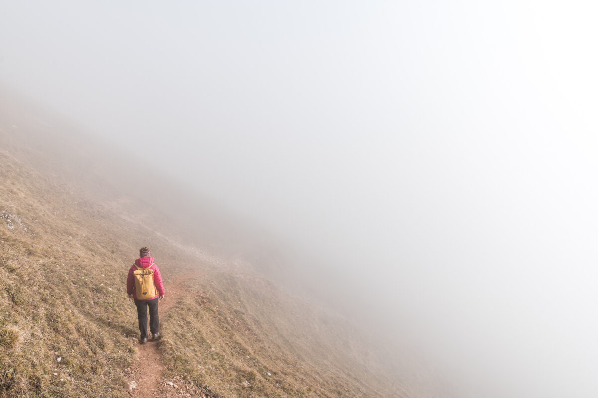
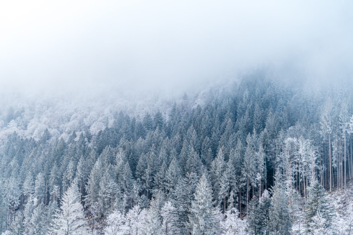
Just in time for the start of operations at 09:00 a.m., we are ready down at the valley station of the Niederurnen-Morgenholz cable car. The cable car cabin can accommodate 8 people. As expected, the rush is limited this morning – and so we only share the first gondola with three other people. Everything around is grey in grey – as announced, the thick high fog has crept into Glarus today. This does not change at the mountain station of the cable car at 982 metres above sea level. While on many days of high fog you are greeted with sunshine from here, today more muscle power is required. But we were aware of this and accordingly we follow the signpost purposefully towards Hirzli.
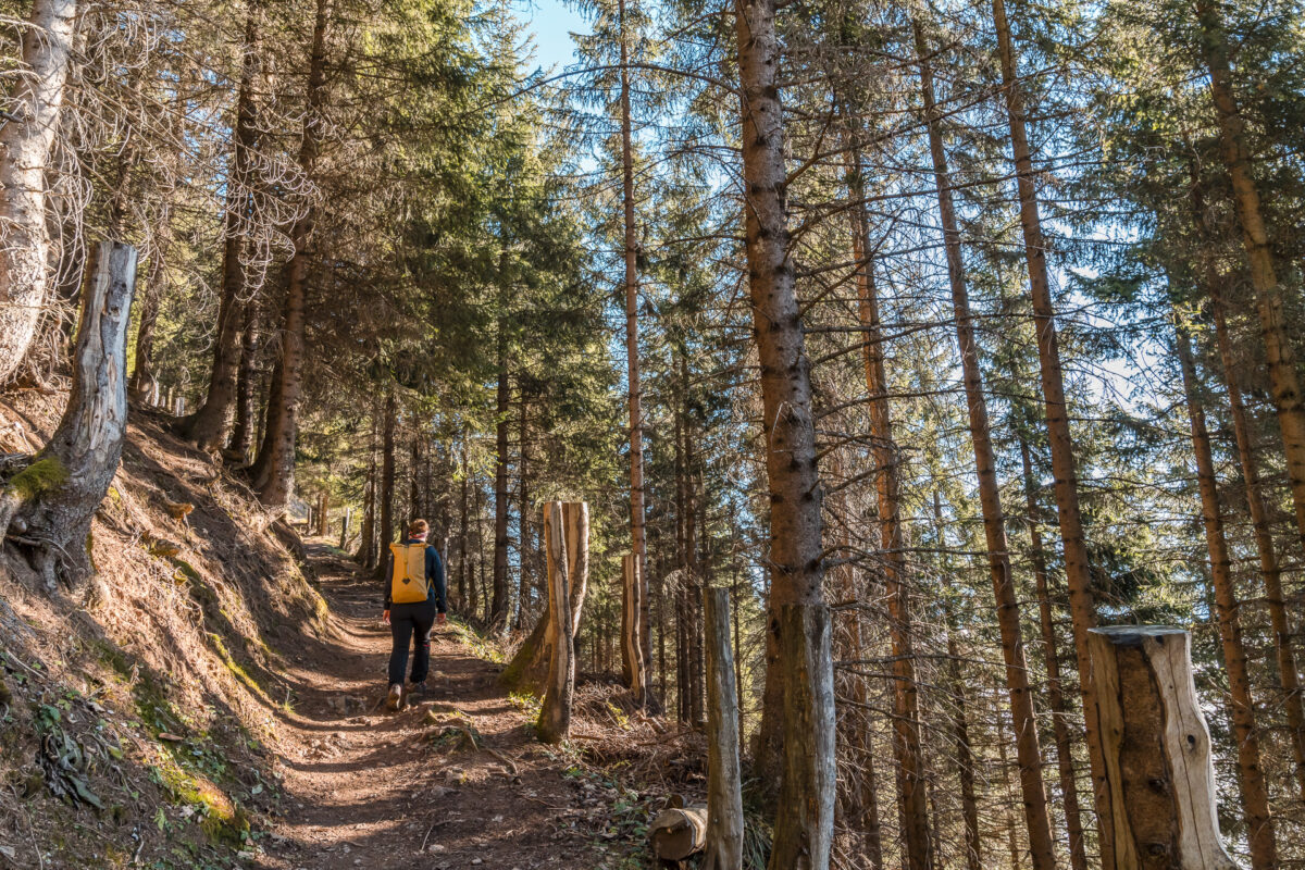
The ascent has it all. The first section of the sculpture trail is very steep despite the zigzag course. A great fitness training. We are on the move quickly and reach the rest area (with fire pit) at “Schwinfärch” after just under 20 minutes. Again, no sign of sun. It is not until a good 100 metres later that we slowly approach the high fog line and at the forester’s lodge at 1,445 metres above sea level we can finally enjoy the first warm rays of sunshine. Splendid!
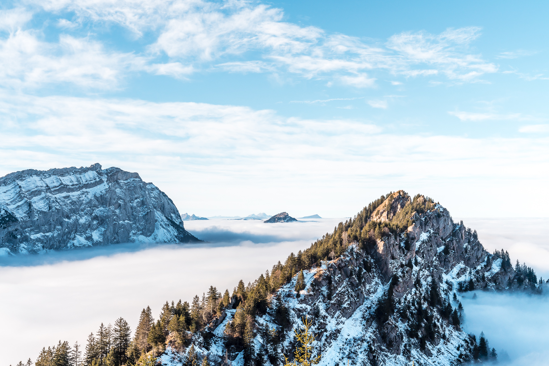
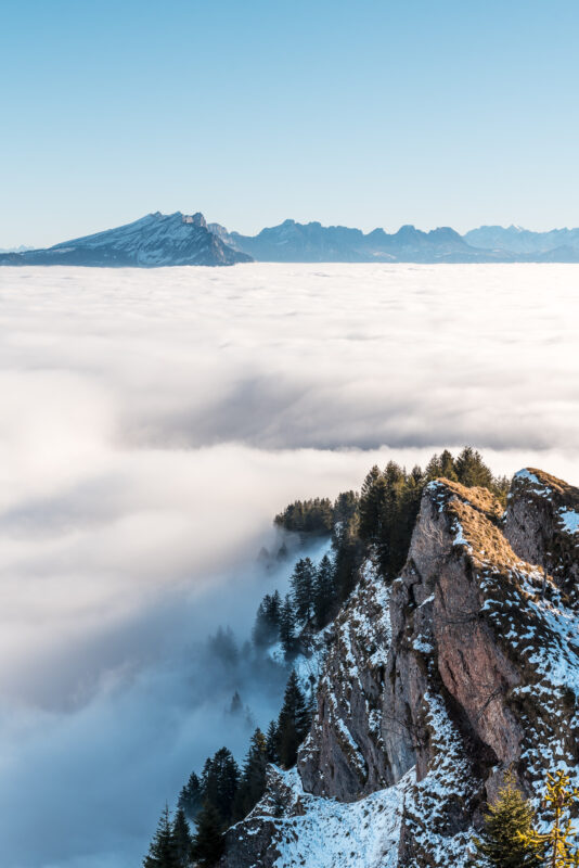
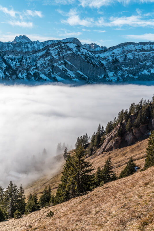
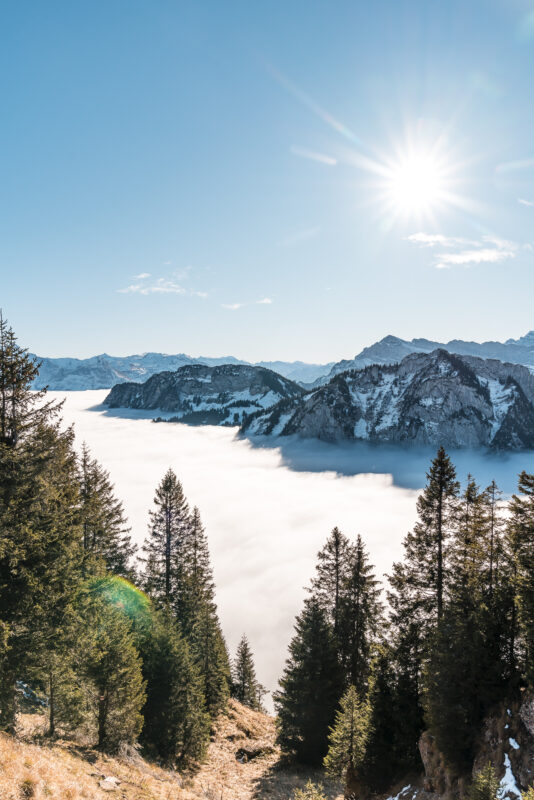
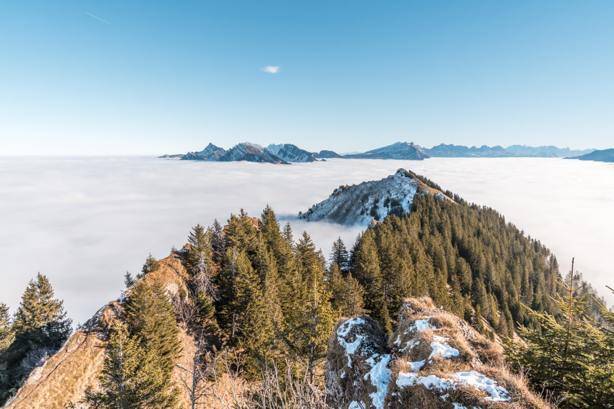
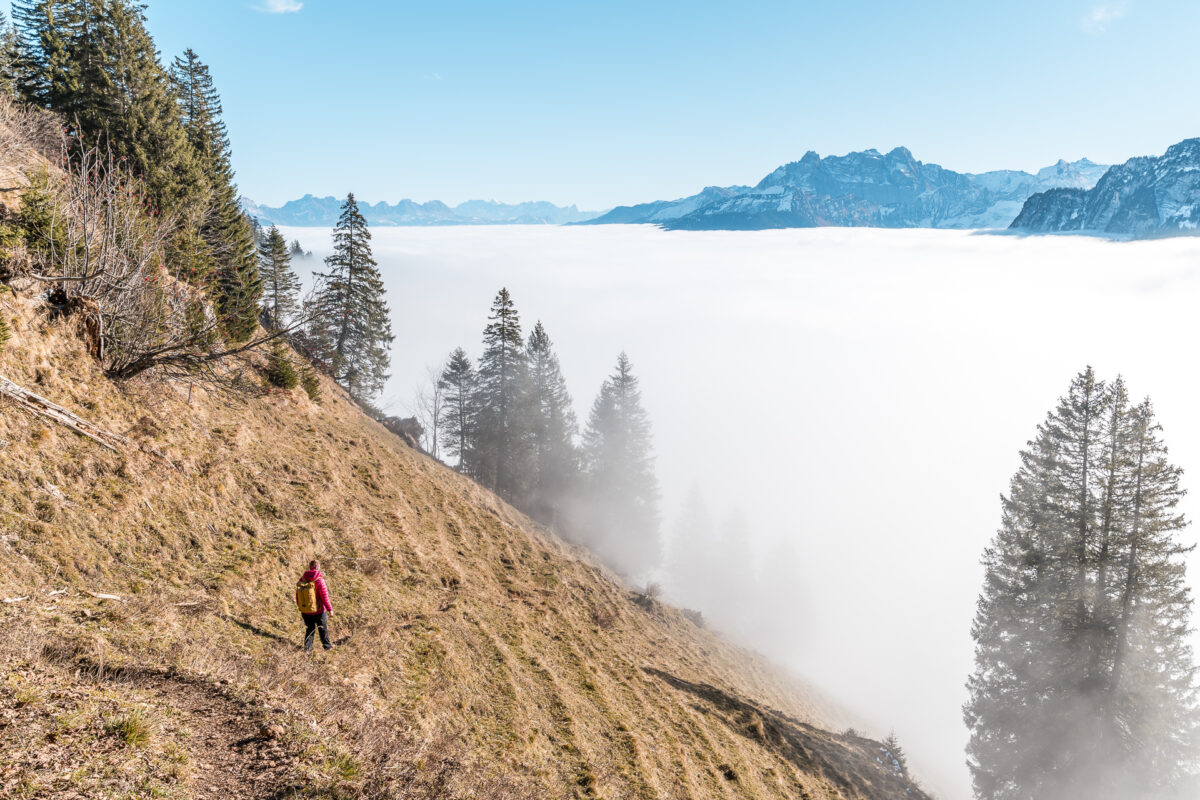
Outstanding – front row seat high above the sea of fog
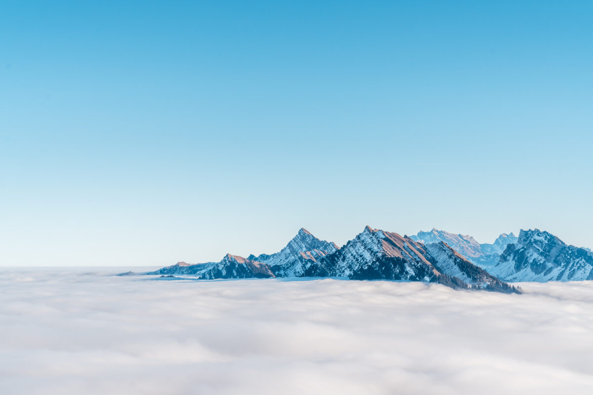
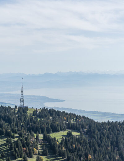
Motivated that our plan has worked out and with some schadenfreude about all those who have headed for the foggy Amden on the opposite side of the valley, the last remaining meters of altitude go up to the summit of the Hirzli ring. A good hour after the march down in the fog soup we stand up here at the summit cross and shine like cockchafers. The view over the sea of fog, where here and there individual peaks or entire groups of peaks protrude, is as surreal as it is imposing. We sit down on one of the benches on the summit, drink warm tea from the thermos flask, eat the wrapped honey rolls and enjoy the view.
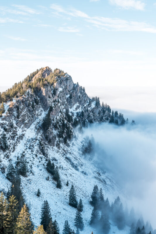
Spectacular ridge path: from the Hirzli to the Planggenstock
When preparing for the hike, we had concentrated on the route of the Hirzli circular trail. We also weren’t sure how much snow there was already (or still) up here. During the ascent, however, it quickly became apparent that the hiking trail following the southern slope of the Hirzli remained free of snow up to the summit and was therefore passable for us without any problems. Motivated by the good conditions, we spontaneously decided to follow the ridge path to the neighbouring summit – the Planggenstock.
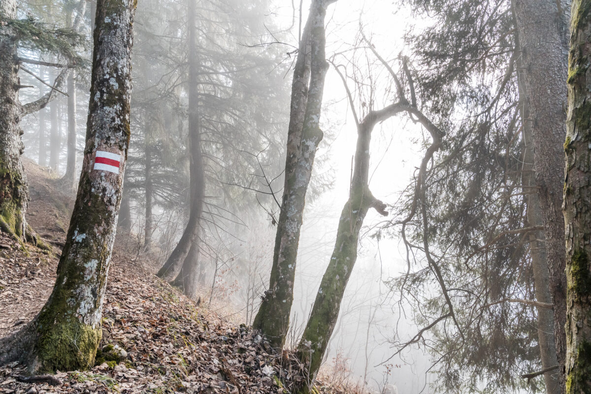
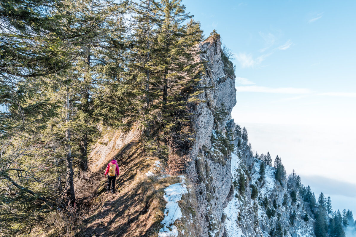
The ridge walk is marked throughout as a white-red-white hiking trail. However, it has some sloping parts. In addition, the path alternates back and forth between the south and north sides and accordingly there are a few shady areas where snow remains at this time of year. I don’t have any trouble with sloping sections on my own and even the short “scrambles” over rock sections secured by wire ropes were easily manageable for me. The most challenging part of this day are actually the icy spots, for which it would have been advantageous to bring spikes (or grodel).
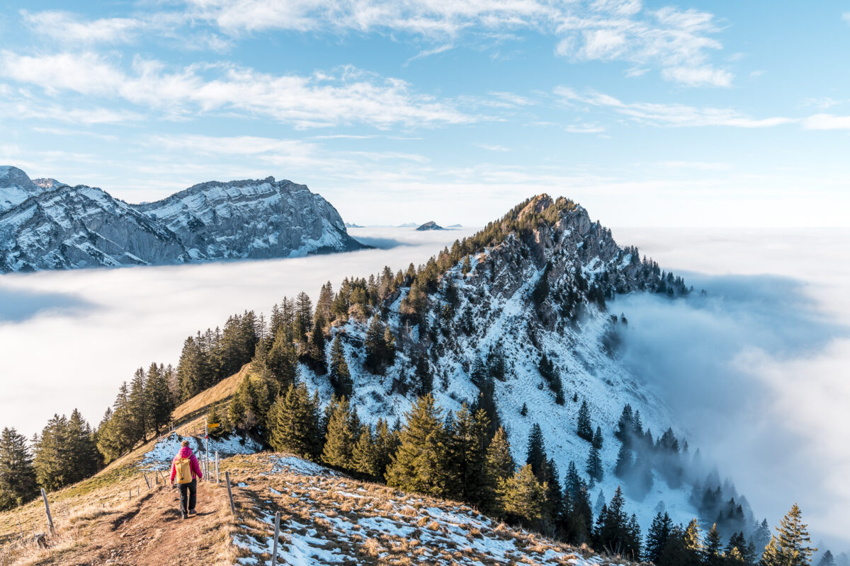
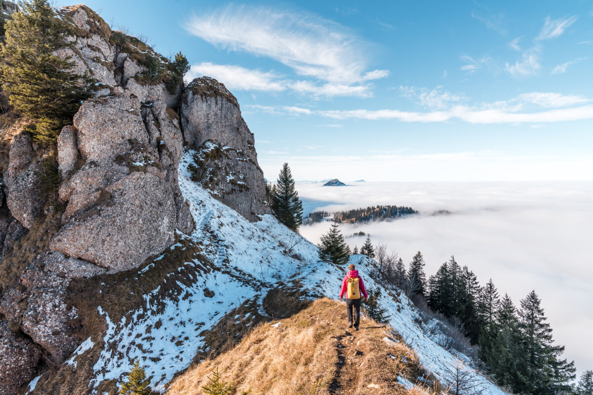
Nevertheless, I master the key sections with flying colors and stand on the summit of the Planggenstock about 30 minutes later. The view back towards Hirzli reveals a spectacular panorama. And from the Planggenstock we can once again enjoy a panoramic view that stretches from the Fronalpstock over the Great Mythen and the Glarus Alps to the Säntis.
And via the Hirzli circular trail back to the fog soup
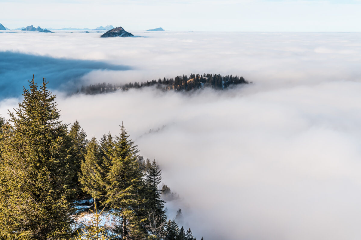
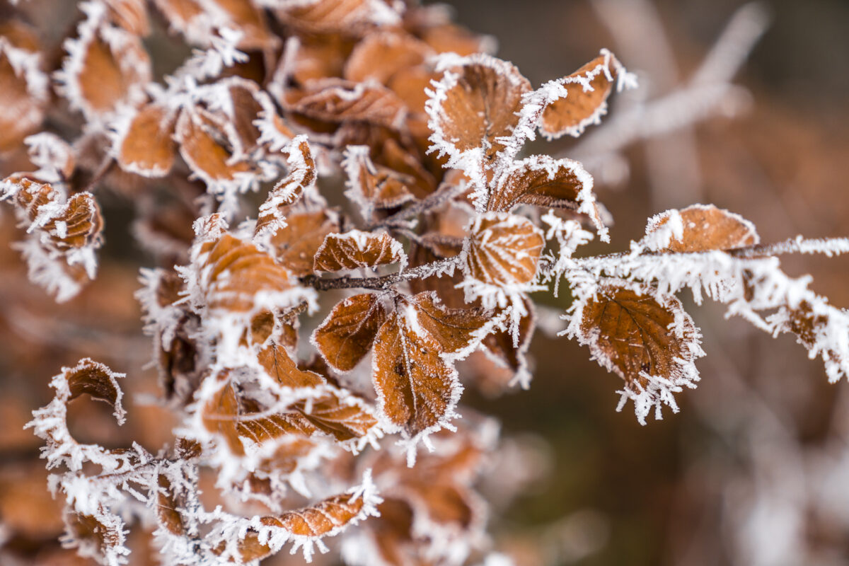
While we were able to enjoy the Hirzli all to ourselves, we meet a good handful of other hikers on the Planggenstock, who have climbed via Tierweg/Oberer Planggen. We now follow this path downhill and meet the Hirzli circular trail again, which follows the southern flank of the Planggenstock. The route over the ridge path has therefore also given us a few valuable additional minutes of sunshine. Soon the fog line appears in front of us, leaving us no choice but to dive back into the monochrome parallel world below 1,400 meters above sea level. But this also has its charm. Back here in the Niederurnertäli, the hoarfrost has covered the meadows and trees – almost as if it had just snowed.
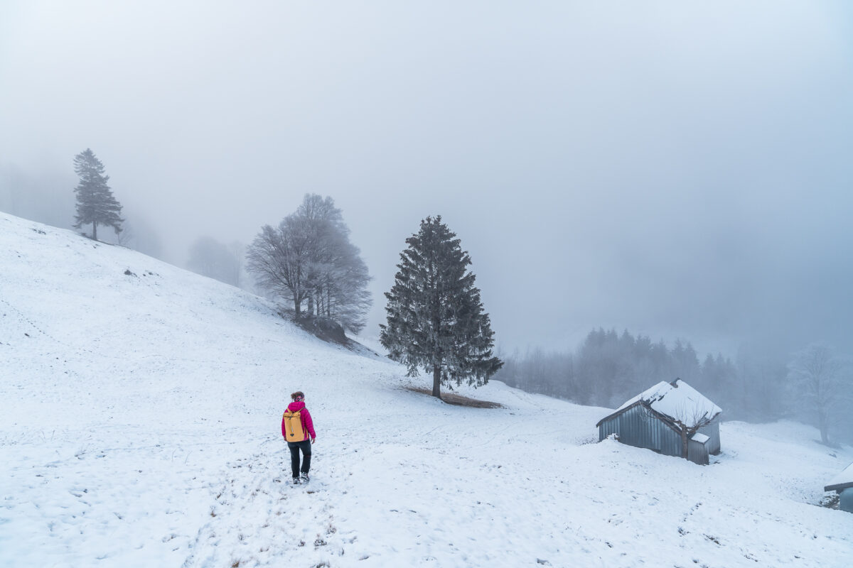
On the way back we meet a few day-trippers who had prepared themselves to escape the high fog at Morgenholz. The prospect of climbing at least another 400 meters in altitude triggers resignation in this group. To avoid such disappointments, it is advisable to study the course of the potential high fog ceiling in addition to the weather forecast.
Practical tips for your hike on the Hirzli circular trail
On the following map you can find our route of the Hirzli circular hike in the version via Planggenstock. The route measures around 8.5 kilometres and includes an ascent of a good 800 metres in altitude. The ascent is very steep in the first section and accordingly the time required for the circular hike varies depending on the basic condition. It took us a good three hours to cover the entire route, but we were on the way quickly (and without breaks) on the ascent. The Hirzli circular trail is a hiking trail/mountain trail of difficulty T2. The ridge path between Hirzli and Planggenstock corresponds to the difficulty level “challenging mountain hiking” (T3). Surefootedness and a head for heights are a must on this passage.
You can reach the starting point of the hikes with the Niederurnen – Morgenholz cable car. During the winter timetable (from the beginning of November to the end of April), the cable car runs on weekdays (Monday to Friday) only by appointment (at least 24 hours in advance). On Saturdays and Sundays, as well as on public holidays, it operates regularly from 09:00 to 16:00. By public transport you can reach the valley station of the cable car with a short walk from the bus stop Niederurnen, Ochsenplatz. For adults, the fare is CHF 18 (round trip). Further up-to-date information can be found on the website of the Niederurnen-Morgenholz cable car.
The Niederurnertäli is also a worthwhile excursion destination in winter for all those who are looking for something away from the hustle and bustle. If the snow conditions are right, you can follow the hiking trail towards the Rossweidhöchi pass crossing, for example, with snowshoes
Key dates of the tour: Morgenholz – Hirzli – Planggenstock – Morgenholz
| Starting point | Mountain station of the Niederurnen-Morgenholz cable car (982 m above sea level) |
| Reachability | accessible by public transport |
| Length | 8.5 kilometers |
| Elevation gain | ↗ 800 m 800 m ↘ |
| Duration | 3:45 p.m. |
| Destination | Mountain station of the Niederurnen-Morgenholz cable car |
| Catering | Restaurant Hirzli (15min walk to the mountain station, closed until 22 January 2021) |
Leave a Reply