

Over Mont Tendre to St-Cergue: Jura-Höhenweg stages 14 and 15
The Jura High Trail has already been a topic here on the blog several times. In recent years, we have completed seven of the 16 stages of the long-distance hiking trail (route no. 5), which leads from Dielsdorf in the canton of Zurich over the heights of the Swiss Jura to Lake Geneva to Nyon. Last autumn, two more routes were added. In the most magnificent autumn weather, we climbed the highest of all Swiss Jura peaks: Mont Tendre.
Stage 14 from Le Pont to Mont Tendre
When we arrived in Le Pont in the Vallée de Joux, the sky was still quite grey and overcast – typical Jura weather. But that was about to change. For our planned two-day hike along stages 14 and 15 of the Jura High Trail, the best autumn weather has been announced. After the rainy hiking stage from the Chasseral to the Vue des Alpes almost a month earlier, we absolutely deserved it.
After a short coffee stop at the Hôtel de la Truite, which is located right next to the train station, we start the long ascent towards the highlight of today’s tour. If the weather forecast keeps what it promises, a magnificent view awaits us on Mont Tendre.
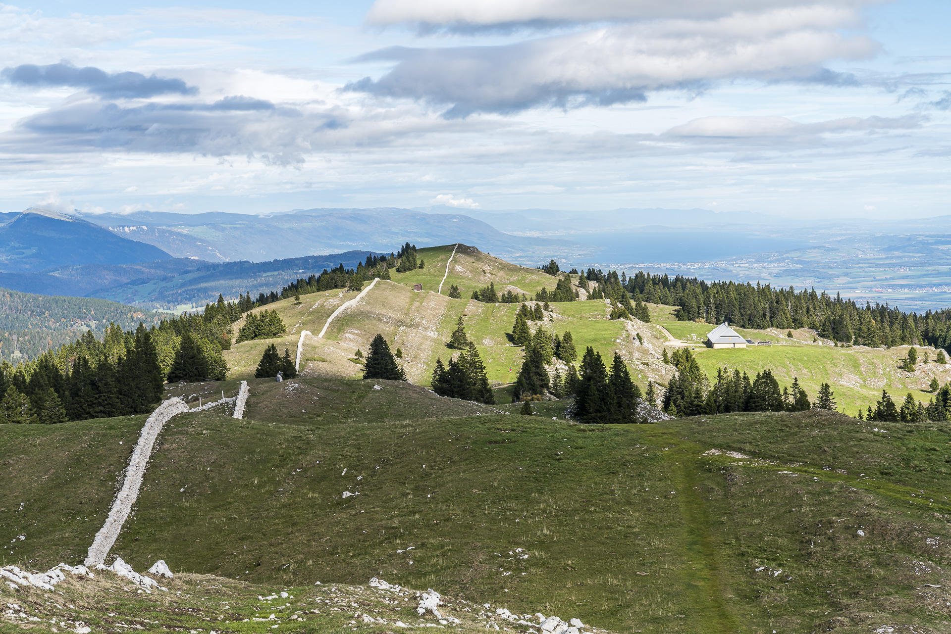
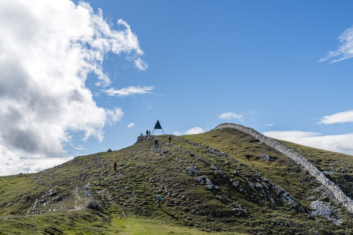
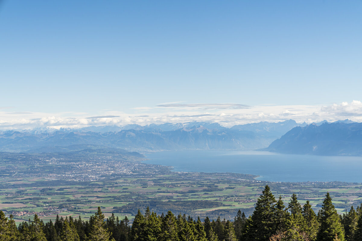
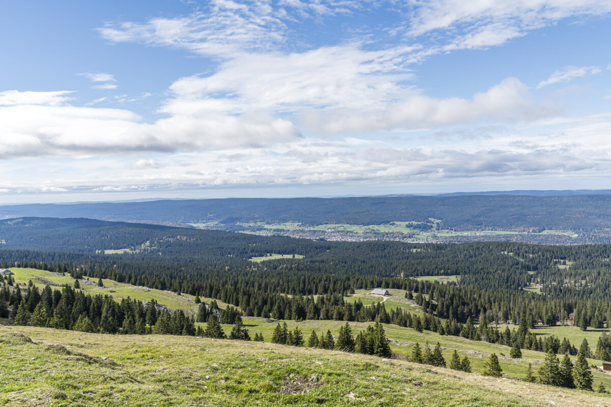
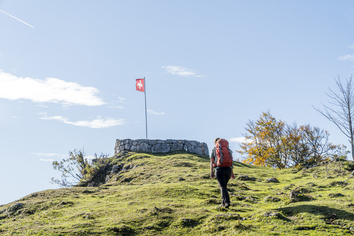
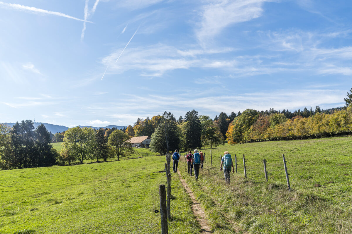
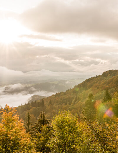
We walk along the lakeside of Lac de Joux and then follow a forest path uphill towards the Col du Mollendruz. From here we leave civilization behind us and dive into the vastness of the Jura pastures. Scattered farms here and there, winding gravel paths, far-reaching views over fir forests – the Jura never ceases to amaze me! Oh, and as if by magic, the gray clouds were pushed away in the meantime. We cover the last meters of altitude to the summit cross of Mont Tendre under a bright blue autumn sky.
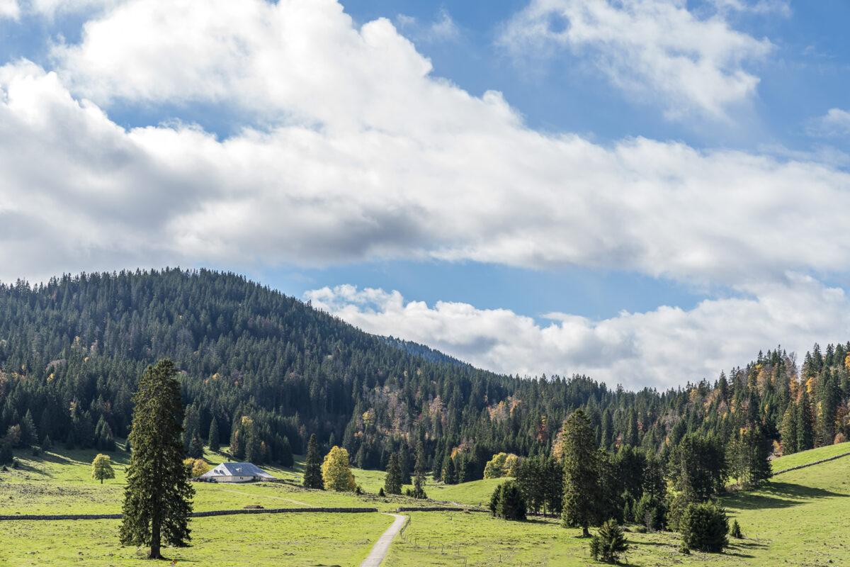
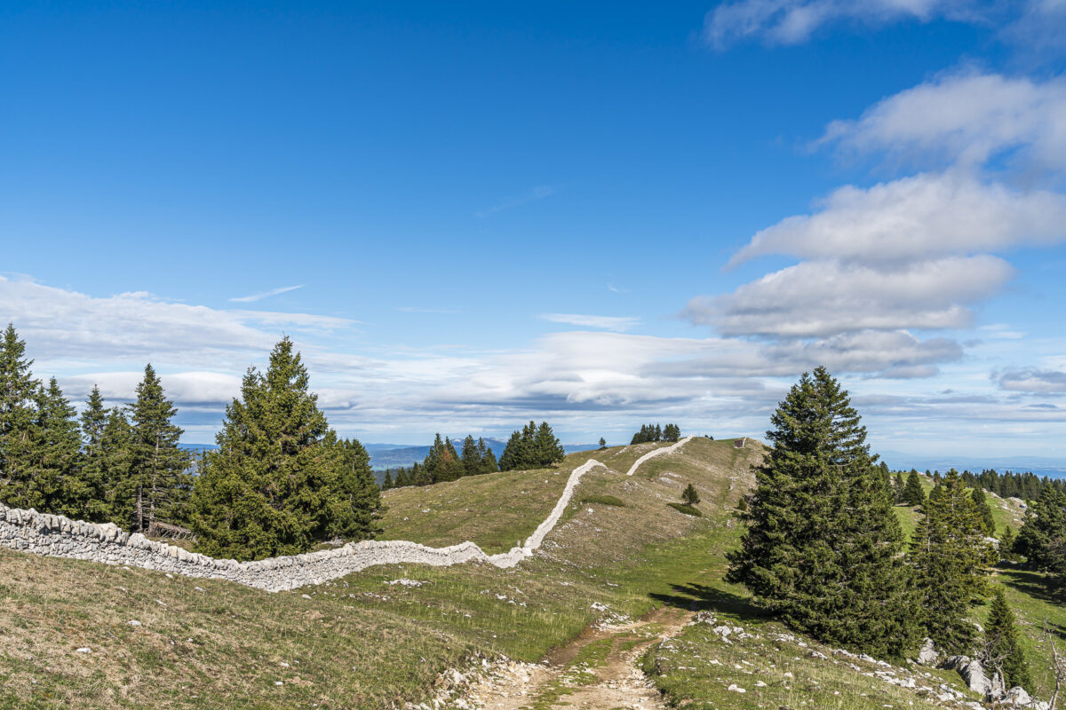
On this stage of the Jura High Trail, the dry stone walls appear as a constant companion. They follow the hill ranges and form miles of imposing stone structures that almost remind me a little of the Great Wall of China.
The view from the highest peak of the Swiss Jura
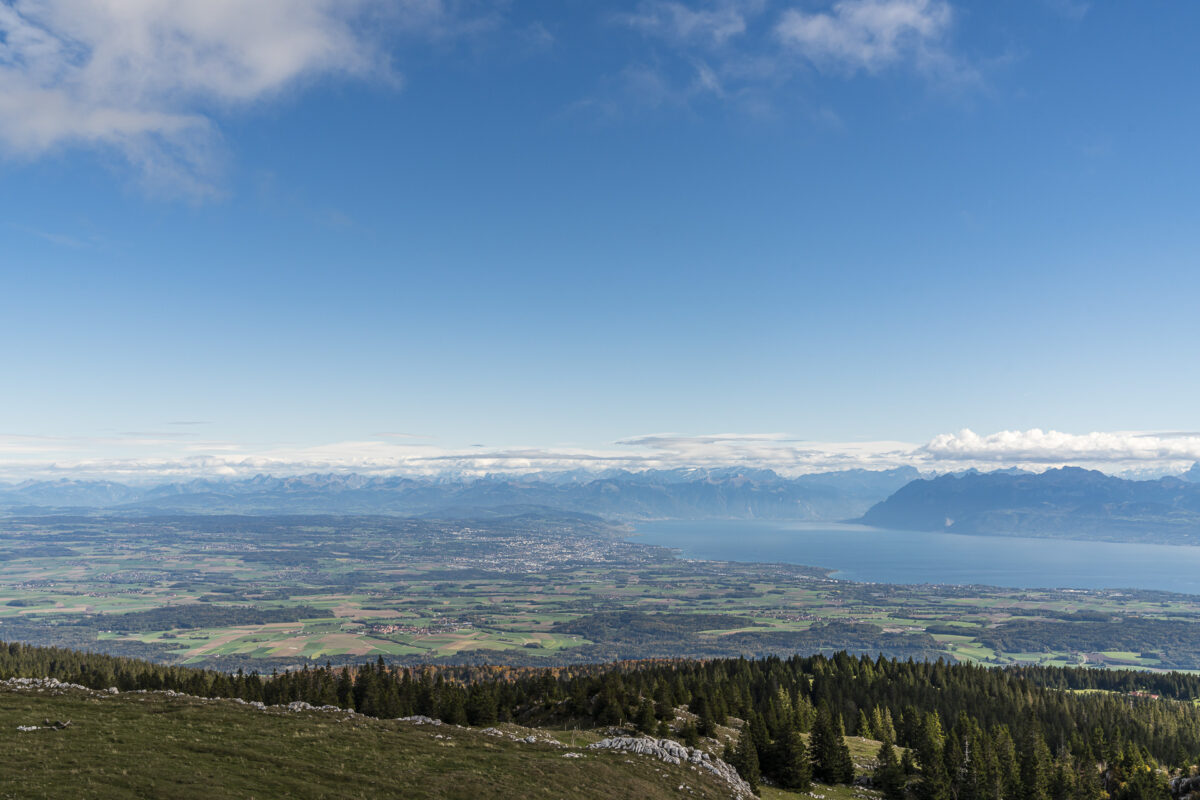
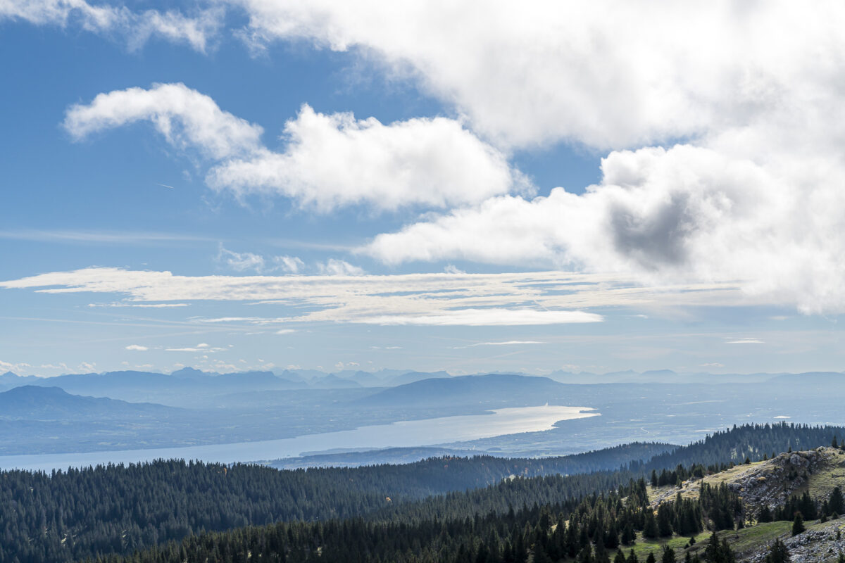
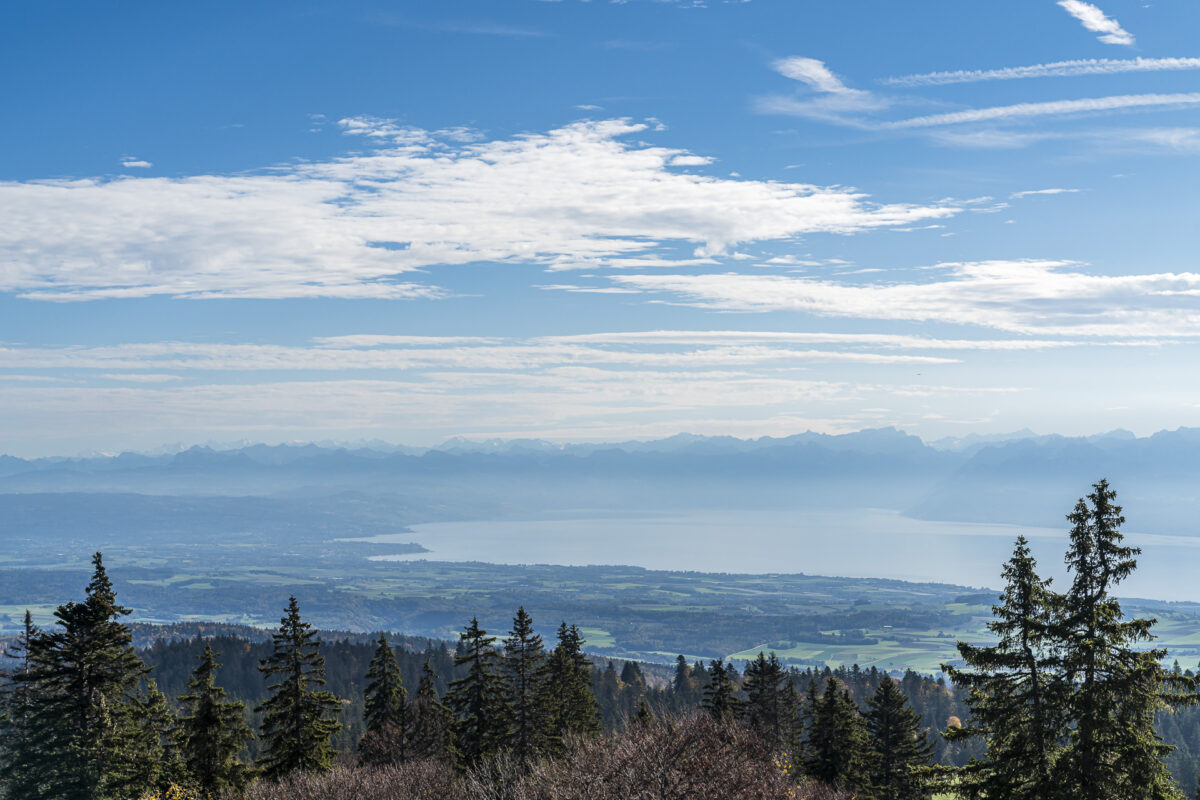
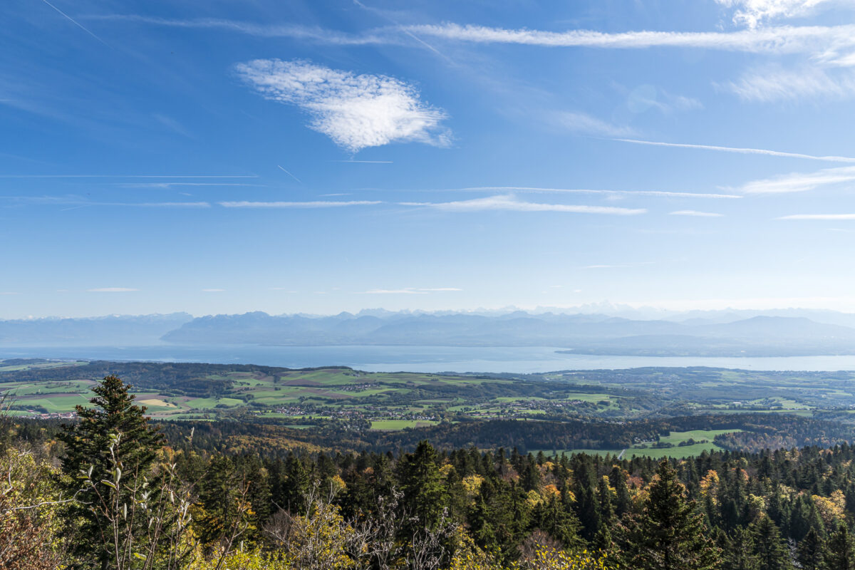
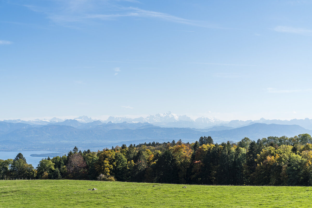
On the last few metres up to Mont Tendre at 1,679 m above sea level, the impressive view towards Lake Geneva opens up to us. Wow! The panorama is simply magnificent, ranging from the Vaud and Valais Alps to the Vosges Mountains, the Mont Blanc massif and the Geneva Jet d’eau. This panoramic view also accompanies us on the remaining seven kilometers, which lead in slight ups and downs to the stage finish on the Col du Marchairuz.
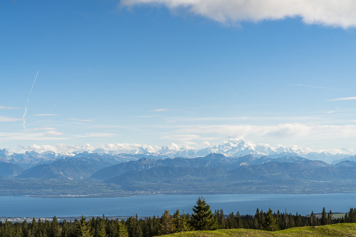
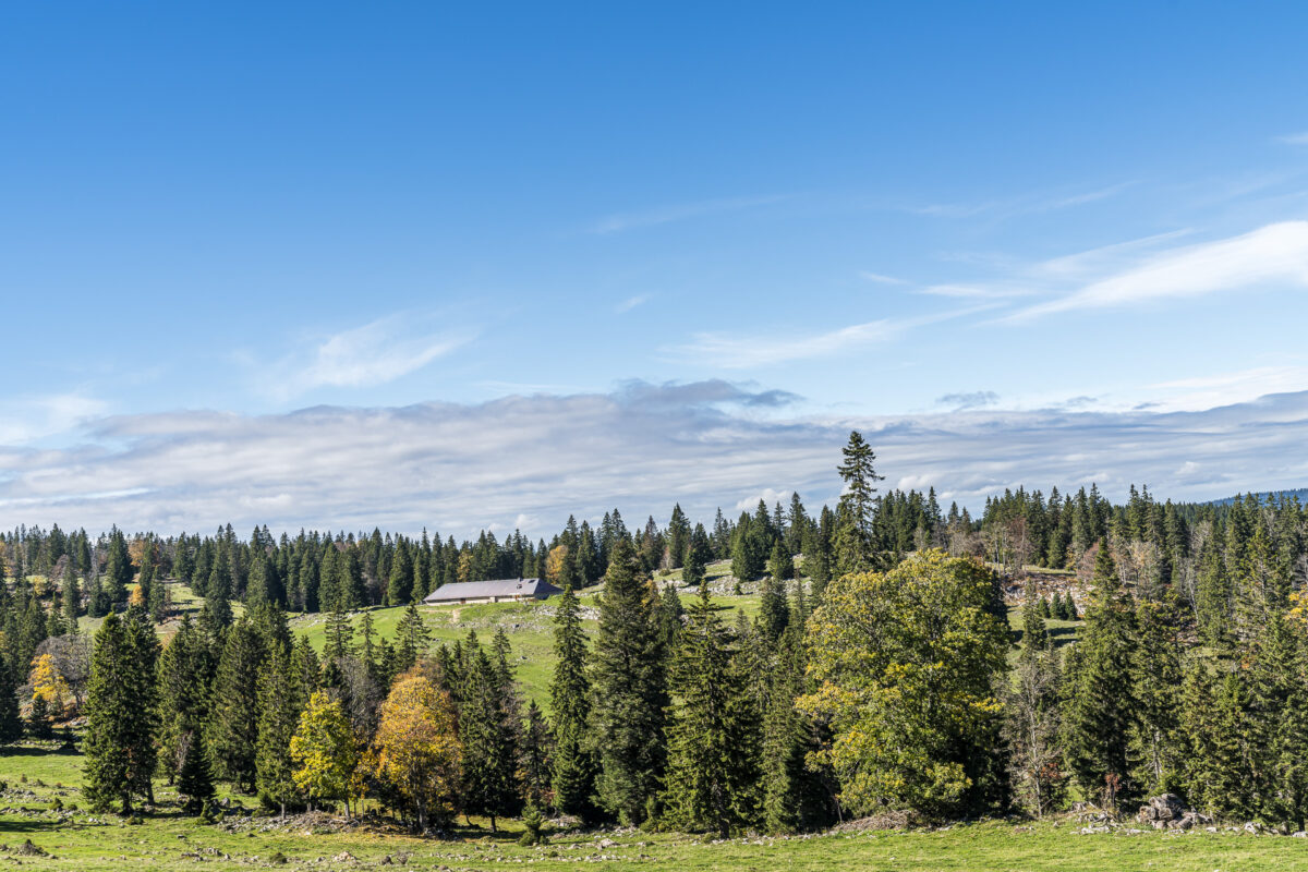
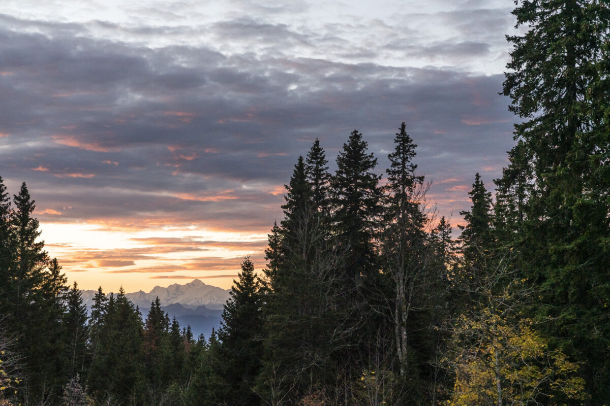
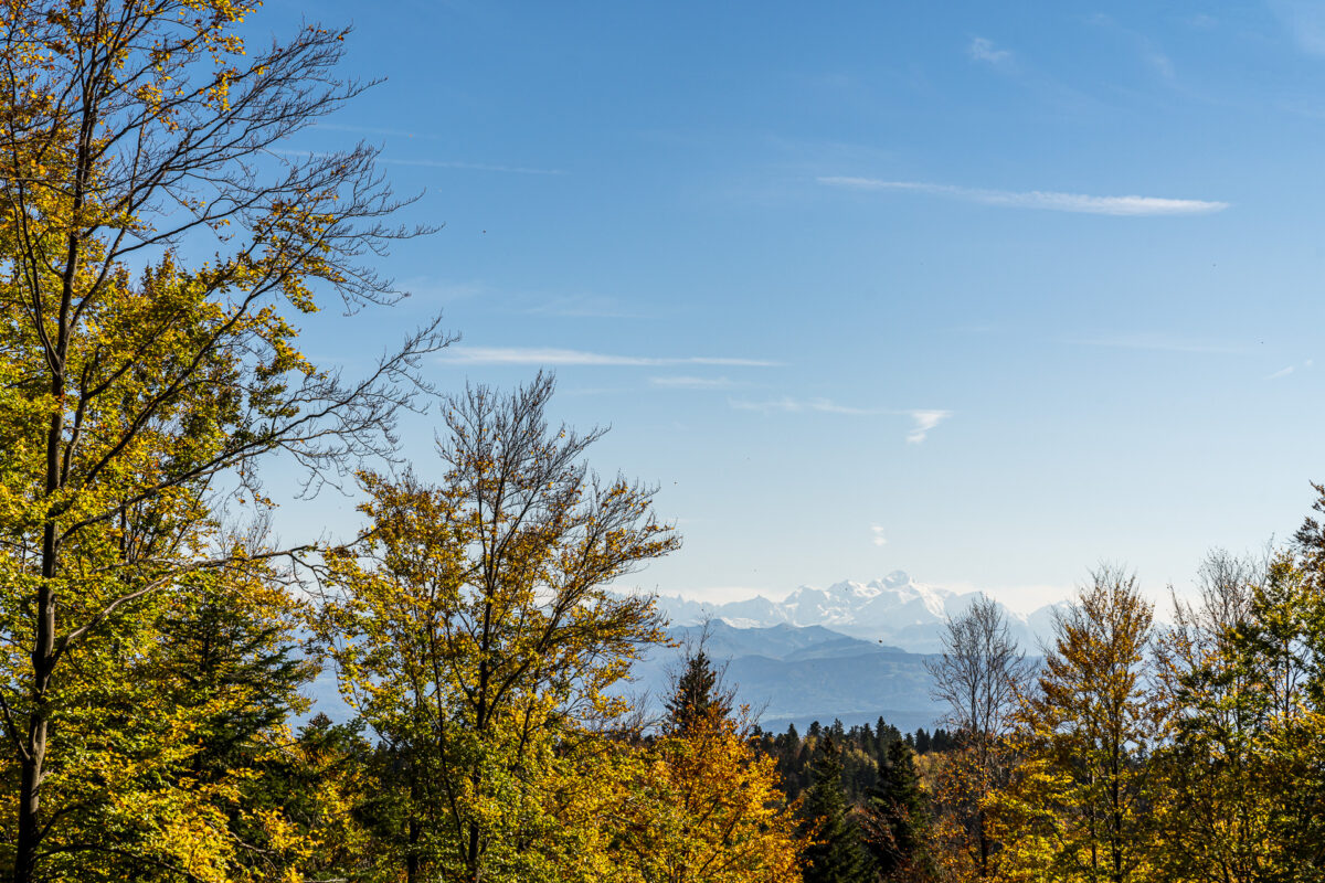
Directly at the top of the pass is the hotel of the same name (Hôtel du Marchairuz), where we spend the night. The hotel surprises us with spacious and nicely furnished hotel rooms (especially in comparison to other Jura accommodations). And the culinary offer is also absolutely solid. In contrast to an overnight stay on the Chasseral or Chasseron, the view here is limited due to its location in the middle of the extensive fir forests. At least we catch a glimpse of the snow-capped Mont Blanc from our room.
Key data of the hike Le Pont – Mont Tendre – Col du Marchairuz
On the map below you can see the route of the hike from Le Pont to Monte Tendre and on to the Col du Marchairuz. It is a yellow-marked hiking trail with a difficulty level of T1/T2. The trail is not technically demanding and runs mostly on forest paths, over pastures and on gravel paths. However, the length of the route (> 20 kilometres) and the number of metres in altitude require a certain basic level of fitness.
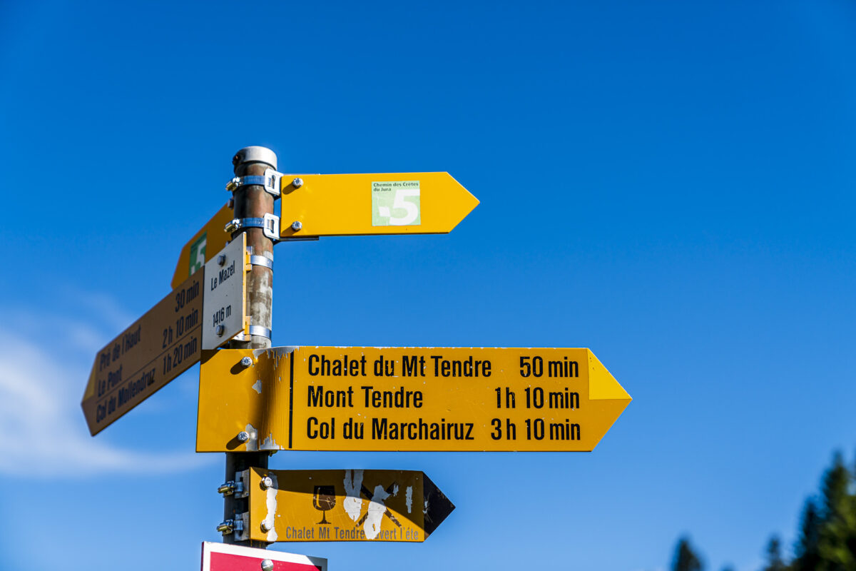
Stage 14 ends at the Col du Marchairuz, where you will also find the Hôtel du Marchairuz and the post bus stop Le Marchairuz, col. The route is served all year round. If you are planning the hike to Mont Tendre as a day hike, I recommend checking the post bus connections in advance (irregular intervals/on average one course every two hours).
By the way, the post bus connection from the Col du Marchairuz leads to Le Brassus in the Vallée de Joux. Alternatively, you could combine the hike over Mont Tendre with a stay at the chic Hôtel des Horlogers.
| Starting point | Bahnhof Le Pont (1,000 m ü. m.) |
| Reachability | Starting point and destination Accessible by public transport |
| Length | 21.4 kilometres |
| Elevation gain | ↗ 1,017 m 579 m ↘ |
| Duration | ca. 6:00 p.m. |
| Destination | Le Marchairuz, col (bus stop) (1,450 m above sea level) |
| Catering | No refreshment stops along the way (take a picnic with you) |
Stage 15 from Col du Marchairuz to St-Cergue
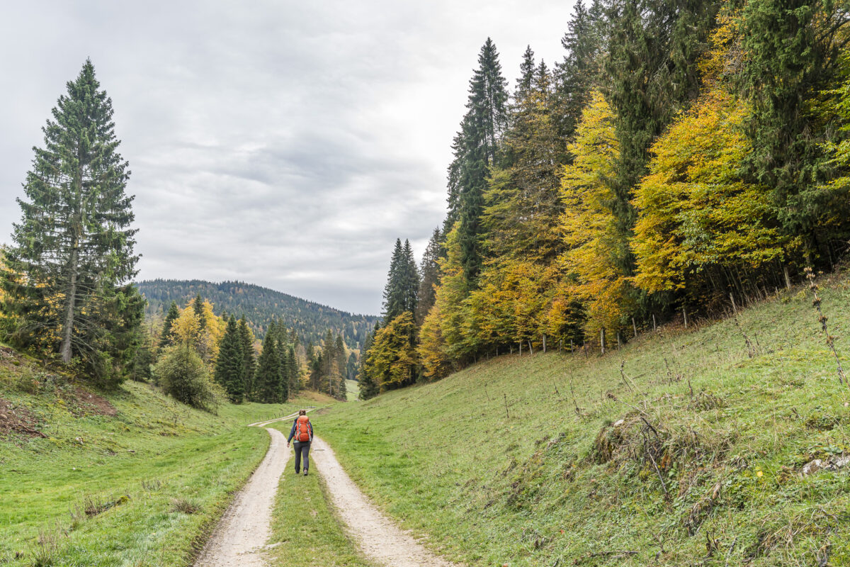
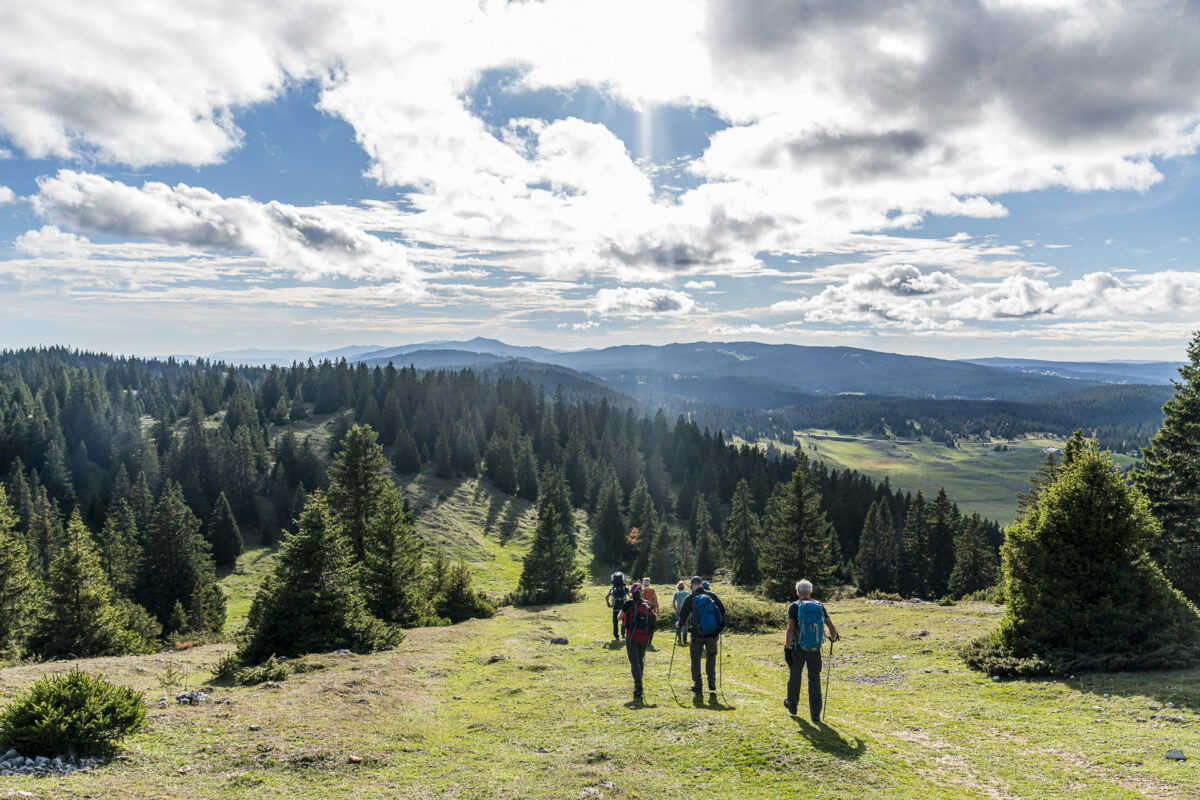
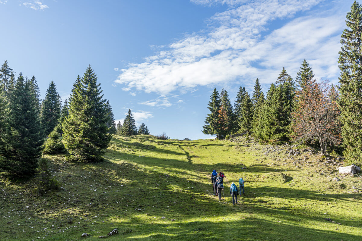
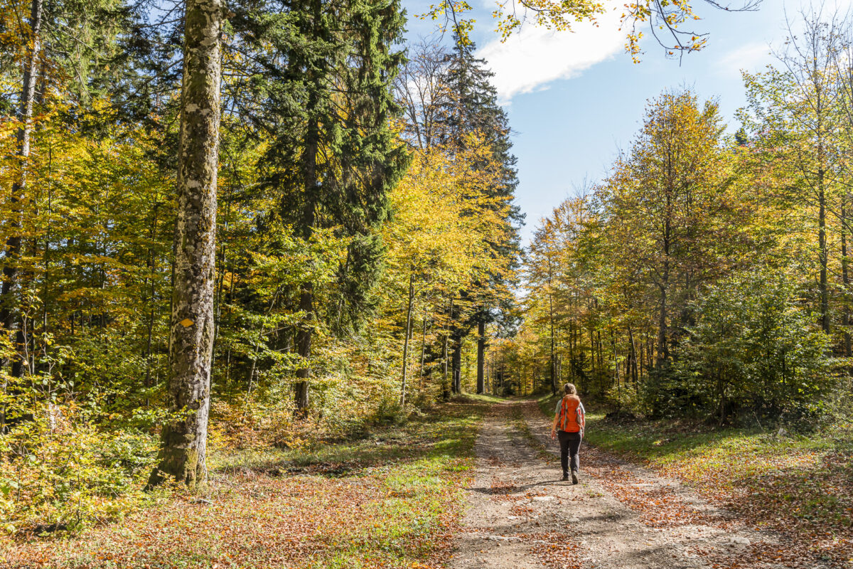
After a quiet night on the Col du Marchairuz and a fine breakfast with a nice selection of regional and homemade products, we start the second day of hiking. The weather is once again kind to us; the perfect conditions for another scenic stage on the Jura High Trail. Today’s route of 17 kilometers is a little shorter than the one of the previous day, whose 22 kilometers still reverberate in my thigh.
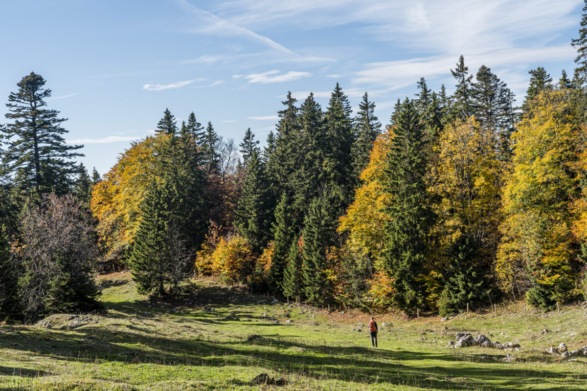
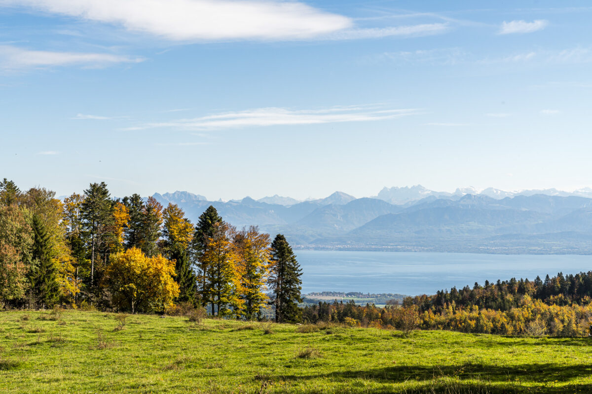
Both yesterday’s stage of the Jura High Route and today’s route run within the Jura Vaudoise Regional Nature Park. We first follow the dry stone walls along a secluded, approximately three-and-a-half-kilometre-long forest clearing to “La Neuve”. Here, for the first time on this day, we climb 100 metres uphill to the so-called “Crêt de la Neuve”, where the view towards Lake Geneva and the Mont Blanc massif opens up again. Definitely the most beautiful viewpoint on this stage. But the following kilometres have even more beautiful views in store.
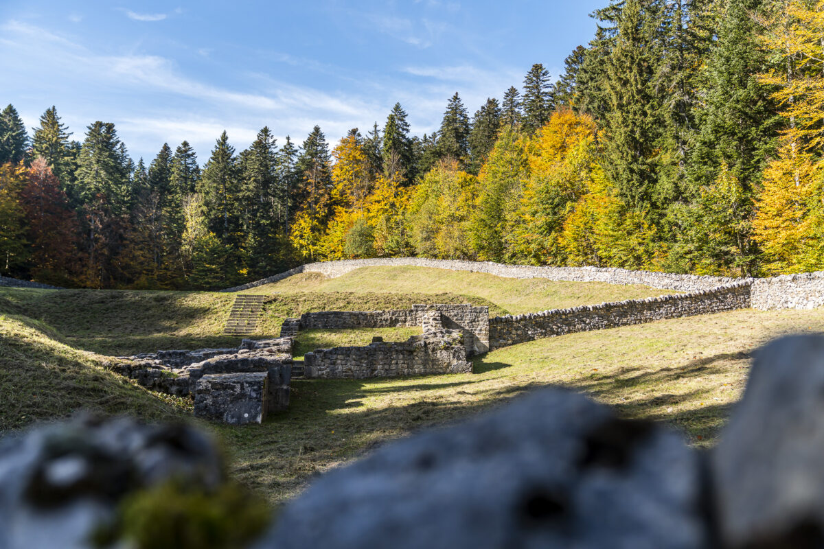
The magnificent autumn forests of the Vaud Jura
The closer we get to the stage destination St-Cergue, the more colourful the forests become. In addition to the blaze of colour, the ruins of the Couvent d’Oujon are also a cultural witness from the Middle Ages. The Carthusian monastery, which was founded in the 12th century and dissolved in the 16th century in the course of the Reformation, is now only remembered by the remains of walls – but the cultural asset of national importance is located directly on the hiking trail and can be visited free of charge. A worthwhile short stop.
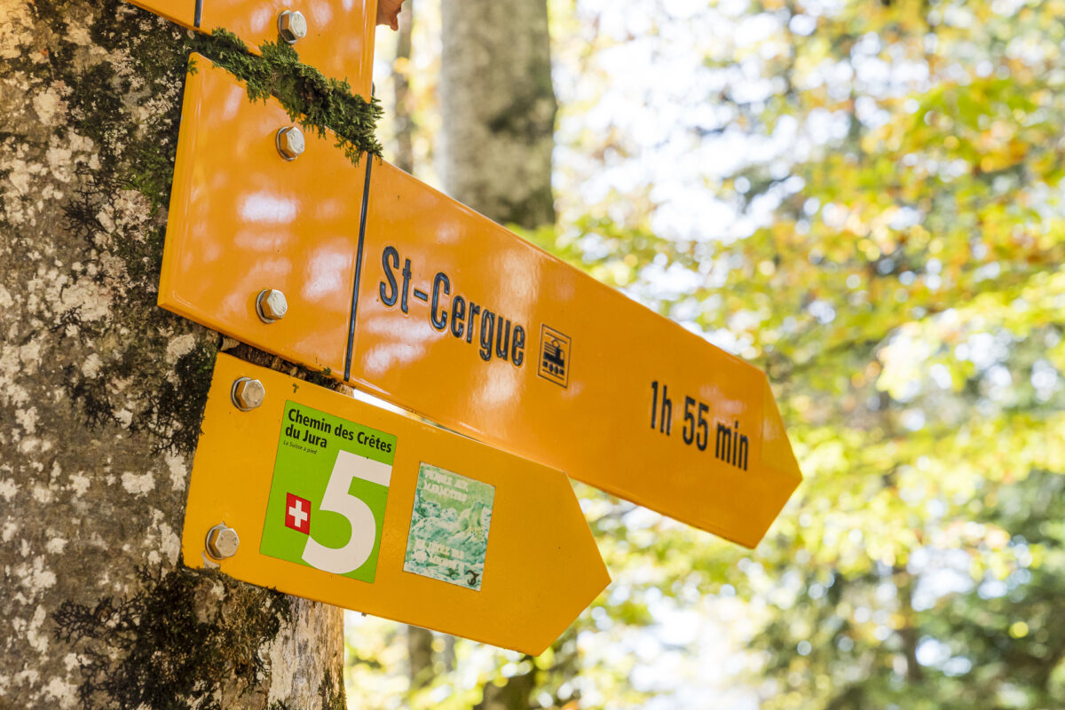
The last remaining kilometre to the stage finish in St-Cergue scores again with a fantastic view. In St-Cergue, due to a lack of alternatives (there are eight of us), we check in at the Hotel de la Poste. The rooms (in 90s charm) were fine so far – otherwise a rather dodgy operation. Otherwise, there are two or three bed and breakfasts in the area. Unfortunately, the selection of accommodation options is generally not exactly extensive.
Eckdaten der Wanderung Col du Marchairuz – Crêt de la Neuve – St-Cergue
On the map below you can see the route of the hike from Col du Marchairuz to St-Cergue. Again, this is a yellow-marked hiking trail with a difficulty level of T1/T2. This stage is also long at 16.5 kilometers, but includes significantly less elevation gain. Thus, it is a little less strict than the first stage on the Chasseral.
| Starting point | Le Marchairuz, col (bus stop) (1,450 m above sea level) |
| Reachability | Starting point and destination can be reached by public transport |
| Length | 16.7 kilometres |
| Elevation gain | ↗ 423 m 823 m ↘ |
| Duration | 4:30 p.m. |
| Destination | St-Cergue railway station (1,050 m above sea level) |
| Catering | No refreshment stops along the way (take a picnic with you) |
Practical tips for your hike over Mont Tendre (Jura High Trail Stages 14/15)
- The hiking season in the Swiss Jura starts at the end of April/beginning of May and lasts until November in mild autumn weather.
- Unfortunately, refreshment stops are rare along these two stages – especially in the low season. I therefore recommend packing a picnic for both routes.
- From St-Cergue to the “other end” of the Jura High Trail – to Nyon – there is only one stage left that could be added directly. Unfortunately, however, the remaining section of the trail is not necessarily the prime piece of the Jura High Trail and disappoints especially on the last eight kilometres with a high proportion of tarred roads. Alternatively – and this is what we did – you can also tackle the 15-kilometre Chemin de la Dôle from St-Cergue. A magnificent panoramic hike that leads through typical Jura pastures to the summit of La Dôle (1,677 m above sea level). By the way, the summit of La Dôle is only two meters lower than that of Mont Tendre. This makes La Dôle the second highest mountain in the Swiss Jura.
Leave a Reply