

On the Rheintal High Trail to the Alpenhof Oberegg
“From which region would you like to read a trip tip this spring?” I asked you on Instagram. The majority voted for Eastern Switzerland. Said and done! Last weekend, we set off to Berneck in the finest spring weather. From there, we hiked up to St. Anton, high above the Rhine Valley, via the Rheintaler Höhenweg. Our destination: the beautifully situated Alpenhof Oberegg.
From the Rhine Valley to the Appenzeller Hill Country
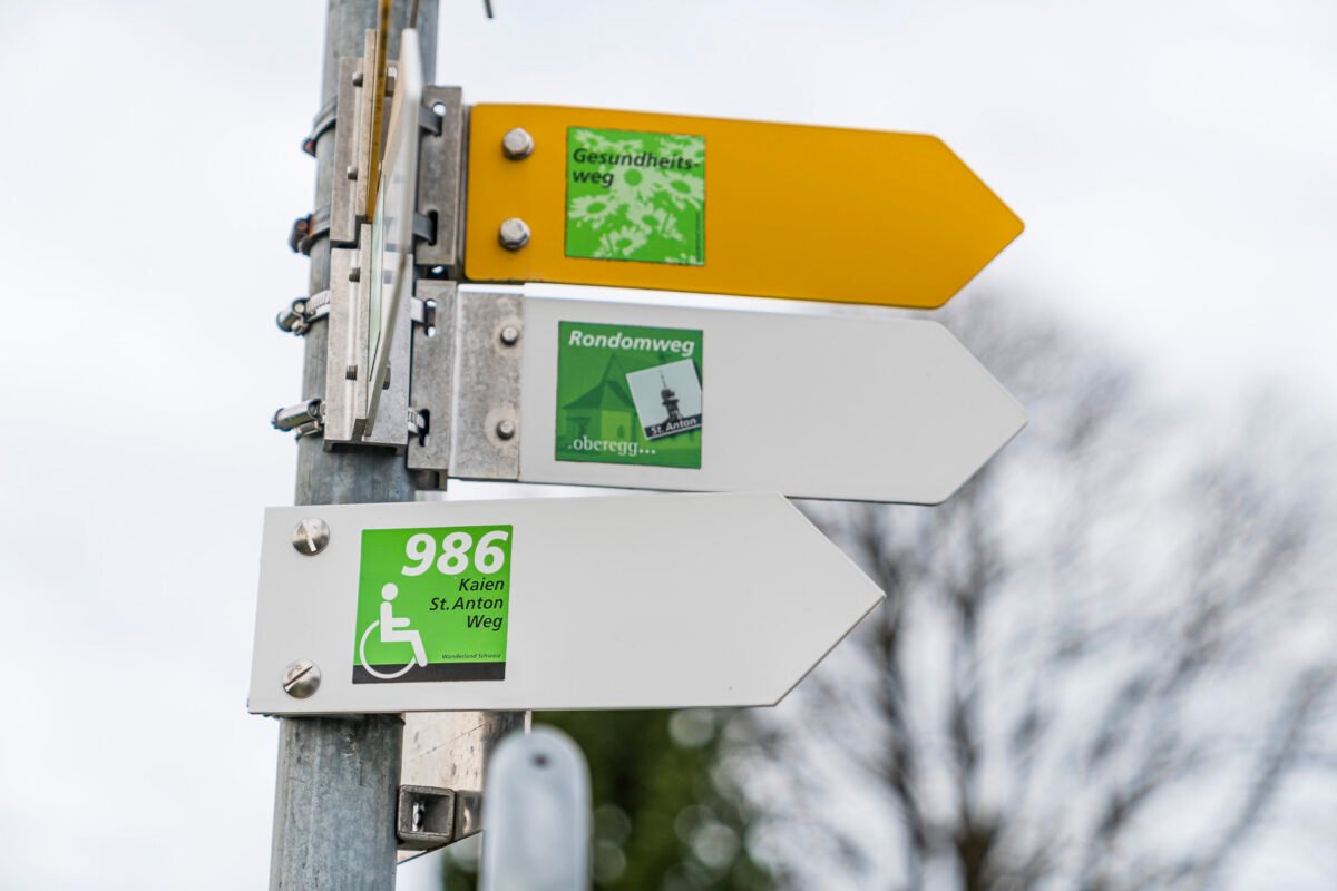
The starting point of our hike is the historic winegrowers’ and craftsmen’s village of Berneck, located in a sun-drenched side valley of the Rhine Valley. From Zurich, the pretty village center of Berneck can be reached in less than two hours by train and bus. Thus, the hike presented in this post (including an option) can also be easily done as a day trip. But on this tour, we want to combine the sporty part with the pleasurable part, giving us a compelling reason for a slightly more extended stopover at the border between the expanse of the Rhine Valley and the green Appenzeller hill country. But more on that later. First, we head from the Berneck, Rathaus bus stop to the signpost opposite to get an overview.


On the Rheintaler Höhenweg through Vineyards
The Rheintaler Höhenweg leads in six stages from Rorschach to Sargans. As befits a Höhenweg, it mostly runs in scenic locations and offers magnificent panoramic views. The second stage, which runs from Berneck to Altstätten, is no exception. We leave the charming village center with the stately town hall behind and are immediately confronted with the first 50 meters of elevation as we climb up Rosenberg. But up there, we are rewarded with that wonderful view over idyllic vineyards towards the opposite Austrian and Liechtenstein mountains.
Just before the place name “Neugrüt,” you can catch another glimpse of Berneck from a bench placed at the edge of the forest. Up here is also a cozy barbecue area, but on this beautiful spring Saturday, it is already occupied.


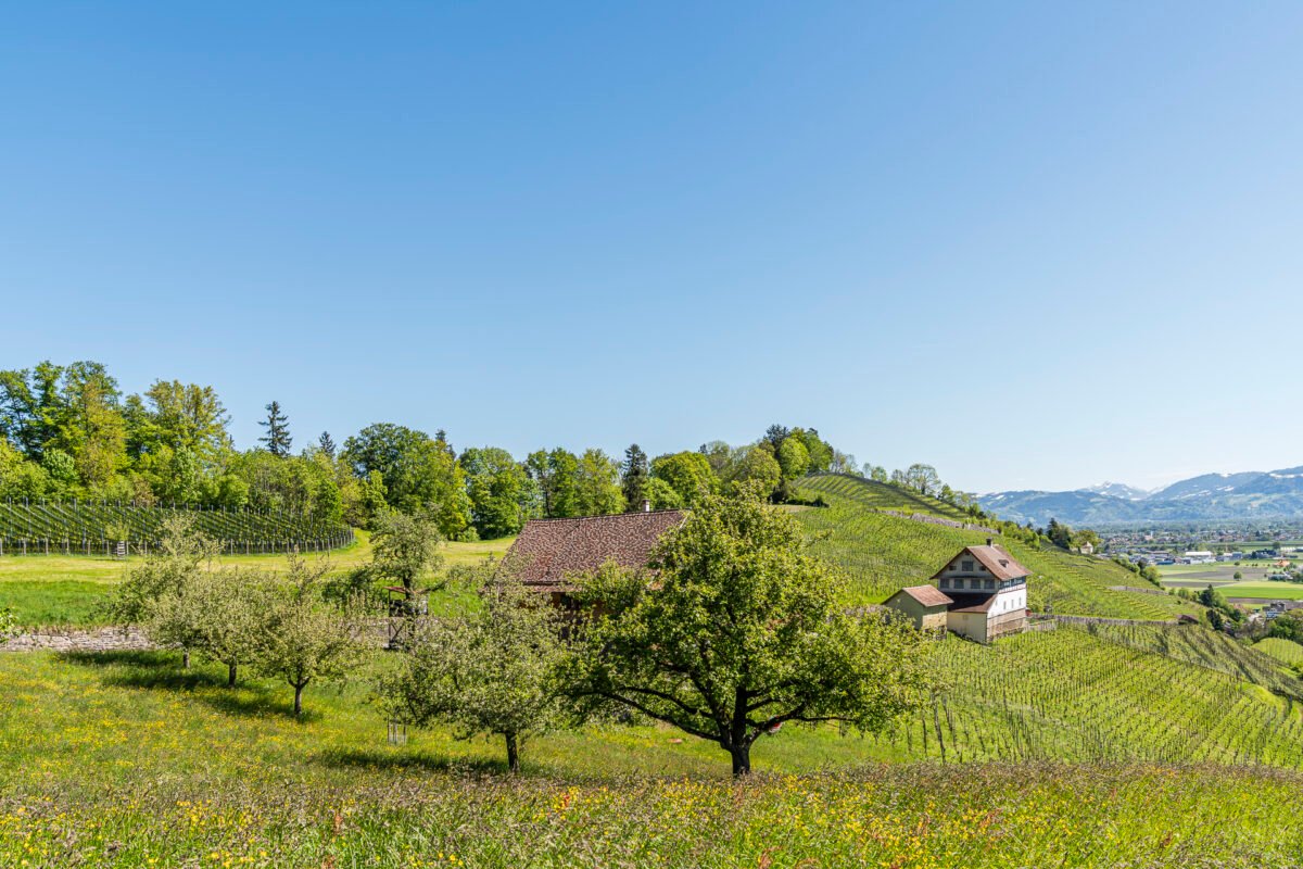

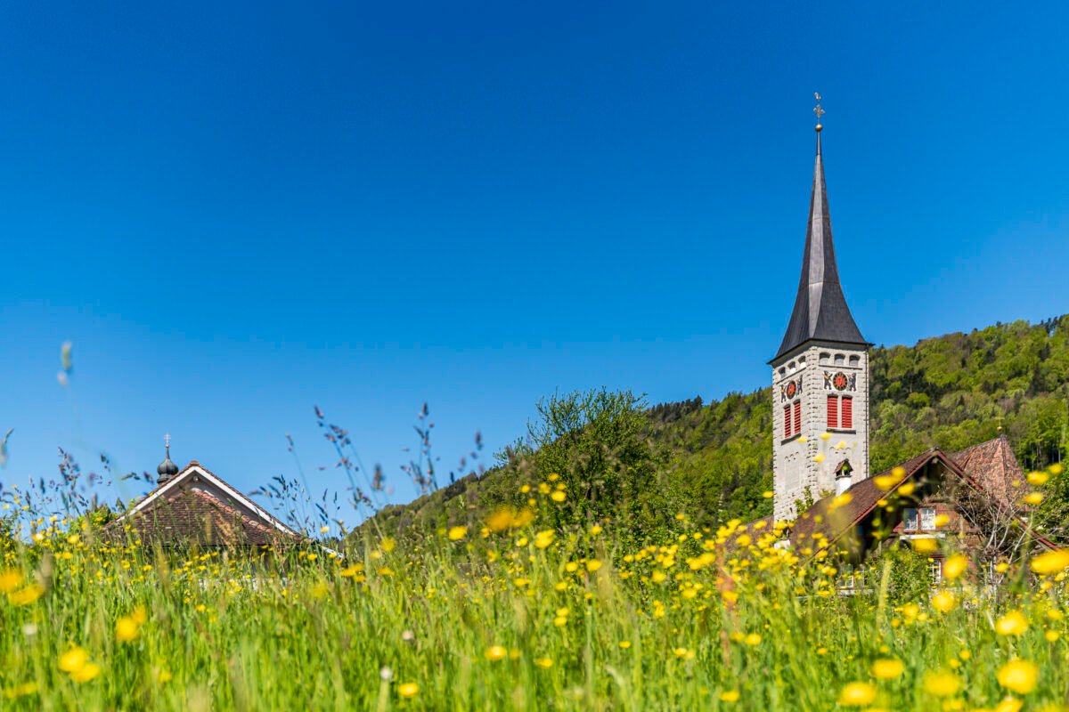
The Rheintaler Höhenweg continues in the following kilometers in a varied up and down through the Hümpelerwald to Balgach. There, the hiking trail makes a short detour through a residential area before continuing on narrow, cool paths along the edge of the settlement, past Grünenstein Castle, and on towards Rebstein.


Challenging Ascent to Alpenhof Oberegg
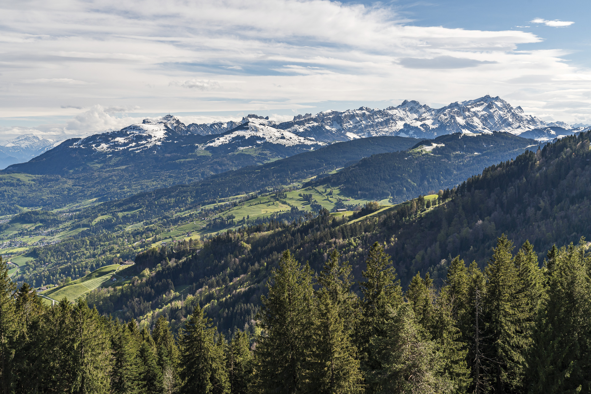
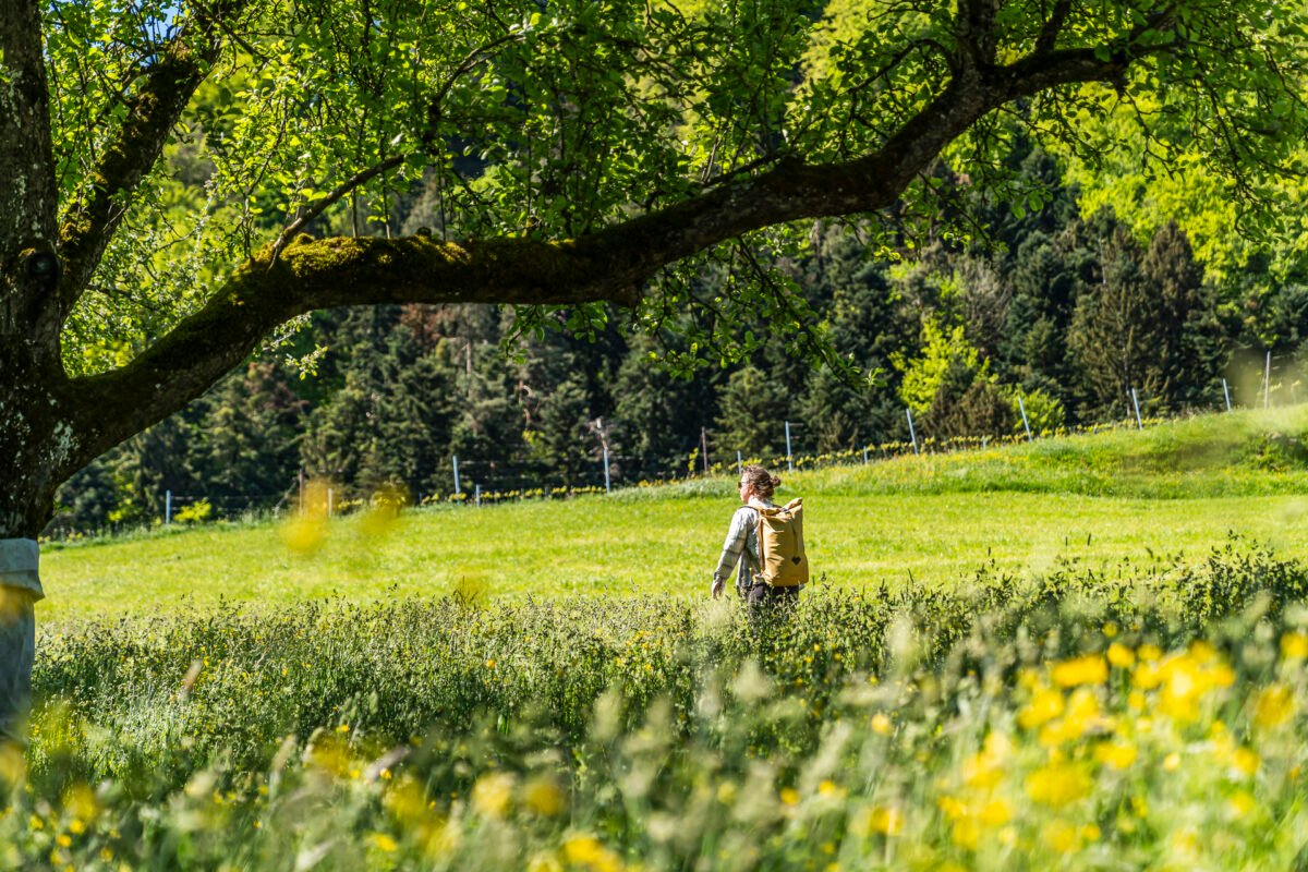
In the meantime, we have covered well over half of the 13-kilometer-long second stage of the Rheintaler Höhenweg. Instead of following the signpost with route number 86 slightly downhill to Marbach at the height of the Hardegg ruins, we climb up through the “Tobelwoad” to Mohren. Past lush green meadows dotted with blooming marguerites, we conquer 150 meters of elevation over a distance of around 800 meters. Quite challenging. But the increasingly better view over the Rhine Valley with each gained meter is a fair reward!

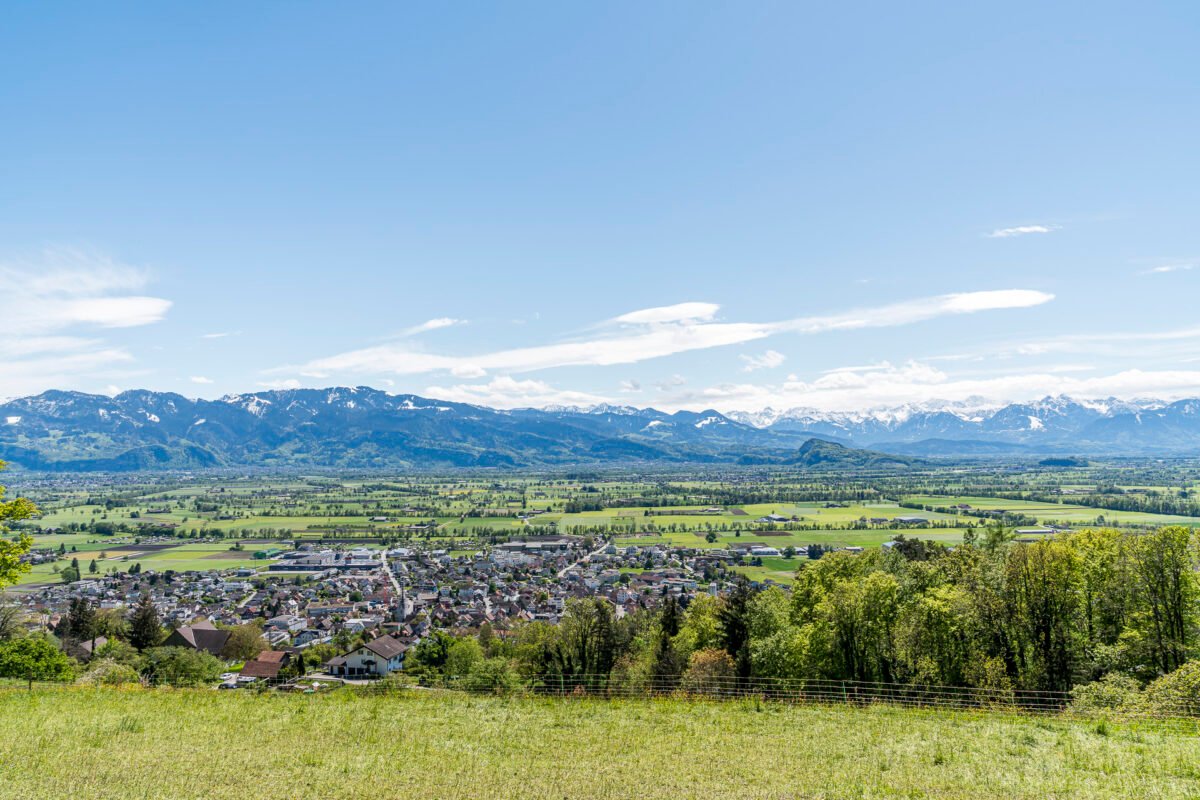
After a short break in Mohren, we continue uphill along a lightly trafficked paved road. The next two kilometers are more about gaining elevation – we see it as altitude training. Fortunately, the paved road changes to a gravel path at Nellenkapf, and the last 1.5 kilometers lead over a beautiful, natural forest path. As a reward, we are greeted with a fantastic Alpstein panorama at St. Anton near Oberegg.


Rest and Stay
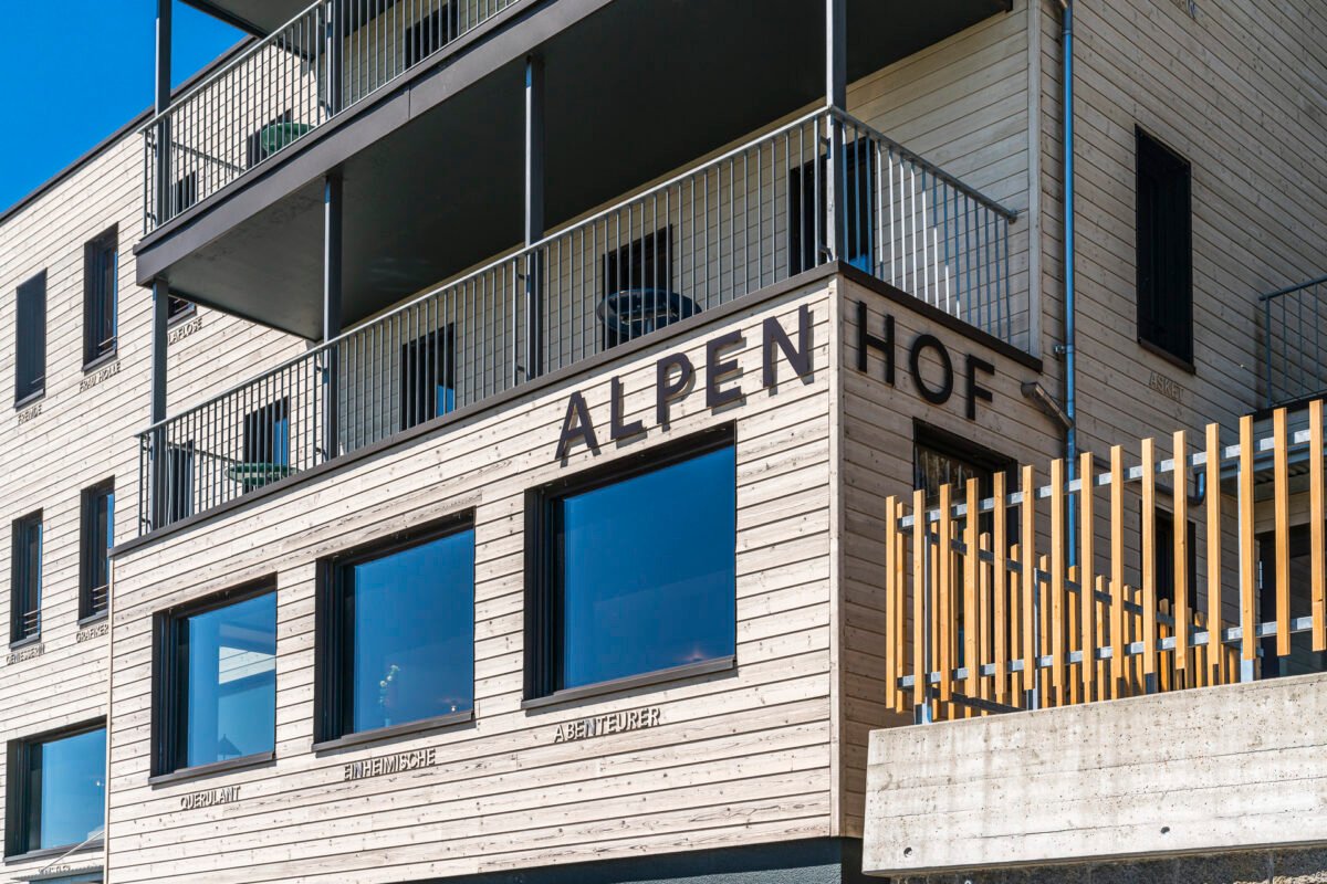
And this is one of the reasons why we don’t just want to stop for a meal at the Alpenhof Oberegg but stay a little longer. The former cultural inn was reopened in 2022 after a two-month renovation break under the management of an ambitious trio, refreshed and rejuvenated.
Since then, the Alpenhof, including the integrated Andreas Züst library, has not only served as a retreat and refuge for artists but has also earned a place on the culinary map. Co-chefs Laura Rössli & Ivanassèn Berov are members of the Slow Food Switzerland association and place great value on homemade and seasonal products from the region. From 11:00 am to 2:00 pm, a small daily menu can be chosen from, and in the evening, a choice of a vegetarian or meat fine dining menu is served. To prevent food waste, reservations are requested.
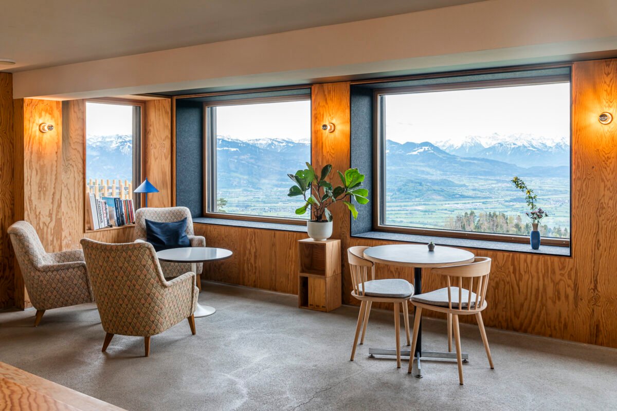
We tried a bit of everything and can join in the praise! The Alpenhof also impressed me otherwise. The double rooms are practically furnished – fancy furniture would only distract from the magnificent view. Shower and toilet are on the floor and shared with other guests, but these are also nicely decorated and include everything you need (hairdryer, towels, etc.).
Unfortunately, during our stay, it was still a bit too chilly (or too windy) to enjoy the aperitif properly outside on the terrace. But there are also cozy seating areas inside. Perfect for spending a few hours with a book or just letting your thoughts wander while looking towards Schesaplana. I also have words of praise for breakfast – everything is freshly prepared and brought directly to the table. We love it!


You see, it would somehow be a shame to only stop for lunch at this wonderful place. But better than nothing! And where else in the Appenzellerland can you get an espresso tonic with your afternoon cake?
Twin room with breakfast 170 CHF | Double room with breakfast 190 CHF | Dinner menu (Thu to Sat) 109 CHF | More info: Alpenhof Oberegg
Key Facts about the Hike from Berneck to St. Anton
The following hiking map shows the route of our hike from Berneck to St. Anton near Oberegg (Appenzell Innerrhoden). It is a consistently yellow-marked hiking trail (T1/T2). The first seven kilometers follow the signs for the second stage of the Rheintaler Höhenweg (No. 86). After the Hardegg ruins, the trail begins a partly steep ascent to St. Anton. Between Mohren and Nellenkapf, the trail runs for two kilometers on a paved side road.
| Starting Point | Berneck, Rathaus bus stop (426 m above sea level) |
| Accessibility | Accessible by public transport |
| Length | 12.2 kilometers |
| Elevation | ↗ 941 m ↘ 260 m |
| Duration | 4:00 h |
| Destination | Oberegg AI, St. Anton Kapelle bus stop (1,109 m above sea level) |
| Refreshment Stops | Restaurant Sonnegg Balgach, Restaurant St. Anton, and Alpenhof Oberegg |
Option: Kaien-St.-Anton-Weg
The following morning, we hiked the Kaien-St.-Anton-Weg, which starts right at the Alpenhof and continues to Rehetobel. For us, it was a leisurely cool-down, as we still felt the altitude gain from the previous day and the weather was no longer as friendly.
This barrier-free hiking trail is also a great option for those who do not want to tackle the climb from the Rhine Valley but still want to get some exercise. Alternatively, you can take the bus to St. Anton.
And for those who enjoy cycling, you should check out the Appenzeller Scenic Route – it also passes right by the Alpenhof.


Key Facts about the Kaien-St.-Anton-Weg Hike
The following hiking map shows the route of our hike from St. Anton via the Kaien-St.-Anton-Weg to Kaien (Rehetobel). It is a yellow-marked, barrier-free hiking trail (T1). The path can also be walked with a stroller. Note that SwitzerlandMobility rates the route as “difficult” for wheelchair users due to the gradient (sometimes significantly over 6%) and the path surface (partly gravel with coarser ruts).
| Starting Point | Oberegg AI, St. Anton Kapelle bus stop (1,109 m above sea level) |
| Accessibility | Accessible by public transport |
| Length | 3.7 kilometers |
| Elevation | ↗ 58 m ↘ 200 m |
| Duration | approx. 60 minutes |
| Destination | Rehetobel, Kaien bus stop (966 m above sea level) |
| Refreshment Stop | Alpenhof Oberegg (or for those who want to walk a bit further: Gupf Rehetobel) |
Further Excursions in the Region
In recent years, we have undertaken other excursions and hikes in the Bodensee – Appenzellerland – Rheintal triangle. Here are a few alternative tips that are also worth it:
- On the Alpine Panorama Trail through Eastern Switzerland
- On the Castle Trail from Werdenberg to Sargans
- Excursion Tips around the Bad Horn Hotel

Leave a Reply