

Multi-day hike in the Rätikon: 3 days on the Prättigau High Trail
Three days on scenic trails, through rugged limestone landscapes and past cozy mountain huts – the Prättigau High Trail truly captivated me. This multi-day hike in the Rätikon combines everything I love about hut tours: spectacular scenery, surprisingly varied trail sections, and that beautiful feeling of sitting contentedly in front of a hut after a long hiking day, soaking in the evening atmosphere.
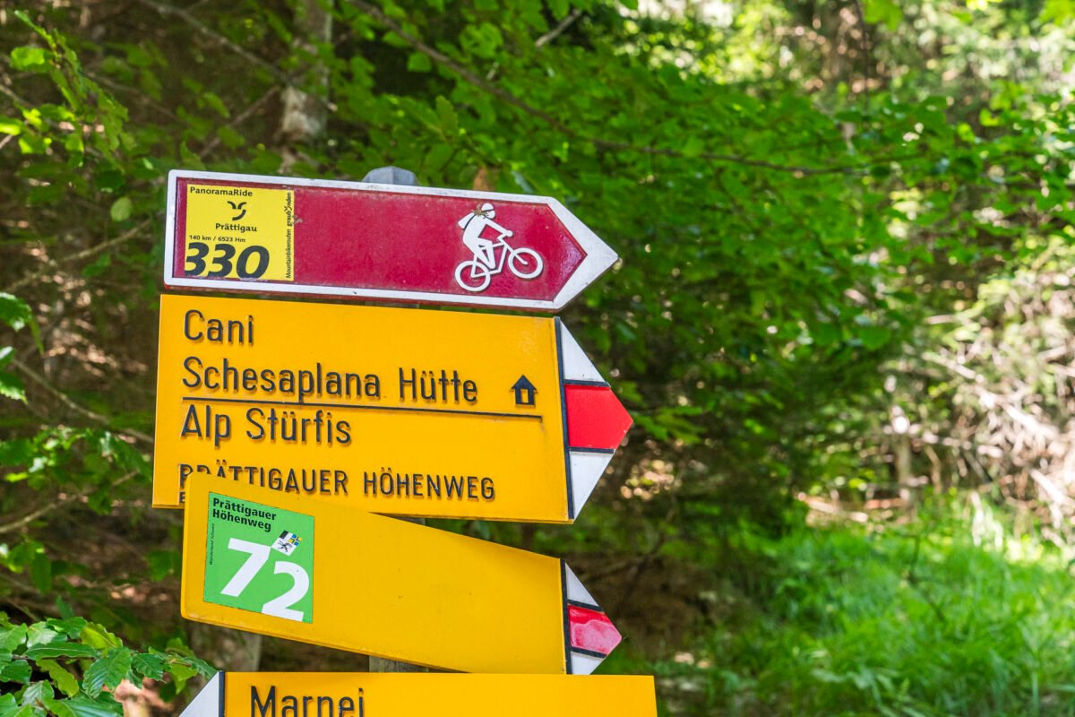
The Prättigau High Trail (marked with route number 72) stretches in its full length over four stages from Landquart to Klosters. However, the multi-day hike can be flexibly adapted. One stage you definitely shouldn’t skip is the second one from the Schesaplana Hut to the Carschina Hut – for me, one of the most beautiful hiking stages of last summer in the mountains.
Day 1: From Seewis Dorf to the Schesaplana Hut
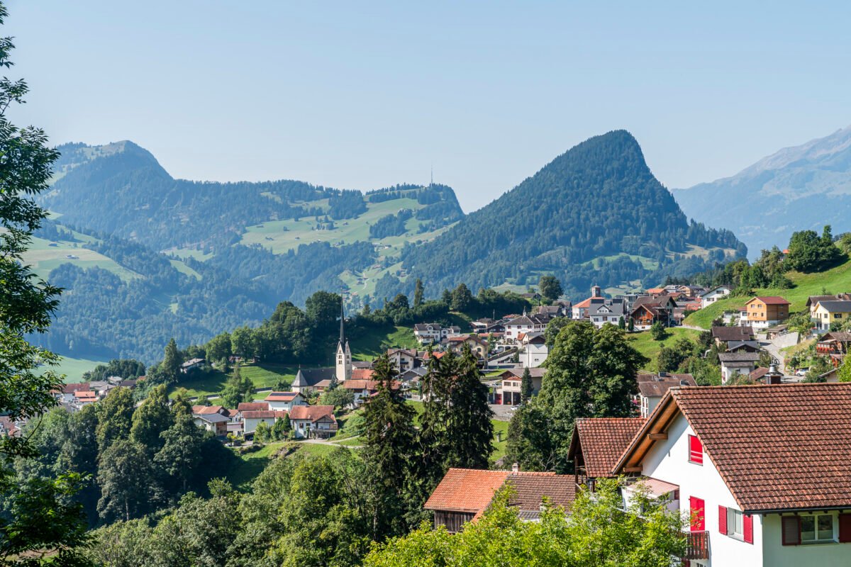
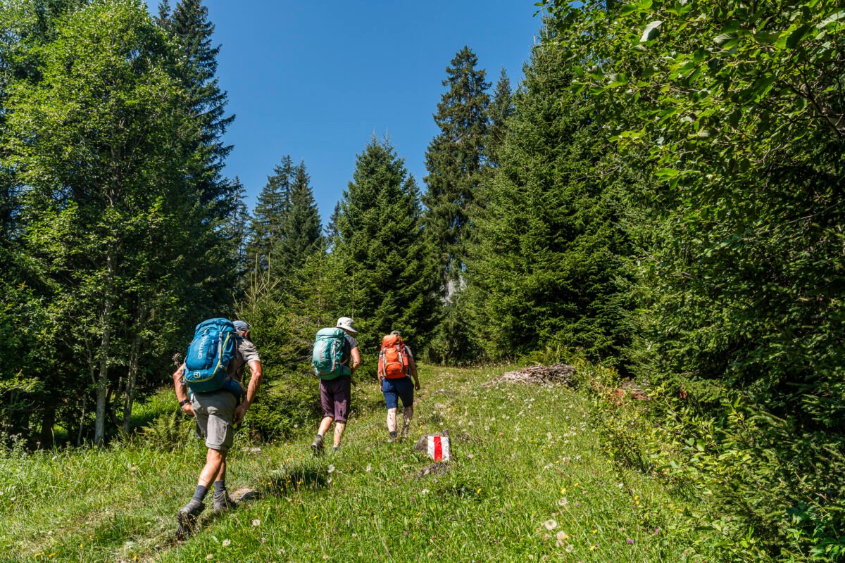
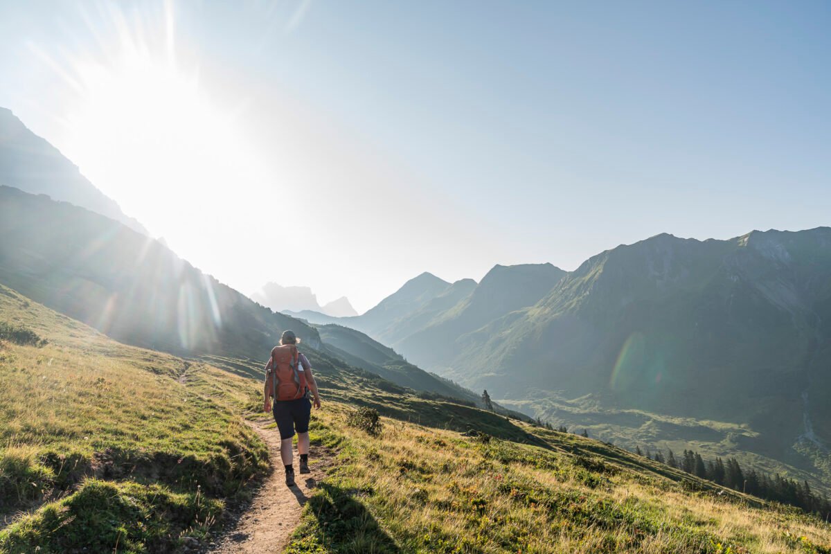
We decided to start the first hiking stage in Seewis. This village lies at the entrance to the Prättigau valley on a sunny plateau and is known for its daffodil bloom. By August, those have long since faded. Even though this starting point shortens the stage a bit, we still have a long and steep climb ahead of us. The motto: start early to cover as many kilometers as possible in the still pleasantly cool morning hours.
But our enthusiasm is quickly dampened: during a train transfer in Landquart, we realize too late that not all train cars stop in Grüsch. One part of our group jumps into the correct train car at the last minute – the other part misses the memo, as those two stations were used for a quiet bathroom break.
The result: only three out of our group of four get off in Grüsch as planned and catch the PostBus. The fourth person is forced to continue to Schiers and take the next train back to Grüsch. While we pass the time with coffee at the Chesa village restaurant, this person – with no other choice, since the PostBus runs only every two hours – hikes up the 40 minutes and roughly 300 vertical meters from Grüsch to Seewis on foot. Hats off for that extra effort!
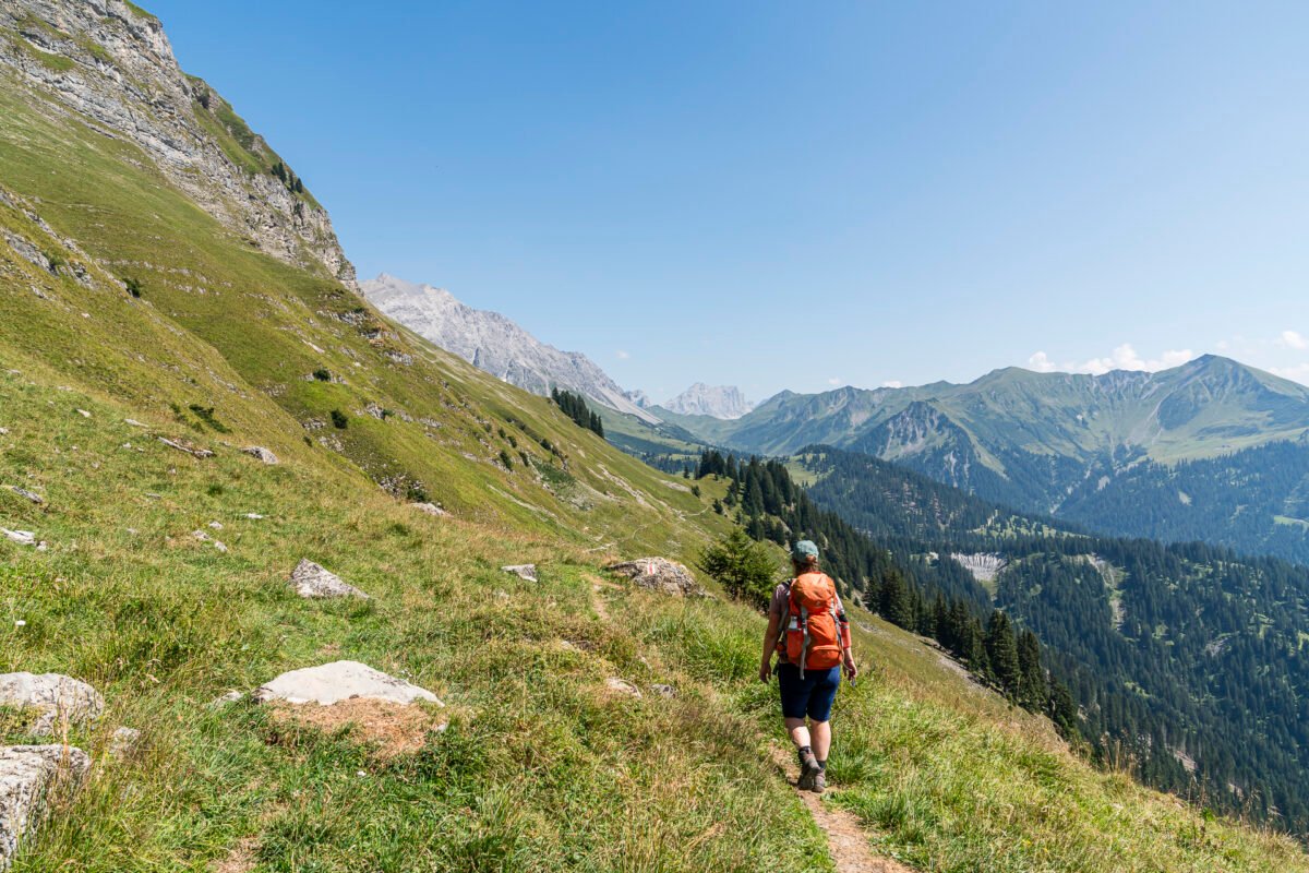
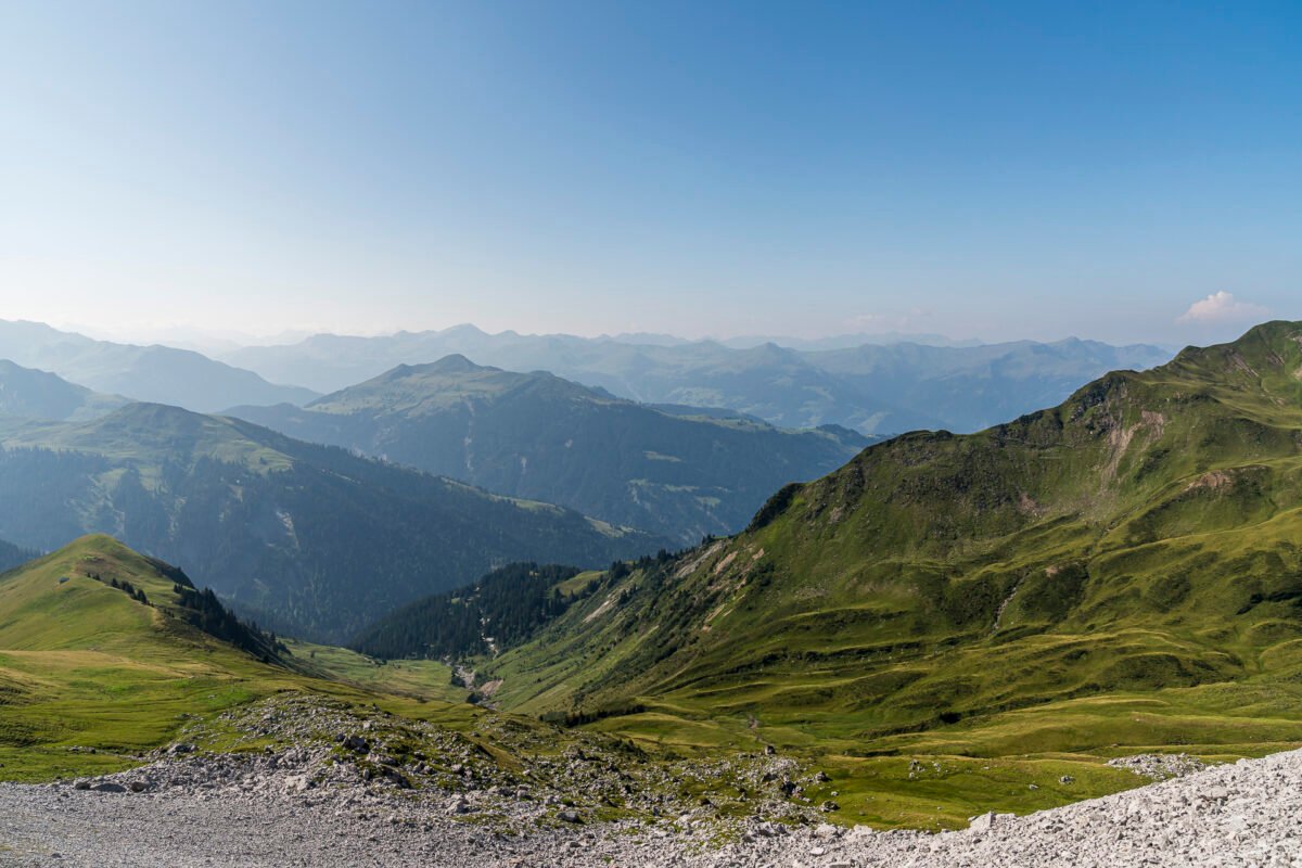
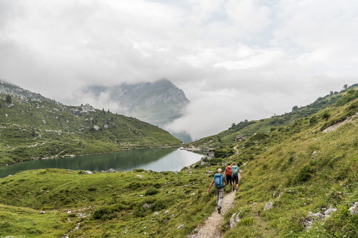
Reunited, we can finally start the actual tour. The trail marker leads us uphill along the road into the forested mountains. Soon, between the dark firs, the steep limestone cliffs of the Rätikon begin to appear. We follow the increasingly narrow road valley-inward for about six kilometers until the Prättigau High Trail branches off to the left near Cani, following the Canibach stream uphill to Alp Stürfis.
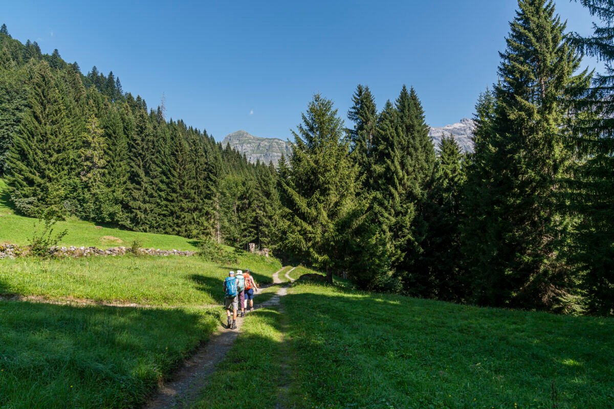
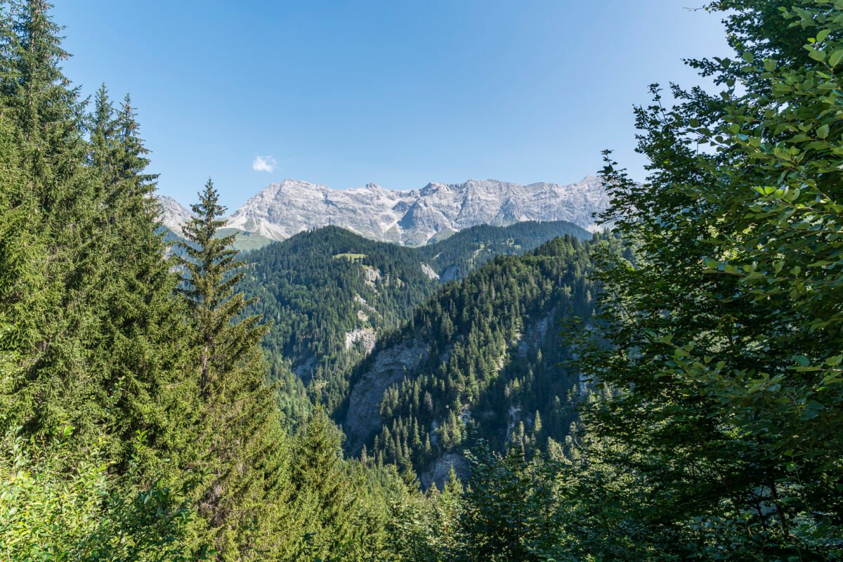
We’re still about 200 meters of elevation below the high trail near Sanalada. The day’s goal is coming into view, and the remaining stretch rewards us with stunning views over Prättigau and the Rätikon range.
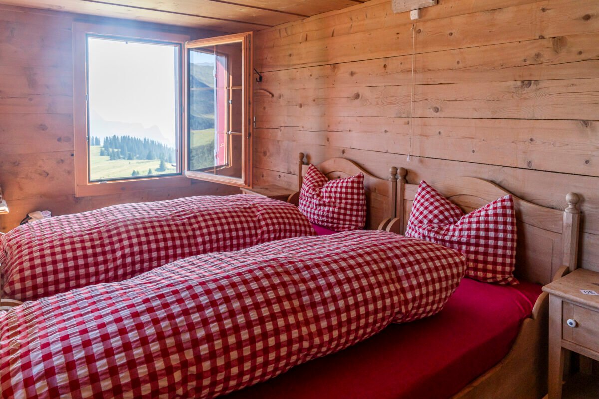
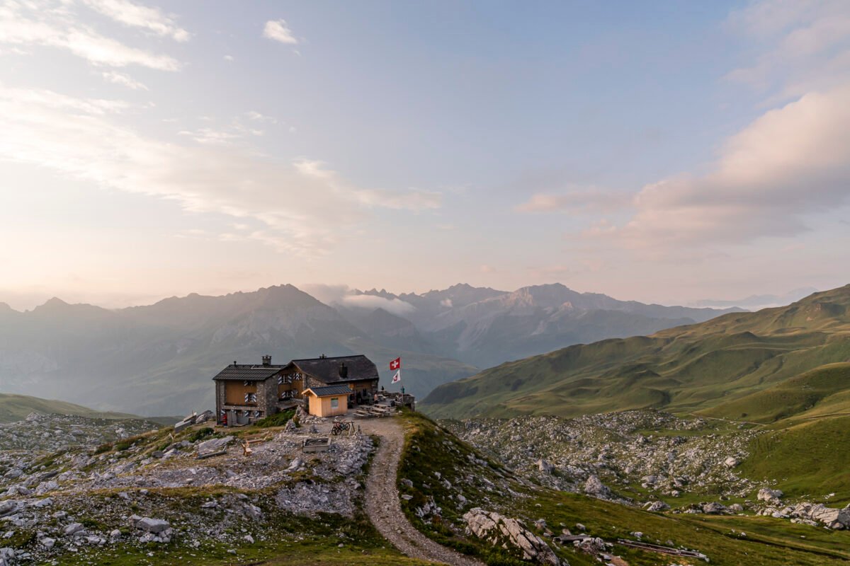
At our destination for the day, we’re welcomed at the Schesaplana Hut with two delightfully cozy, nostalgic double rooms – what a treat! And thanks to the wonderful weather, we enjoy dinner outside on the terrace. A perfect end to a perfect day.
Key Facts: Hike from Seewis Dorf to Schesaplana Hut
The following map shows the route from Seewis to the Schesaplana Hut. It’s a mountain hiking trail marked in white-red-white, with a difficulty level between T2 and T3. The start is relatively gentle – the trail follows a paved/gravel road deep into the valley. The rest of the route holds no major technical challenges. However, because some parts are fairly steep, a good base fitness level is recommended.
| Starting Point | PostBus stop Seewis Dorf, Bühelstrasse (936 m a.s.l.) |
| Accessibility | Accessible by public transport |
| Distance | 16.15 kilometers |
| Elevation | ↗ 1,306 m ↘ 341 m |
| Duration | 5:45 h |
| Destination | Schesaplana Hut (1,907 m a.s.l.) |
| Food options | – |
Day 2: From Schesaplana Hut to Carschina Hut
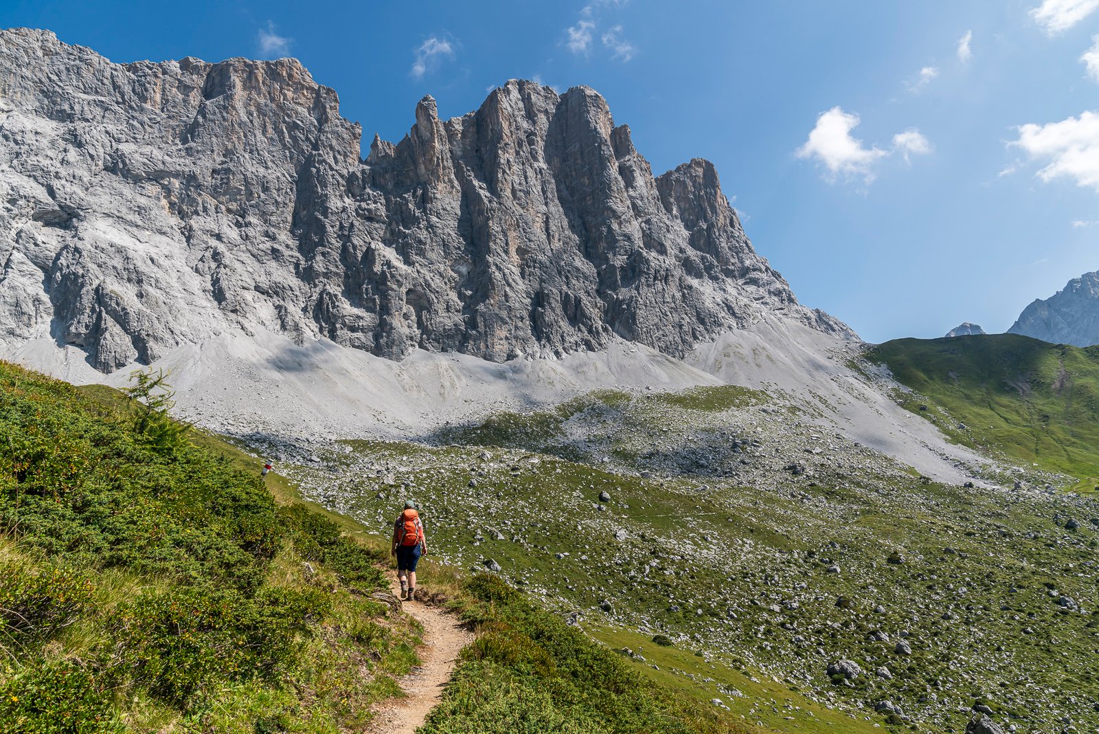
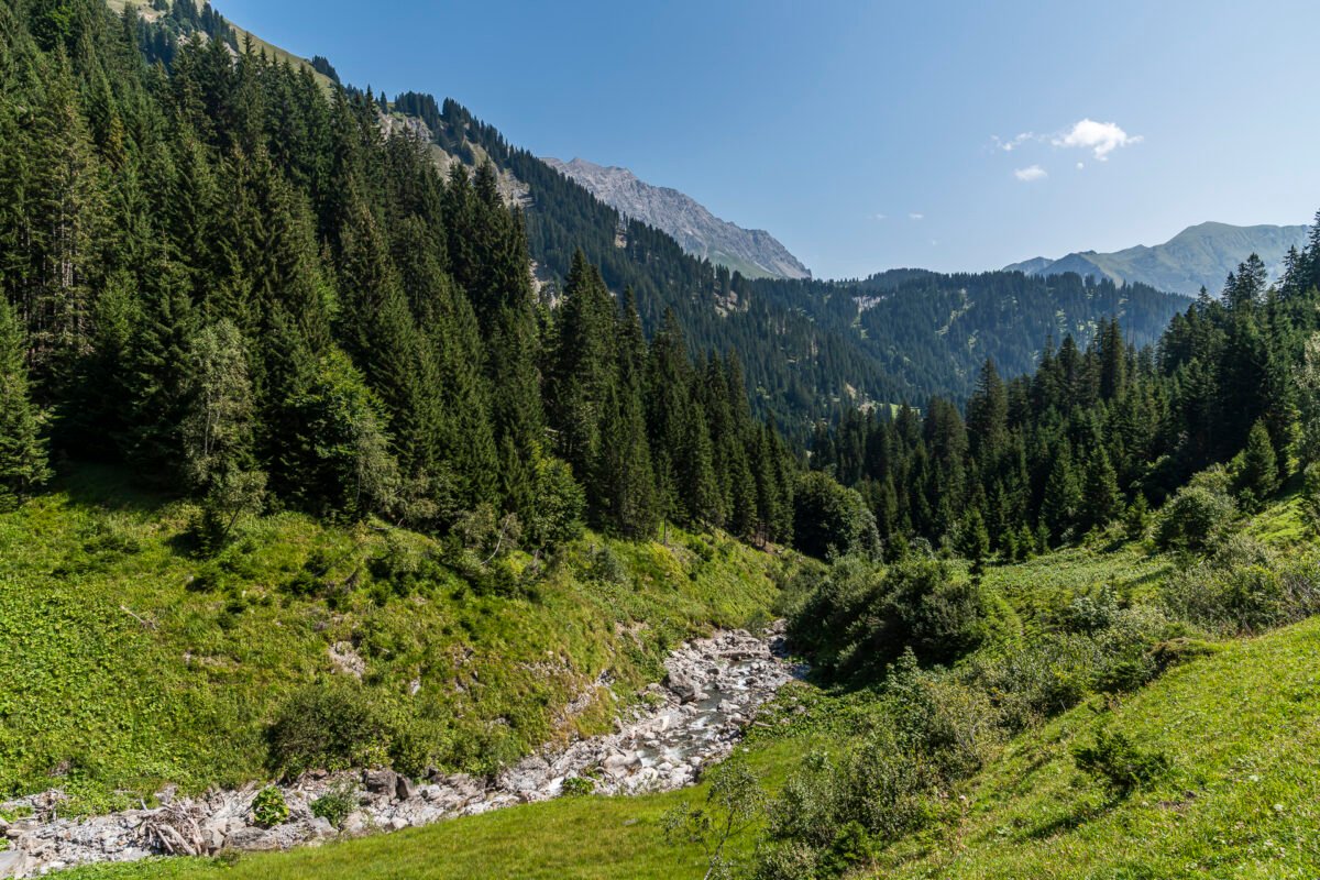
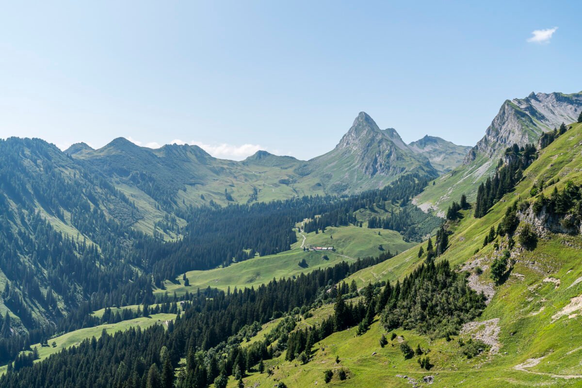
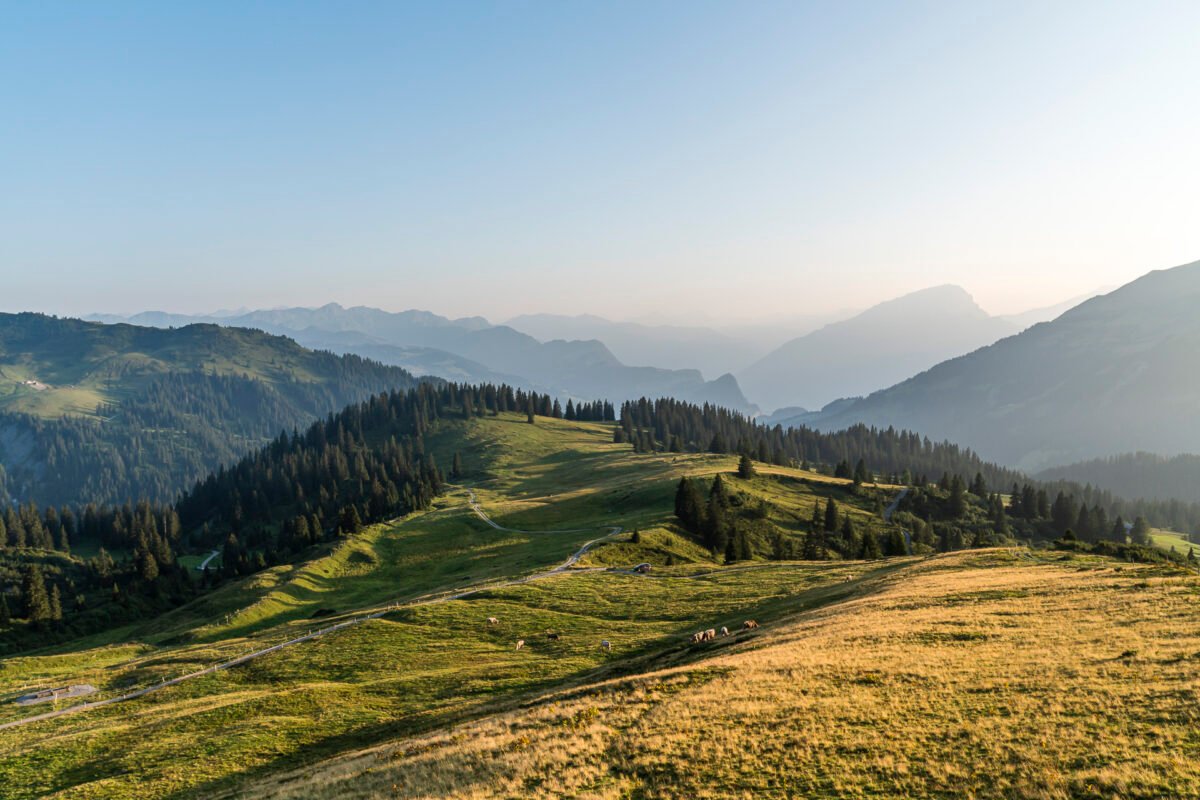
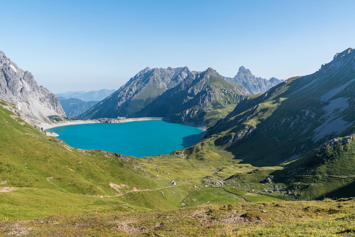
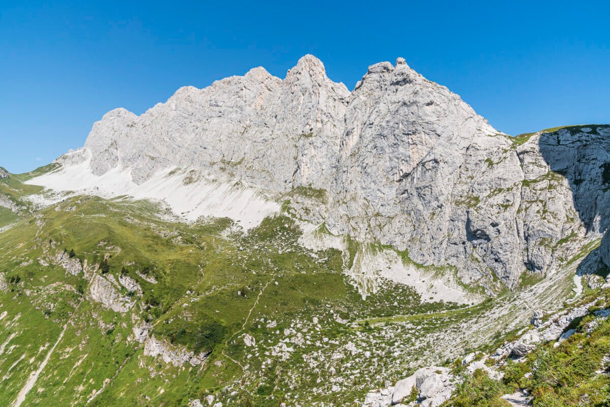
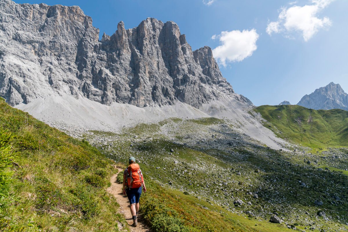
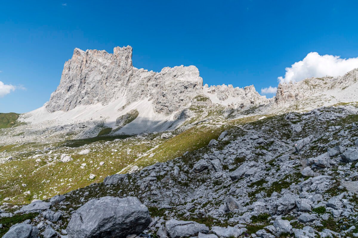
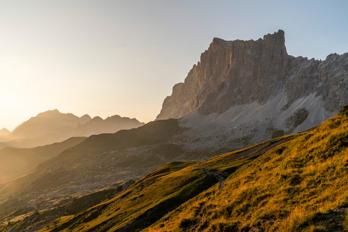
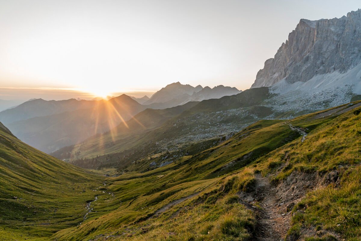
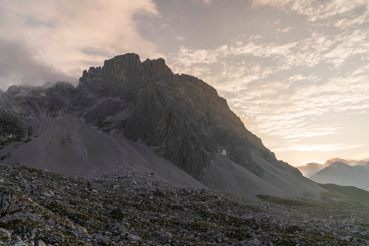
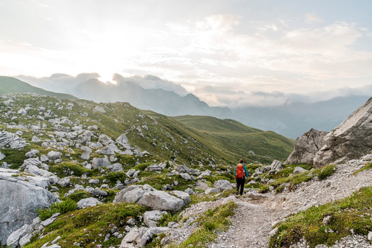
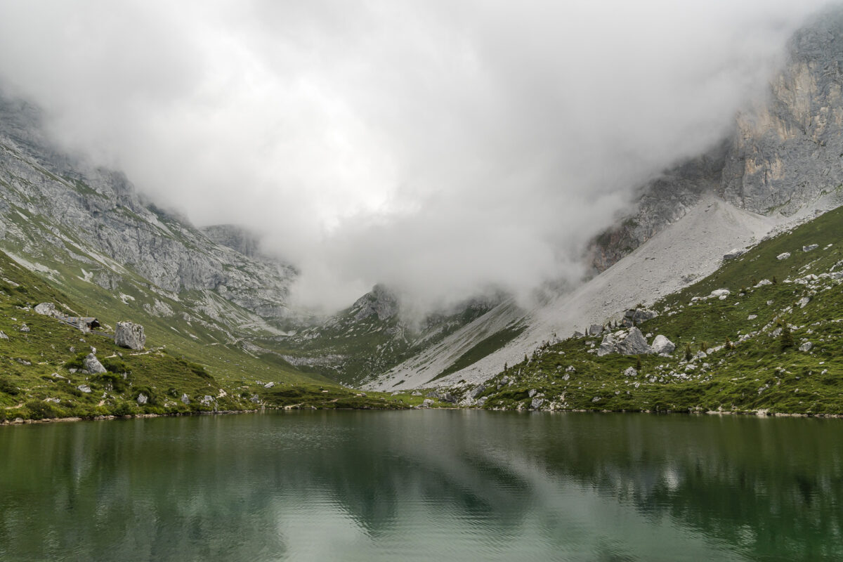
Glorious summer weather is forecast again for the second day on the Prättigau High Trail. We want to take advantage of the cool morning air, so we’re up and moving early. Awaiting us is the actual highlight of the Prättigau High Trail: this stage follows the Swiss-Austrian border between Schesaplana and Sulzfluh and leads along sunny southern slopes up to Cavelljoch – the pass toward Lünersee and the highest point on the route at 2,239 m a.s.l.
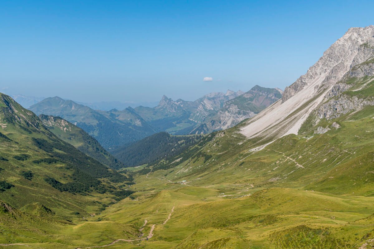
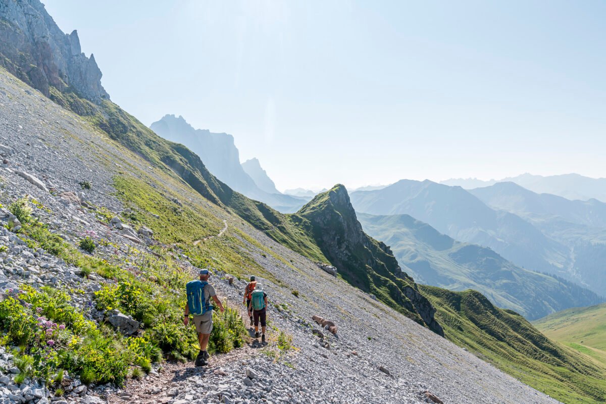
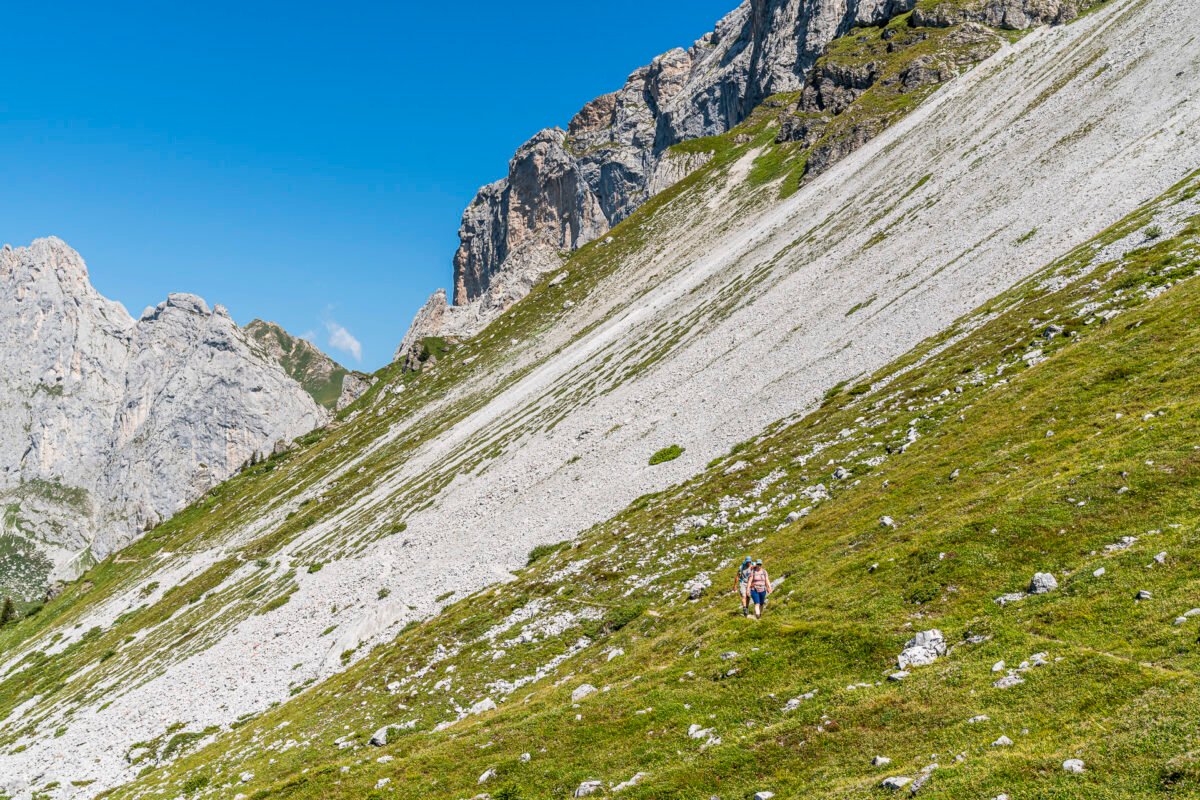
From here on, the mountain scenery becomes increasingly dramatic. The trail winds along the scree slopes of the Kirchlispitzen and continues to the imposing Drusenfluh with its striking “Drei Türme” (Three Towers). Simply fantastic! But don’t let the term “high trail” fool you – this stage also racks up nearly 900 vertical meters of climbing.
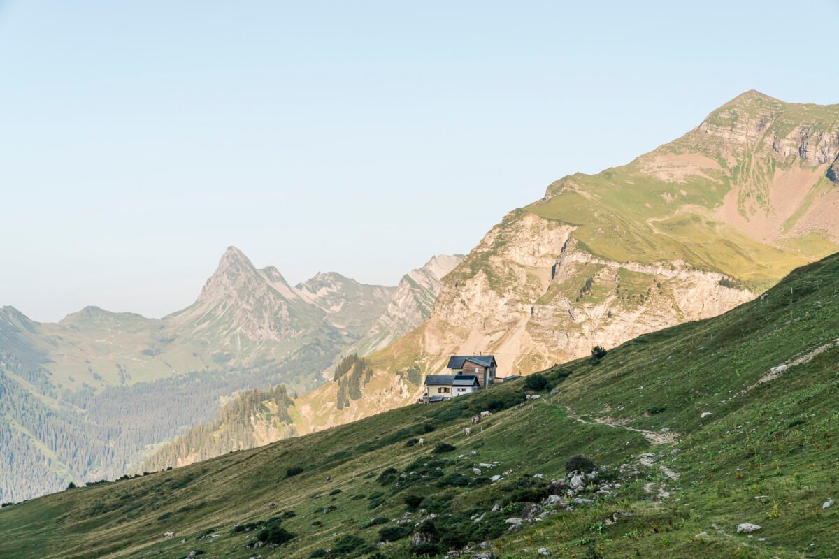
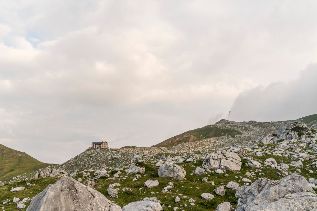
We reach the Carschina Hut in the early afternoon and spend the remaining time until dinner relaxing in deck chairs. Yet another fantastic evening in a truly dreamy mountain setting.
Note: In summer 2025, the Carschina Hut will undergo major renovations and will be closed. From June 10 to October 25, a small and simple outdoor food stand will be available during the day. If you still plan to tackle the two stages of the Prättigau High Trail this summer, you’ll need to include at least an additional one-hour descent (via the most direct path) to Partnunsee. From there, there is a Bus alpin service to St. Antönien.
Key Facts: Hike from Schesaplana Hut to Carschina Hut
The following map shows the route from the Schesaplana Hut to the Carschina Hut. It’s a white-red-white marked mountain hiking trail with a difficulty level of T3 throughout. Expect mostly narrow and sometimes exposed paths. However, they are all well-marked and technically not too demanding.
| Starting Point | Schesaplana Hut (1,907 m a.s.l.) |
| Accessibility | Not accessible by public transport |
| Distance | 15.8 kilometers |
| Elevation | ↗ 868 m ↘ 555 m |
| Duration | 5:00 h |
| Destination | Carschina Hut (2,203 m a.s.l.) |
| Food options | – |
Day 3: From Carschina Hut to St. Antönien
Originally, we had planned to include the Schijenfluh loop (route number 702) on the third and final hiking day. At 17.5 kilometers and 750 meters of elevation gain, this would’ve been another very rewarding stage. We already knew part of it from our hut tour to the Tilisuna Hut in summer 2022 – back then, we approached from the other side, hiking up from Gargellen in Vorarlberg.
In the end, we were glad that only a short descent to St. Antönien awaited us from the Carschina Hut – a change in weather was approaching. We just barely made it to our destination before the rain.
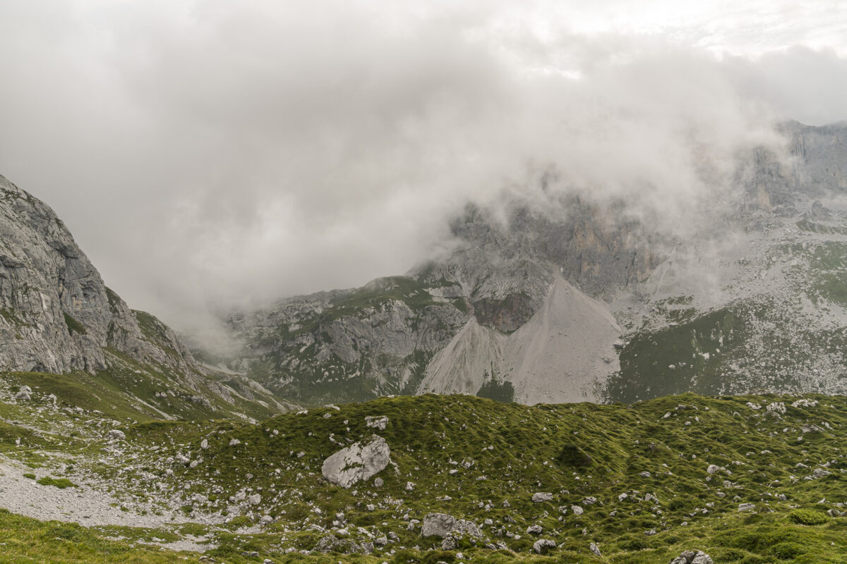
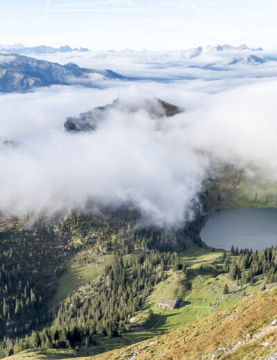
The highlight of this third stage is undoubtedly the Partnunsee. Even if you take the extra loop around the Schijenfluh, you’ll pass by this idyllic mountain lake.
Key Facts: Hike from Carschina Hut – Partnun – St. Antönien
The following map shows the route from the Carschina Hut via Partnunsee to St. Antönien. The entire route follows white-red-white marked mountain trails with difficulty levels ranging from T2 to T3. The descent from the Carschina Hut to Partnunsee is a classic mountain path. From Partnunsee to St. Antönien, the trail alternates between field paths and gravel roads.
| Starting Point | Carschina Hut (2,203 m a.s.l.) |
| Accessibility | Destination accessible by public transport |
| Distance | 8.5 kilometers |
| Elevation | ↗ 115 m ↘ 875 m |
| Duration | 2:30 h |
| Destination | PostBus stop St. Antönien, Rüti (1,461 m a.s.l.) |
| Food options | Berghaus Alpenrösli and Berghaus Sulzfluh |
Practical Tips for Your Multi-Day Hike on the Prättigauer High Trail
-
- The Prättigauer High Trail reaches altitudes of up to 2,250 m a.s.l. and is mostly south-facing. It’s usually snow-free and hikeable from mid-June to late September/early October.
-
- The Schesaplana Hut opens for the summer season at the beginning of June. The Carschina Hut normally operates from early June to mid-October (closed in 2025 due to renovations!).
-
- Overnight stay at the Schesaplana Hut including half-board costs 79 CHF (SAC members: 70 CHF). There’s a surcharge of 22 CHF per person for double rooms.
-
- If you don’t have time for a three-day hike – or if the Carschina Hut is closed like this summer – you can extend the second stage to Partnun or all the way to St. Antönien. Another alternative is to continue hiking to the Tilisuna Hut.
-
- The Carschina Hut is also a popular day trip destination from St. Antönien and a base for ascending the 2,817 m high Sulzfluh (marked mountain trail).

Leave a Reply