

Sentiero Cristallina: great multi-day hike in Ticino
Walking through the Ticino Alps in three days – this can be experienced with manageable effort on the 40-kilometre-long Sentiero Cristallina. We tackled the multi-day hike at the end of August and embarked on a varied and sporty discovery tour through the varied landscapes between the Leventina and the Valle Maggia. From alpine pass crossings to crystal-clear mountain lakes to quaint stone villages, the Sentiero Cristallina has a number of highlights in store away from the well-known sights of Ticino.
The Sentiero Cristallina at a glance
The Sentiero Cristallina is a multi-day hike that leads from Bignasco in the Maggia Valley to Airolo at the foot of the Gotthard Pass. The route is signposted with the route number “59” and is divided into three stages.
Stage 1 from Bignasco to S. Carlo (Val Bavona) leads mainly along historic mule tracks (difficulty level T1/T2). The second and third stages are classic mountain hiking trails of difficulty level T2/T3. The path is well signposted throughout and does not include any technically difficult parts. In both the second and third stages, it is possible to shorten the stages of the route by taking the cable car. Therefore, it is also possible to complete the Sentiero Cristallina in only two instead of three daily stages.
Alternatively, you can extend the second stage between Capanna Cristallina and Robiei (S. Carlo) with an additional loop through the fascinating glacial landscapes at the foot of the Basòdino (the highest mountain in the Ticino Alps). That’s exactly what we did and spent three hiking days on the Sentiero Cristallina despite cable car rides. The cornerstones and routes of our daily stages are shown at the end of each stage.
There is also flexibility in terms of the start and end point of the multi-day hike. While SwitzerlandMobility describes the route in a northerly direction (starting in Valle Maggia), we started the tour in Airolo and completed it in the opposite direction.
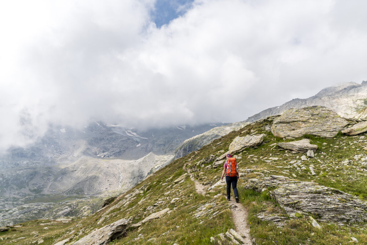
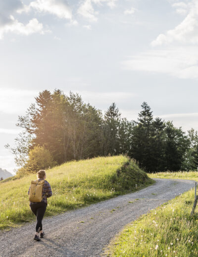
Stage 1: from Airolo to Capanna Cristallina
Thoroughbred trekkers may turn up their noses now – let’s actually start our multi-day hike on the Sentiero Cristallina with a shortcut. But the 600-metre difference in altitude between Airolo and Alpe di Pesciüm can be overcome much more comfortably and quickly with the gondola lift than on foot. And so, instead of a tough 1.5-hour ascent, we look down into Val Bedretto after just 15 minutes.
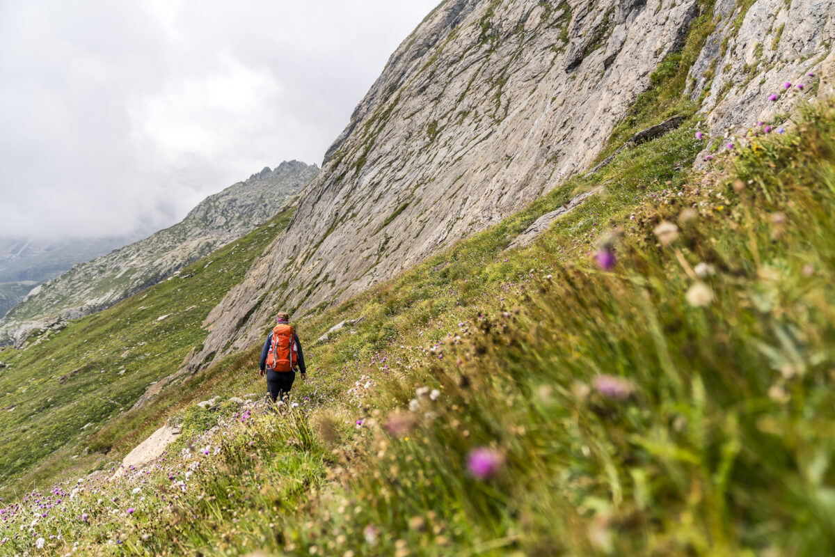
For us, the tour only really starts at the Pesciüm mountain station. We follow the “Strada degli Alpi” (a relatively wide gravel path), over which a bike trail also runs, in the direction of “Piano die Pescia/Alpe di Cristallina”. The paths are part of the alpine pastures and due to the sometimes very sloping terrain, it can happen that the herd of cows is so close together on the path that it is difficult to get through. We had to drive the herd in front of us for a section of about one kilometer so that we could continue on the way. Since I spent a few summer weeks on farms, I am fortunately used to such situations. However, I can imagine that this could be an unpleasant situation for someone with a fear of cows or a lack of knowledge in dealing with cows.
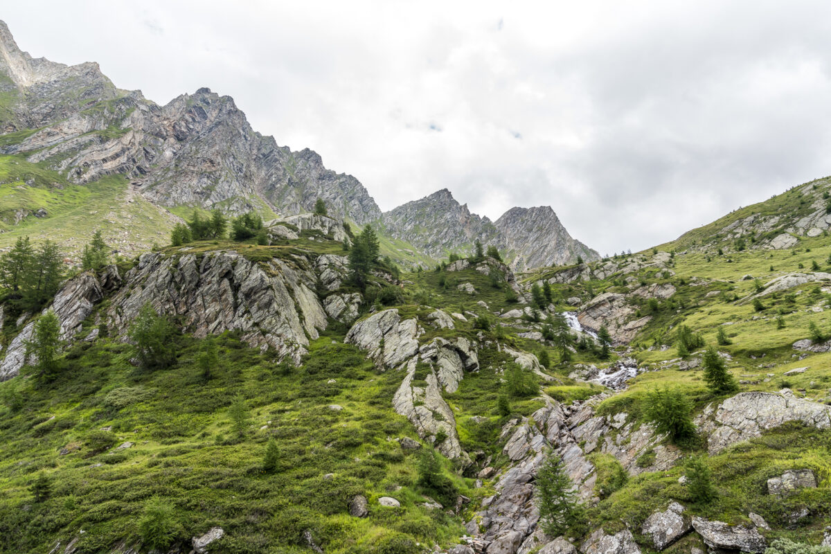
Otherwise, the section between Pesciüm and Alpe di Cristallina offers beautiful larch forests and moorland landscapes as well as magnificent panoramic views towards the Gotthard massif and the Val Bedretto.
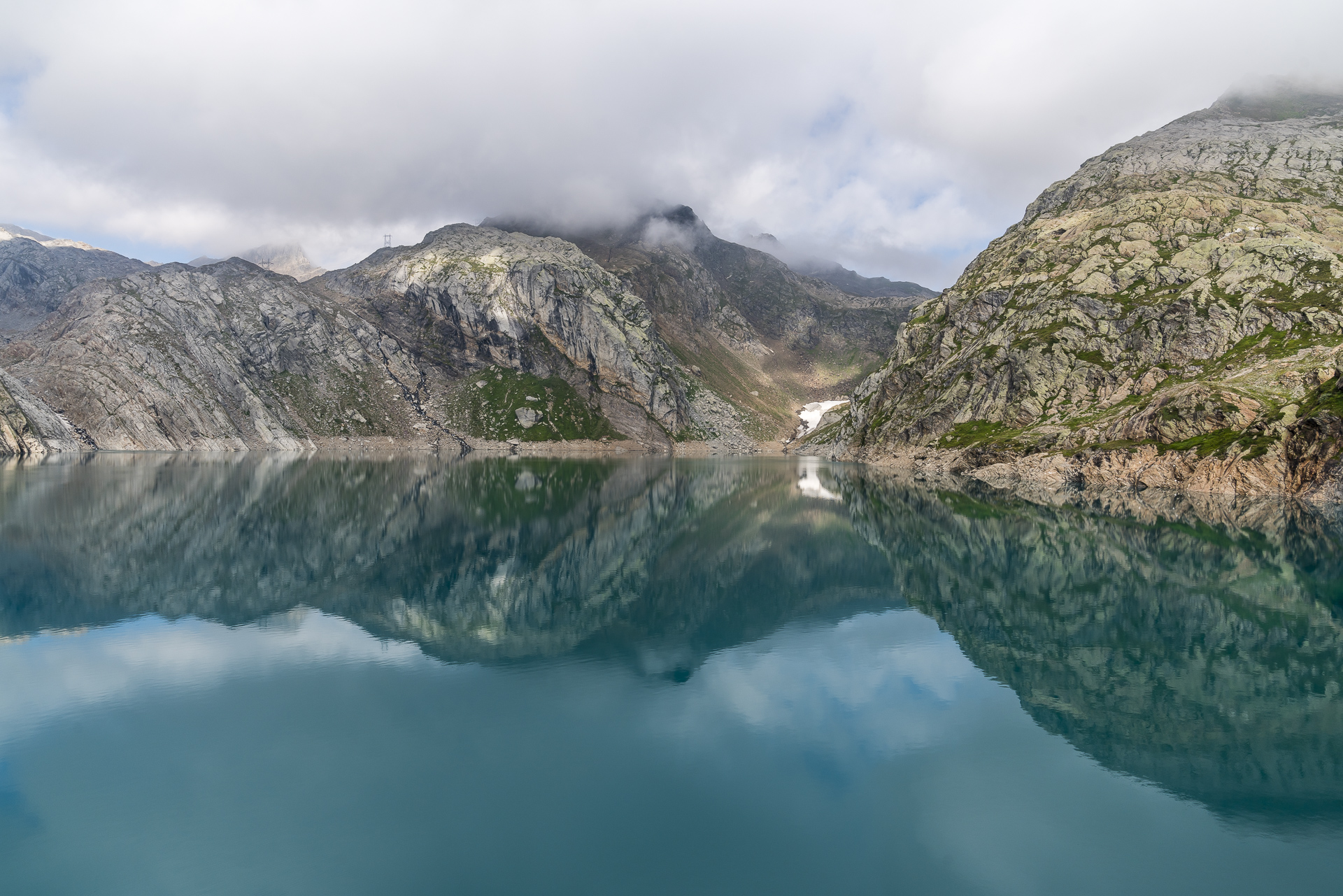
After a leisurely start along the high trail to Piano di Pescia, the sporty – but even more scenic – part of this stage begins with the ascent to Alpe di Cristallina. The path follows the babbling Ri di Cristallina continuously uphill. The vegetation, which was lush at first, becomes more and more sparse, until the stony Passo di Cristallina finally appears in front of us, at the top of which the Cristallina hut is enthroned. The original SAC hut was built in 1939 about 150 meters below the current location. However, after it was damaged several times by avalanches and almost completely destroyed by an avalanche in 1999, the new building, which opened in 2002, was placed outside the avalanche couloirs directly at the top of the pass for safety reasons.
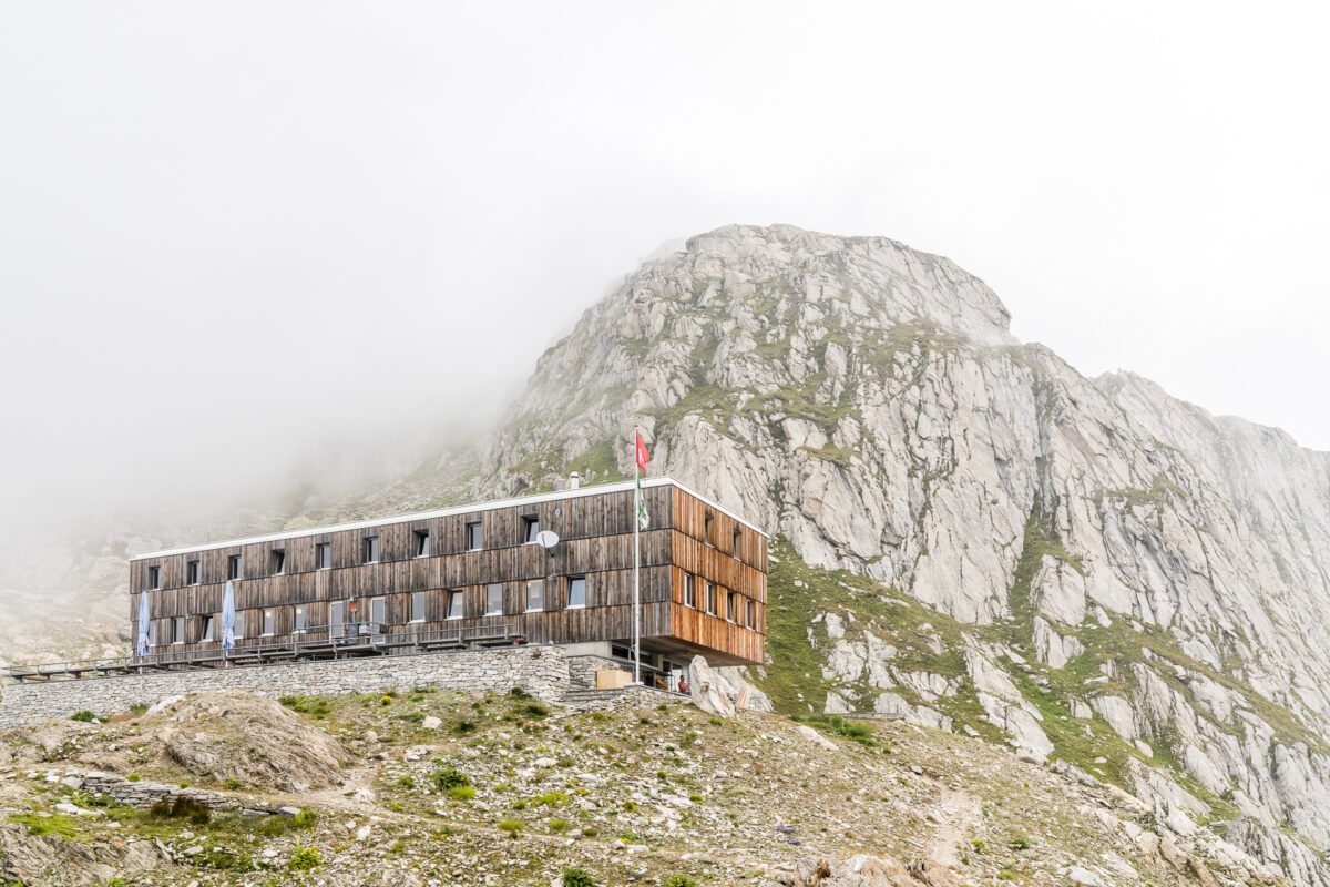
When we check in, we are assigned a sleeping place in an 8-person loft, but it is currently only half occupied. While we started the hike in Airolo in summery temperatures and bright sunshine, the clouds were surprisingly persistent up here. And so, unfortunately, we do not get to enjoy a well-deserved aperitivo on the beautiful sun terrace of the hut. Instead, we make ourselves comfortable in our assigned place in the common room and pass the remaining time until dinner with a Scrabble (cheers to the large selection of board games in the hut).
Key data of the 1st stage Pesciüm – Capanna-Cristallina
| Starting point | Mountain station of the Airolo-Pesciüm gondola lift |
| Length | 11.8 kilometers |
| Elevation gain | ↗ 1,107 m 284 m ↘ |
| Duration | 4:30 p.m. |
| Destination | SAC Crystalline Hut |
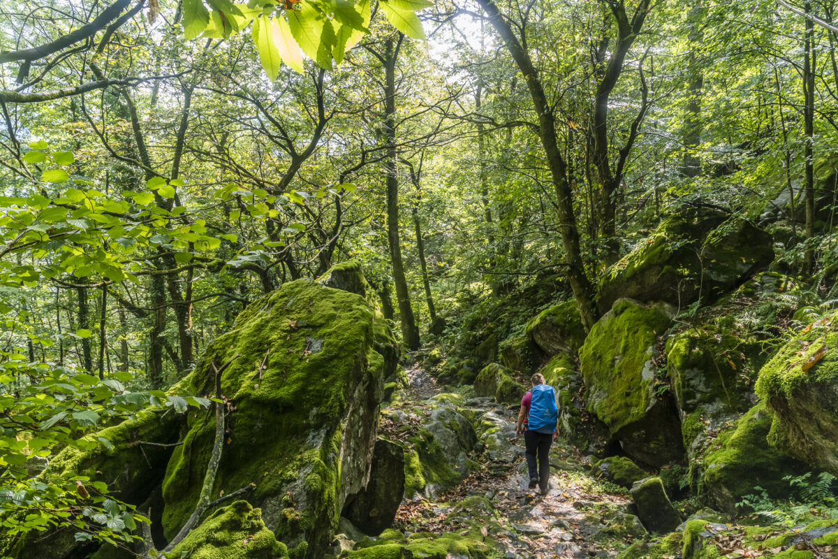
Day 2: from the Capanna Cristallina on the attractive 7 Lakes Trail to Robiei
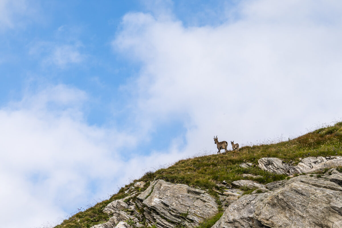
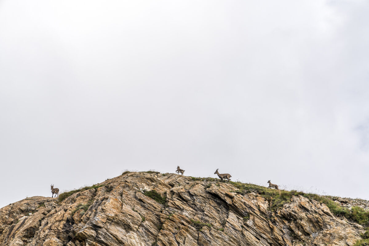
The next morning is even cloudier than the night before. Unfortunately, this was probably nothing like a sunrise over the Ticino Alps. Well. On the other hand, the morning visit of the ibexes brings movement to the breakfast room. These can be seen here often and accordingly it is worthwhile to take a good zoom lens with you. Unfortunately, we only had our “standard lens”, the Sony FE 24-70 mm f/2.8 GM, with us, which unfortunately didn’t offer anything useful in this nebula.
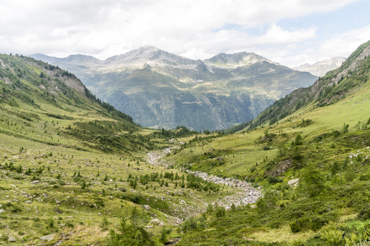
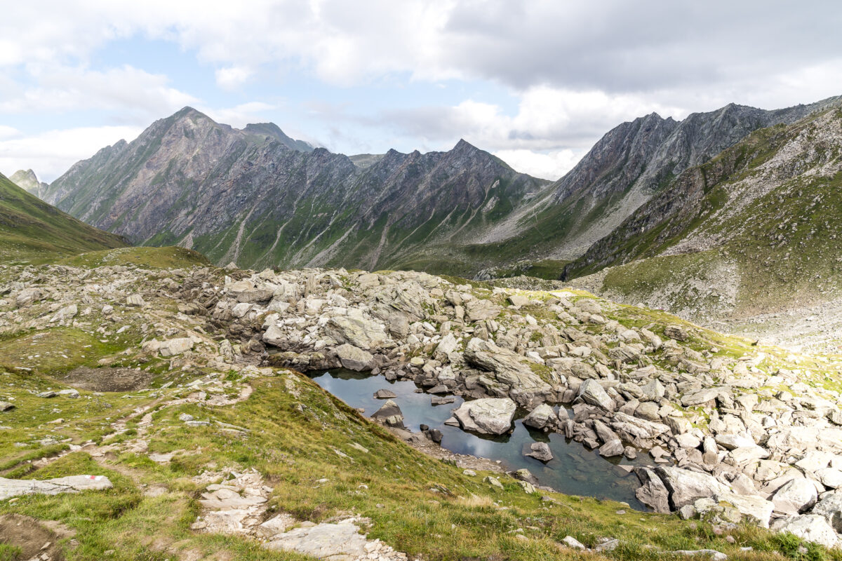
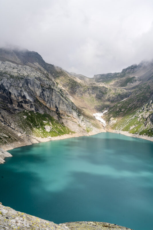
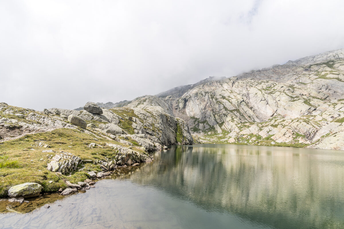
Despite the low-hanging clouds, we set off early. If we were to follow the Sentiero Cristallina directly to our next overnight stop in Robiei, we would be at our destination after two hours. On this day, however, we want to take a detour via Lago di Cavagnöö and Lago dei Matörgn to the Valletta di Fiorina.
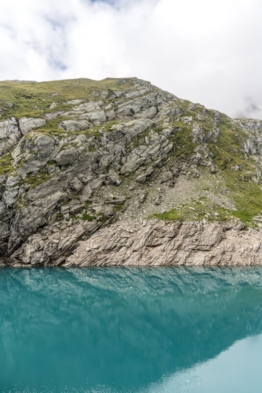
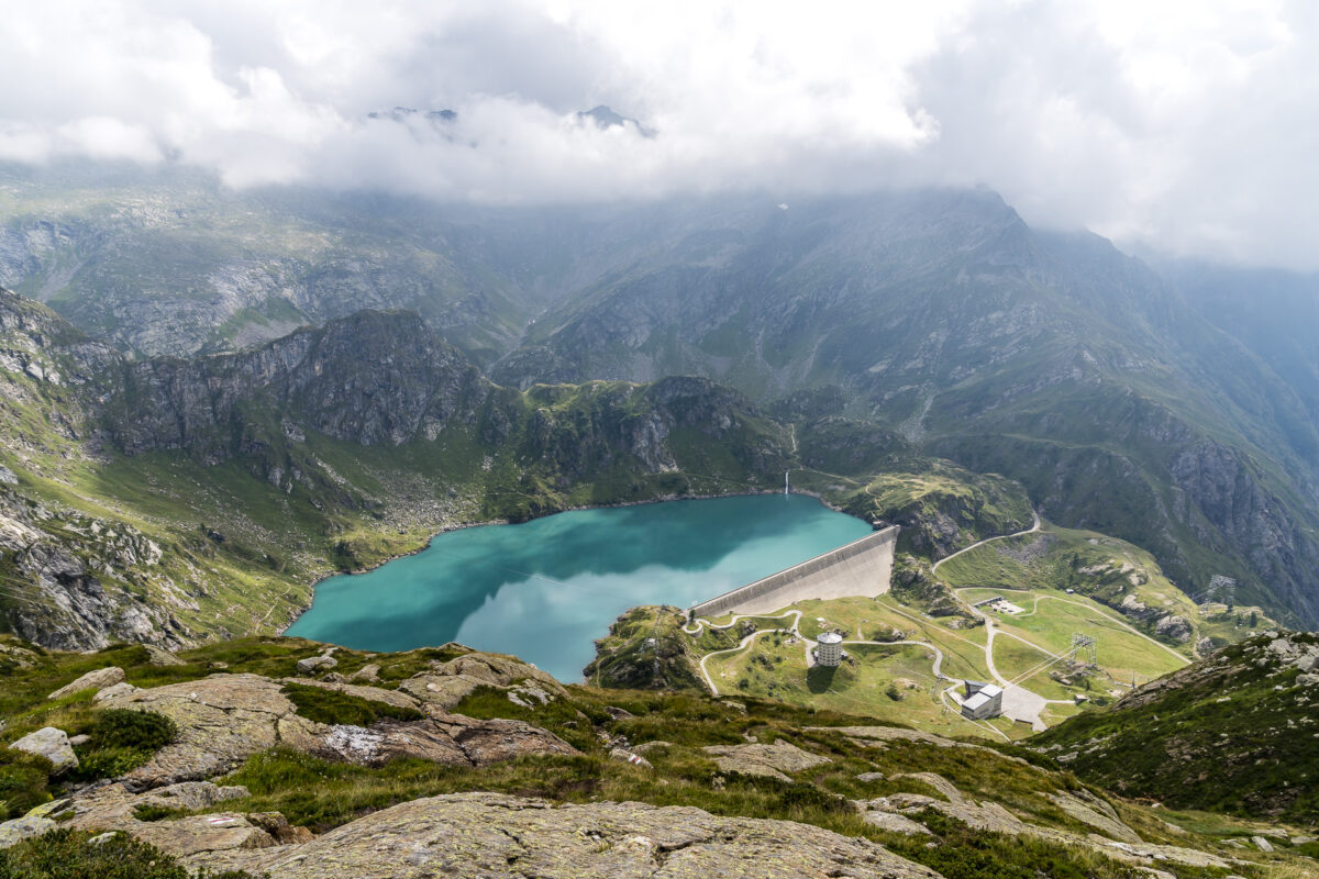
We first follow the Sentiero Cristallina, which leads us along a narrow path high above the imposing Lago Sfundau. At the end of Lago Sfundau we turn right and walk over stony terrain down the valley to the access road to Lago di Cavagnöö. Shortly before the reservoir, we unexpectedly startle a group of stone goats with offspring. Even if we don’t have the right equipment with us, we can still capture this encounter with some photos.

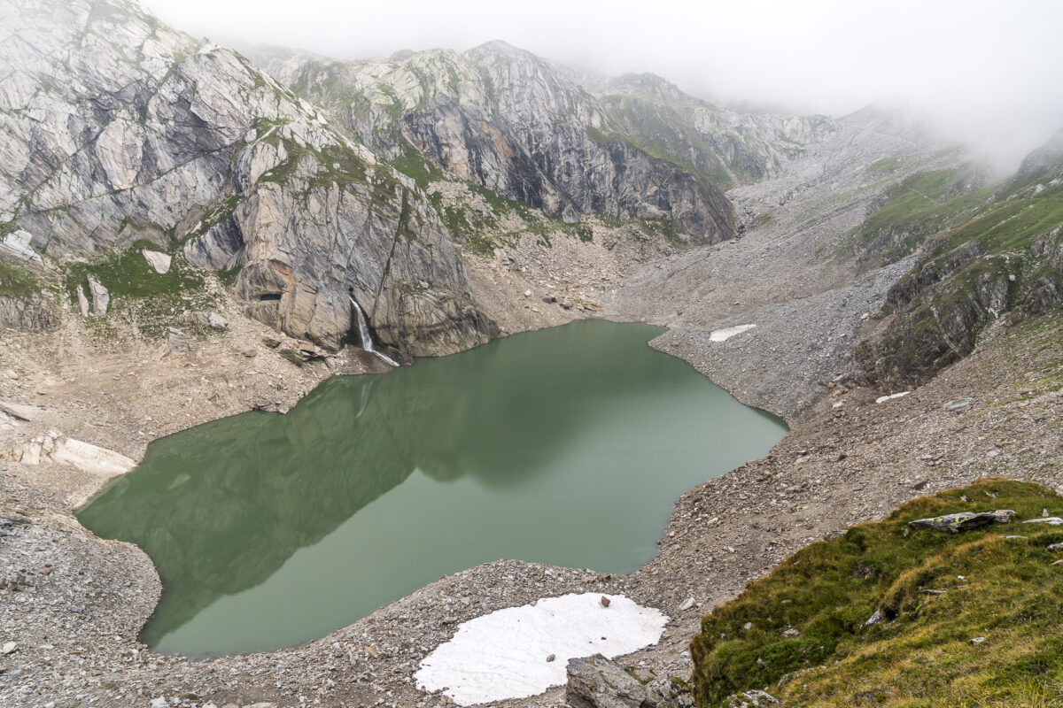
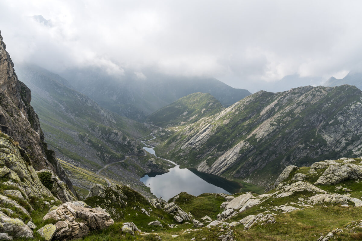
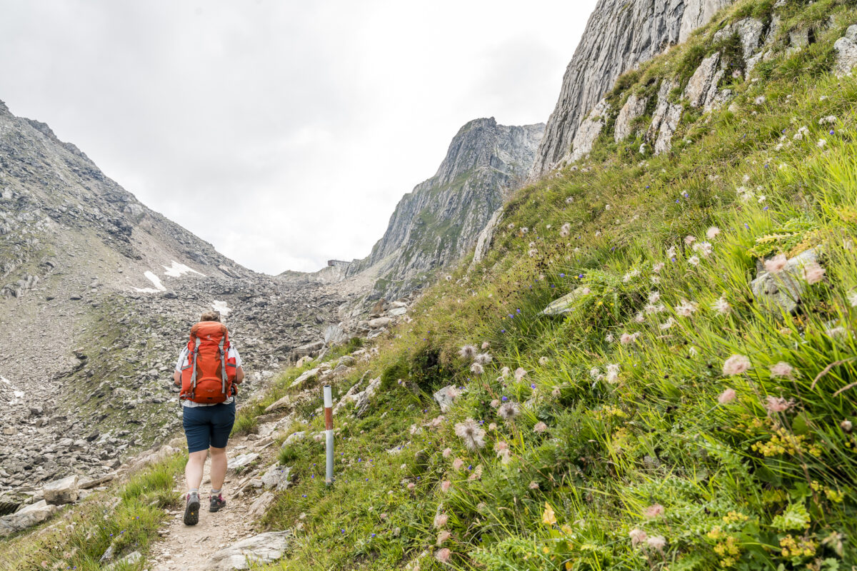
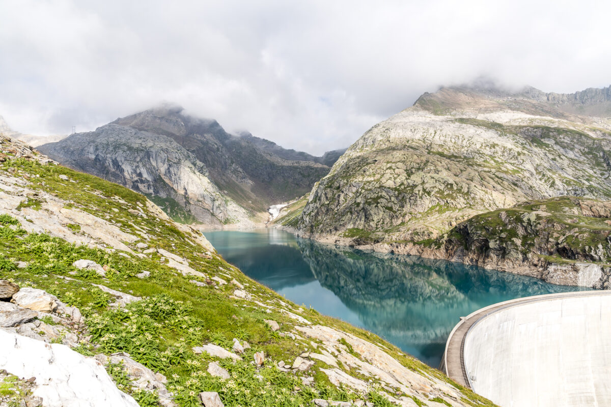
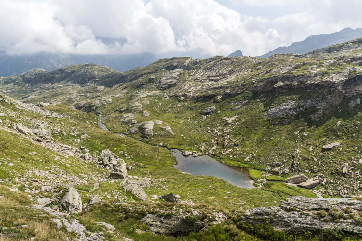
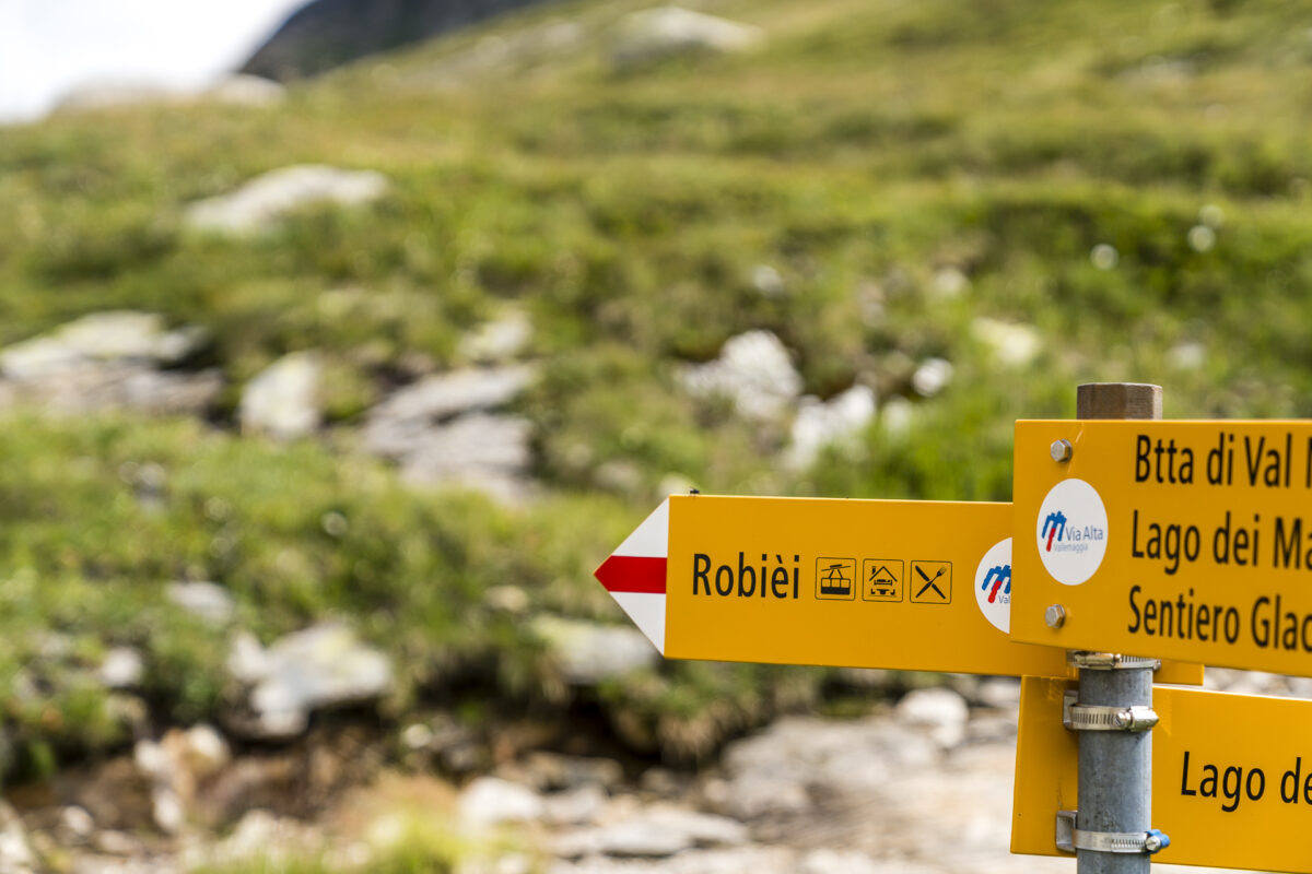
Today’s stage is characterized by constant ups and downs. We now climb up again to reach the next high valley via the Cresta dell’Arzo. Our destination for the day, Robiei, seems to be within reach and the view of this imposing and at the same time massively shaped mountain landscape by infrastructure buildings is incredibly fascinating from up here.
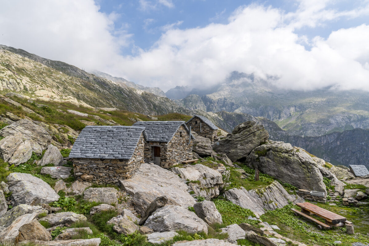
The cheerful ups and downs continue cheerfully and so a short, jagged descent is followed by another ascent towards Bocchetta di Val Maggia (high alpine pass crossing to Italy). We pass the beautifully restored stone houses near Arzo and enjoy the view in this beautiful – and in contrast to Robiei completely natural – high valley.
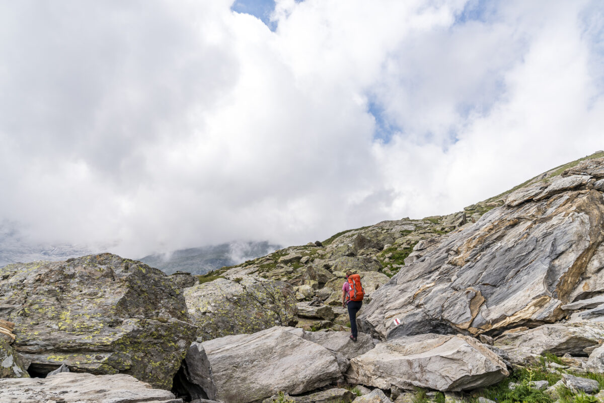
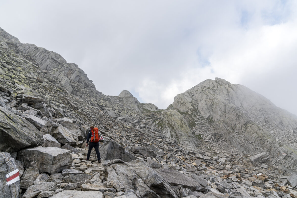
At Lago dei Matörgn we start our way back and follow a white-blue-white marked path down to the Valletta di Fiorina. The white-blue-white marked section was a factor of uncertainty for me when planning the tour – but the path does not hold any insurmountable obstacles in store for me. It is steep and two or three sections lead over shorter rock sections, which are well secured with steel cables. If you have surefootedness and don’t let yourself be immediately disturbed by sloping sections, you will master these games without any problems.
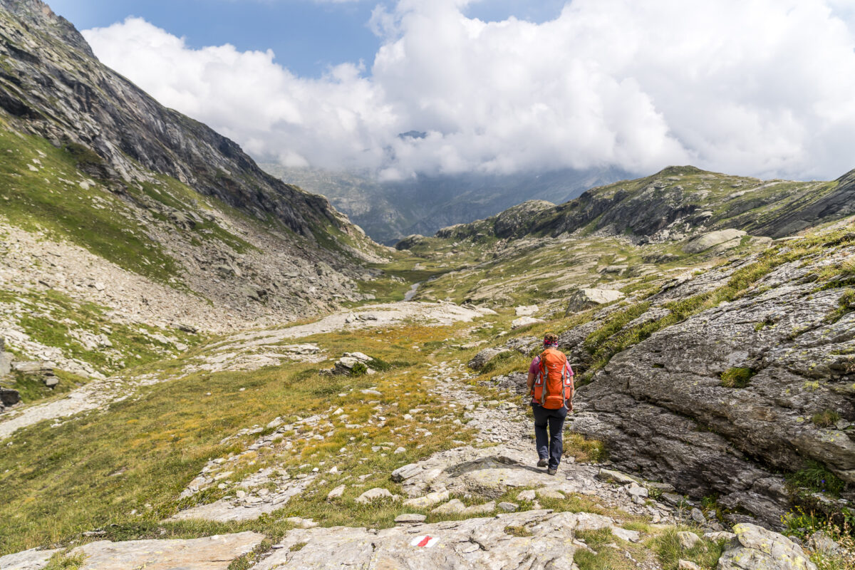
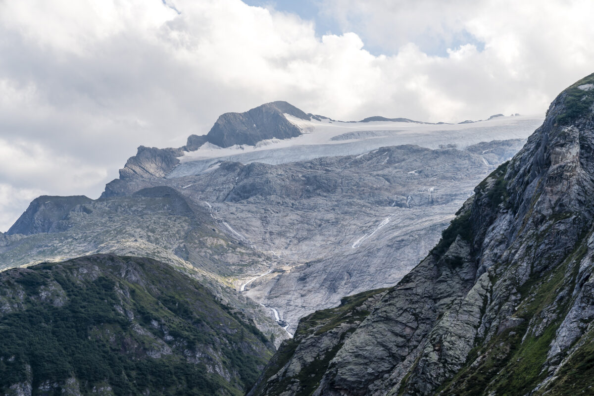
The way back through Valletta, the Fiorina to Robiei is another highlight for me on this day. The trail is part of the Basòdino Glacier Trail and offers unique glimpses of a landscape shaped by glaciers.
In Robiei there are two places to stay: the Capanna Basodino and the Albergo-Ristorante Robiei. Alternatively, you can of course take the cable car down to S.Carlo and spend the night there (although the choice down in Val Bavona is not much larger). We decided to spend a night at the Albergo-Ristorante Robiei (partner link), which offers comfortable double rooms with integrated toilet/bathroom (hotel standard). The hotel is housed in the premises of the striking octagonal building, which was used to house the power plant employees in the 1960s. Our room as well as the view – directly on the Basodino glacier – are great. We were less convinced by the local cuisine. But my parents’ field trial a few weeks earlier showed that the Capanna Basodino was no better in this regard.
Key data of the 2nd stage Capanna Cristallina – Robiei
| Starting point | SAC Crystalline Hut |
| Length | 12.25 kilometers |
| Elevation gain | ↗ 692 m 1,351 m ↘ |
| Duration | 4:45 p.m. |
| Destination | Bondage |
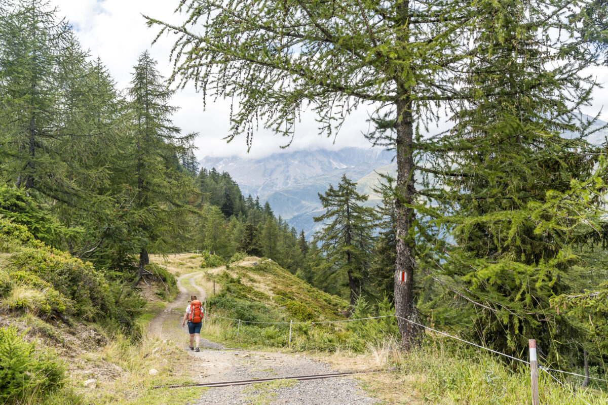
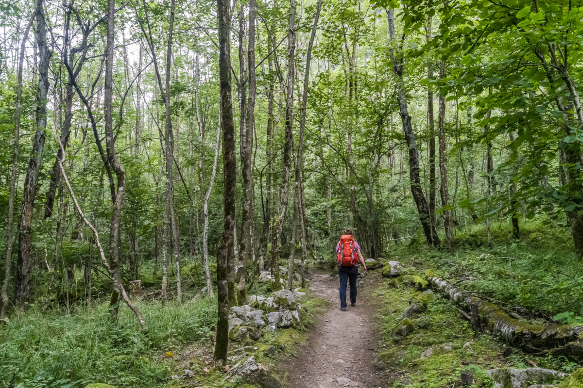
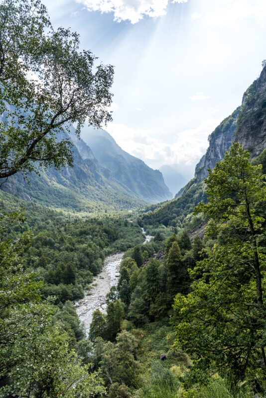
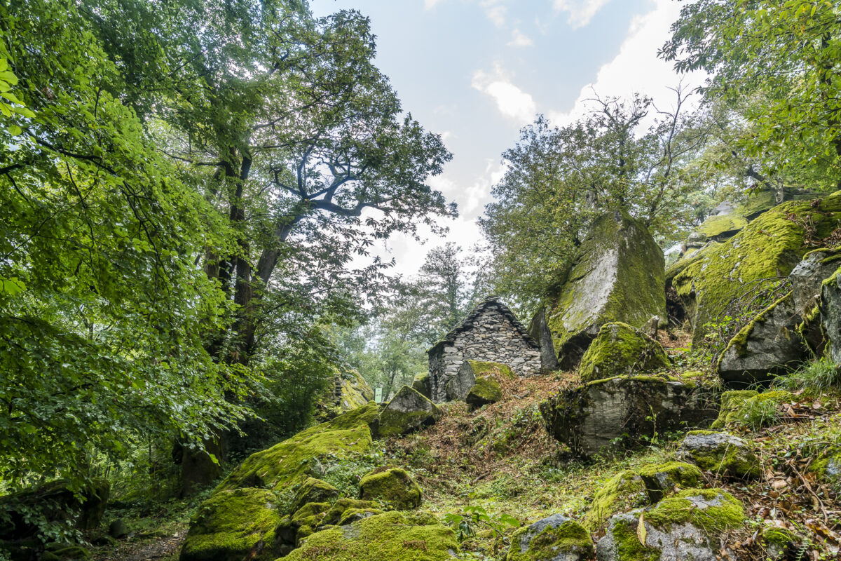
Day 3: through the enchanted forests of Val Bavona
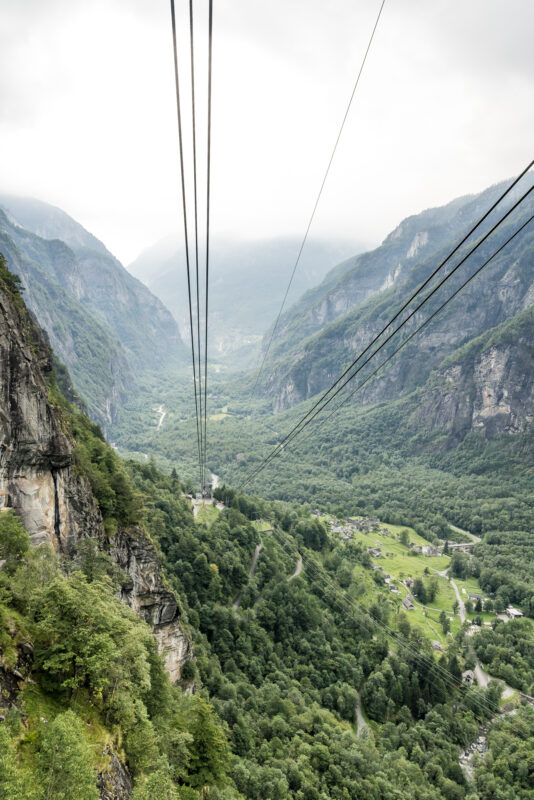
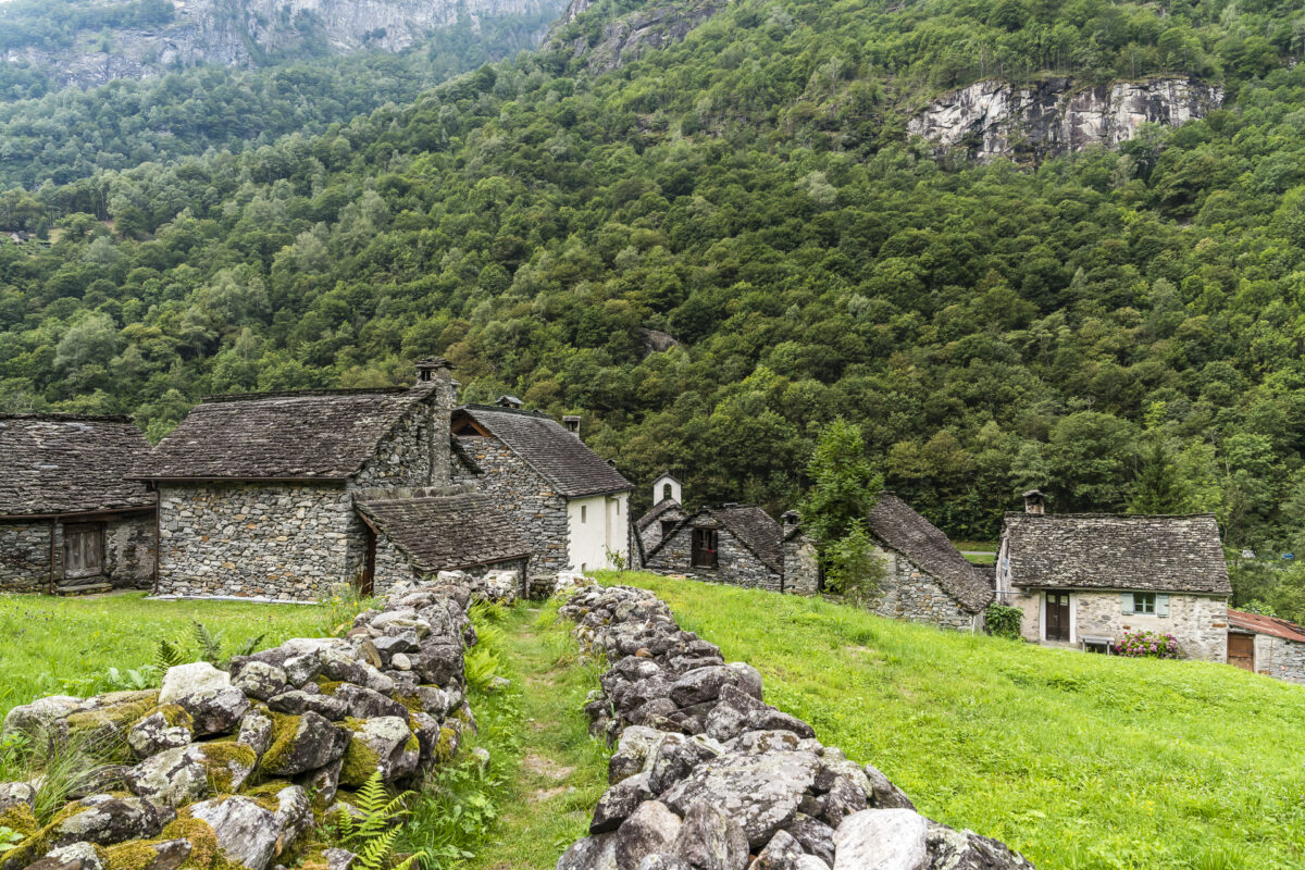
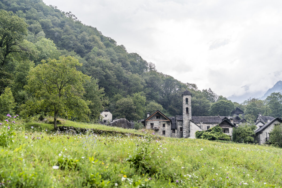
On the third day of our multi-day hike along the Sentiero Cristallina, we take the cable car down to Val Bavona. As I said, this route can also be done on foot, but on the one hand the view from the cable car into this densely wooded valley landscape is impressive and on the other hand my knees are grateful that they are spared the altitude difference here. Incidentally, it is paradoxical that despite its proximity to the power plant landscape near Robiei, Val Bavona still has no electricity in large parts. The small settlements in the valley are still self-sufficient and make do with solar cells, gas and small power plants.
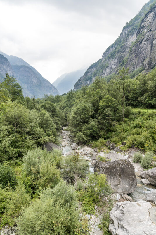
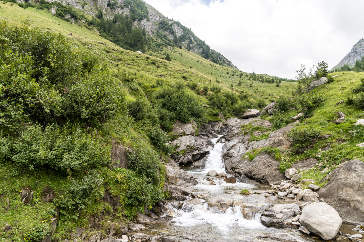
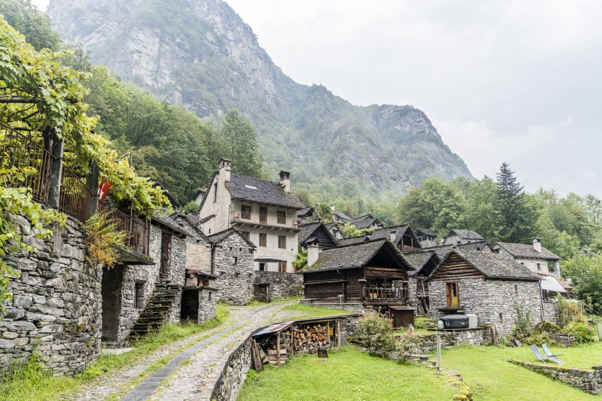
The third hiking stage offers a whole new facet of landscape. Instead of far-reaching views, alpine pastures and scree slopes, we are now offered what feels like a thousand shades of “green”. To perfect the jungle feeling, Petrus has also provided moist, warm temperatures and continuous rain showers. We are not spared anything on this day – but that’s exactly what makes this stage so magical. Thanks to numerous information boards with explanations of historical buildings, we take a lot of interesting facts about the valley and its inhabitants with us on the way.
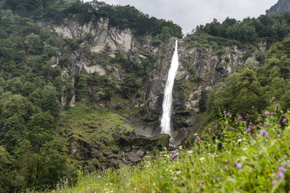
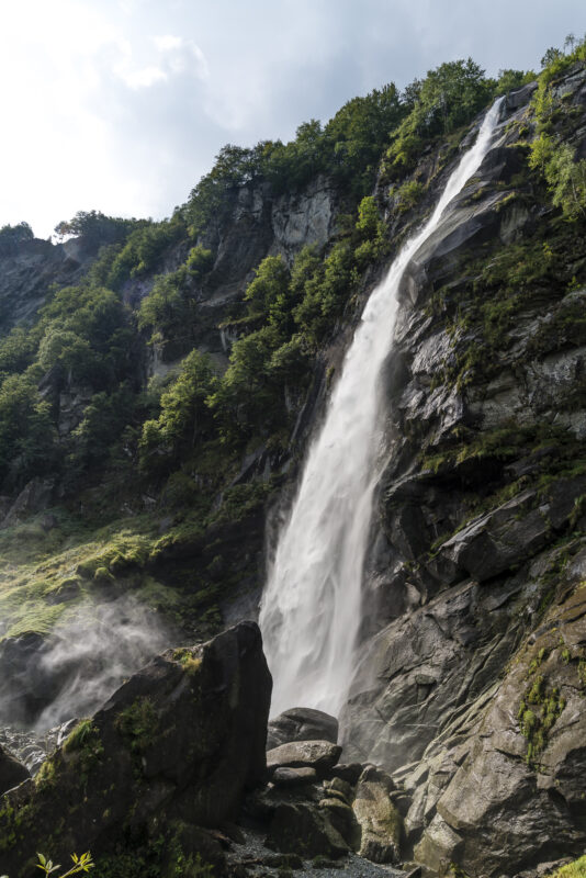
We marvel at the lovingly and carefully restored small settlements and of course do not miss the highlight in the valley – the Cascata di Foroglio. The only pity I find is that, according to our observations, the majority of tourists do not use the beautiful hiking trails in the valley, but prefer to jet directly to Foroglio by car and walk a maximum of 500 meters to the waterfall and back. You don’t have to hike the whole Sentiero Cristallina, but you could simply enjoy the third stage from S. Carlo to Bignasco as a leisurely day hike.
We leave Foroglio and the unexpected crowd behind us and dive once again into the green canopy. Two hours later, after 39 kilometres, we reach the destination of our three-day hike along the Sentiero Cristallina: the Bignasco Posta bus stop. What we particularly liked about this multi-day hike is its variability and flexibility in terms of route guidance and stage length. This gives everyone the opportunity to adapt the Sentiero Cristallina according to their preferences.
Key data of the 3rd stage S. Carlo – Bignasco (incl. Cascata di Foroglio)
| Starting point | Robiei – S. Carlo cable car valley station |
| Length | 15 kilometers |
| Elevation gain | ↗ 403 m 1,005 m ↘ |
| Duration | 4:25 p.m. |
| Destination | Bushaltestelle Bignasco, Post Office |
Practical tips for your hike on the Sentiero Cristallina
- In our variation of the Sentiero Cristallina, a total of 39 kilometers have to be completed on foot in three days. The three daily stages are similarly long, with the last stage (Val Bavona) being the longest but with the least incline.
- The majority of these are white-red-white marked mountain hiking trails. One section is marked in white-blue-white. On the second stage, surefootedness as well as a head for heights (no fear of sloping places) are required.
- The Airolo-Pesciüm cable car runs in the summer season from the end of June to mid-October (every 30 minutes).
To the current timetable and ticket information - At the Capanna Cristallina, an overnight stay for adults aged 22 and over including half board costs 80 CHF, SAC members receive a 10 CHF discount (2020 prices). Sleeping places can be reserved online.
- At the Albergo-Ristorante Robiei (partner link), a double room with shower costs 128 CHF (price as of 2020). The rooms can be reserved via Booking (which gives you the necessary flexibility in case of bad weather).
- On the 3rd stage through Val Bavona, it is worth planning a stopover at the Ristorante La Froda in Foroglio. The restaurant is a member of Slow Food and serves typical local dishes. However, it is advisable to avoid lunchtime on nice weekends – due to the numerous day-trippers who want to have a quick drink here, the Slow Food idea is unfortunately lost.
Leave a Reply