

From Signau to Chuderhüsi – promising hike in the Emmental
Advertising: Contribution in cooperation with BLS
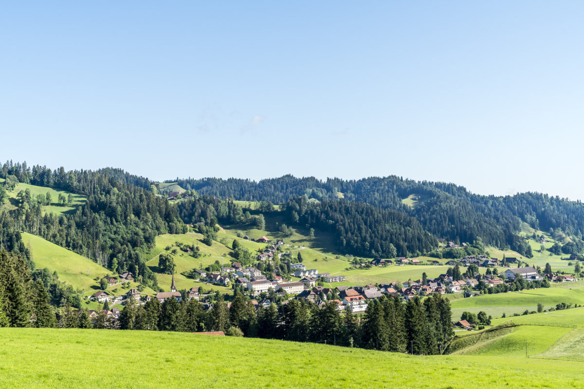
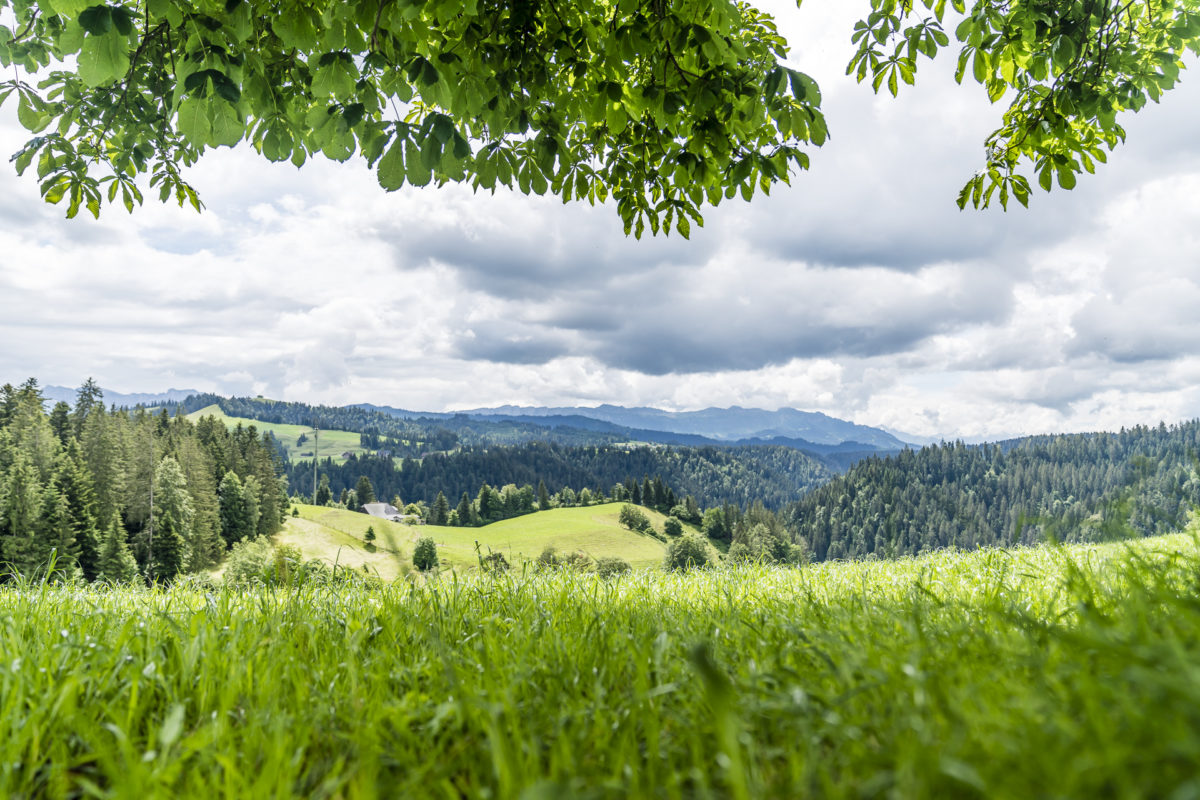
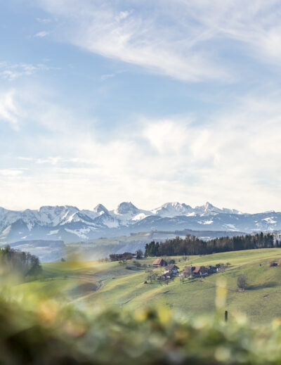
The hilly Emmental is an Eldorado for easy and at the same time maximum panoramic hikes. The patchwork landscape of forests, open pastures, interspersed farms and hamlets is crisscrossed with a variety of officially signposted hiking trails. Suggestions on how the trails can be combined to create exciting hikes can be found in the BLS “Emmental” hiking brochure, among others. At the end of June, we took a closer look at one of the 14 tours presented in it and set off on old pilgrim paths between Signau and Würzbrunnen.
In the morning light to the castle ruins of Alt Signau
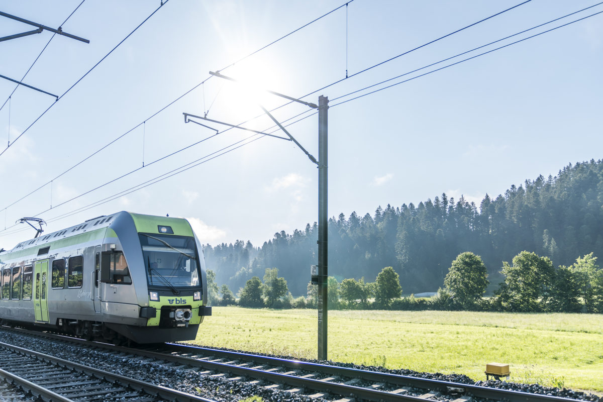
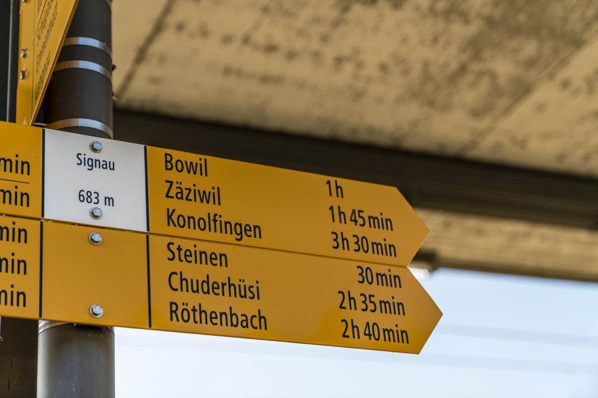
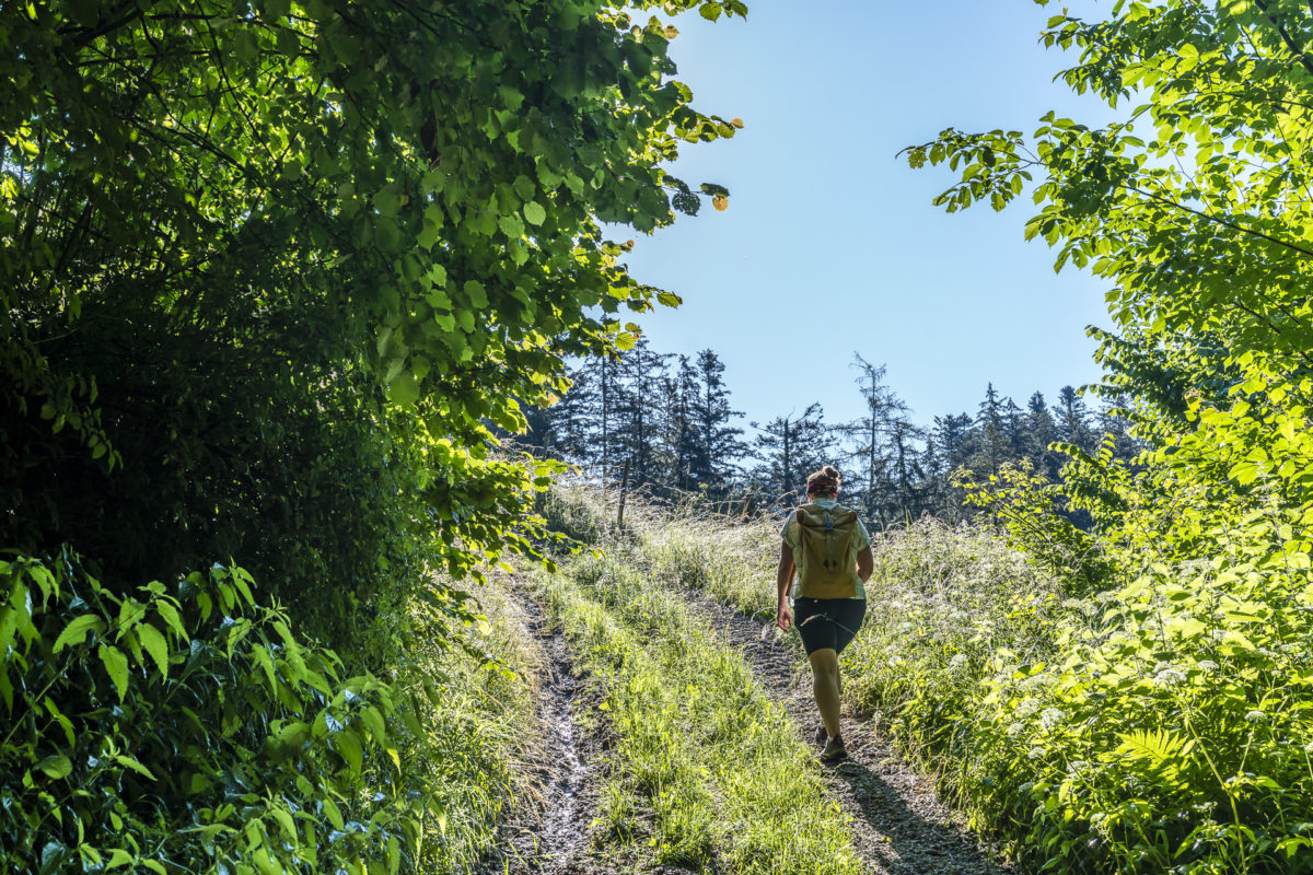
“Sunny at first, thunderclouds gather around noon”, these weather forecasts tempted us to start the hiking day early once again. The starting point of today’s tour is Signau in the Emmental, which we reach by train easily and surprisingly quickly with one change in Bern. Less than a week before, we cycled through here on the way to Burgdorf and fought our way up the steep slope towards Blasenflue behind Signau. Today we look for the hiking trail signs at the Signau train station. “Röthenbach 2 hours 40 minutes” is our destination for the day. And this is an example of the fact that there are many ways to reach your goal in the Emmental. For us, this time the focus is not on the fastest, but the most panoramic and historic way to Röthenbach.
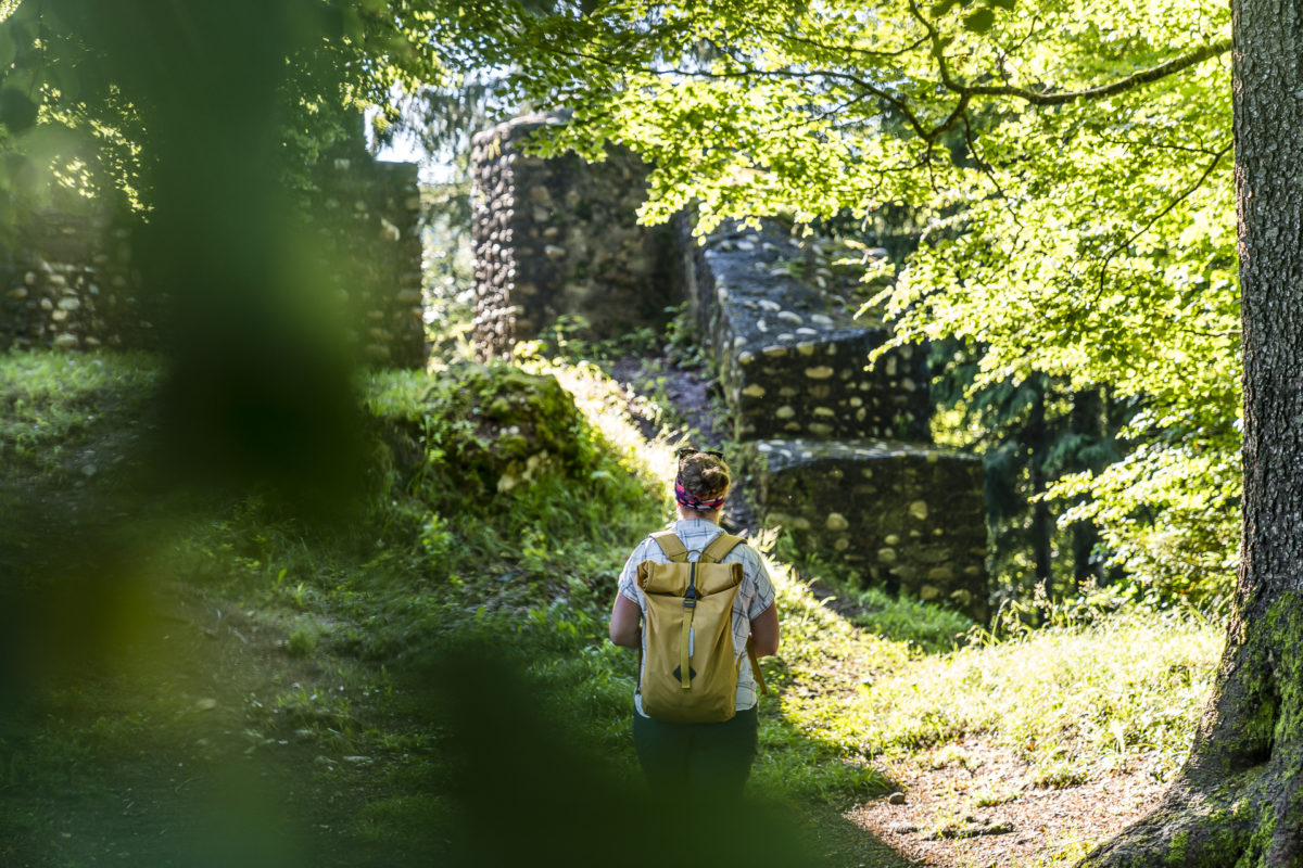
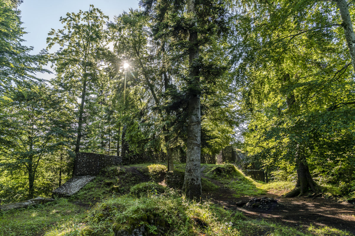
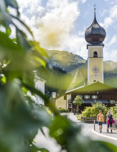
And so we follow the hiking trail through the pretty village centre of Signau in a westerly direction, cross the Schüpbach Canal and walk along the tarred road to the Steinen mill. The last wisps of fog cling to the surrounding hills, while we start to sweat for the first time on the following ascent via the former access path to the castle. The path up to the ruins of Alt Signau Castle is short but steep. Once at the top, it is worth taking the few additional steps up to the former seat of the Barons of Signau and taking a tour of the grounds with overgrown remains of walls from the early Middle Ages. No castle ruin in the Emmental is as well preserved as that of Alt Signau.
On historical paths through mosaic landscapes
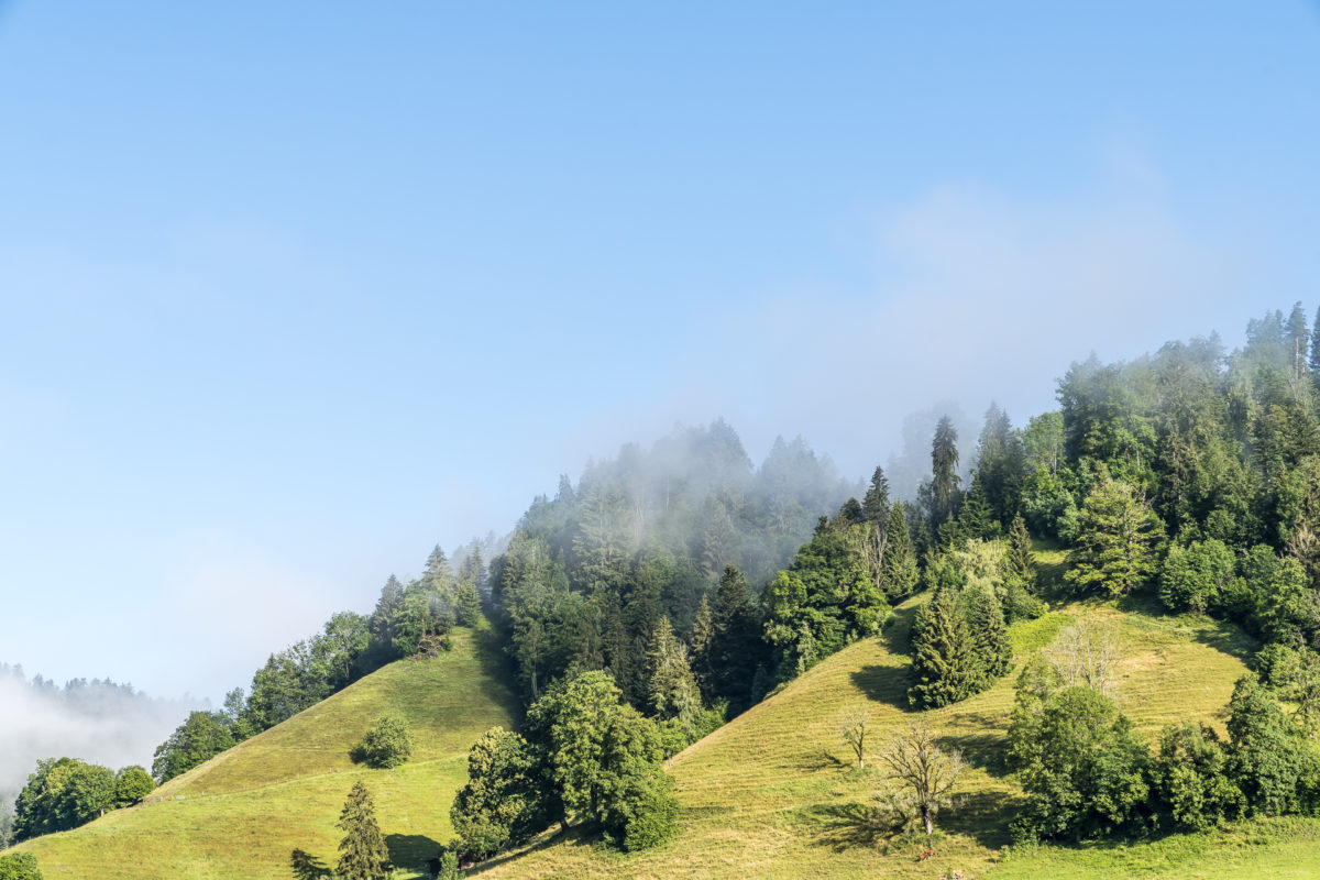
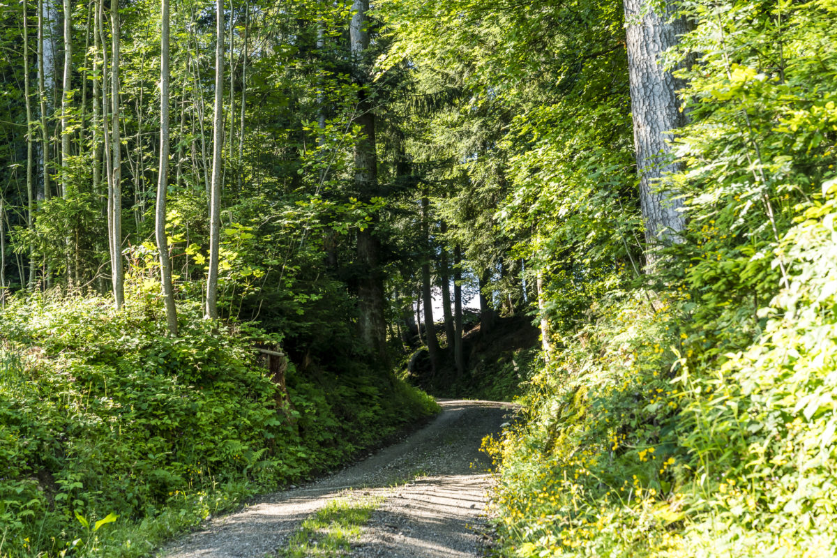
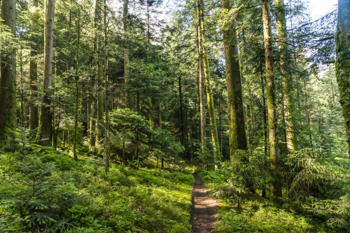
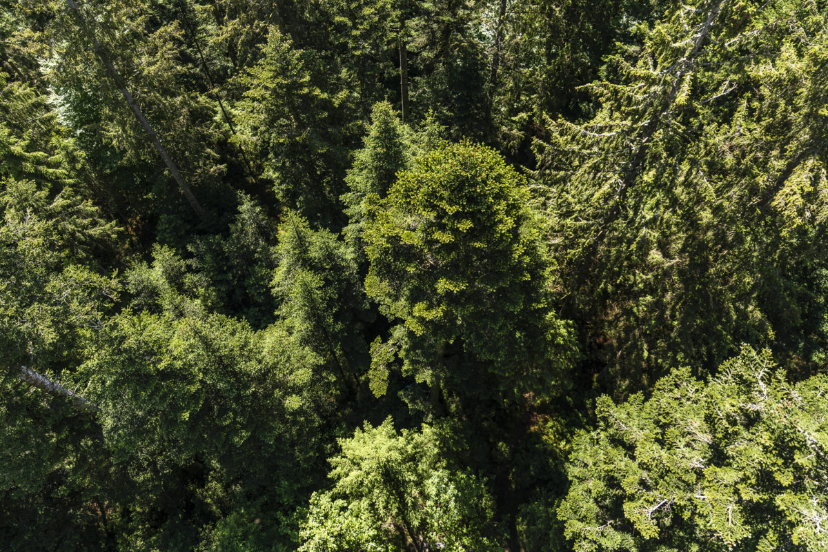
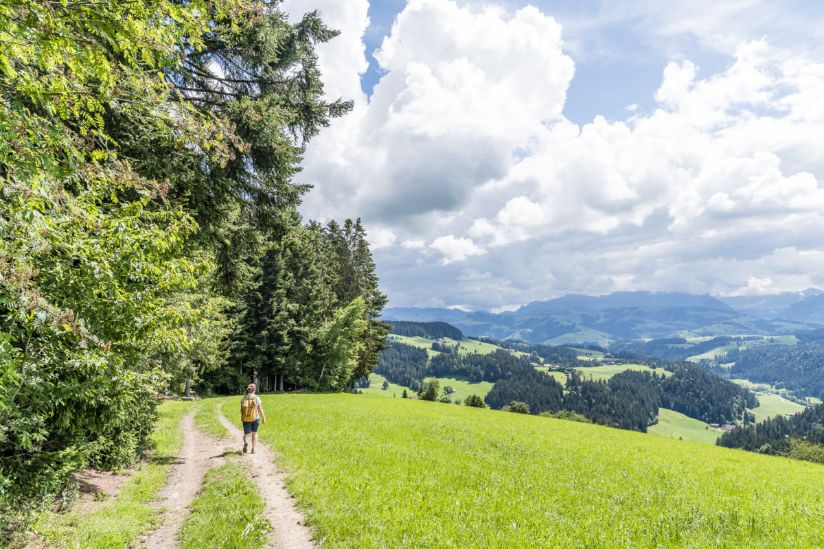
For us, it is now much less steep. We follow the hiking trail through the Hasli forest, which inspires us with a wonderful play of light, and continue to ascend towards the heights via Schlapbach. While the section between the castle ruins and Schlapbach runs on tarred roads, it branches off at Schlapbach onto a meadow forest path, which leads us cross-country further up into the Emmental hills. The great thing about this additional bow stroke is that we can enjoy a beautiful panoramic view back towards Signau.
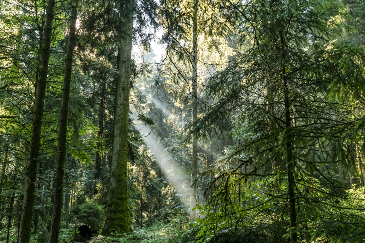
I particularly like the following stage – shady forest sections alternate with open pastures. Only the imposing Alpine panorama hides behind a persistent cloud front in the early morning. However, it is not only the views that are exciting, but also the historical features of the individual sections of the trail. Between the farms Schlappbach and Lamicheli we pass a conspicuous hollow road – a remnant of what was once the most important road connection towards Thun and further south. Today’s main traffic route along the Emmengrund was only created in the 19th century – before that, all trade relations led over this ridge.

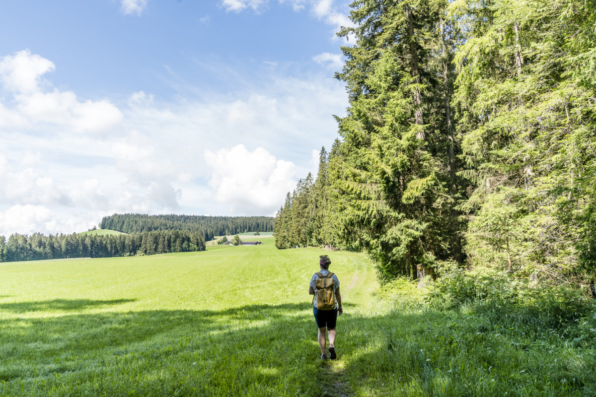
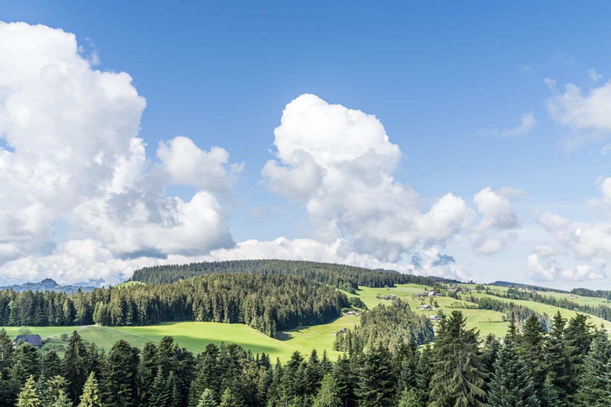
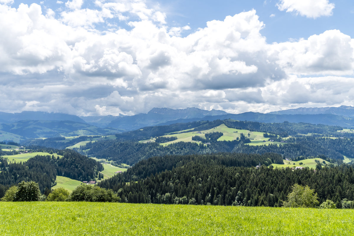
Due to the many different hiking trails that crisscross the Emmental, it is advisable to take a look at the map from time to time. Shortly after the Junkholz, we are not attentive enough for a short moment and mistakenly catch the turnoff towards Chapf at the fork in the road. However, the additional loop to the popular viewpoint is not tragic and is a worthwhile addition to this tour anyway. With good visibility, the Bernese Alps are presented to you on a silver platter.
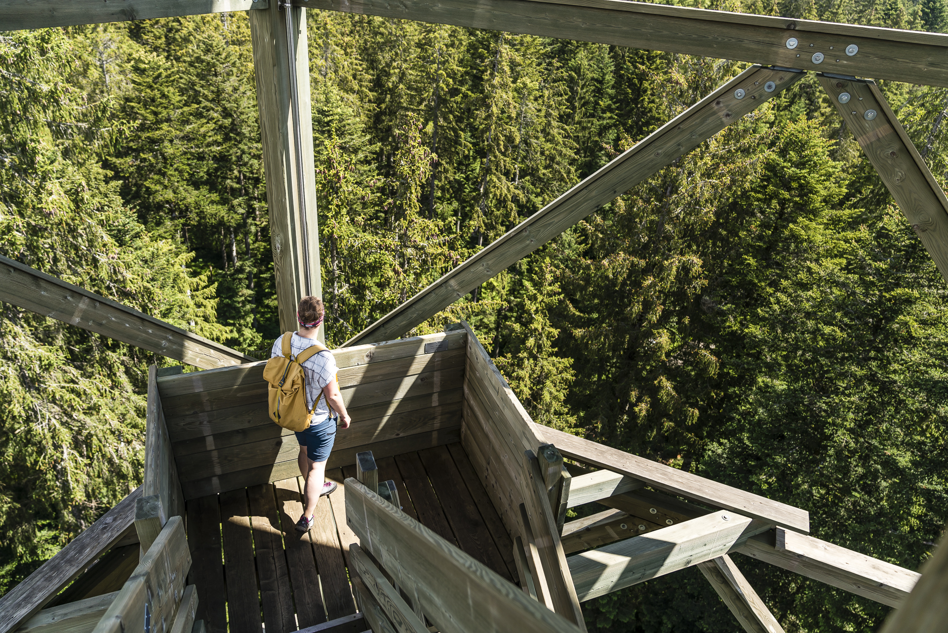
Ascent to the Chuderhüsi lookout tower
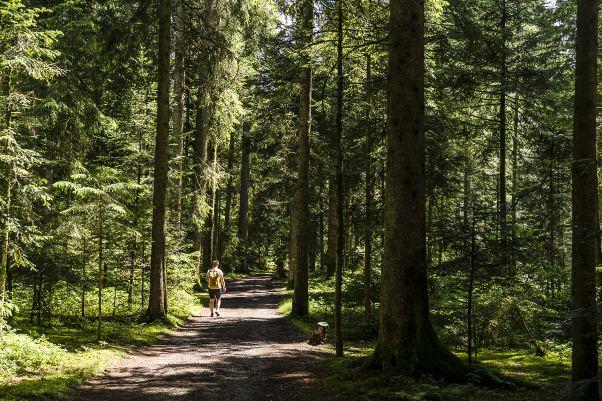
Slowly we get closer to the highlight of this hike. However, there is still nothing to be seen from the 42 m high observation tower “Chuderhüsi” far and wide. This is so well embedded in the landscape that you can hardly see it from a distance. Built in 1998 (and rebuilt in 2002 after a fire), the observation tower is located about 10 to 15 minutes’ walk from the restaurant of the same name, in the middle of the dense fir forest. Until 2010, it was considered the tallest wooden tower in Switzerland at 42 m. In the meantime, the Chutzenturm in Frienisberg in Zeeland trumps it by three metres
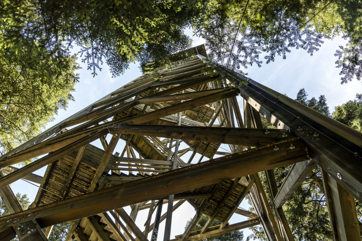
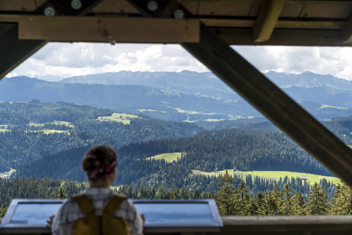
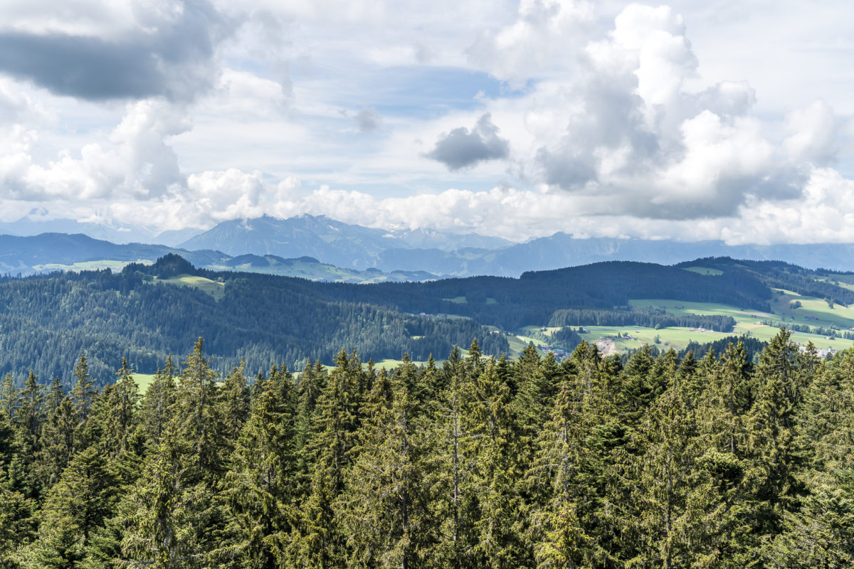
The meters of altitude that have already been mastered today will now be enriched with 195 steps. This leads me to the viewing platform at a height of 37 m. An impressive construction and a no less impressive panoramic view over the gentle Emmental hills over the foothills of the Alps to the snow-capped four-thousand-metre peaks, which today gallantly hold back behind the clouds. The observation tower offers a 360° panorama over the fir tree tops, which on clear days stretches from the Bernese Alps to the Black Forest.
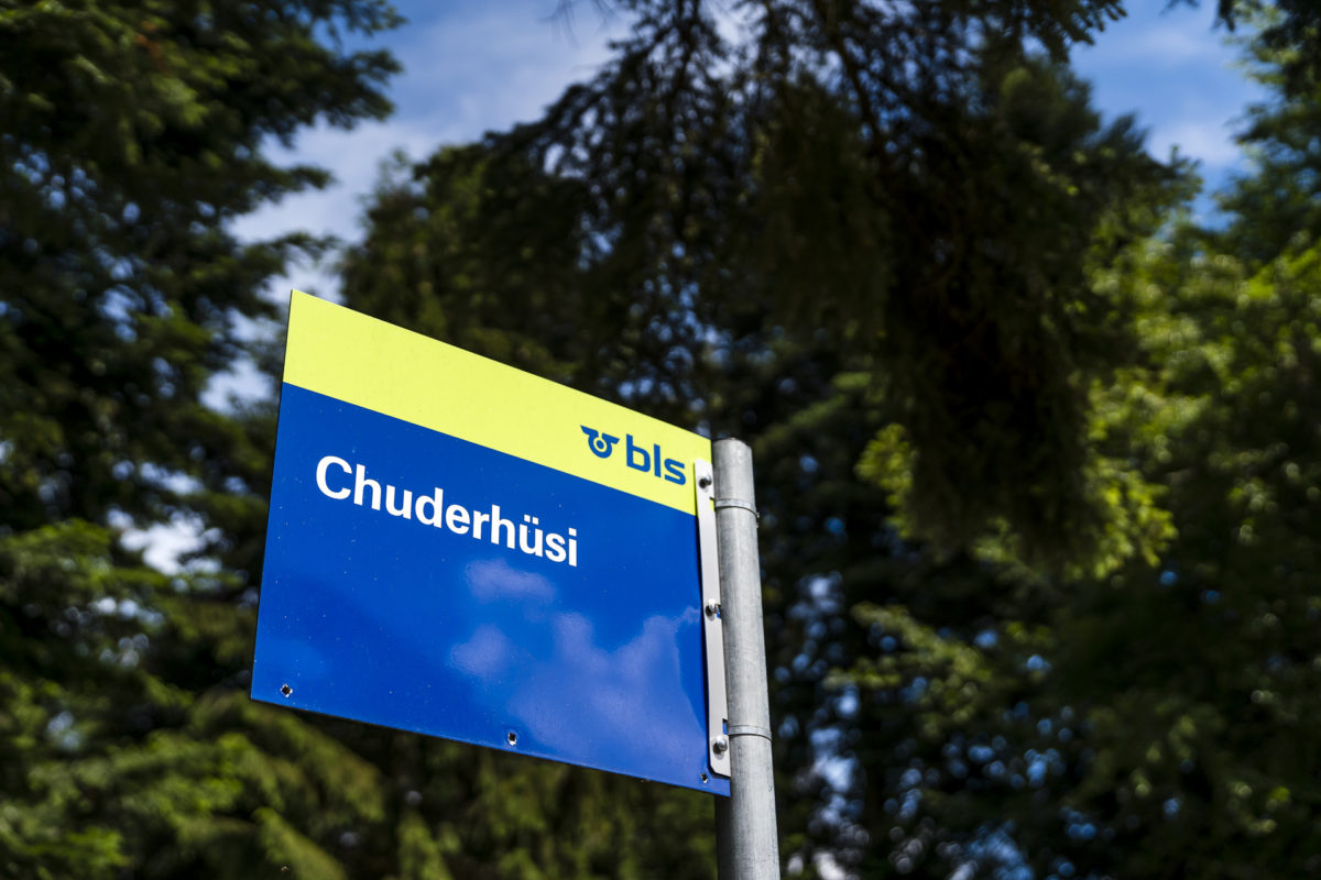
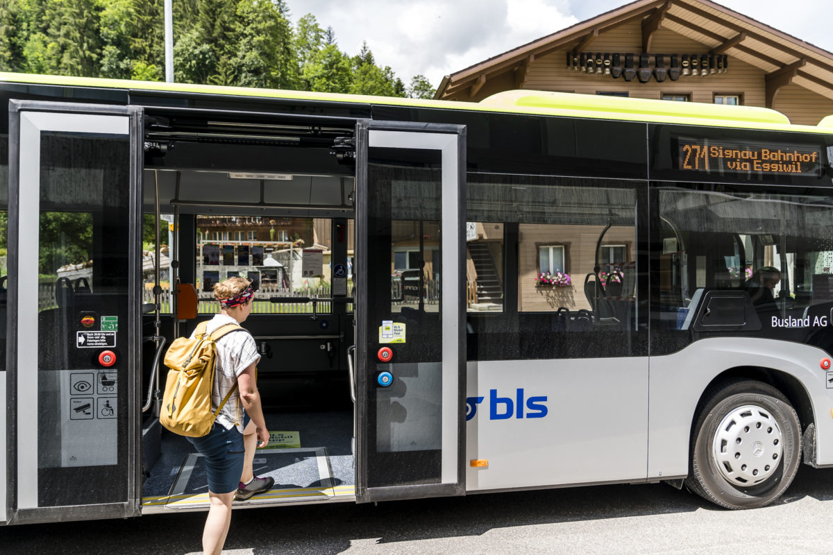
The Chuderhüsi is a popular regional excursion destination. While we met only a few hikers on the hiking trails between Signau and Martinsegg, there is a little more going on up here on this beautiful Sunday. This is also due to the fact that the Chuderhüsi is well developed and even has a bus stop, which is served by the BLS hiking bus from Signau on Saturdays and Sundays from May to October, as well as on public holidays. Thus, the hike can also be ended here (note the timetable).
Via Chilchli Würzbrunnen downhill
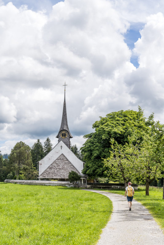
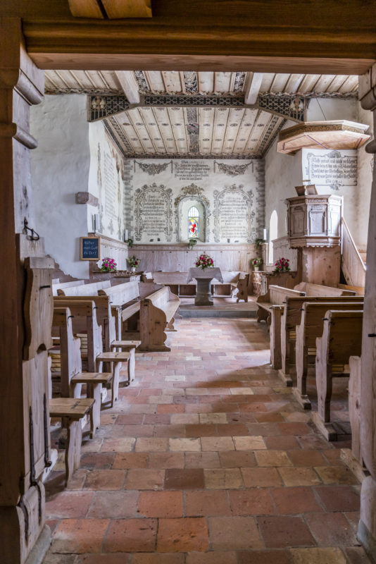
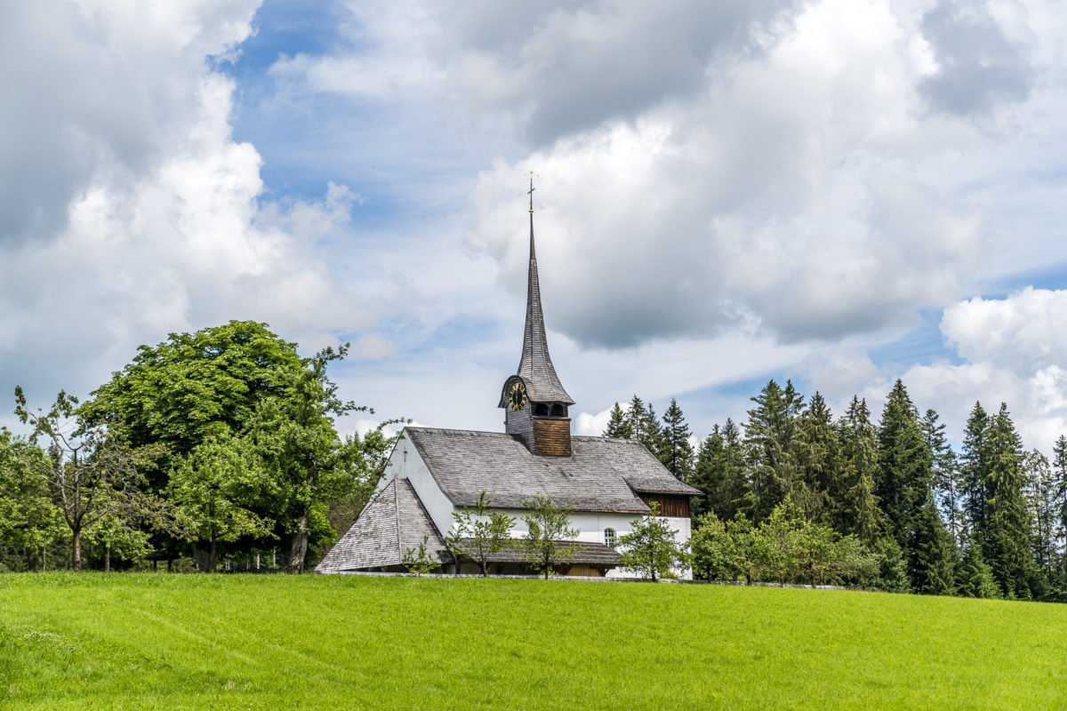
But we still have enough energy to master the last part of this pilgrimage route from Signau to Würzbrunnen with our own muscle power. Light-footed, it now goes downhill along the edge of the forest to Würzbrunnen. The top of the church tower of the former place of pilgrimage can be spotted from afar. The timetable check shows that we have enough time until the departure of the next bus in the direction of Signau to take a look inside the Chilchli. The history of the Würzbrunnen church can be traced back to the early Middle Ages. After the original wooden church went up in flames in the 15th century, it was rebuilt shortly afterwards in its present form and painted in the 18th century in the baroque style – surprisingly opulent by Emmental standards.
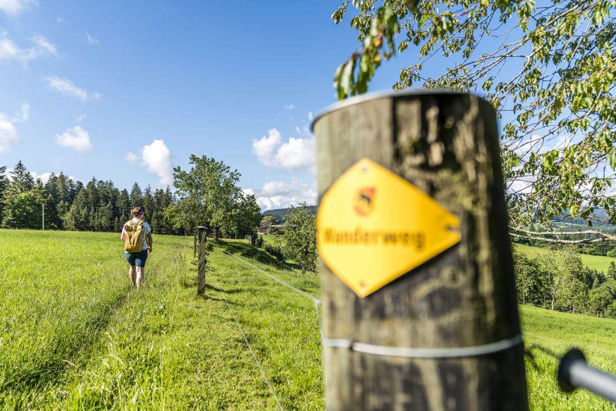
It is just under 20 minutes on foot from Würzbrunnen to the village centre of Röthenbach – and this last section of the trail also offers a typical Emmental vantage point – a bench under a lime tree – and leads you on an attractive, narrow path along the hills to the village square of Röthenbach.
In Röthenbach there is an hourly bus connection back to Signau. If you just miss a connection, you can bridge the waiting time on the sun terrace of the Moos-Pintli restaurant right next to the bus stop. However, we have coordinated our hiking time so well with the timetable that there is no need to stop for a bite to eat – but we review the 18 kilometres we have mastered on the way back to Signau and agree: This route hike has clearly exceeded our expectations with its varied route.
Practical tips for your hike to the Chuderhüsi
The route of our hike from Signau to the Chuderhüsi and from there on to Röthenbach in the Emmental can be found on the following map. The inspiration for this came from the book “The Upper Emmental – Hikes to History and Culture” by Jonas Glanzmann (by the way, a great source for other Emmental hiking ideas, off the beaten track).
Due to the numerous hairpin bends, this tour adds up to an impressive 18 kilometers and around 700 meters of altitude uphill. The altitude difference is particularly high in the first third of the ascent from Signau via the castle ruins. Depending on your mood, an extra loop to another great vantage point – the Chapf – can be built in just before the Chuderhüsi. In any case, it is recommended with good visibility in the Alps. We needed almost 5 hours of walking time for the tour (including an additional loop to the Chapf). The Chuderhüsi observation tower is accessible free of charge, although a box is available on site for voluntary collections. Twice a day, the hiking bus stops at the “Chuderhüsi” bus stop (only a 15-minute walk from the observation tower) and from there offers a direct connection to Signau train station with train connections to Bern and Langnau im Emmental.
BLS Hiking Tips in the Emmental
For the summer of 2020, BLS has prepared 14 hiking tips criss-crossing the Emmental in brochure form (also available for digital download). Among other things, it describes in detail the route of the pilgrims from Signau via Chuderhüsi to Würzbrunnen. If the tour described here seems too strenuous for you, you will also find another hiking tip on how to combine the detour to the Chuderhüsi observation tower with a somewhat shorter route hike via Röthenbach to Eggiwil. Alternatively, on Saturdays and Sundays as well as public holidays (May to October), the BLS hiking bus serves the excursion destination Chuderhüsi along with the Lüderenalp and the Mettlenalp (two other great starting points for hikes in the Emmental). The regular tickets are valid on the BLS hiking bus (no extra charge). All further information about the hiking bus can be found here: Hiking bus
Signau – Chuderhüsi – Röthenbach: Key data of the tour
| Starting point | Signau Railway Station |
| Length | 18.2 kilometres |
| Elevation gain | ↗ 710 m 570 m ↘ |
| Duration | 5:00 p.m. |
| Destination | Bus stop Röthenbach im Emmental, Dorf |
Leave a Reply