

3 hikes with summit experiences in the Friborg region
After hiking on the Chemin de Gruyères across the Gruyère region at the end of May, we ended up back in Fribourg on what was probably the hottest July weekend since records began. A sporty program awaited us and accordingly we did one thing above all during the three days: sweat.
For three years, I commuted every day with the SBB from Bern over the Grandfey Viaduct to Fribourg to the university. For me, this railway bridge high above the Sarine is the perfect visualization of the Röstigraben. Or, the other way around, the connection from German-speaking Switzerland to French-speaking Switzerland. Fribourg Region took this melting pot of two worlds as an opportunity to bring the cultural and scenic diversity of the region closer to guests within the framework of eight “time-outs”. One of the eight time-outs provides a very special feeling of exhilaration. Under the motto “Summit Experiences”, a package has been put together that includes two overnight stays and three hikes in La Gruyère and Les Paccots (incl. cable car tickets). And it was precisely this package that we took a close look at during our second visit.
Below you can expect three hiking descriptions to different peaks in the canton of Fribourg:
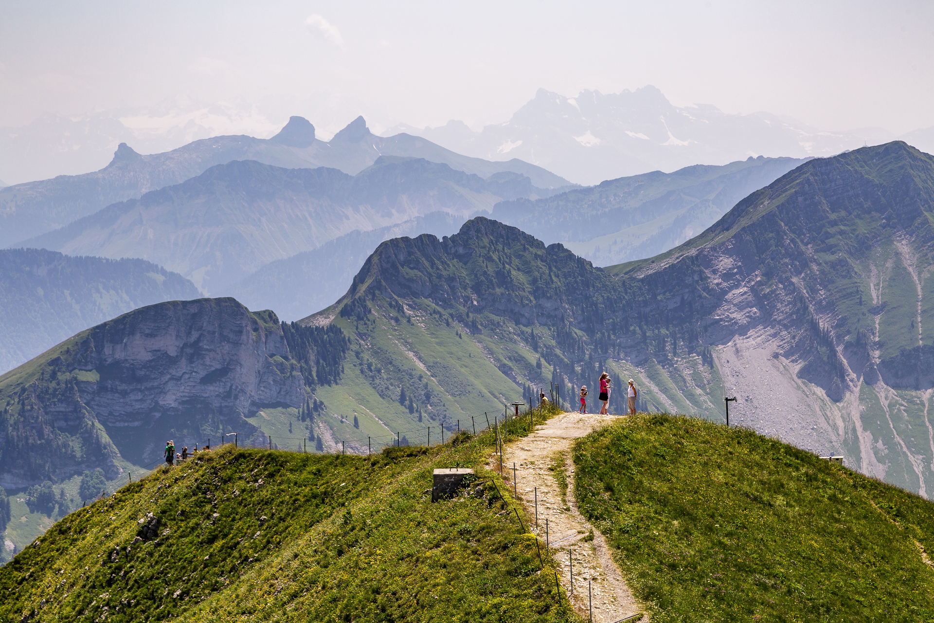
Hike from Moléson – the 360° summit
The starting point for our three hikes was the Hostellerie Saint-Georges in Gruyères. The inn is located in a beautiful location in the middle of the picturesque main street of the medieval town. Unfortunately, Gruyères is not very well connected to the public transport network of the Fribourg region, which presented us with logistical challenges during the three days. After all, the Moléson is practically right in front of the door as a local mountain and so we made our way straight to our first summit experience after arrival.
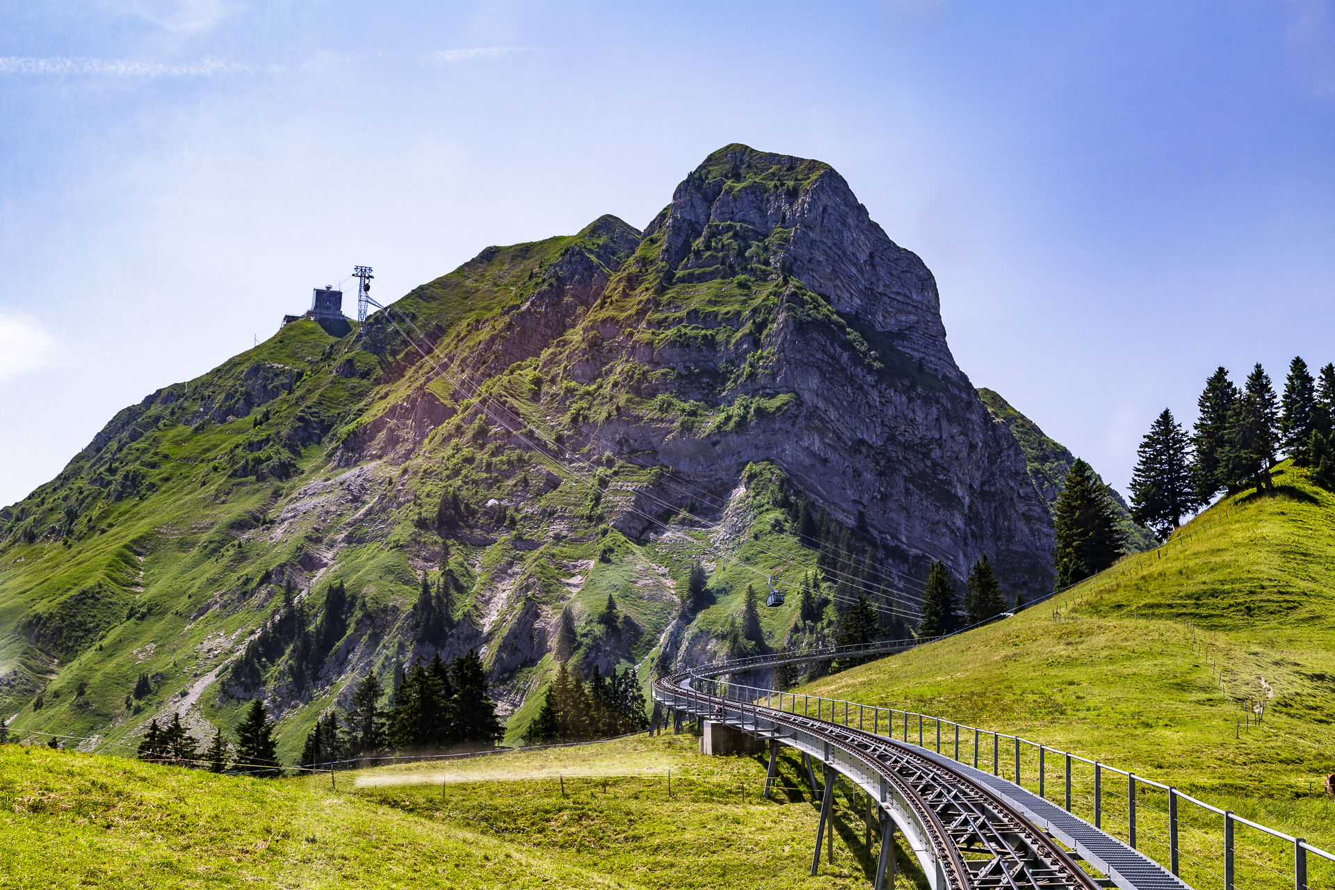
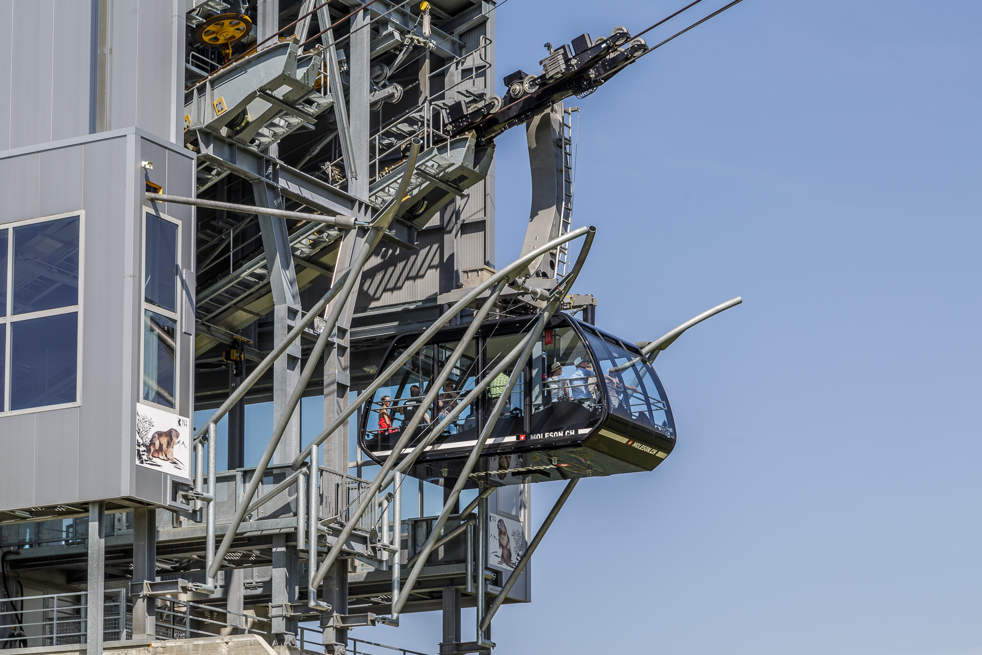
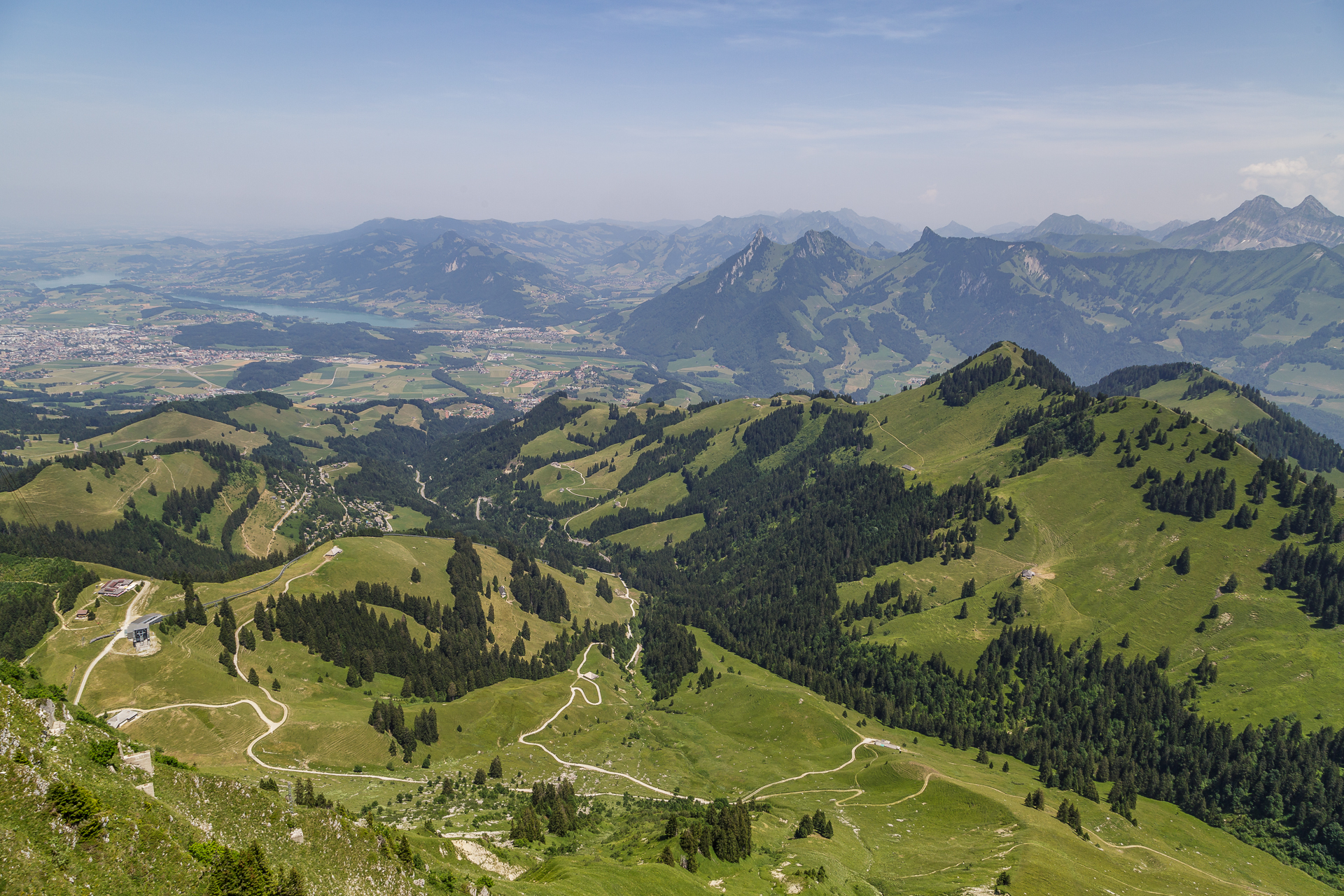
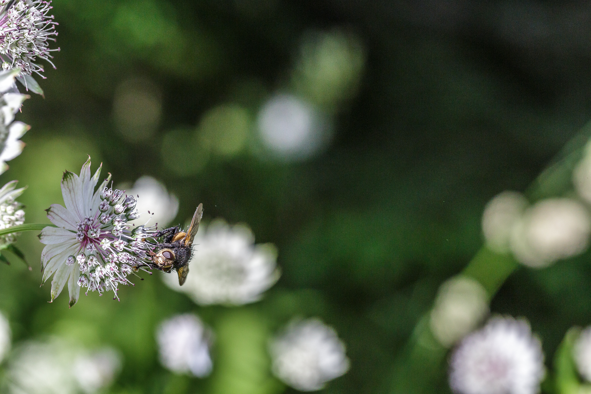
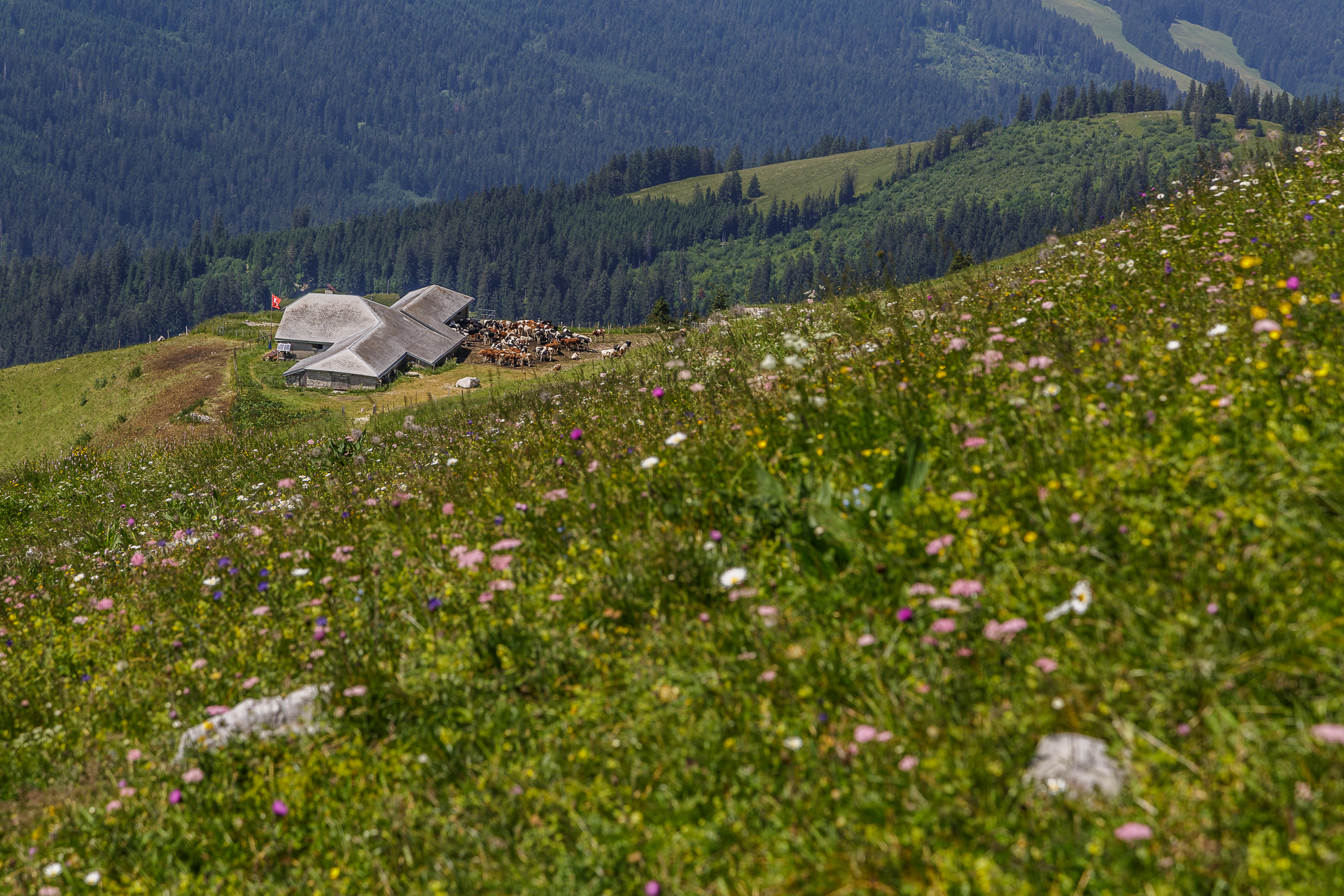
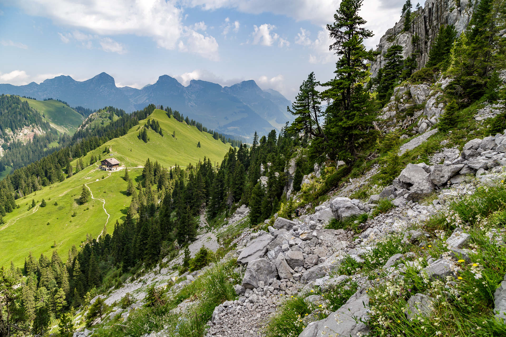
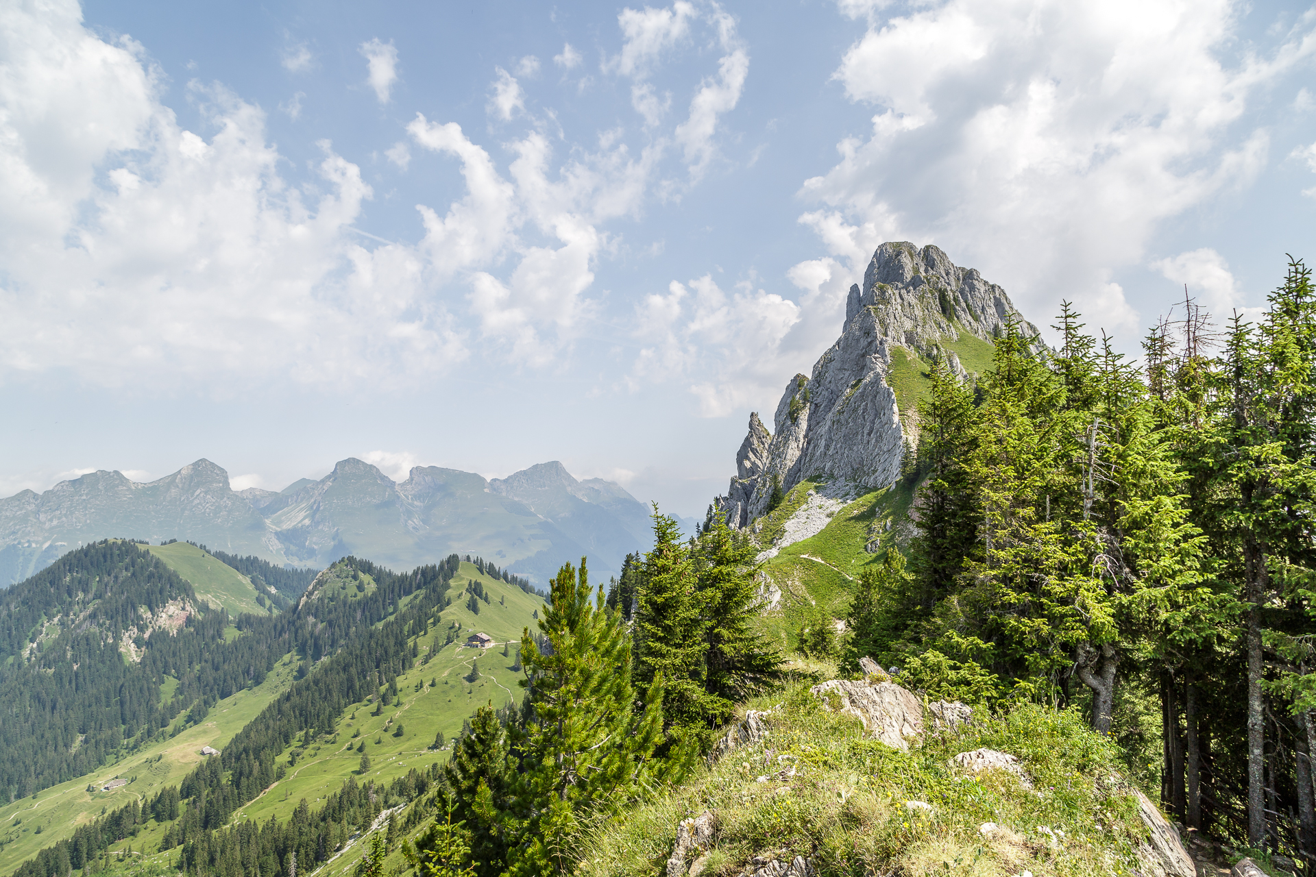
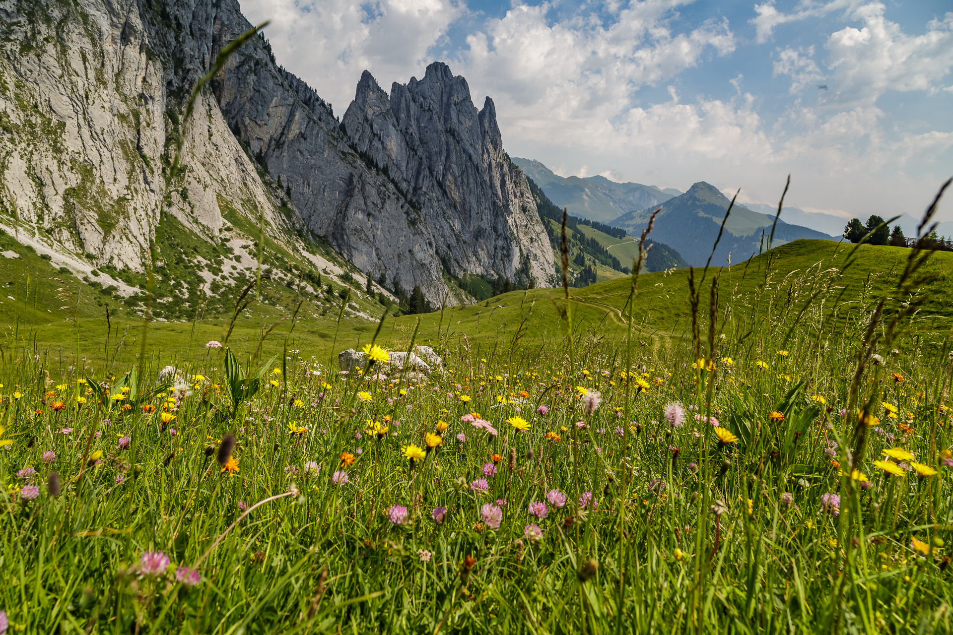
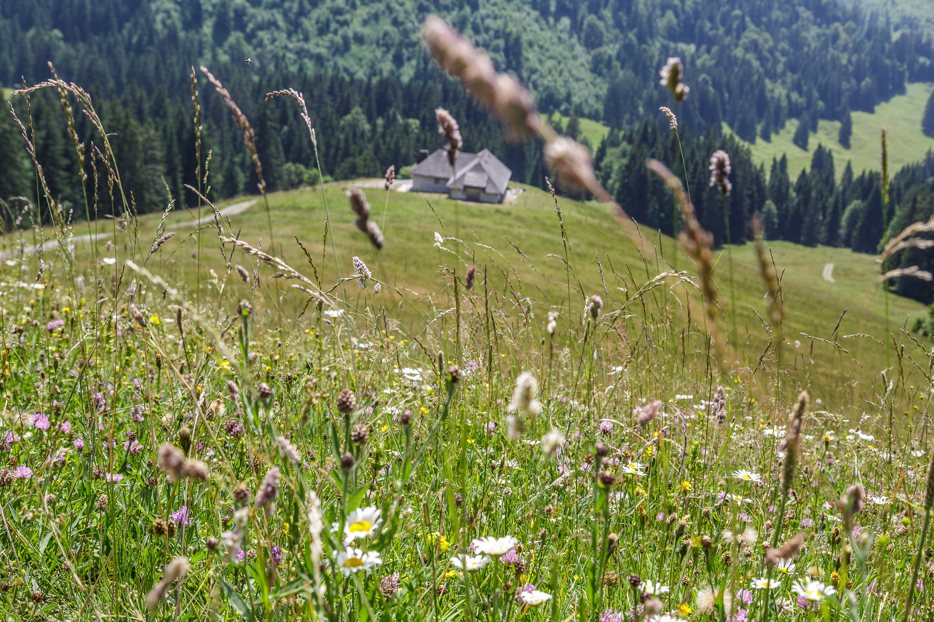
With the cogwheel railway and cable car, we reached the summit of the Moléson in no time at all, which with its 2,000 meters of altitude forms the northernmost corner of the Fribourg Prealps. We didn’t miss the opportunity to climb the stairs to the roof of the cable car station and let our gaze wander all around from up here. What a phenomenal view! The impressive panorama also accompanies us on the first stage, which follows the Moléson ridge towards Teysachaux. After that, the knees are badly strained on the descent to Le Villard. What immediately catches our eye – in addition to the great view – are the alpine meadows. It seems as if the numerous flowers are blooming in competition.
The last stage of the trail leads along the back of the Moléson to the Plan-Francey middle station and from there, with a few bends, back to the starting point in Moléson-sur-Gruyère.


Practical tips for the Moléson tightrope walk:
The route can be found on the map below. The ridge walk from the summit of the Moléson to Moléson-sur-Gruyères is about 11 kilometres long, includes an ascent of 250 metres and a descent of 1,000 metres in altitude. The pure runtime is around 3.5 hours. The starting and finishing point – the cogwheel railway in Moléson-Sur-Gruyères – can be reached from Gruyères Gare in 15 minutes by hourly post bus.
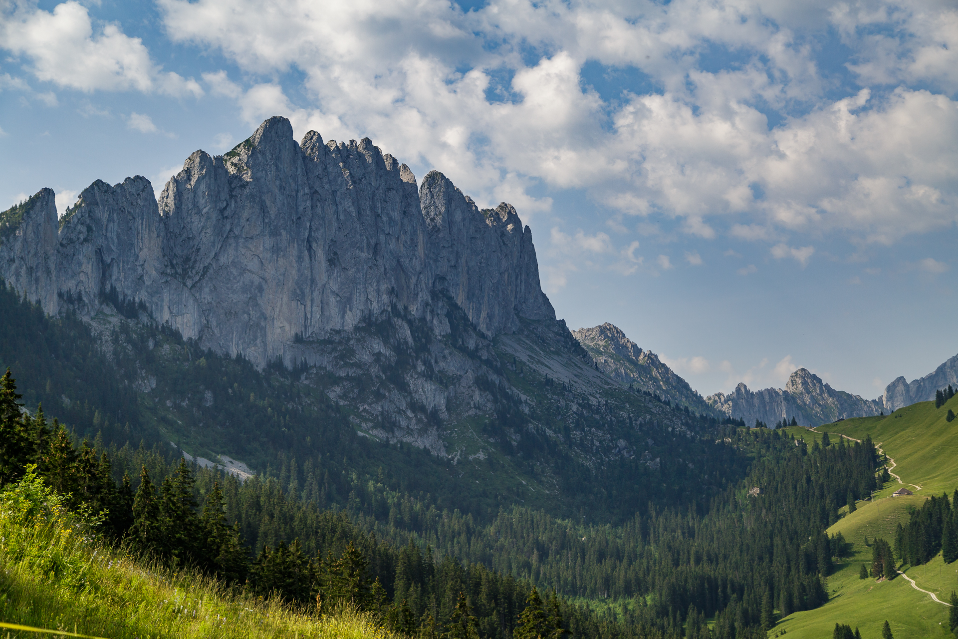
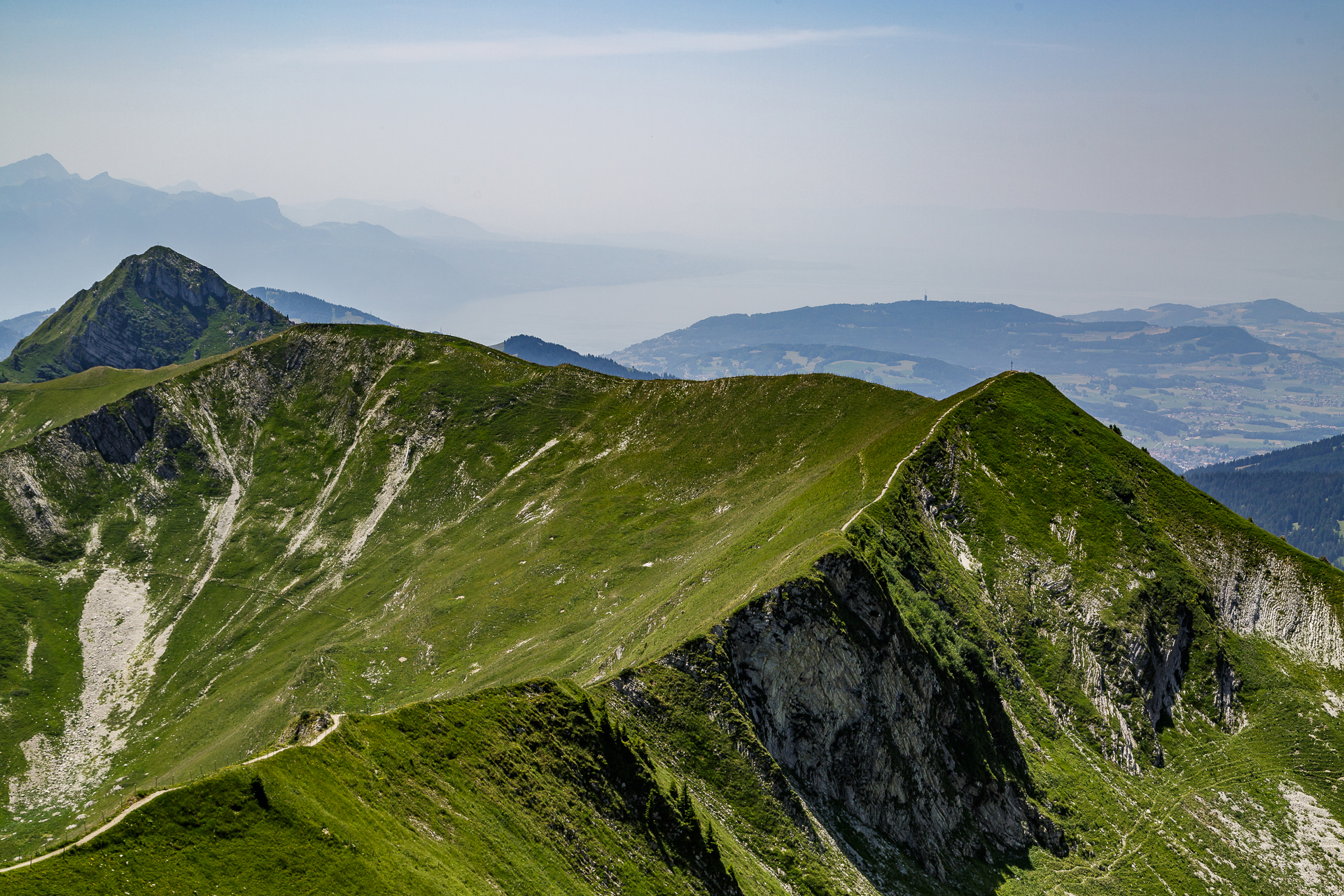
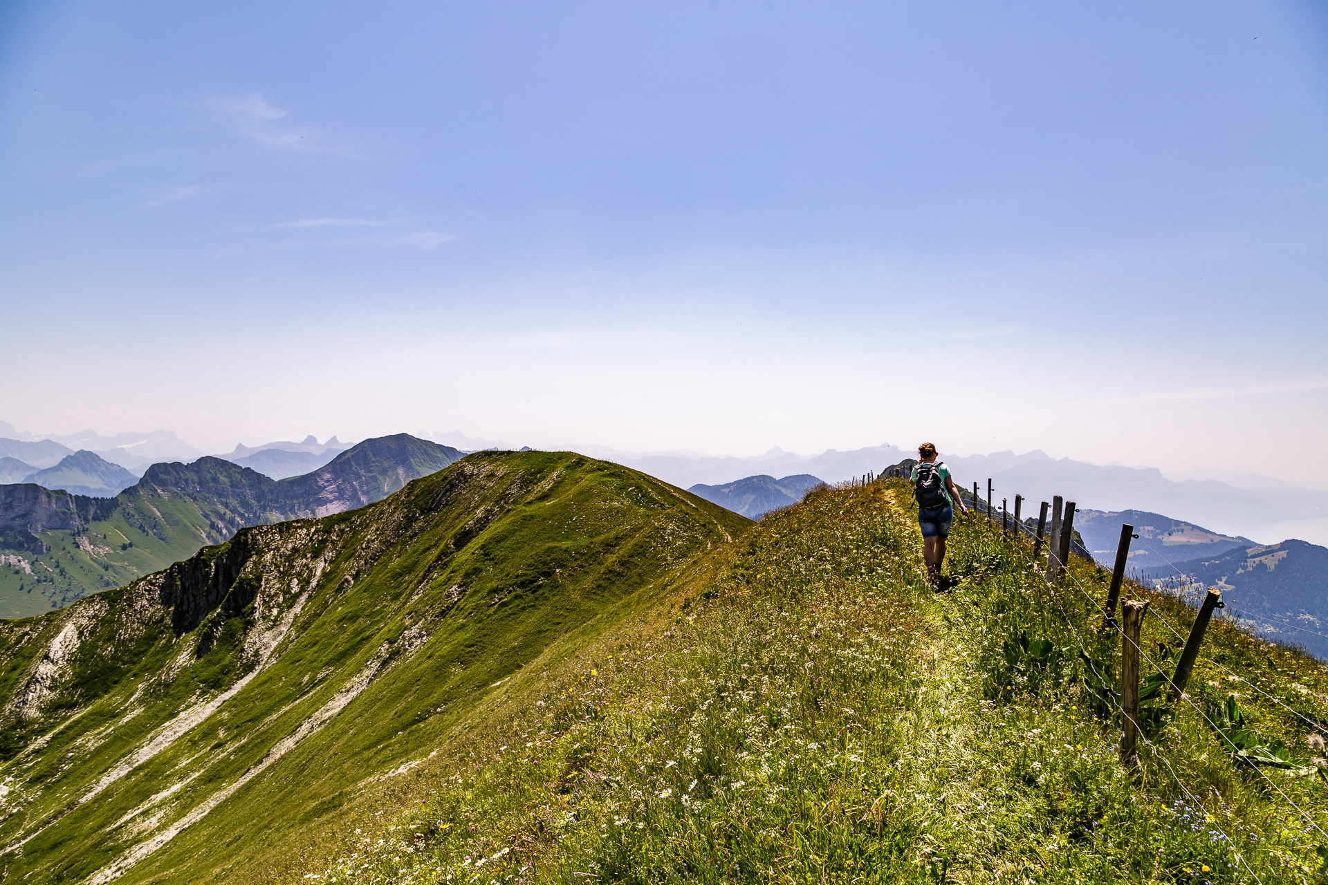
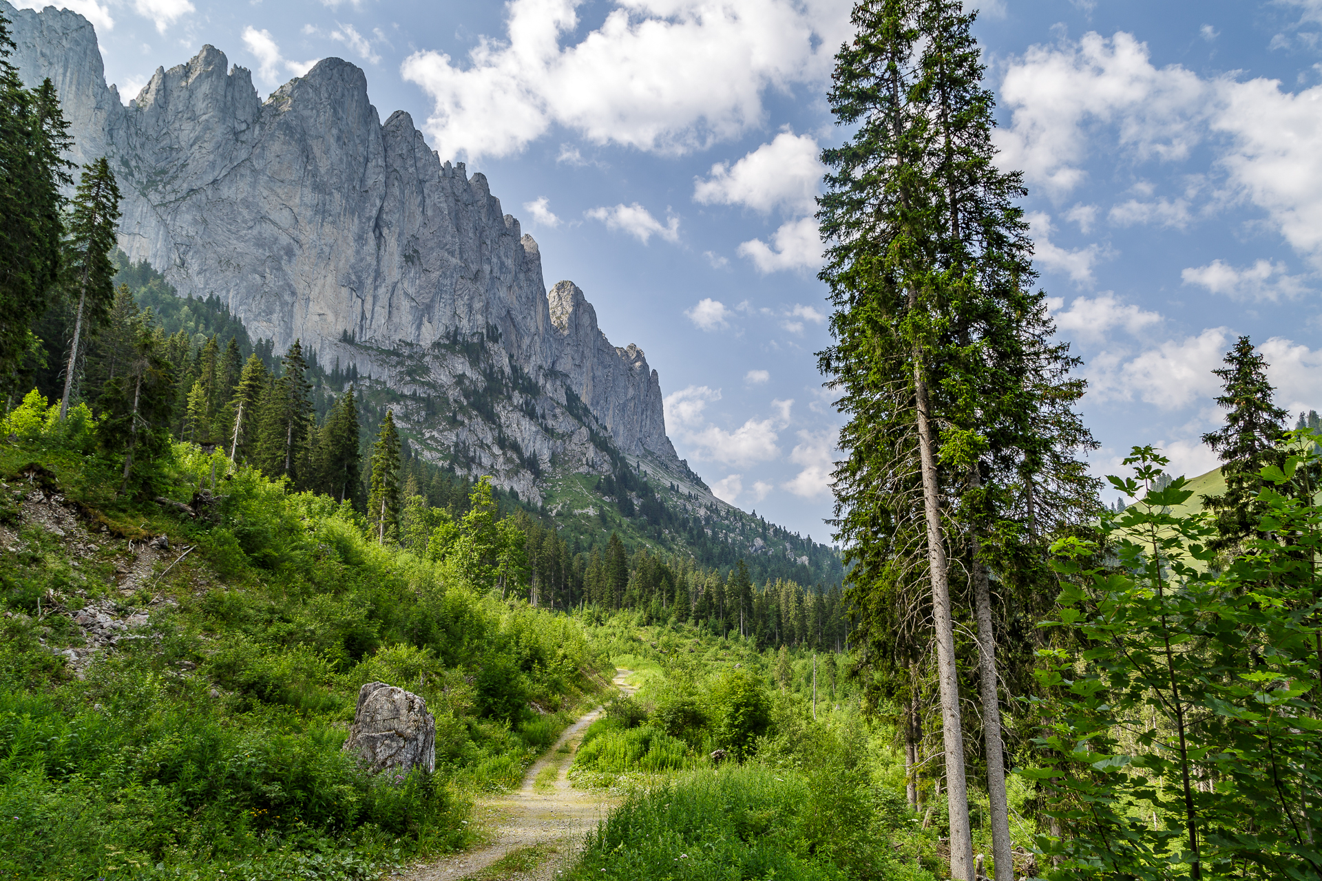
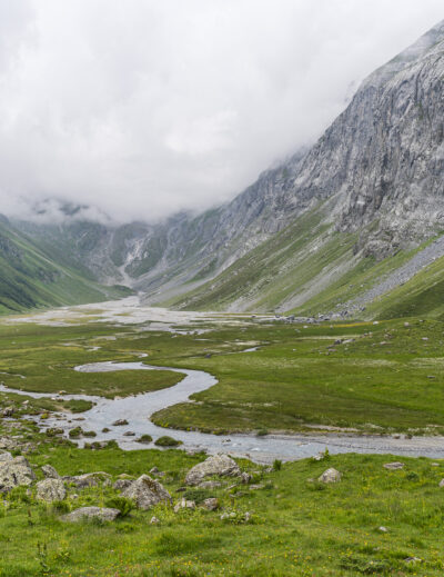
Hike around the Gastlosen – the rugged peaks
On the second day of hiking, it was time to wake up early. The one-way journey from Gruyères to Kappelboden takes almost two hours. Why the Freiburg transport company does not seem to be able to get a better coordination of train and bus on the right track remains the big mystery of the weekend. The fact is, if you want to spend the three summit experiences in a relaxed way without meticulous travel and descent planning, you should ideally travel by car or choose a hotel in Bulle. Well, we mastered the challenge by public transport, but it was quite stressful.
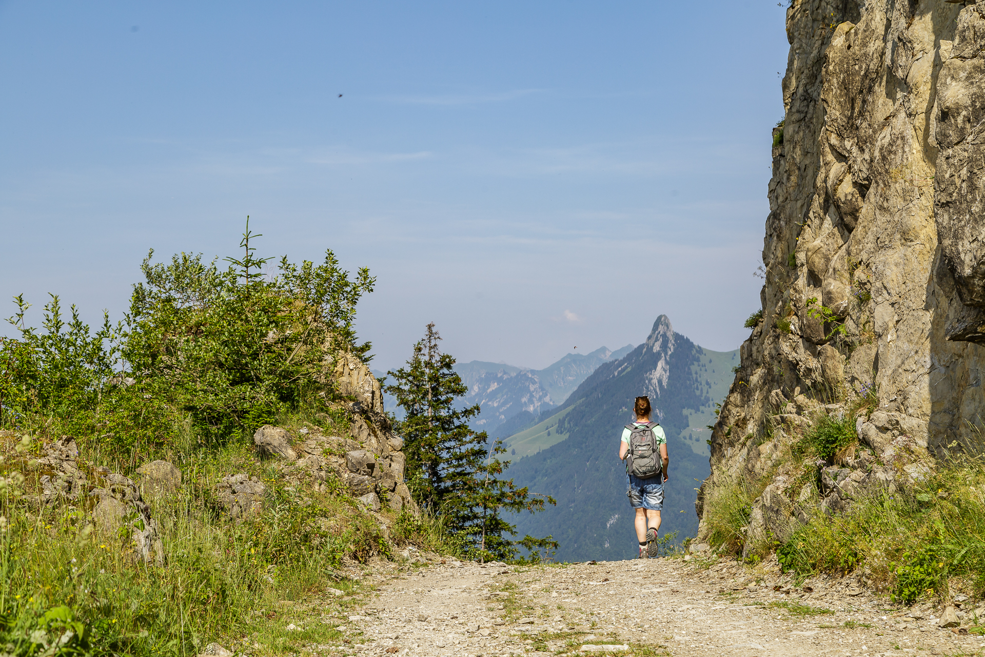
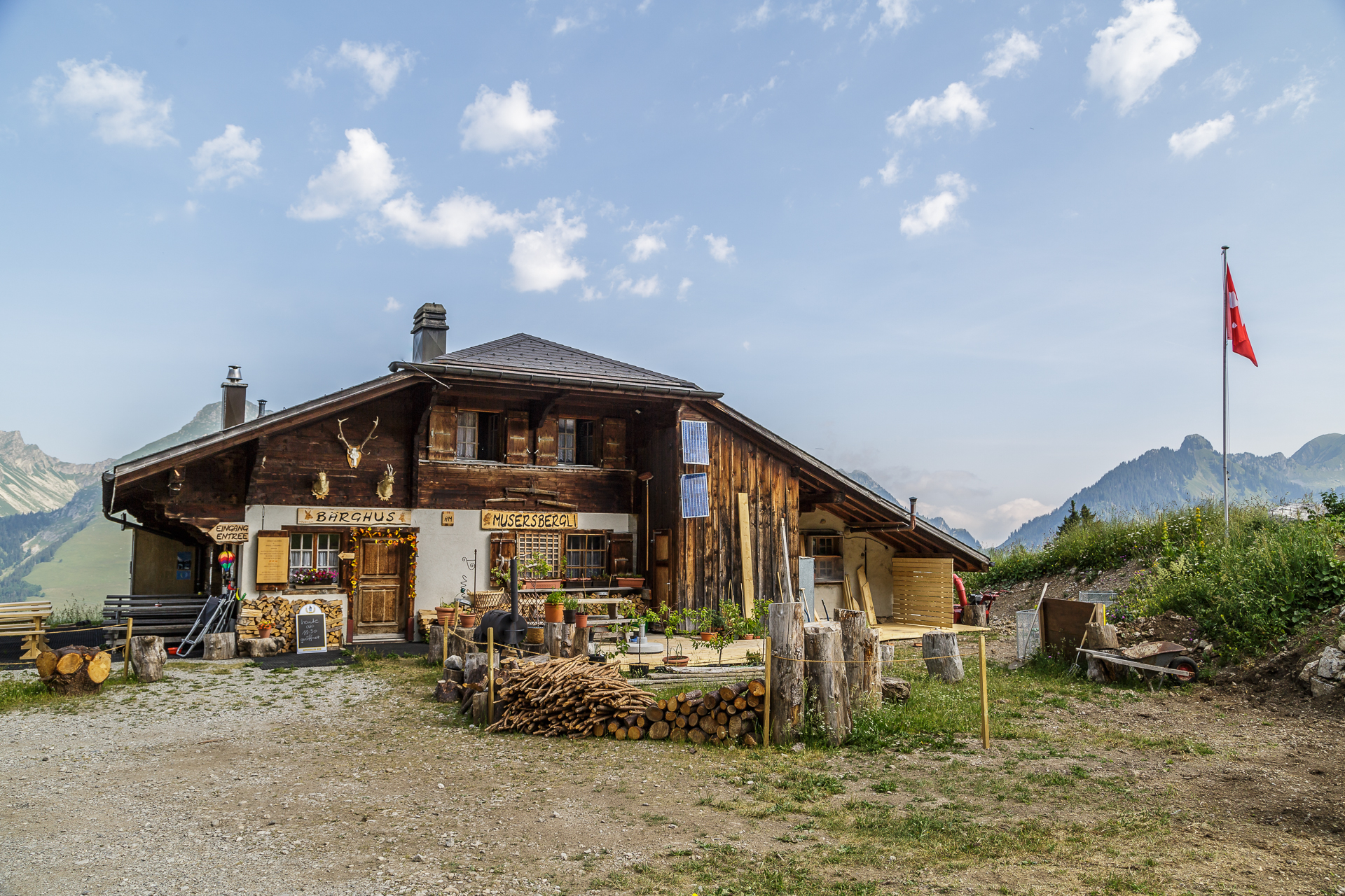
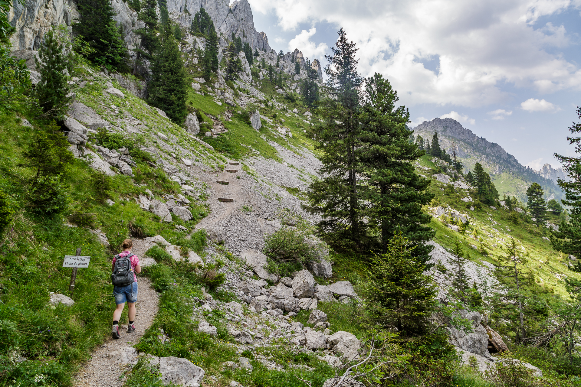
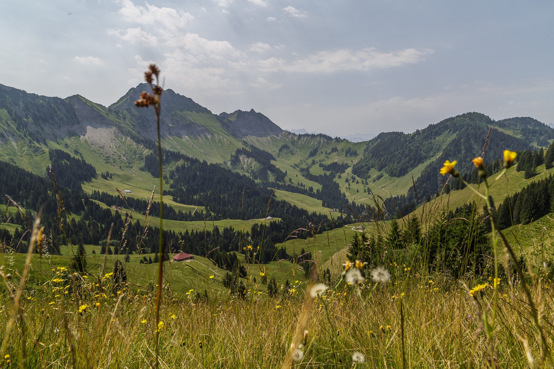
Because of the hot temperatures, we chose the earliest connection to Kappelboden. For the first meters of altitude of the day, we sat down on the Gastlosen Express, which connects Kappelboden with Musersbergli. If you hike around the mighty limestone walls of the Gastlosen in a counterclockwise direction, like us, you will benefit from an ascent on the still shady northern slope. On the Gastlosen circular hike, you never stand on a summit, but you always have the rugged massif in front of you. The nickname “Saaneland Dolomites” has definitely been earned by the Gastlosen. The attentive hiker does not miss the “grandmother’s hole” either. The devil himself is said to have lived in the area and hurled his grandmother over the mountain range in anger. But at the last moment, he was seized by pity. He smashed through the rock and caught the grandmother in free fall on the other side. During the winter months, the sun shines directly through this rock opening and makes for a special light spectacle.
The ascent to the Wolfsort on the south side takes some breath and perseverance. After a short rest at the picturesque soldiers’ house, a steep ascent through stony terrain follows. Some places are quite exposed and on the steepest part I get the crisis very briefly because I suddenly have to hold on to the boulders on my hands and feet.
On the south side, the hiking trail leads through lush green alpine meadows and species-rich forest sections. Quite surprisingly, we crossed a naked hiker (yes, you know them from Appenzell) on this section, exchanged a friendly “Bonjour” and walked further along the way.
If I had to award points for the three summit experiences, the Gastlosen circular hike would be at the top of the podium. I like this tour best in terms of landscape and in terms of varied routing. And by the way, the locals in Jaun are anything but “hospitable”.
Practical tips for the Gastlosen circular hike:
The route can be found on the map below. The Gastlosen circular hike is about 10.5 km long, includes an ascent of 750 meters and a descent of 750 meters in altitude. The pure runtime is a good 3.5 hours. The starting and finishing point – Jaun Kappelboden – can be reached from Bulle / Fribourg or Boltigen by post bus. From Bulle, the Postbus serves the route every hour (duration 40 minutes), from Fribourg there is a direct connection at 08:38 a.m. (duration 1h 10min). The Gastlosen Express runs from 09:00 to 17:00 during the summer months.
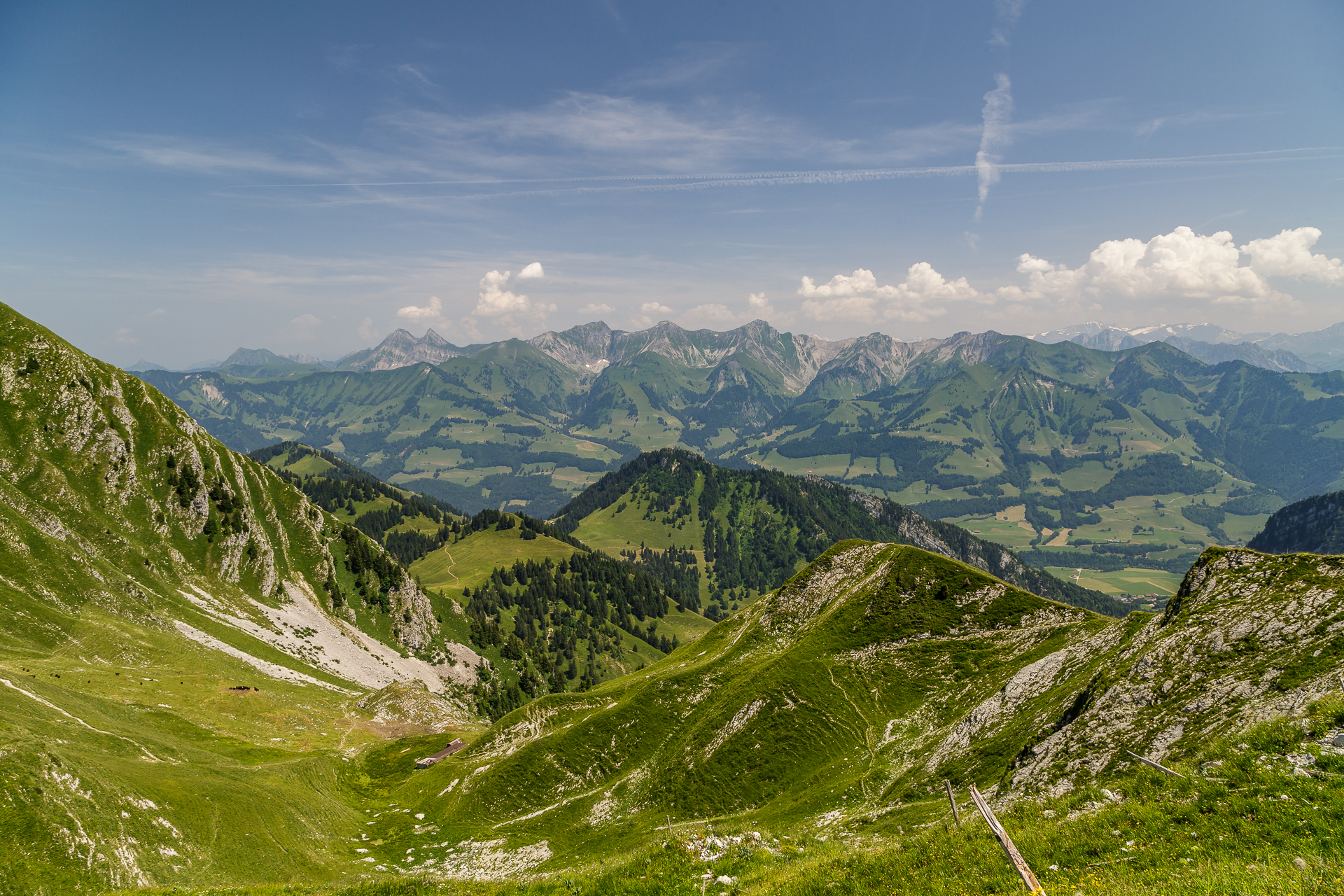
Les Paccots – The hike to the gourmet summit
The last summit experience took us to Les Paccots in the southern tip of the Fribourg region. An annual highlight here is the daffodil blossom, which transforms the alpine pastures into a white carpet of flowers every May. Unfortunately, we were too late for this spectacle at the beginning of July. At this time of year, however, there are a total of four gourmet trails with local specialties.
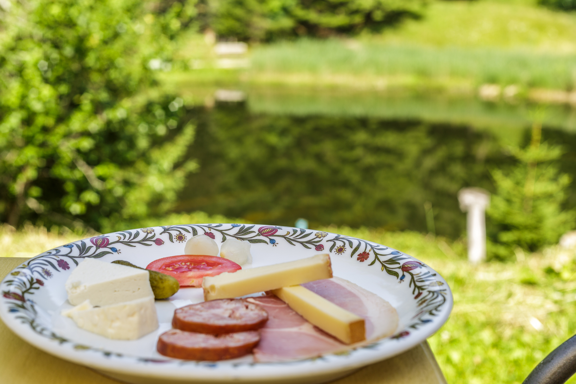
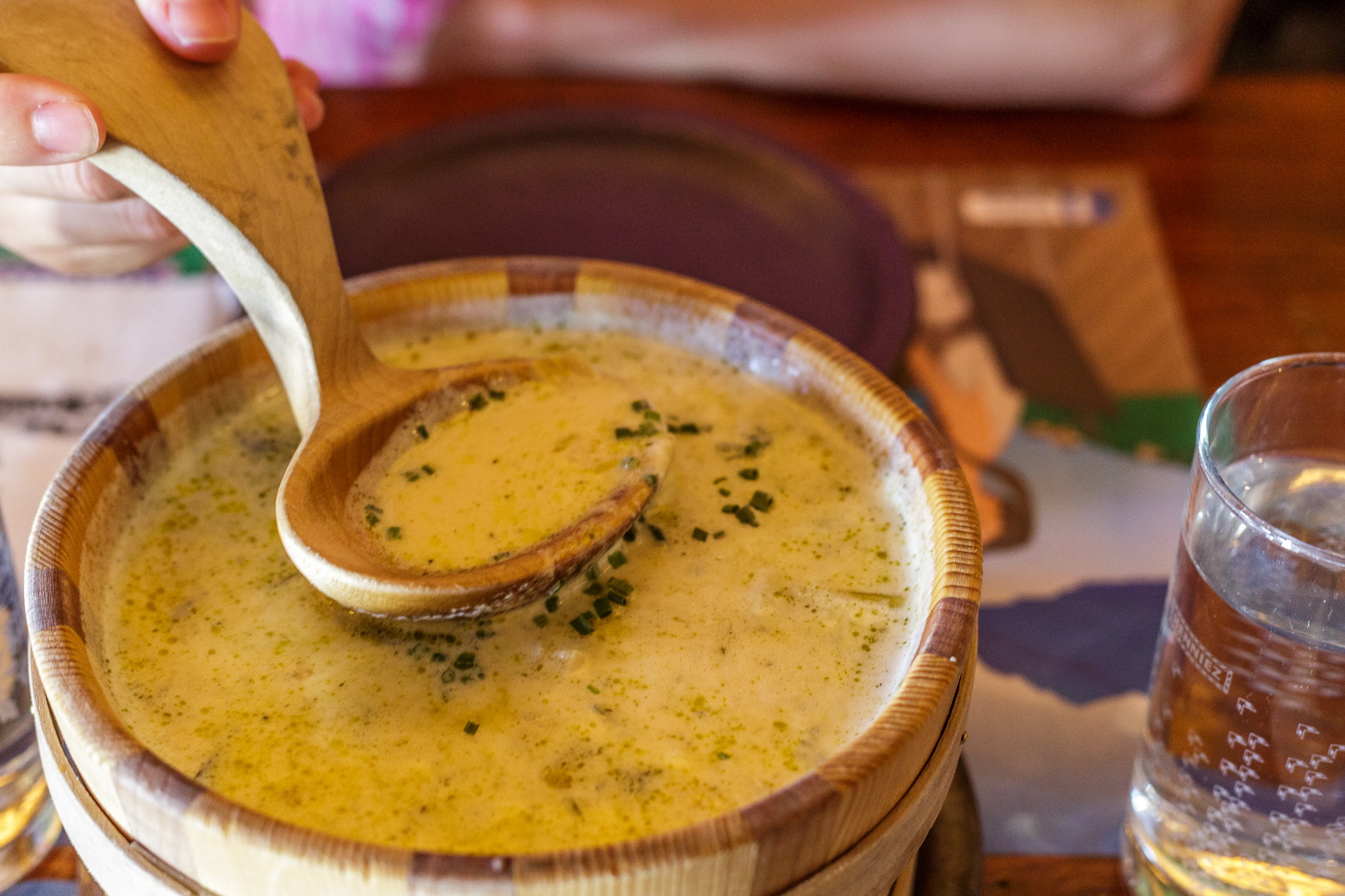
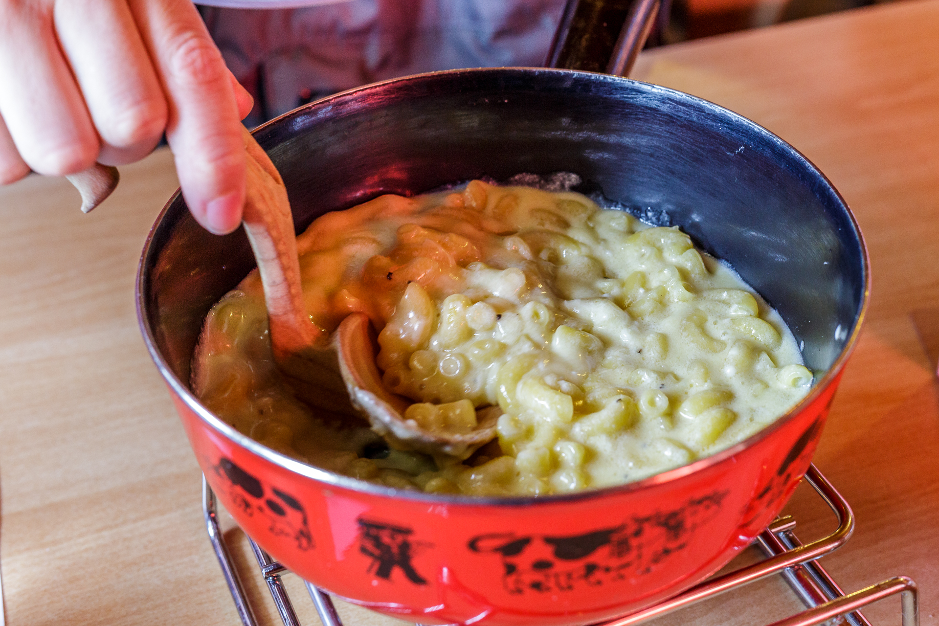
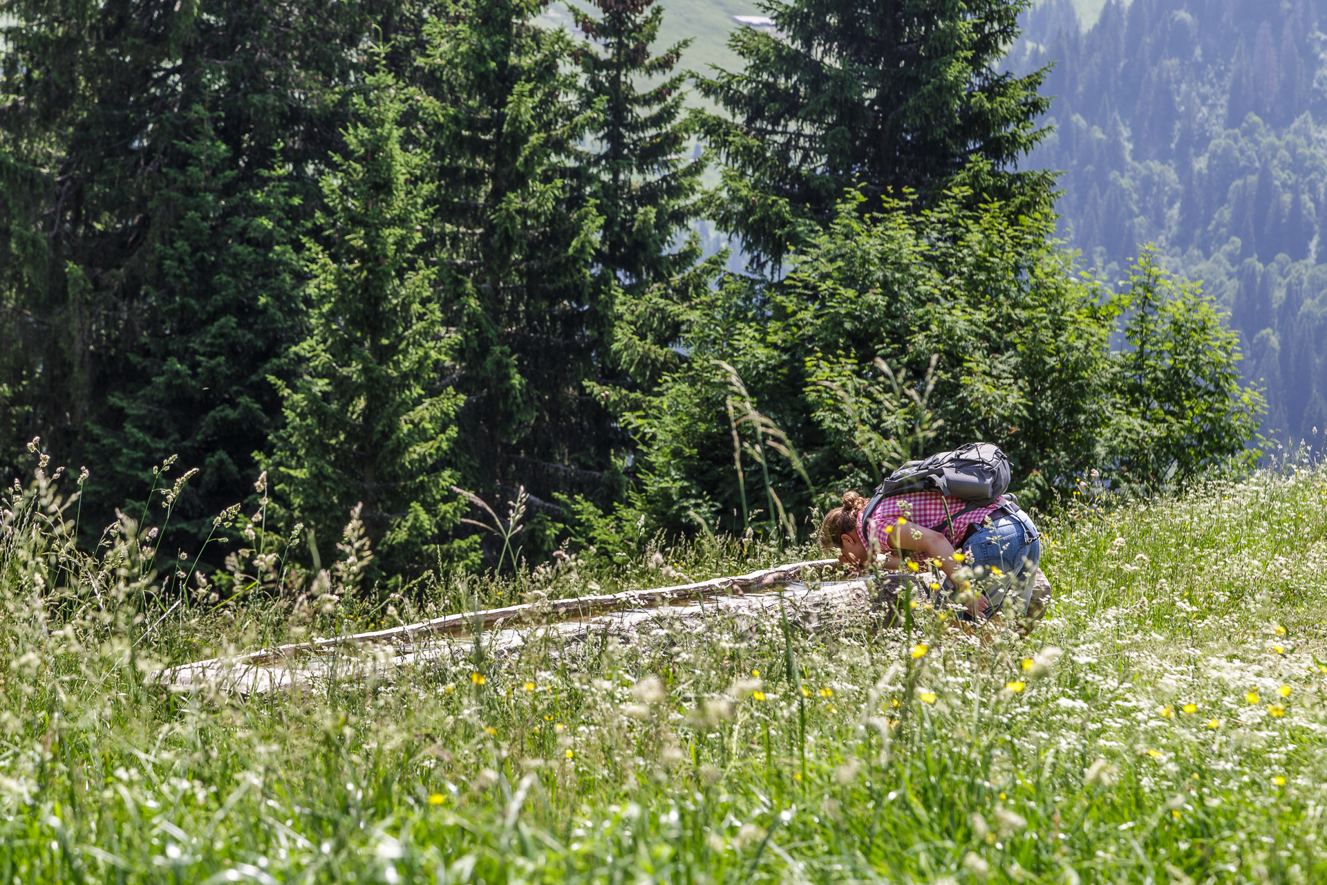
The Panorama Gourmet Trail – the longest of the four tours – leads for around 15 kilometres from Les Paccots in the direction of Dent de Lys and then via Vupey back to Les Paccots. Along the way, four culinary stops are integrated into the hike. We start the tour directly with a Fribourg farmer’s board at the Auberge du Lac des Joncs. This is followed by an exhausting ascent. We definitely deserved the chalet soup in the La Saletta alpine hut and the alpine macaroons in the Le Vuipay alpine hut afterwards. Equally welcome is the refreshing conclusion with a vin-cuit (“pear”) ice cream at the restaurant Les Rosalys. At almost 30° degrees, we were most looking forward to the refreshingly cool mountain spring water that we received at every stop.
Practical tips for the Panorama Gourmet Trail:
The route can be found on the map below. The panoramic gourmet trail Les Paccots is about 15 km long, includes an ascent of 650 meters and a descent of 650 meters in altitude. The pure running time is around 4 hours. With the culinary stops, about 6 hours are to be calculated. If you are travelling by car, you can start the hike at Les Rosalys. There is a large parking lot. If you are travelling by public transport, take the post bus from Châtel-St-Denis to “La Borbuintze” directly below the first culinary stop at the Auberge du Lac des Joncs. During the morning hours, there is no post bus service at the “Les Rosalys” stop.
More impressions of the gourmet trail can be found at Patotra.
Gruyères Base Camp
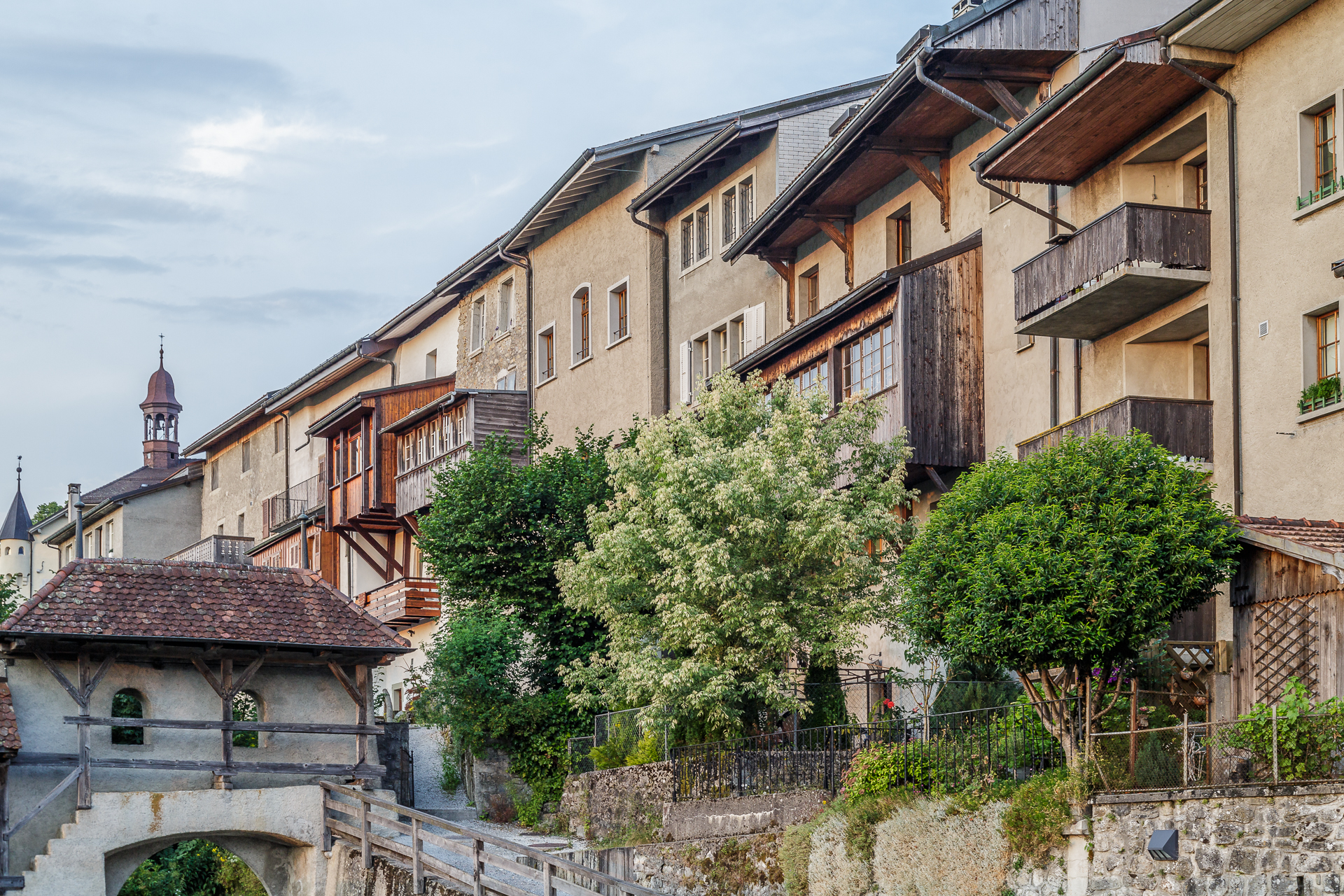
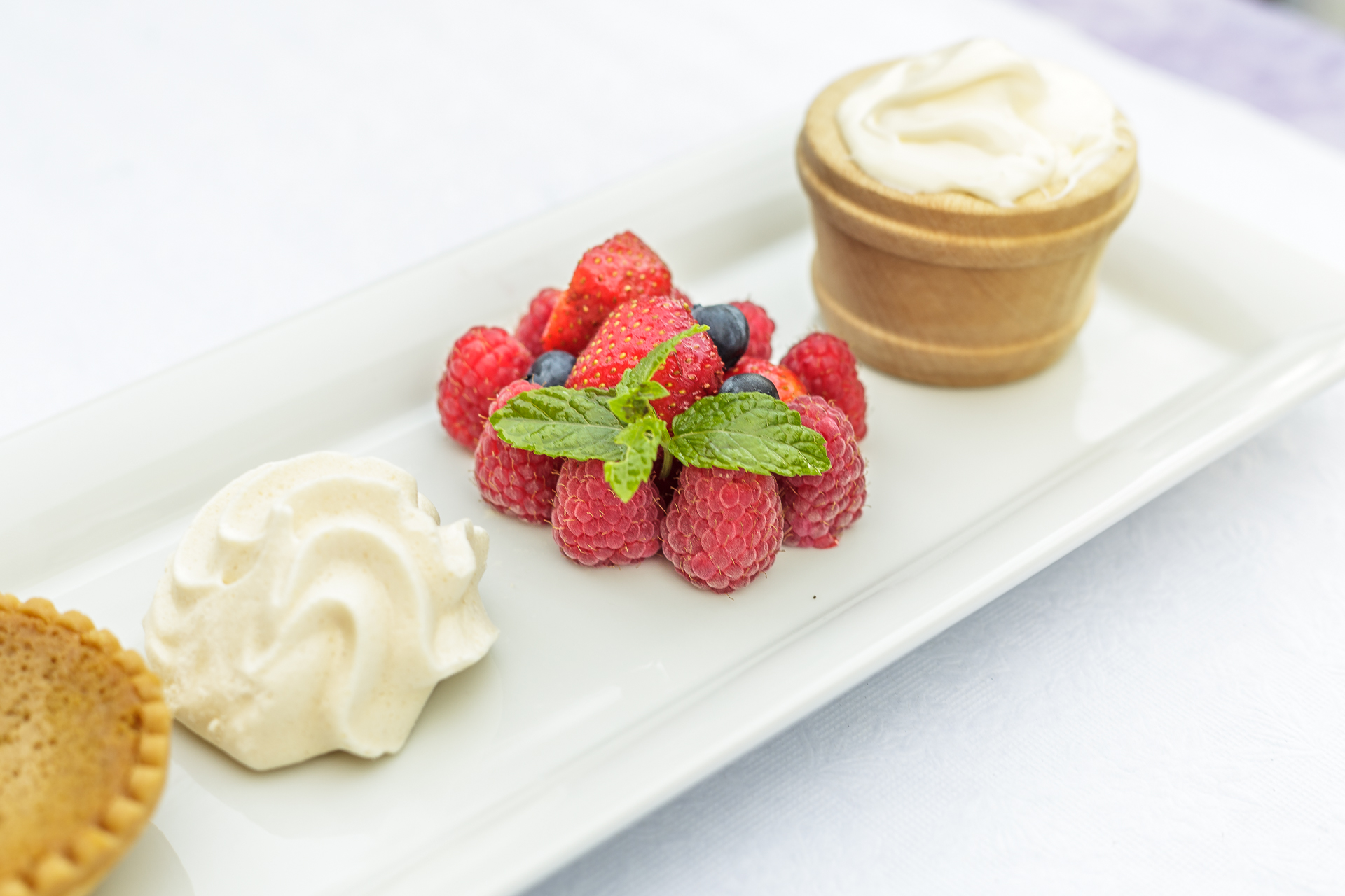
Even though I ranted non-stop about the hair-raising public transport connections during the three days, Gruyères put a smile on my face every evening after returning from the hikes. This town is simply magical and as the icing on the cake, there are kitschy sunsets and Gruyère double cream with seasonal berries. Hallelujah, a kingdom for Double Crème de Gruyère et Fruits Rouges.

Overall, the Summit Experiences package offers a varied insight into the region’s scenic diversity. Every hike is different and has its own peculiarities. The Moléson scores with its phenomenal panorama, the Gastlosen circular hike with its bizarre rock formations and the gourmet path with regional delicacies. Unfortunately, Gruyères is suboptimal as a starting point for public transport travellers. There is still room for improvement.
Note: I was allowed to test the package “Summit Experiences” at the invitation of Fribourg Region. Thank you very much for this! As always, my readers can be sure that I always represent my views and enthusiasm.

Leave a Reply