

Hiking on Lake Maggiore: beautiful tours between Gambarogno and Ascona
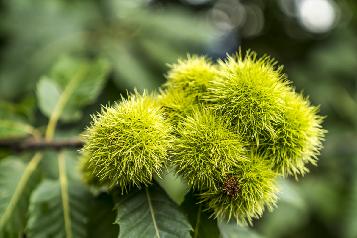
It’s almost a tradition – whether it’s to savour the first tentative rays of sunshine in spring or to swap misty autumn days for a few sun-drenched hours – Ticino regularly lures us to the southern side of the Alps. And on each of our previous detours to Ticino, we have laced up our hiking boots at least once to explore the diverse valleys on foot. This was also the case during our last weekend in Ticino at the beginning of September. This time, the focus was on the Riviera del Gambarogno, on the southern shore of Lake Maggiore. From charming Ticino villages to secluded chestnut forests to 360° summit views, everything that makes my hiker’s heart beat faster can be found here in a compact space.
Advertisement: this article was created in collaboration with Ticino Turismo
The antithesis of Ascona-Locarno: the Gambarogno Riviera
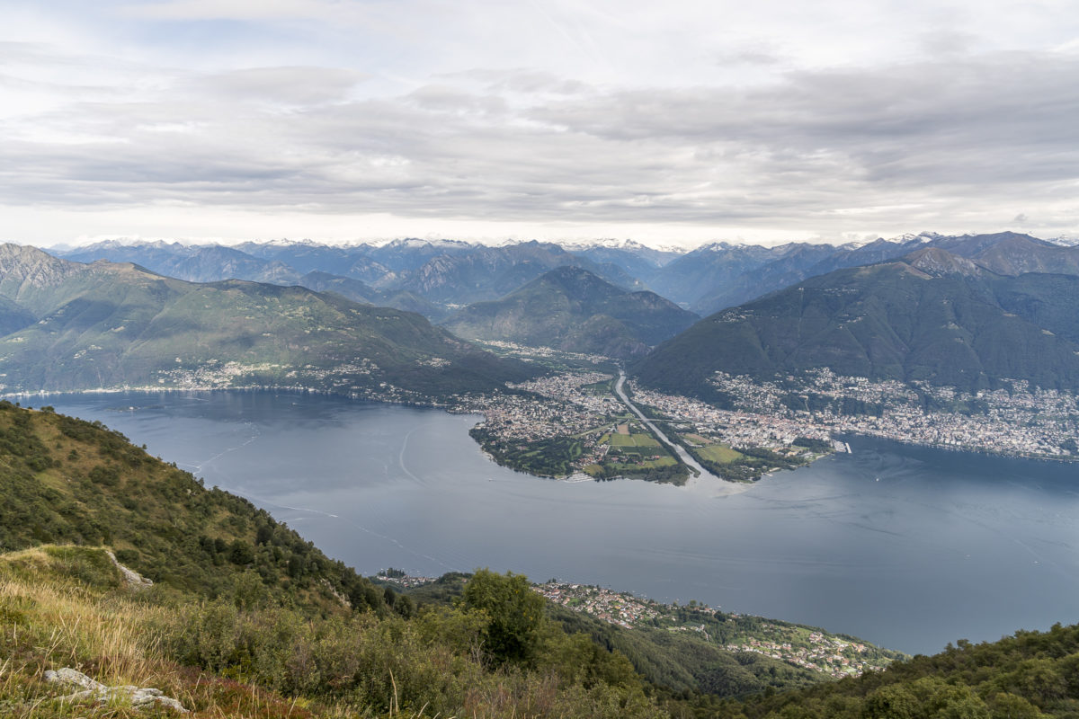
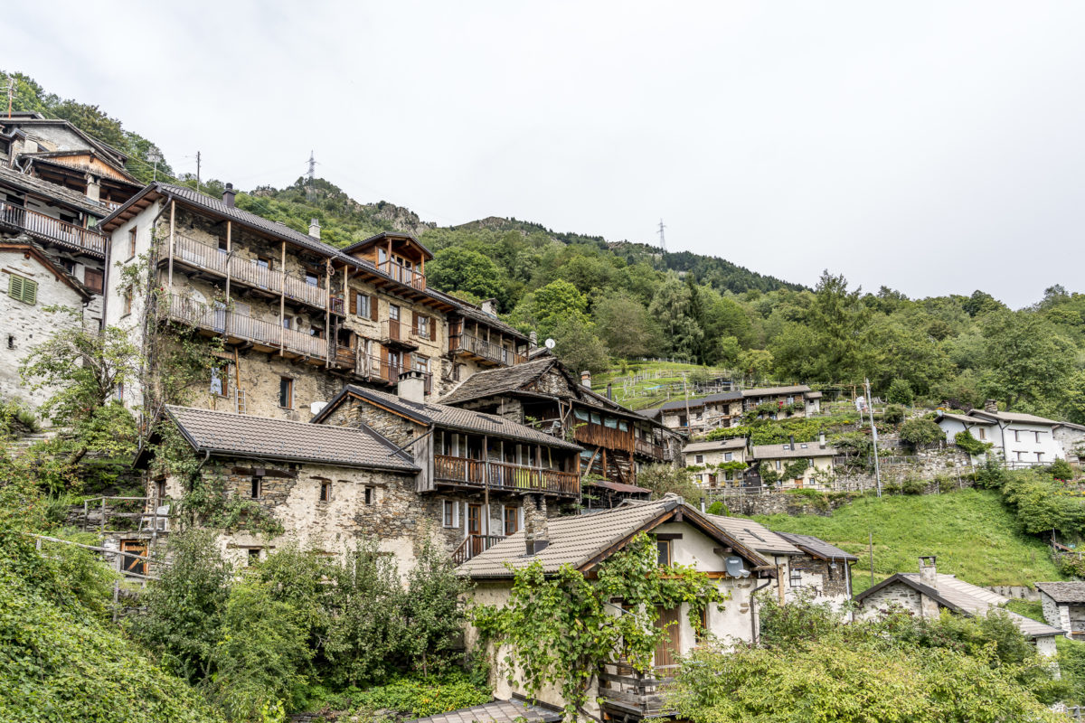
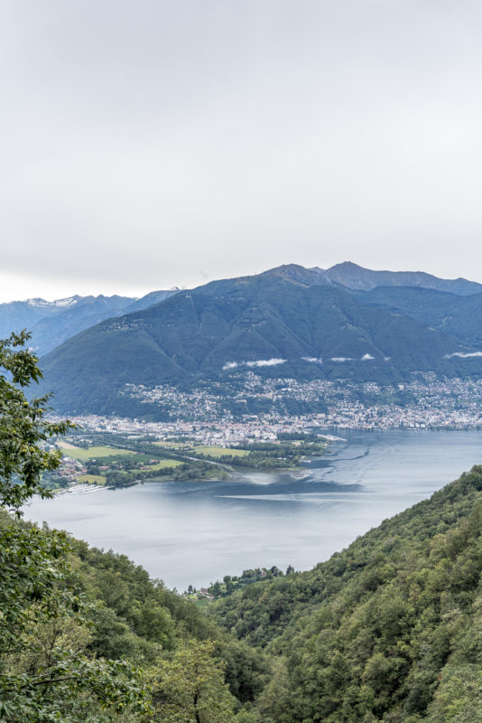
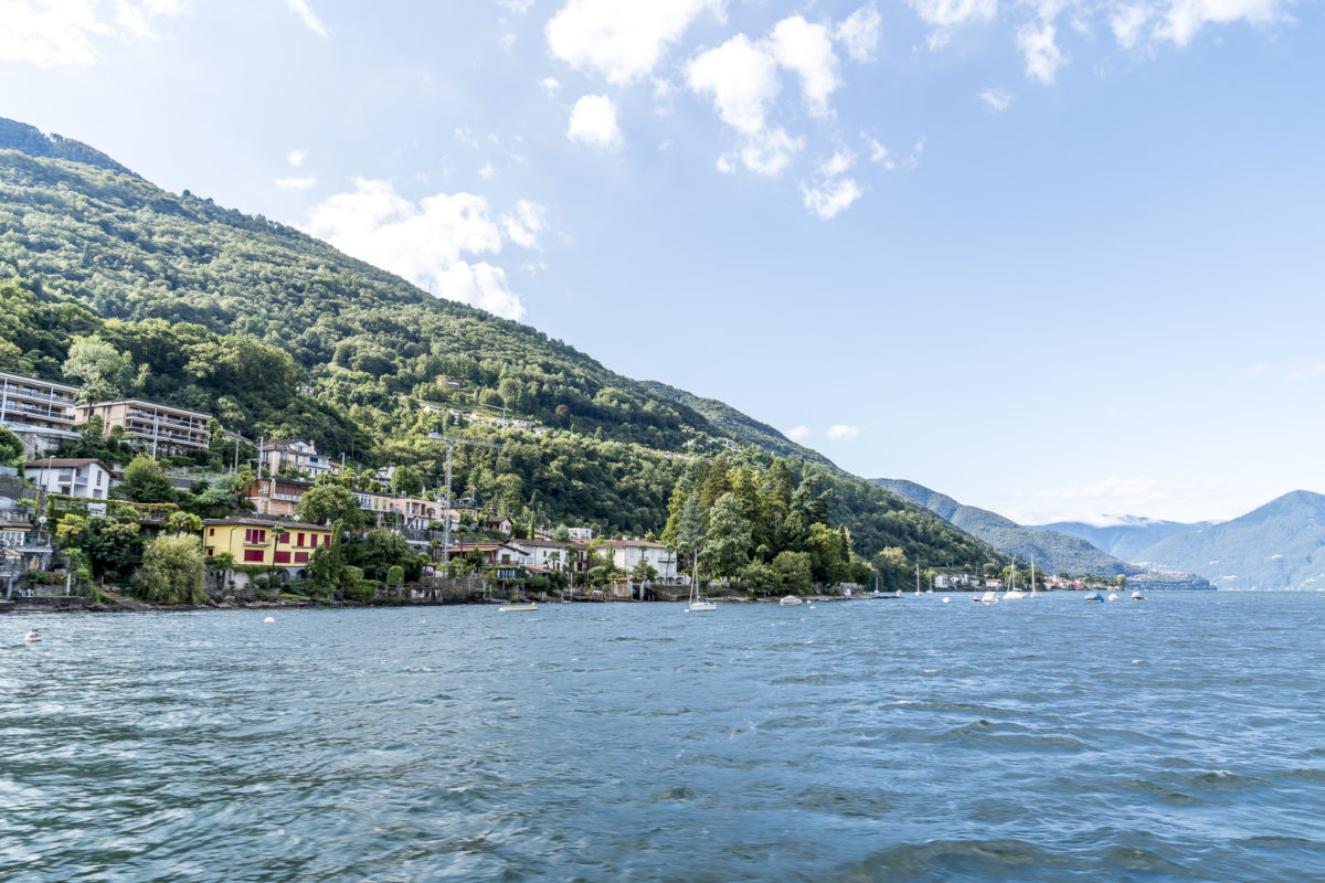
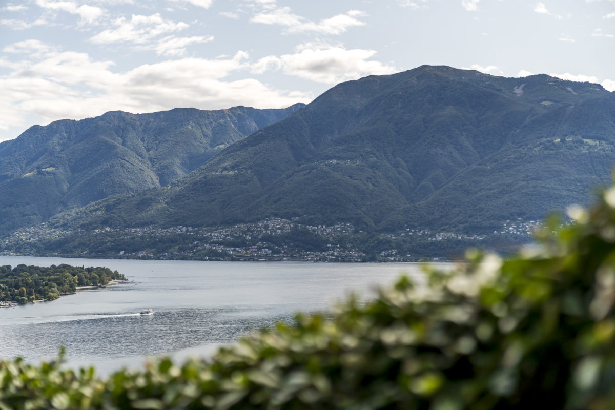
The Riviera del Gambarogno stretches from the Magadino plain over ten kilometres along the southern shore of Lake Maggiore to the Italian border. The area is part of the Locarnese region. The panoramic view of Locarno, the Maggia Delta and Ascona accompanies you every step of the way on this side of the lake. A new perspective for me. However, I am probably not an isolated case in this regard. Most visitors to Ticino are likely to be much more familiar with the view from Locarno towards Monte Gambarogno. And yet curiosity about what it looks like behind this green range of hills lures one or the other across the lake to Gambarogno.
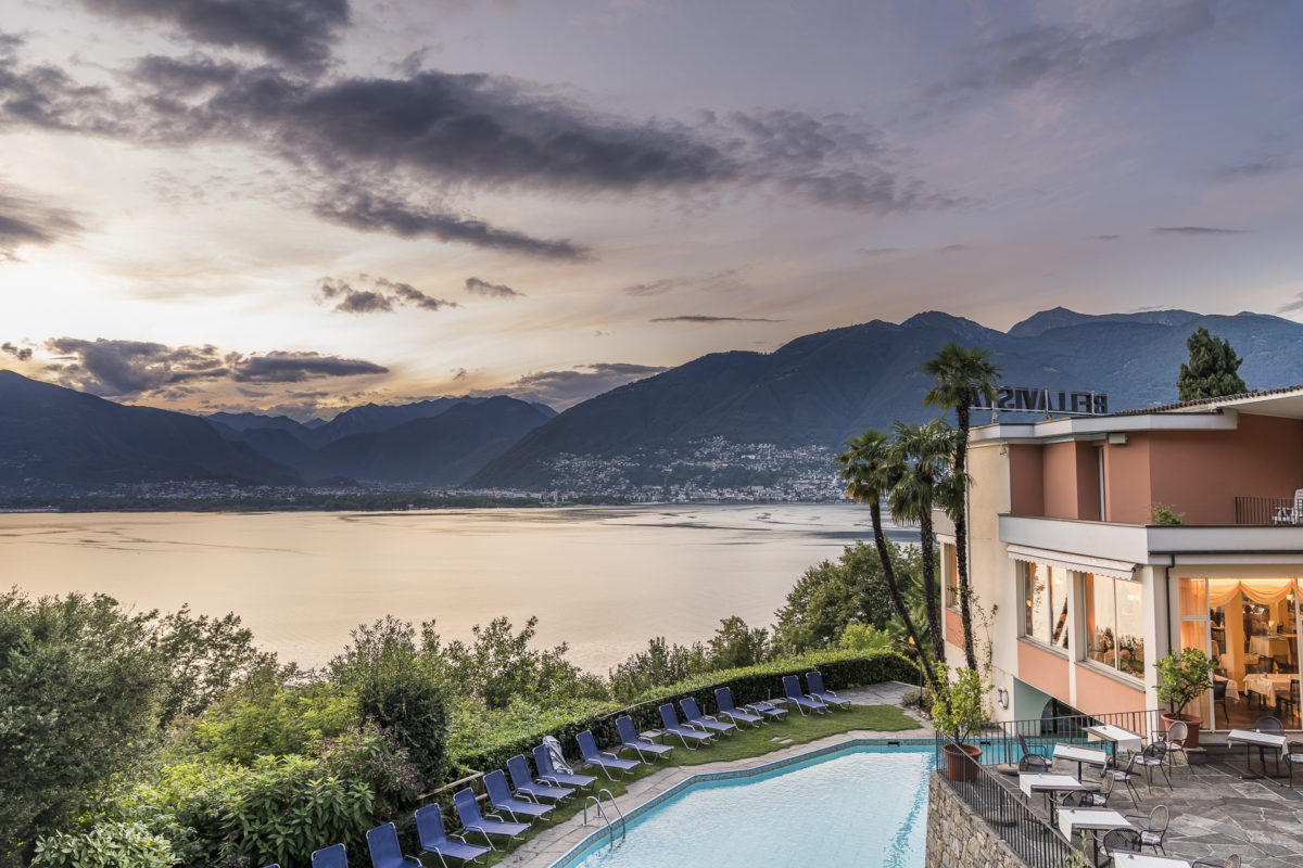
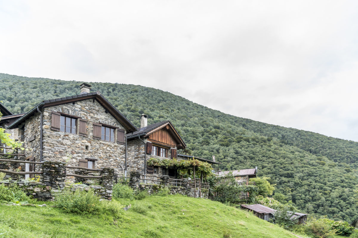
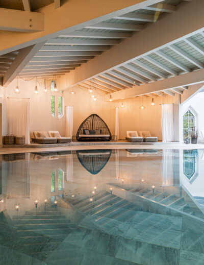
The starting point for our two-day discovery tour through this region is the Hotel Bellavista above the historic centre of Vira. Beautiful views are guaranteed here – and the next day you can go even further up.
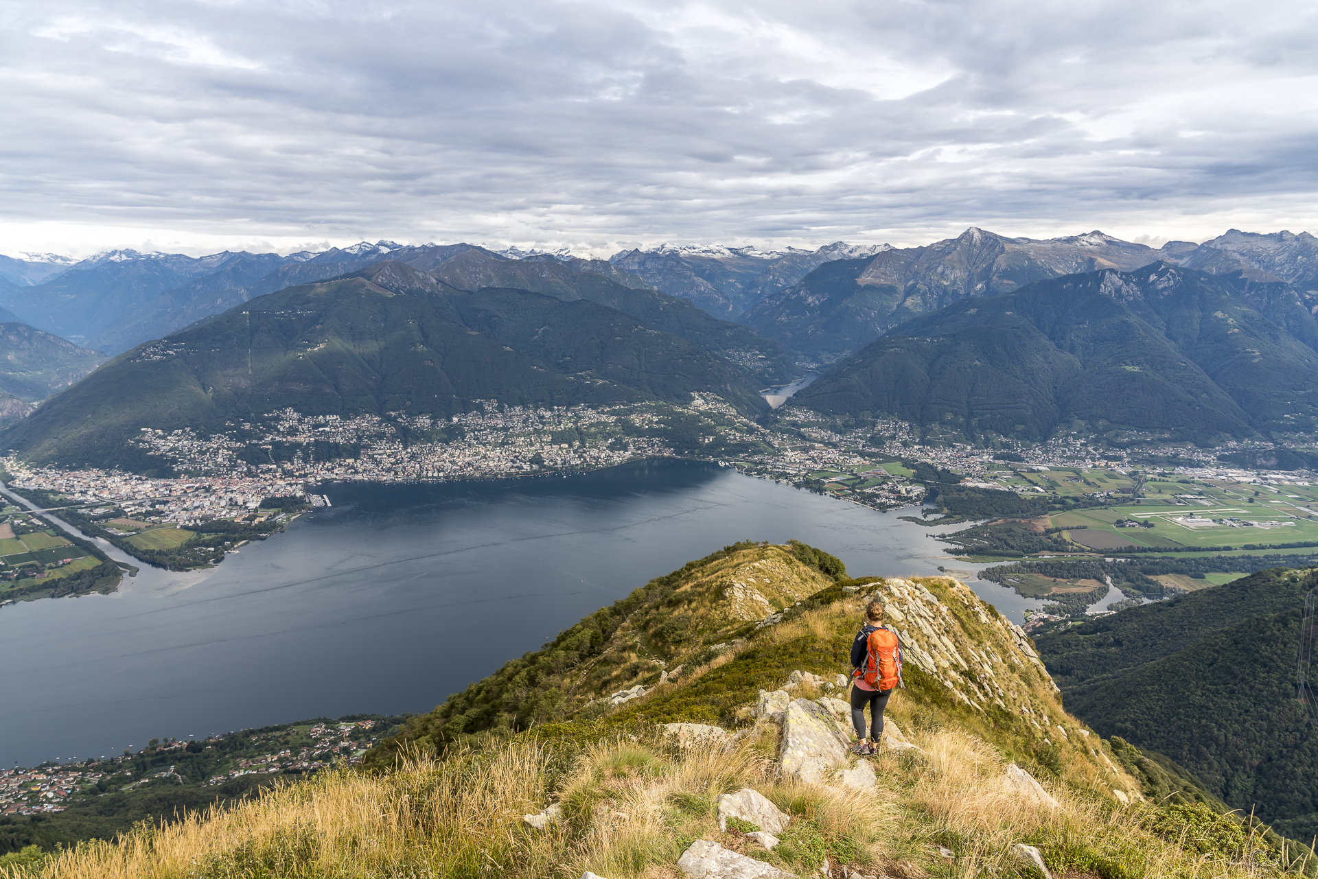
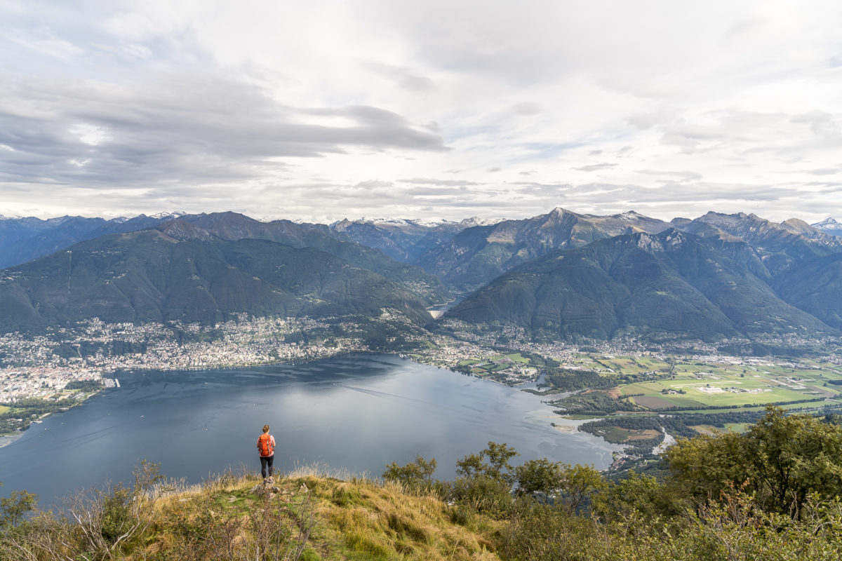
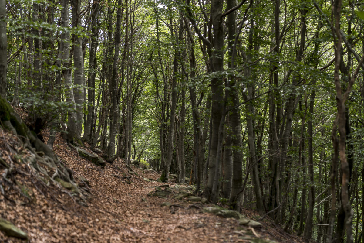
#1: From Alpe di Neggia via Monte Gambarogno to Indemini
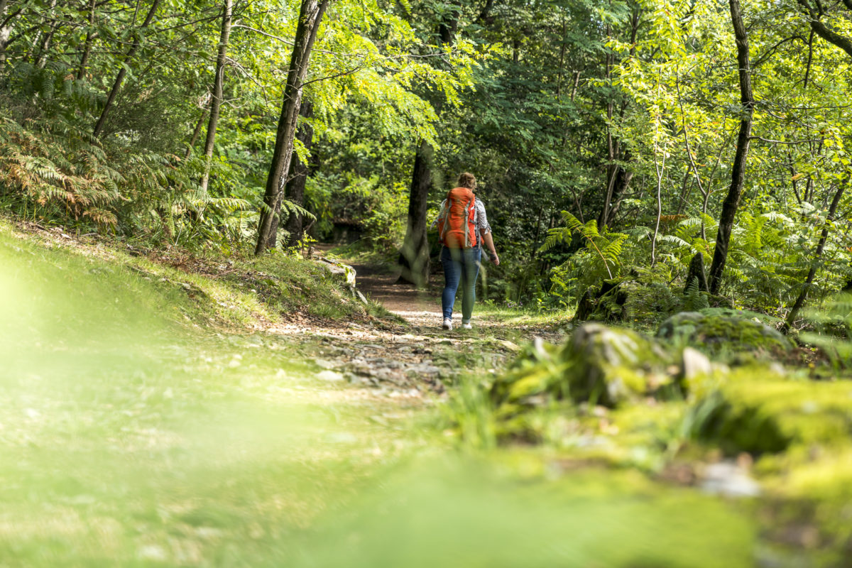
To the top of the Riviera del Gambarogno – Monte Gambarogno. The almost three-hour tour from the Alpe dei Neggia along the summit flanks to the stone village of Indemini is one of the most popular hikes in Gambarogno. From Vira, a winding mountain road leads to the starting point of the tour on the Alpe di Neggia. Not an easy task for the Postbus driver – the roads are narrow and the curves are narrow. Most of our fellow travellers get off the Neggia like we did in the Alpe. A good half of them travel by bike – on the Alpe die Neggia there is also a technically demanding bike route.
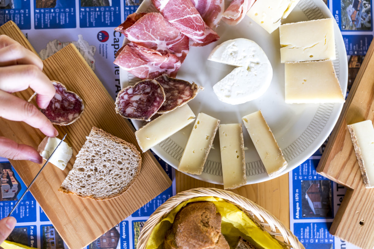
Before ascending towards Monte dei Gambarogno, follow the sign for “Alpe di Neggia”. This guides us to the alpine farm of the same name with a small shop. Various alpine products can be bought here. Among them are cheeses made directly on the alp. Actually, it’s not a very smart idea to fill the backpack with extra load before the tour, but I can’t resist the offer.
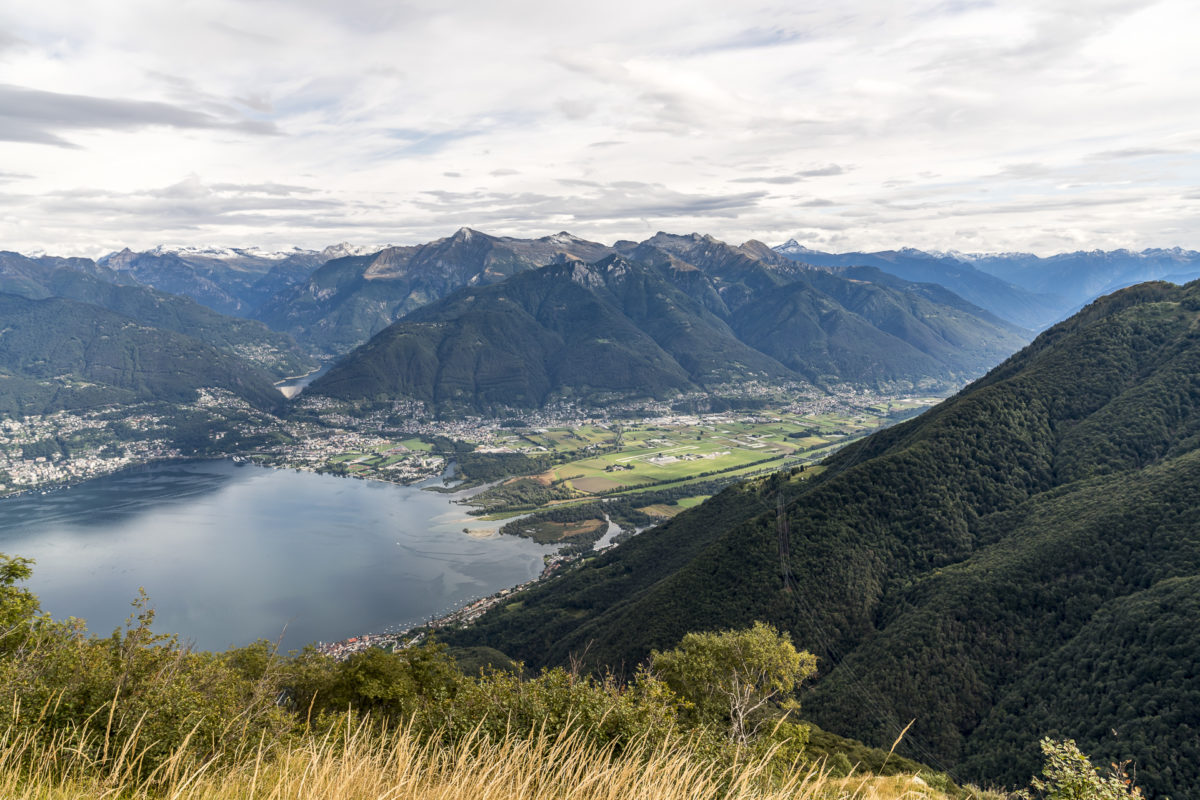
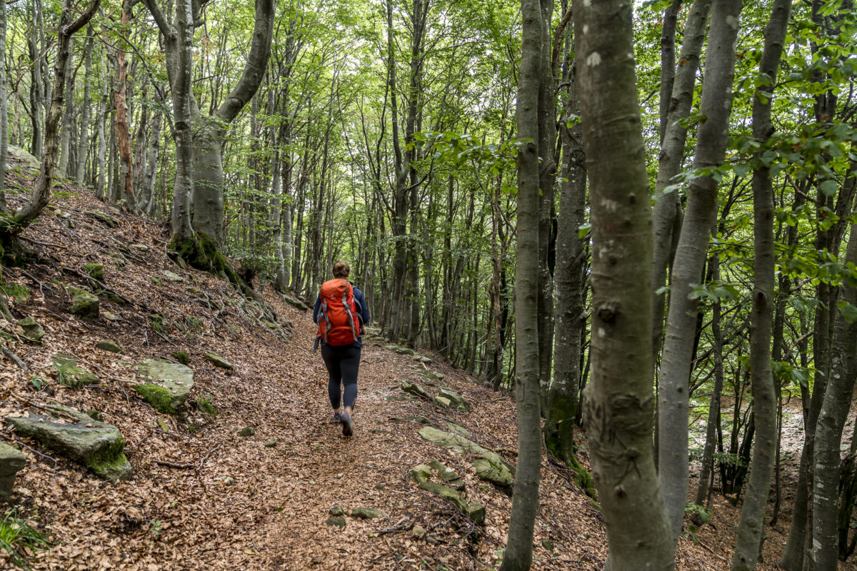
Then we follow the signposted hiking trail uphill. Soon there will be the first view towards the Magadino plain and the Verzasca valley. With every meter of altitude, another piece of the lake appears and after just under 45 minutes, the panorama over Lake Maggiore and the peaks behind it unfolds in all its splendor.
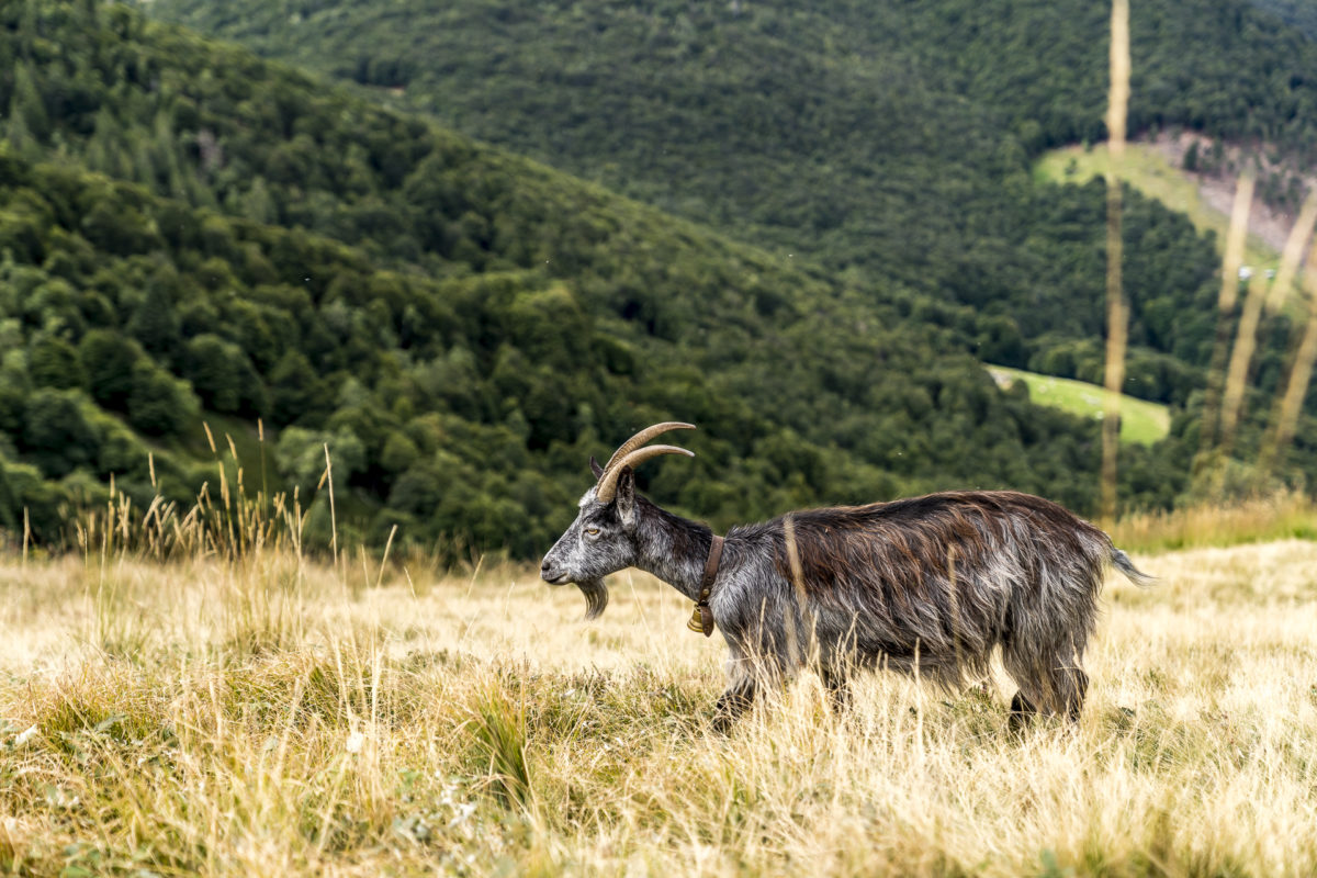
Now follows the descent over alpine meadows and loosely planted birch forests to Alpe Cedullo. On the way, a few goats cross our path. They are the source of the milk that is processed into fine cheese in Alpe Cedullo. In addition to self-produced cheese and meat products, Alpe Cedullo also offers minestrone or polenta, depending on the day of the week and the season. Of course, we don’t want to miss such a stop.
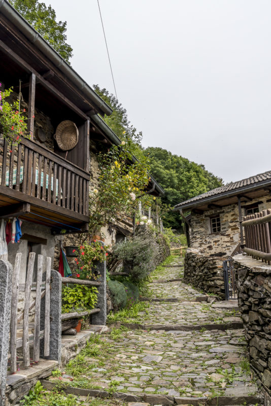
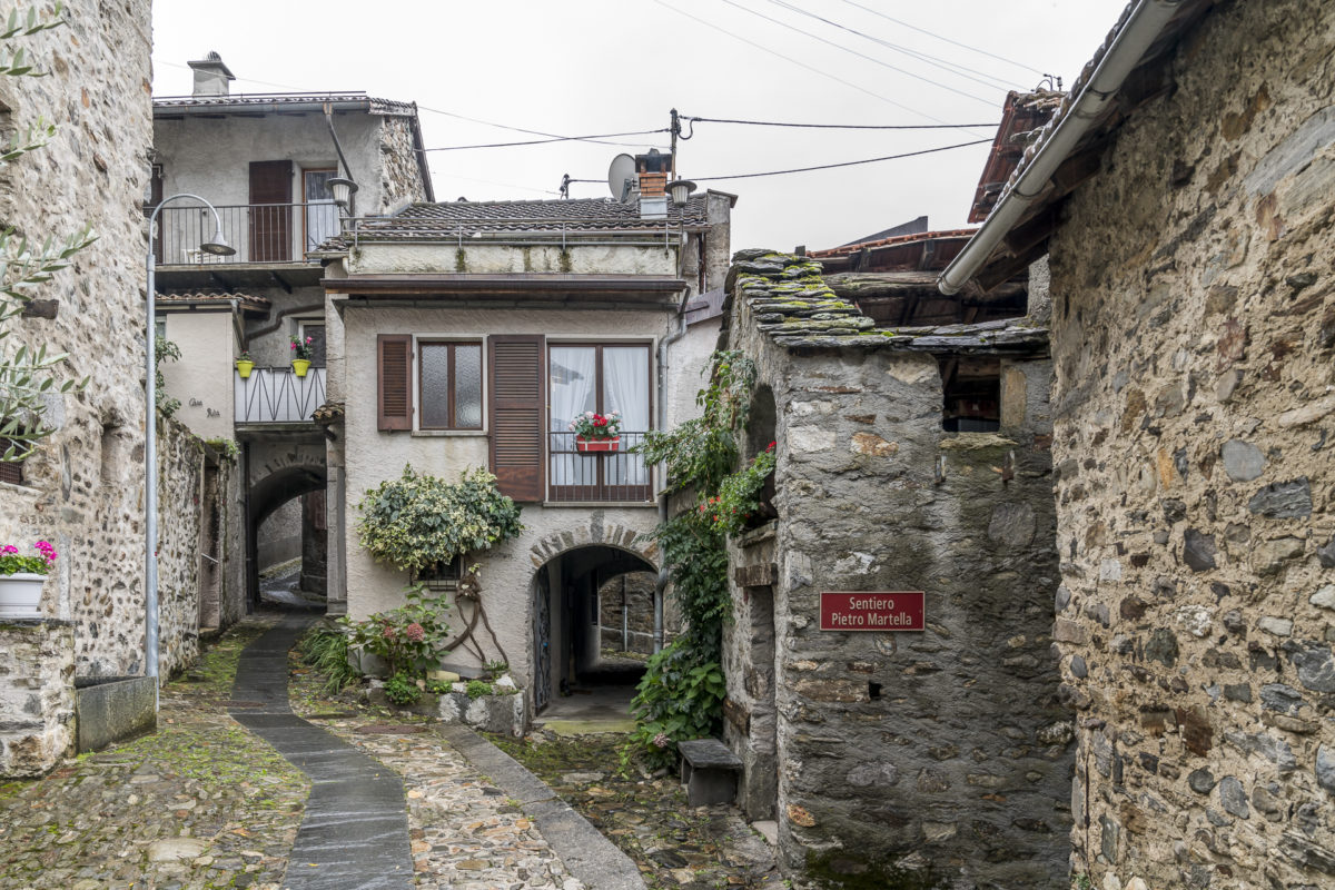
Freshly strengthened, we then tackle the descent towards Indemini. It’s not far anymore – the rest of the route takes about an hour to walk. We’re not in a hurry either. The Postbus only serves the route sporadically on weekends; i.e. between 12:10 and 16:10, you have no choice but to wander through the narrow cobblestone streets of Indemini (or stop at the Indeminese restaurant). A wonderfully decelerating excursion!
The route of the hike from Alpe die Neggia to Indemini can be found on the map below. You can find the important key data as well as further information about this hiking route here: Monte Gambarogno: From Neggia to Indemini
#2: Monti di Piazzogna Trail
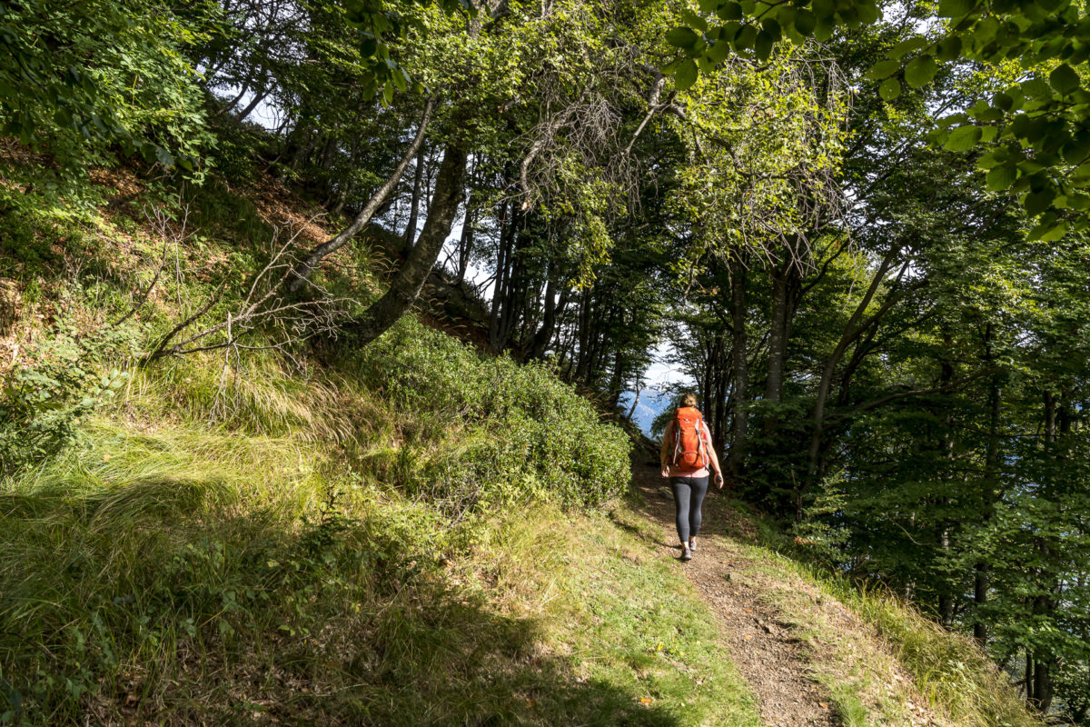
While on the first hike we circled Monte Gambarogno, on the second tour we follow the Riviera del Gambarogno to the Italian border. The starting point of the high-altitude hike along the Monti di Piazzogno can be reached with the same post bus line Magadino – Alpe dei Neggia – Indemini. The first hairpin bends above Scesana are followed by the “Monti di Piazzogna” turn-off. Here we get off and walk along the tarred road to Monti di Vairano. After about 2 kilometres of asphalt, the mountain path starts at Corte della Costa.
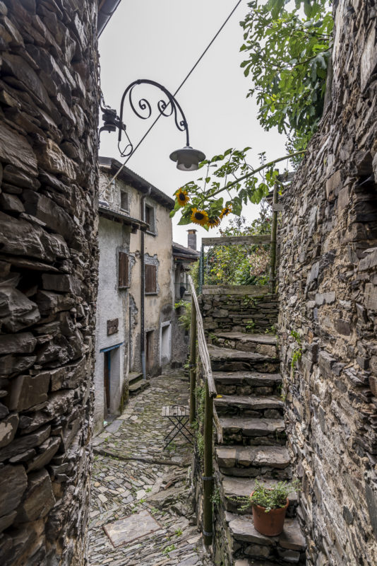
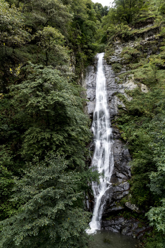
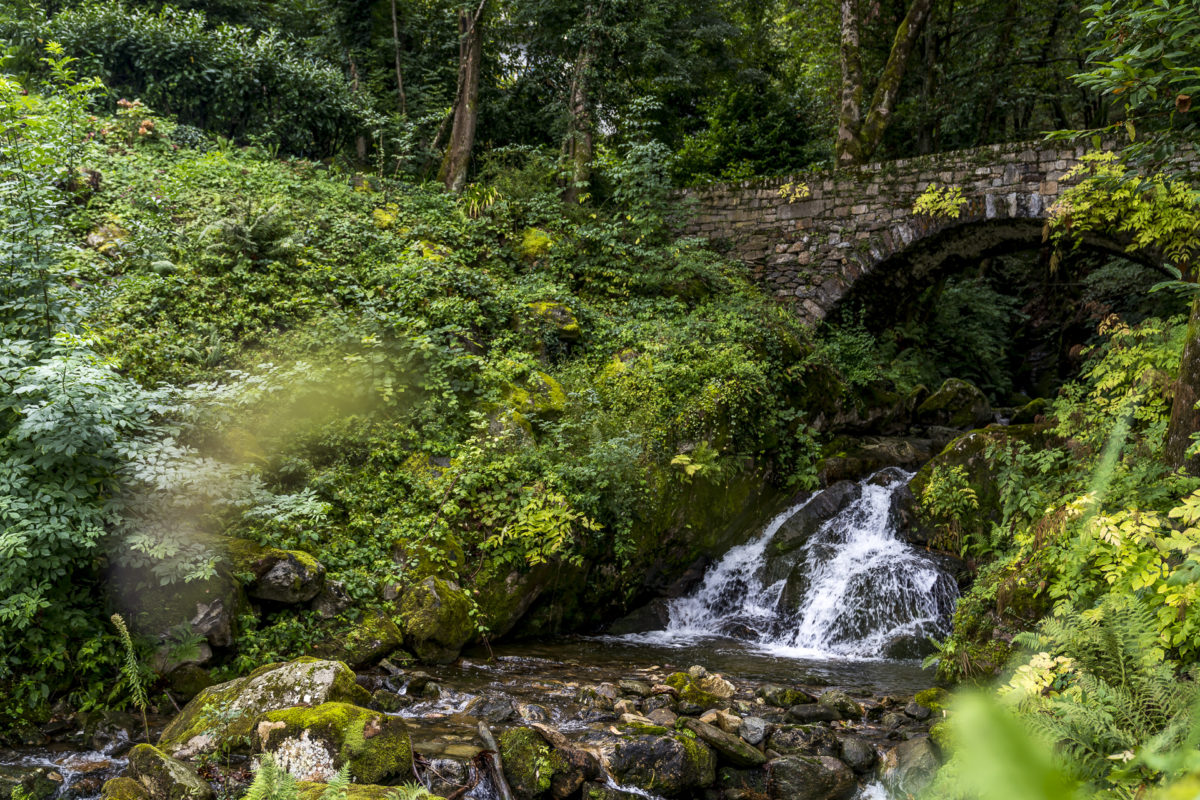
This follows in a varied up and down the slope edges to Monti di Caviano. A highlight is the wild Cedullo Valley with its imposing waterfall. The individual scattered hamlets that we cross on this hike are also pretty. In Monti di Caviano there is also a stone house with an original rye thatched roof.
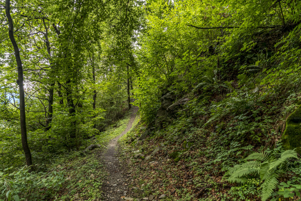
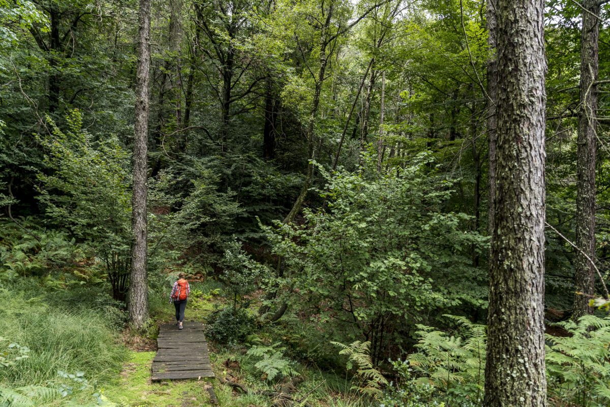
Even though we weren’t exactly blessed with luck with the weather that day, we really enjoyed this 3.5-hour hike because of its versatility. In addition, you are guaranteed not to come across any streams of people here. We didn’t meet a single hiker along the entire length.
The route of this hike is shown below. You can find all further information about the hike from Monti di Piazzogna to Dirinella here: High-altitude hike in the mountains of Gambarogno
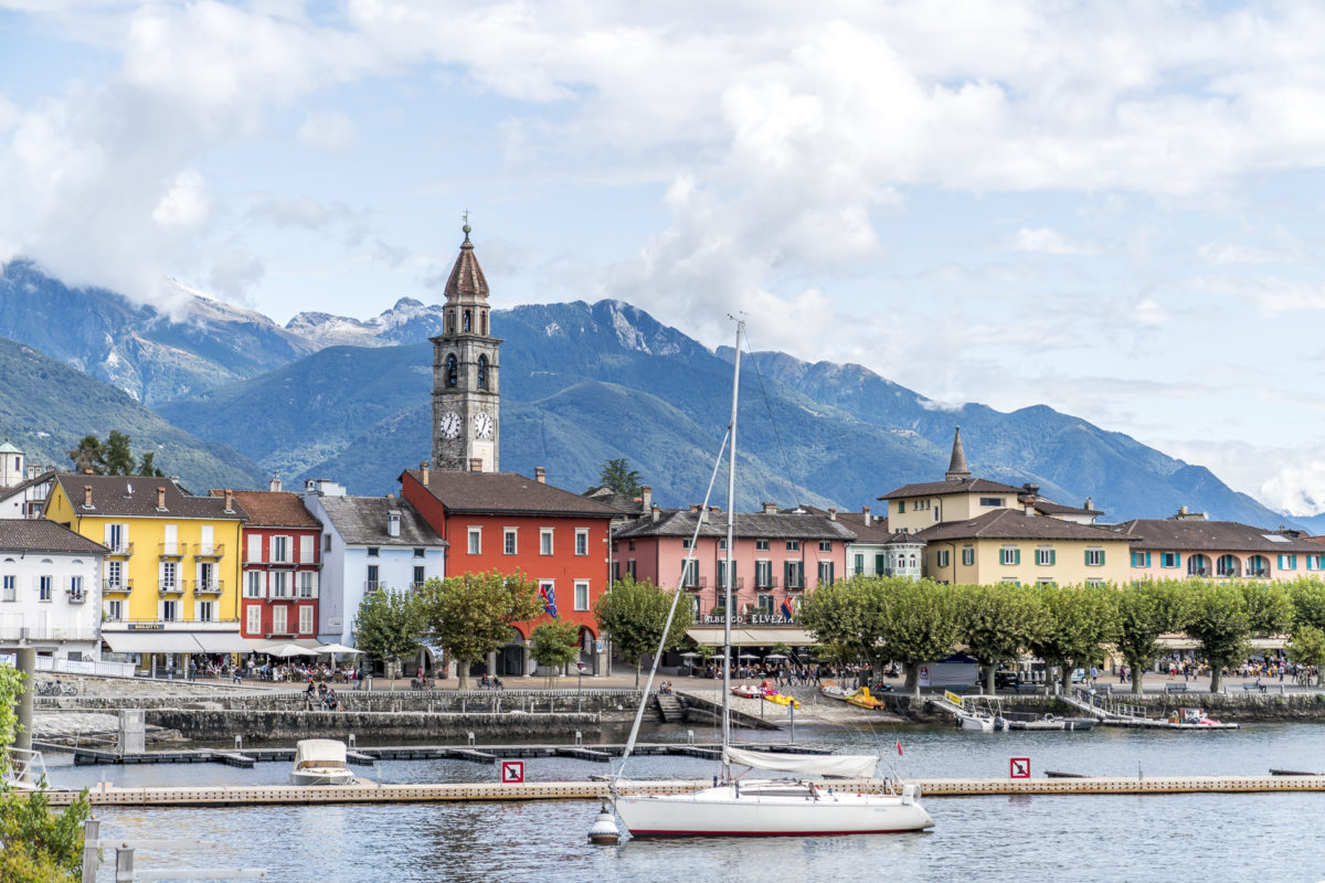
#3: From Ascona to Monte Verità
After two busy days, Switzerland’s sunshine lives up to its name on the third morning. The view through the hotel window promises the most beautiful late summer weather. Therefore, we spontaneously decide not to wait for the post bus, but to walk towards the boat landing stage in San Nazzaro. The villages in Gambarogno are connected by numerous winding footpaths. And so we follow the signpost along the hill towards Piazzogna/Vairano. Even if you’re only planning a short hike, think carefully about which shoes you wear. The idyllic stone paths have their pitfalls, depending on the degree of steepness.
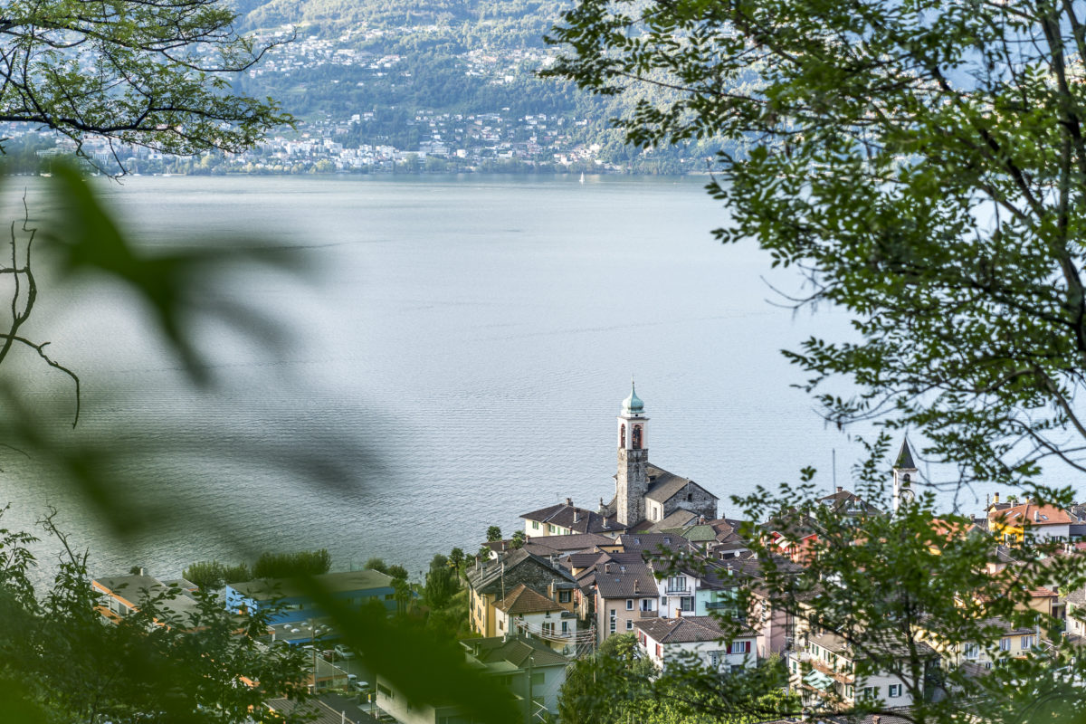
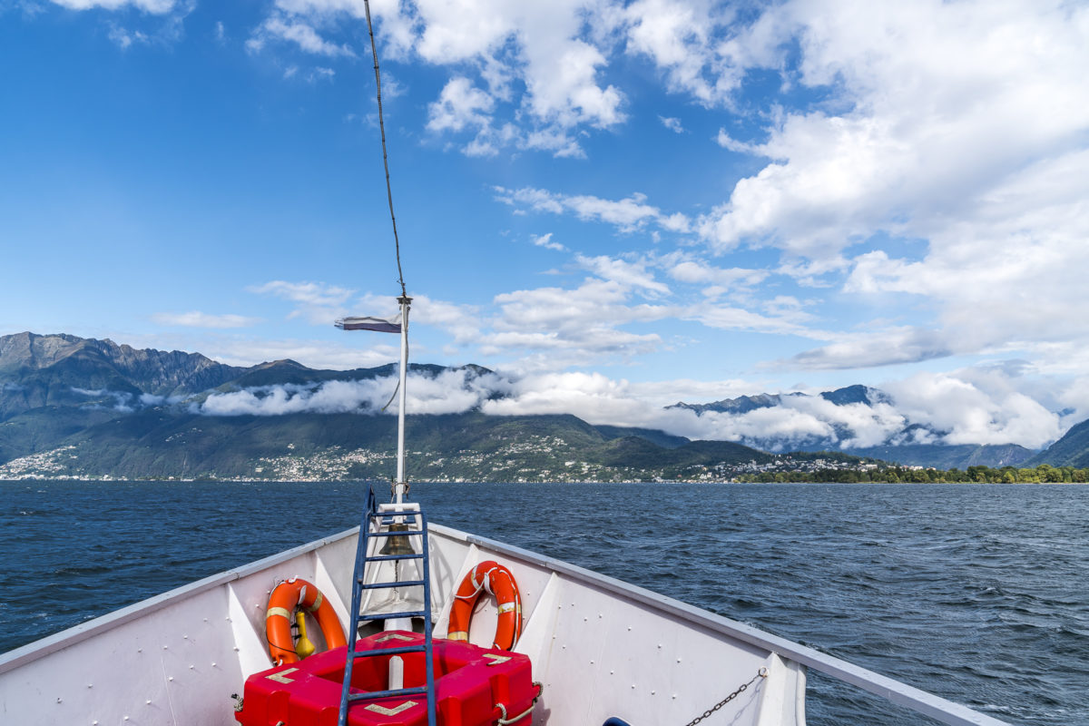
After about an hour’s walk, we reach the pier in San Nazzaro. About every two hours, one of the ships stops here, sailing from Locarno to the Brissago Islands. For us, this is the shortest and probably also the most beautiful connection over to the other side of the lake. While you only get a 20% discount on the ticket price with the Ticino Ticket, the GA travelcard is fully valid to our delight. Boating is doubly worthwhile.
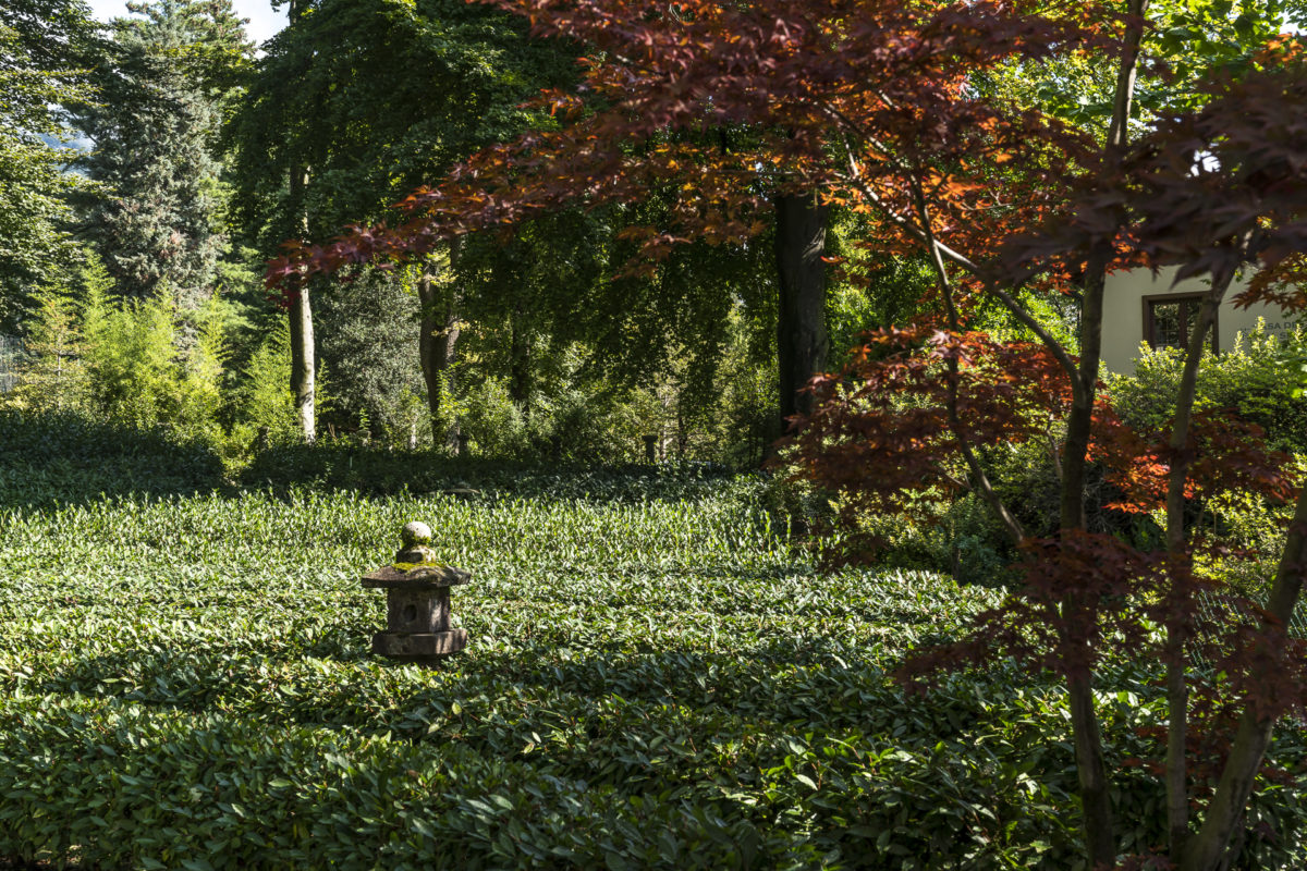
Before we end the Ticino weekend in style on the piazza of Ascona, we follow the narrow stairways up to Monte Verità. Hidden in the middle of the park on the “Truth Mountain” is one of my favourite places in Ticino: the Casa del Té, in the middle of an idyllic tea plantation. Here you can get the matcha tea exactly as it is celebrated in Japan.
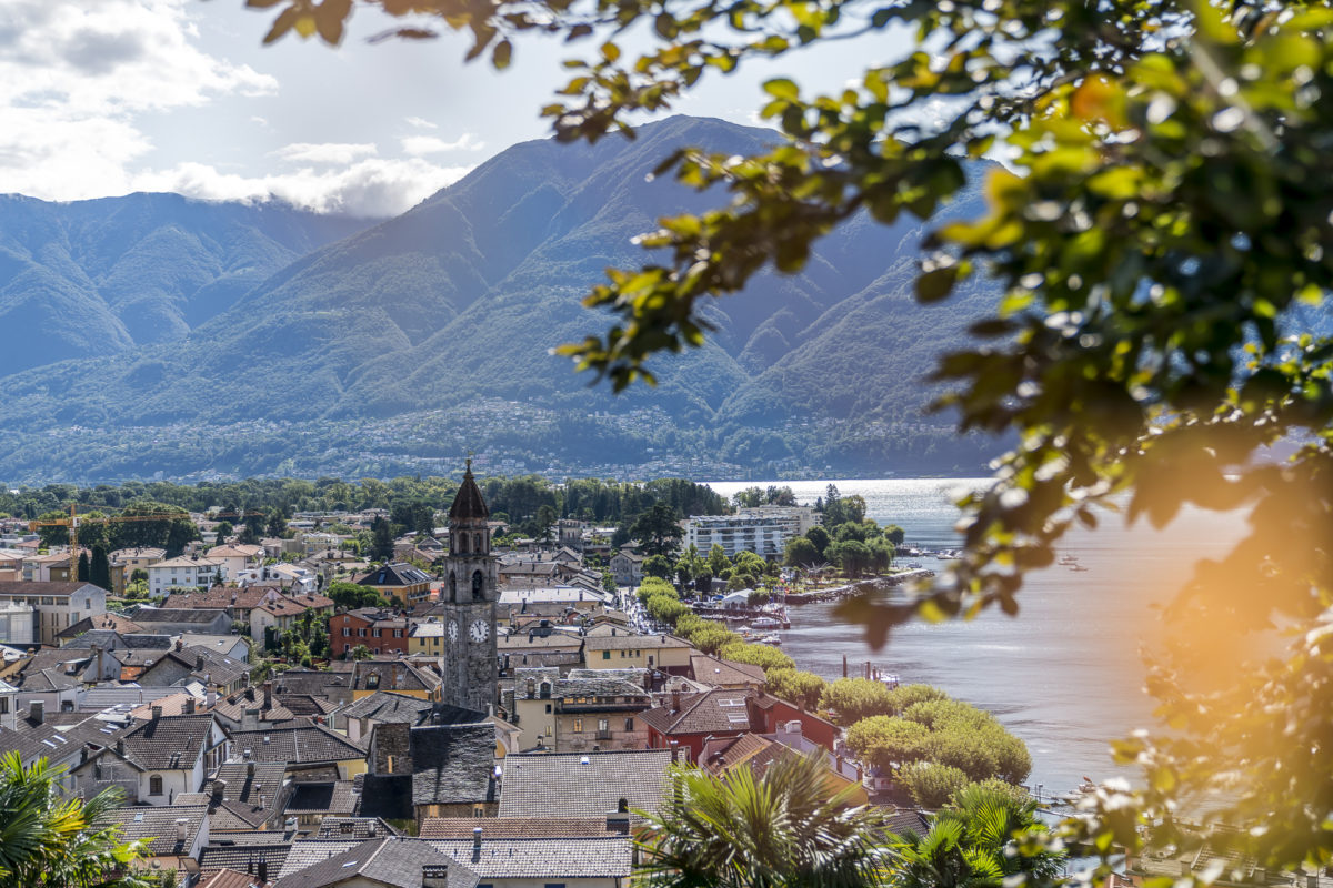
From Monte Verità, a hiking trail leads via Gruppaldo to Ronca sopra Ascona. The path is lined with numerous vantage points with beautifully placed benches – the perfect route for a Sunday walk with great views.
After this round, we have really earned the pasta party in the middle of the hustle and bustle of Ascona. And so, once again, an all-round successful Ticino weekend is coming to an end. We have already forged ideas for the next detour on the way. While browsing through the various hiking routes, we were shocked to discover that we had only explored a fraction of the canton on our previous short trips to Ticino.
The route of the short circular hike from Ascona via Monte Verità back to Ascona is shown below. You can find more information here: Panorama walk Monte Verità – Ronco sopra Ascona
More hiking tips for Ticino
- The TicinoHike app offers a nice overview of the diverse hiking routes in Ticino. A total of 229 tours are described in detail there. In addition to the basic information on the length of the route, duration, difficulty, etc., explanations of the interesting sights along the route are also integrated. You have the option to filter routes, create your personal favorites list and save tours offline.
- I have already described some hikes, which can also be found on the TicinoHike app, in detail here on the blog. These include the high-altitude hike from Monte Tamaro to Monte Lema as well as the chestnut trail in Malcantone – two super beautiful autumn hikes!
- You can find more inspiration for beautiful autumn hikes in Ticino on the following page: ticino.ch/moments
- If you stay in a hotel, a youth hostel or a campsite in Ticino, you will receive the Ticino Ticket. With this, you can use public transport throughout the canton free of charge and receive a discount on ticket prices for mountain railways and boat trips in the Swiss lake basin.
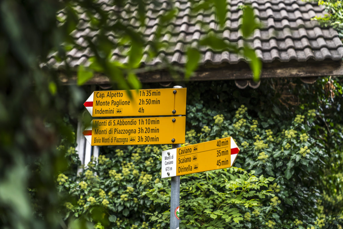
- The post bus connections in Gambarogno sometimes run only irregularly – look for the right connections in advance, so that you don’t get “stranded” somewhere unexpectedly.
Leave a Reply