


3-day hike Hüfihütte – Cavardirashütte – Sumvitg
The first of two 3-day hikes that we undertook this summer took us from the Maderanertal via scenic mountain hiking trails into the Surselva. During our tour we stayed overnight in two SAC huts with great views.
In this article I will show you what surprises along the way will sweeten your ascent to the Hüfihütte and what impressive views you can look forward to while climbing the blockstones on the way to the Cavardirashütte.
1. Hiking day: from Golzern to Hüfihütte
Our first 3-day hike almost fell through. We had planned the tour for the first of August and if you remember: the weather forecast was – to say the least – very mixed. Two days before the 3-day hike, all signs pointed to “cancellation”. But the phone call to the Hüfihütte made me confident again. At least the hut warden was able to reassure me that the climb was manageable even when it started to rain (not a thunderstorm!).
And since the weather forecasts were improving hourly, especially for the second day of hiking, which includes the technically most difficult sections, we courageously tackled the 3-day hike on August 1st – and with an umbrella at the ready. Since it was unclear how long the dry weather would last, we decided to use the starting point closest to the Hüfihütte by public transport: the Golzern mountain station.
Ascent through the Maderanertal
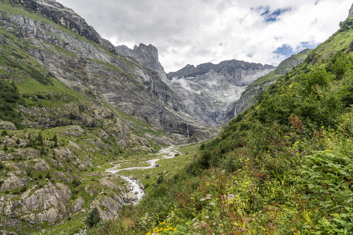
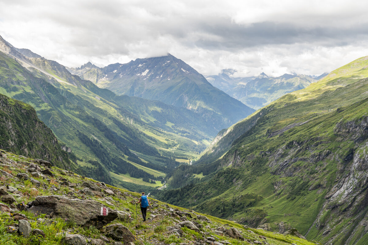
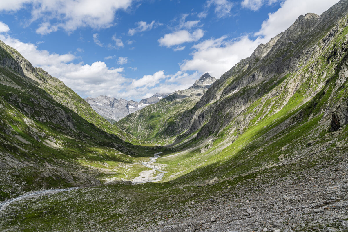
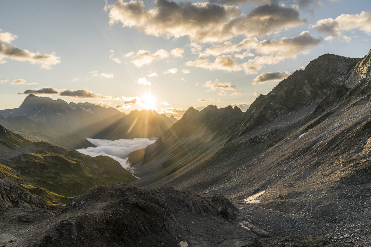
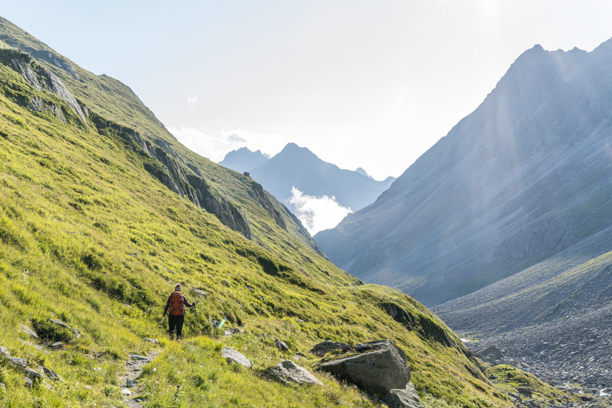
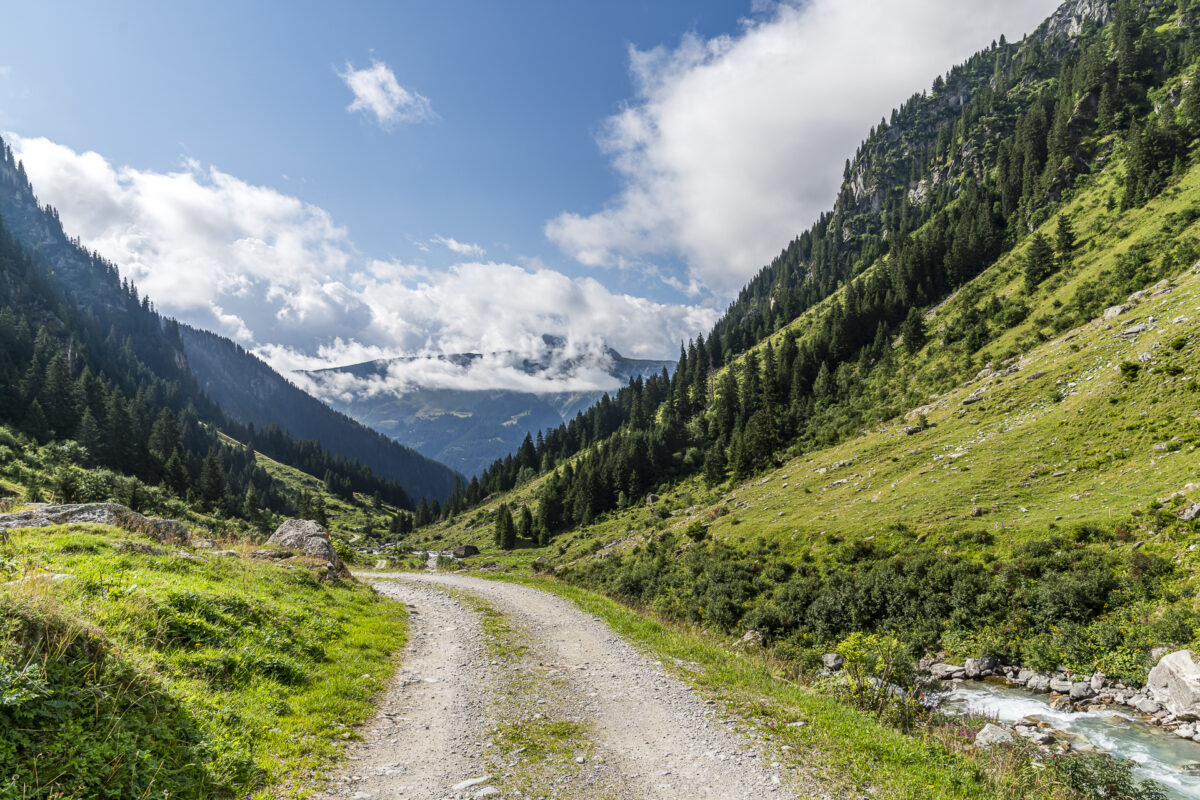
Instead of low-lying, heavy rain clouds, the Maderanertal welcomes us with a few surprising patches of blue sky. Nevertheless, we start quickly and follow the Maderanertal high trail for the first twenty minutes to the hamlet of Seewen near Golzernsee. There we turn off to the right onto the Graspelenweg and descend over a steep ledge almost 300 meters into the valley end of the Maderanertal. Unfortunately, this jump in altitude cannot be avoided with any tour variant.
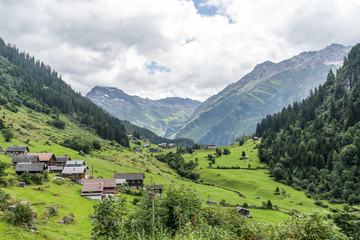
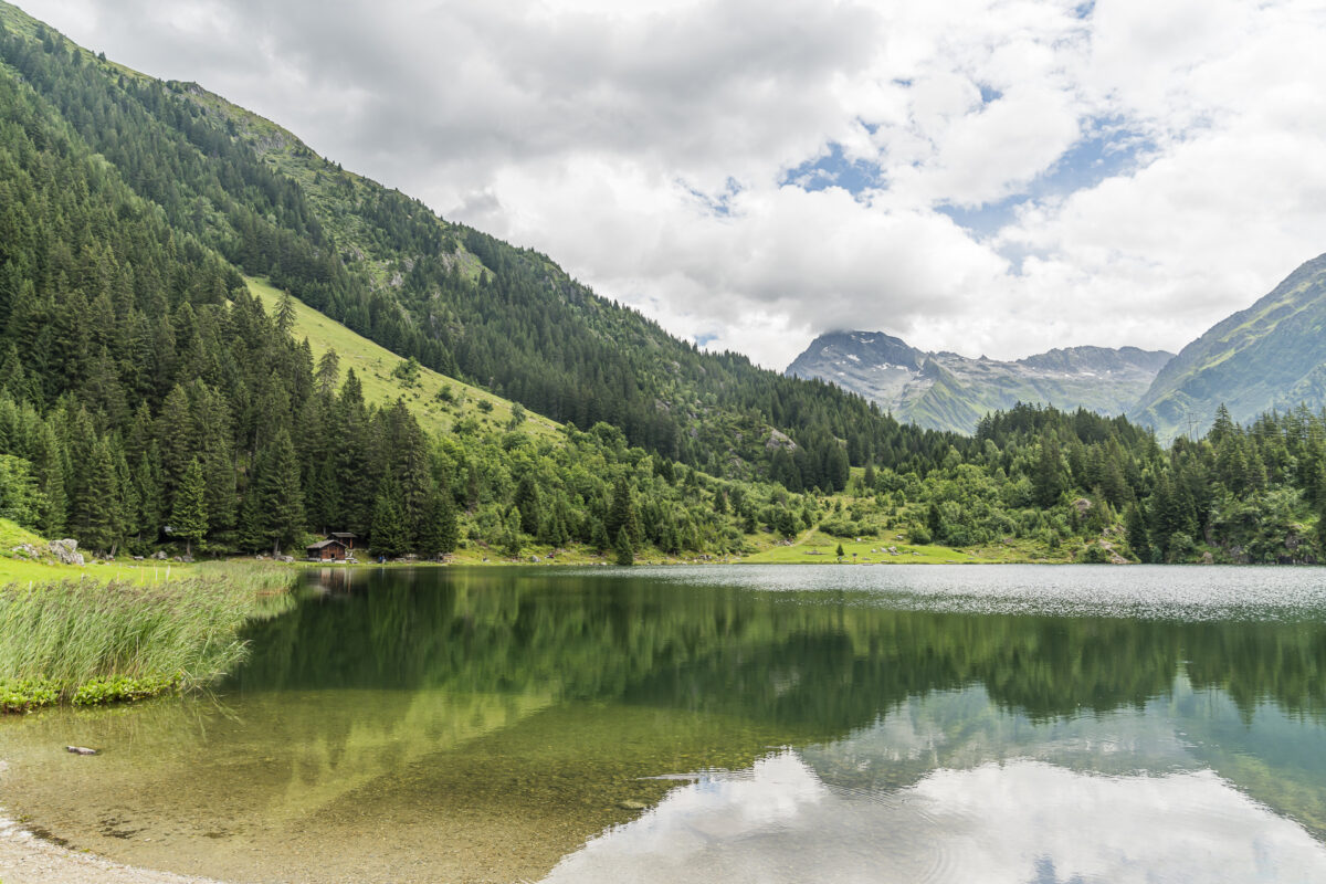
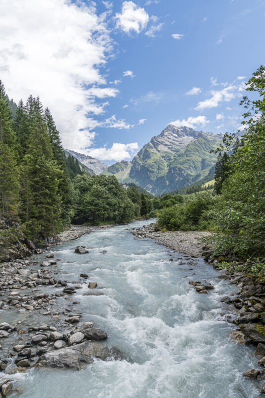
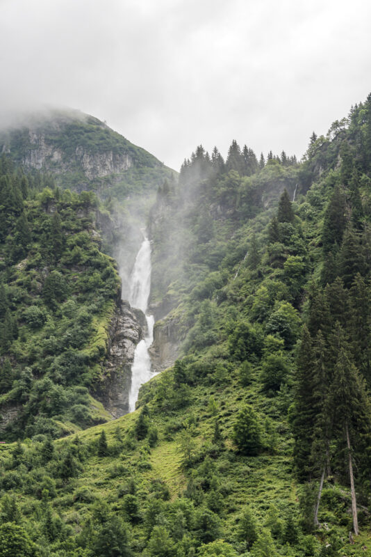
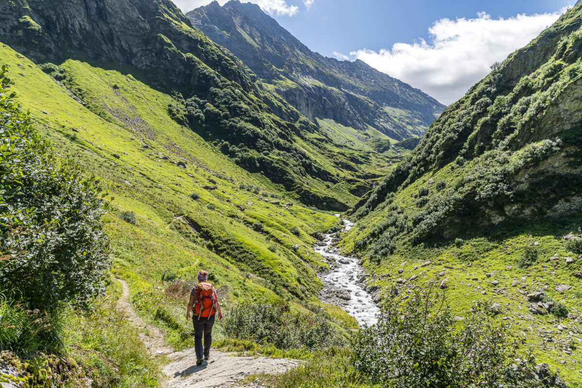
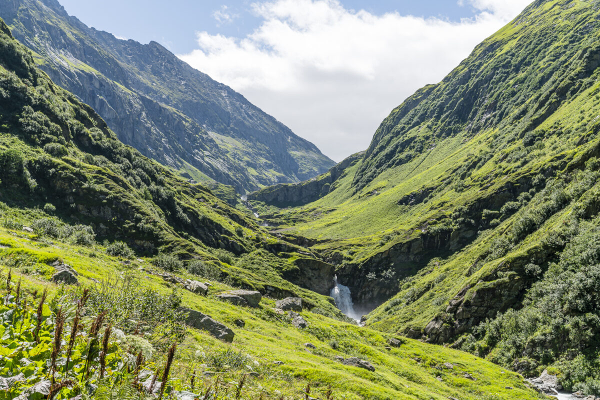
Arrived at the lowest point of the tour, we cross the Chärstelenbach and then follow the signposts over gently ascending nature paths via Alp Stössi and Guferen to Blindensee. The landscape back here in the Maderan Valley is wild and impressive. My highlight: the thundering waterfall of the Brunnibach. On tomorrow’s hiking day we will follow these same water masses to their source at Brunnifirn.
Another highlight and a real boost of motivation is the “Sirup Bar”, which is located near the signpost at Blindensee (Hinterbalm junction). For us, this is where the climb really begins. After another 15 minutes we cross the Chärstelenbach on a rickety suspension bridge. After that, the path only has one direction: steeply uphill. And that for a good 2.5 hours. Thanks to a constant gradient and excellent path conditions (few stones), it is very pleasant to walk.
Unfortunately the clouds will soon gather. That’s why there are no more photos of the rest of the route – we hardly noticed any of the view. At least it stayed dry and I think it was a good thing for my head that it didn’t even see where it still had to go, but was able to deal with what was imminent step by step.
As a reward, a completely peaceful August 1st hut evening awaited us in the Hüfihütte. The hut crew served an excellent lasagna. And since there were only five of us guests, we were able to enjoy a “private” blow.
Key details of the Golzern – Hüfihütte hike
You can see the route of our hike from Golzern to the Hüfihütte on the following hiking map. It is a white-red-white marked mountain hiking trail (T3). The descent from Golzerensee to Chärstelenbach is steep and a bit downhill in sections – but well secured. Alternatively, you can start the climb to the Hüfihütte in Bristen or follow the Maderaner Höhenweg from Golzern over the Windgällenhütte. However, both variants take longer and involve more meters in altitude than our chosen variant. In combination, they would be ideal for a two-day circular hike to the Hüfihütte.
| Starting point | Golzern (mountain station) (1,390 m above sea level. ) |
| Accessibility | Starting point accessible by public transport |
| Length | 11.2 kilometers |
| Elevation meters | ↗ 1,300 m ↘ 356 m |
| Duration | 5:00 h |
| Destination | Hüfihütte (2,335 m above sea level) |
| Food | Alp Stössi, syrup bar at the “Blindensee” turnoff |
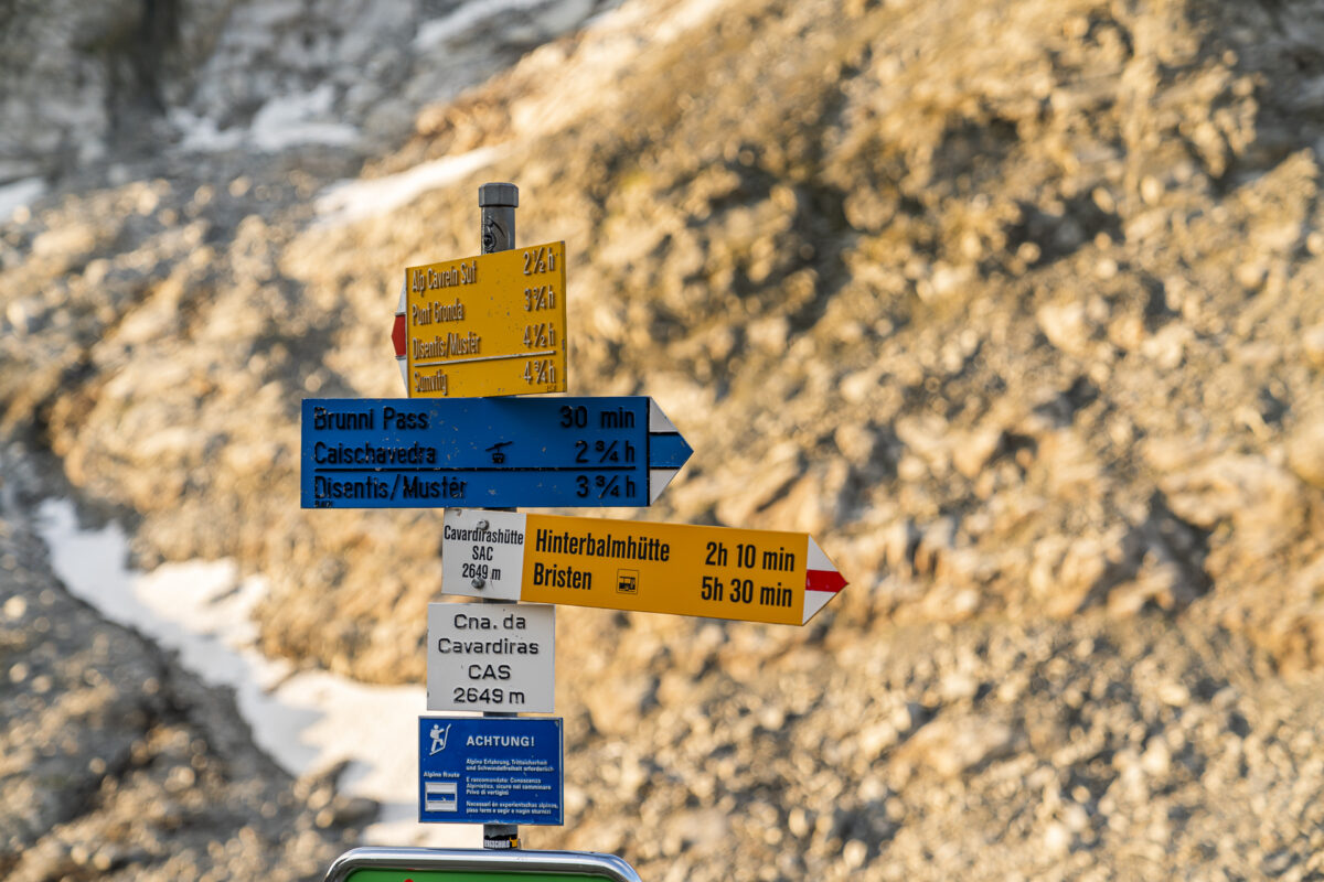
2. Hiking day: from the Hüfihütte via Hinterbalm to the Cavardirashütte
The next morning, the Maderan Valley presents itself to us exactly as we had expected the day before: surrounded by dark, rain-heavy clouds. Well, what to do? First have a leisurely breakfast and then wait and drink tea. Finally, we have the whole day for the five-hour hike to the Cavardiras Hut (just walking time). With the rain clouds announced to be moving away soon, it doesn’t seem necessary for us to set off in the pouring rain at eight in the morning.
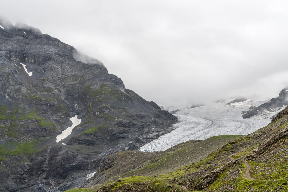
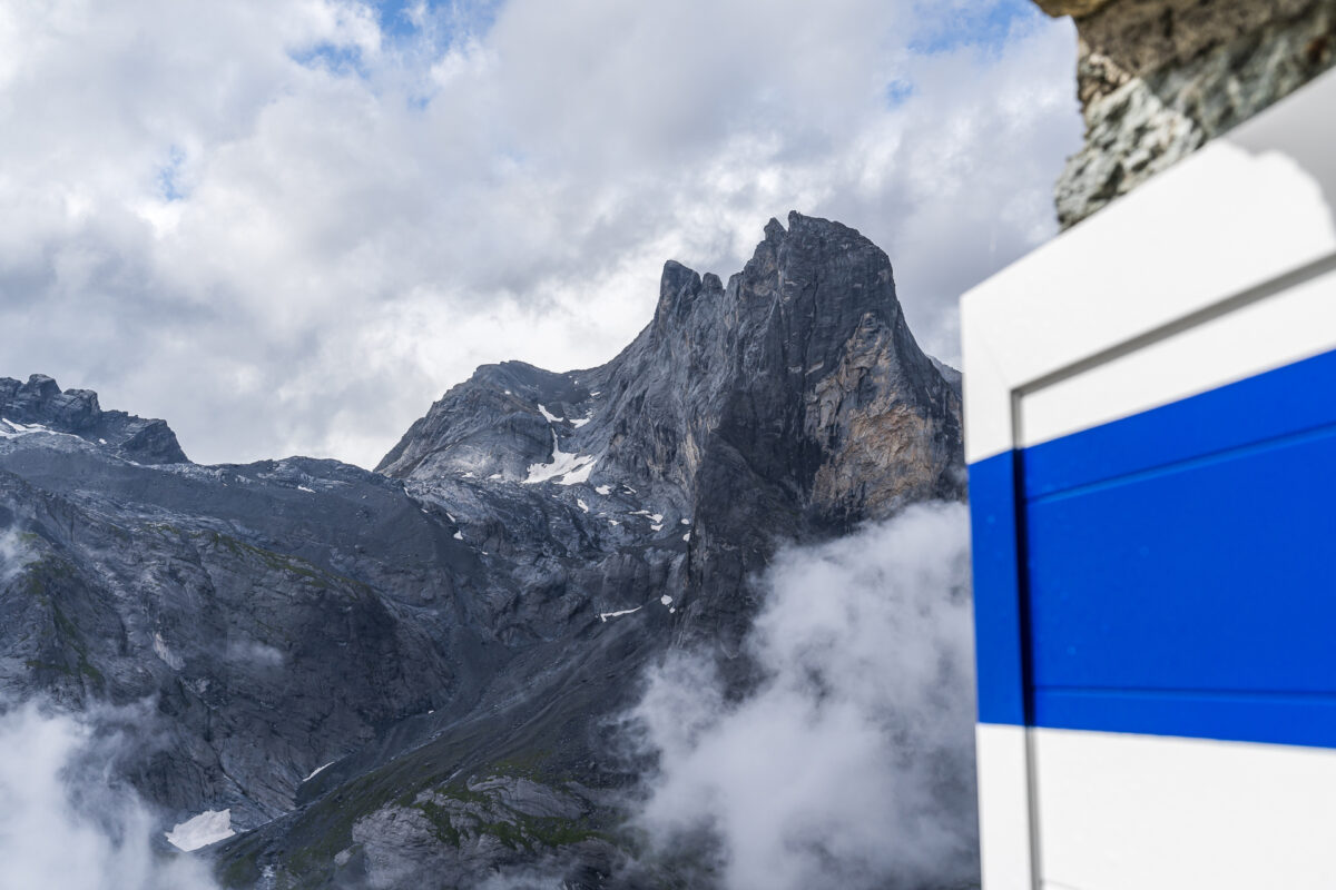
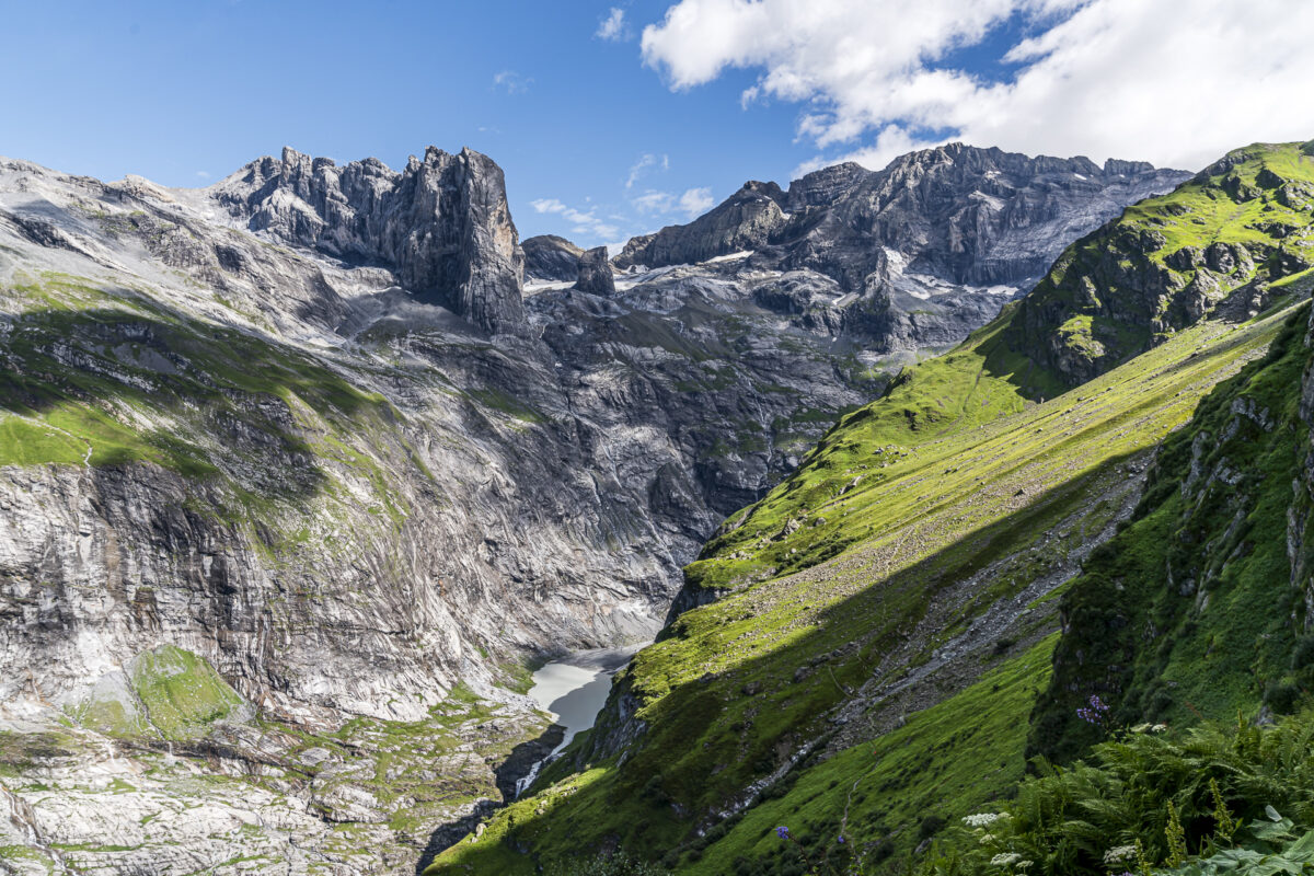
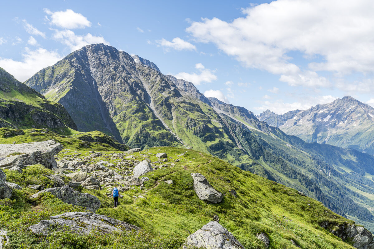
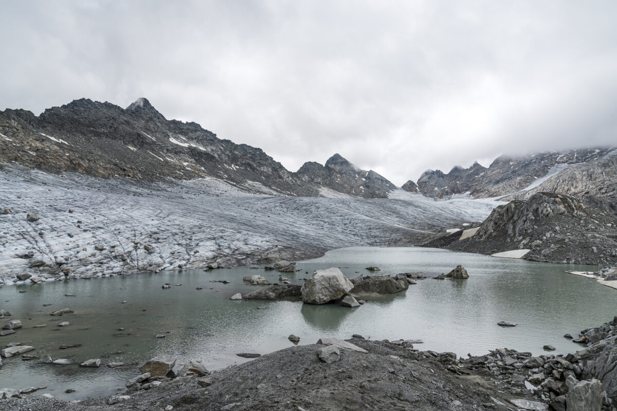
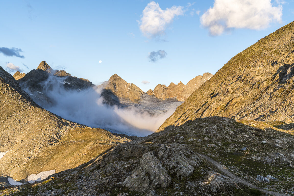
At 9:30 a.m. the time has finally come. The rain has let up. With a last look at the impressive Hüfi glacier, we descend for the first 45 minutes along the same path where we ascended yesterday. With one important difference: today we get to see the panorama. At the signpost at 1,870 m above sea level. M. we branch off onto the white-blue-white path, which leads steeply uphill along a ledge of rock on the left.
I asked acquaintances who had already completed the trail as well as directly at the hut about the nature of the trail and its difficulty, and based on that I decided that I was confident enough to do this. The technically more difficult passages occur in the first thirty minutes, in which you climb a good 200 meters in altitude via the so-called “Schafweg” through the Rimenen rock ledges to the “Murenplanggen” high plateau. I find it less and less “bad” when I go uphill when I have to use my hands and it’s a little steeper. Of course, this always has to be assessed individually. Overall, I was pleasantly surprised that the path was well marked throughout and secured with step steps and steel ropes where necessary.
Once you have reached the top of the high plateau, you will be rewarded with a wonderful panoramic view that extends from the Hüfihütte over the Hüfisee to far beyond the Maderanertal. Fantastic!
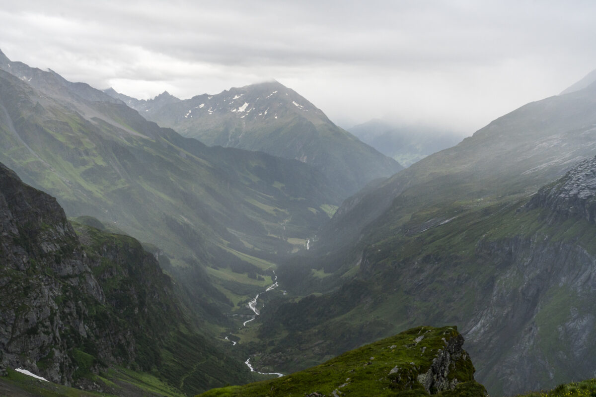
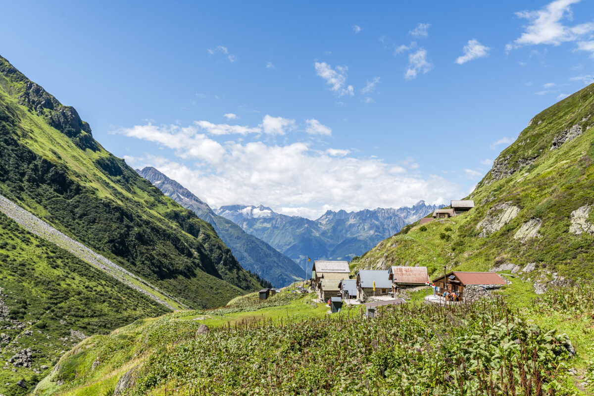
The second half of the white-blue-white marked section corresponds to a completely “normal” mountain hiking trail (T3). After a good two hours we reach the Hinterbalmhütte at the entrance to the Brunnital, where we treat ourselves to a refreshment in the form of soup of the day and a cheese plate.
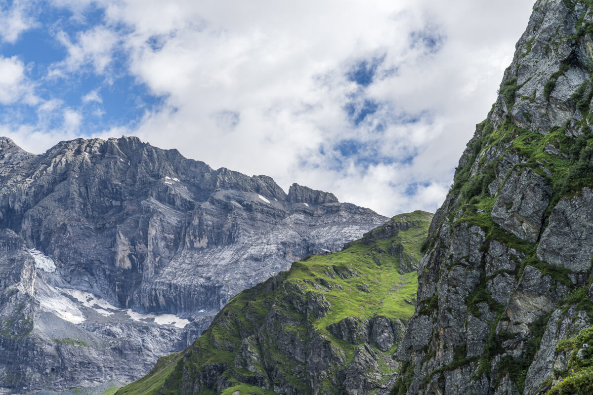
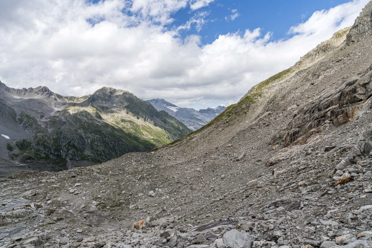
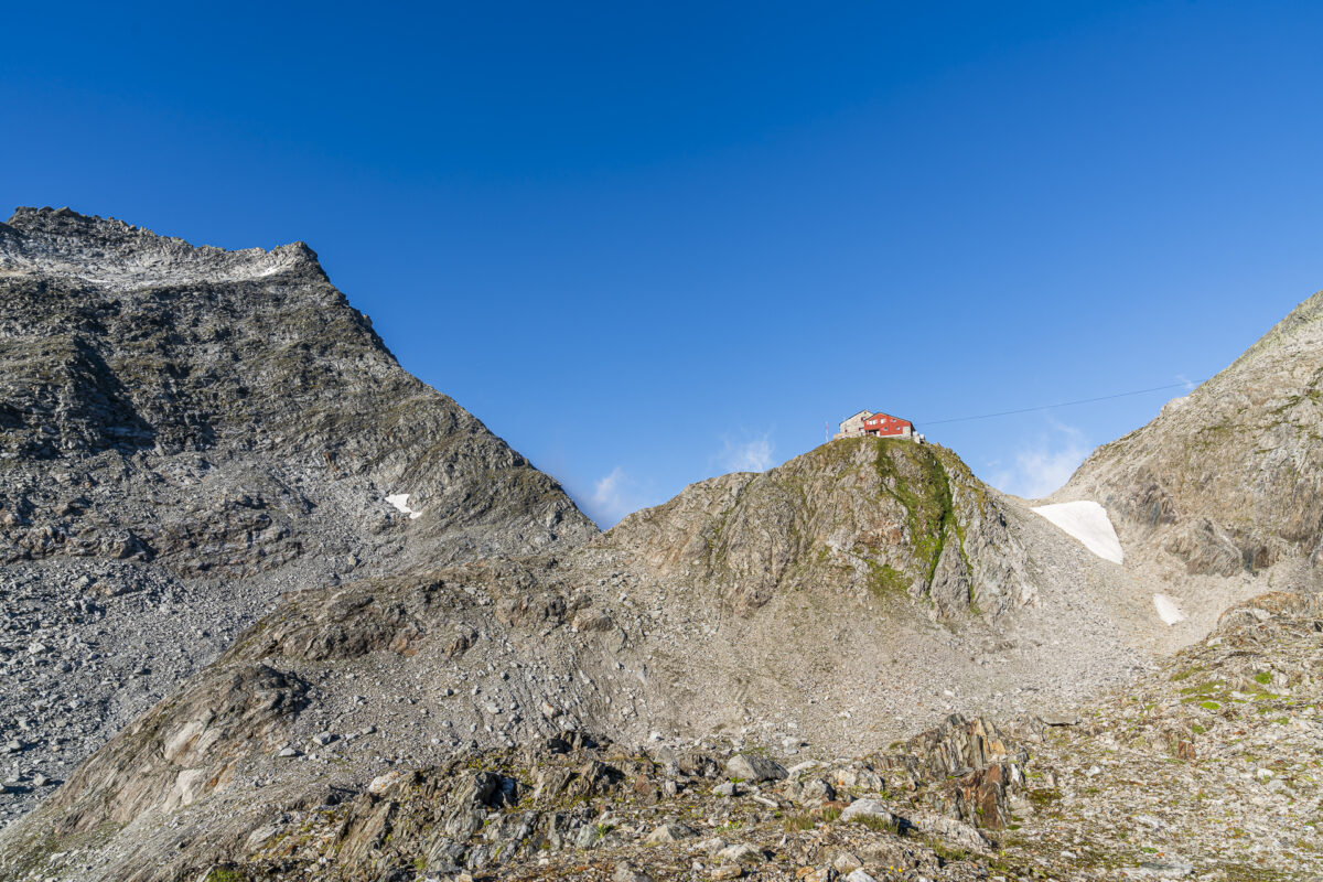
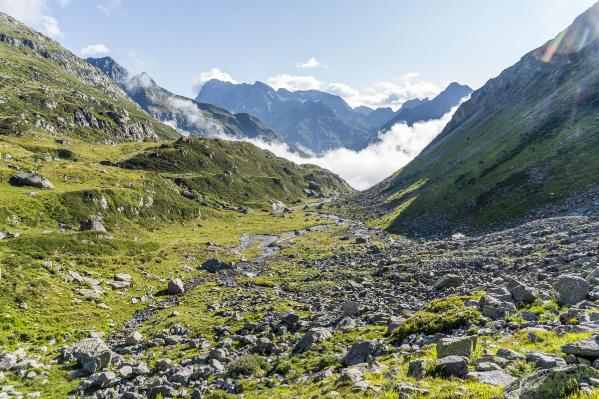
Then follows the long climb through Brunnital to Fuorcla da Cavardiras. This can be divided into three segments: The first hour follows the narrow hiking path over green slopes along the Brunnibach, continuously climbing uphill, then follows the beautiful Brunnialp plateau – a dream! – and last but not least, a tough, steep climb awaits you over stony terrain to the pass crossing at the foothills of the Brunnifirn. Technically, in my opinion, this last game has passages that are similarly difficult, like the section marked white-blue-white. The route is not always clear and you have to use your hands every now and then. Around six hours after starting at the Hüfihütte, the Cavardirashütte appears in front of us. There is a lot more going on here – depending on the weather.
Key details of the hike Hüfihütte – Hinterbalm – Cavardirashütte
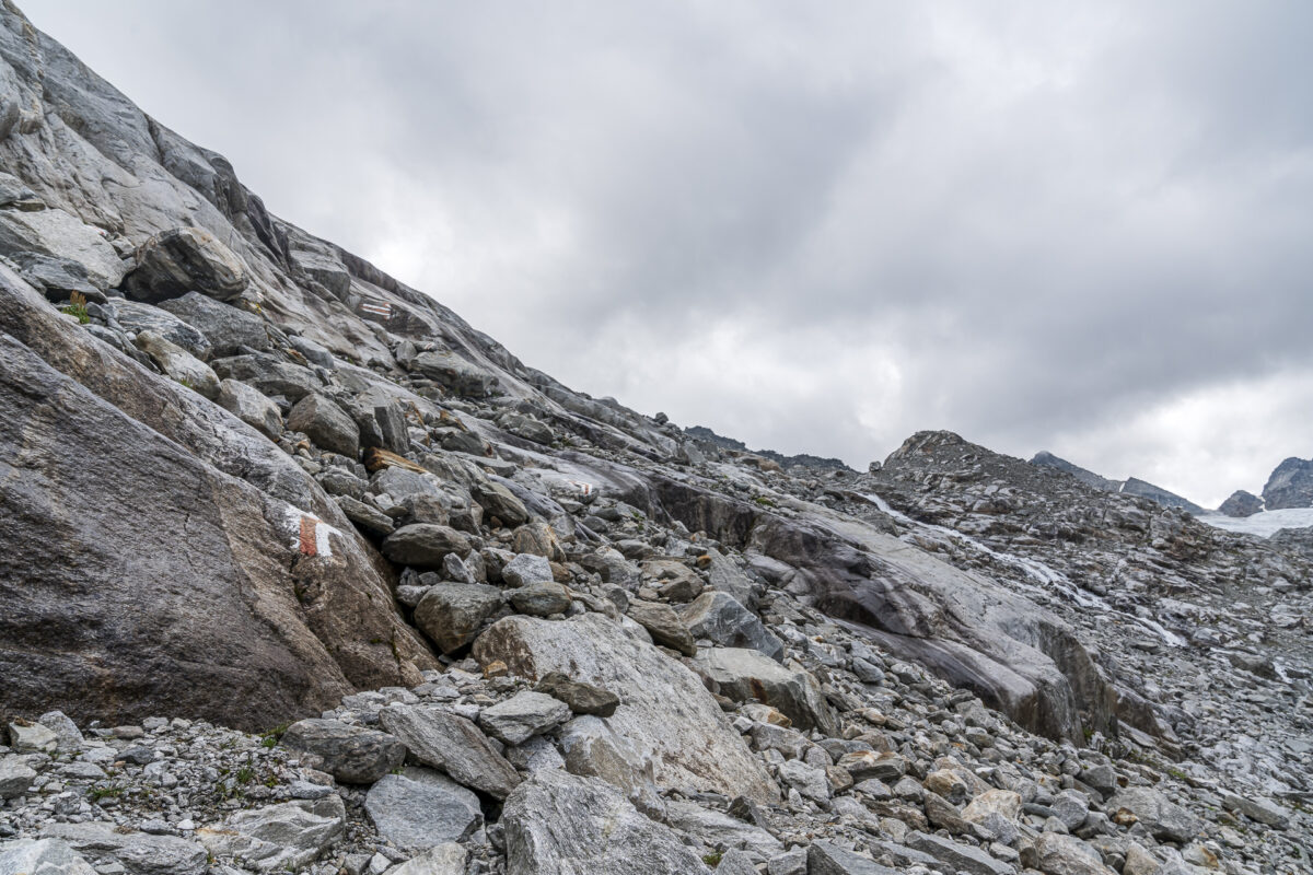
You can see the route of our hike from the Hüfihütte via Hinterbalmhütte to the Cavardirashütte on the following hiking map. The route includes both white-red-white marked sections (T3/T4) and a white-blue-white marked section (T4+). The alternative path without the white-blue-white part of the path via the Blindensee junction takes approx. 45 minutes longer (+2.3 kilometers / +200 m in altitude). Please note that on this tour, the white-red-white marked paths also require sure-footedness and a head for heights in some sections. The ascent to Fuorcla da Cavardiras leads over blockstone terrain, where the path is not clearly visible throughout (some markings using “Steinmannli”).
| Starting point | Hüfihütte (2,335 m above sea level) |
| Accessibility | Starting point and destination cannot be reached by public transport |
| Length | 11.0 kilometers |
| Elevation meters | ↗ 1,184 m ↘ 872 m |
| Duration | 5:15 h |
| Destination | Cavardiras Hut (2,640 m above sea level) |
| Catering | Hinterbalmhütte |
3. Hiking day: from the Cavardirashütte to Sumvitg
The Cavardiras Hut is still a hut from the “old” generation and will soon be rebuilt. There is currently a large mattress warehouse with around 50 sleeping spaces (further sleeping spaces in an adjoining room). To our surprise, we had a very quiet night despite a good occupancy (estimated to be 3/4 full). Completely in contrast to the Keschhütte< /a>, where a few days before we shared the loft with only six other people and were able to experience an unparalleled snoring concert.
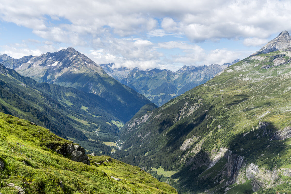
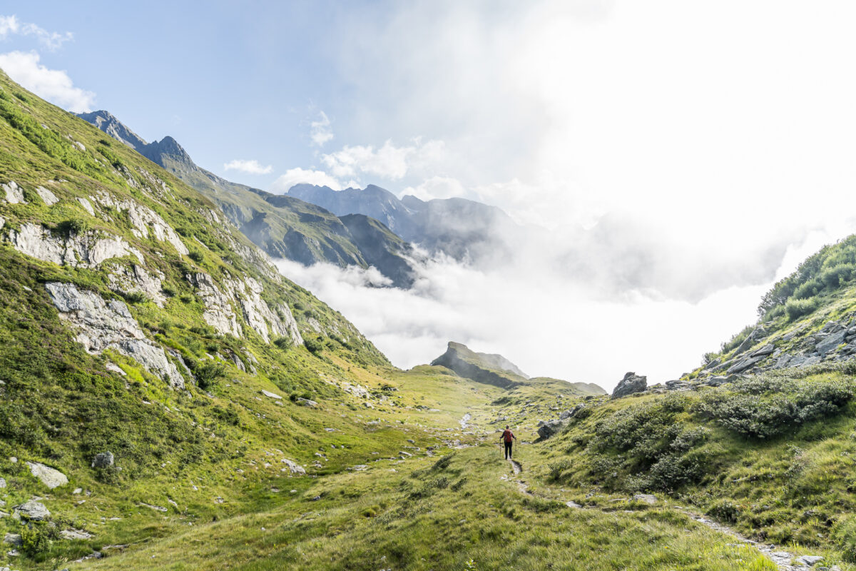
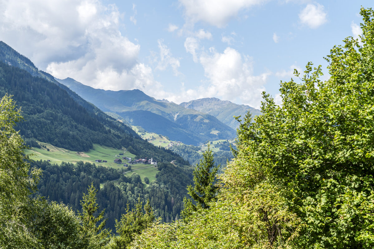
The wonderful sunrise the next morning reinforced our decision to tackle the 3-day hike despite the uncertain weather forecast (of course not lightly, but well thought out!). If the weather is good, we can tackle the long descent into the Surselva. Instead of the long route through Val Cavardiras, there is also a white-blue-white alternative route over the Brunni Pass towards Disentis (Caischavedra). But I didn’t dare take this route – especially not downhill. And so we follow the signpost towards Sumvitg, first over steep blockstone terrain (the view back to the Cavardiras Hut, which sits on a rocky spur like an Alderhorst, is worth it!) and then over extensive alpine pastures step by step out of the valley. We beat the signposted 4 ¾ hour by a good thirty minutes and managed to get an optimal train connection back to Zurich.
The conclusion on the train home: A strenuous but scenic 3-day hike in an area that is definitely not overcrowded!
Key details of the hike Cavardirashütte – Sumvitg
You can see the route of our hike from the Cavardirashütte to the Sumvitg-Cumpadials train station on the following hiking map. It is a white-red-white marked mountain hiking trail (mostly T3, the top first thirty minutes T4). The next public transport stop is at the valley exit of Val Russeins (Disentis/Mustér, Punt Russein). The hike there takes “only” four hours. However, the connections are sparse and not optimally coordinated with the train connections. For this reason we decided to hike to the Sumvitg-Cumpadials train station.
| Starting point | Cavardirashütte (2,640 m above sea level) |
| Accessibility | Destination accessible by public transport |
| Length | 15, 1 kilometer |
| Altitude | ↗ 143 m ↘ 1,804 m |
| Duration | 4:30 h |
| Destination | Sumvitg-Cumpadials train station |
| Meals< /td> | Ustria dalla Staziun at Sumvitg train station |
Practical tips for your hike from the Maderanertal to the Surselva
- The summer season of the Hüfihütte lasts from the end of June to the end of September. There are 32 sleeping spaces divided into 4 bedrooms. The overnight price for non-members is 82 CHF (including half board). Members pay 69 CHF. The hut can be booked via the alpsonline.org reservation tool.
- The summer season of the Cavardirashütte lasts from the beginning of July to mid-September. Reservations are only accepted by telephone (!). An overnight stay with half board costs 86 CHF for non-members. SAC members pay 74 CHF. The Cavardiras Hut will soon be rebuilt. It may therefore be closed for the next summer season or the one after that.
- The Hüfihütte, Hinterbalmhütte, Windgällenhütte and Cavardirashütte are part of the five-day Maderan circular tour..
- If you want to shorten the long climb to the Hüfihütte, you can take the Alpentaxi Uri< /a> drive to Guferen. However, registrations must be made at least one week in advance.

Leave a Reply