

Capanna Bovarina – Capanna Cadagno: 3-day hut tour on the Lukmanier
In mid-August, we spent three wonderful hiking days in the border area between the Graubünden and Ticino Alps around the Lukmanier Pass. Together with my parents, we went on a hut tour, which roughly followed the Alpine Pass Trail from the Blenio Valley to the Leventina. A multi-day hike, which scored with some crisp climbs, wonderful views and cozy hut evenings. Predicate worth emulating!
Day 1: over the Cristallina Pass to Capanna Bovarina
While the Alpine Passes Trail winds its way from Vrin in Graubünden over the beautiful Greina plateau towards Capanna Bovarina in Val di Campo, we have chosen a much less frequently used route from Val Medel over the “Pass Cristallina” for the first day of the tour (not to be confused with the Sentiero Cristallina). How little used I realize when no one gets off in the well-filled post bus in the direction of the Lukmanier Pass at the Pardatsch stop except us. Well then – let’s see if we will meet anyone else on the way.
The mountain hiking trail follows the first 4.5 kilometres of a slowly ascending gravel road leading into the valley from Pardatsch. Not particularly exciting in terms of running – but perfect for warming up. In the summer months, the Val Cristallina is used for alpine farming. At the same time, a sign at the entrance to the valley draws our attention to the fact that the military sometimes conducts shooting exercises here or that it is a test shooting range. It is therefore advisable to find out in advance whether access to the valley will remain temporarily closed due to military exercises. As a rule, the information is published in good time on the corresponding VBS website.
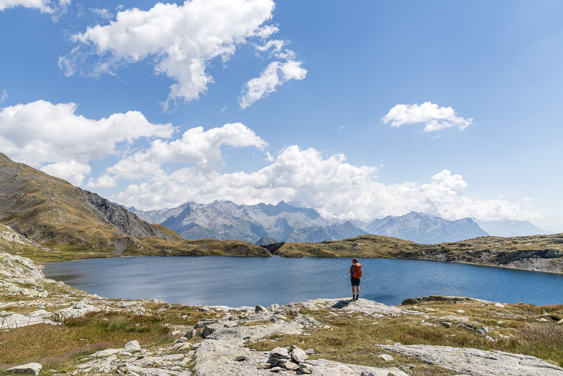
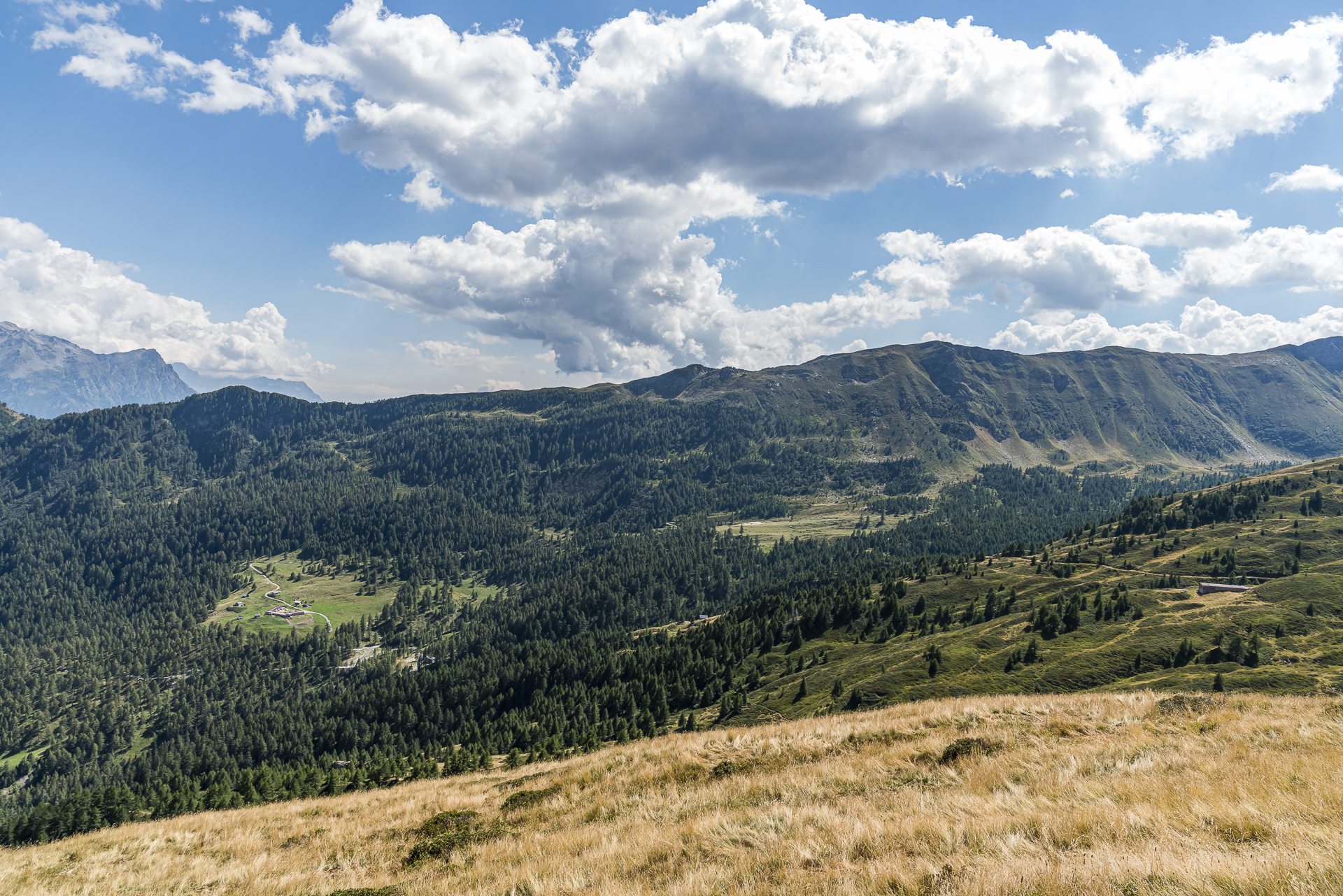
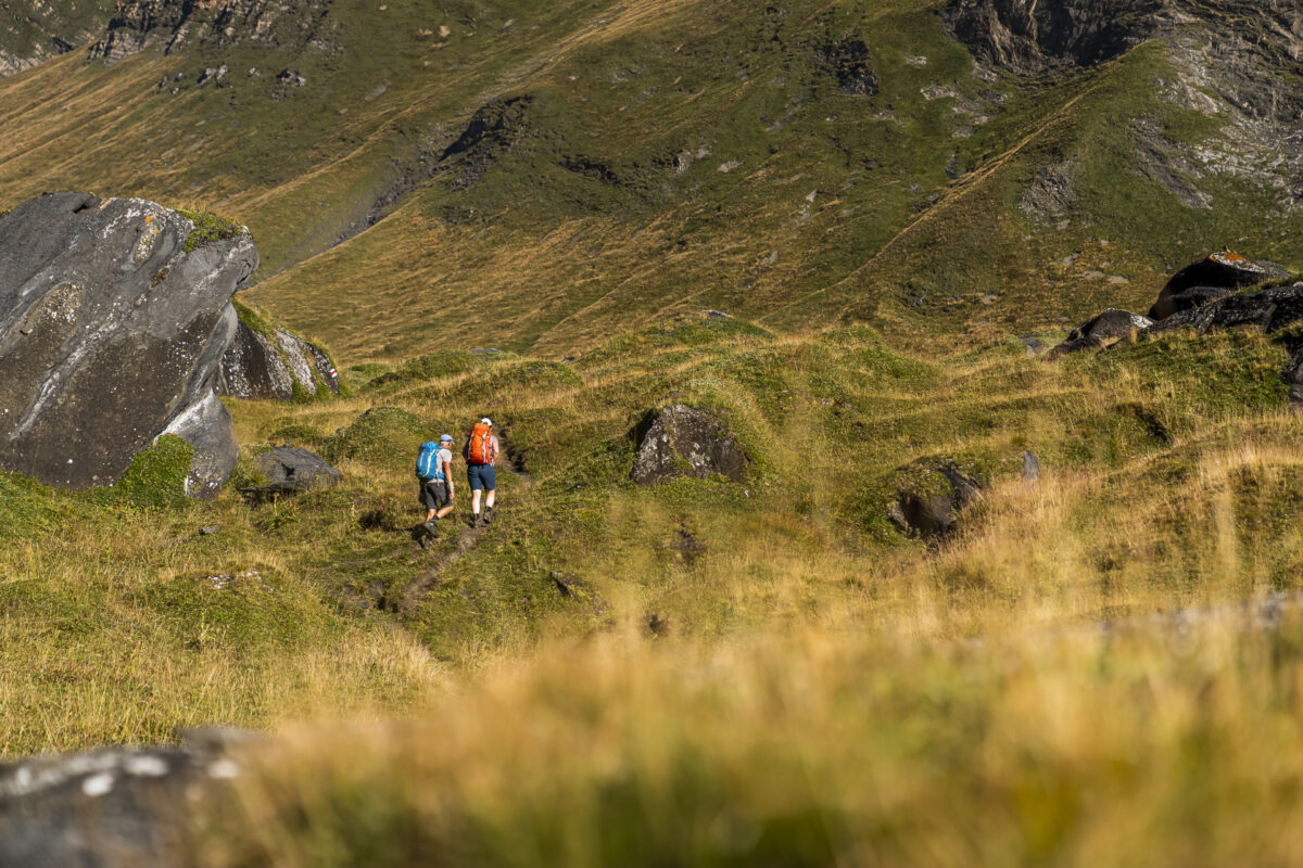
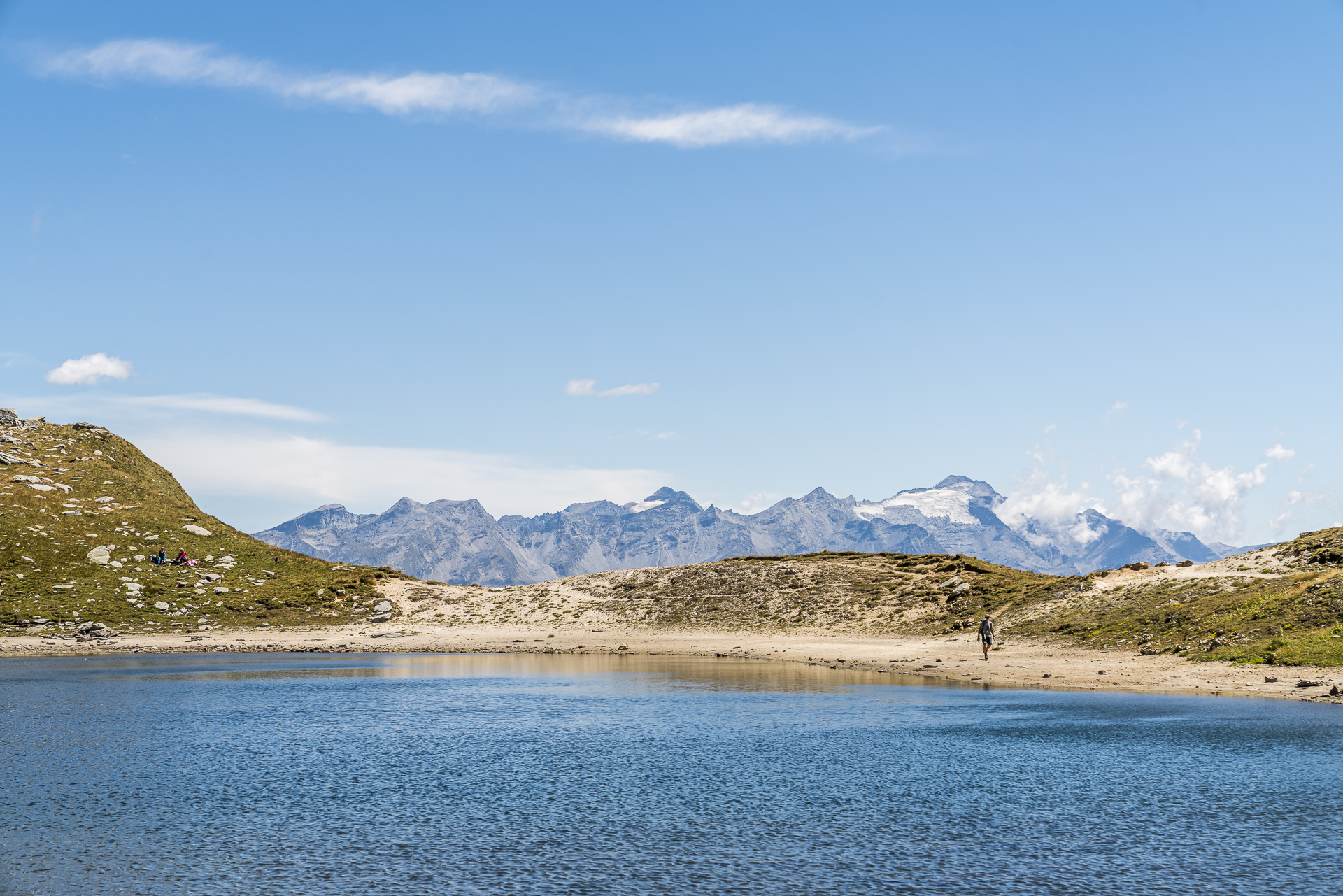
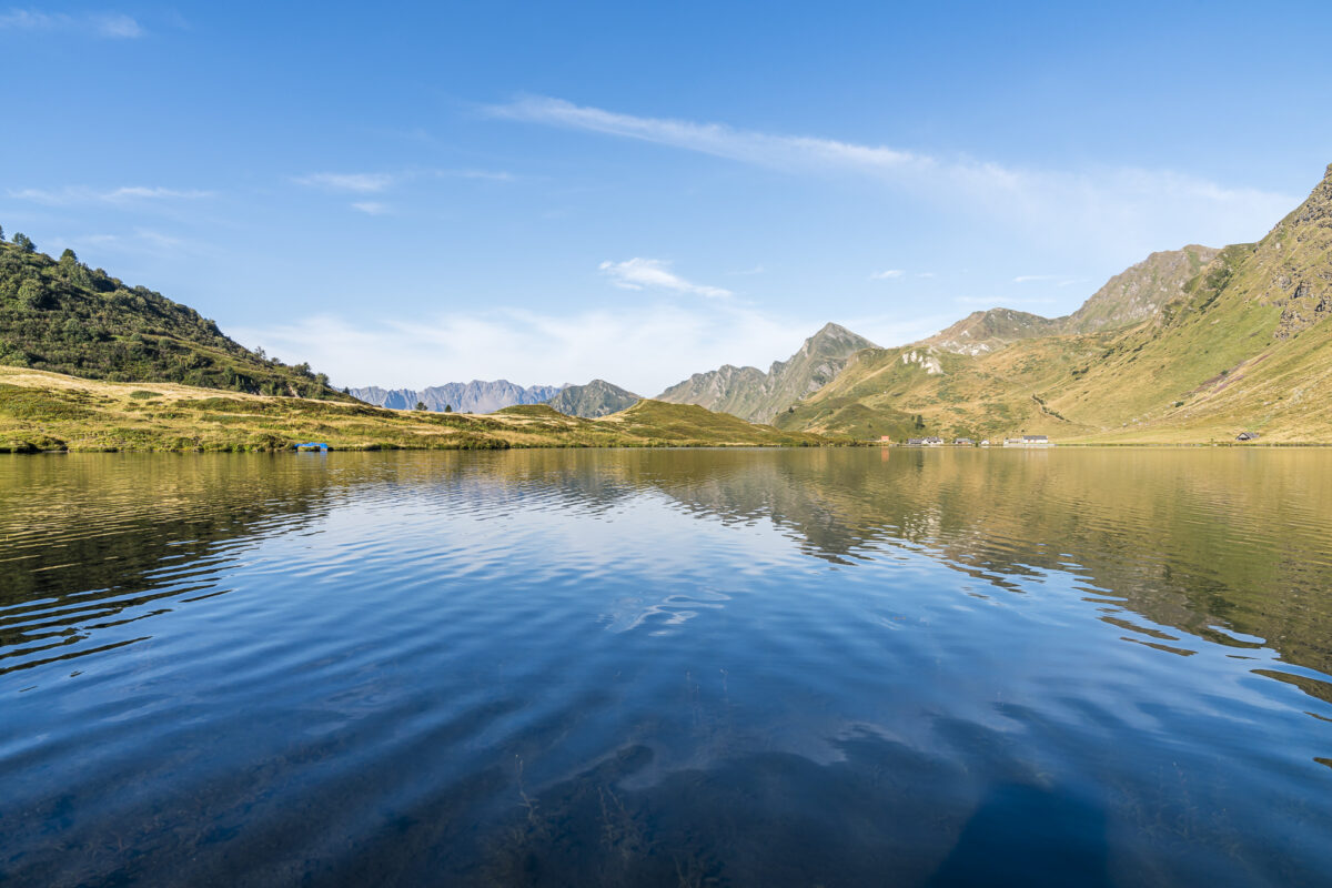
In the meantime we have warmed up and are happy when the desolate gravel path turns into a “real” hiking trail. This now climbs steeply and partly not so well marked via Plaun Grond to the “Lajets”. It is now not far to the highest point of the tour – the 2,400-metre-high Cristallina Pass. And when you finally reach the pass, you will be rewarded with a phenomenal view of Lago Retico. Wow, what a magnificent backdrop!
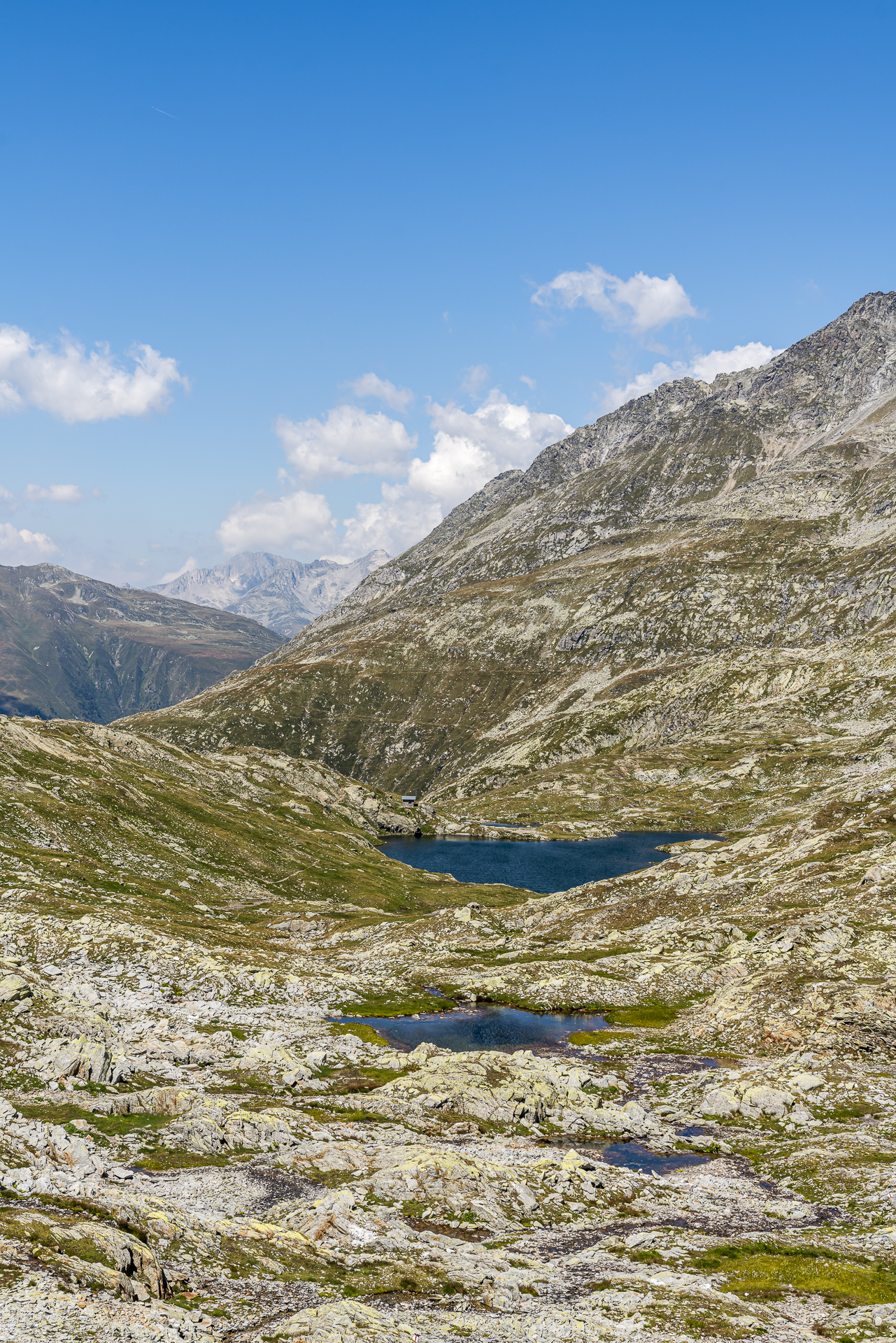
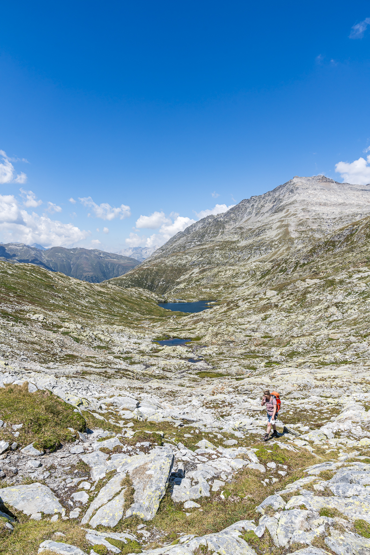
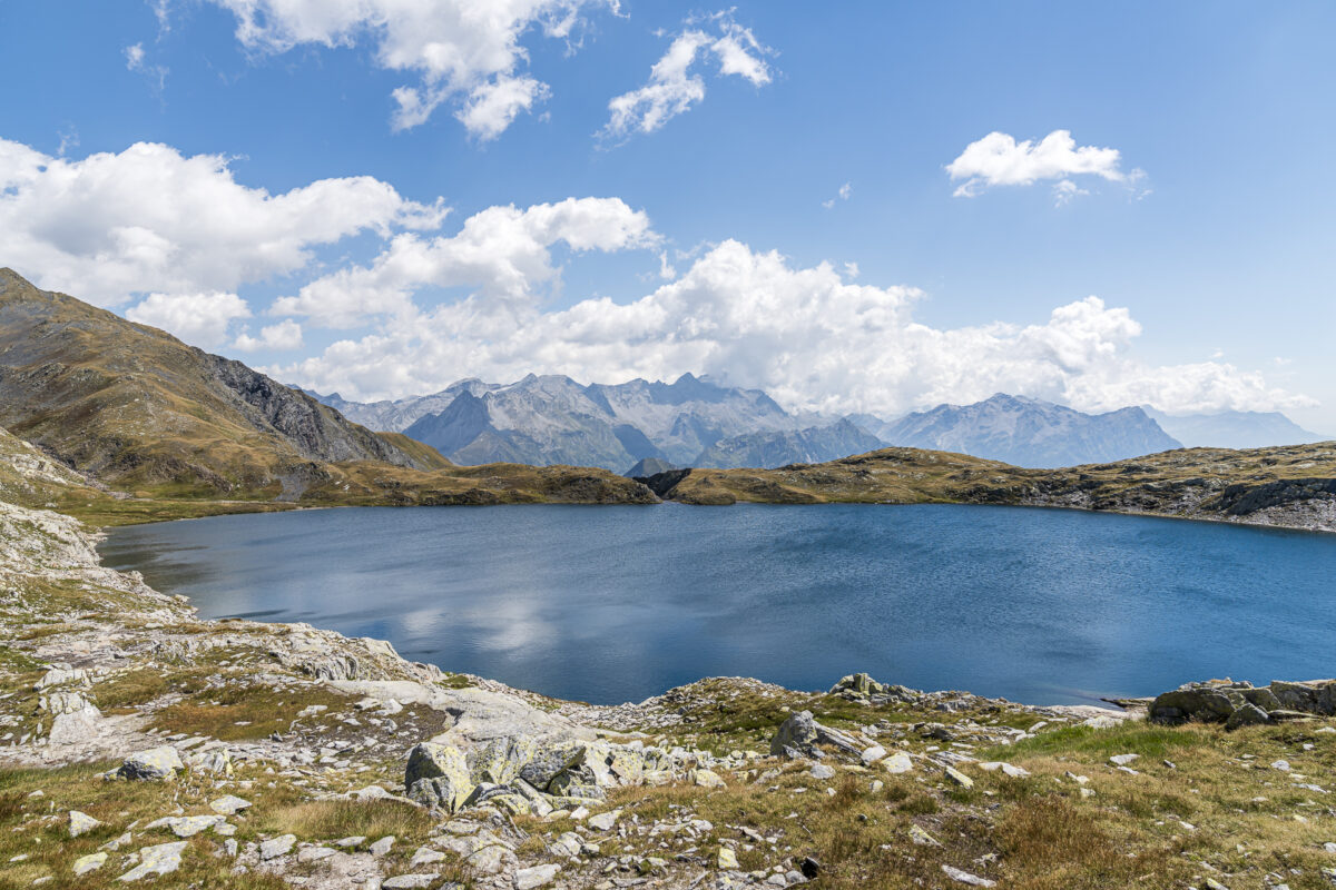
The ideal setting for a picnic break before tackling the steep descent into Val di Campo to Capanna Bovarina. Here on the south side of the pass crossing, the landscape presents itself in an autumnal yellow as early as mid-August. The dry summer has left its mark on the alpine pastures. What will it look like in two months’ time, when the larches will glow golden?
The descent to Capanna Bovarina takes just under an hour and is altogether less arduous than the first 15 minutes in the steep terrain suggest.
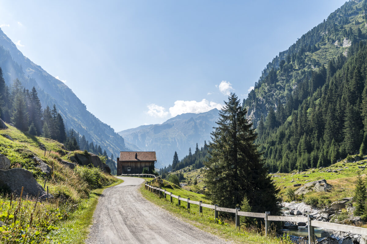
By the way, we actually only met a handful of people on the way. There is also surprisingly little going on in the Capanna Bovarina, despite the good weather and the fact that it is a Friday evening. There are six of us in a loft of 8 – quite comfortable!
Key data of the tour Pardatsch – Pass Cristallina – Capanna Bovarina
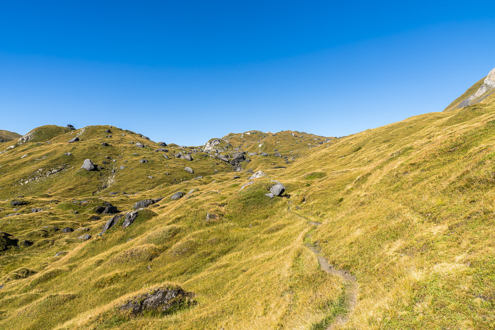
On the following map you can see the route of the hike from Pardatsch (Val Medel) via Val Cristallina and Pass Cristallina to Val di Campo. It is a white-red-white marked mountain hiking trail with a difficulty level of T2/T3. The first four kilometres are more like a yellow-marked hiking trail (T1). However, the ascent to Lago Retico is only sparsely marked and the path is not immediately intuitively visible everywhere. When descending from Lago Retico to Capanna Bovarina, poles can be an advantage in the partly slippery path crisscrossed by deep earth furrows.
| Starting point | Pardatsch bus stop (1,560 m above sea level) |
| Reachability | Starting point can be reached by public transport, destination not |
| Length | 12.0 kilometers |
| Elevation gain | ↗ 964 m 654 m ↘ |
| Duration | 4:30 p.m. |
| Destination | Capanna Bovarina (1,870 m above sea level) |
| Catering | There are no places to stop for refreshments along the way |
2nd hiking day: on the Alpine passes trail over the Lukmanier to Capanna Cadagno
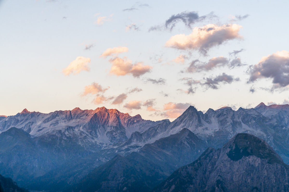
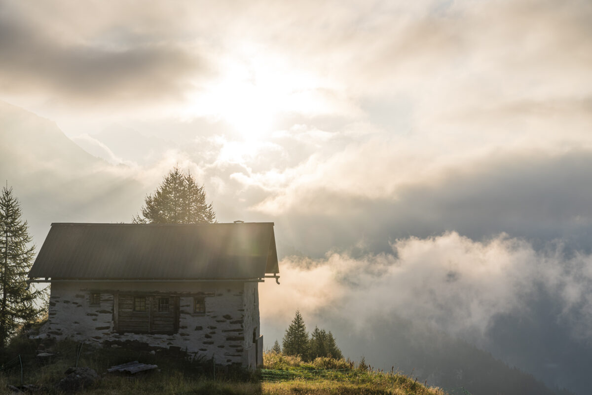
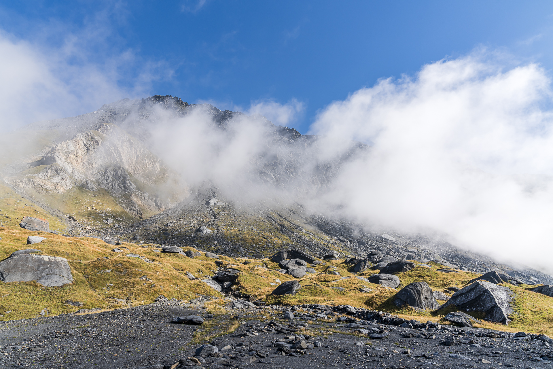
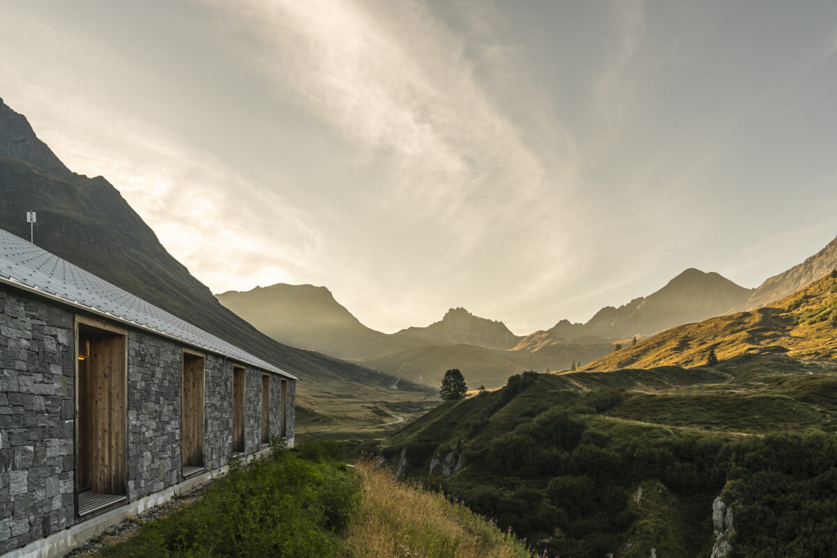
While the Adula Alps on the opposite side presented themselves from their best side in the soft sunset the evening before, this morning they hide behind a layer of fog. The clouds pushing in from the Blenio Valley create a great morning atmosphere and a welcome contrast to the ever-present steel-blue sky this summer.
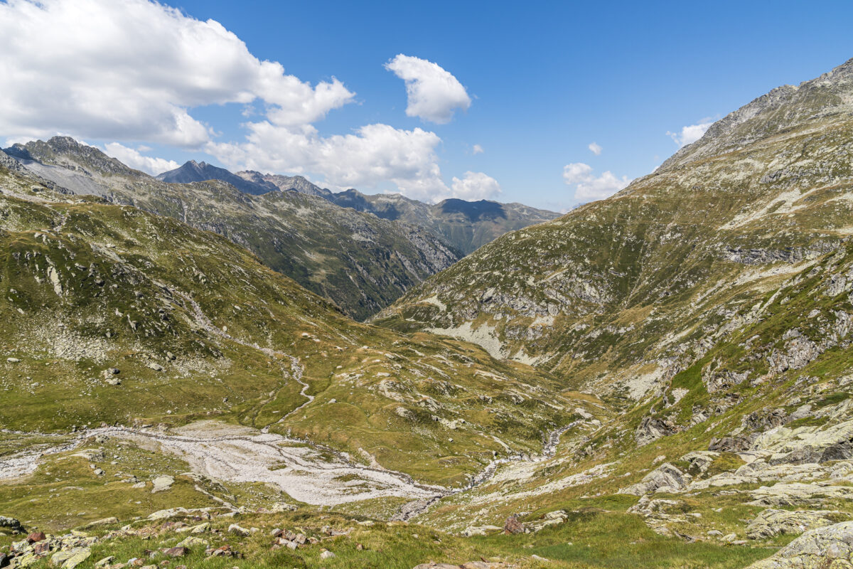
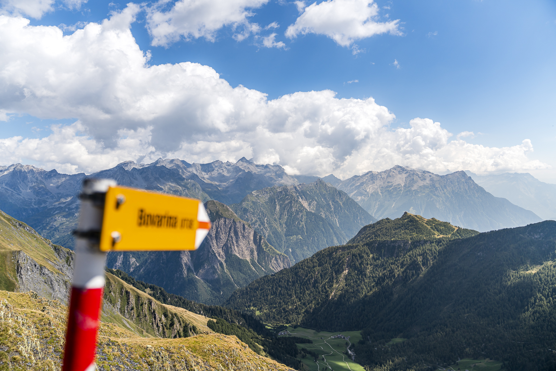
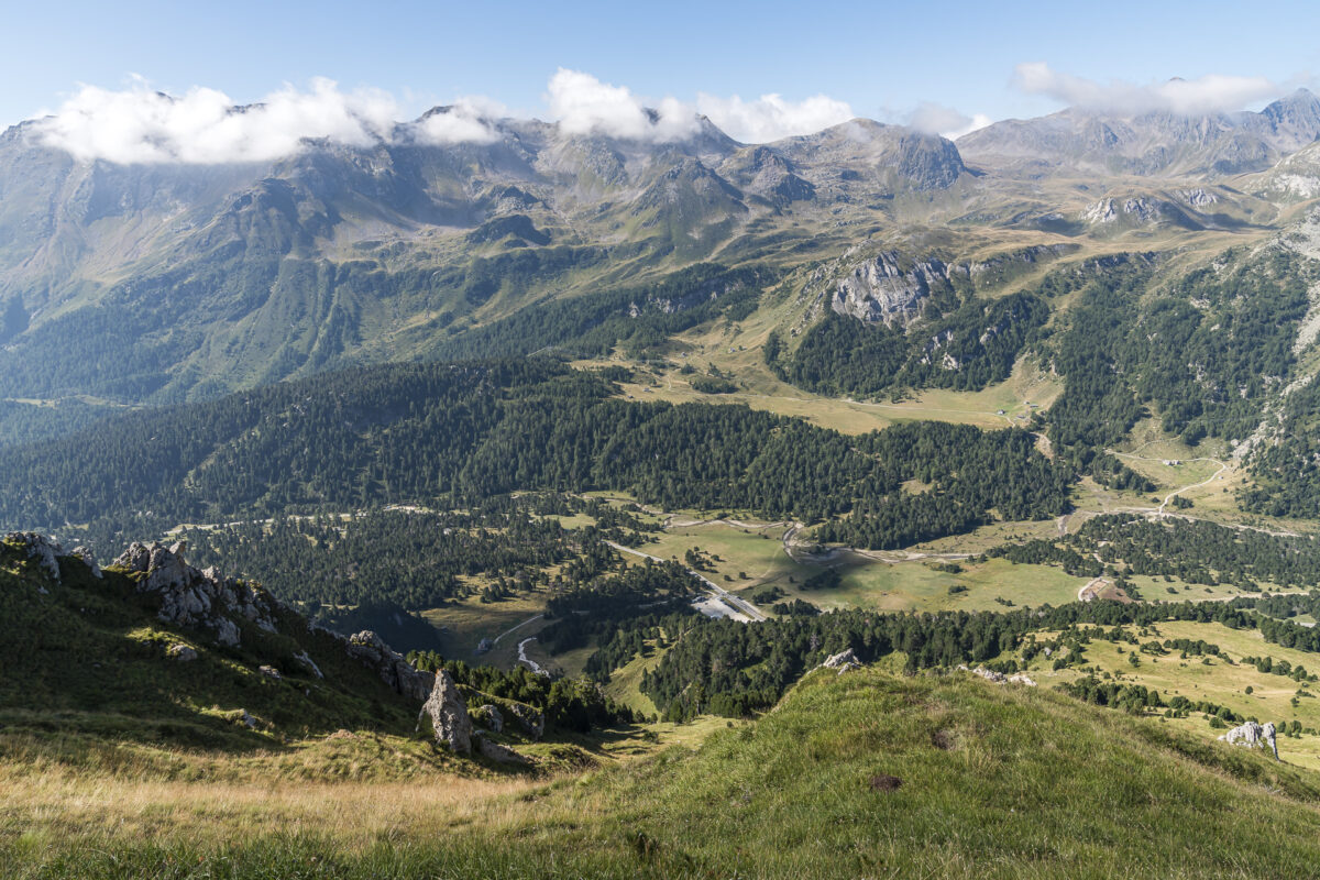
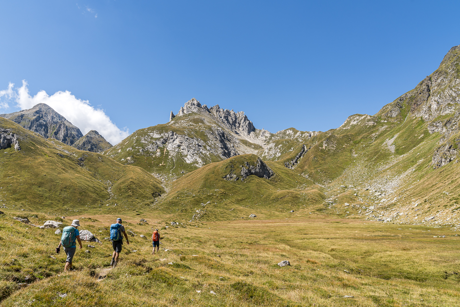
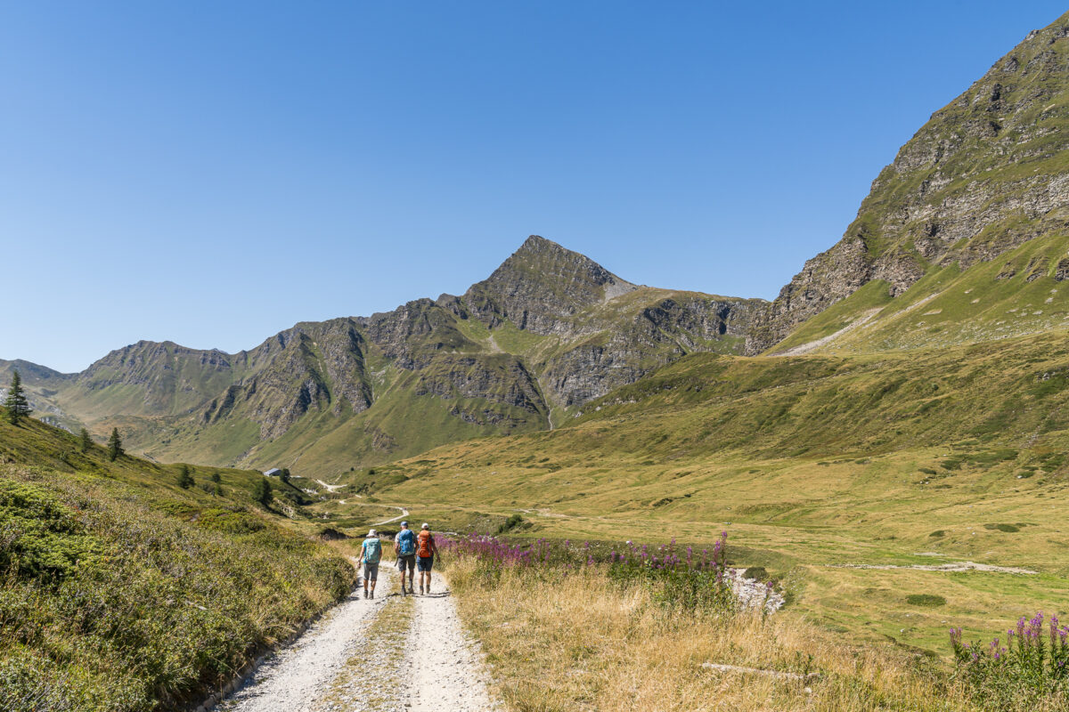
Today we follow stage 11 of the Alpine Passes Trail over two pass crossings into Val Piora. In terms of fitness, this is the most demanding of the three hiking days. Accordingly, we start early with the first of two ascents. From the Capanna Bovarina, the hiking trail leads over the Alpe di Bovarina up to the Passo di Gana Negra at 2,433 m above sea level. The name says it all: To the left and right of the path are impressive deep black stone blocks, which – it seems – some huge creature must have placed here.
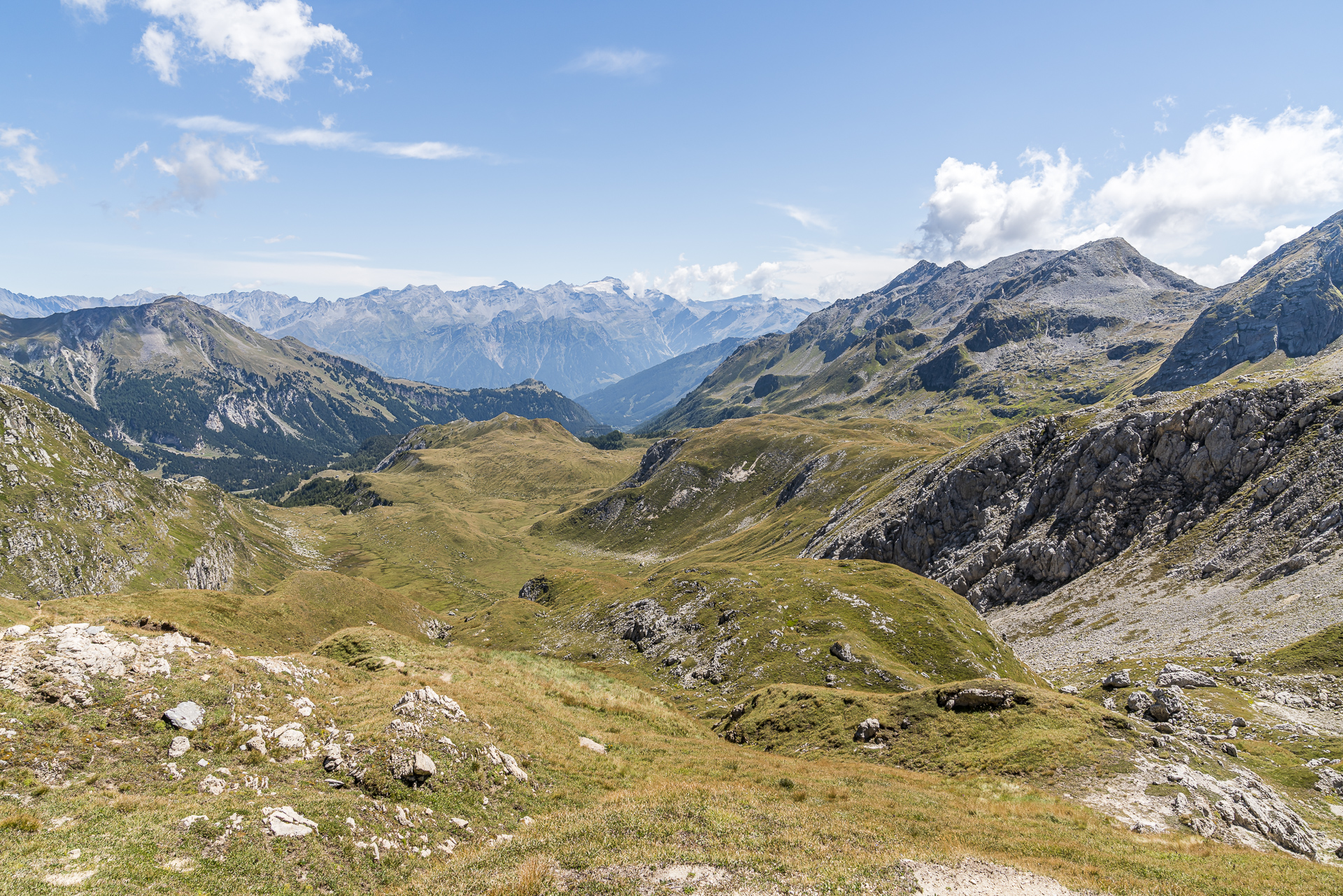
Arriving at the pass crossing, a tremendously beautiful mountain panorama awaits us once again. At the same time, however, we are also realizing what is still ahead of us today. The course of the path is clearly visible from here. For us, it first goes downhill to the Lukmanier Pass road and then everything up again on the opposite side of the valley until we are again at almost the same height as now.
At least we were treated to a refreshment stop at the bottom of the hiking car park at Casaccia before the new ascent. We had prepared ourselves for the fact that there would be no place to stop for refreshments on the way and we are all the more pleased when we find out that cool gazosas, coffee and cake are sold to hungry and thirsty hikers (and of course to everyone else who passes by here) in the information center at the level of the pass road.
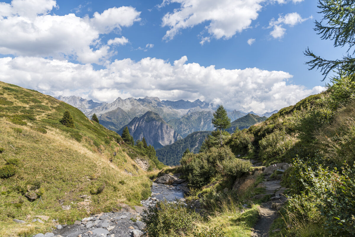
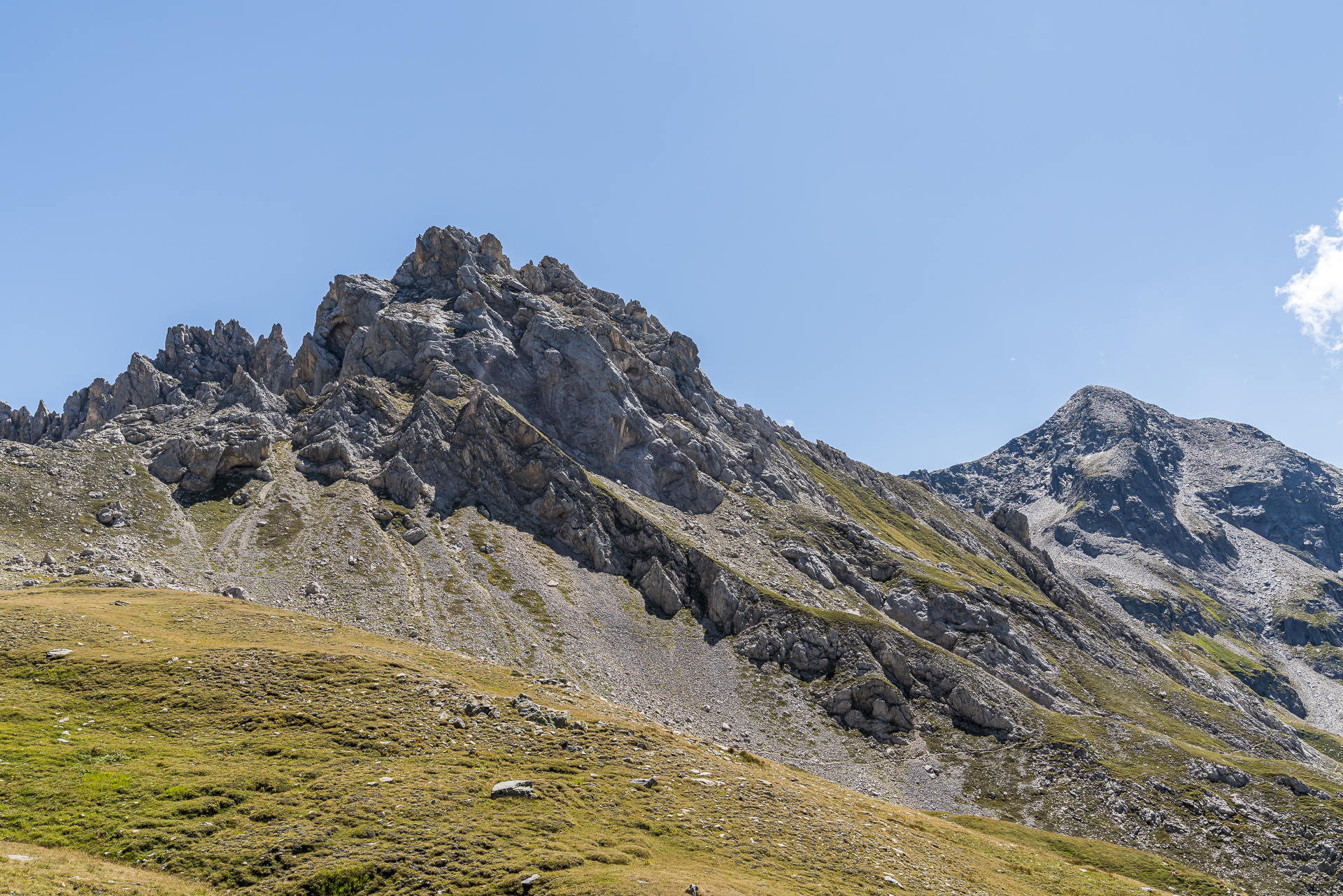
Strengthened, we cross the Brenno del Lucomagno, on the banks of which numerous day-trippers have set up their deckchairs on this beautiful summer day, and then ascend through a sparse coniferous forest to the battlements of Pizzo Columbe. From Alpe Casaccia, a circular hike via Passo delle Columbe and Passo del Sole also leads around these striking dolomite rocks.
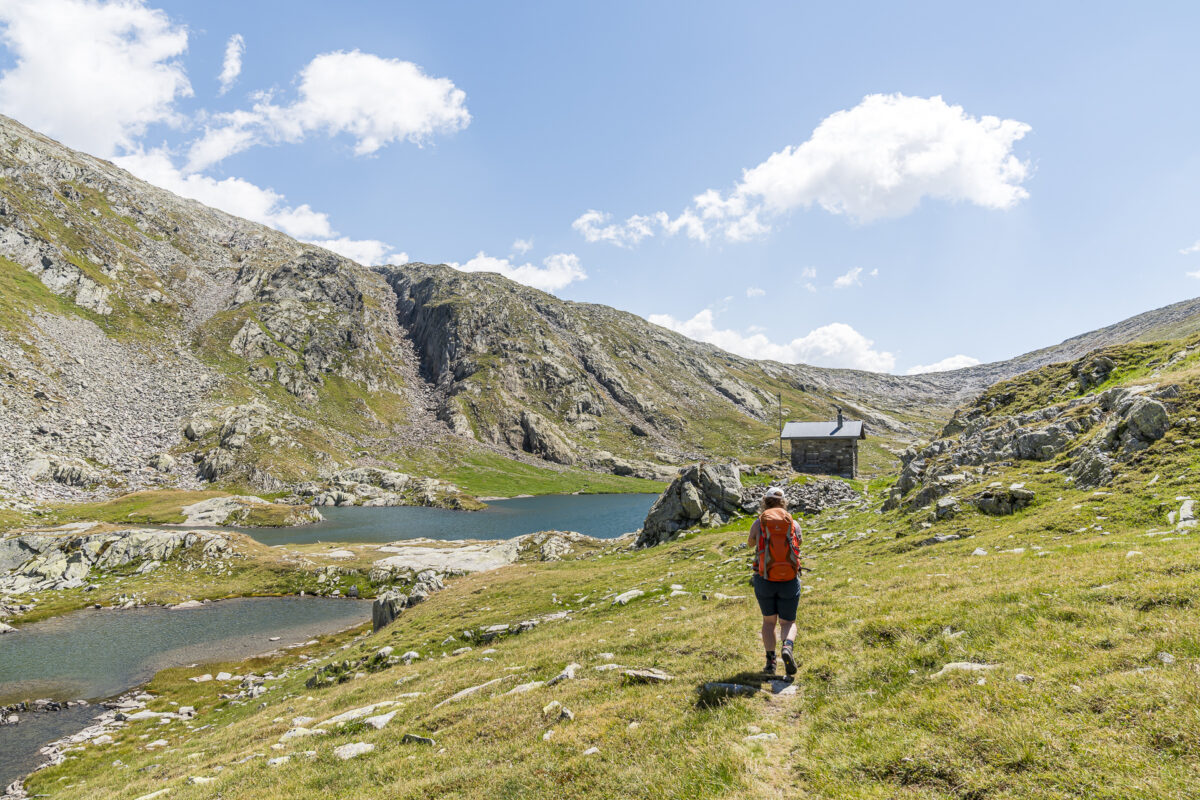
We follow the sign for Passo delle Columbe and make good progress. Only the very steep last 200 meters of altitude from the plateau Piano dei Canali to Lago dei Campanitt challenge me a bit. But now it’s done!
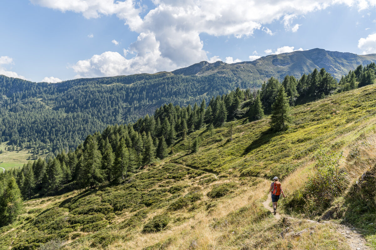
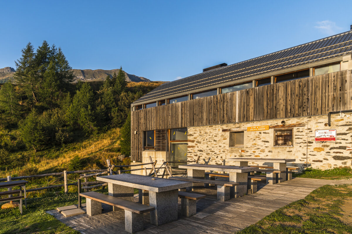
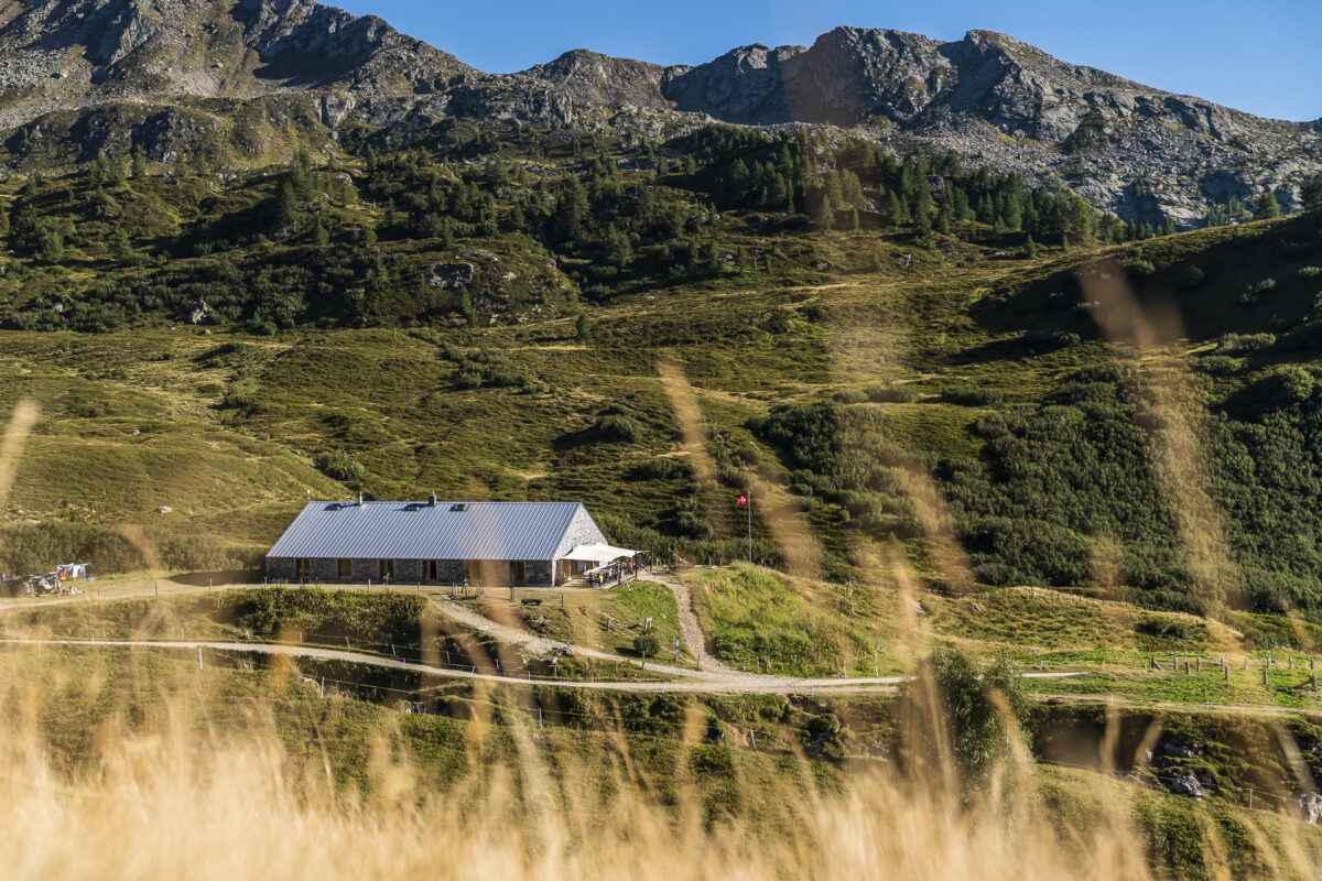
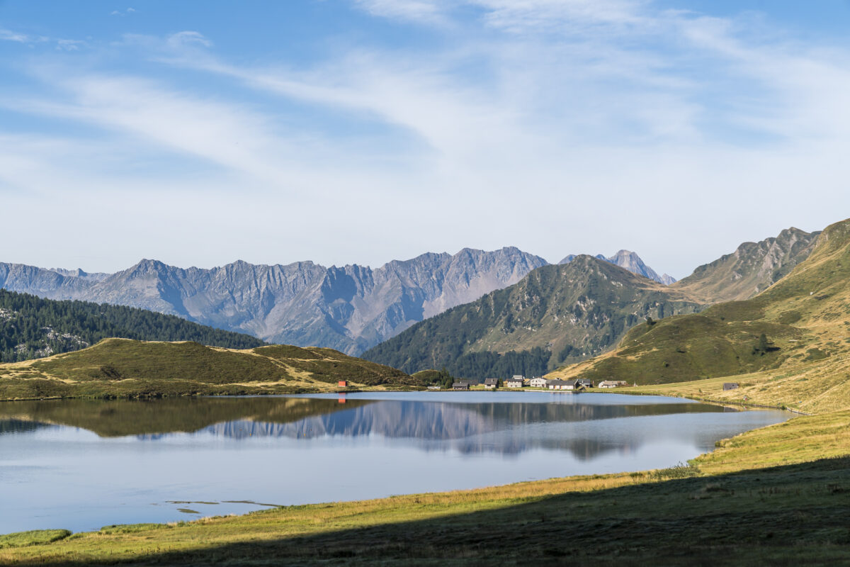
From here, our destination – the Alpe di Piora – is already in sight. And on the mostly rather wide path or in some sections even as a gravel path, it hikes briskly down into the valley. We reach the Capanna Cadagno shortly after 2:00 p.m. and enjoy the wonderful weather on the sun terrace for the rest of the afternoon. To our delight, we even get an 8-stroke for the sole use of four. The SAC hut, which was completely renovated in 2013, is very spacious and comfortable.
Key data of the tour Capanna Bovarina – Capanna Cadagno
On the following map you can see the route of the hike on the Alpine Passes Trail (stage 11) from Capanna Bovarina to Capanna Cadagno. It is a white-red-white marked mountain hiking trail with a difficulty level of T2/T3. The descent from Passo di Gana Negra to the Lukmanier Pass road is also quite steep in the first third. Otherwise, the path does not offer any technically difficult or particularly sloping sections.
If your condition is not sufficient for the rather demanding route, then you have the option of breaking off the hike at Alpe Casaccia. From there you have a bus connection via Lukmanier Pass to Disentis. The route from Capanna Cadagno to Alpe Carorescio is also often used by bikers, as the bike route 65 (Gottardo Bike) runs over it.
| Starting point | Capanna Bovarina (1,870 m above sea level) |
| Reachability | not accessible by public transport |
| Length | 17.0 kilometers |
| Elevation gain | ↗ 1,200 m 1,090 m ↘ |
| Duration | 6:15 p.m. |
| Destination | Capanna Cadagno (1,987 m above sea level) |
| Catering | At the Infocentro Casaccia there are drinks and cakes |
3rd hiking day: via Lago Ritom downhill to Airolo
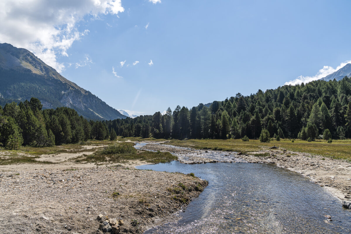
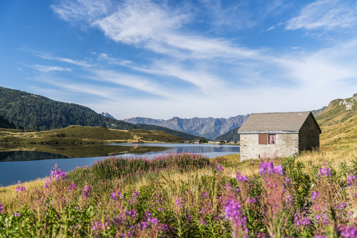
We’ve definitely put the tough games behind us. On today’s hike, which, with the exception of a detour around Lago Cadagno, also largely follows the route of the Alpine Passes Trail (stage 12), we can expect significantly more meters of altitude downhill than uphill. Nevertheless, we start the tour punctually with the first rays of sunshine of the day. We deliberately build in an extra loop around the photogenic Lago Cadagno. The lake is considered to be particularly rich in fish and accordingly attracts anglers in the early morning hours.
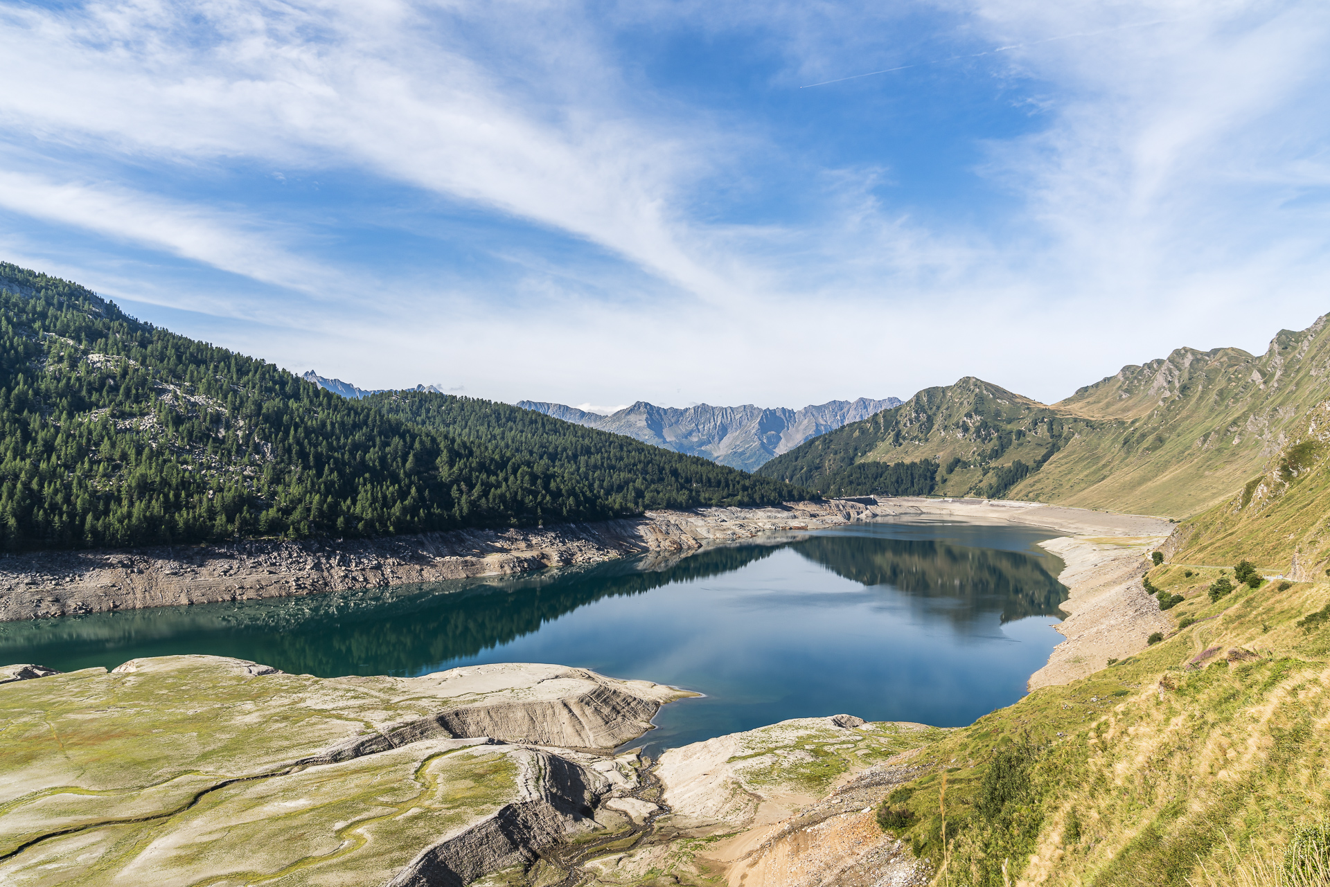
The following section along the southern shores of Lago Ritom to the Rifugio at its end is also impressive. In the first half of the 20th century, Lake Ritom was developed into a reservoir by the Swiss Federal Railways and has been used to generate electricity ever since.
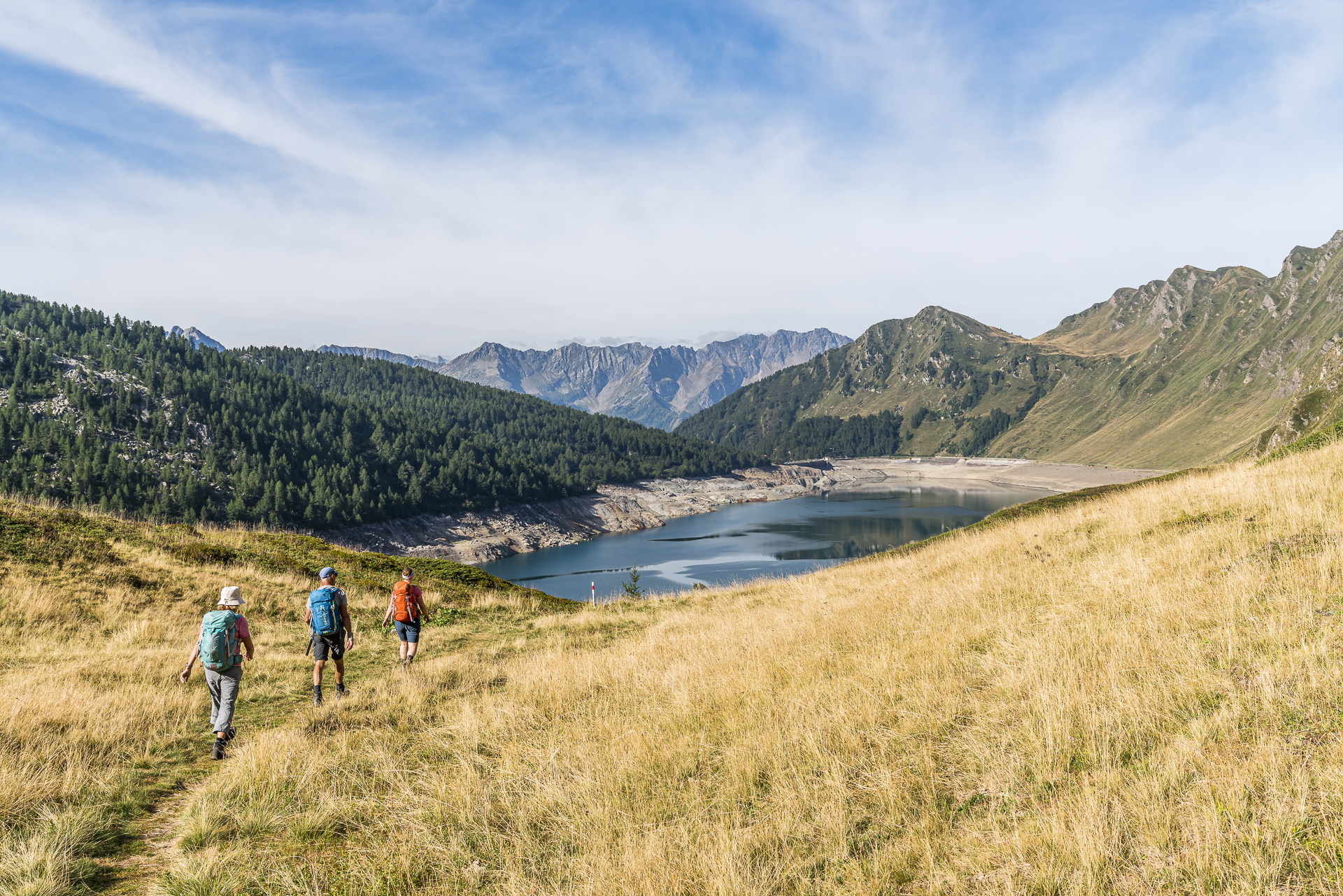
When we reach the end of the reservoir, we have two options: either take the Ritom funicular down to Piotta. Or follow the old mule tracks down to Airolo. We opt for the latter. Thus, after three varied days, we leave the rugged mountain peaks behind us and immerse ourselves in the hamlet structure of the Leventina. “What a scenically incredibly diverse multi-day hike,” we conclude as we wait for the train at Airolo station.
Key data of the tour Capanna Cadagno – Rifugio Lago Ritom – Airolo
In the following map you can see the route of the hike on the Alpine Passes Trail (stage 12) from Capanna Cadagno to the Airolo train station. It is a white-red-white marked mountain hiking trail with a difficulty level of T2/T3. The path does not offer any technically difficult or particularly sloping sections. The additional loop around picturesque Lago Cadagno is definitely worth it in good weather!
Shortly before the village of Altanca, the hiking trail leads over cow pastures or over the pasture of a bull, depending on the season. Please be careful at this point and avoid the spot if one (or more) cows are in your way. We had to make the experience that individual animals are combative.
| Starting point | Capanna Cadagno (1,987 m above sea level) |
| Reachability | Starting point not accessible by public transport |
| Length | 15.6 kilometers |
| Elevation gain | ↗ 290 m 1,130 m ↘ |
| Duration | 4:30 p.m. |
| Destination | Airolo railway station (1,142 m above sea level) |
| Catering | Ritom Lake Refuge |
Practical tips for your hike on the Alpine Passes Trail
- The multi-day hike runs on mostly technically easy mountain hiking trails at altitudes between 1,100 and 2,400 metres above sea level.
- The second day of hiking is the most demanding in terms of fitness.
- The starting point of the multi-day hike “Pardatsch” can be reached in the summer months (mid-June to mid-October) from Disentis train station by post bus (line 481) in the direction of the Lukmanier Pass
- The Capanna Bovarina is open all year round. An overnight stay with half board costs 70 CHF. SAC members pay 5 CHF less for the overnight stay.
- The Capanna Cadagno is manned from the beginning of June to mid-October. For non-SAC members, an overnight stay with half board costs 60 CHF. SAC members pay 57 CHF.
Leave a Reply