

With the tent around the bowl: these beautiful places await you
Advertising: Contribution in cooperation with the Napf region
The Napf region is an unparalleled hiking paradise. Thanks to altitudes below 1,500 metres above sea level, hikes are conceivable here as early as the end of April and into November. The extensive network of hiking trails can not only be explored on day hikes, but can also be combined into multi-day hikes. We have taken this as an opportunity to explore the most beautiful hiking stages as well as the associated overnight places together with the regions bordering the Napf – UNESCO Biosphere Entlebuch, Emmental and Willisau – as well as Nomady, the platform for camping in nature. At the end of this post, I will also provide you with the answers to the most frequently asked questions about hiking with a tent.
In 3 beautiful hiking stages through the Napf region
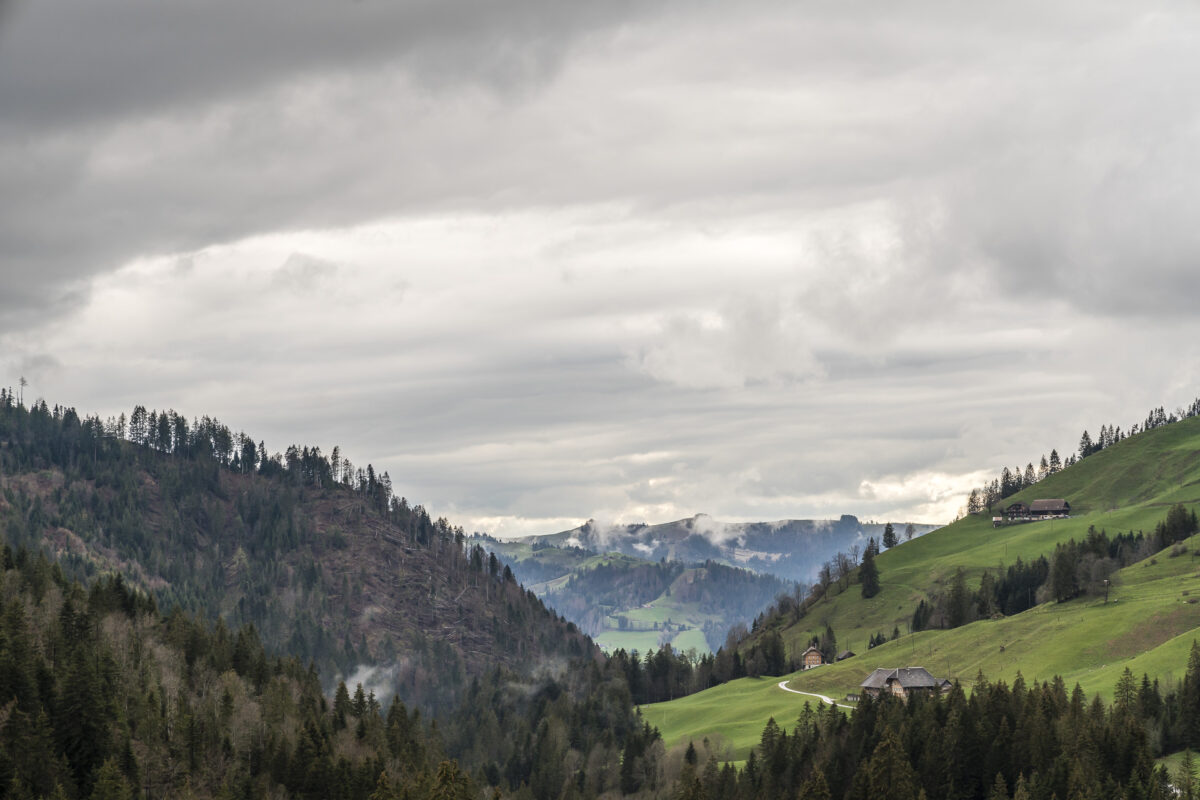
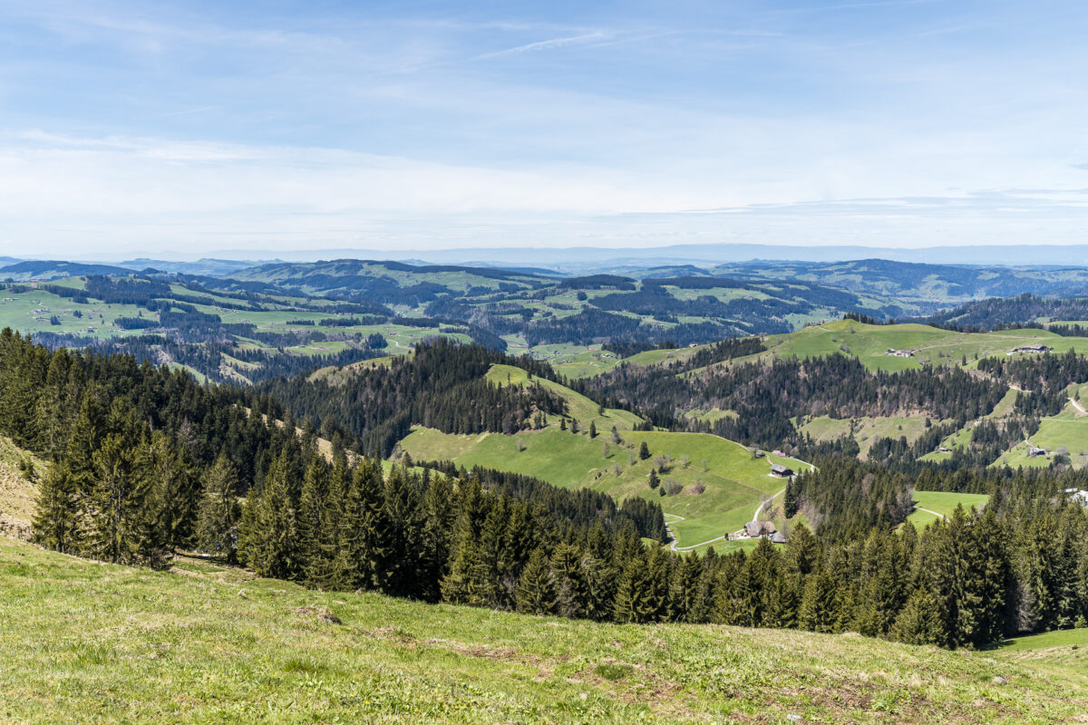
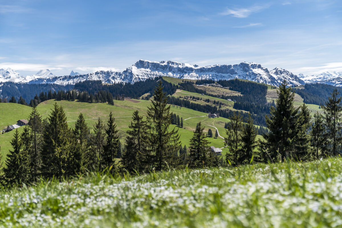
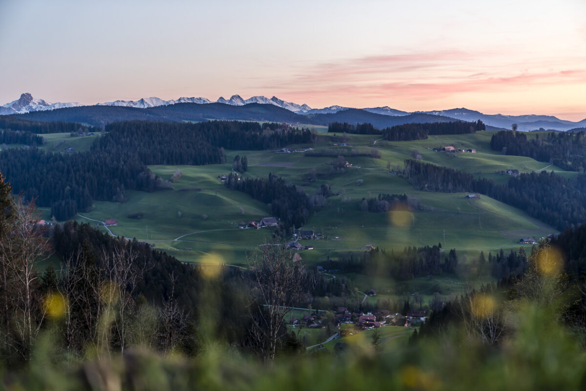
The Napf area stretches between Sumiswald and Wolhusen and is separated from the foothills of the Alps in the south by the Entlebuch. Deeply incised valleys and panoramic mountain ranges are in constant interplay here. As a result, the Napf area is still not easily accessible and the ascent to the summit requires your own muscle power. On the other hand, it scores with its central location between the Jura and the Alps, but also with an abundance of great vantage points.
Our three-day tour combines some of the most popular excursion destinations around the Napf and leads from the moorland of the UNESCO Biosphere Entlebuch via the Napfbergland border path to the idyllic Luther Valley. The three tours can either be implemented as day hikes or, as we did, equipped with a tent to combine a multi-day hike. Thanks to the commitment of Nomady, there is now a nice selection of campsites in the Napf area, where you can indulge in camping pleasures in the midst of the most beautiful nature.
You want to take a look at the most beautiful campsites around Napf? Then click through here:
Campsite In the shadow of the Schratten
Campsite Hof Brügglen
Campsite Mittler Gernet
1st tour: on the moorland path over the Hilferen Pass
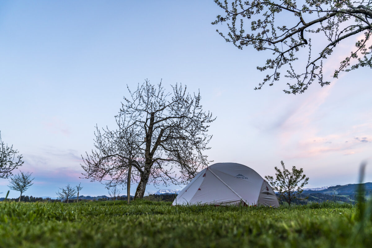
Our introduction to this outdoor experience is anything but relaxed. And yes, the preparations for this three-day tour with a tent and your own food actually feel adventurous to me. The last time we were on the Cerro Castillo Trek with a tent and as self-catering. In Switzerland, we sometimes used the comfort of mountain huts and alpine pubs.
And although we have prepared everything meticulously, one important component is dancing around on our noses: the weather. But since I had taken it into my head to reach every campsite on foot, we set off in Flühli despite the cool drizzle. Unfortunately, the announced improvement in the weather is longer in coming than expected.
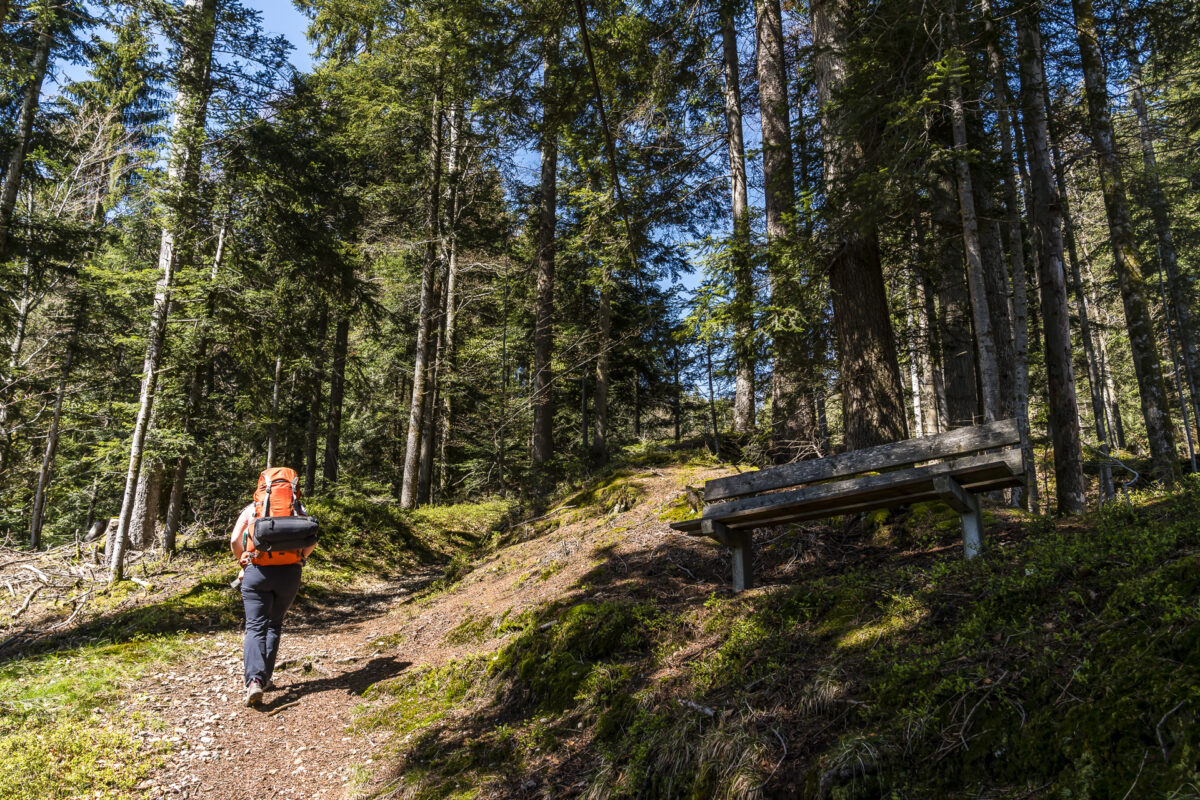
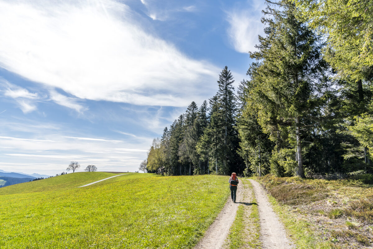
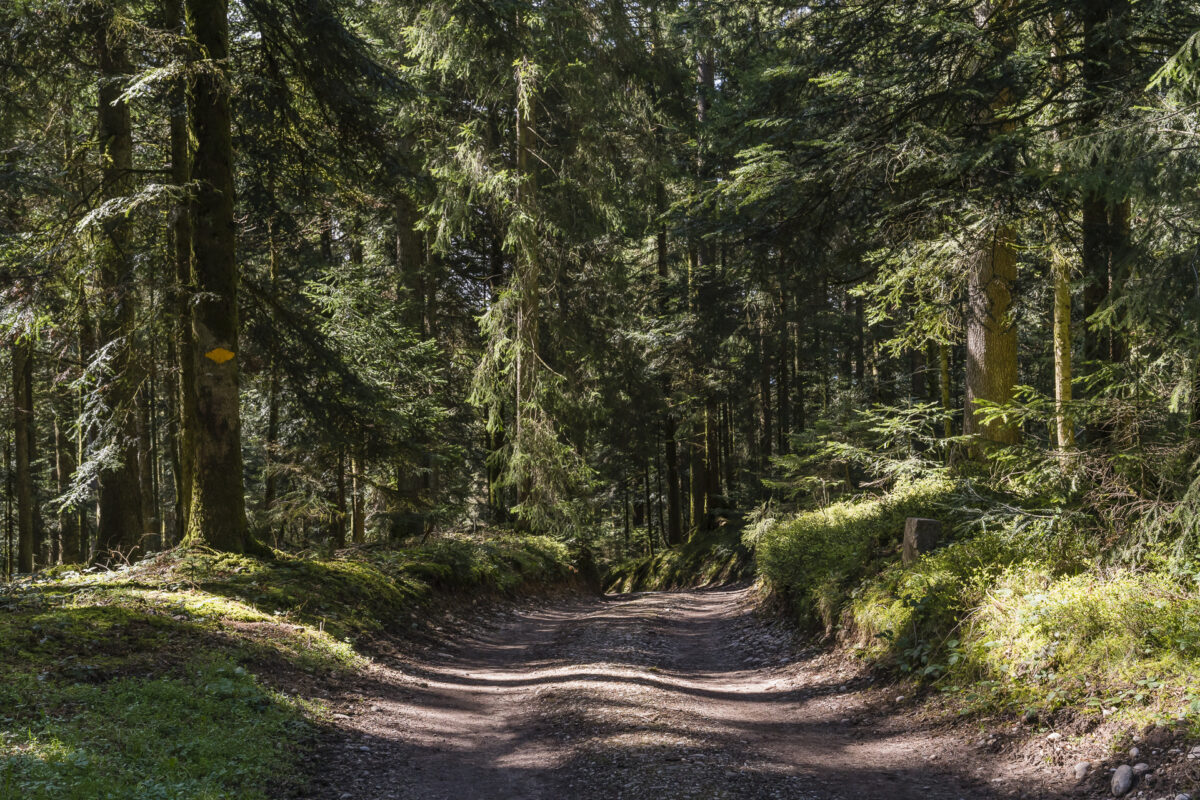
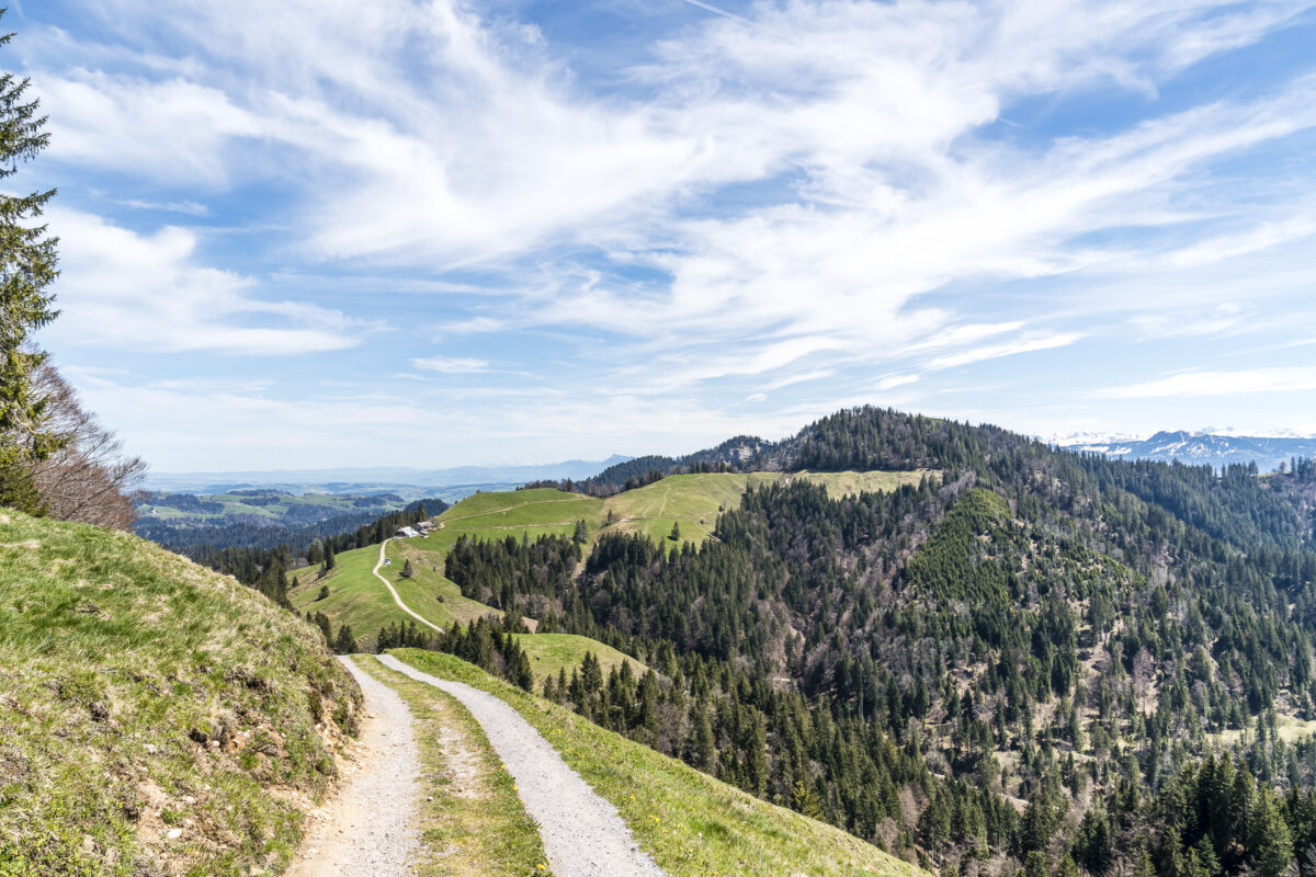
From the Torbach bus stop, we follow the moorland path uphill towards the Hilferen Pass. Up to the top of the pass, there are about 450 meters of altitude to overcome. While the hiking trail leads quickly away from the tarred road over pastures and through forest ravines, we stay true to the road for once. The shoes definitely get wet less quickly here than on the thoroughly damp moor meadows.
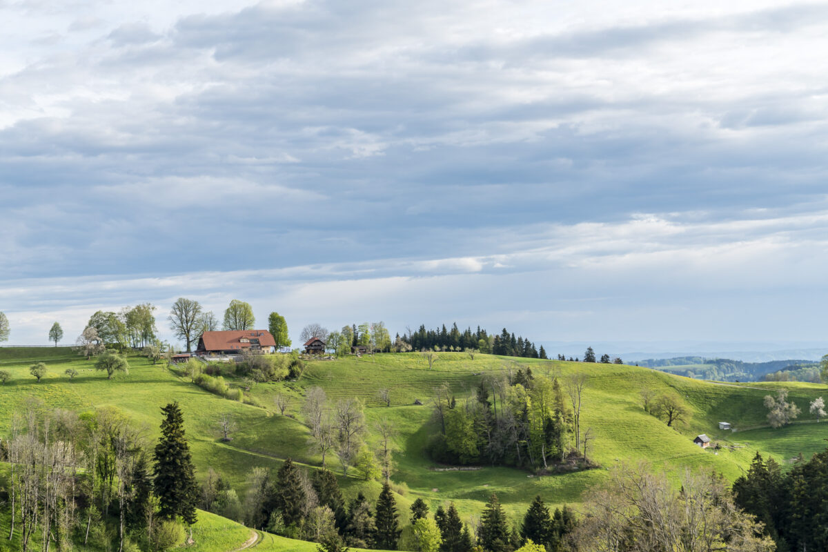
After the Hilferen Pass, we leave the moorland path, which continues to follow the northern slopes of the Schrattenfluh as a high-altitude trail, and choose the “Direttissima” in the direction of Marbach. Our destination – the Stächelmoos farm directly below the mighty north face of the Schrattenfluh – is soon visible. But in order to cross the impassable ravine of the Hilfere, we have to make the bow over Dorbach. In the striking building with turrets (the former schoolhouse of the valley) at the fork in the road, probably the most famous chef of the Entlebuch lives: Stefan Wiesner.
Key data of the hike Flühli – Hilferepass – Stächelmoss
On the following map you can see the route of our hike from Flühli over the Hilferen Pass to Hof Stächelmoos. The hike starts at the Flühli Torbach bus stop and leads from there through the middle of the moorland of the Entlebuch Biosphere.
| Starting point | Bus stop Flühli (LU), Torbach (890 m above sea level) |
| Reachability | Destination can only be reached on foot (or by bike/car) |
| Length | 9.1 kilometres |
| Elevation gain | ↗ 587 m 300 m ↘ |
| Duration | 3:00 p.m. |
| Destination | Stächelmoos (1,185 m above sea level) |
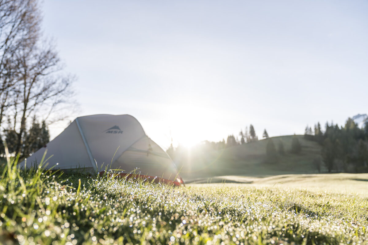
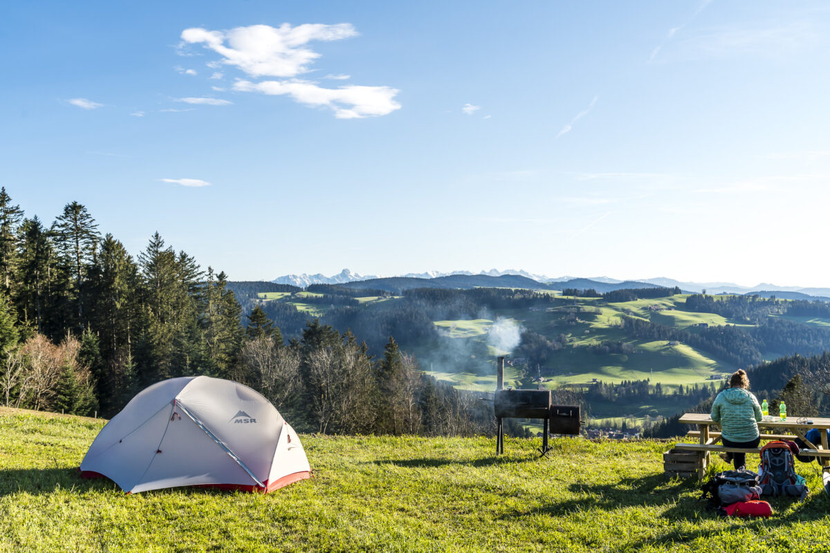
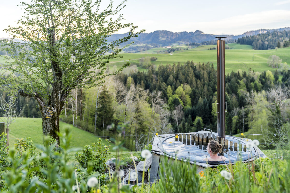
1. Campsite: Nomady Camp in the shadow of the Schratten
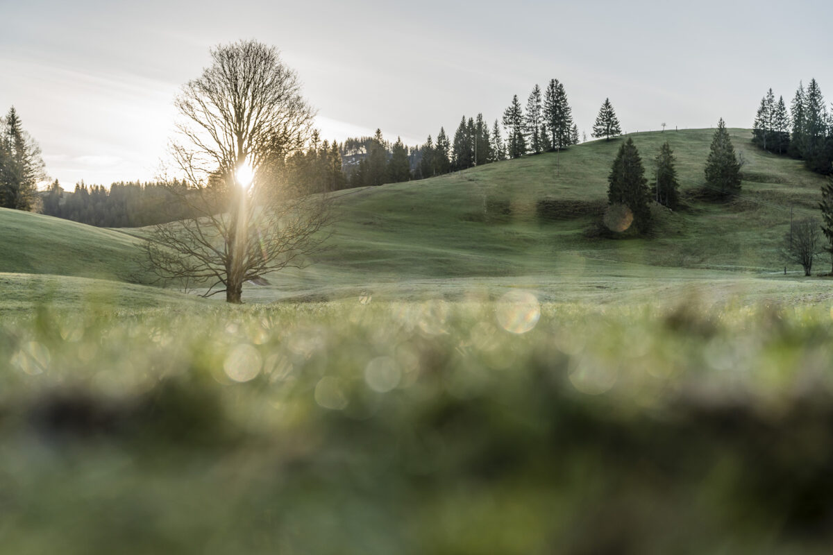
And while the valley is still cloudy on the ascent towards Stächelmoos, the view of the Schrattenfluh clears up just as we arrive. Susanne and Patrick’s organic farm may be remote, but it is surrounded by an even more impressive backdrop. Since spring 2020, they have been offering a nature campsite right on the edge of the forest about 400 m away from the farm. The “Ahornplätzli” is equipped with a toilet (in a deluxe version, as you would not expect in such a place), a fireplace and a hammock and can accommodate 1 to 2 tents or two smaller buses. If you book the Ahornplätzli, you will enjoy it for yourself!
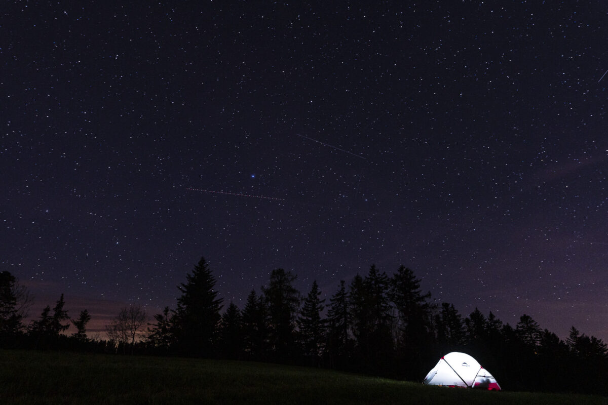
While we set up our tent, the sun’s rays can finally assert themselves against the cloud layer and awaken the anticipation of the following days. Shortly before dark, we make a detour to the small farm shop, where Susanne and Patrick have a small selection of local products ready for their guests. Later, we snuggle up in the warm sleeping bag and are curious to see how low the temperatures will drop that night.
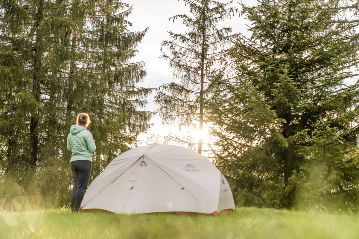
Almost seven hours later, we know the answer: so deep that it is enough for ground frost. Fortunately, our sleeping bags have a comfort level in the minus range. Nevertheless, we are happy about the first warming rays of sunshine.
For all those who do not carry a Bialetti for weight reasons, a coffee machine is available in the courtyard shop. Exactly what I need now. Somewhat wistfully, we pack up our things afterwards. I could easily stay longer on the Ahornplätzli. Reading an exciting book dangling in a hammock, immersing yourself in mountain forest bathing under Susanne’s guidance or exploring the moorland of the Entlebuch Biosphere on foot – the possibilities are endless.
Cost Ahornplätzli: from 65 CHF per night for 2 persons
2nd tour: via the Napfbergland border path over the Rämisgummen
But on today’s hiking stage, not only the “exotics” of the Entlebuch await us, but also a beautiful ridge path with the most magnificent panorama of the foothills of the Alps. From Stächelmoos to the village centre of Marbach it takes about 1.5 hours (approx. 8.5 kilometres) on foot. The hiking trail leads past the Schufelbühl farm, where the Renggli family has been keeping water buffalo as farm animals since 2009. In conversation with farmer Bruno Renggli, I learn that water buffaloes are good-natured, but also sensitive animals. If the people around the buffalo are stressed, the animals supposedly react stubbornly. It works best if you give the impression that you have all the time in the world – the buffaloes are therefore something like deceleration coaches, says Bruno Renggli with a smile.
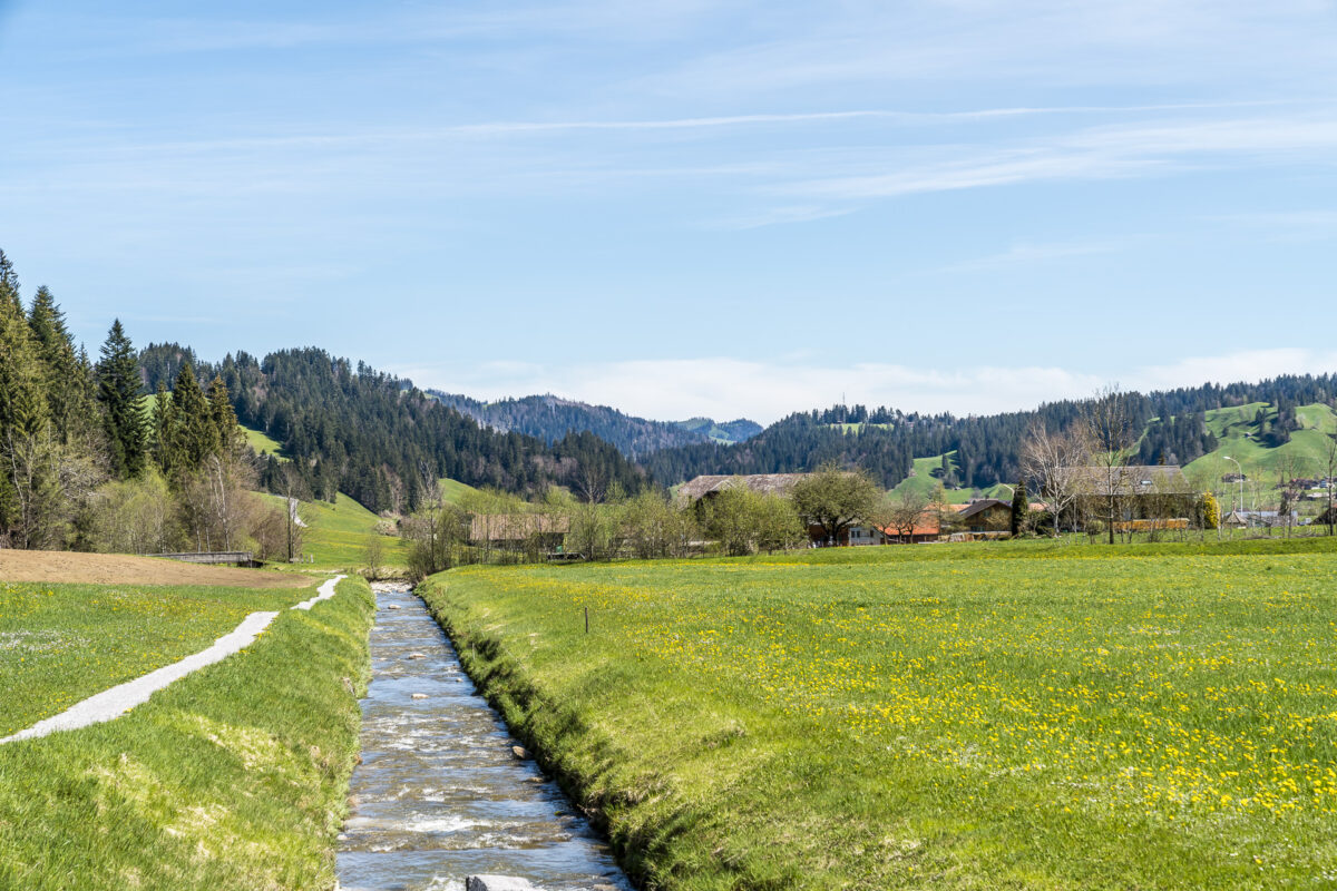
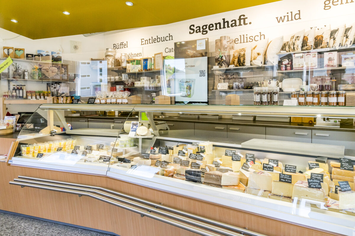
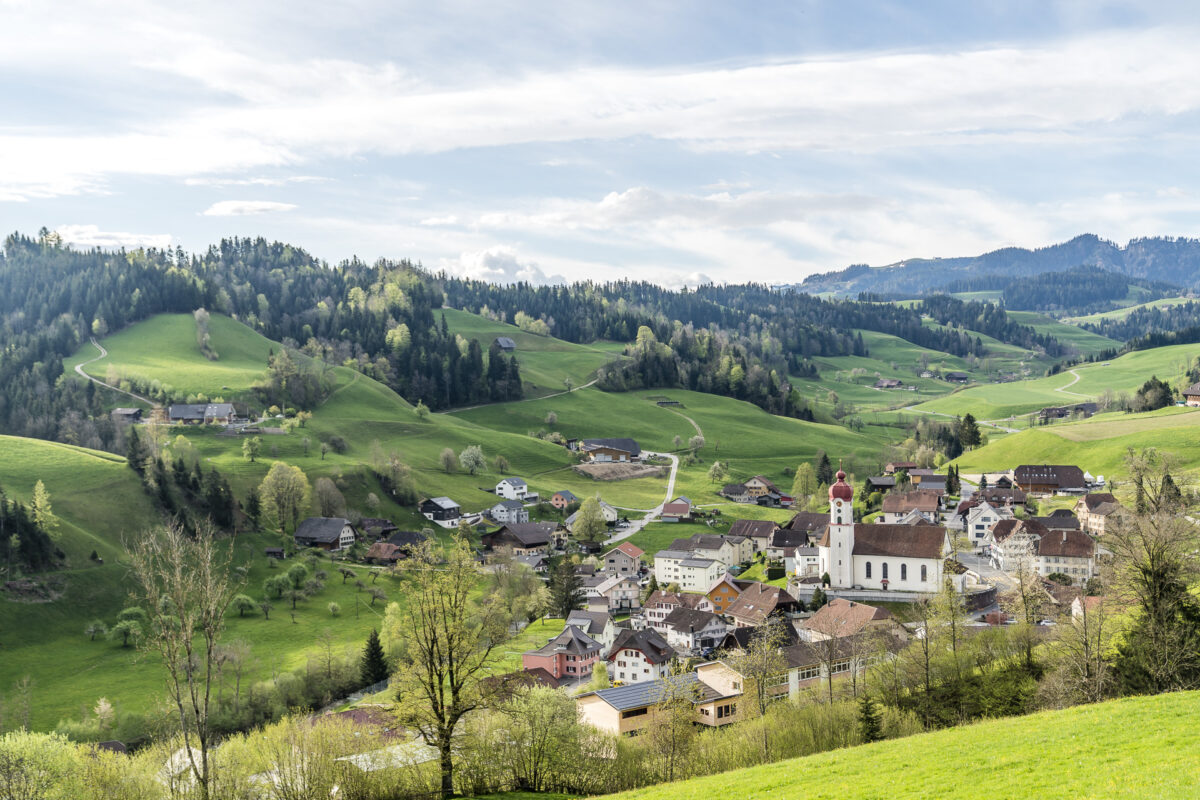
Via the beautiful, newly created riverside path we reach the village center of Marbach along the Schönbach. Following in the footsteps of the water buffaloes, the FoodTrail Marbach also runs over it and connects the Schufelbühl farm with the Marbach mountain cheese dairy, where mozzarella and other specialties such as the buffaletta grilled cheese are created from the buffalo milk.
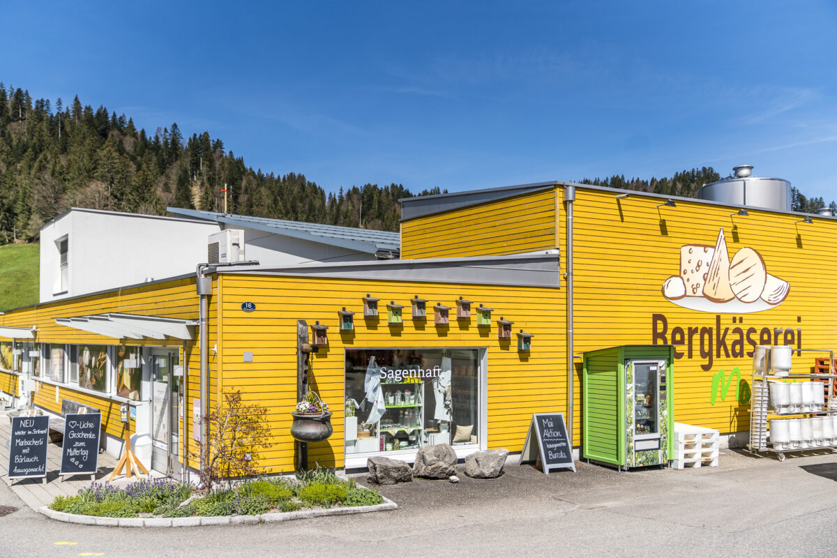
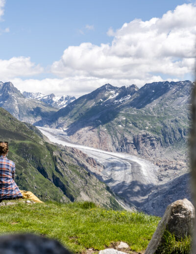
Here we stock up on our provisions and then tackle the almost two-hour ascent to the Wachthubel. 570 meters of altitude have to be mastered in the first four kilometers – for this we are rewarded with a great panoramic view at the top.
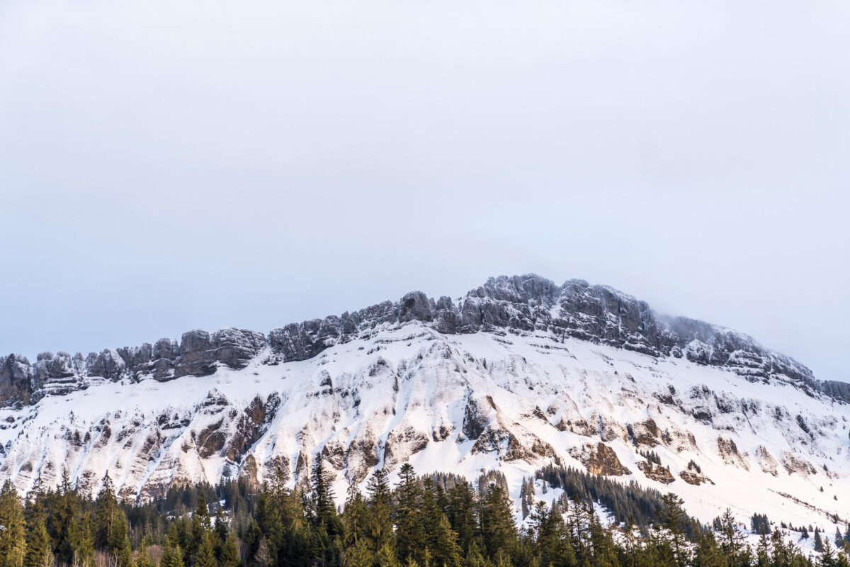
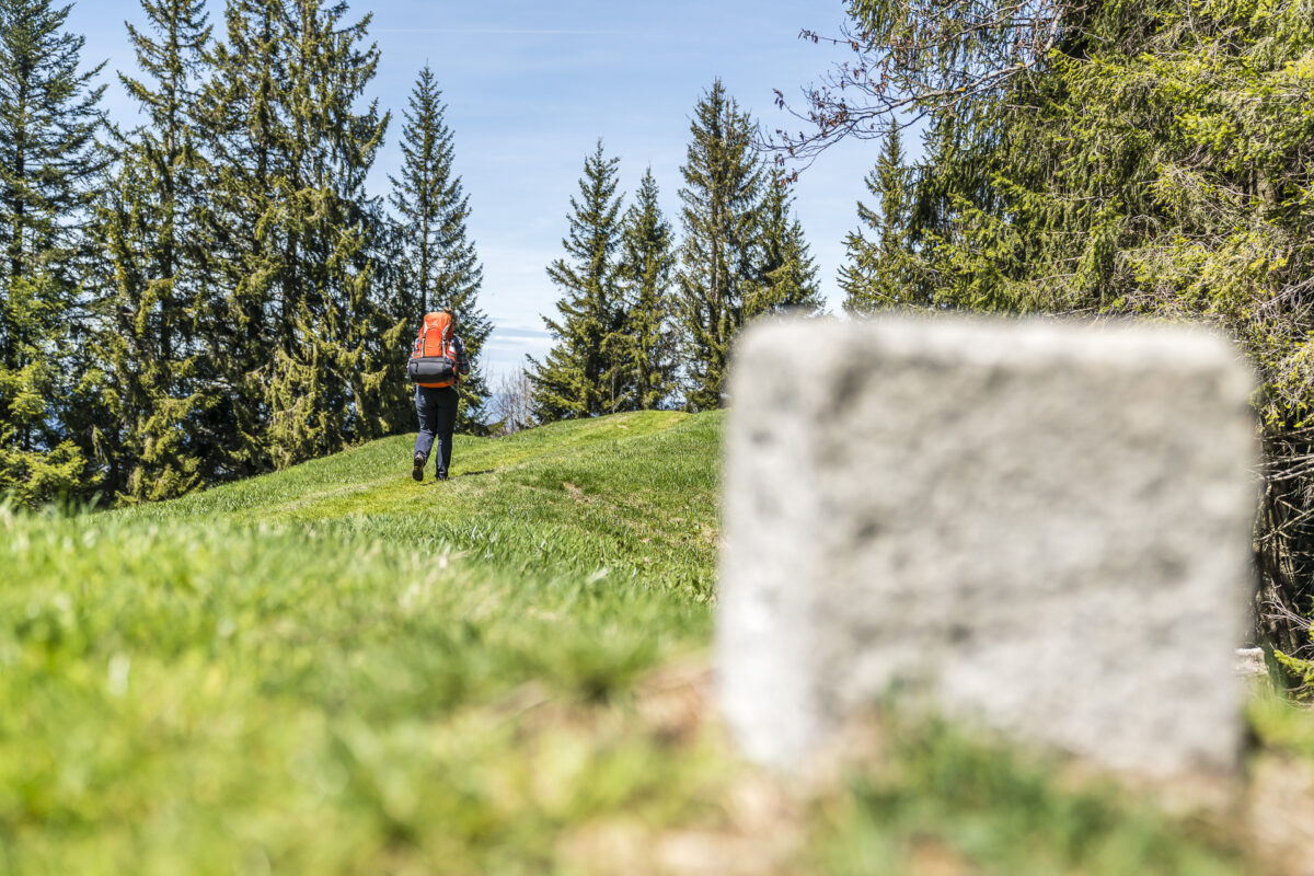
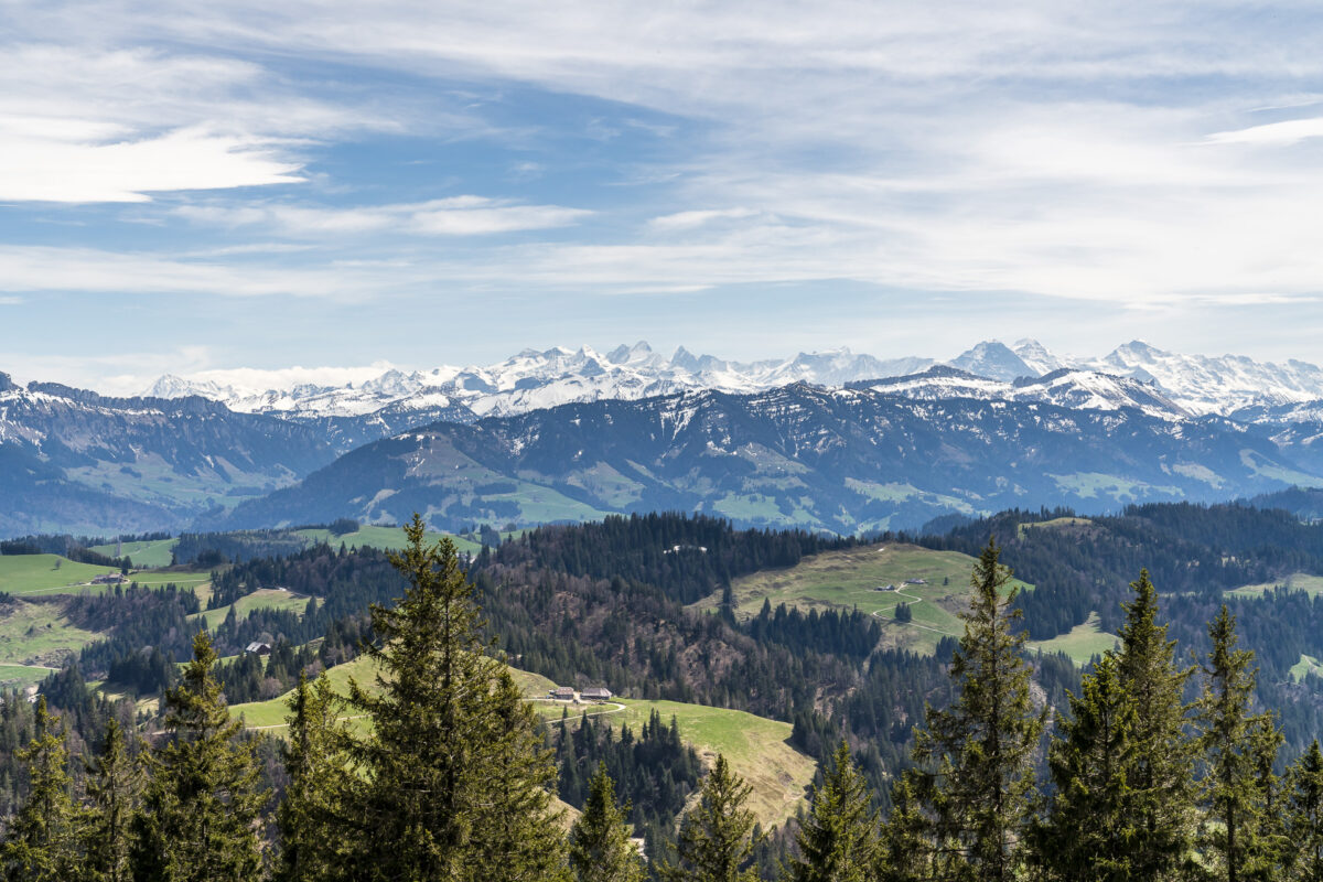
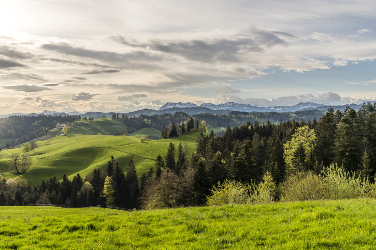
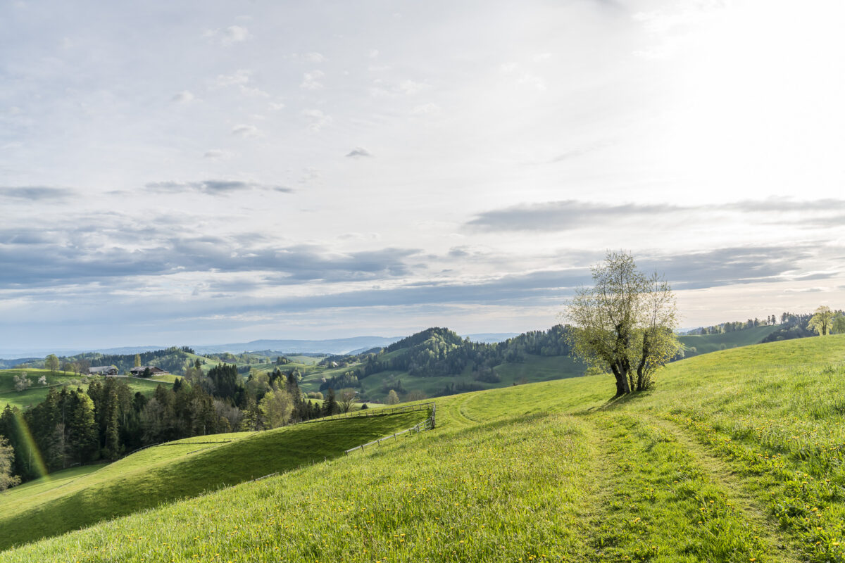
The path leads us along the cantonal border between Bern and Lucerne to the Rämmisgummehoger. The crocuses have faded in the meantime, but lush green grass covers the meadows, while in the background the Hohgant is still wintry white.
Key data of the hike Marbach – Rämisgummen – Brügglen
On the following map you can see the route of our hike from Marbach over the Rämisgummenhoger to Brügglen near Langnau. The hike starts at the height of the Marbach mountain cheese dairy. If you want to hike from Brügglen (or Langnau Hochwacht) to Langnau station, you should allow an additional hour for the remaining distance.
| Starting point | Bus stop Marbach LU, Post Office (860 m above sea level) |
| Reachability | Destination can only be reached on foot (or by bike/car) |
| Length | 18.4 kilometres |
| Elevation gain | ↗ 861 m 753 m ↘ |
| Duration | 5:30 p.m. |
| Destination | Brügglen near Langnau (970 m above sea level) |
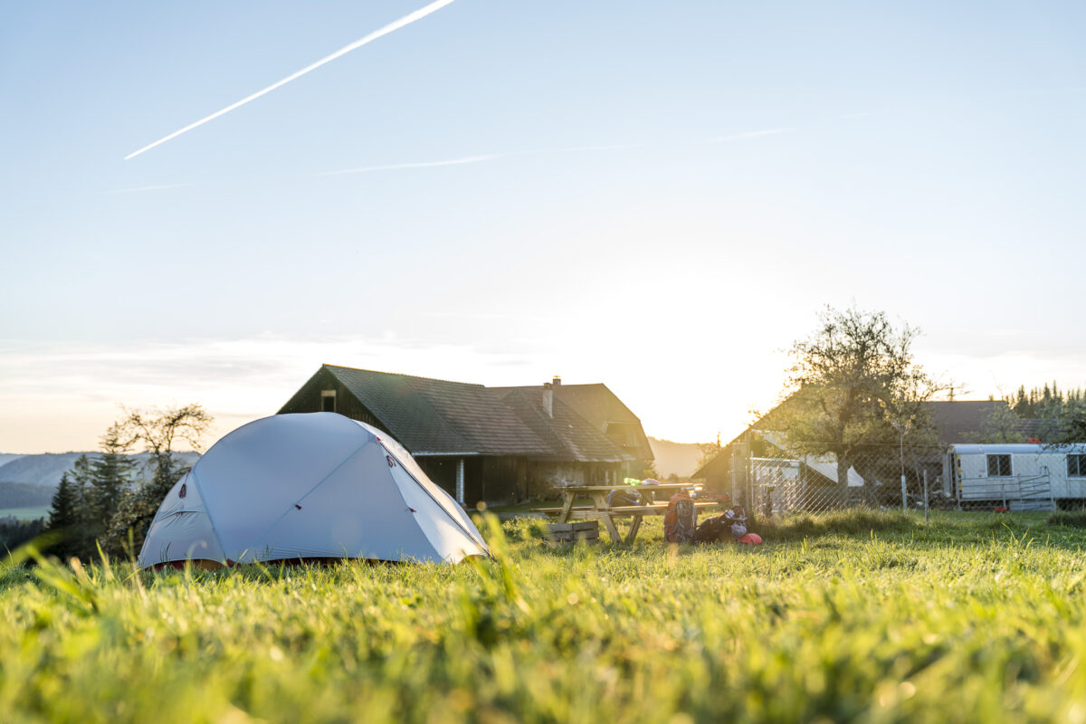
2. Campsite: Nomady Camp Brügglen near Langnau
After more than 20 kilometres in the Füssen, we are happy when the path branches off towards Brügglen at the height of Langnau Hochwacht. Only a few more meters until today’s overnight place – the Demeter Hof Brügglen of Susanne and Boris – appears in front of us. Susanne and Boris now offer five – or soon six – overnight places on their farm.
We are allowed to pitch our tent on the new sixth place this evening and this place is simply “wow”. Unobstructed view of the Stockhorn chain. It immediately makes me feel at home. The various campsites are spread around the farm. If you are looking for seclusion, you are in good hands “with the wild blueberries” or in the teepee at the Ilfisgraben. Our place is not quite so remote, but scores with the phenomenal panorama.
A toilet and a shower are located in the stable building. In addition, there is also a small farm shop (incl. coffee machine) and at our place there is even a power connection in addition to the grill and a nice bench. Does this already fall into the category of glamping? Who knows – in any case, we couldn’t have imagined a better place for this atmospheric evening.
Cost for overnight stay: depending on the place between 50 and 90 CHF per night for 2 persons
3. Tour: From Lüderenalp via Napf to Luthertal
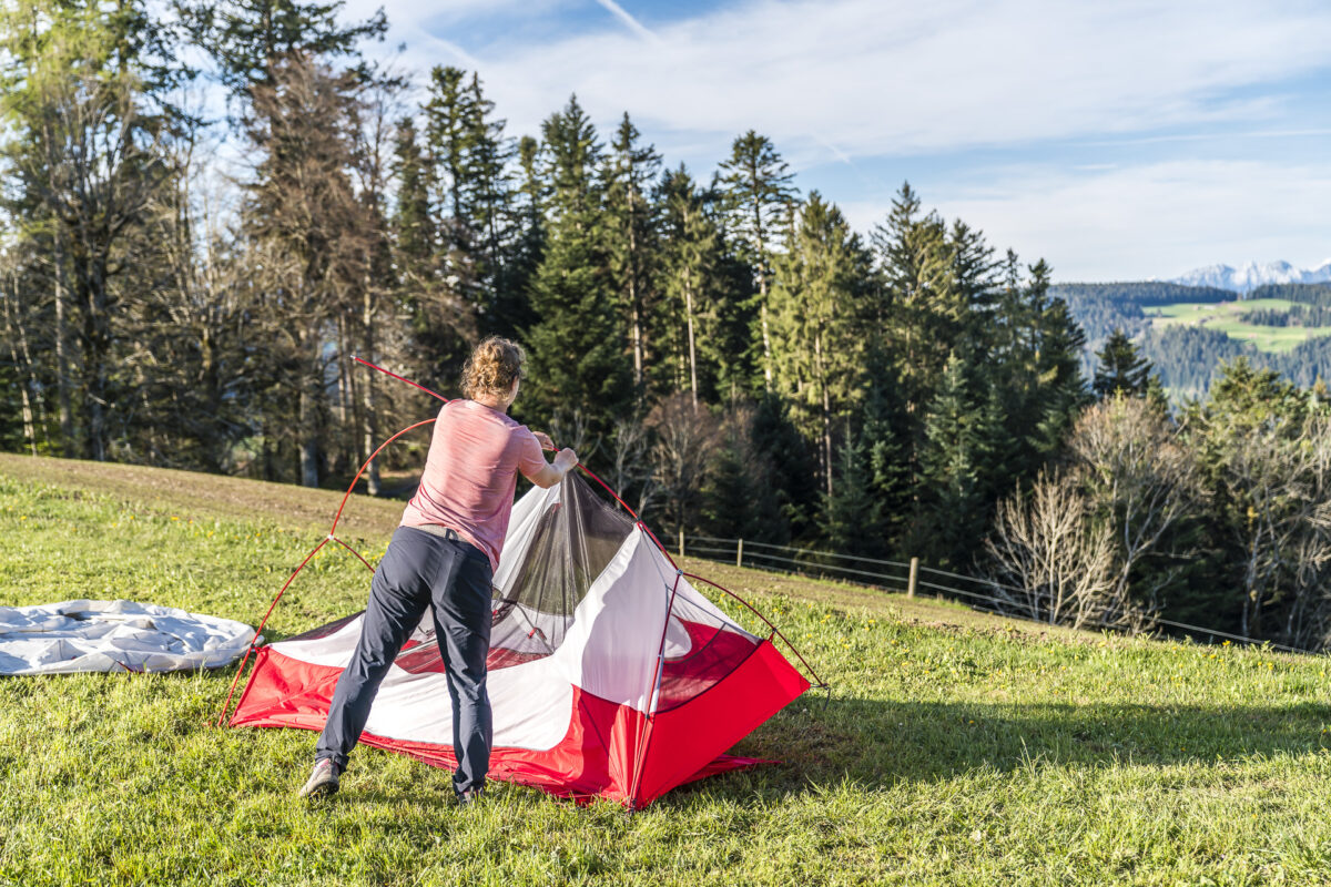
Today, a veritable hiking classic of the Napf region is on the program. We reassemble the tent in time and pack all our belongings into the backpack. Here, too, the credo applies: leave the place as you found it. Afterwards, the smell of fresh druffle makes us pause for a moment at the farm shop. Yes, camping guests can look forward to a freshly baked braid here every Sunday morning!
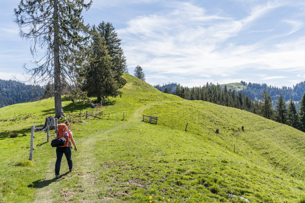
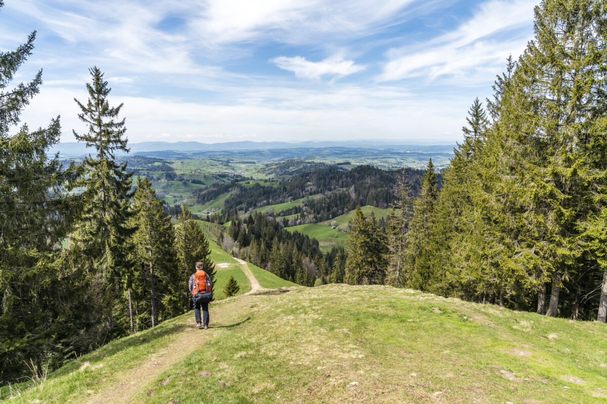
Afterwards we hike from Brügglen down to Langnau and from there we take the post bus to Lüderenalp. This is where the wonderful panorama trail starts, which leads to the Napf in 12 kilometres following the mountain range. The course of the trail is pleasantly varied – narrow forest paths alternate with wider gravel paths. Only the steep zigzag path down to the Änzisattel is a bit tedious, as the gravel surface is very “slippery”.
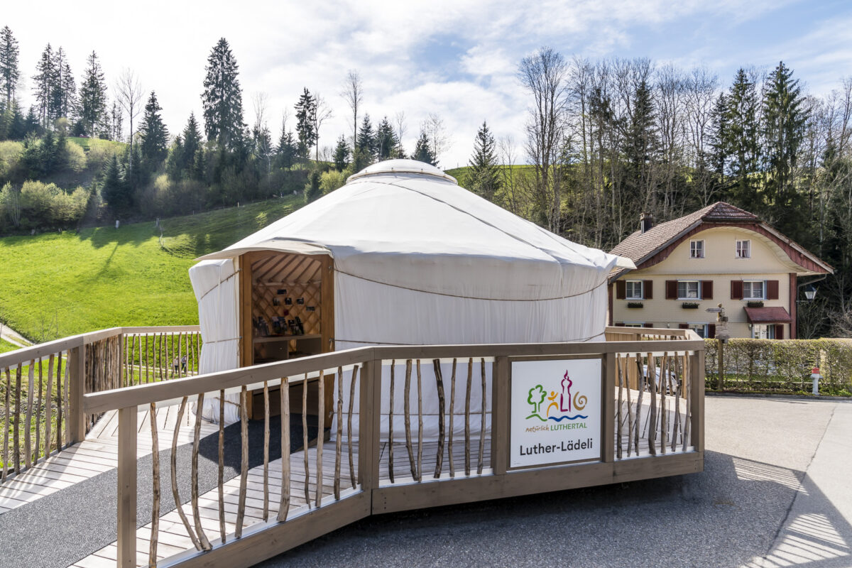
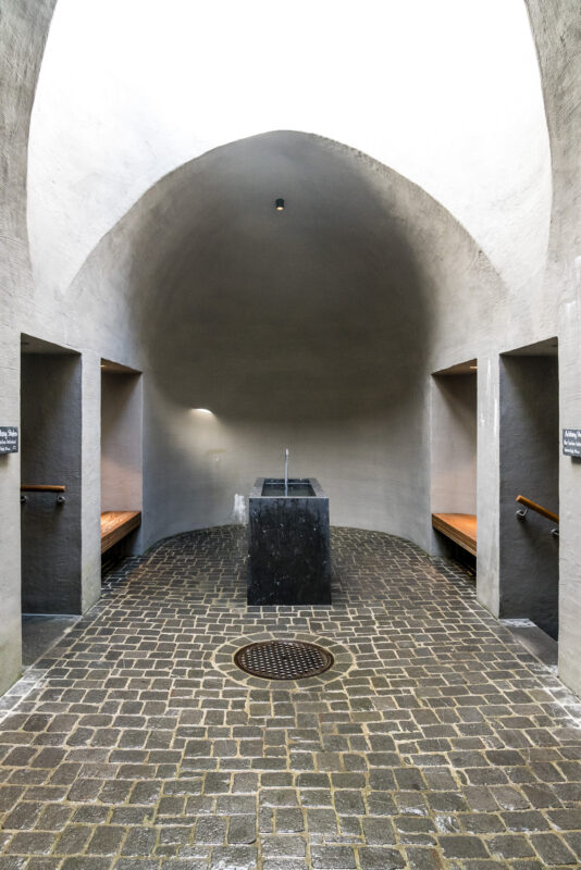
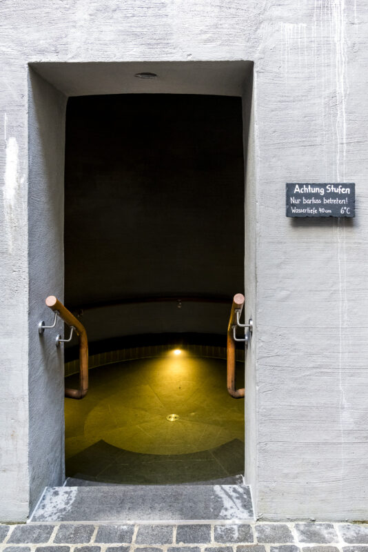
After a breather on the Napf – after all, the panorama wants to be admired here too – we tackle the steep descent to Luthern Bad. If you have trouble with your knees, you should pack poles for this game. Plan your arrival in Luthern Bad in such a way that you still have a good 45 minutes to 60 minutes until the next post bus departure. The waiting time flies by during a visit to the Luther shop (self-service, payment via Twint possible) as well as the arm and foot bath. While fine regional products (including those from the Napf-Chäsi) are sold in the Luther-Lädeli, tired feet can expect well-deserved refreshment in the free and 24/7 freely accessible arm and foot bath – a real treat!
Key data of the hike Lüderenalp – Napf – Luthern Bad
On the following map you can see the route of our hike from Lüderenalp via Napf to Luthern Bad. Both the start and end points of this tour can be reached by public transport (but it is advisable to consult the timetable in advance, as the connections are not so frequent).
| Starting point | Bus stop Lüderenalp (1,164 m above sea level) |
| Reachability | Accessible by public transport |
| Length | 15.6 kilometers |
| Elevation gain | ↗ 841 m 1,105 m ↘ |
| Duration | 5:15 p.m. |
| Destination | Bus stop Luthern Bad (876 m above sea level) |
3. Campsite: Nomady Camp Mittler Gernet
To get to the place for the third night of the tent, we take the post bus from Luthern Bad to Luthern Dorf, Wieden. Here we follow the road uphill for a good 25 minutes until the sign “Gernet” welcomes us under a mighty, old giant tree.
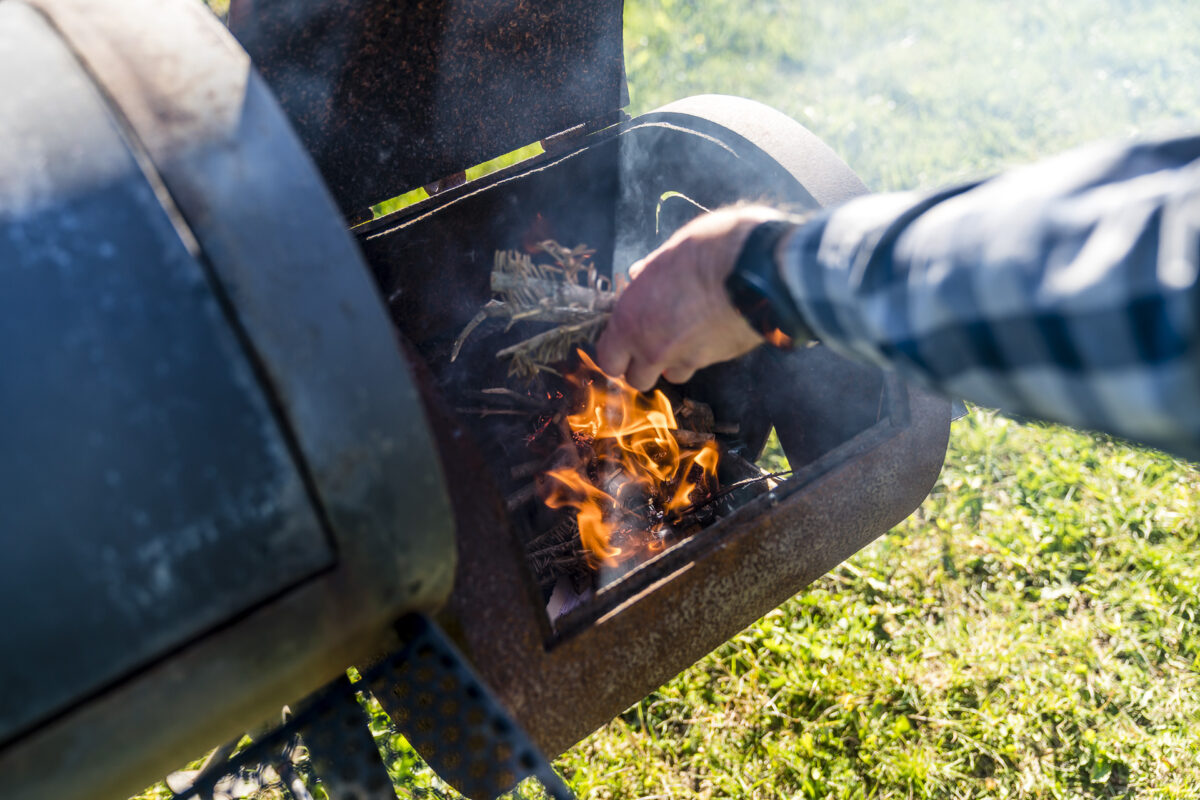
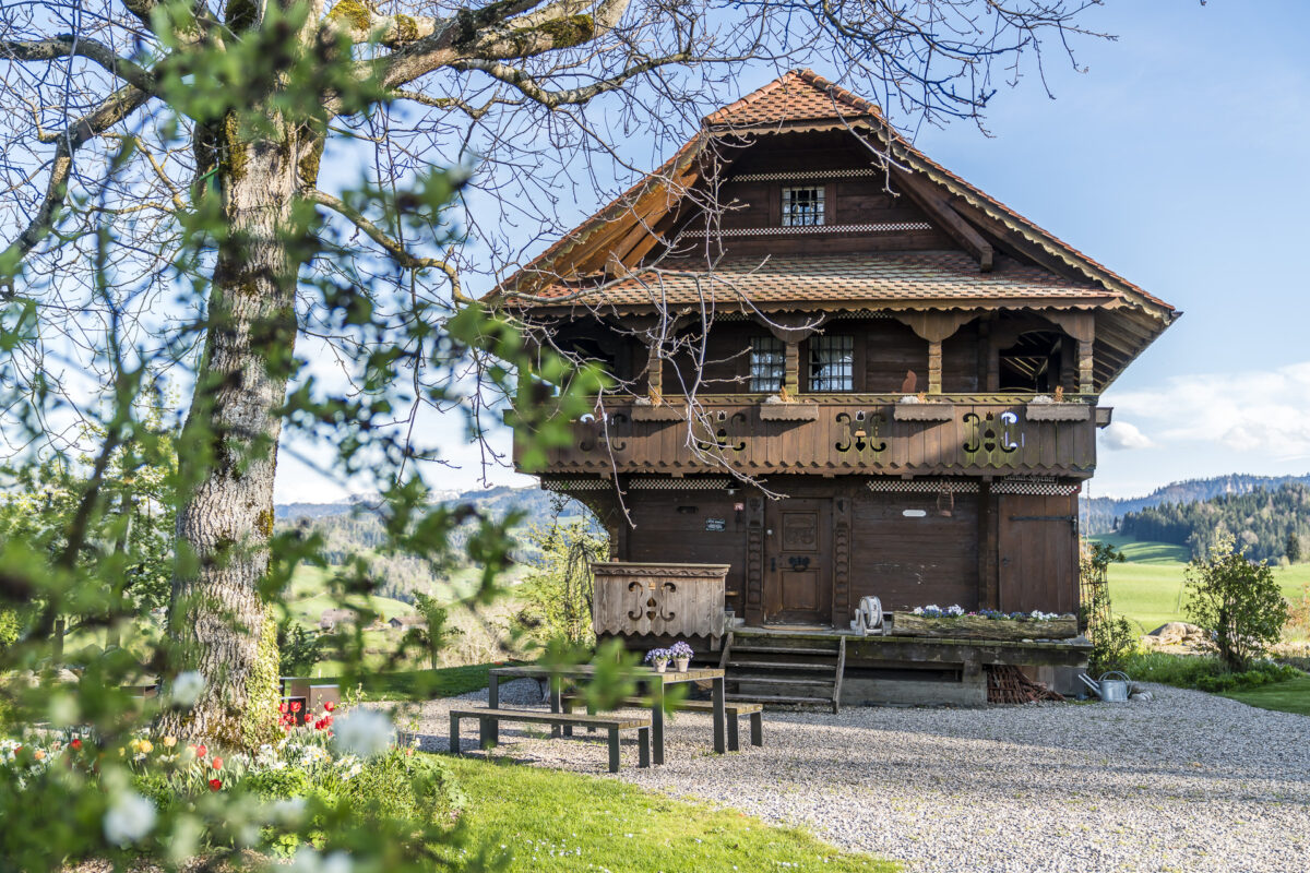
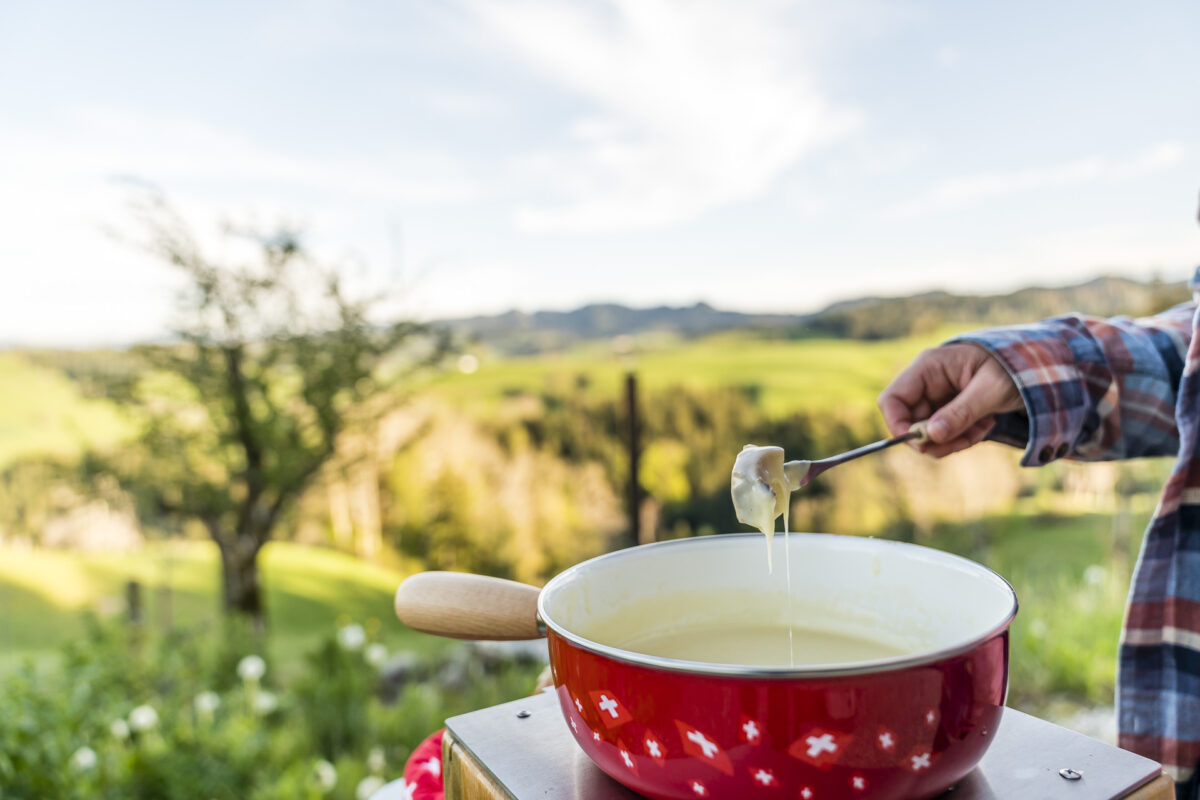
On the farm of Lucia and Markus Stirnimann, a true paradise awaits camping fans. The site (for max. 1 vehicle/tent, or a group of max. 6 people) includes a homely Spycher and a fire ring, both of which may be used. Especially on cool, wet days, access to the Spycher is a real luxury. Shower and toilet are located in the house. If you like, you can also reserve fondue dishes for an outdoor fondue (the Stirnimanns, who are also managing directors of Napf-Chäsi, will be happy to provide the right fondue mix on request) and enjoy a pleasantly warm bath in the Chäs-Chessi-Hot-Pot.
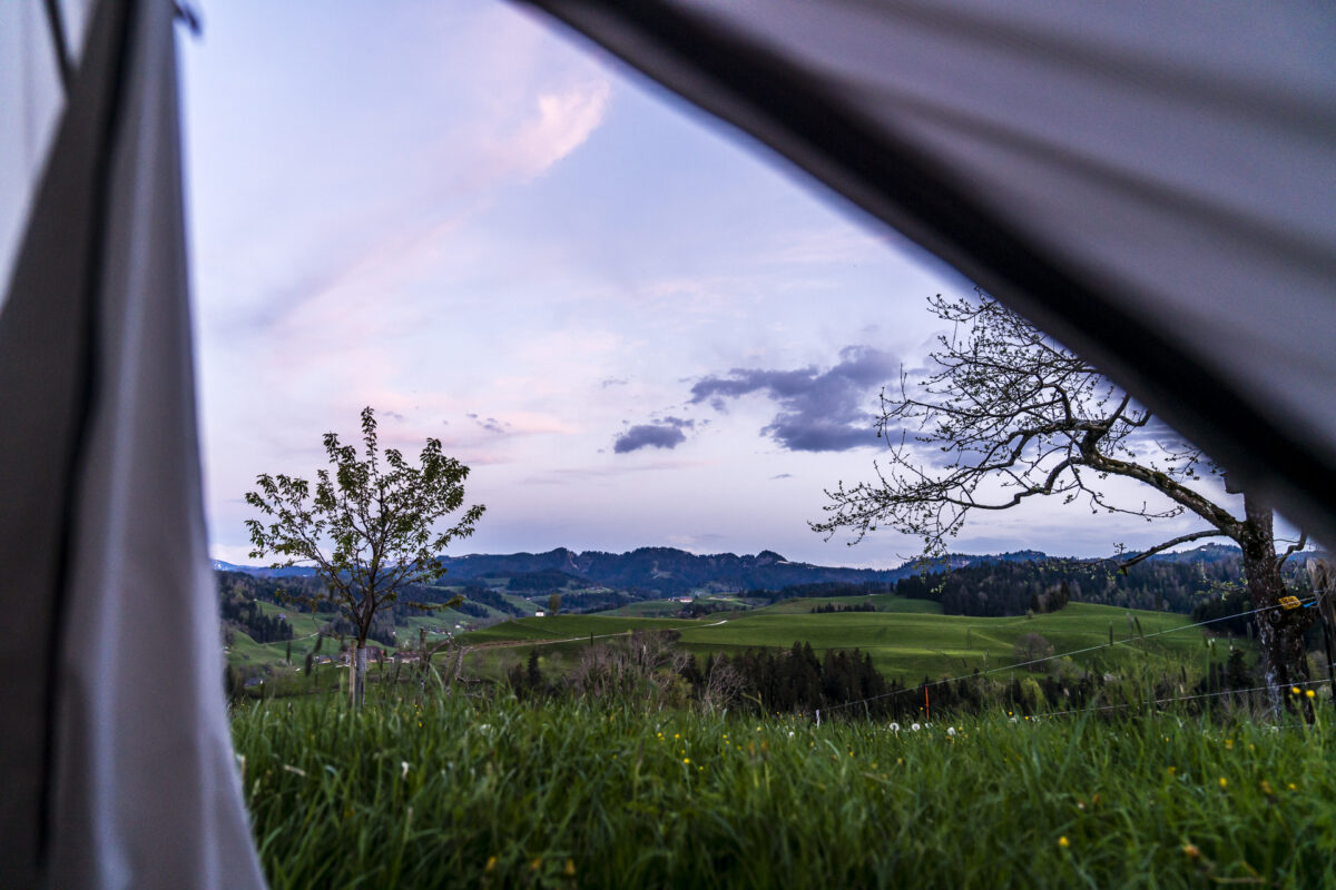
And yes, with this great ambience between buzzing bees and chattering geese as well as the far-reaching view towards the Napf, the hustle and bustle of everyday life seems incredibly distant. Too bad, our multi-day hike with tent ends at this point.
At the end of the day, we enjoy a wonderful morning atmosphere the next morning on the last kilometers from Gernet down to Luthern. With the knowledge that the camping guests in the Gernet will also be spoiled with a delicious breakfast basket on request, it may well be that we will soon make our way to the Luther Valley again with the tent.
Cost Mittler Gernet: from 65 CHF per night for 2 persons
With the tent around Napf – practical tips for camping beginners
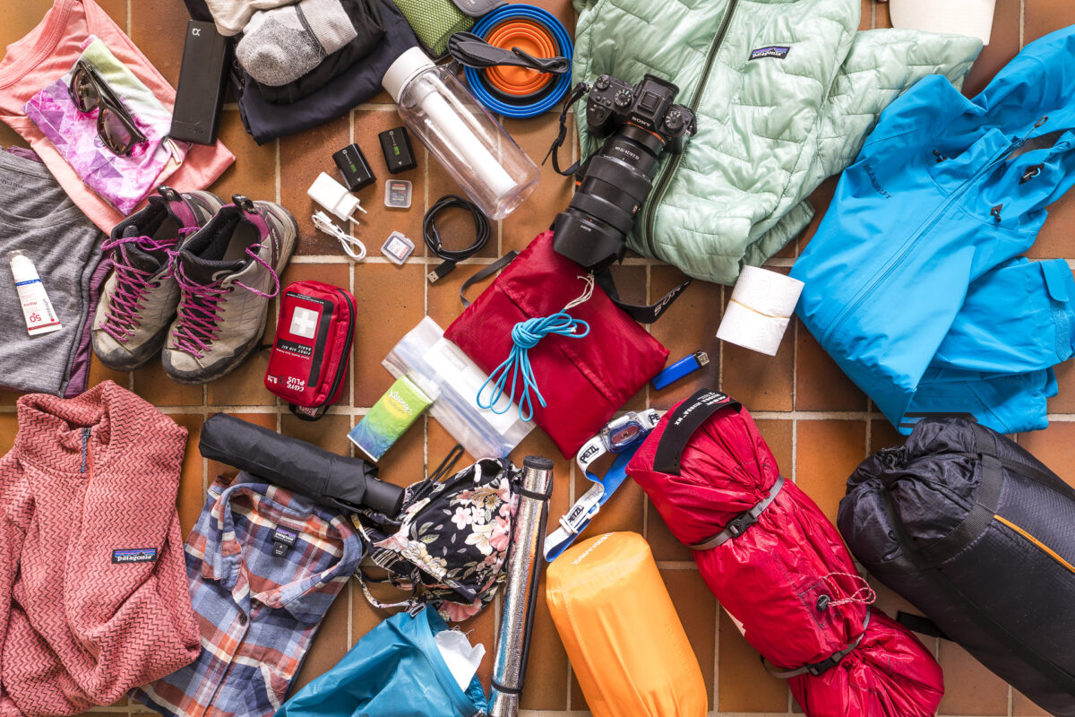
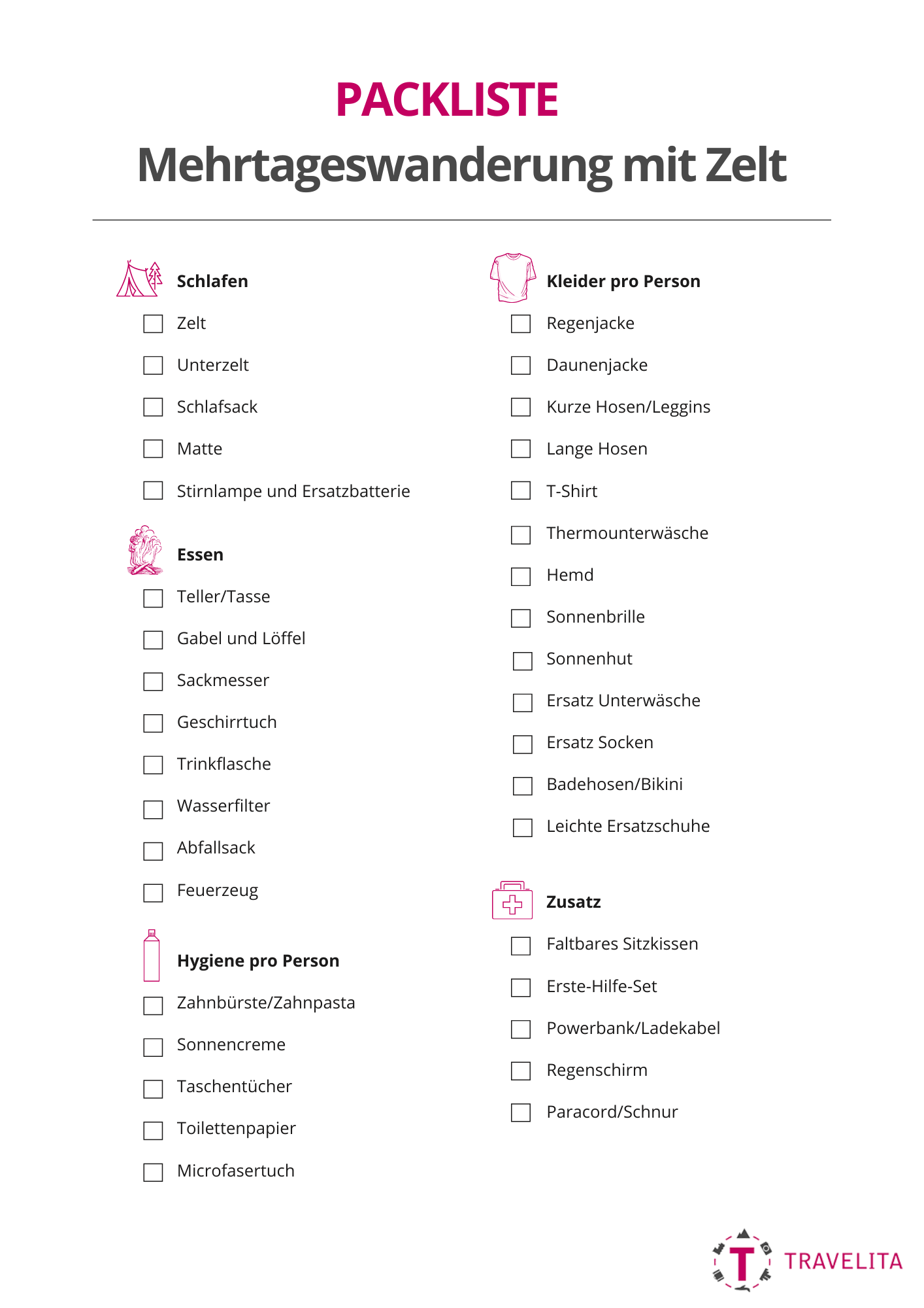
I always get questions about equipment for hiking or equipment for multi-day tours. The following picture shows (with the exception of the food) at a glance what I have packed for this three-day hike with tent. For multi-day hikes, I have been on the road with a Deuter Futura Pro 34 SL for several years. This backpack is ideal for hut tours. However, as soon as you have to carry a tent, a mat and a “real” sleeping bag, this backpack is a bit tight. The friend strapped the tent to his backpack – the rest I carried myself. Further details about the tent, the packing list and the campsites can be found in the FAQ below. And you can find even more impressions of our hike through the Napf region in this post on the blog of Lucerne – Lake Lucerne: great nature experiences in the Napf region – 7 tips for outdoor fans
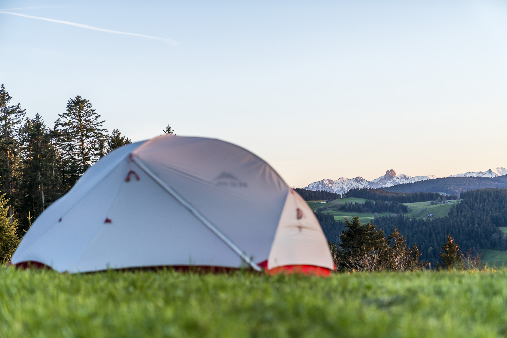
We opted for the ultra-light MSR Hubba Hubba NX2. It weighs 1’540g without additional floor and kept us dry even during the rain.
Since we didn’t want to carry our own gas stove with us, we opted for a basic meal of fruit (apples) and protein bars. In most nomady camps it is possible to make a fire on site (firewood is available). So you can also take everything you can do over the fire with you (e.g. grilled cheese or a cervelat). On the way, you can also stock up on provisions in the farm shops along the way.
For us, a beautiful view was important and accordingly we can recommend all three places visited.
On all marked campsites. in case of doubt, always ask the landowners or the municipality in advance. You can find more information about the rules around camping and bivouacking in this compilation from the SAC.
The following graphic lists the most important components of a packing list for multi-day tours with tents/camping trips. Depending on the season, the packing list varies (in spring maybe pack a buff or hat and gloves – in midsummer leave out the thermal underwear).

Leave a Reply