

Eiger Trail – hike at the foot of the Eiger north face
Where did you get all your excursion ideas from? It’s a question I’m often asked, and if I remember correctly, I don’t really know the answer to it. The fact is that every excursion is an inspiration for further excursions. Just looking at the hiking trail signs usually gives me ten new ideas for a “next time”. And that’s exactly how the Eiger Trail crept onto my bucket list of Swiss excursion destinations during my first summer trip to the Jungfrau region four years ago (hey, how time flies – crazy!). Last Saturday we finally tackled this hiking classic between Kleine Scheidegg and Grindelwald.
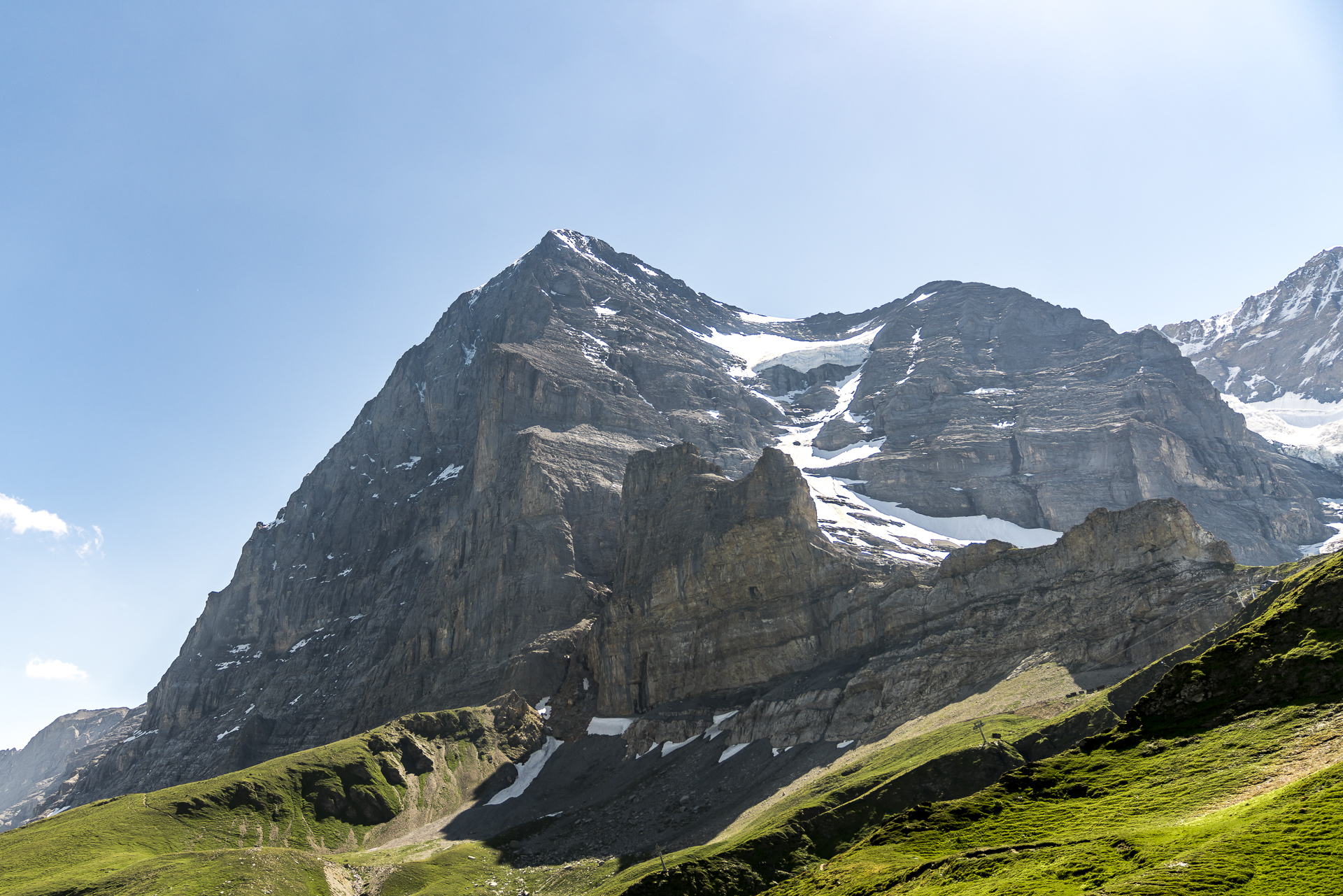
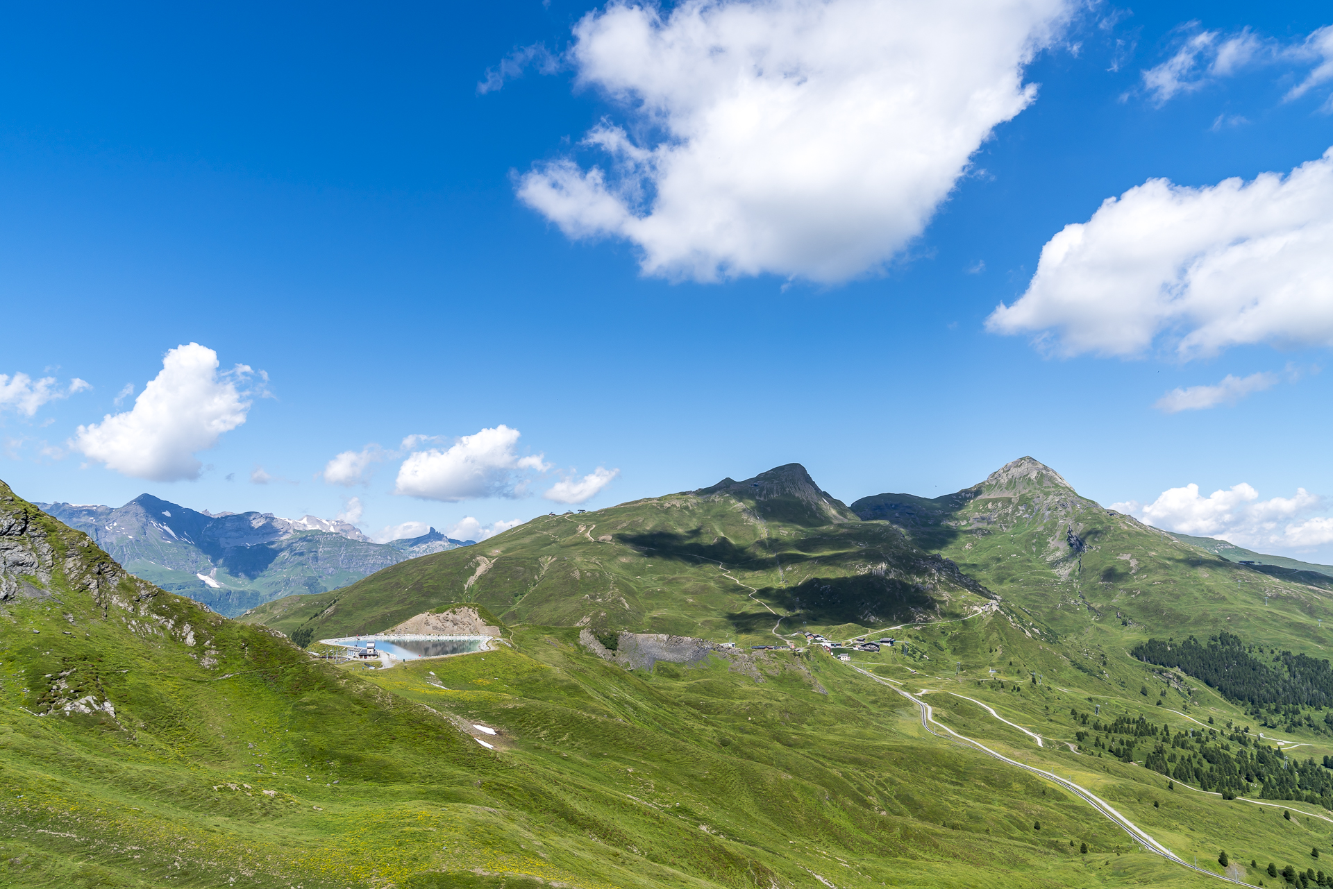
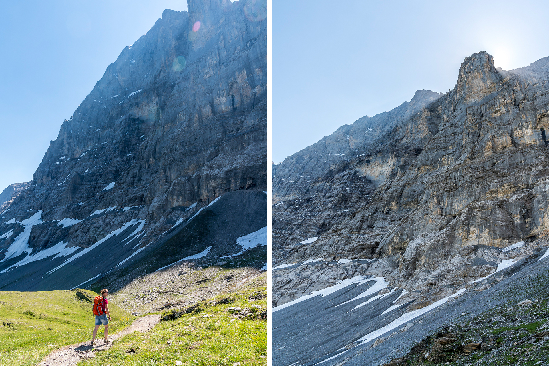
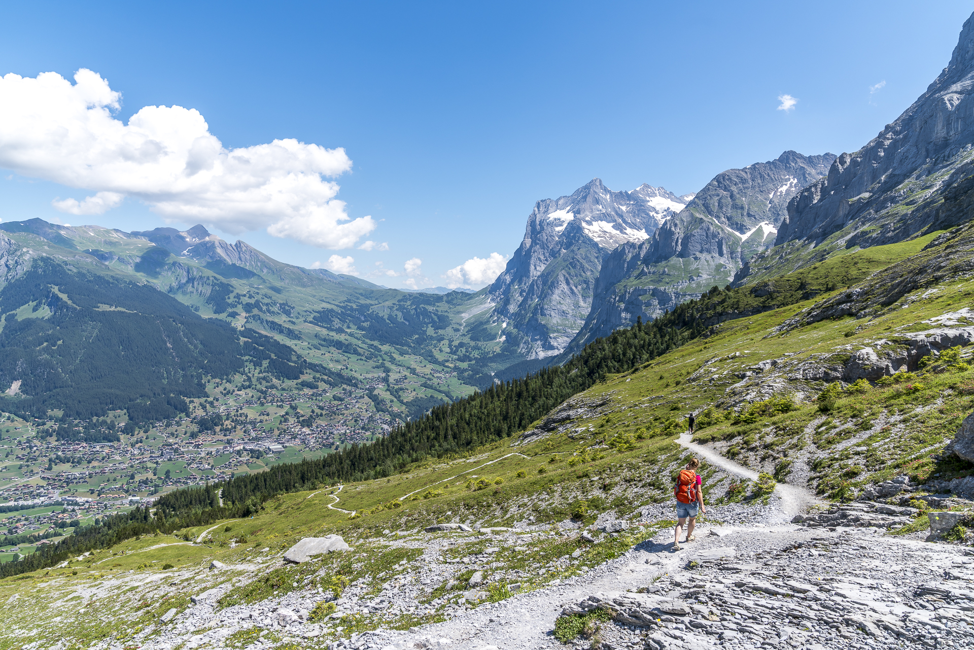
On no other hiking trail can you get as close to the notorious Eiger North Face as on the Eiger Trail. The alpine route hike leads directly at the foot of the almost vertically rising rock massif from the Eiger Glacier station in the direction of Grindelwald. Depending on your mood and knee ability, the hike can be completed in both directions. We start the Eiger Trail directly on the Kleine Scheidegg. To get to the Eiger Glacier station, we would have to change from the Wengeneralpbahn to the Jungfrau Railway anyway and instead of waiting for the connecting train, we prefer a few additional meters of altitude to warm up. After a good 15 minutes, we reach the artificially created reservoir at the Fallbodenhubel halfway to the Eiger Glacier. The doors of the transformer station next to it, labelled “Entrance”, arouse my curiosity. Although at first glance I don’t see any indication of what awaits me inside the old transformer station, I take a look inside. A good decision! The former transformer station of the Jungfrau Railway has been converted into a small museum, which, as part of the Eiger Walk (a 2-kilometre-long path between Kleine Scheidegg and the Eiger Glacier), takes up the theme of crossing the north face of the Eiger. It is worth planning a short stop here.
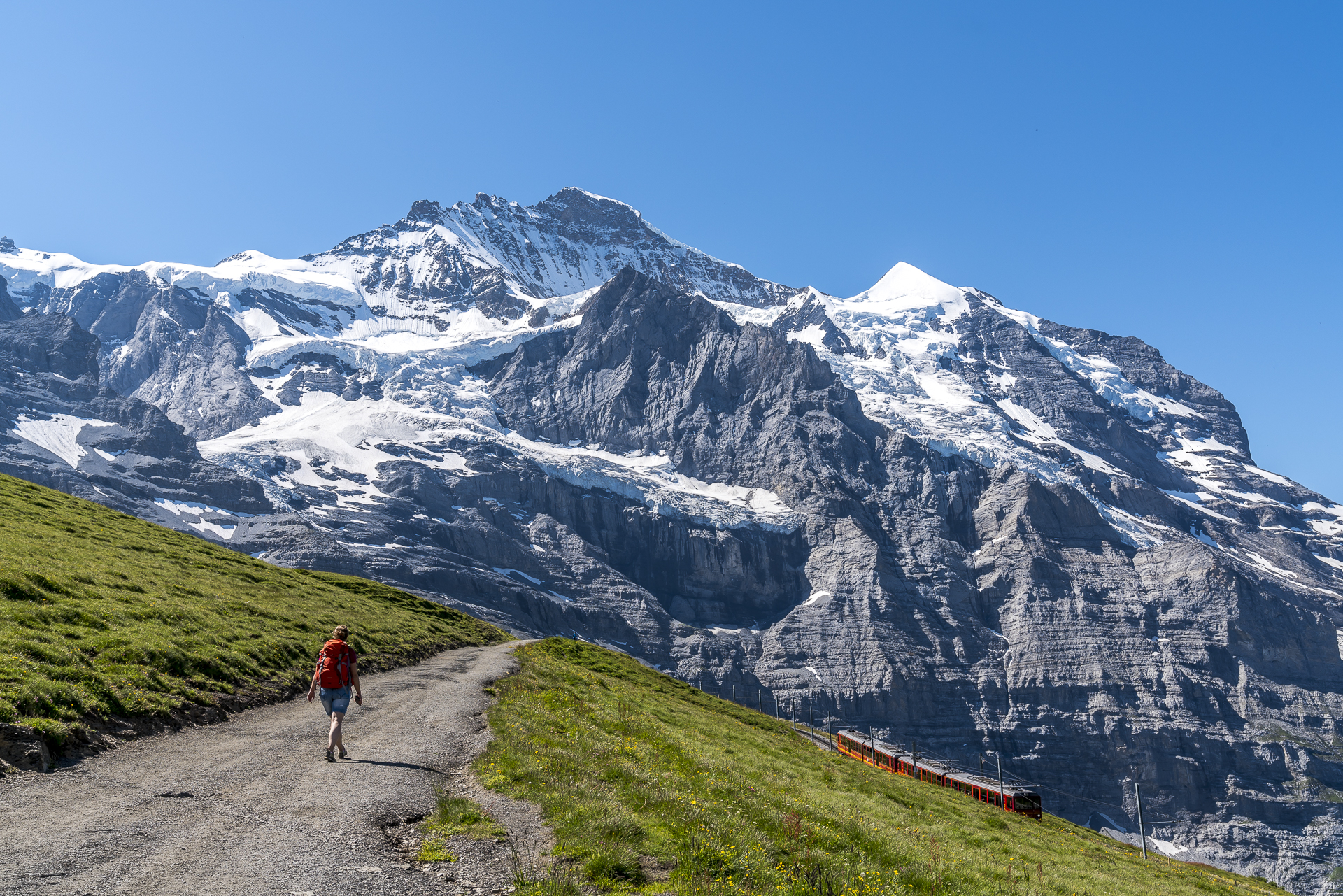
Directly behind the reservoir, the route seems unclear to us for a short moment and after a short check on the hiking map, we follow a path along the edge of the slope towards the Eiger north face. With this shortcut, we save ourselves a few meters in altitude, as we now meet the Eiger Trail instead of “grinding” via the Eiger Glacier. The Eiger Trail is one of the most popular hikes in the Jungfrau region and accordingly we are not alone here on a beautiful summer’s day. Overall, however, the crowd of people is limited and we can maintain our marching rhythm undisturbed.
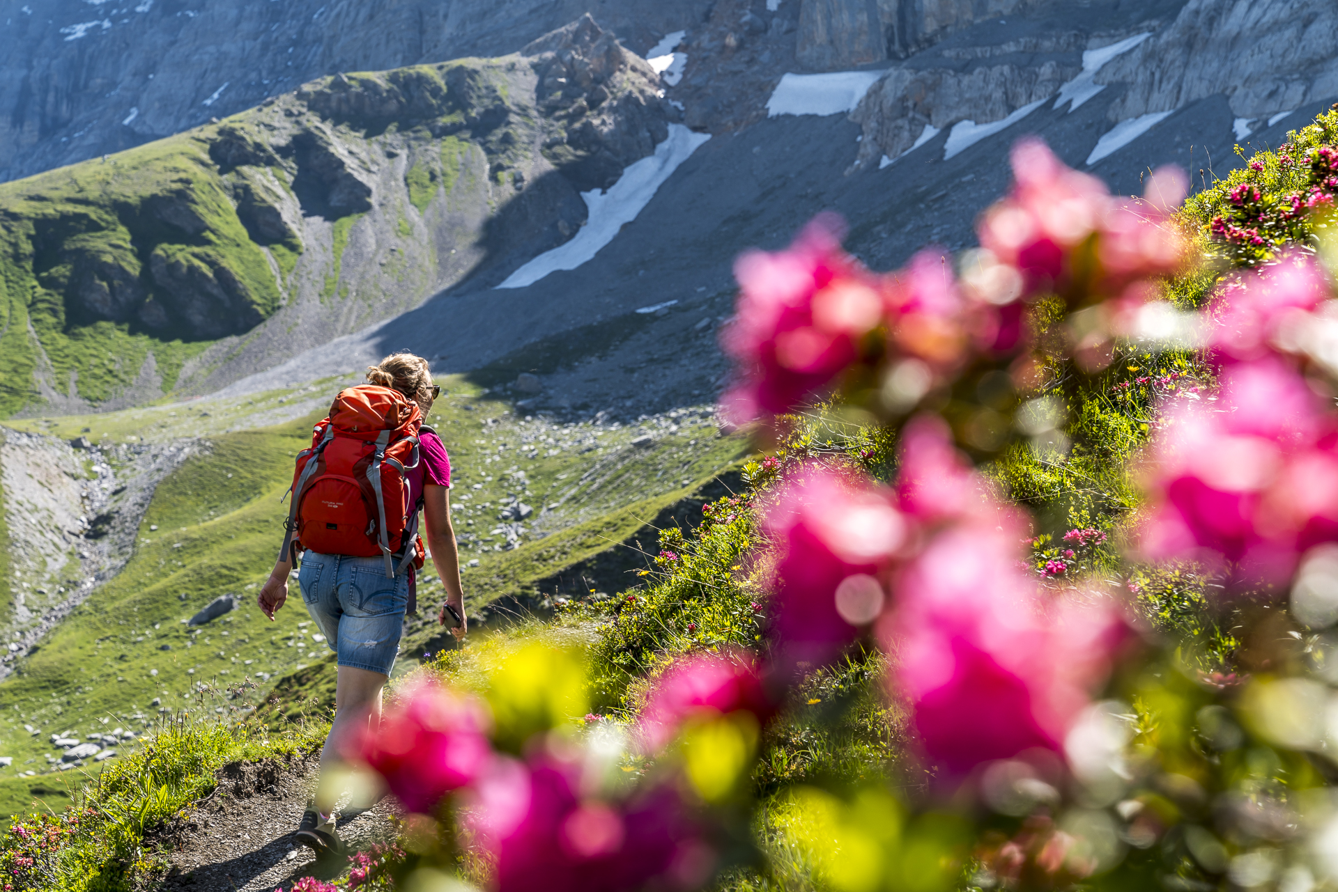
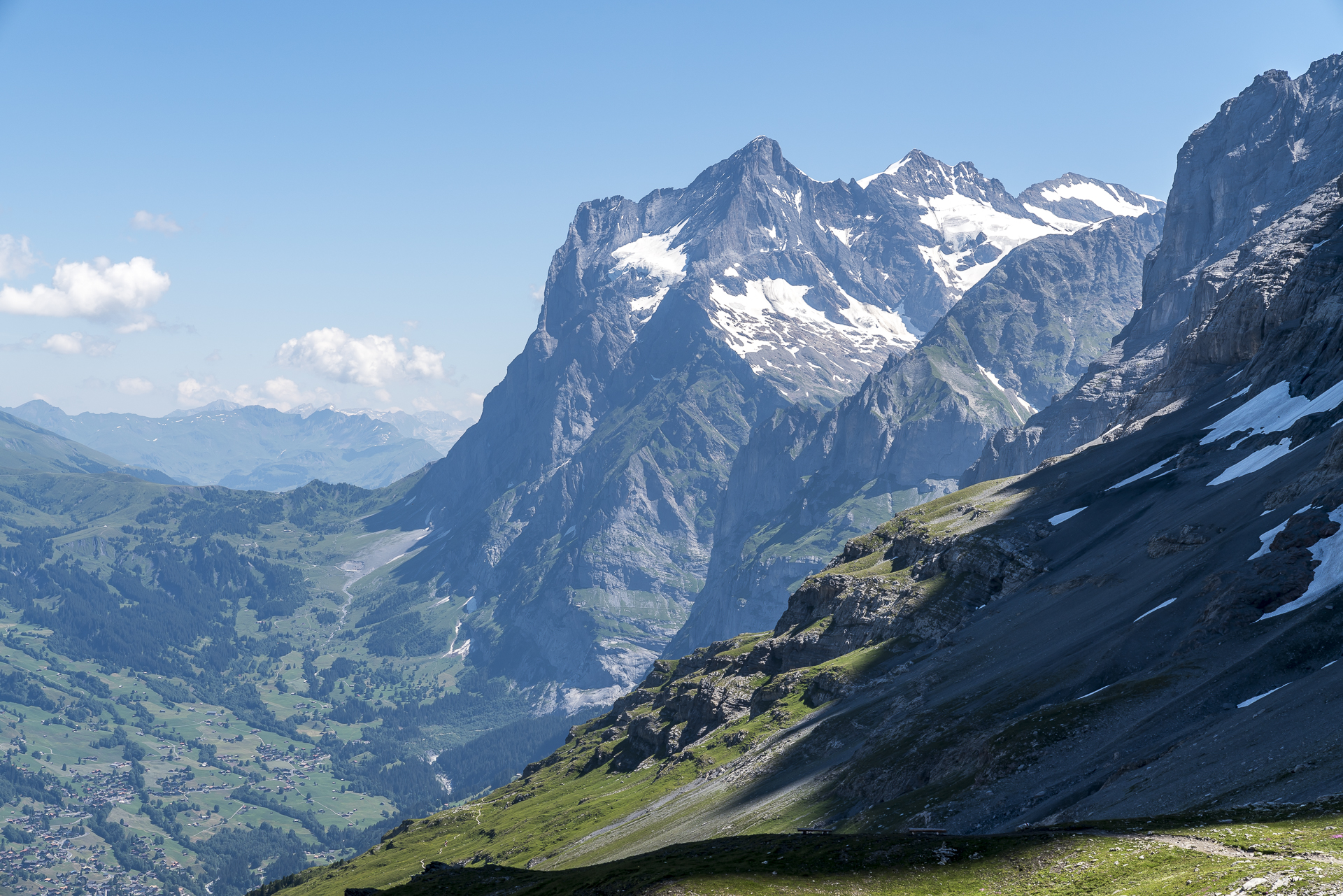
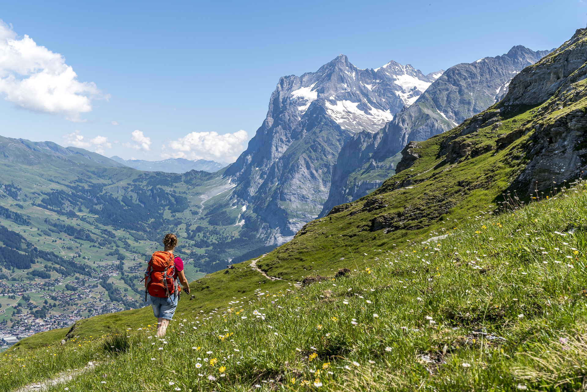
At the entrance to the Eiger-Rotstock via ferrata (this excursion idea has now replaced the Eiger Trail on my bucket list), we take a short break and admire the beautiful panorama from the Kleine Scheidegg over the Lauberhorn, Männlichen and the Grindelwaldtal to the Grosse Scheidegg and the Wetterhorn. Afterwards we watch the hustle and bustle on the via ferrata for a while. I’m still pretty scared of via ferratas, but I’d like to take on the challenge again…
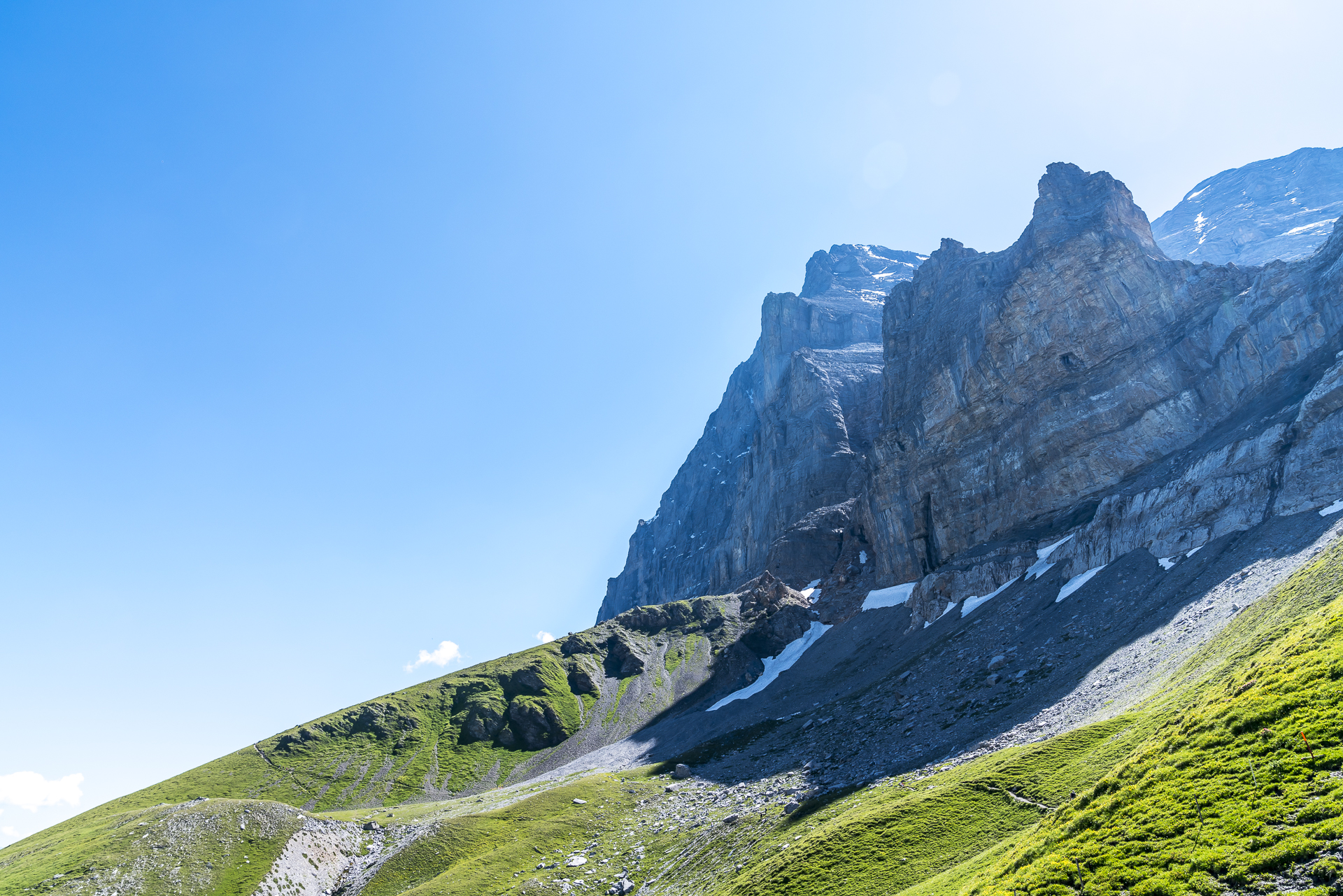
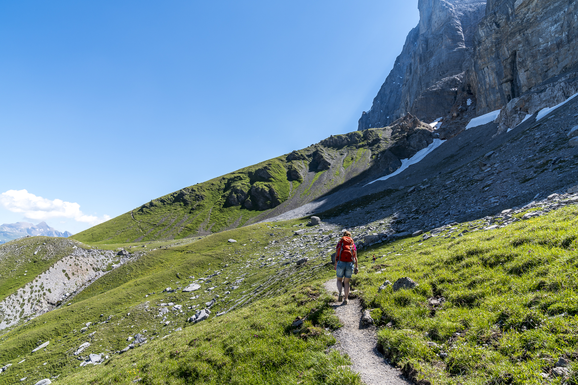
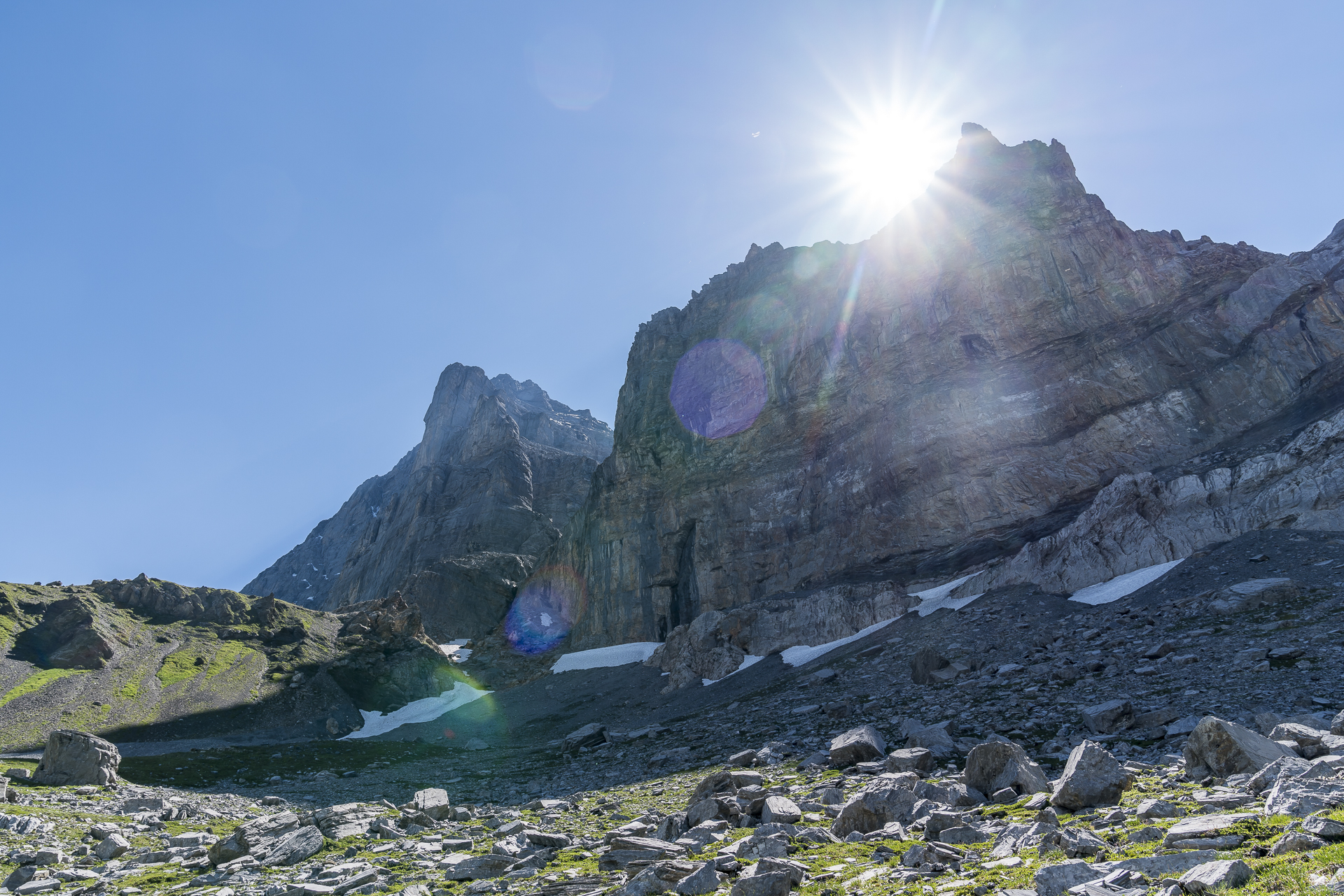
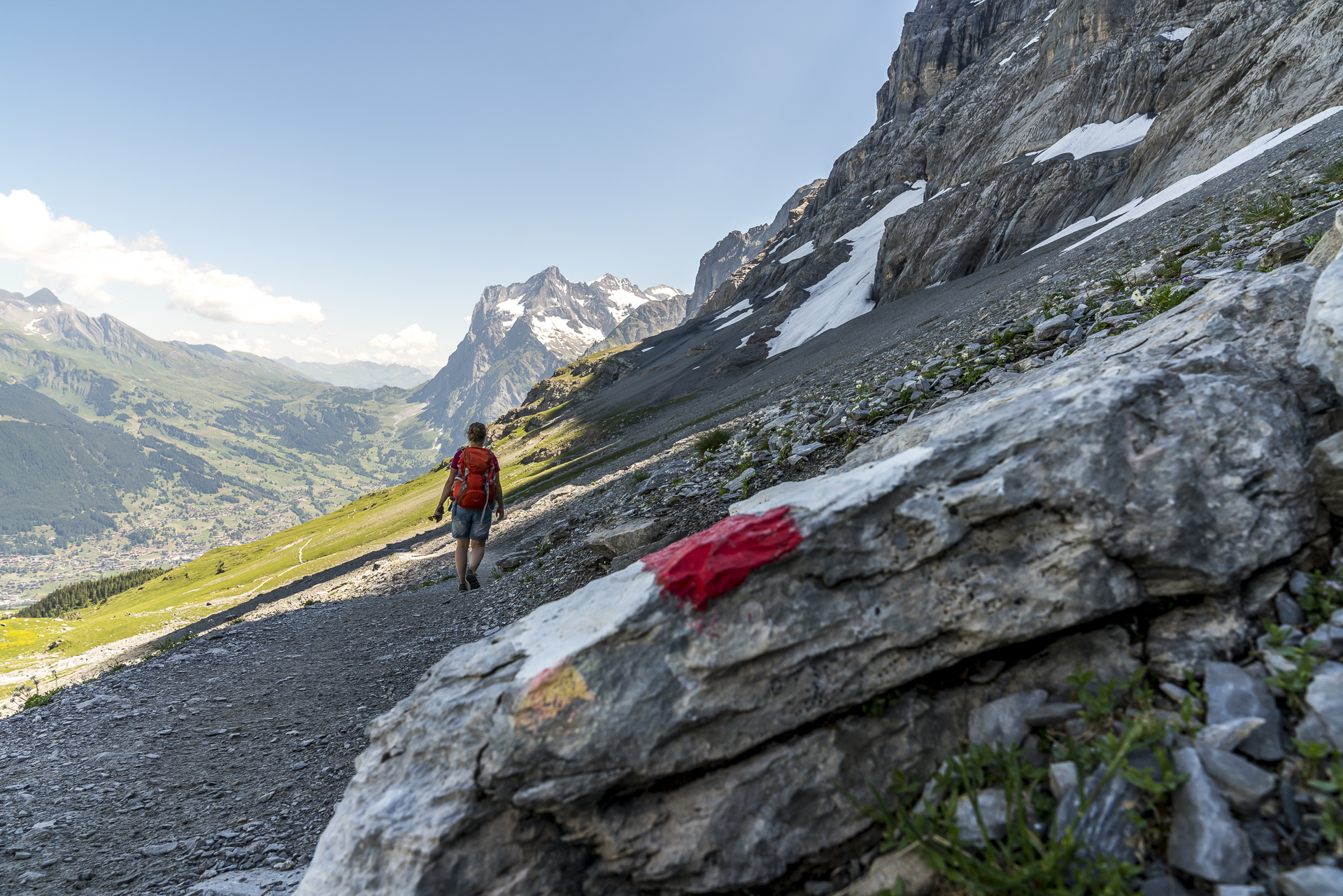
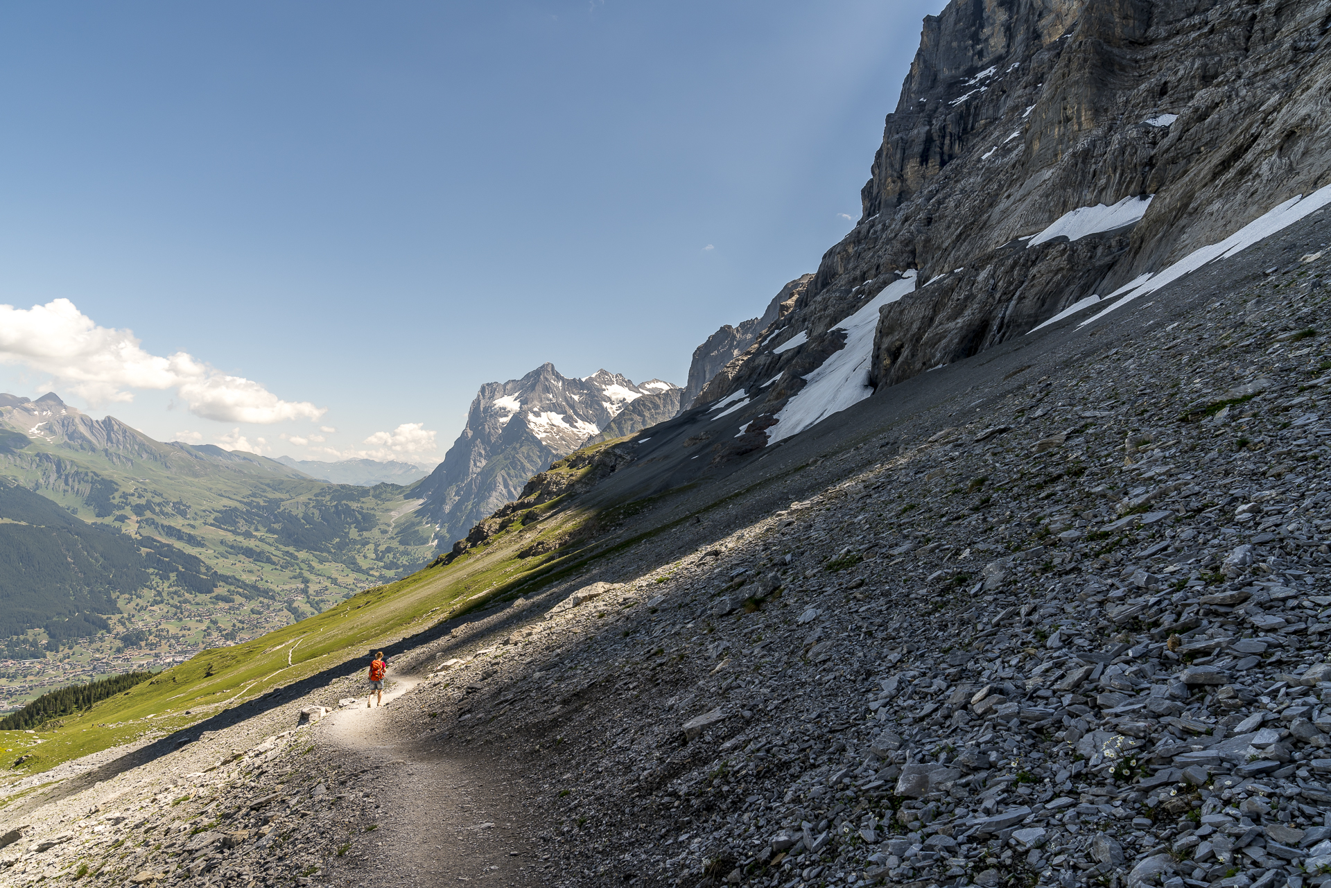
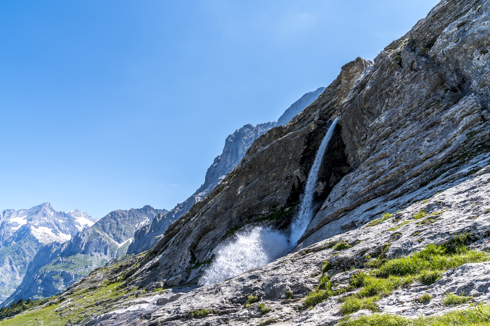
From now on, it’s all downhill. In the shady scree fields at the foot of the north face of the Eiger, we still encounter isolated snowfields – partly a right-wing slide. Due to the shady location, I recommend not tackling the Eiger Trail too early in the hiking season. We pass the roaring sand stream, which has dug deep into the rocks, and then follow the steep path down to Alpiglen. Alternatively, there is the possibility to continue hiking to the glacier gorge at Sandbach – according to my parents, a beautiful and much less frequently used route compared to the Eiger Trail. With this additional loop, the running time is extended by a good 2.5 hours to Grindelwald Grund.
Practical information about hiking on the Eiger Trail
The route of the Eiger Trail can be found on the map below. We adapted the route slightly and started on Kleine Scheidegg – the Eiger Trail in its original version leads from the Eiger Glacier station to Alpiglen, although it should be noted that the route has currently been slightly changed due to construction work for the V-Cableway (for current information consult the website of the Jungfrau Region).
The distance from Kleine Scheidegg to Alpiglen is 7.2 kilometres. An ascent of 270 meters in altitude and a descent of 715 meters in altitude have to be overcome. If you want to protect your knees, you can start the hike in Alpiglen and hike uphill. The pure running time for the downhill variant is 2.5 hours. Kleine Scheidegg and Alpiglen can be reached with the Wengeneralpbahn either from Lauterbrunnen or from Grindelwald.
Leave a Reply