

Titlis: Cooling off in summer – ice grotto and hiking
Advertising – this article on the Titlis was created in cooperation with SBB RailAway
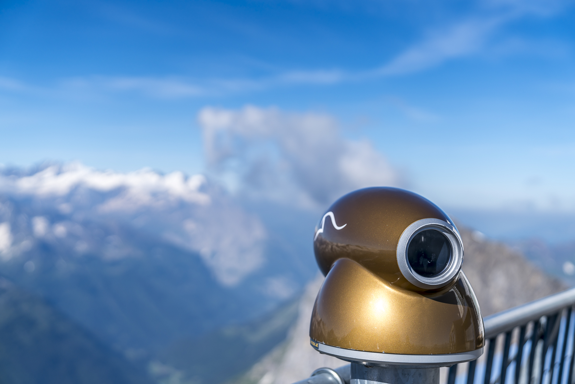
With an impressive height of over 3,000 metres above sea level, Mount Titlis claims the title of the highest excursion mountain in Central Switzerland. At the same time, it is one of Switzerland’s tourist summit classics. It not only promises a magnificent view, but also offers a welcome cooling on scorching hot summer days. In the ice grotto on the summit, it is constantly minus one degree cool. Afterwards you will appreciate the warming rays of the sun again. But the Titlis is also a “Heimlifeisser” summit. While the sun is shining from a cloudless sky around the summit, on some days the few clouds cling so stubbornly to the summit that a thick fog supper awaits you at the top instead of the magnificent panorama. A mishap that can be prevented with a short, prior check on the webcam.
In cooperation with SBB RailAway, we will be able to do what we enjoy in August – visit four fantastic Swiss mountain peaks and report on them. After visiting the Pilatus near Lucerne and the Männlichen in the Bernese Oberland, we have set our sights on the highest excursion mountain in Central Switzerland as our third summit.
At 10 m/s at 3,000 m above sea level.
The webcam check shortly after 5 o’clock in the morning gives the green light; we don’t see a single cloud that could get in the way of the panoramic view. For me, this is my Titlis summit premiere today. Even though the Central Swiss excursion mountain is one of the classic tourist destinations, I have never made it further than the first of the two intermediate stations to the summit in good weather. The Zurich – Engelberg route takes less than two hours by train with a single change in Lucerne. Once again, we are on the road early and reach the valley station in Engelberg shortly before the start of operations.
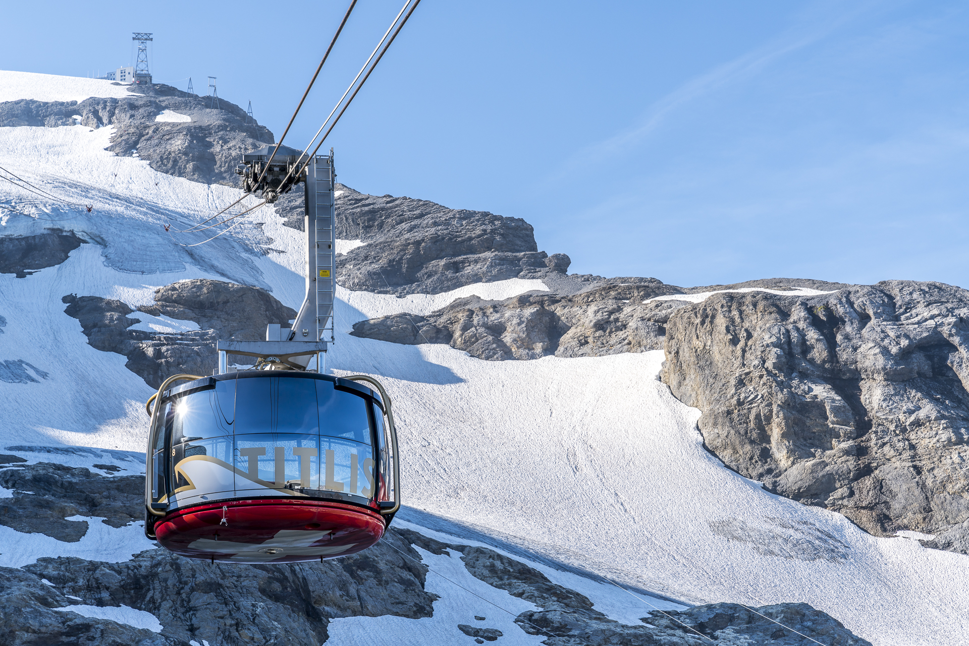
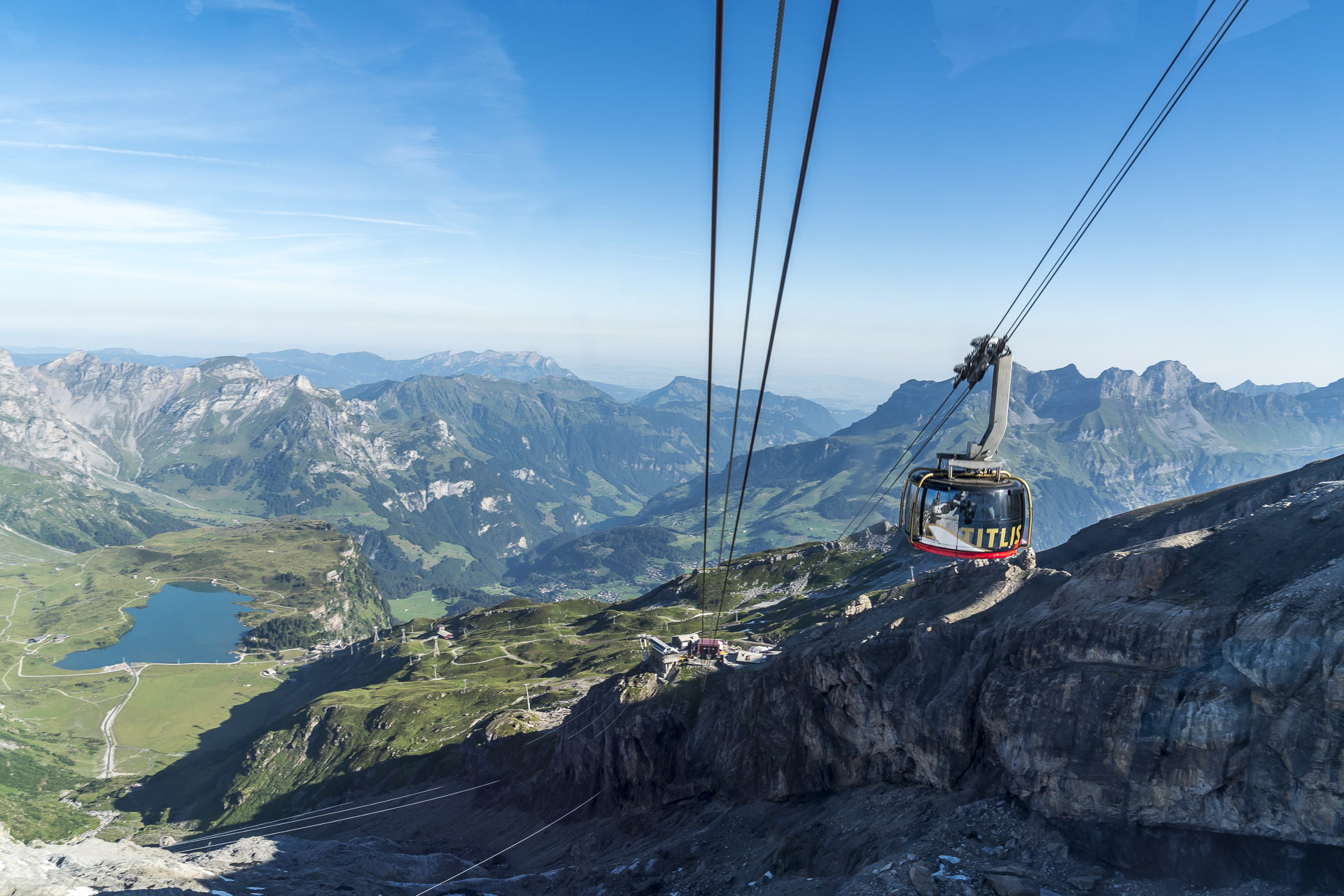
An ideal time – in addition to us, there are only a few hikers on site, who later get off at the intermediate station Trübsee and from there tackle the popular 4-lake hike in the direction of Melchsee-Frutt. We stay in the Titlis Express and continue to the station Stand. Fortunately, the windows of the 8-seater gondola lift can be opened. This allows us to capture the impressive panorama of the high plateau with the Trübsee on one side and the ever-approaching snow-covered Titlis on the other side without disturbing reflections with the camera.
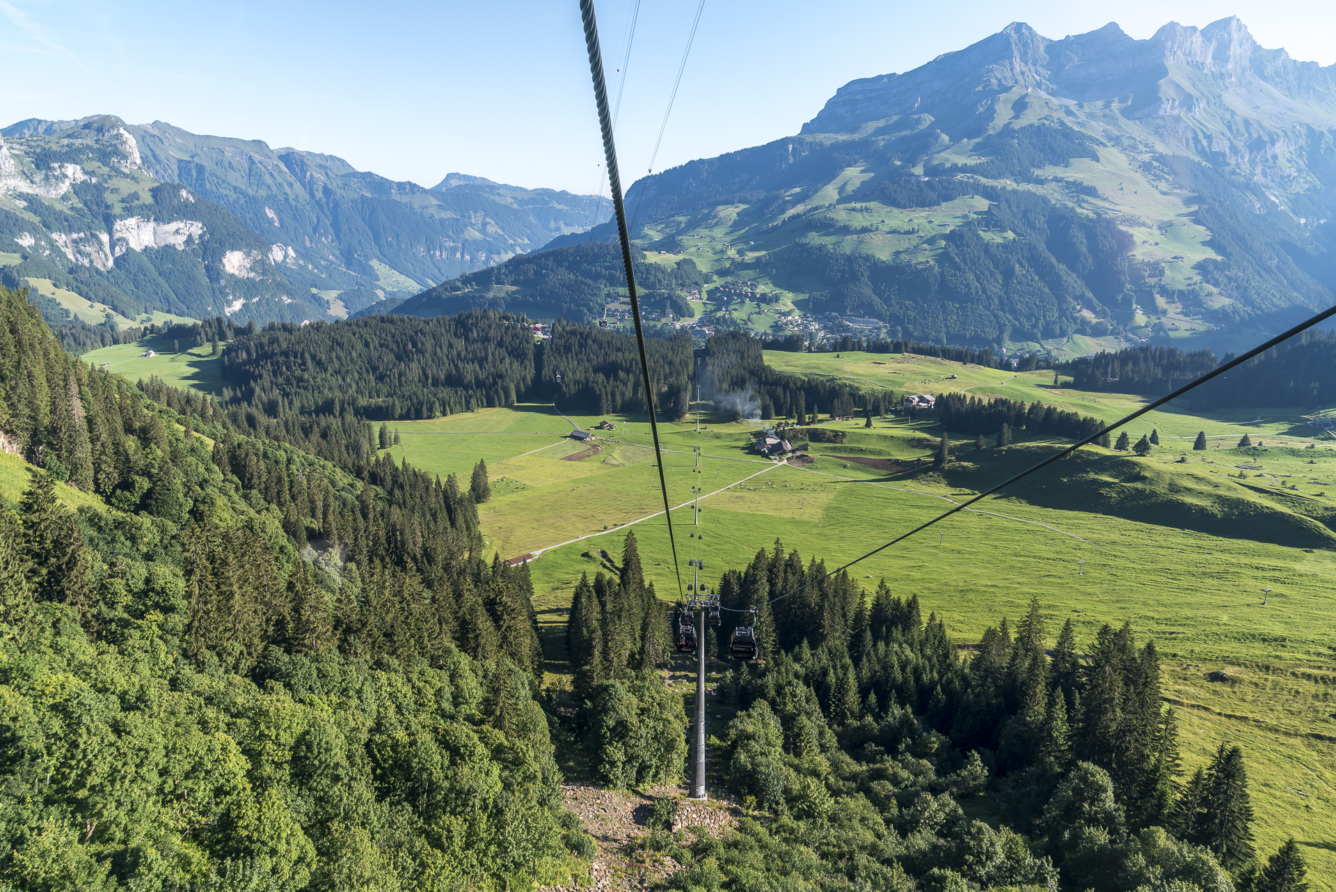
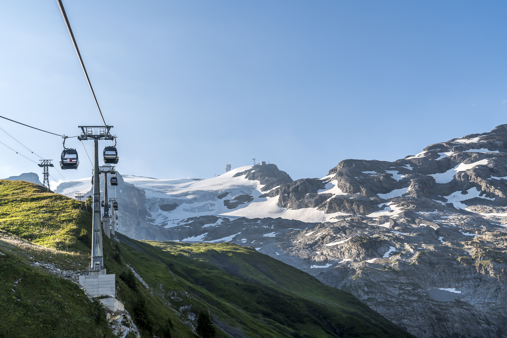
At the Stand station, we change to the Rotair cable car. While there is a big rush here less than an hour later, we only have to share the gondola with three Titlis employees. A luxury! The rotating movement of the gondola guarantees a 360° panorama of the surrounding mountains, even when fully occupied. During the five-minute ride, the gondola rotates exactly once on its own axis. It’s only when we cross the gondola heading down the valley that I realize how fast we are going. “8 m/s,” the cable car operator answers the question about the speed in the “driver’s cab” and adds, “depending on the crowds, the speed is increased up to 10 m/s”. Really impressive and, above all, almost impossible to capture a good picture of the descending gondola unprepared. Fortunately, we have a second chance in the downturn.
Sub-zero temperatures in the ice grotto and 360° alpine panorama
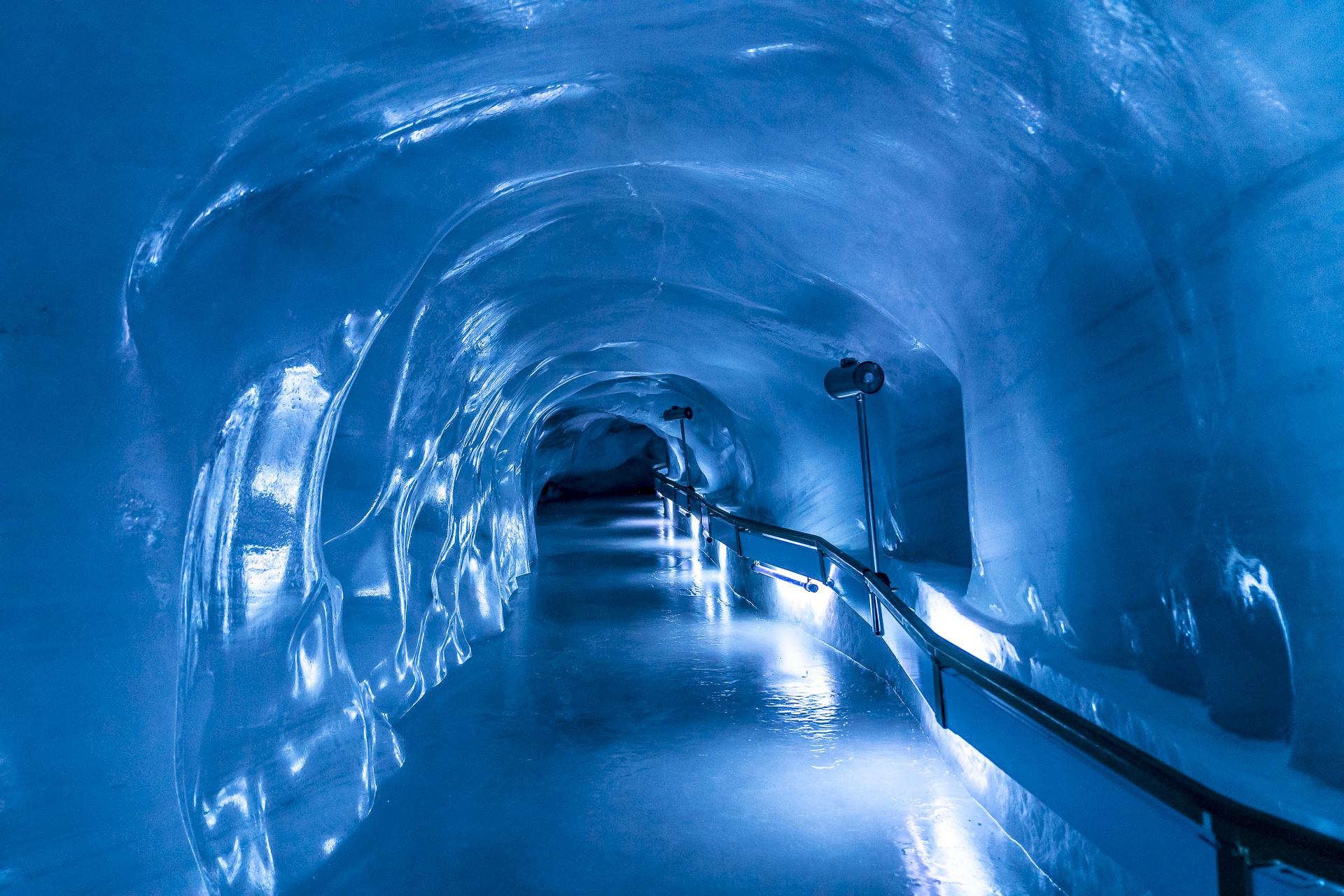
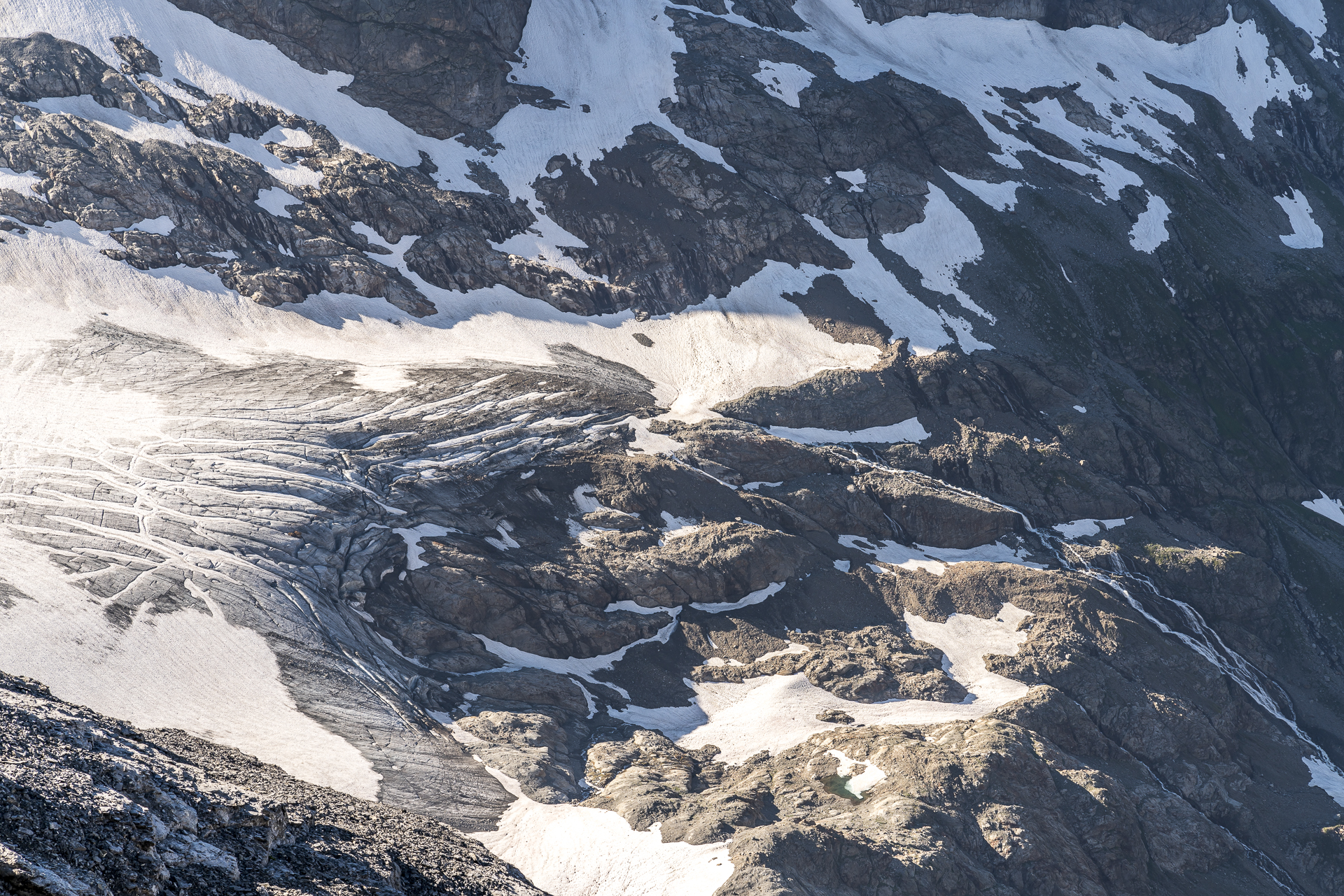
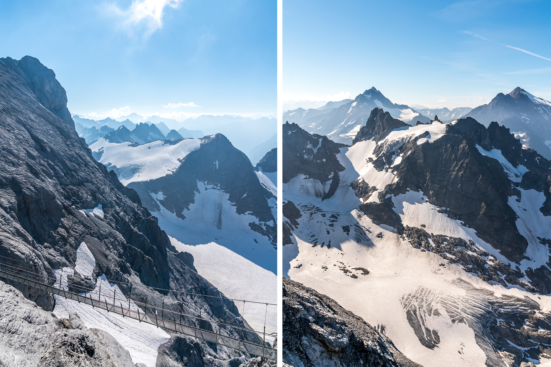
The thermometer reads 11 degrees when we arrive. For us, the longed-for cooling, but the Titlis glacier is also groaning under the persistently hot summer temperatures. The coolest place on Mount Titlis is the 150-meter-long ice grotto and that’s exactly what we’ll look at first.
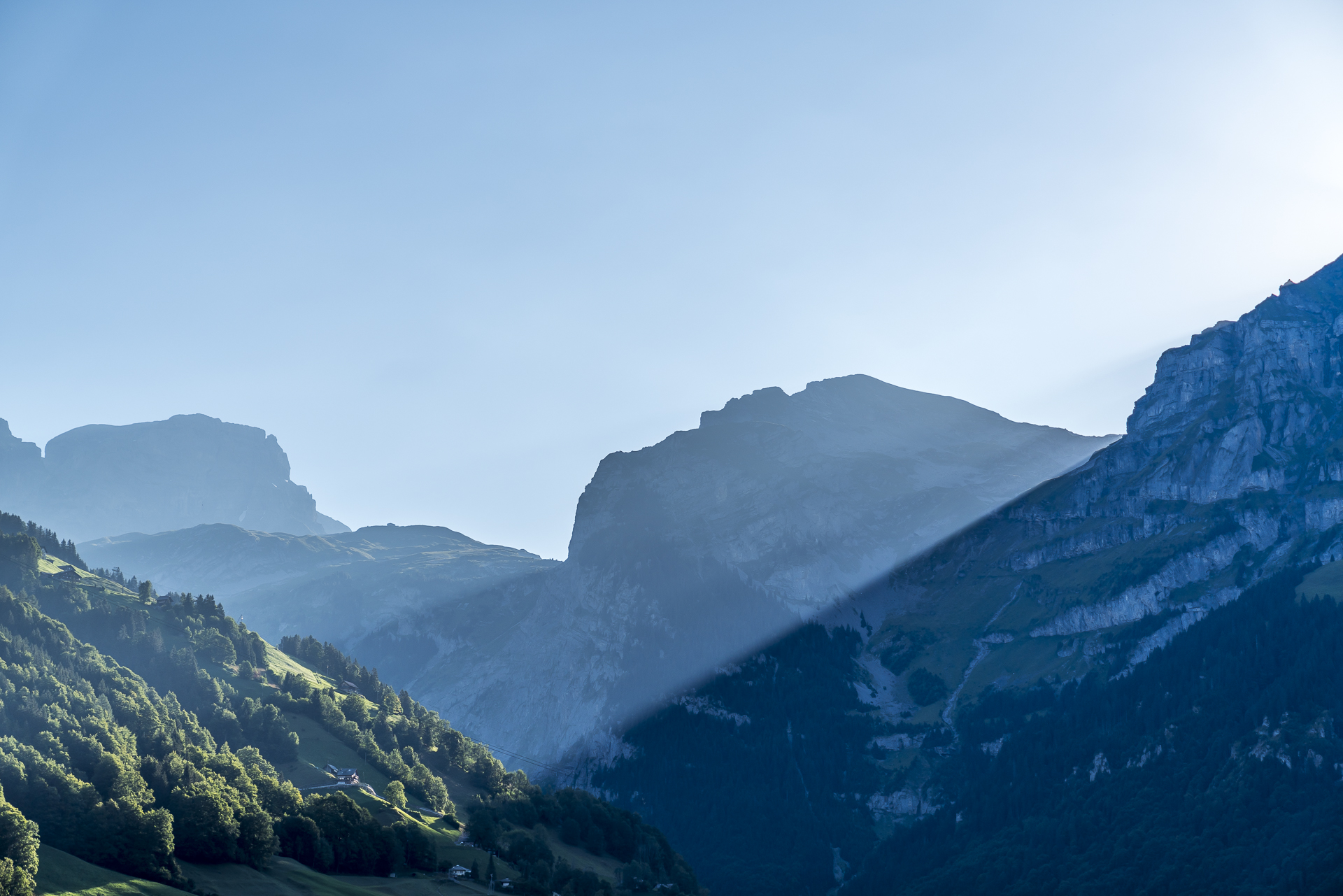
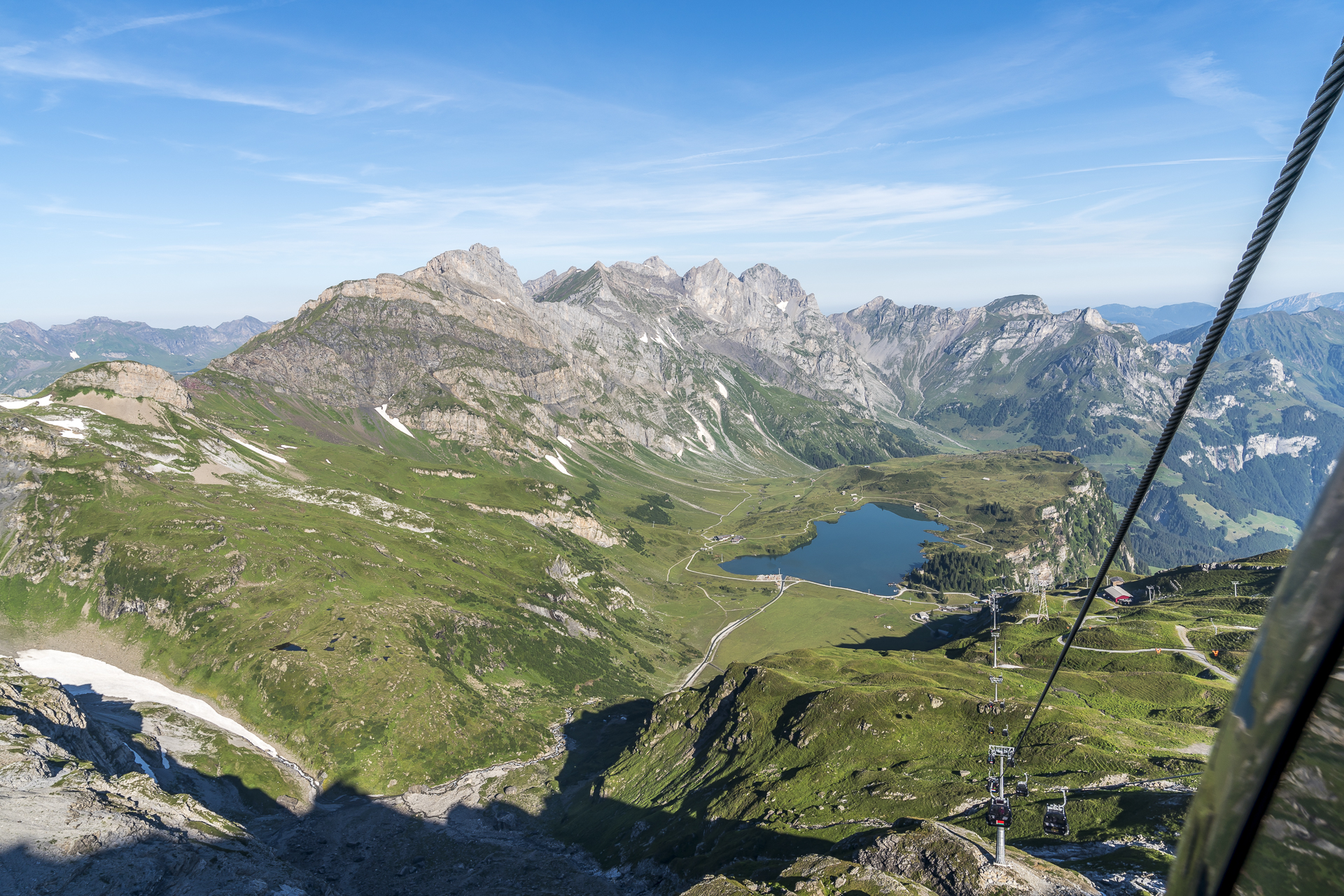
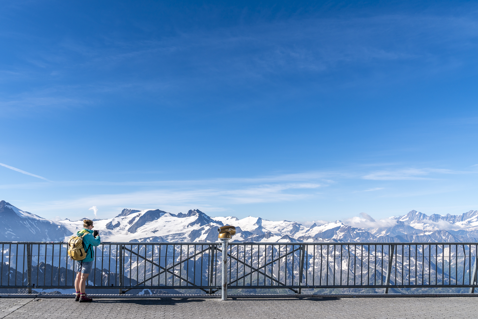
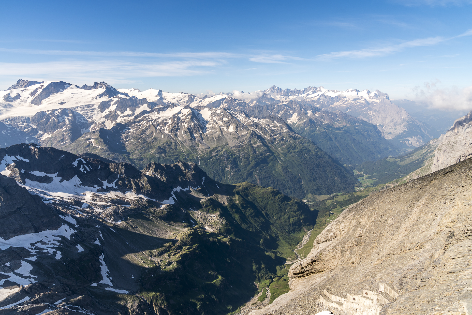
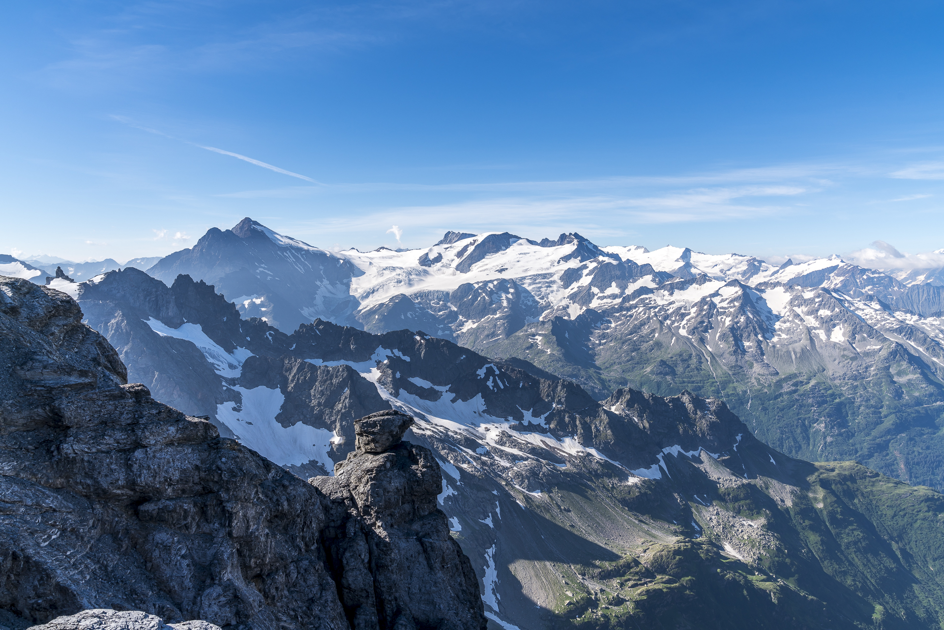
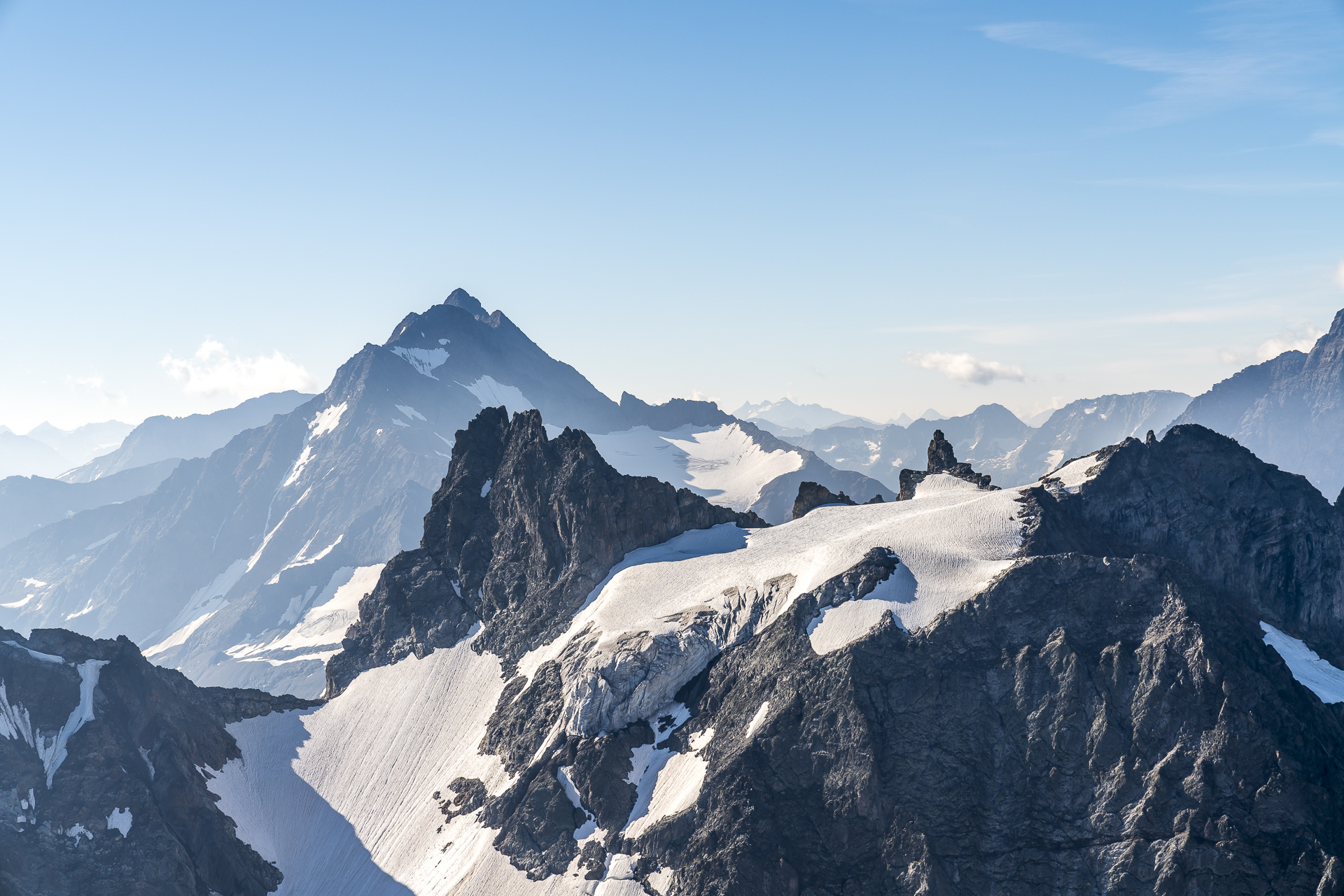
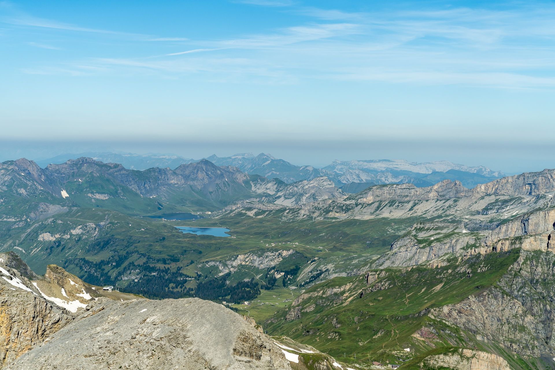
Three floors up, a phenomenal Alpine panorama awaits us on the roof terrace. In contrast to the Bernese Oberland, I can’t name any of the striking peaks here at first glance – but the scenery is no less impressive.
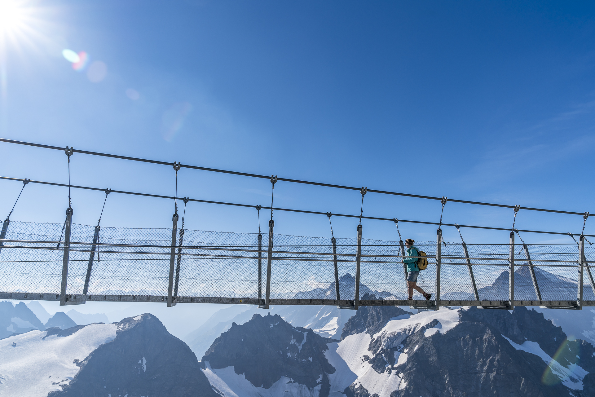
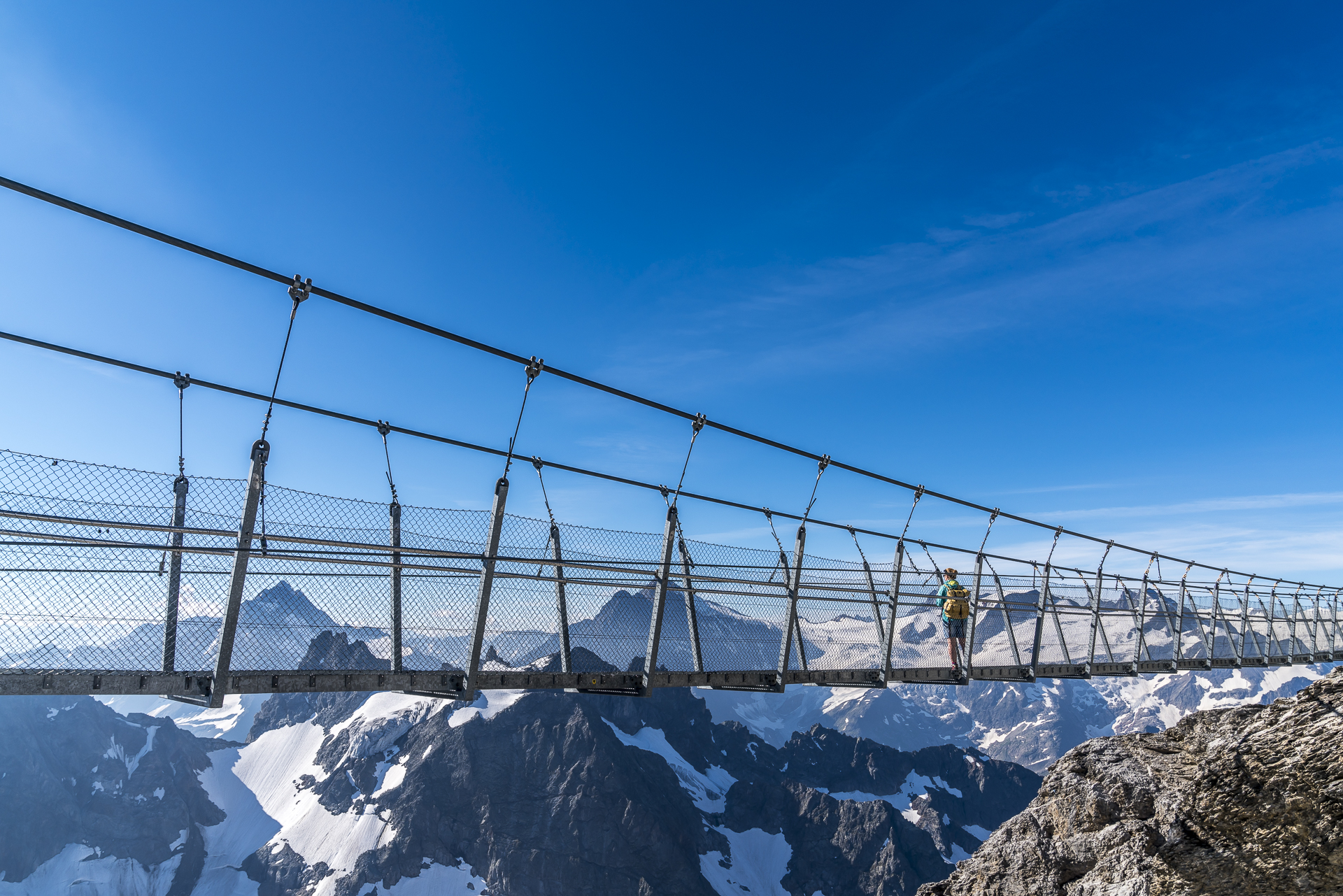
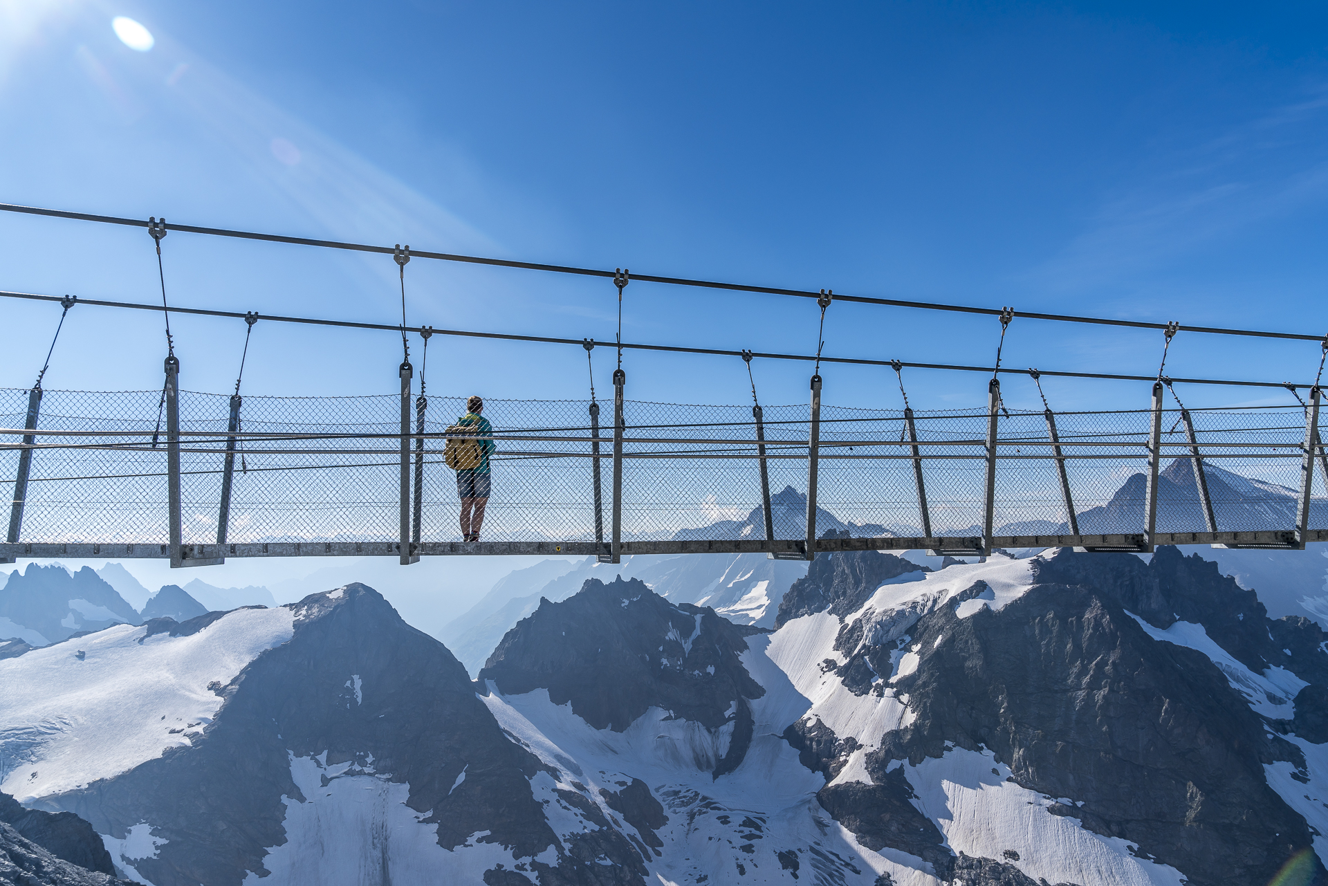
We walk from the roof terrace over the snow via the “Ice Flyer” chairlift towards the Cliff Walk. The suspension bridge is one of the main attractions on the summit and is the record holder – it is considered the highest suspension bridge in Europe. For me, in combination with the view, it is clearly the highlight of the summit visit!
Short hike at the stopover at the Trübsee
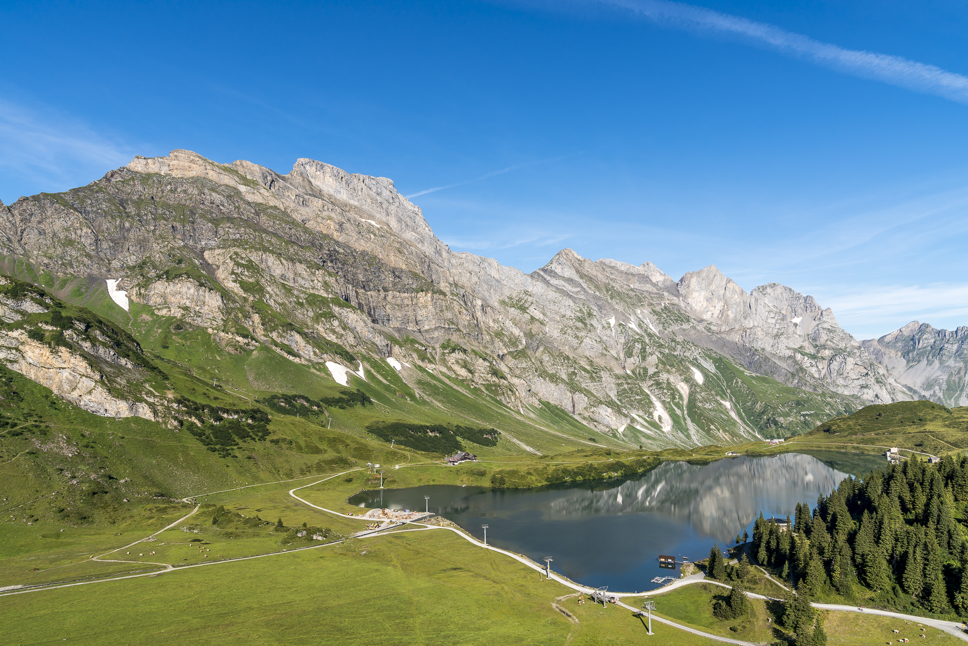
If you fancy a short hike in the heights, you can hike from the Titlis mountain station on a groomed path to the “Stotzig Egg” viewpoint (about 40 minutes). After a coffee break in the summit restaurant, we decide to make a stop at the Trübsee instead and walk around it in about an hour. Fortunately, the ticket allows for this flexibility. The view through the glass pane of the Rotair in the direction of Engstlensee and Melchsee awakens the wanderlust in me on the descent. Basically, the detour to the Titlis can easily be combined with a subsequent hike from Trübsee over the Jochpass in the direction of Engstlenalp / Melchsee-Frutt.
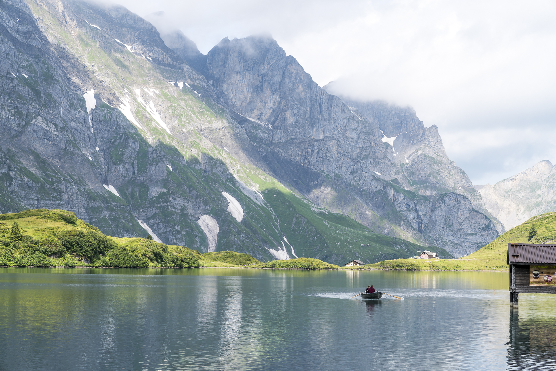
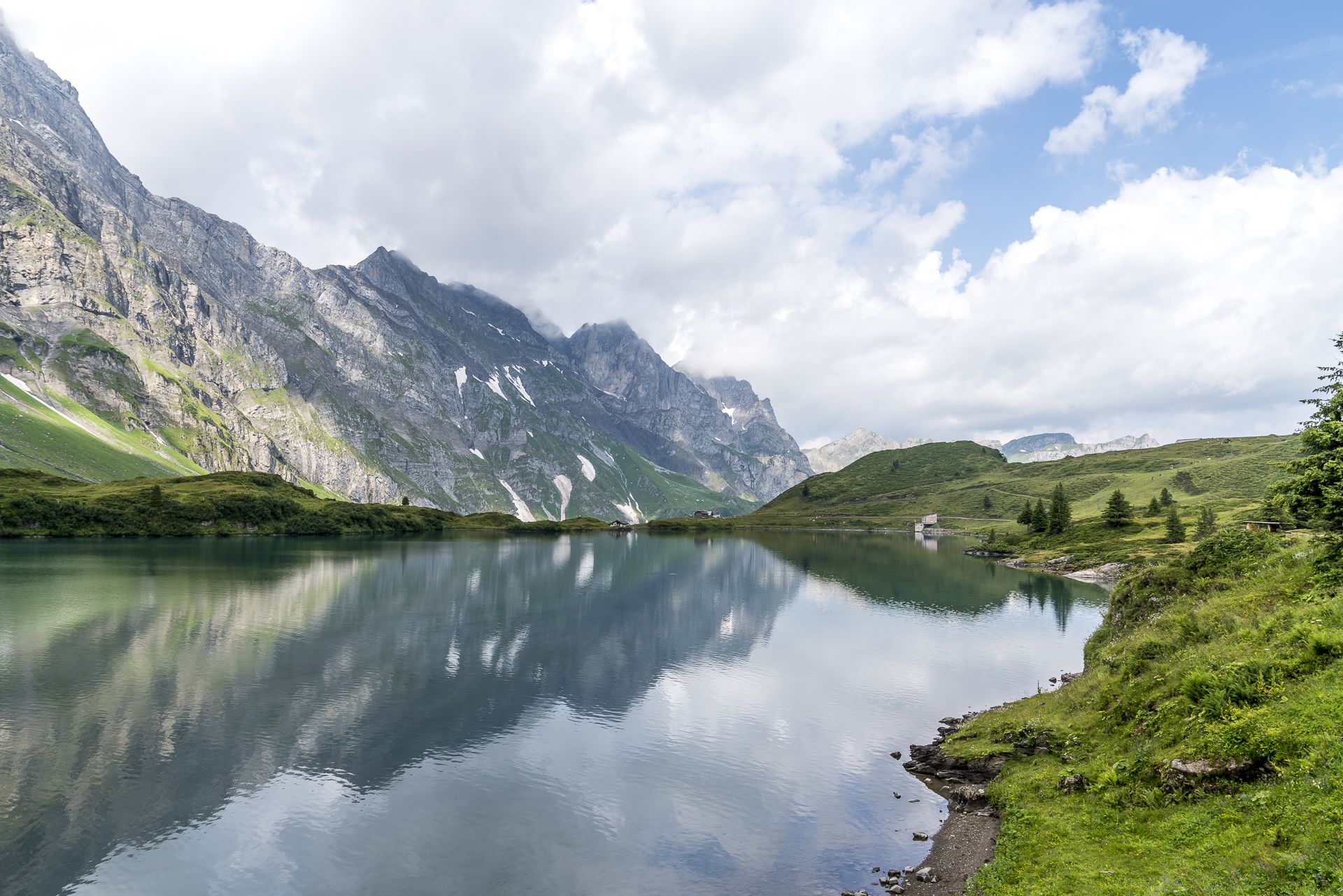
We leave it with the original plan and walk on a wide gravel path to the shore of the Trübsee. The short loop around the Trübsee does not have any significant inclines and is not stingy with beautiful photo motifs. If you still have energy left, you can work out on one of the five rowing boats. These are freely available (with a contribution to expenses of 10 CHF per hour, you contribute to the maintenance). Back at the cable car station, the inviting-looking sun terrace of the Trübsee Bar-Lounge promises enjoyable hours. I would have liked to try the Trübsee-Plättli here, but unfortunately the serviced service of the sun terrace is not set up for morning guests.
Delicacies for the way home
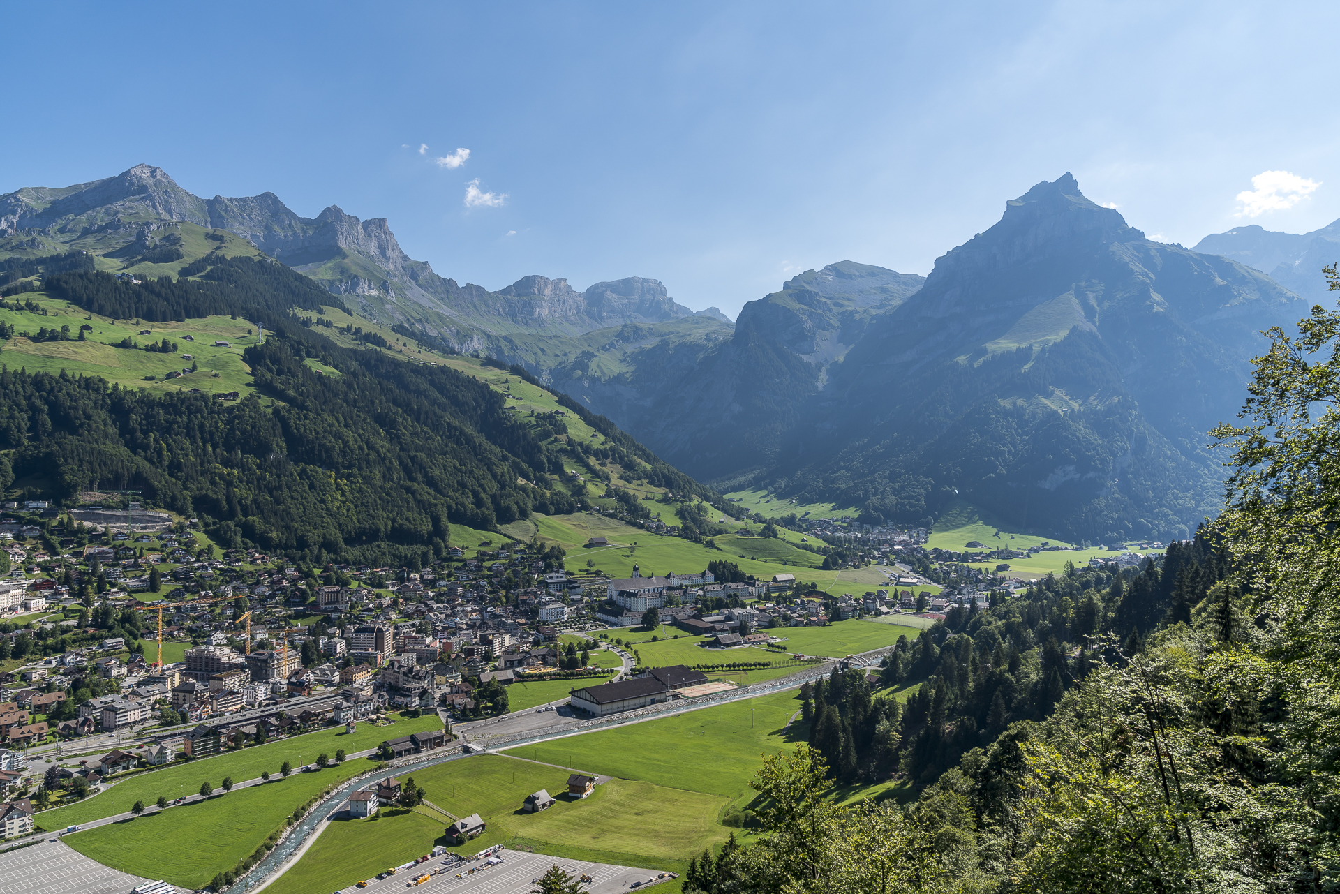
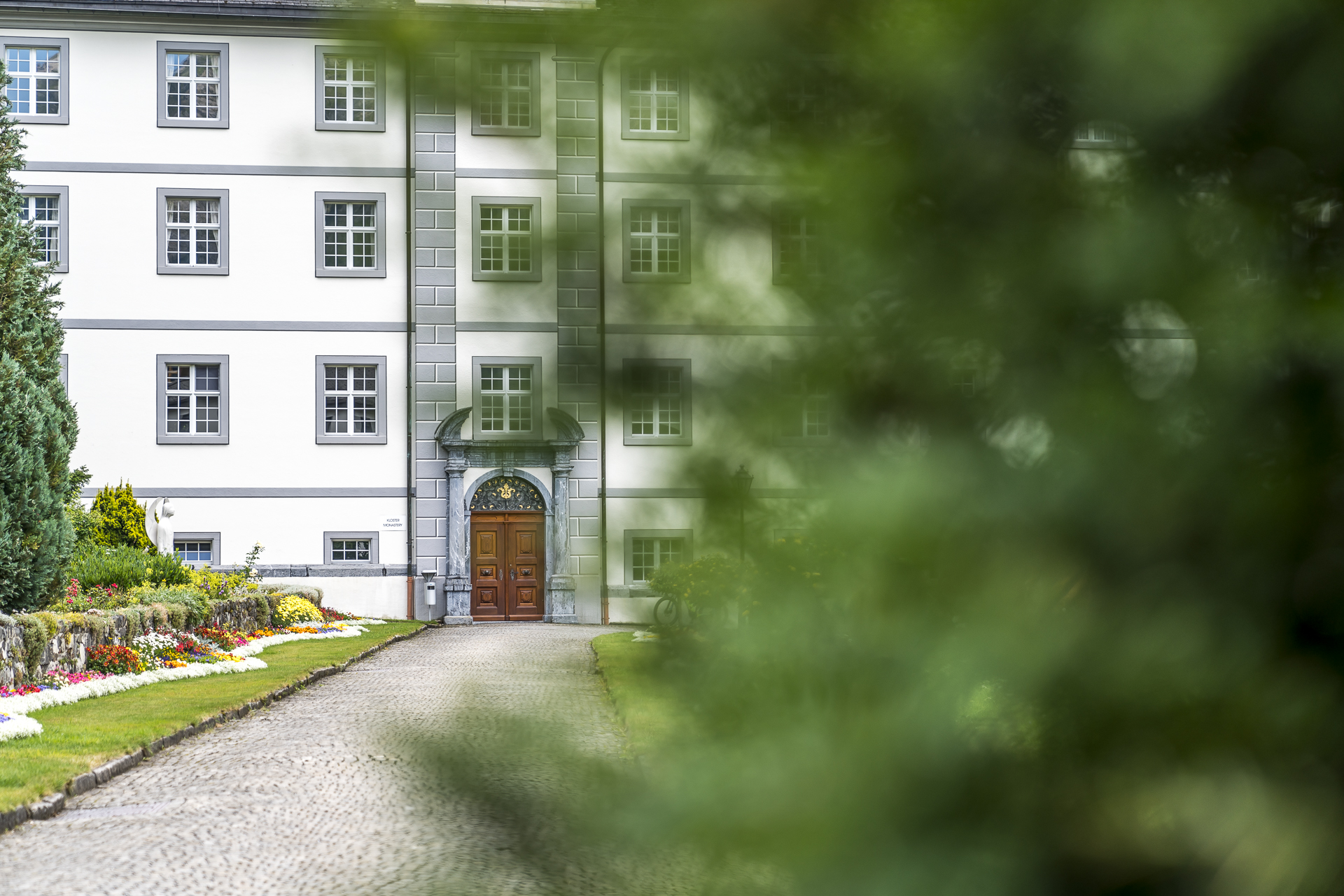
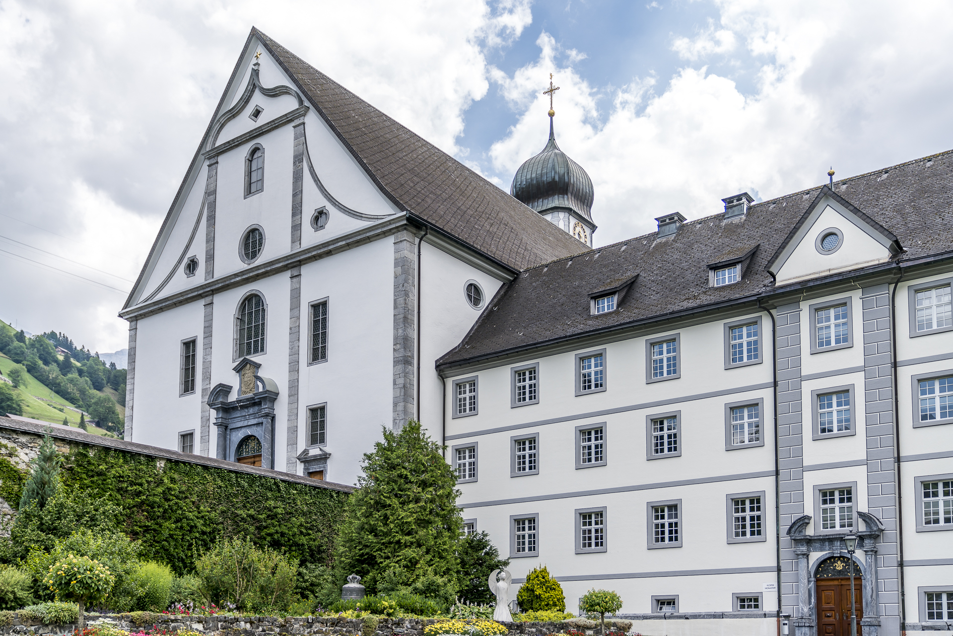
Nevertheless, we don’t have to return home hungry. Back in Engelberg, we walk from the valley station of the Titlis cable car through the village centre to the imposing monastery complex with collegiate church. The development of Engelberg is strongly influenced by the Benedictine abbey founded in 1120. Around 30 Benedictine monks still live and work here today. The monastery complex also includes a show dairy with a shop, where the different types of cheese can be tasted. In addition to cheese, other regional products are sold in the shop. I stock up on spicy monastery cheese, Dallenwiler Geisschäs, Stanser Schafreblochon and dry herb sausages and buy an oven-fresh farmer’s bread at a market stall on the way to the train station. The perfect basis for a snack plate that I will put together after my return home.
[alert color=”FFFFFF” icon=”Select an Icon” title=”SBB RailAway Kombi-Angebot Titlis“] SBB RailAway offers a 20% discount on the return Engelberg-Titlis cable car journey and a 10% discount on an ascent and descent on the “Ice Flyer” glacier chairlift. All information can be found at sbb.ch/titlis [/alert]
Practical tips for your trip to Mount Titlis
Similar to the Jungfraujoch, the Titlis is a popular destination for foreign tour groups. If you want to avoid rush hour, you can take advantage of the early morning hour and head to the valley station at around 8:30 a.m. (start of operation). The glacier grotto, the glacier park with snow tubing and the cliff walk are free attractions. The ride on the Ice Flyer glacier chairlift costs 12 CHF extra. An overview of all activities as well as the prices can be found on the website of the Titlis mountain railways. If the altitude doesn’t bother you, I recommend the short summit hike from the Titlis mountain station to the “Stotzige Egg” viewpoint or, alternatively, the lower-lying 3.5-kilometre-long circular hike around the Trübsee (walking time about an hour). The route of the circular hike can be found on the map below.
Leave a Reply