

Leiternweide suspension bridge: entertaining hike in the Simmental
-This post contains advertisements for the Swiss Mountain Aid-
Who of you has ever heard of the Leiternweide suspension bridge? Even my hiking mom had to google this destination first. And that’s exactly the reason why I think the anniversary campaign of the Swiss Mountain Aid is so brilliant!
The foundation, which was founded in 1943 with the aim of improving livelihoods and living conditions in the Swiss mountain region and thus counteracting emigration, is celebrating its 75th anniversary this year. Swiss Mountain Aid is taking this as an opportunity to use 44 selected projects as part of the Berghilfe Trophy to show what has been created with the support of Mountain Aid. And best of all, there are not only exciting things to see, but also something to win. Anyone who visits at least three of the 44 projects by 31 December 2018, finds the respective codes and enters them on the Berghilfe website will automatically be entered into a raffle for great prizes.
When Swiss Mountain Aid contacted me last autumn with a view to a possible cooperation within the framework of the Berghilfe Trophy, I was hooked after a quick click on the project map. The 44 projects spread across Switzerland are a great source of inspiration for exciting excursions into the mountains. I had a hard time making a selection of three projects that I will present to you here on the blog during this summer.
The first thing I did was to head for the Leiternweide suspension bridge in the Simmental together with my friend and mum. A visit to this project can be perfectly combined with an entertaining hike from Oberwil to Weissenburg.
Start in Oberwil and ascent to the Schnurreloch
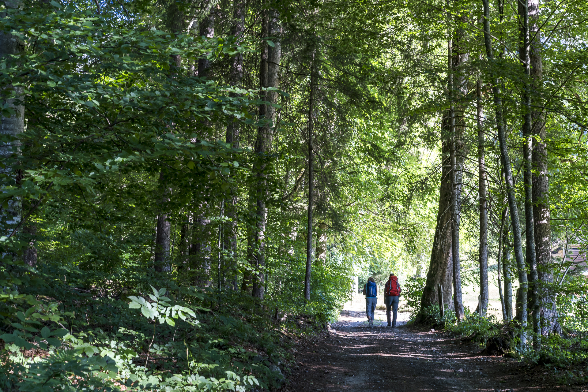
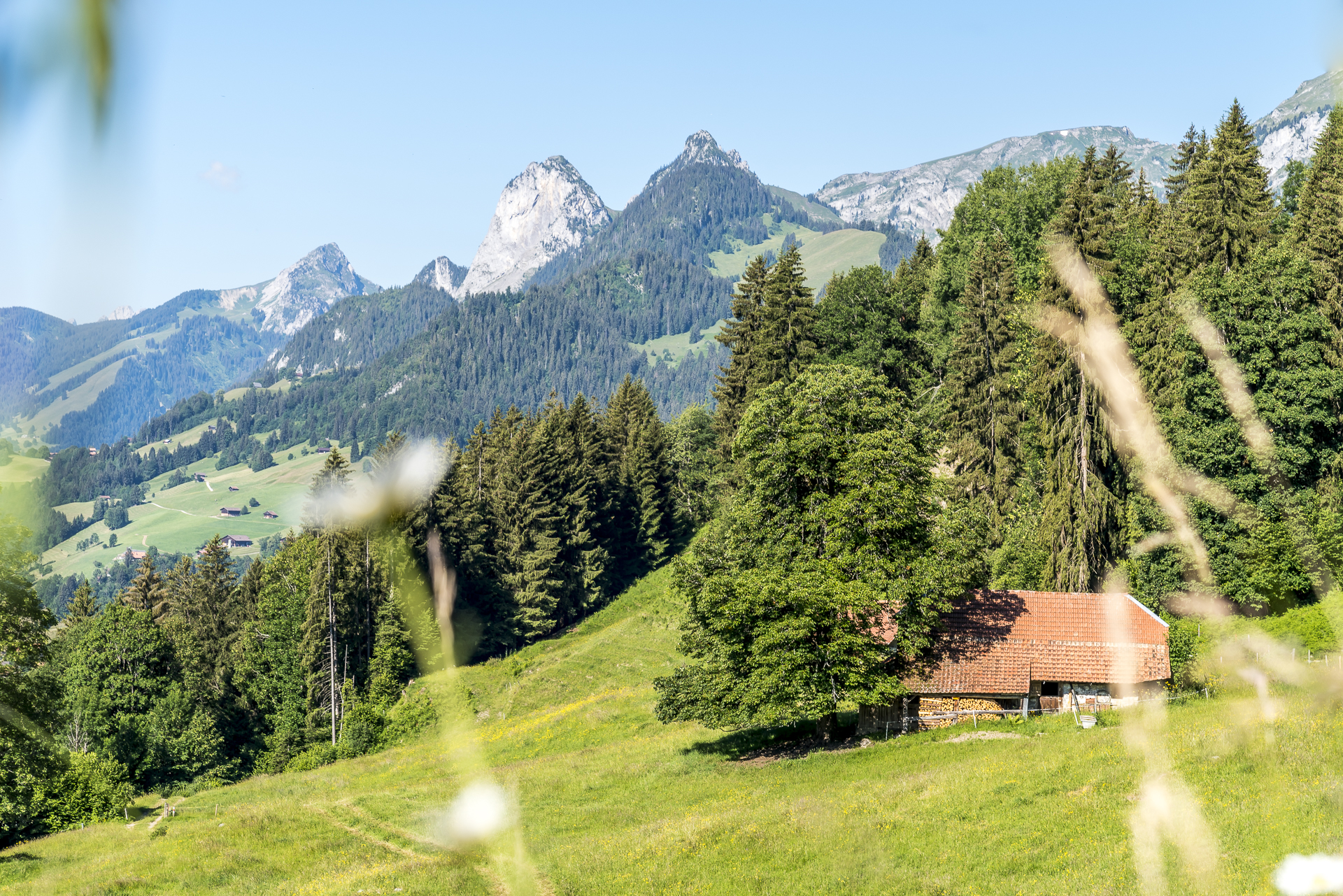
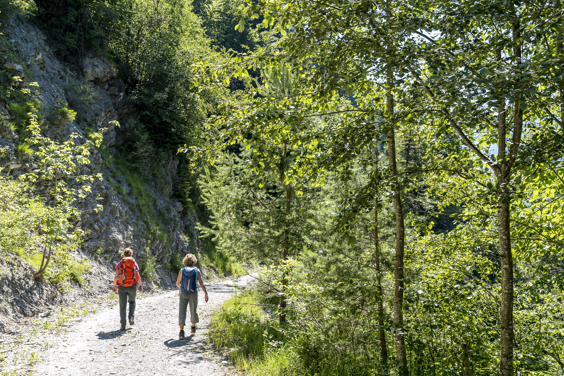
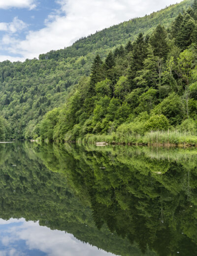
Through the train window, a bright blue sky smiles at us. The magnificent summer weather has lured numerous hiking enthusiasts out of bed early and accordingly the 07:39 train from Bern towards Simmental is well filled. Most of our train travellers leave us in Erlenbach in the Simmental with destination Stockhorn. We hold out for another two stations until we reach Oberwil after a good hour’s drive. Apart from us, no one gets out – a good sign! The hike to the Leiternweide does not seem to have spread far yet. After a short walk along the village road, we reach the marked junction that takes us up the ravine into the hills. The trail runs parallel to a bubbling stream under shady trees – luckily! The sun is already shining at 9:00 a.m. with all its might. Above the first piece of forest, a beautiful panoramic view over the idyllic landscape of the Simmental awaits us. But where is the way? In the tall grass, the tracks of the narrow path are only vaguely visible. Another sign that the phenomenon of pack hiking is largely unknown on this section of the trail.


After a short additional loop (caused by me, because I overlooked the junction in the tall grass), the sign “Cave Path” lures us astray. The hiking trail to the Leiternweide runs partly parallel to the cave path, which leads from Oberwil to the prehistoric caves Zwärgliloch, Schnurenloch and Mamilchloch. In these caves, bones of the now extinct cave bear were found, as well as the oldest man-made stone tools in the canton of Bern. While the Zwärgliloch is easily accessible and has a barbecue area, exploring the Mamilchloch and Schnurenloch requires an adventurous spirit and good footwear. The detour to the caves extends the hike by a good 45 to 60 minutes (without a break).
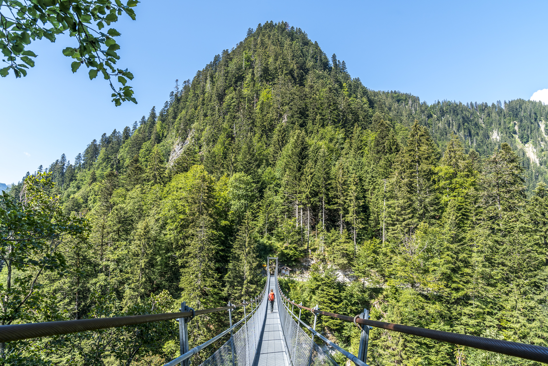
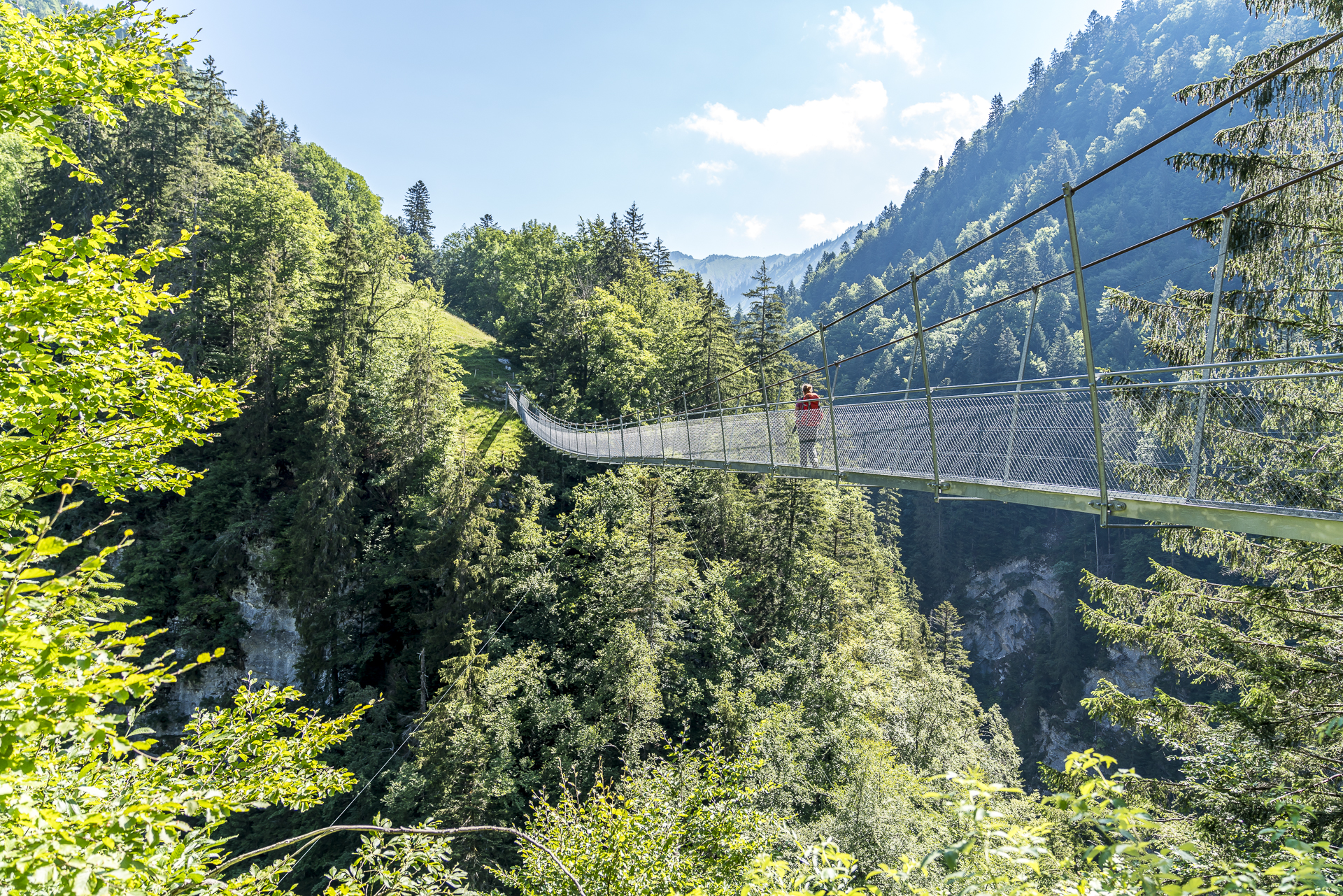
Suspension bridge Leiternweide – At lofty heights over the Morgetenbach
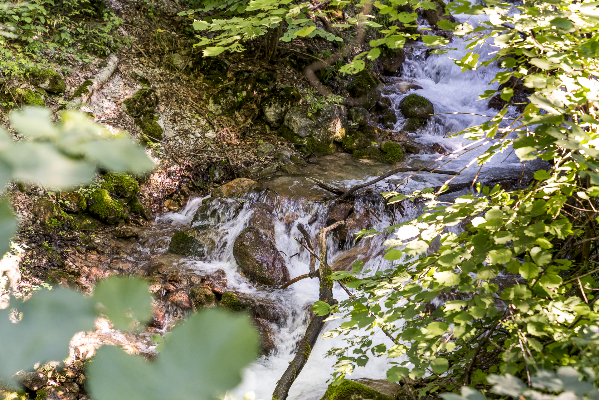
After the short but steep ascent to the Schnurenloch we can breathe a sigh of relief. The altitude difference is mastered for today. This is followed by a short descent through the forest until we reach a gravel path that leads us along the slope flank to the Morget stream, which is deeply dug into a gorge. The original goal of the initiators of the Leiternweide suspension bridge was to improve access to the pasture in the gorge, which was once only accessible via ladders tied to the rock faces.
In 2013, the 111 m long suspension bridge was inaugurated, which now leads at lofty heights over the imposing gorge on a direct route to the pasture. At the same time, the path down to the Buuschebach was also safely developed with stairs. The ascent is free of charge for hikers – but there is the possibility to pay a voluntary bridge toll. At the same time, it’s also worth taking a look at the wooden box at the information board. Delicious alpine cheese from the Morgeten Pass is stored in here (it’s worth taking coins with you!). As long as the bridge, as deep is the gorge. 111 m below us, the Morgetenbach stream rushes down into the valley. However, our camera doesn’t stand a chance against the strong shadows of the midday sun – if you want to capture the view of the gorge, you have to choose an overcast day.


Welcome cooling off at the Buuschebach
After crossing the Buuschebach, we follow the steep steps down into the gorge. A welcome cooling! The cheerfully bubbling Buuschenbach with its small gravelly bays seems like a small paradise on this hot summer day. It doesn’t surprise me that in the 18th century an international crowd of guests flocked here for the cure. Today, however, only stone ruins bear witness to the Weissenburgbad, which was once known beyond the country’s borders. The facts about the thermal spring and the former baths can be found on information boards. In the summer months, there are also various public guided tours (information and dates).


Even though the hike from Oberwil to Weissenburg via the Leiternweide suspension bridge only takes two hours of pure walking time, there are many exciting things to see and discover along the way. For me, therefore, a successful day trip for young and old (please note: the path is not suitable for strollers).
Practical information about the Leiternweide suspension bridge hike
The route of the hike to the Leiternweide suspension bridge can be found on the map below. The distance from Oberwil to Weissenburg is about 6 kilometres. To reach the prehistoric caves, there is an ascent of 300 meters in altitude. The descent to Weissenburg is 350 metres in altitude. The pure running time is two hours. But since there is a lot to see on the way, I recommend planning enough time for stopovers. Oberwil as well as Weissenburg are located on the Spiez-Zweisimmen railway line and are served hourly by a regional train to/from Bern. Attention – in Weissenburg the train only stops “on request”. You can find more information about the Oberwil-Weissenburg hike via the Leiternweide suspension bridge at Schweiz Mobil.
[alert color=”FFFFFF” icon=”Select an Icon” title=”Information about the Berghilfe Trophy“] This year, Swiss Mountain Aid is presenting 44 projects spread across Switzerland that could be realized thanks to Mountain Aid. If you visit three projects, find the respective code and enter it on the Swiss Mountain Aid website, you can win great prizes with a bit of luck. All information about the Trophy and the 44 projects can be found on the website of the Swiss Mountain Aid. [/alert]
Note: As part of a collaboration with Swiss Mountain Aid, I am visiting three different projects supported by Mountain Aid this summer and will introduce them to you here on the blog.

Leave a Reply