

Hike to the Hardwaldturm: from Kloten via the observation tower to Wallisellen
Advertisement: This post is supported by Komoot
A new observation tower was opened this summer in the Hardwald forest between the municipalities of Kloten, Opfikon, Bassersdorf, Dietlikon and Wallisellen. The Hardwald Tower is the result of a project competition and stands out from the abundance of Zurich observation towers with its striking appearance.
In mid-December, we made a detour to the new excursion destination in the Zurich agglomeration and enjoyed a fairytale winter hike through the Hardwald. The hike described in this article is of course recommended in every season!
Click here to go directly to the hiking map and the key data of the tour
Where and how can I find ideas for new outdoor activities in the Zurich region?
Every now and then I am asked where I actually come across all the hiking ideas and excursion tips that I present to you here in the blog. For me, it’s usually a mixture of recommendations from family and friends – or from you readers, discoveries in print and online media, or routes I come across in apps. One such app, which I have been using “passively” for almost two years, is Komoot. I created a profile there in spring 2021 and signed up for their newsletter. Since then, the Komoot newsletter has provided me with a “personalized” list of ideas with three regional highlights once a week. These are favorite places of the Komoot community – recommended by those who know them best; magnificent panoramic peaks, panoramic trails, casual mountain pubs or even cool single trails or gravel bike routes. A cool service that has already given me one or two suggestions for a future trip.
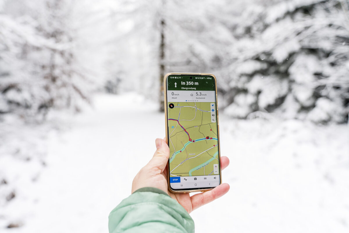
So when Komoot asked me if I would like to try out the app “actively” as part of a collaboration and introduce it to you, I was immediately on board. As part of this collaboration, I “actively” used the app’s “explore” function for the first time. In the Komoot app, you can find route ideas for your favorite outdoor activities in your area with just a few clicks.
To do this, go to “discover”, select your desired activity and either search directly for tips for your location or set a radius of your choice around the location of your interest. Especially with regard to the Hardwaldturm, I found this function helpful, because there are only a few route descriptions for hikes to the Hardwaldturm online (and it is not yet marked on the swisstopo map, for example).


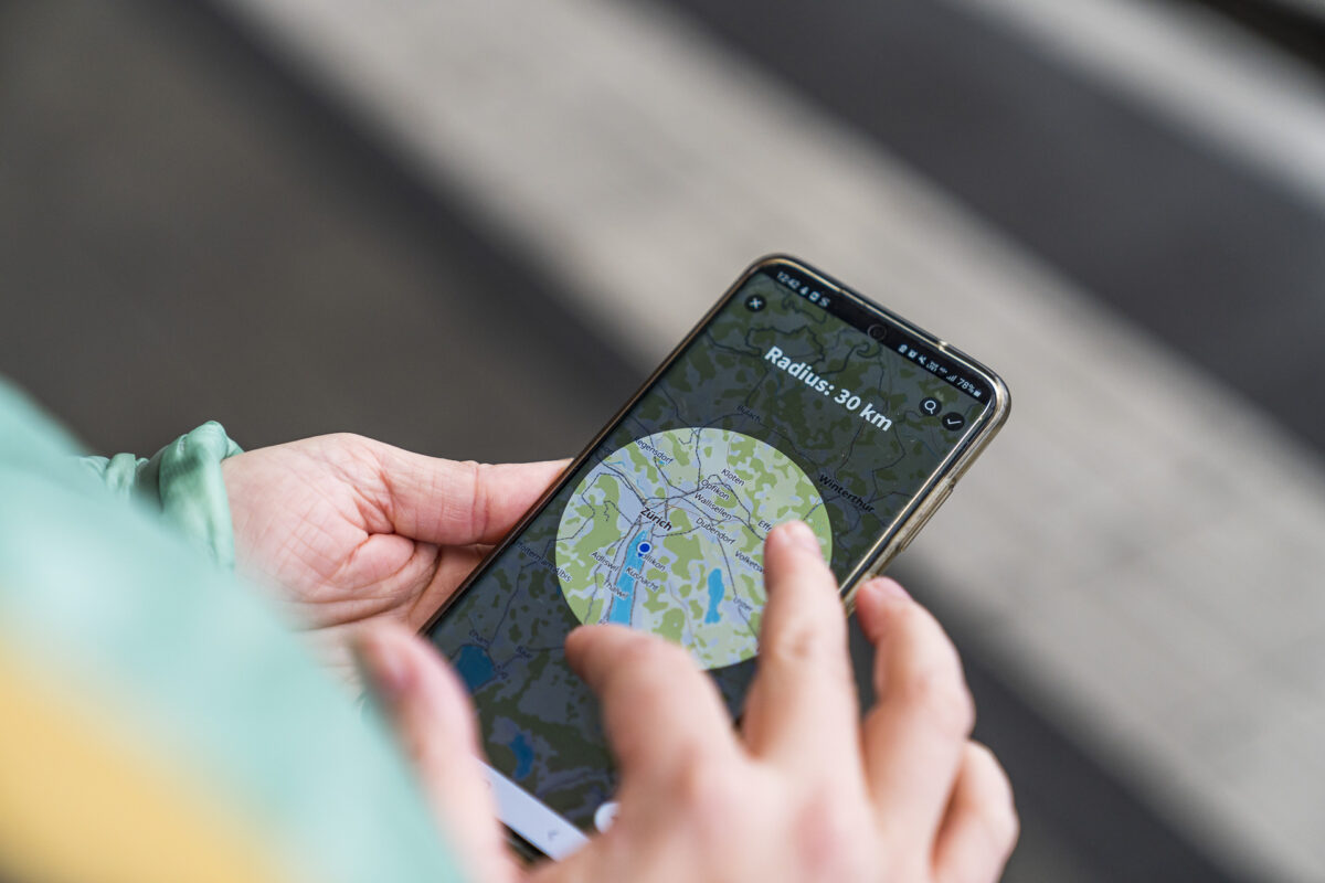
Plan a hike with the Komoot app
Once you’ve set a location, you’ll see the tours suggested by Komoot based on your criteria. You can sort them by difficulty and time period. You also have the option of saving them as a “planned tour” or starting navigation directly.
Alternatively, you can of course plan your own tours. To do this, the start and end points as well as the waypoints in between (if you want to head for certain fixed points – such as the Hardwald Tower) are entered. If you only enter the start and end points, the app will automatically suggest a route from A to B. I find it regrettable that the Swiss hiking trail network is not stored as a data basis in the app and therefore it does not lead you primarily over signposted hiking trails. I would therefore recommend consulting the hiking trail network on swisstopo in parallel with route planning.

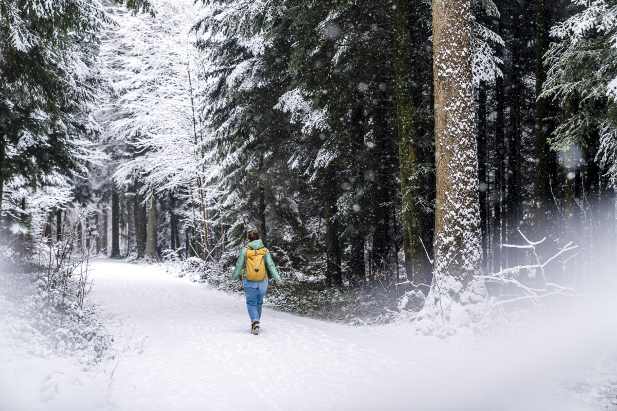
And off we go – the Hardwald in winter garb
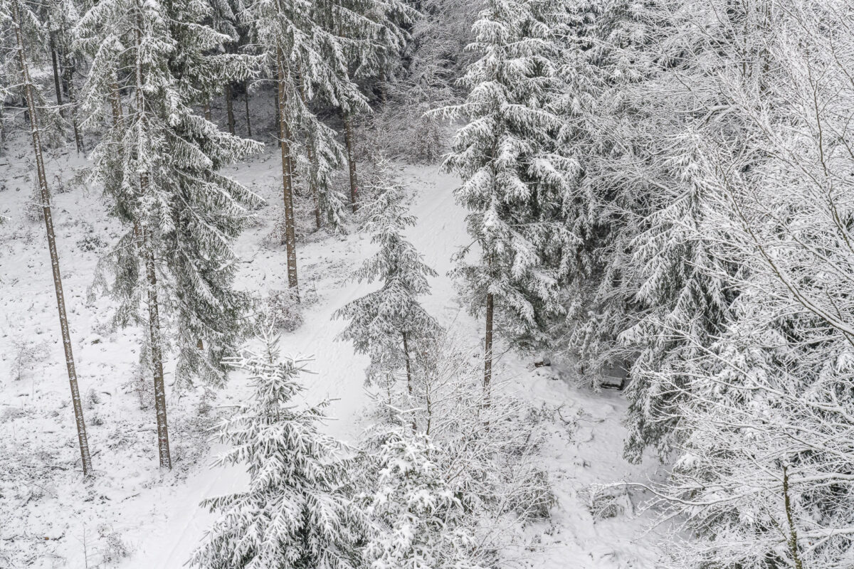
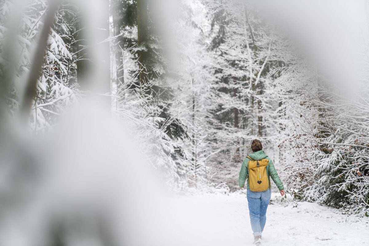
That’s exactly what I did for the hike to the Hardwaldturm. I first looked at which hikes to the observation tower had already been shared by the Komoot community and then created my own route with a comparison of the hiking trail network and the desired start and finish location. All of this can be done with just a few clicks. And then? Start navigation and start marching. We set off from the Kloten train station in a wet and cold snow flurry and quickly immersed ourselves in the fairytale-like snow-covered Hardwald. A magical atmosphere!

Exciting silhouette and fantastic views
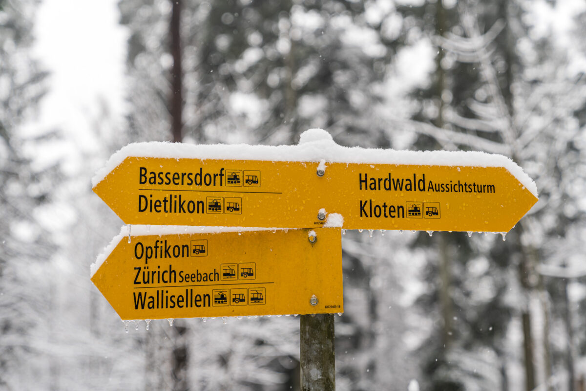
From Kloten, following the hiking trail, it takes about 35 minutes until the observation tower appears in front of us. A glance at the Komoot navigation confirms that we will soon reach our intermediate destination.
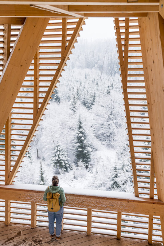
And there it is – the Hardwald Tower. The project competition held in 2020 for the implementation of the observation tower in the Hardwald recreation area was won by the consortium Holzing Maeder + luna productions. The design is based on triangles that are twisted to each other in prefabricated wooden elements. The wood used for this comes from the Hardwald.
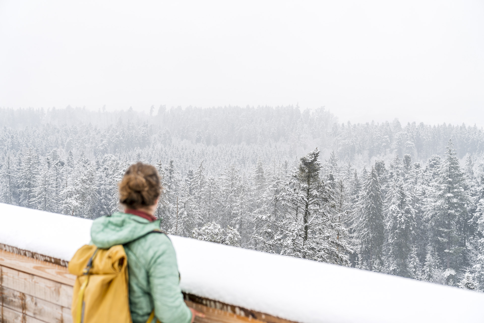
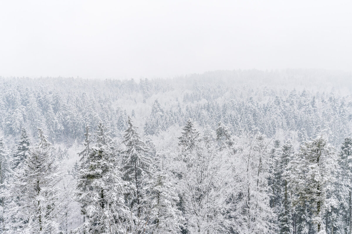
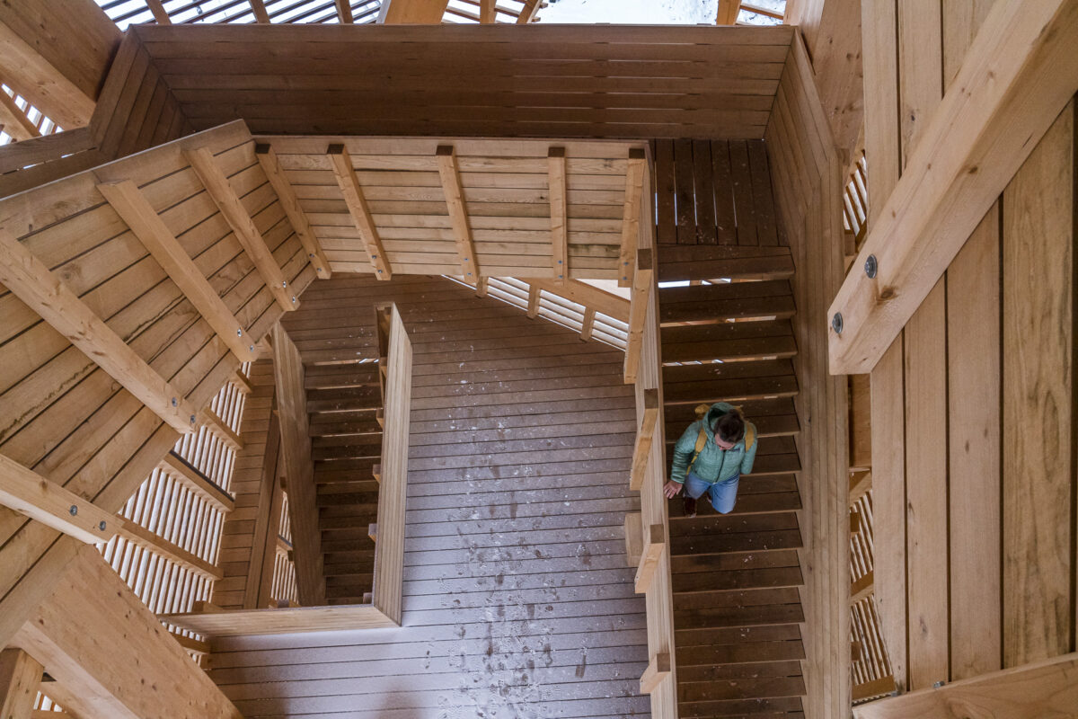
The staircase is arranged in the core and leads over four landings to the viewing platform at a height of 40 m. Through cleverly placed openings, you get beautifully “framed” image sections into the Hardwald as soon as you ascend and descend. And once the 209 steps to the top have been overcome, you can enjoy a wonderful view over the canopy of the Hardwald to the Alps when the weather is nice. As you can see from the following pictures, the view also has its charm in snow flurries!

Our hike through the Hardwald takes us from the observation tower for another half hour on mostly wide gravel paths through the forest. Afterwards we reach the settlement area of Wallisellen. Here we follow the signposted hiking trail through the village centre, past the Reformed church to the train station.

Practical tips for your hike to the Hardwald Tower
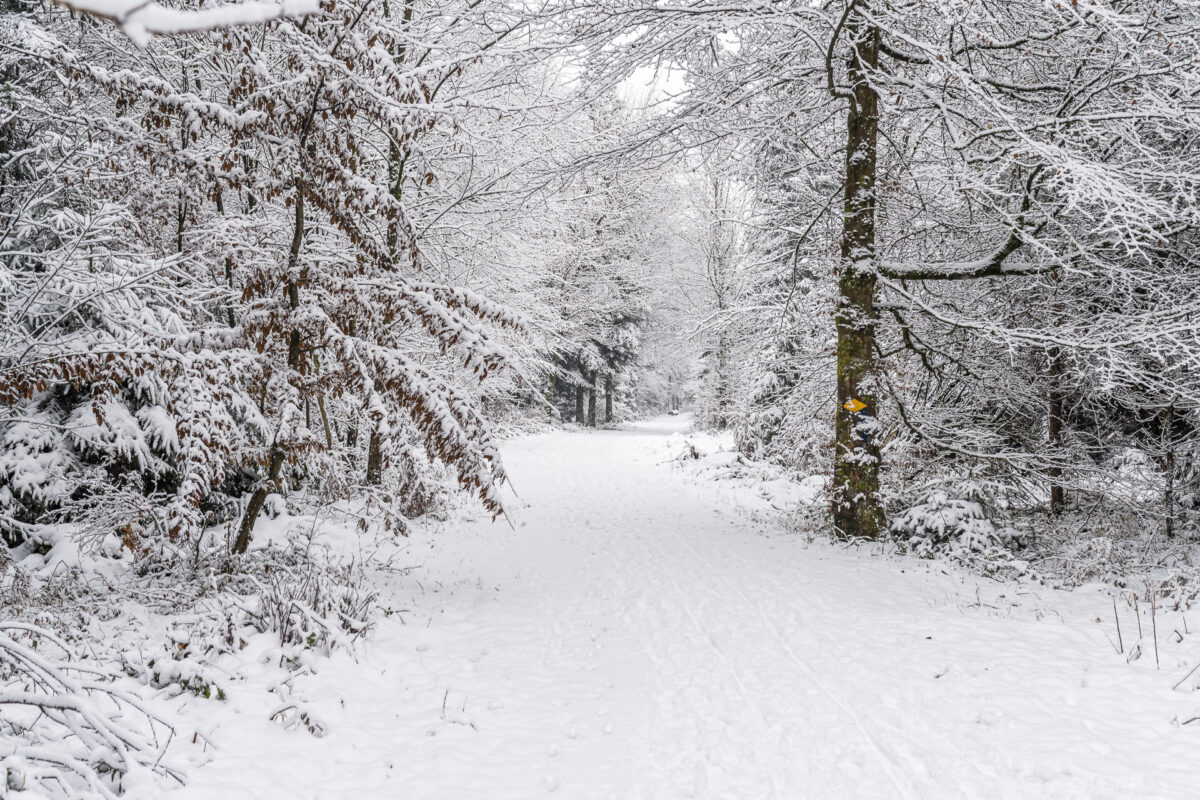
On the following map you can see the route of the hike from Kloten via Hardwaldturm to Wallisellen. The hike runs along yellow-marked hiking trails (difficulty T1). The trail is easy to walk and mostly runs along wide gravel paths. For the most part, it is also suitable for strollers or there are path options suitable for strollers. The ascent to the viewing platform seems to me to be less “frightening” compared to other Zurich observation towers, as the stairs are nowhere exposed. In addition, the four platforms also offer alternative views for those who do not want to or cannot climb to the top.
Key data of the tour Kloten – Hardwaldturm – Wallisellen
| Starting point | Kloten railway station (455 m above sea level) |
| Reachability | accessible by public transport |
| Length | 6.2 kilometres |
| Elevation gain | ↗ 70 m 90 m ↘ |
| Duration | 1:30 p.m. |
| Destination | Wallisellen railway station (430 m above sea level) |
| Catering | There are no places to stop for refreshments along the way |
You can find more tips for regional short hikes – of course on Komoot – or in this blog post: 9 hikes around Zurich. In the future, I will probably plan and track more hikes with the help of Komoot. If you are interested, you are also welcome to follow my profile on Komoot.
Leave a Reply