

Incredibly beautiful panoramic high-altitude hike from Gurnigel to Stockhorn
Advertising: Contribution in cooperation with Stockhornbahn AG
There are few mountains that are as familiar to me as the Stockhorn. I grew up with a view of the striking rock head at the entrance to the Bernese Oberland. And accordingly, it is not surprising that one of my earliest hiking memories is associated with this panoramic high-altitude hike from the Gurnigel to the Stockhorn. The hiking classic over the Gantrisch chain inspires with a magnificent view over the Bernese mountains and meets almost all requirements. Whether it’s a family hike or a sporty trail running route – these 11 kilometres of beautiful hiking trails are not to be missed!
Starting point: Gurnigel watershed
While the high-altitude hike starts in the Gurnigel area, the Thurnen train station is the actual starting point of the tour. And it is precisely in this tranquil village in the middle of the Gürbe Valley that I grew up. From here, the Postbus line 323 transports hikers to the magnificent heights of the Gantrisch Nature Park. The hike from the Gurnigel to the Stockhorn is therefore a home game and a matter of the heart for me at the same time. Because let’s be honest: isn’t this mountain scenery rushing past the Postbus window simply beautiful?
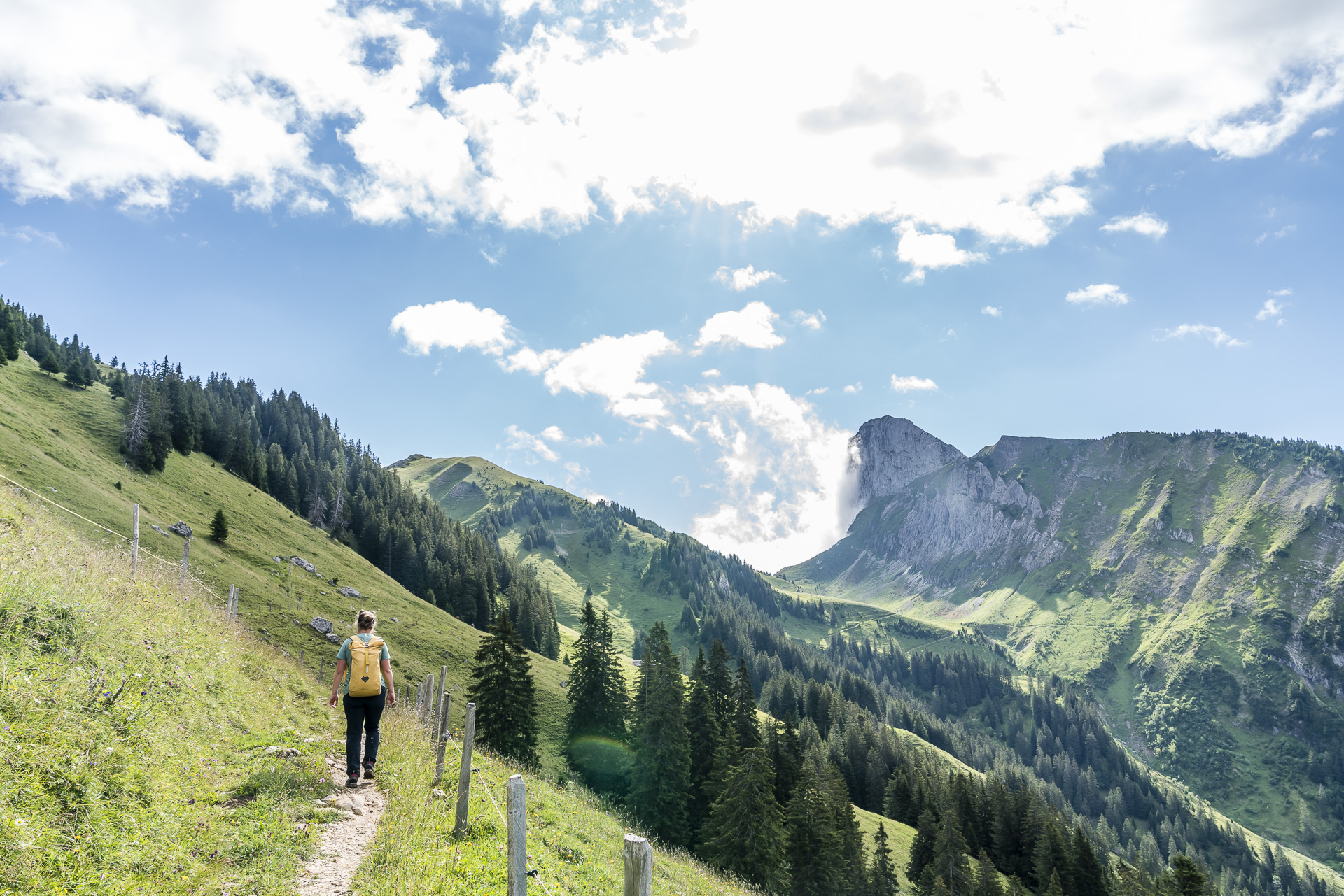
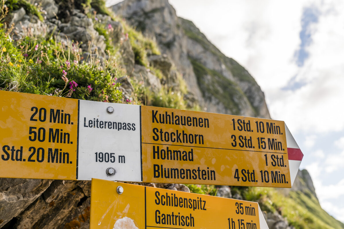
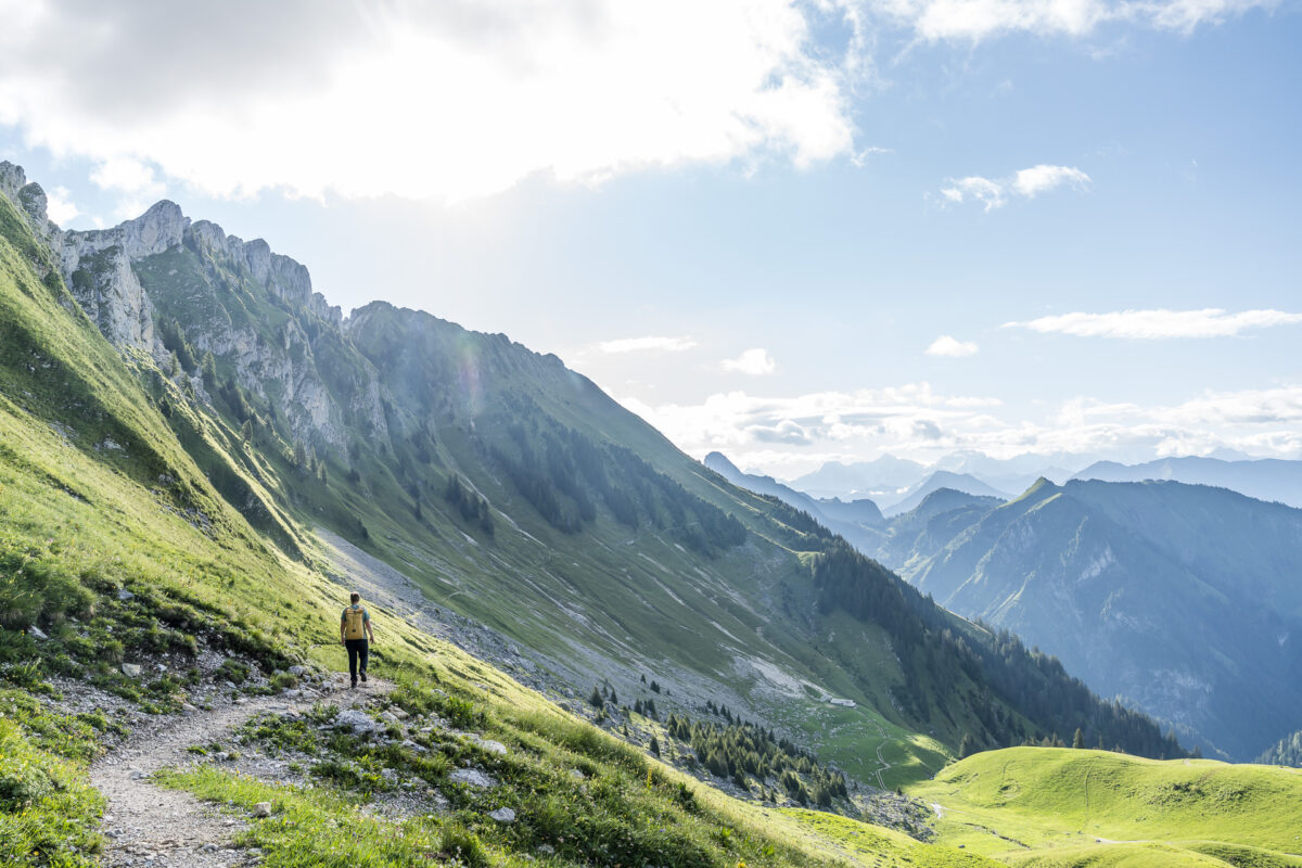
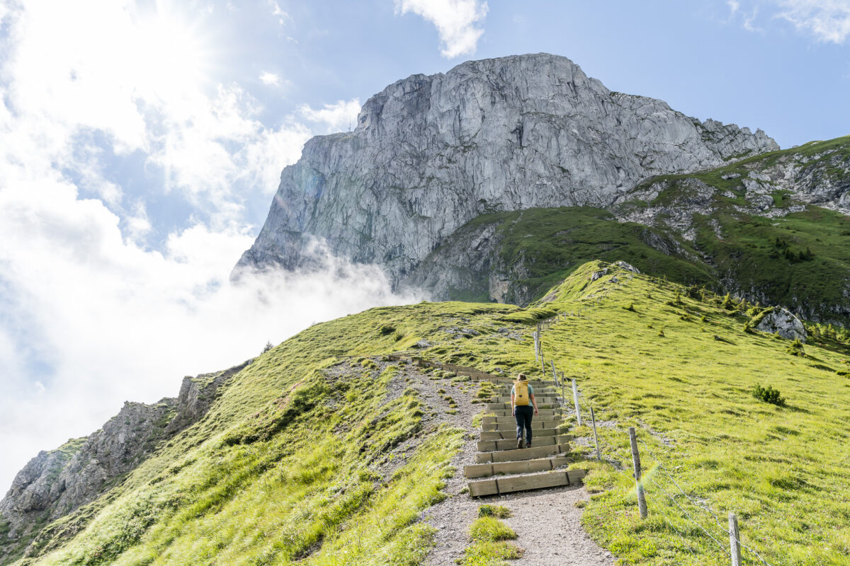
Over hill and dale to the ladder pass
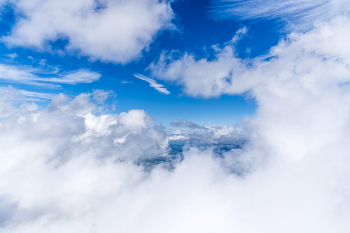
After an entertaining, almost 40-minute bus ride, we reach the Gurnigel, Wasserscheide stop. Here we get off and follow the signpost towards Obernünenen. The path to the popular mountain pub is designed as a comfortable gravel path and leads only moderately uphill. So we can put the energy into admiring the panorama, which stretches from the Gürbe Valley to the Fribourg Pre-Alps. The last passing storm clouds provide incredibly great moments of light this morning.
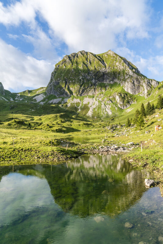
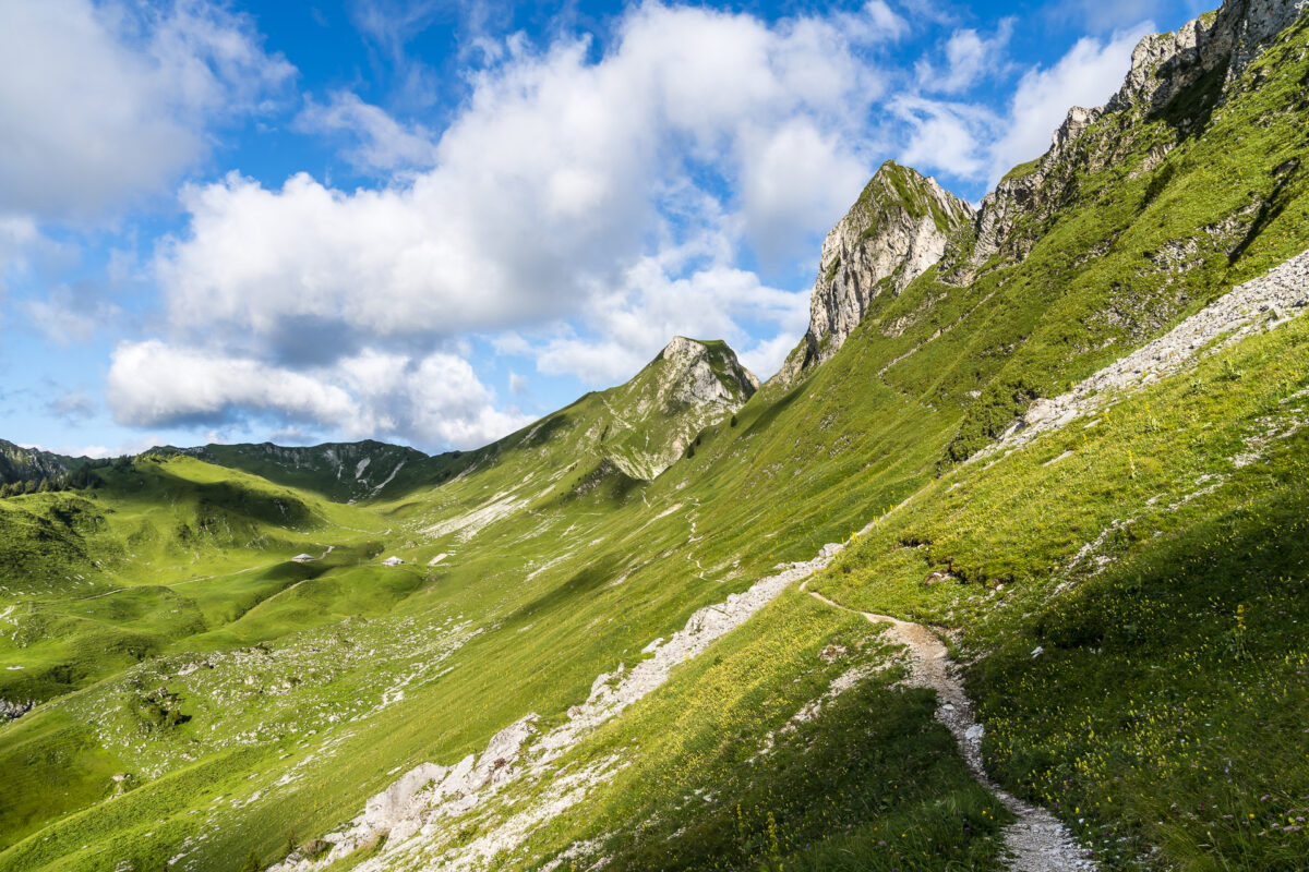
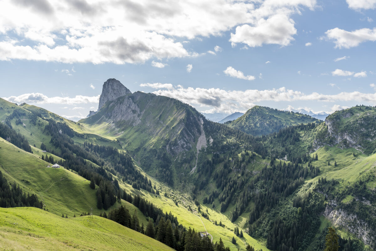
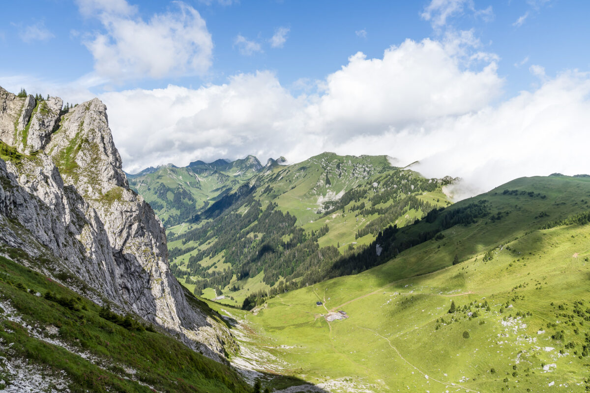
Once Alp Obernünenen has been passed, there is a short, jagged ascent to the Leiterenpass. The mountain trail winds its way in a zigzag between the mighty flanks of the Gantrisch and the Nünenflue 220 metres up to the top of the pass. Once these have been mastered, a magnificent view opens up over the Simmental to the snow-covered three- and four-thousand-metre peaks. And lo and behold: The destination of today’s tour – the Stockhorn – can also already be seen.
Panoramic high-altitude hike over the Stockhorn chain
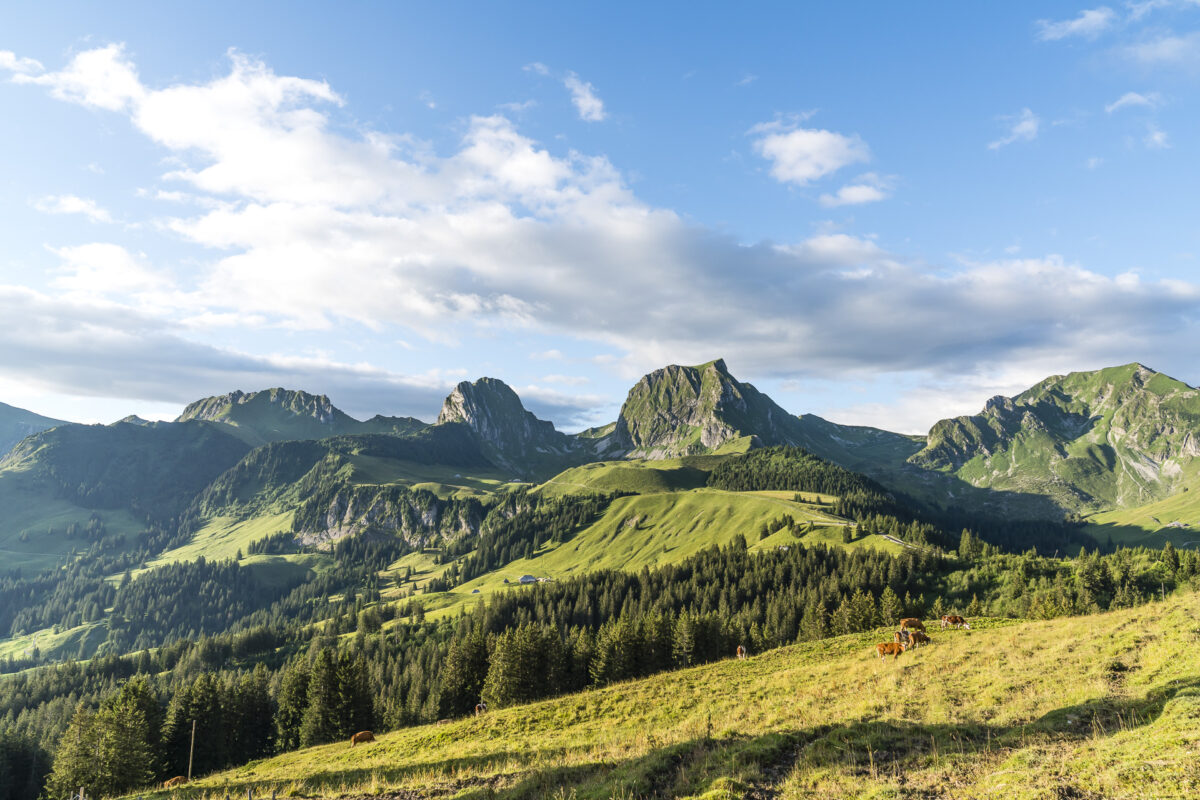
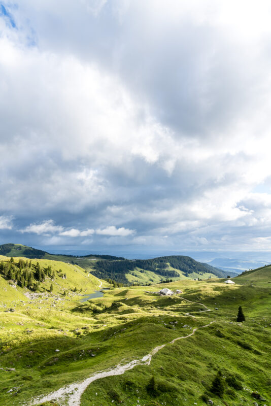
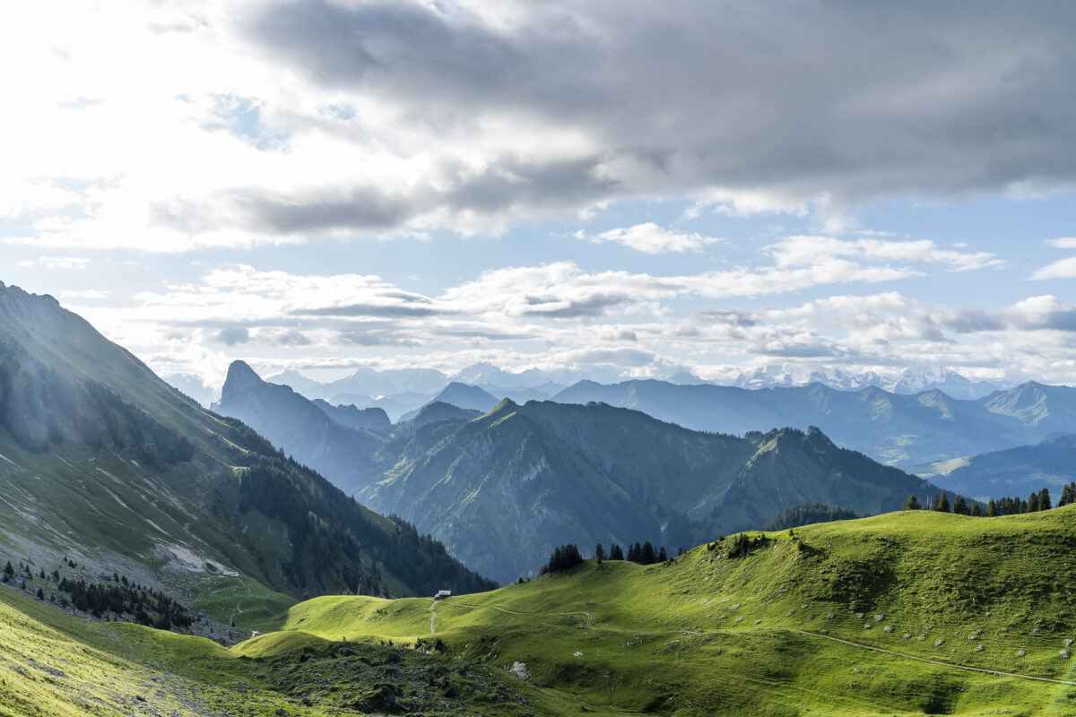
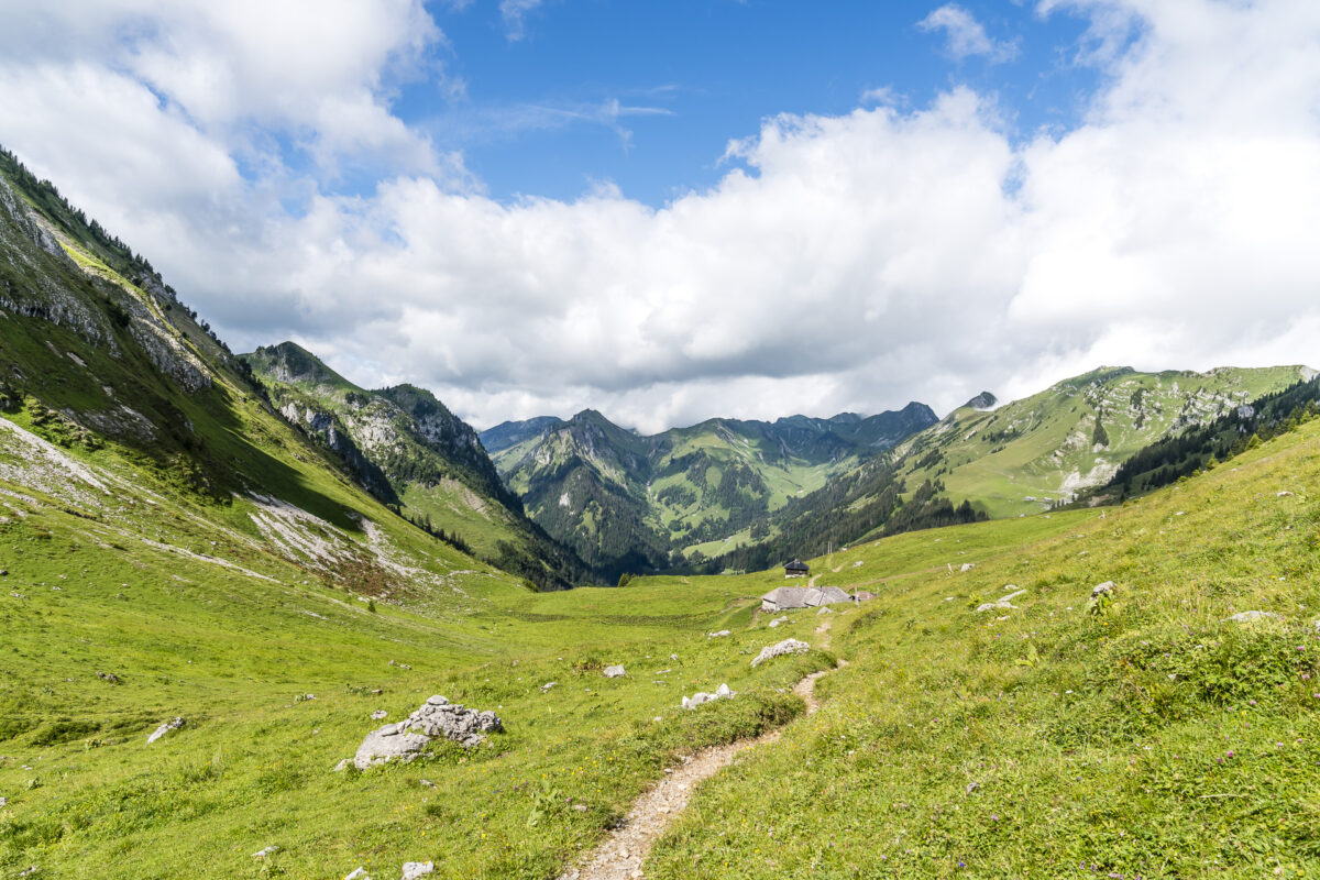
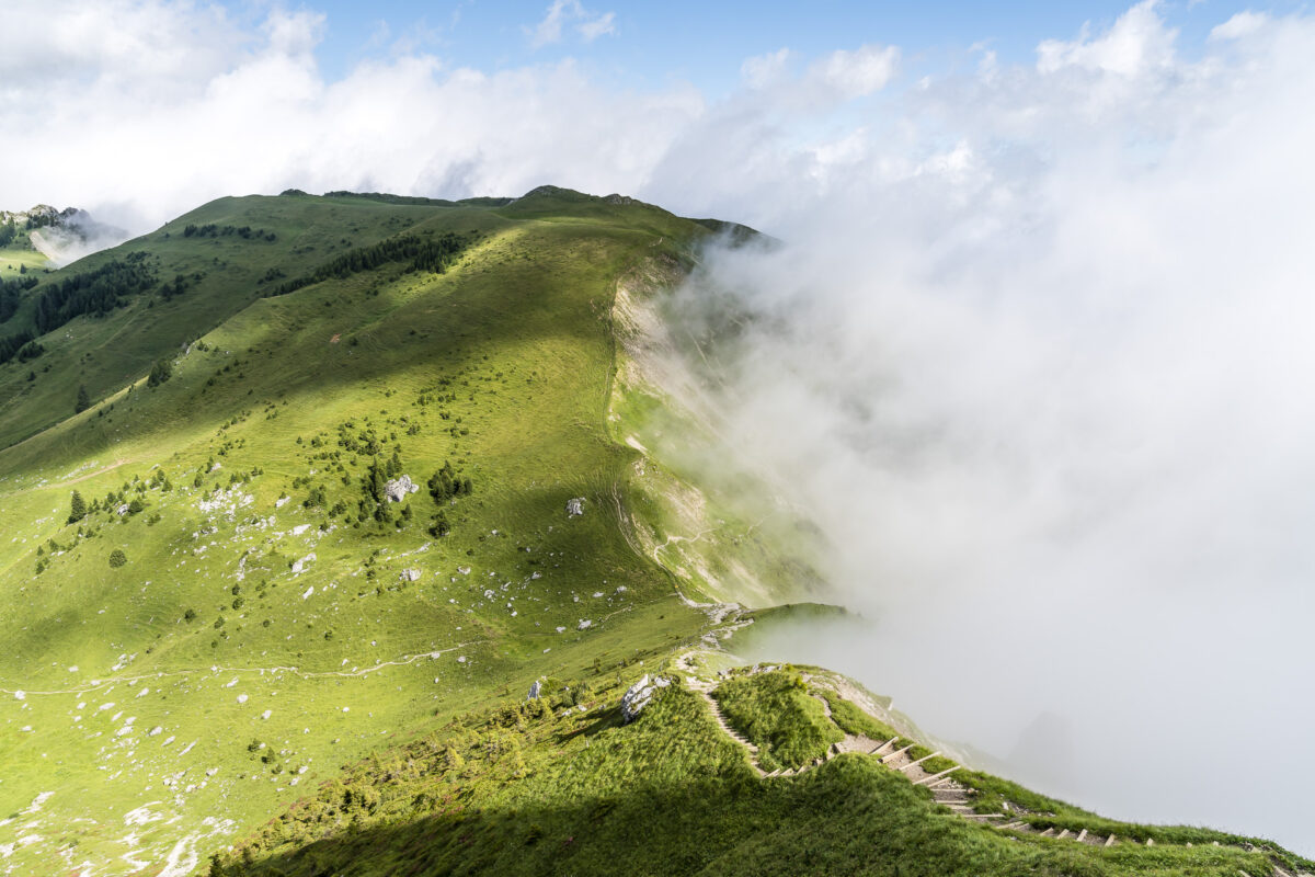
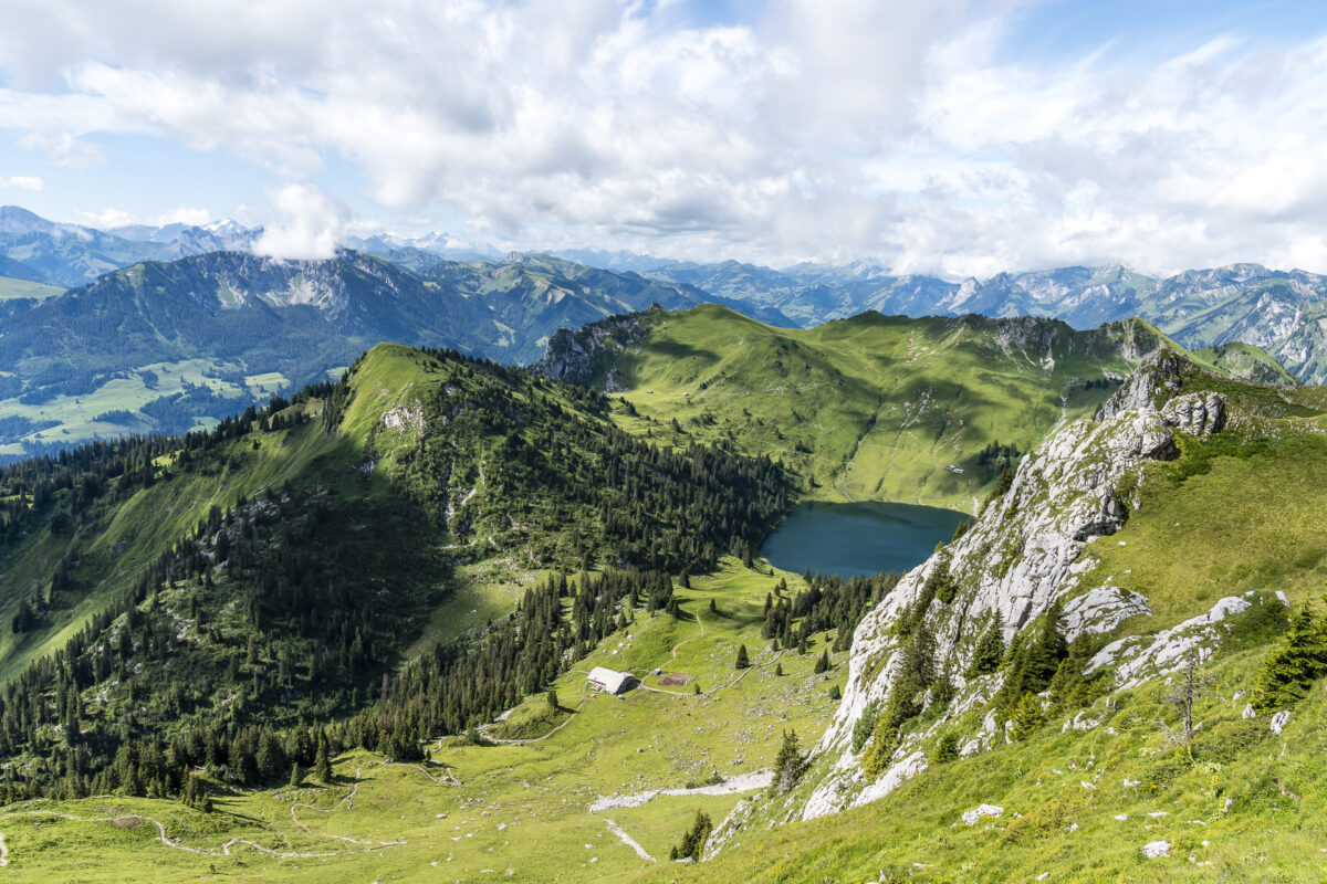
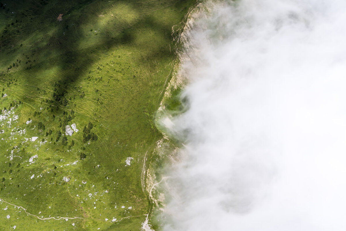
After this sporty start, the tenderloin of the high-altitude hike now awaits us. In slight ups and downs, the narrow mountain path winds its way along the Gantrisch chain to Walalp. And while the destination on the Leiterenpass seemed unexpectedly close, the next 1.5 hours, which we follow the high-altitude hiking trail, show that there are still one or two unexpected turns to conquer. The first section between Chrummfadeflue and Homad leads through alpine and untouched terrain.
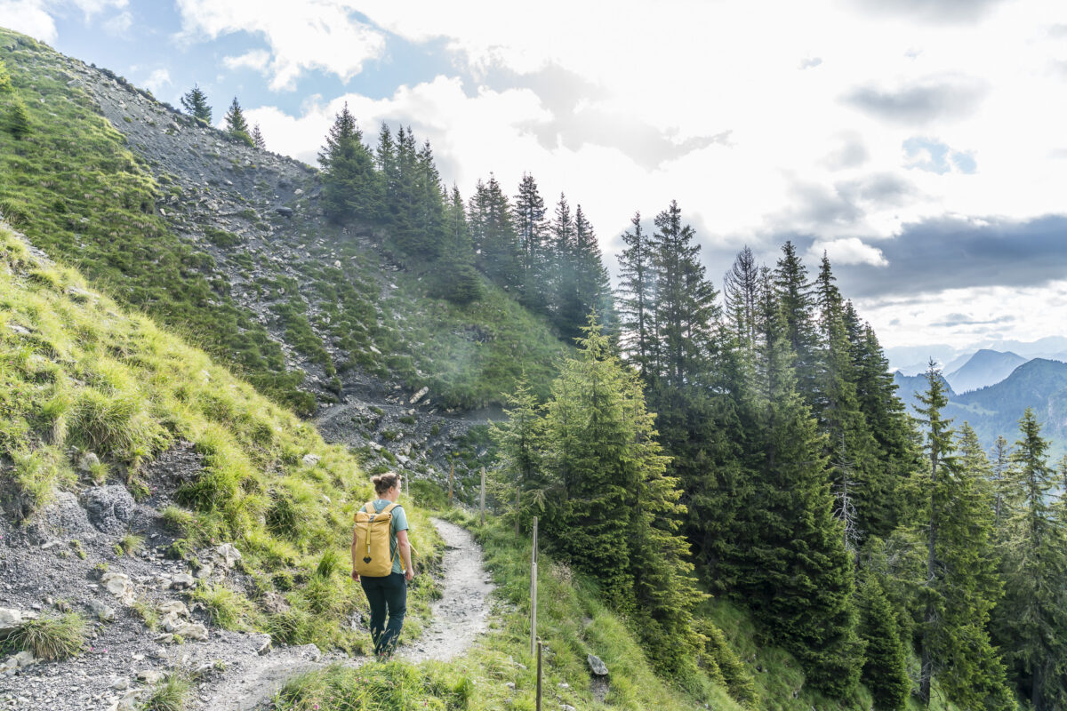
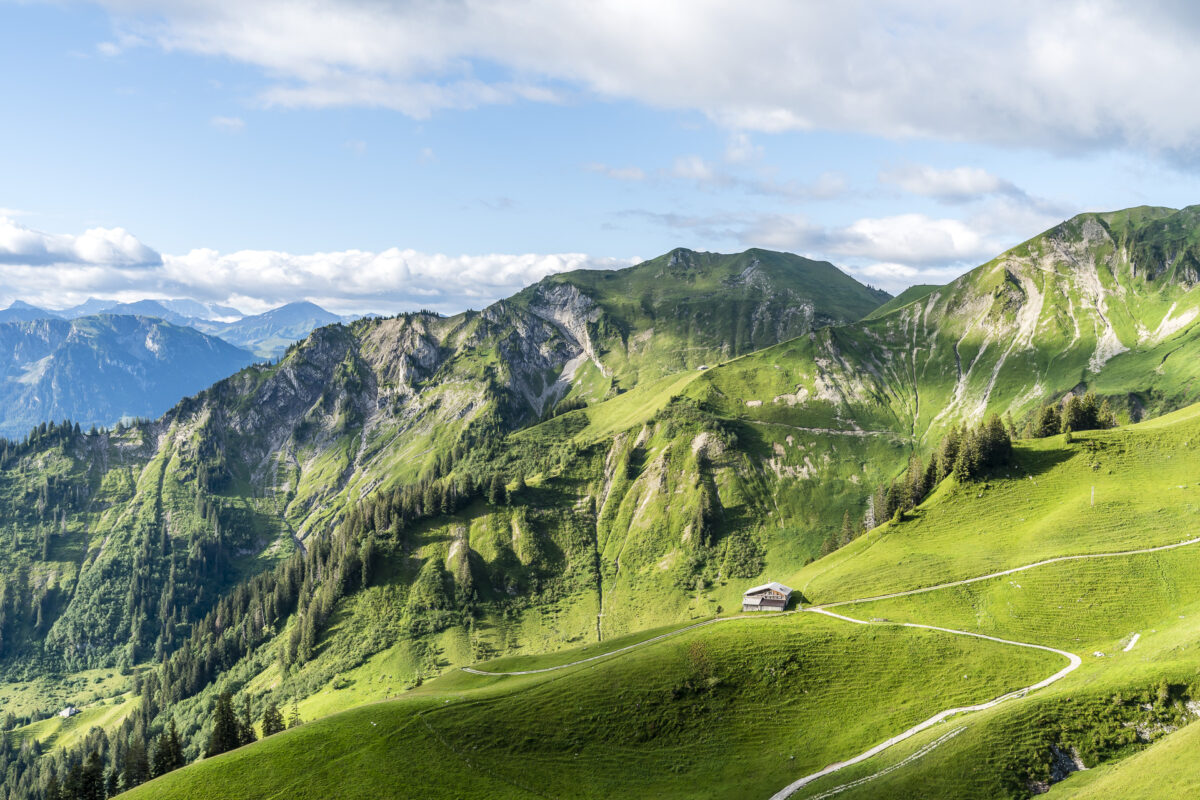
From the height of Chuelouene, the landscape changes subtly. Here and there we cross shorter wooded sections as well as cultivated alpine pastures. While a beautifully placed “beverage bench” at Äust invites you to give your legs a breather, a lovingly designed broom pub with all kinds of homemade alpine products awaits us on the Obere Walalp.
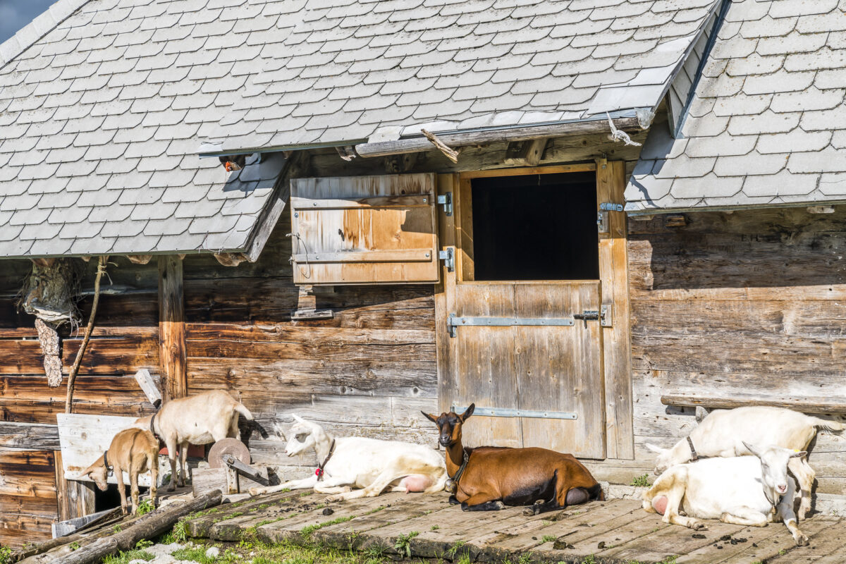
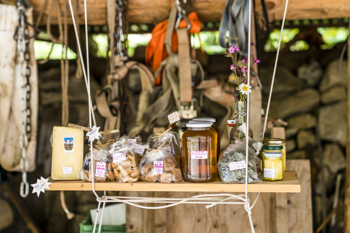
A refreshment at the right time. From the Walalp hollow we can see what lies ahead of us so shortly before our destination. But before we tackle the remaining meters of altitude to the Stockhorn, I treat myself to a glass of pine pine syrup. By the way, the Bernese alpine cheese is also said to be excellent here, as an oncoming hiker assures us.
Steep final ascent to the Stockhorn
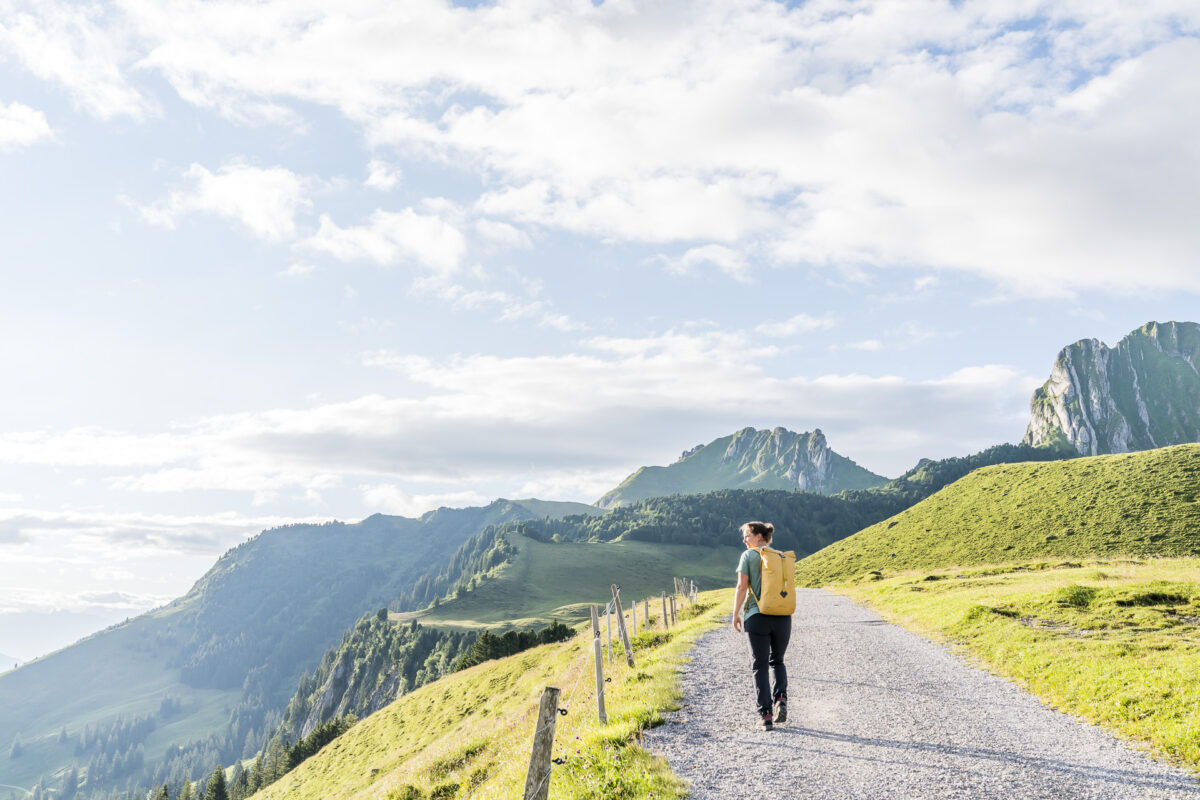
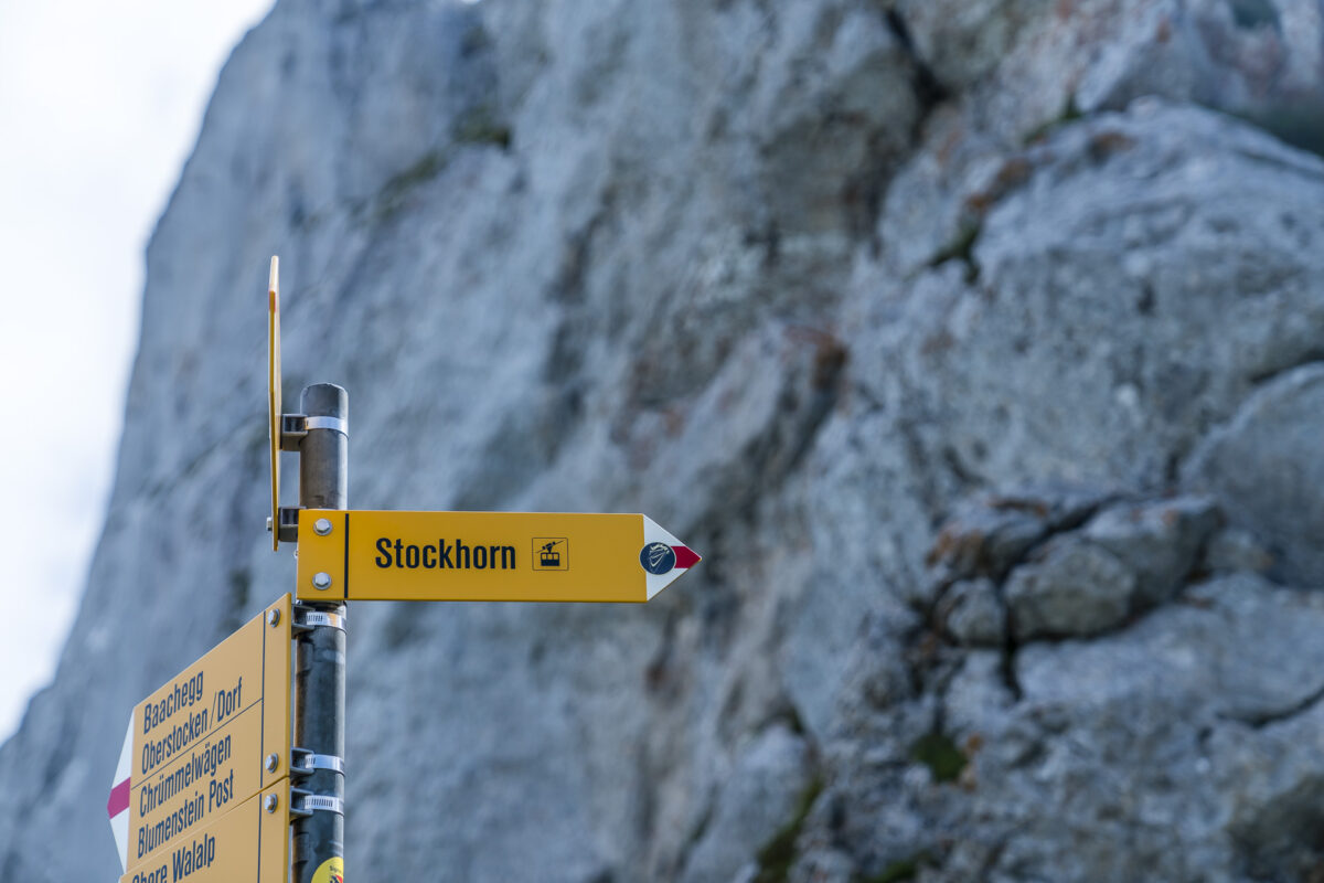
We are still 430 metres away from reaching the summit of the Stockhorn. And these want to be overcome in the remaining 1.6 kilometers of hiking trail. With the goal in mind, the altitude is easier to conquer, isn’t it? And so we shoulder the backpacks and follow the mountain path up to the Baachegg. From here, the stairway begins, which leads over the “north face” of the Stockshorn to the ridge. The path is steep, but well “in good shape”.
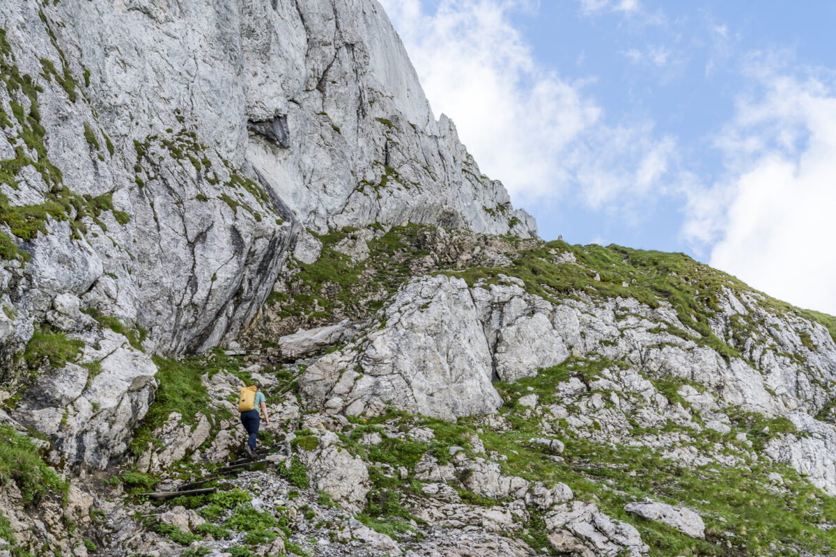
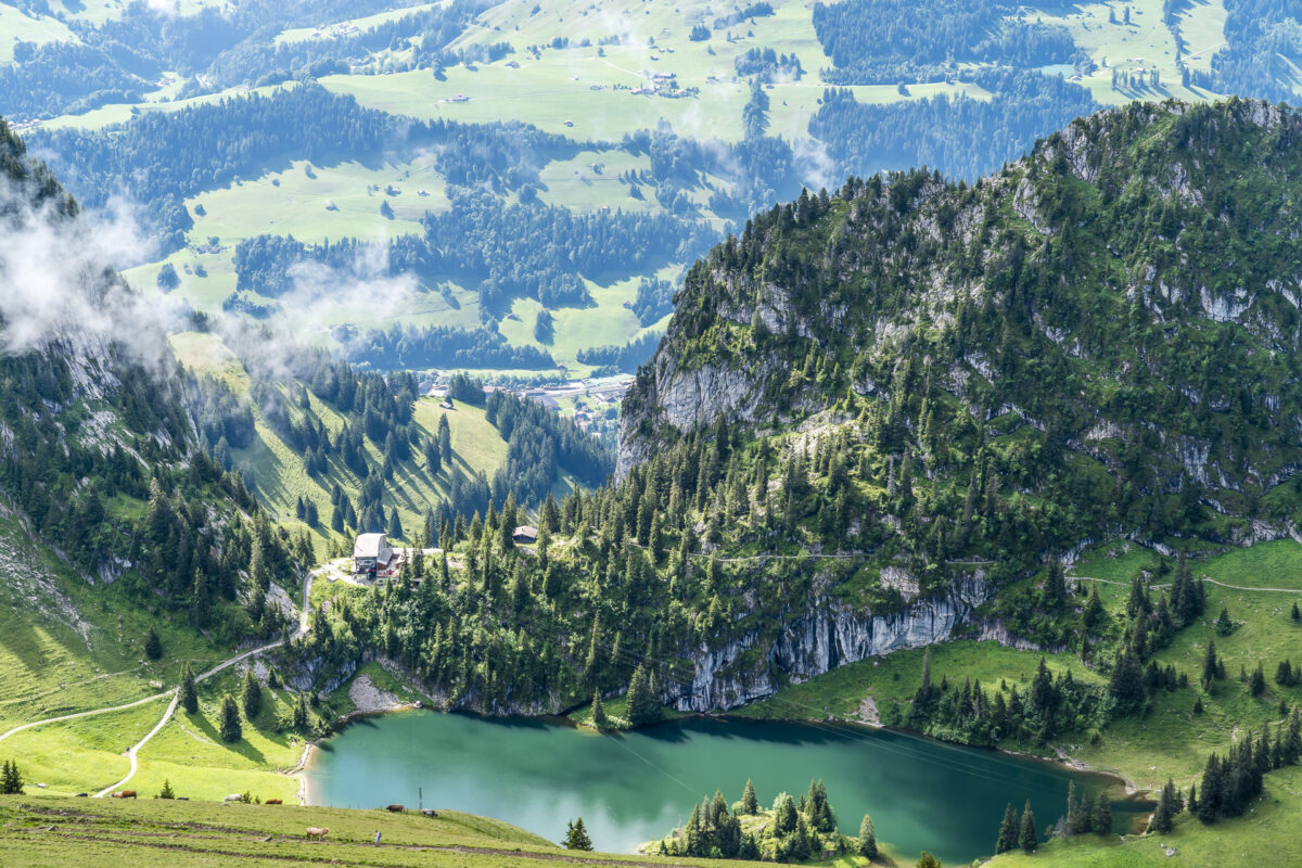
Faster than expected we reach the ridge and from here we enjoy the view down to the Walalp and towards Oberstockensee. For this, the effort was definitely worth it.
Gipfelglück
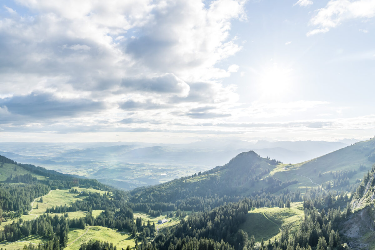
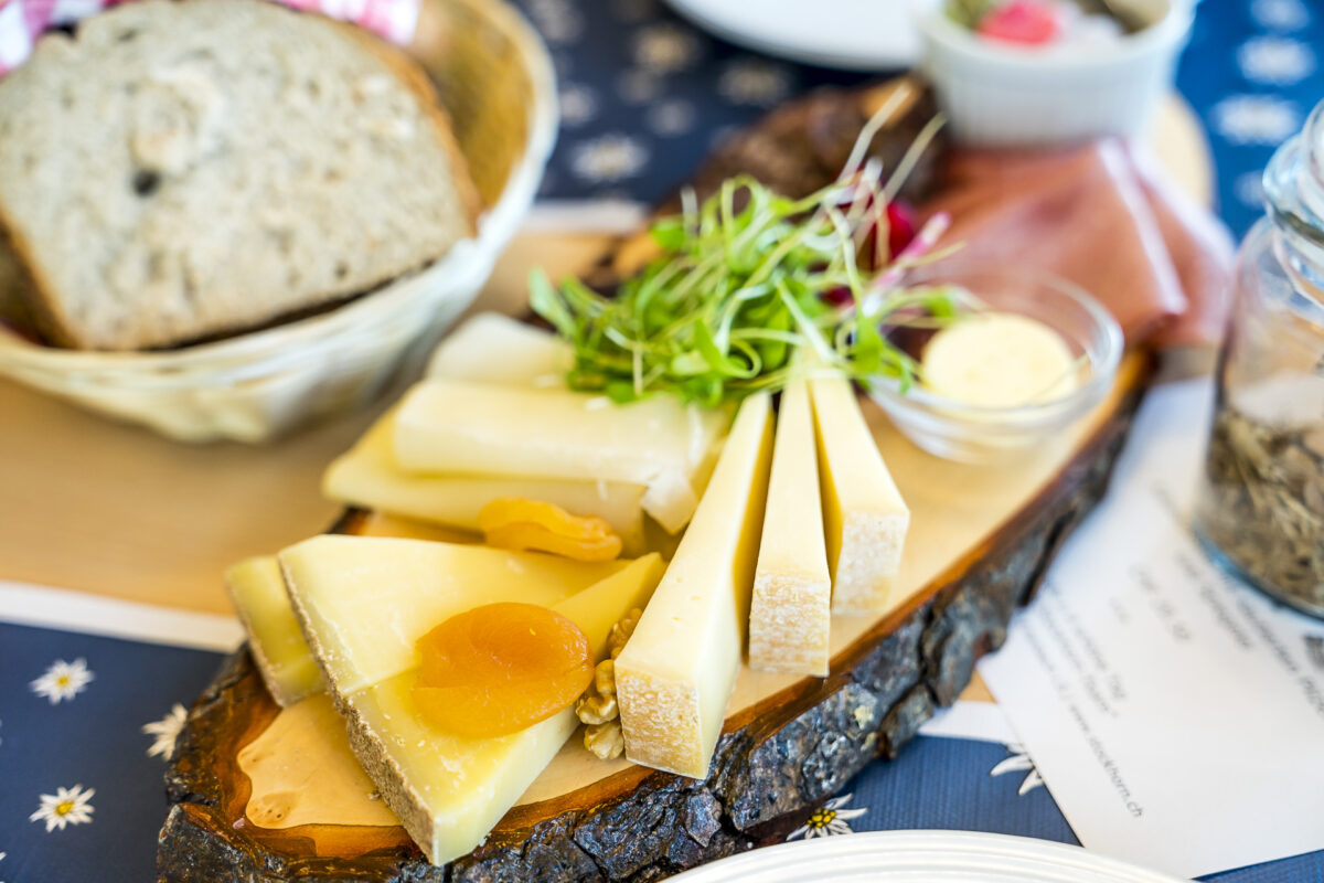
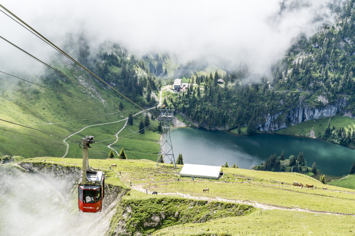
The “hardest” is mastered at this point and 15 minutes later we can already see the panorama restaurant Stockhorn in front of us. If you still have energy left at this point, you can still take the few additional metres of altitude to the summit or the ground-level path through the “tunnel” to the panoramic viewing platform. For us, there is another impressive view of the north face from the summit at the top, then we sit down on the sun terrace and share a fine plate – before we take the gondola down to the valley.
Practical tips for your high-altitude hike to the Stockhorn
On the following map you can see our route along the high-altitude hiking trail from the Gurnigel to the Stockhorn. The route is around 11 kilometres long and includes an ascent of almost 1,000 metres in altitude, most of which occur at the two neuralgic points of the Leiterenpass and the Stockhorn North Face. It took us a little less than four hours for the tour – it is signposted as around 4.5 hours. The high-altitude hike leads along a mountain path of difficulty T2. There are no particularly sloping or technically tricky passages and the tour can also be undertaken with sure-footed and fit children (I myself completed the tour together with my parents at the age of about 10 years). Since the altitude difference is piecemeal, you shouldn’t be deterred too much by this.
You can reach the starting point of the hike by PostBus from Thurnen. This summer, Stockhornbahn AG launched a new hiking ticket together with BLS and PostBus. This includes the post bus ride Thurnen Bahnhof – Gurnigel, Wasserscheide as well as the descent with the Stockhornbahn from Stockhorn to Erlenbach. The ticket costs CHF 55.60 for adults without a discount (with Half-Fare travelcard 28.30). You benefit from a price reduction of around 20% compared to the regular individual purchase of tickets. It should be noted that the hiking ticket is only valid for the PostBus route of line 323 (departure at 08:35 a.m. in Thurnen). The ticket can be purchased via the BLS webshop until at least 24 October 2021. The journey by train to Thurnen or the return journey from Erlenbach is not included in the hiking ticket.
By the way, you can also enjoy Zmörgälä on the Stockhorn. You can find out more about it here: Stockhorn-Zmorgen – Breakfast above the clouds
Key data of the tour Gurnigel – Leiterenpass – Stockhorn
| Starting point | Postbus stop Gunigel, watershed (1,584 m above sea level) |
| Reachability | Accessible by public transport |
| Length | 11.3 kilometres |
| Elevation gain | ↗ 1,008 m 460 m ↘ |
| Duration | 4:20 p.m. |
| Destination | Stockhornbahn mountain station (2,190 m above sea level) |
| Catering | Underi Walalp (self-service with al-products), Panorama Restaurant Stockhorn |
Leave a Reply