

Hikes around the Schallenberg: three tips for every taste
Advertising: Contribution in cooperation with PostBus Ltd
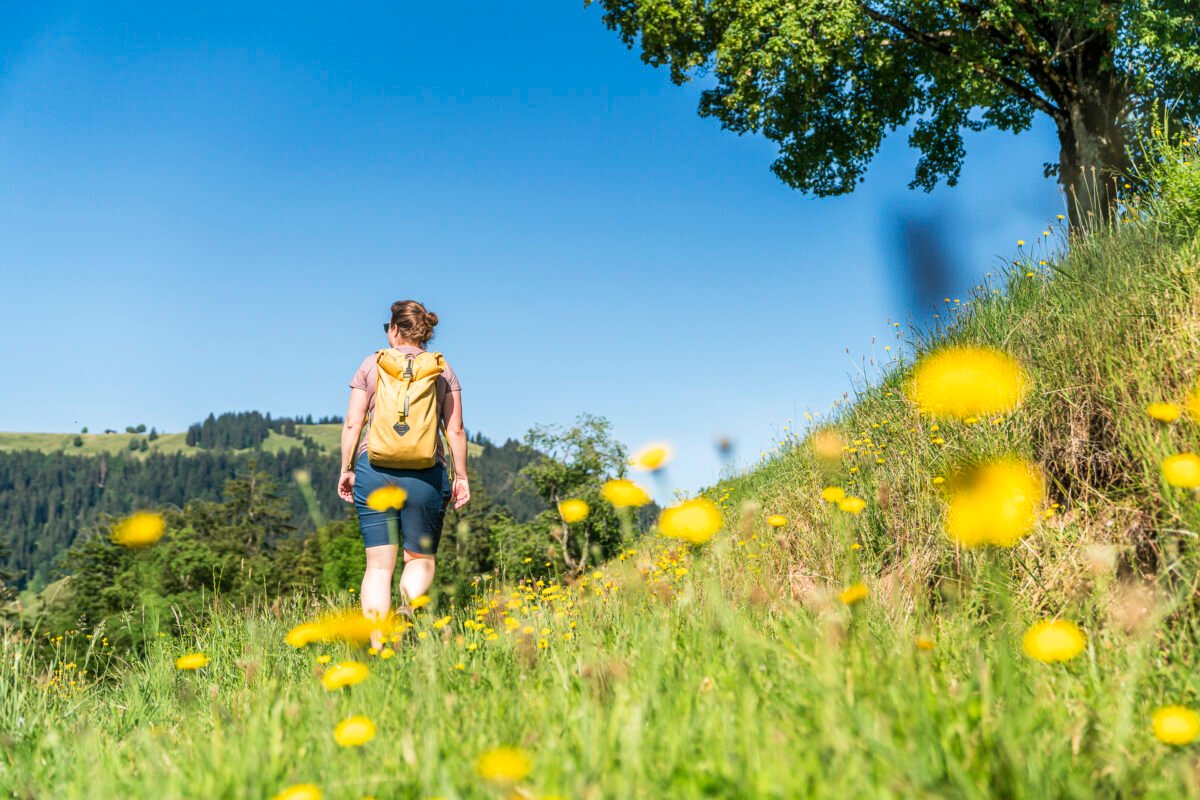
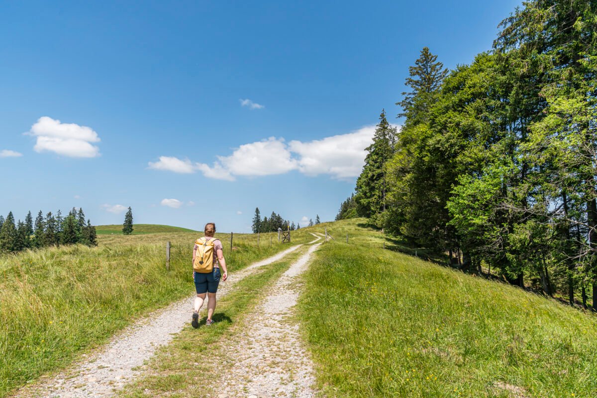
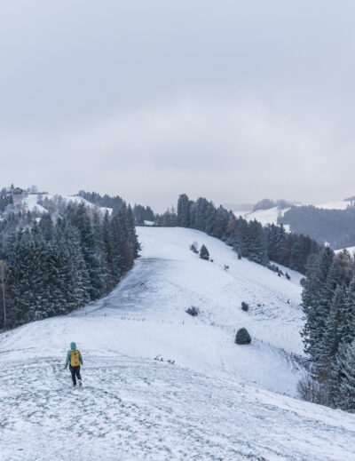
Leisurely hiking trails with far-reaching views, family-friendly routes and hidden natural gems – all this can be found around the Schallenberg. The pass, which connects the Thun region with the Emmental and Entlebuch, has so far been known mainly to motorcyclists. Since this spring, you can also experience the pass ride by public transport – and at the same time discover new corners of the beautiful Entlebuch and Emmental. We took the opportunity to explore three varied hikes around the Schallenberg for you.
[alert color=”FFFFFF” icon=”Select an Icon” title=”New hiking destination thanks to new PostBus line“]
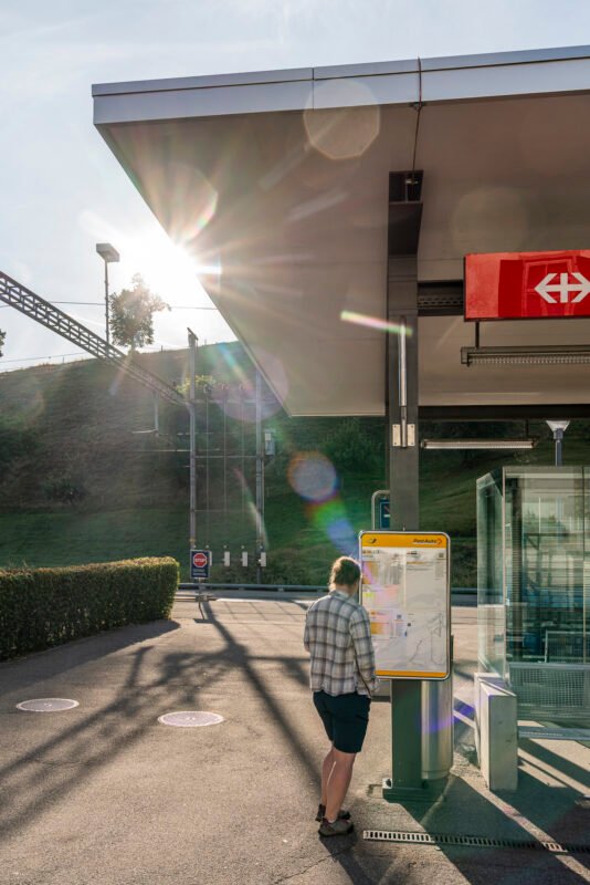
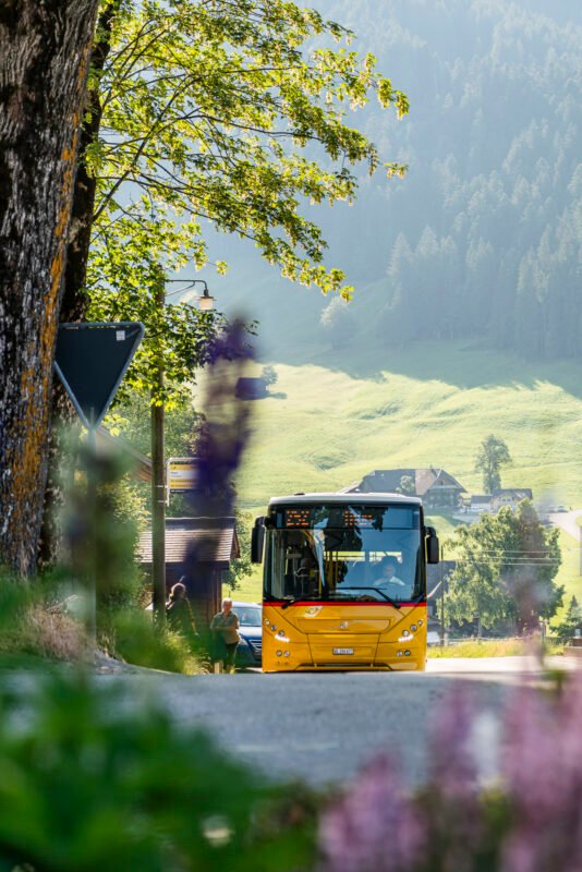
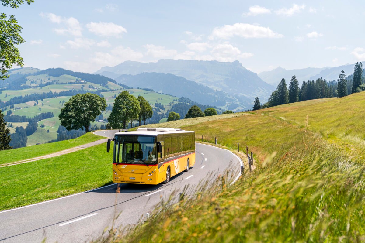
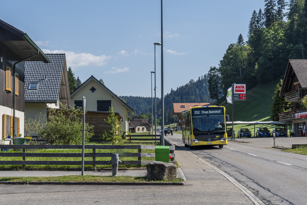
In cooperation with PostBus, I present you in this section selected excursion destinations in the Bern/Central Switzerland region, which are located along the various PostBus lines. The first is the Schallenberg, which can be easily reached from Escholzmatt and Thun on weekends from May to October with the newly commissioned line no. 252. Numerous excursion destinations and hiking routes in this region thus benefit from improved access by public transport.
[/alert]
Hiking tips around the Schallenberg
We start our excursion in the most wonderful summer weather at the Escholzmatt train station. The timetable of the new line provides for four routes in each direction every Saturday, Sunday and public holidays. This will not only create a direct and attractive connection between the Thun region and Entlebuch, but the excursion destinations in between – including Marbachegg and Schangnau – will benefit from optimised connections.
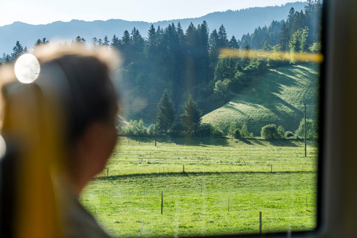
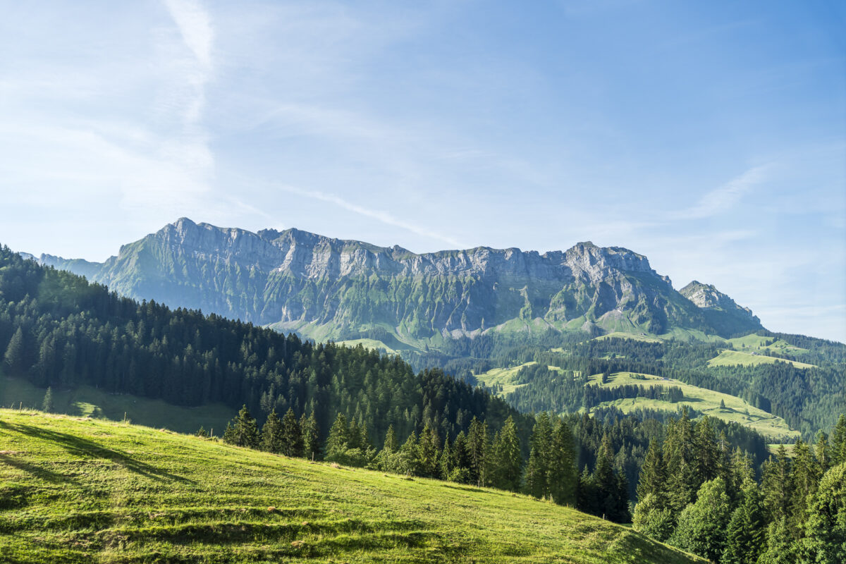
Punctual to the minute, the post bus arrives at 8:10 a.m. I secure one of the panoramic window seats on the left in the direction of travel. If you sit here, you can enjoy a magnificent view of the green hilly landscape of the Entlebuch and Emmental as well as the distinctively furrowed Hohgant.
For the more adventurous: from Schangnau via the Räbloch Gorge to the Schallenberg
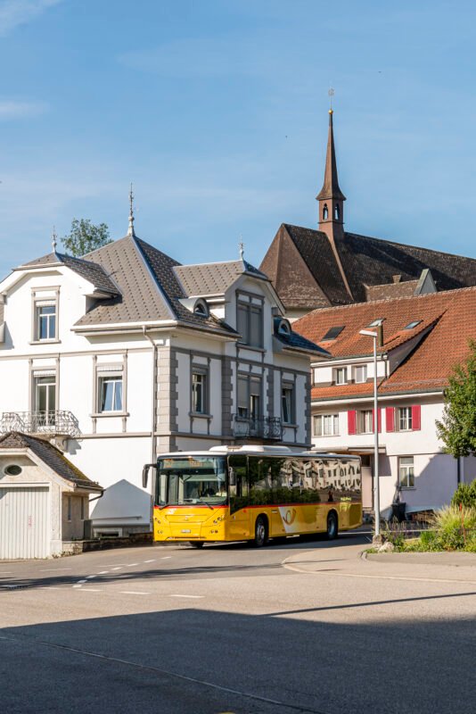
Shortly before Schangnau, it appears in front of us like a mighty bulwark. What an impressive sight! At the bus stop Schangnau, Post in the middle of the idyllic center of Schangnau, the first stage of the bus ride on the Schallenberg line ends for us.
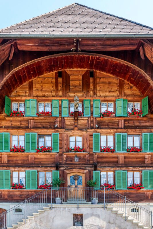
Before we shoulder our backpacks to tackle the last few kilometres to the top of the Schallenberg pass with our own muscle power, we fortify ourselves with a coffee in the cosy dining room of the Gasthof Löwen. This is located directly opposite the bus stop and cannot be overlooked thanks to its magnificent facades.
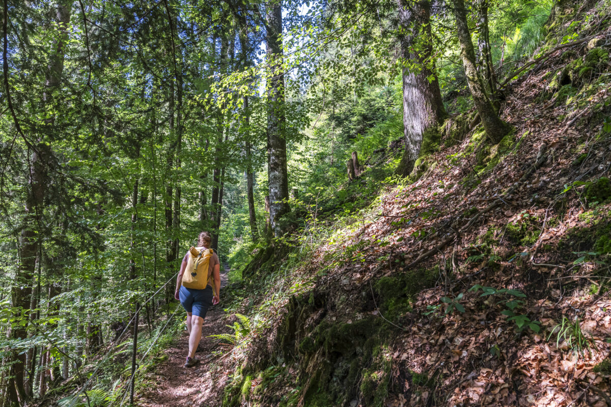
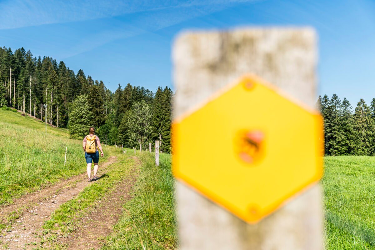
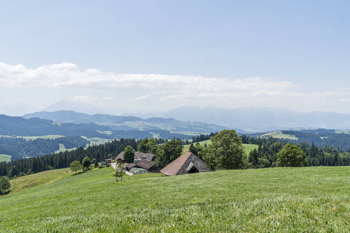
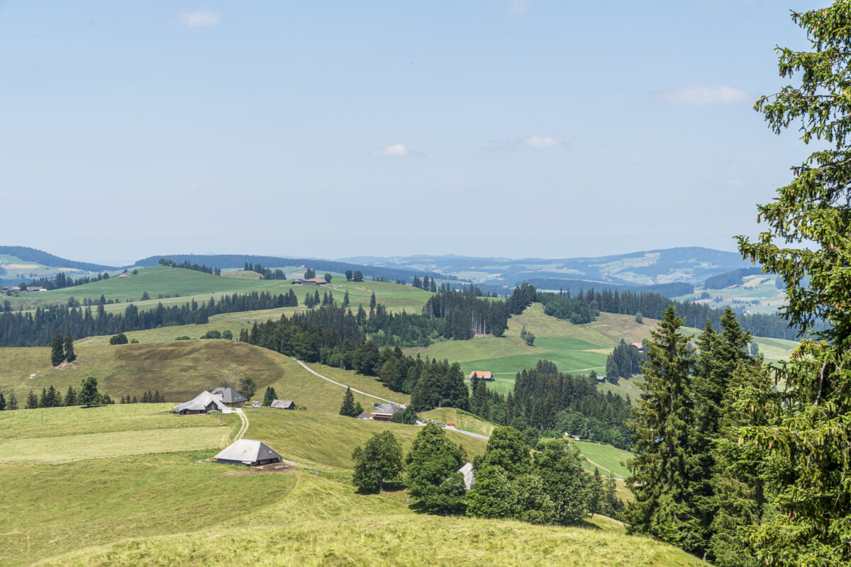
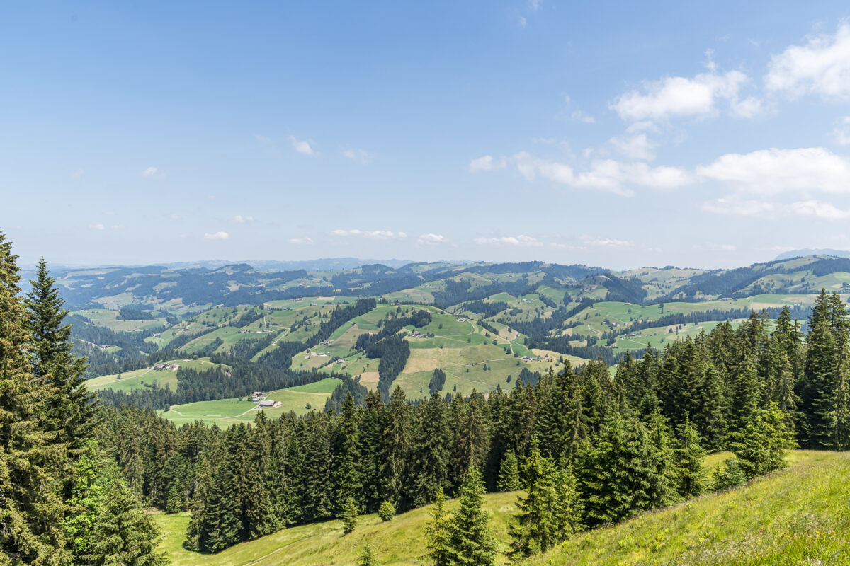
Then we follow the signpost through the village centre uphill towards Scheidbach. Once the first metres of altitude have been overcome, an impressive view opens up over the municipal area of Schangnau. This stretches, wedged between the Schrattenfluh and the Hohgant, all the way to Kemmeriboden-Bad.
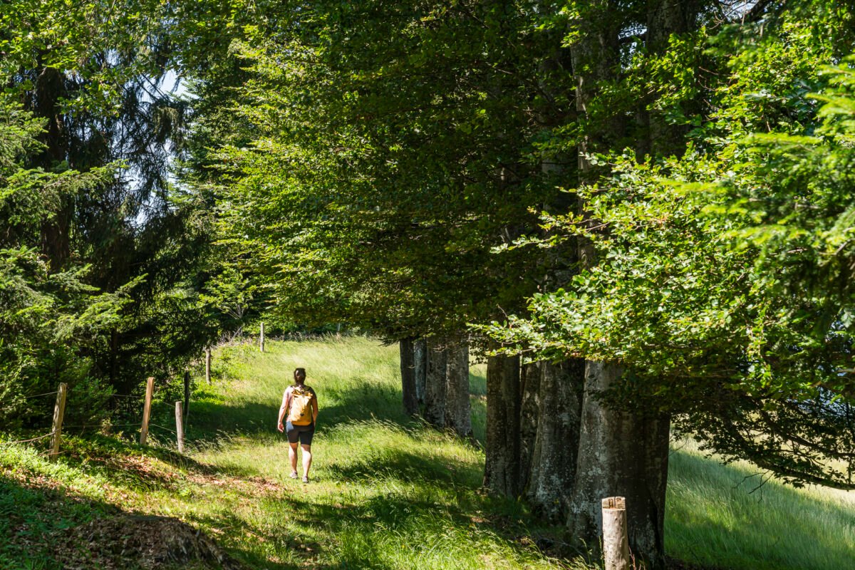
We pass a children’s playground with a barbecue area and follow the tarred road further along the edge of the slope. Soon, the hiking trail signs lead us to nature trails. After the Schafschwand (where, funnily enough, a few sheep are actually lazily lying in the shade), it goes short but crisp down into the Räbloch gorge.
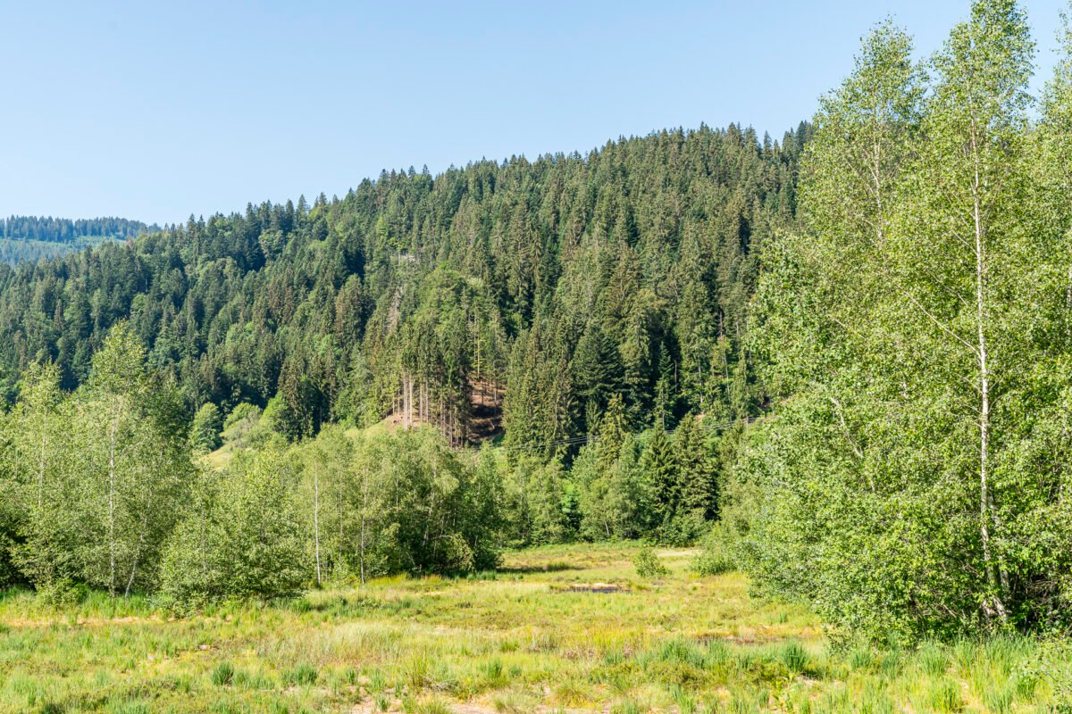
The gorge is a contemporary witness of the last ice age, when the Räbloch was still ice-covered compared to the rest of the Emmental. Arriving at the bottom of the natural bridge, we pause for a moment and examine the imposing, high rock faces. At this point, they come almost to within a meter of each other. In between, the Emme splashes peacefully along on this day.
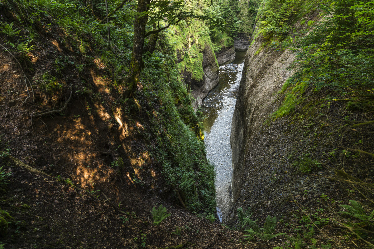
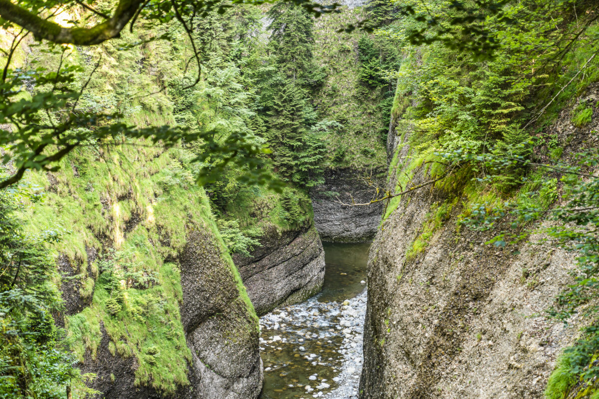
However, the breather is short-lived. On the other side of the natural bridge, it is just as steep uphill as we descended before. Another highlight after crossing the Räbloch Gorge is the Steinmösli nature reserve. This is connected to the hiking trail by a wooden footbridge and is considered the most important raised moor in the region. It is worth pausing here for a moment and taking a sip before the remaining final ascent to the Schallenberg.
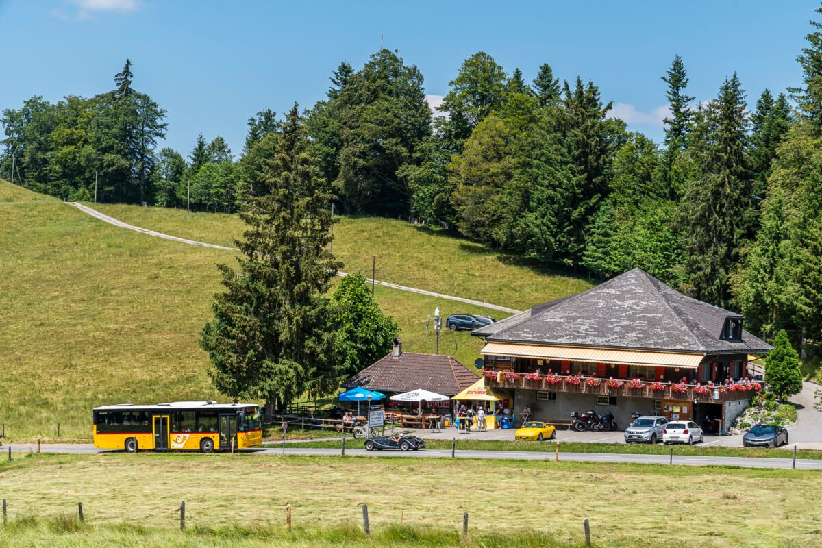
We pass the bus stop Eggiwil, Räbloch, cross the pass road and then take course towards Schallenberg via Knubelhütte and Huriwald. I particularly like the last 500 meters or so, which lead over a lovely plateau to the Gabelspitz restaurant at the top of the pass. We have well deserved the stop there with the completed tour!
Key data of the hike Schangnau – Räbloch – Schallenberg
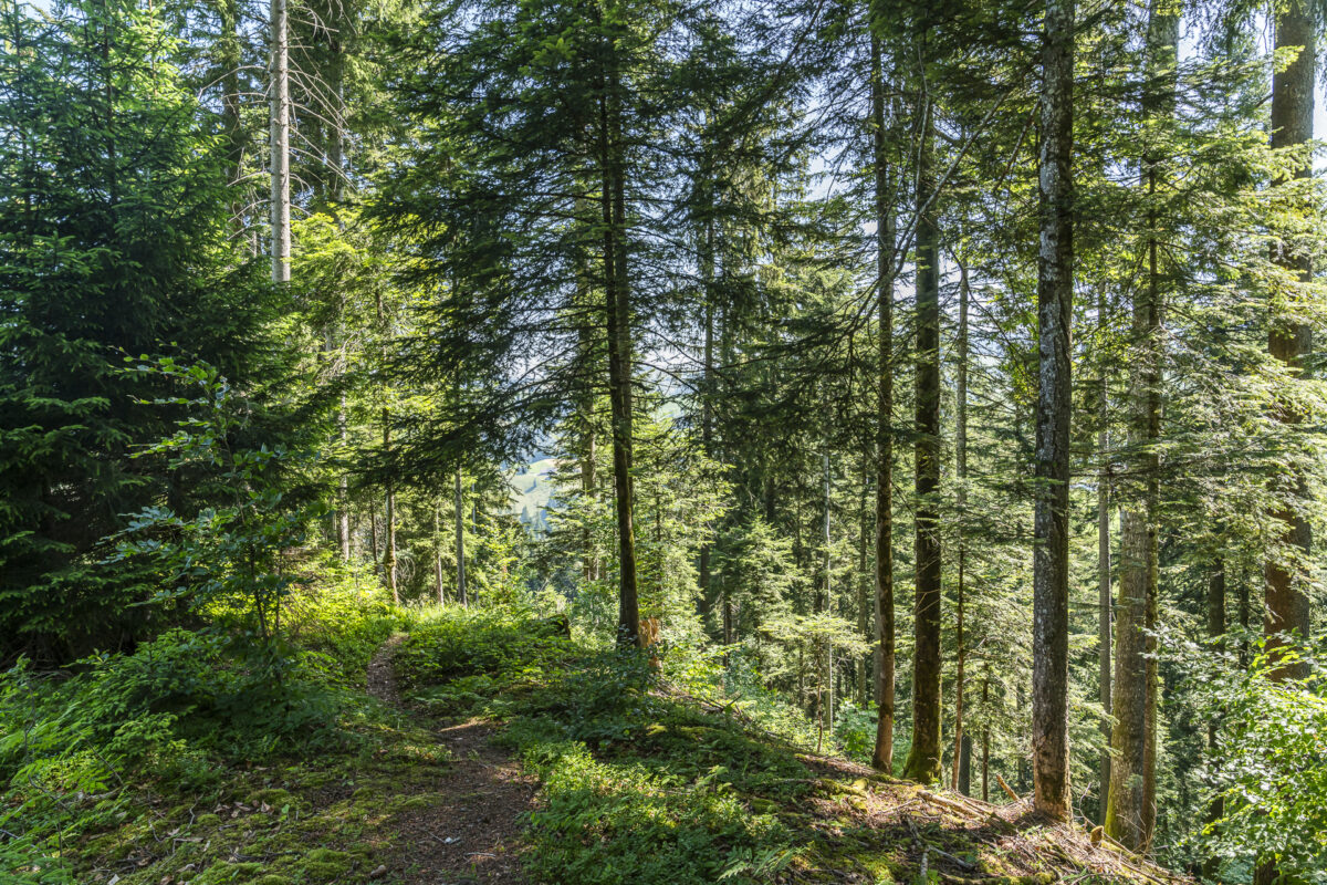
On the following map you can see the route of the hike from Schangnau via Räblochschlucht to the Schallenberg. It is a yellow-marked hiking trail with a difficulty level of T1/T2. Note that the descent to the Räbloch gorge is not sloping, but quite steep over partly uneven terrain. If you feel unsafe on such passages, you are well served to pack hiking poles. On the way, you can expect both paved sections and natural paths. From the Steinmösli high moor, the path runs within walking distance of the Schallenberg Pass road, i.e. the “sound” of loud motorcycles and convertibles accompanies your ascent.
| Starting point | Bus stop Schangnau, Post (930 m above sea level) |
| Reachability | Schallenberg can only be reached by public transport on Saturdays/Sundays |
| Length | 6.9 kilometres |
| Elevation gain | ↗ 476 m 241 m ↘ |
| Duration | 2:20 p.m. |
| Destination | Schallenberg Pass bus stop (1,161 m above sea level) |
| Catering | Restaurant Gabelspitz, Schallenberg |
For the far-sightedness: from Schallenberg via Naters to Röthenbach i. E.
While my first hiking tip scores with a beautiful view, especially at the beginning and at the end, the foresight is a constant companion on this tour. To do this, we stay in the Postbus until we reach the Schallenberg stop, at the top of the pass. Instead of setting off straight away, it’s worth making a short pit stop on the sun terrace of the Gabelspitz restaurant after arrival. The nut croissants are already very tempting on the tables.
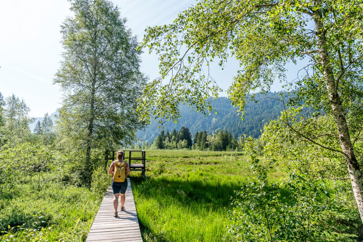
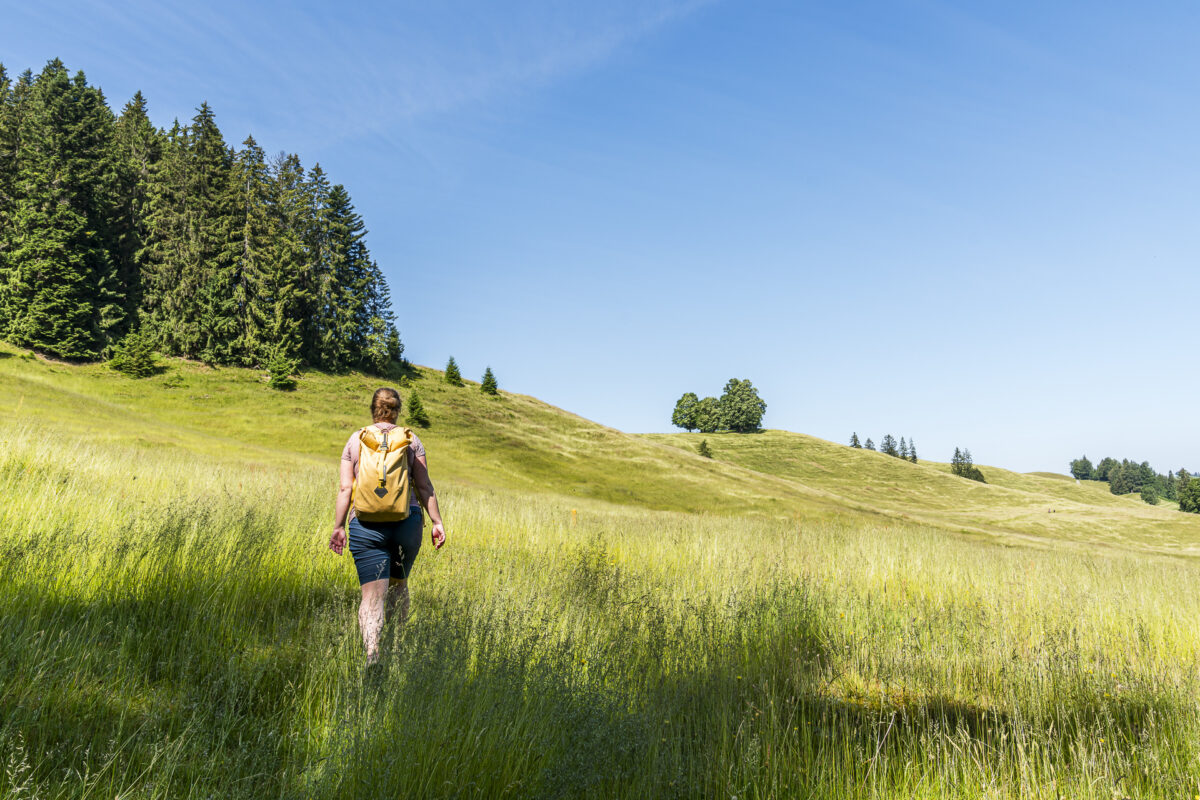
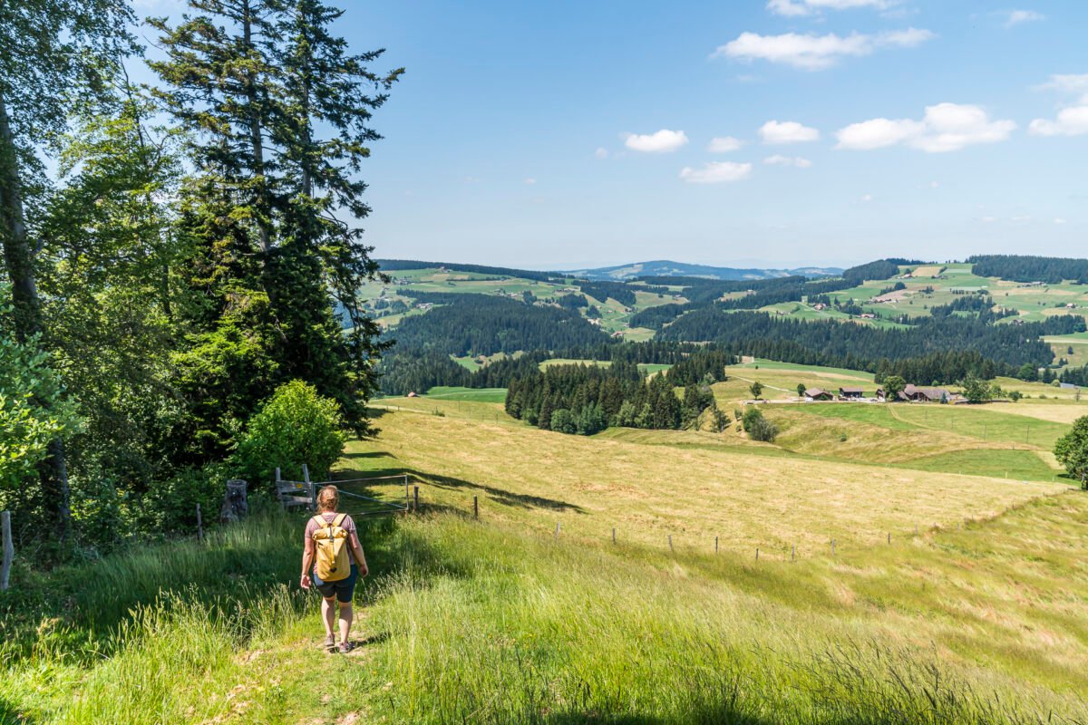
Then we follow the signs from Schallenberg in the direction of Röthenbach. The hiking trail follows a wide gravel path along the ridge in the direction of Naters. To the right of the path, the view sweeps over the Emmental hills – to the left we see the beautiful Bernese Pre-Alps.
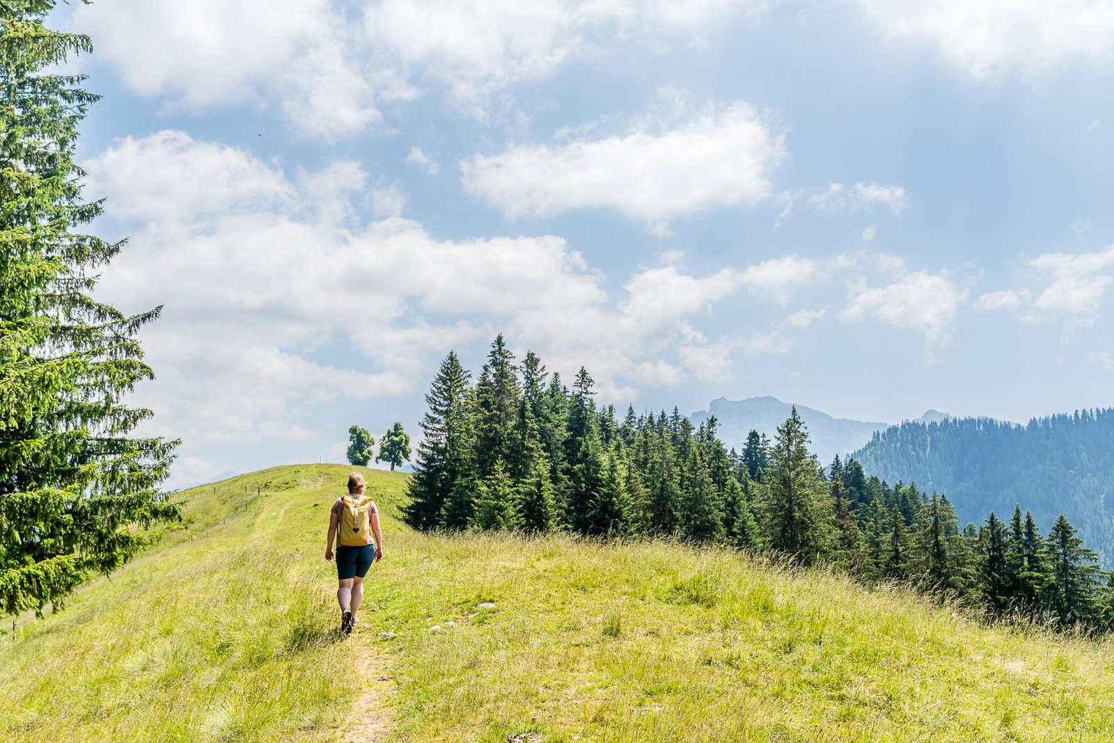
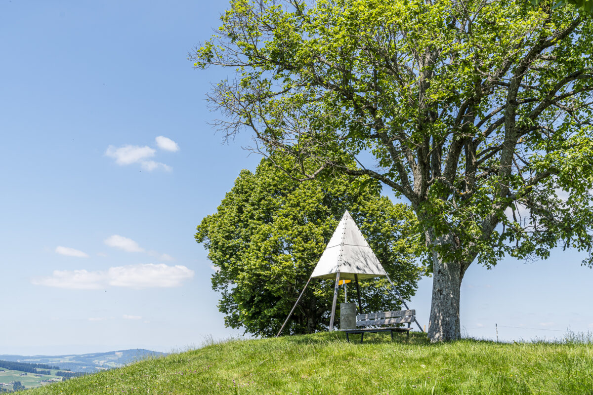
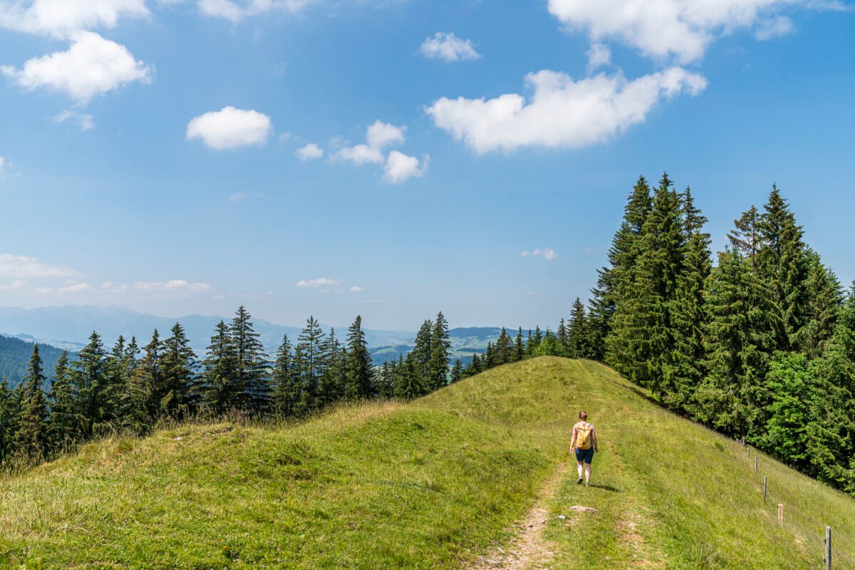
Shortly after “Hinter Naters”, the most beautiful part of this tour follows: On little-used field and meadow paths, we ascend to the old survey pyramid at 1,212 m above sea level. Here you can expect cosily placed benches and a magnificent view towards the Stockhorn chain.
Afterwards it goes downhill to Röthenbach with a view of the Chuderhüsi observation tower. We bridge the waiting time for the bus connection to Thun with a stop at the Moos Pintli restaurant, which is located right next to the bus stop and convinces with an extensive dessert menu. Alternatively, depending on the time of day and timetable connection, you could also install an additional loop to the Chuderhüsi Tower.

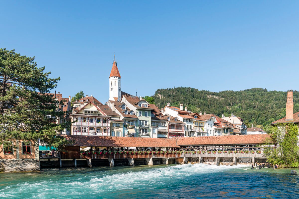
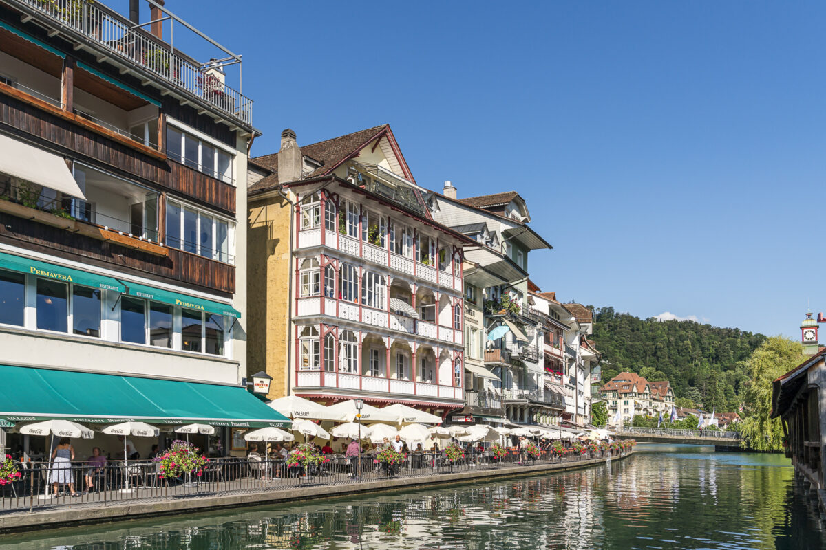
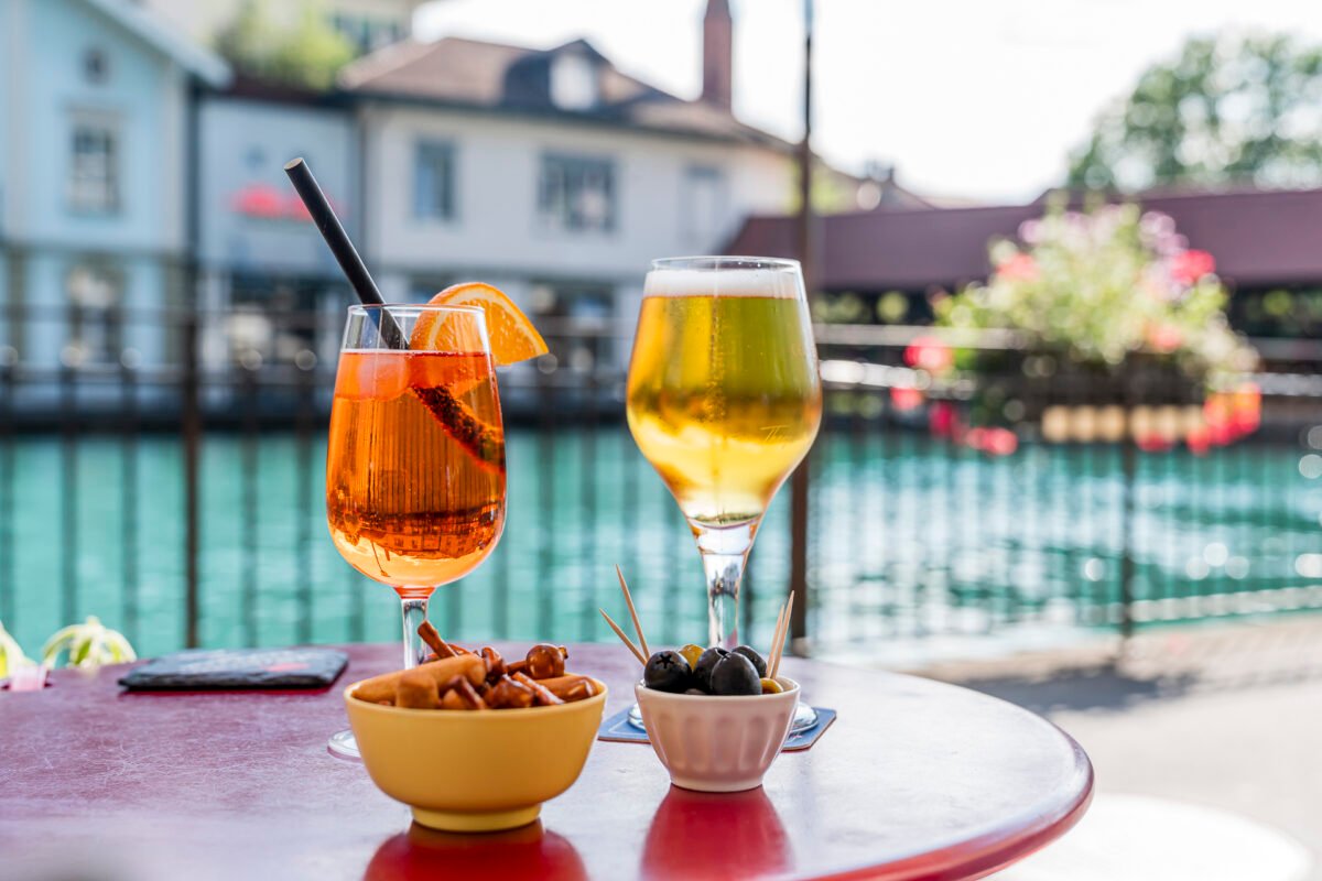
Our hiking trip ends – how could it be otherwise, with this connection with the STI bus to our beautiful “old” homeland – with an aperitif on the Aarequai in Thun. Is there a more attractive place to end a summer day of hiking? Hardly!
Key data of the hike Schallenberg – Naters – Röthenbach i. E.
On the following map you can see the route of the hike from Schallenberg to Röthenbach in the Emmental. It is a yellow-marked hiking trail with a difficulty level of T1/T2. The trail is not technically demanding and runs mostly on forest paths, over pastures and on gravel paths. In the last third you can also expect a longer paved section. The final descent through the forest to Röthenbach is short, but “gääch” – as they say in Bernese German.
| Starting point | Schallenberg Pass bus stop (1,161 m above sea level) |
| Reachability | Schallenberg can only be reached by public transport on Saturdays/Sundays |
| Length | 6.2 kilometres |
| Elevation gain | ↗ 101 m 444 m ↘ |
| Duration | 1:45 p.m. |
| Destination | Bus stop Röthenbach i.E., Dorf (825 m above sea level) |
| Catering | Restaurant Moos Pintli in Röthenbach |
For the Sunday excursion: from Schallenberg to Turner
My third hiking tip is ideal for those who want to combine a pass ride with a short hiking tour. From the top of the Schallenberg pass, a hiking trail leads southeastwards over the ridge in a good thirty minutes (signposted 35 minutes) to the Turner. Here you can expect not only a comfortable bench, but also a good panoramic view over the hills of the upper Emmental. The way back is the same way.
Key data of the hike to the Turner
On the following map you can see the route of the short hike from Schallenberg to Turner and back. It is a yellow-marked hiking trail with a difficulty level of T1/T2. The ascent to the Turner is signposted at the top of the Schallenberg pass with 35 minutes and leads over gravel and natural paths (not suitable for prams!).
| Starting point | Schallenberg Pass bus stop (1,161 m above sea level) |
| Reachability | Schallenberg can only be reached by public transport on Saturdays/Sundays |
| Length | 3.1 kilometers |
| Elevation gain | ↗ 160 m 160 m ↘ |
| Duration | 1:00 p.m. |
| Destination | Schallenberg Pass bus stop (1,161 m above sea level) |
| Catering | Restaurant Gabelspitz, Schallenberg |
Extra tip for the ambitious
If you like, you can also combine the three hiking routes described above wonderfully. That’s exactly what we did. For the route Schangnau – Schallenberg – Turner – Schallenberg – Röthenbach we needed about 4.5 hours of pure hiking time.
Practical tips for your trip to the Schallenberg
- The Schallenberg line runs from Escholzmatt in Entlebuch with stops in Marbach, Schangnau, Eggiwil, over the Schallenberg Pass to Röthenbach i. E., Steffisburg and Thun. The line is operated by PostBus in cooperation with STI.
- From 29 April to 29 October, the connections via the Schallenberg will be offered on Saturdays, Sundays and public holidays with four courses in both directions.
- GA and Half-Fare travelcards as well as all other regular tickets are valid on this route.
- Since there are only four courses per day, it is advisable to study the timetables carefully when preparing the excursion so that you are not suddenly confronted with unintentionally long waiting times. However, since there are places to stop for refreshments in Schangnau, on the Schallenberg as well as in Röthenbach, these would also be relatively easy to bridge.
- The Schallenberg line also offers transfer options in Schangnau in the direction of Kemmeriboden and in Röthenbach to the BLS hiking bus to Chuderhüsi.
- Further information on the timetable and the other sights along the Schallenberg line can be found on the PostBus website.

Leave a Reply