

Hiking in the Napf Region: Three Stages with Panoramic Views and Culinary Moments
Advertisement: Post in collaboration with Emmental Tourism, Willisau Region Tourism, and UNESCO Biosphere Entlebuch
The Napf region is a paradise for active travelers. For those who take the time, a landscape full of diversity awaits here in the heart of Switzerland—with deeply carved gorges, endless forest trails, and scenic ridges. Along the way, culinary highlights and warm hospitality await. This very combination makes our three-day hike from Menzberg over the Napf to Ahorn Alp an unforgettable experience for anyone who loves natural beauty and panoramic views.
Day 1: From Menzberg to Schwesteregg Ridge
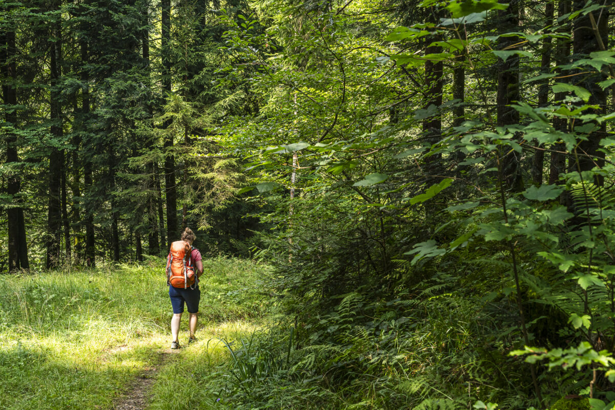
This isn’t our first visit to the Napf region. We’ve explored the hilly landscape by bike, and another time we hiked the Alpine Panorama trail to scenic campsites. This time we’re dedicating three days to a 28-mile hike that takes us not just around but also over the “muscle mountain.” Our starting point is Menzberg, the highest village in the Napf region. Since enjoyment is an important part of this tour, we start with a meal at the Landgasthof and Hotel Menzberg at the village entrance. Built as a spa hotel in the 19th century, this establishment is now run by the third generation of the Peter-Schmidlin family and impresses with expansive views over the Midlands. We strengthen ourselves with coffee and a croissant for the 10.5 miles ahead on the first day.
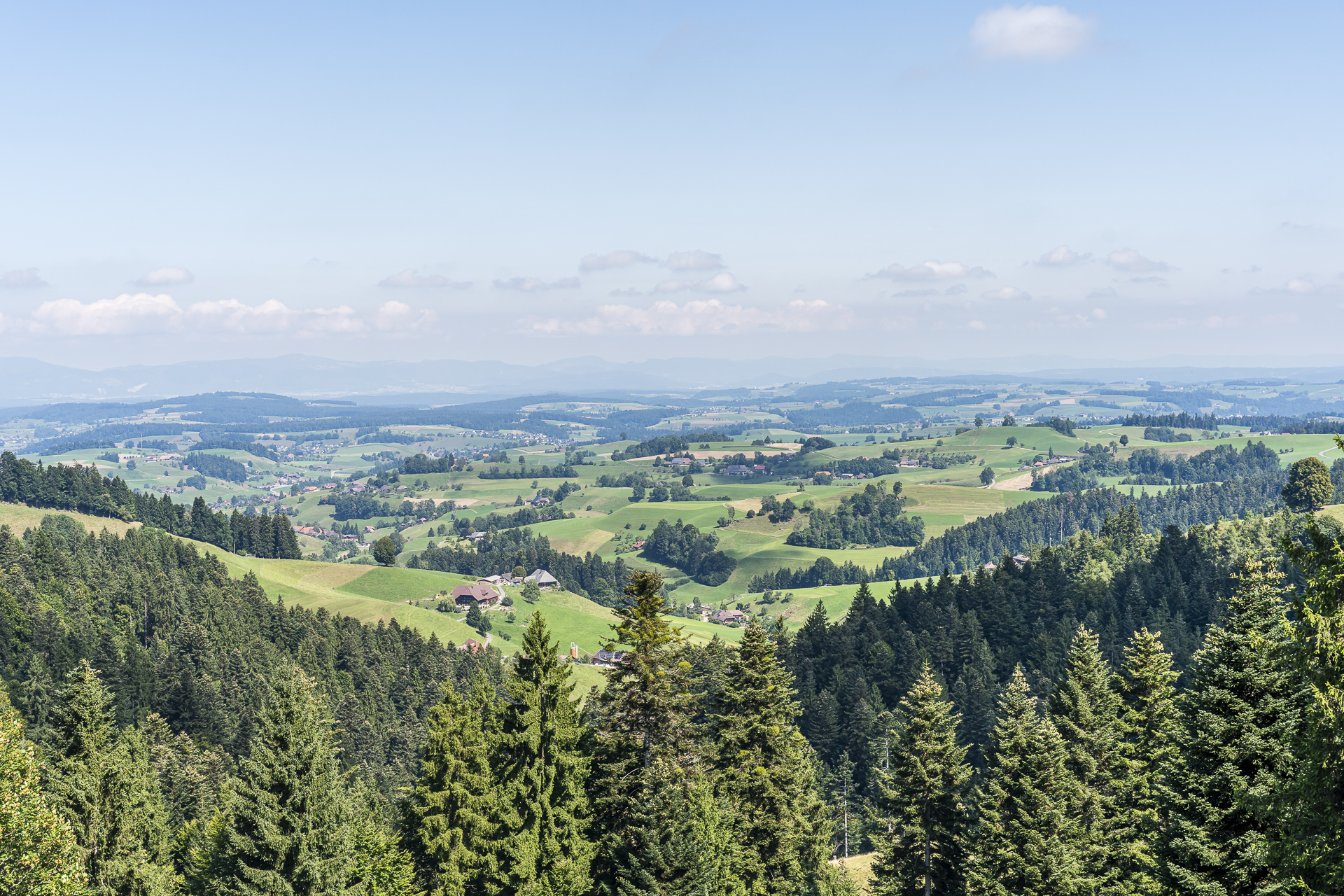
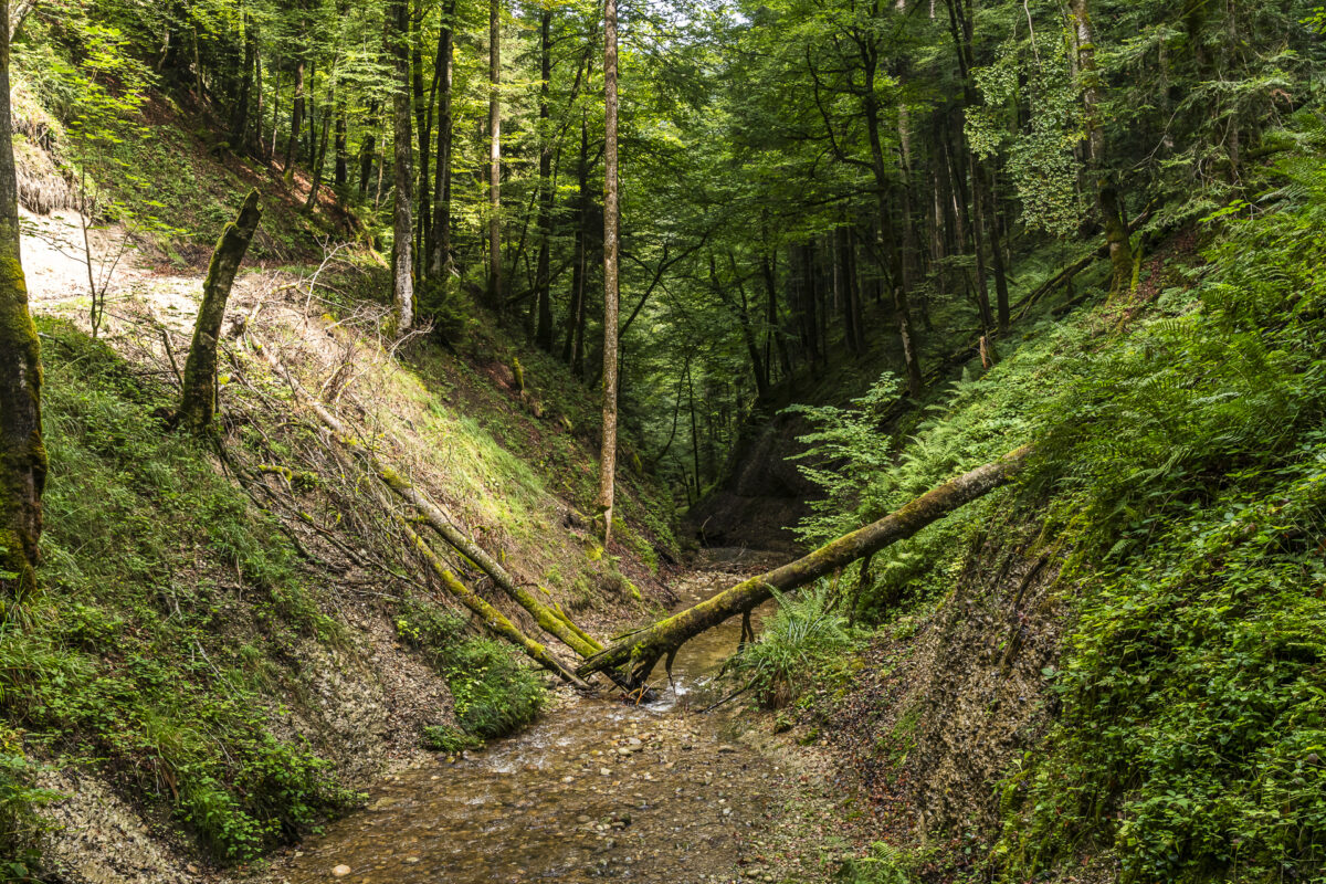
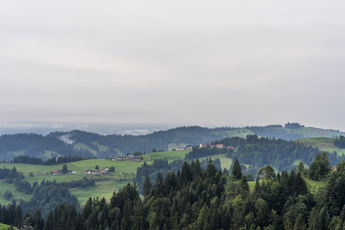
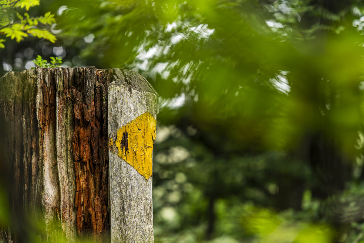
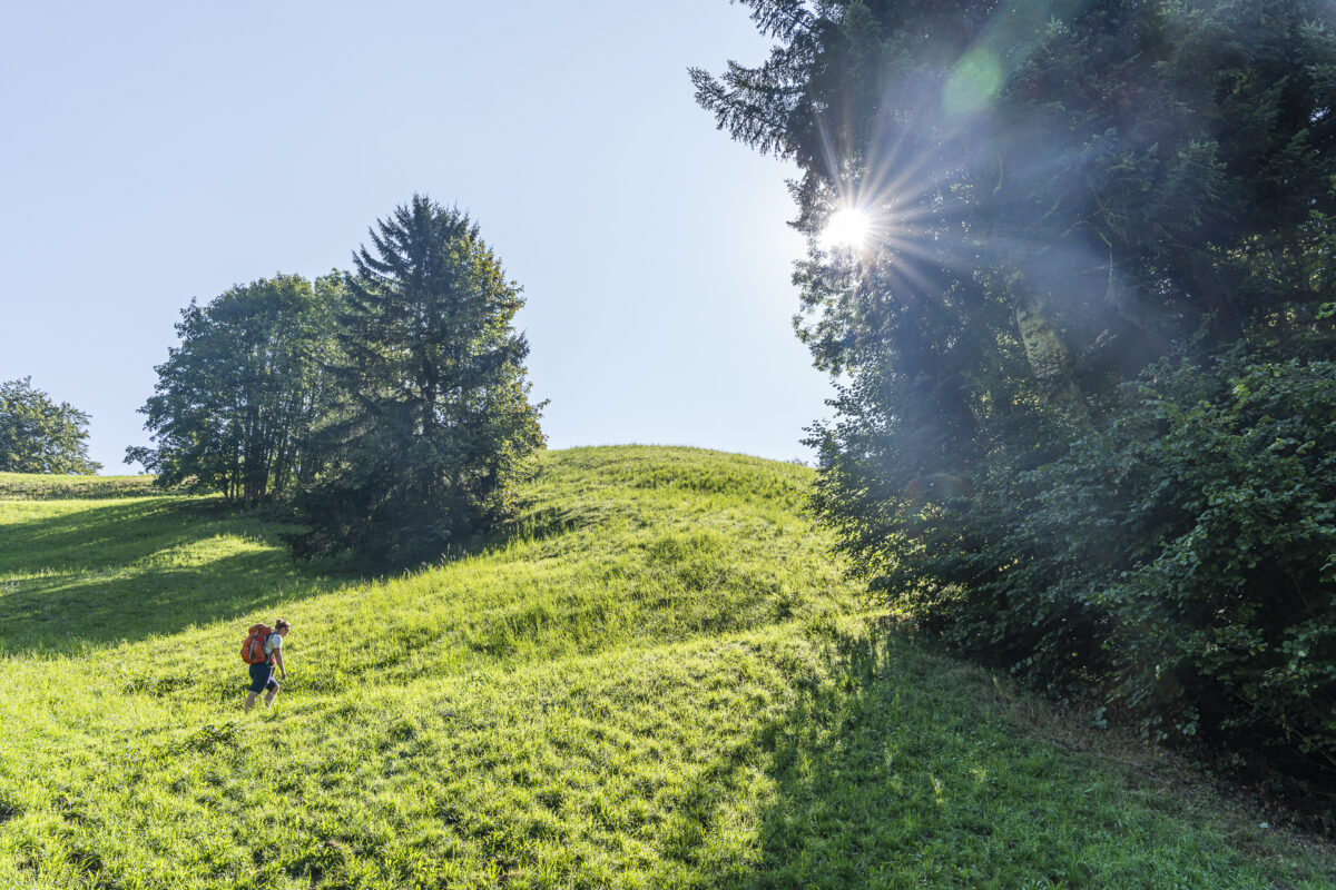
The air still carries considerable moisture from the previous day’s rain, so visibility toward the Midlands is somewhat reduced this morning. However, the mystical atmosphere fits perfectly with the Napf region. With one last look back at the idyllic village view of Menzberg, we follow the signpost toward Wolf and descend steeply through a forested gorge. The Napf region is often called the “Wild West”—and indeed, I feel as though I’m far from civilization on these forest paths. The hiking trail passes the grilling spot “Fuchsloch,” which sits directly beside a hidden waterfall and surely provides refreshing relief on hot summer days.
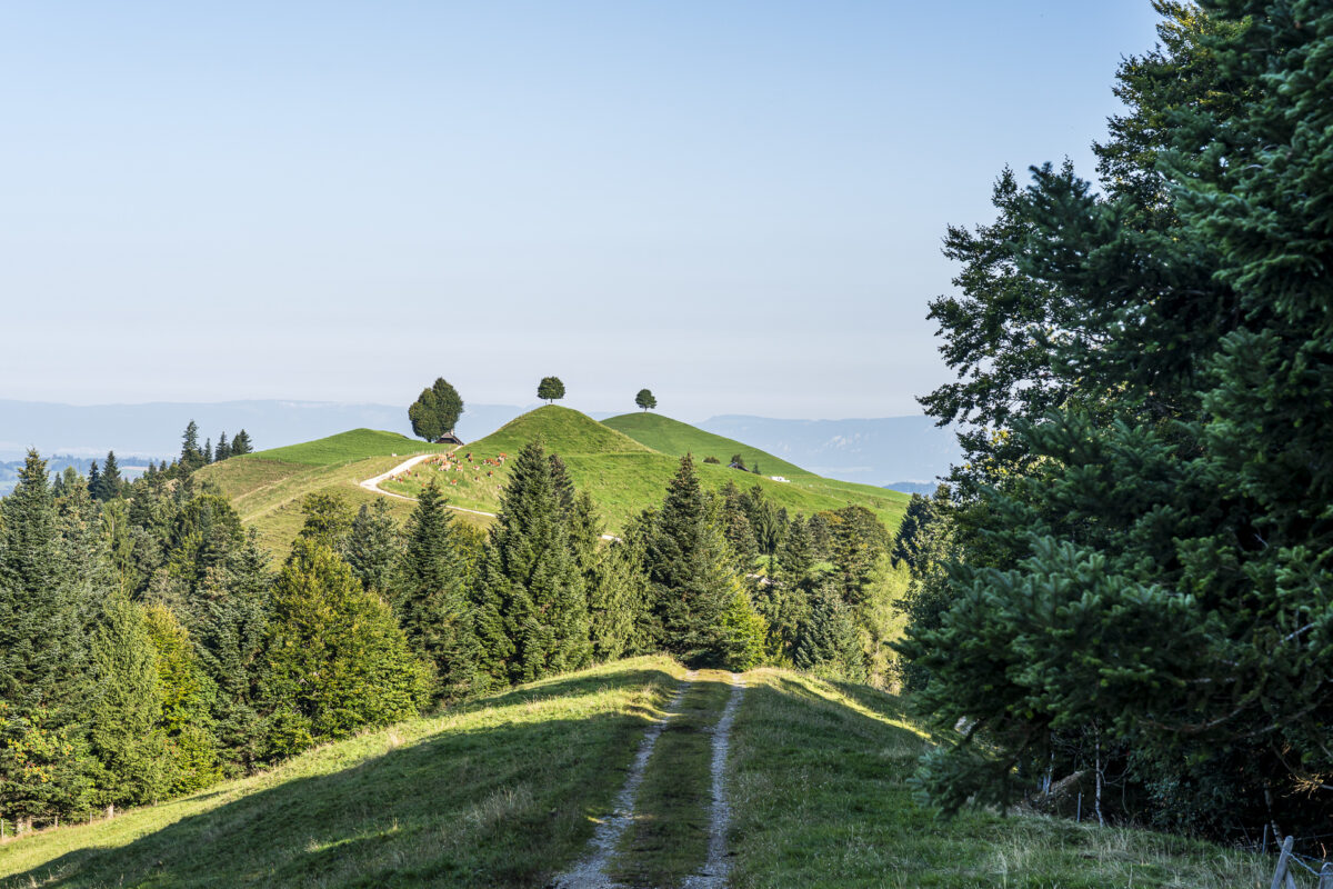
After 40 minutes we reach the valley floor. And as is often the case in the Napf region: elevation lost must be regained immediately. A steeply ascending path leads us in tight switchbacks up the elongated “Grosseberg.” Two hours and 2,000 feet of elevation gain later, we arrive at the mountain hut Ober Änzi, our intermediate destination.
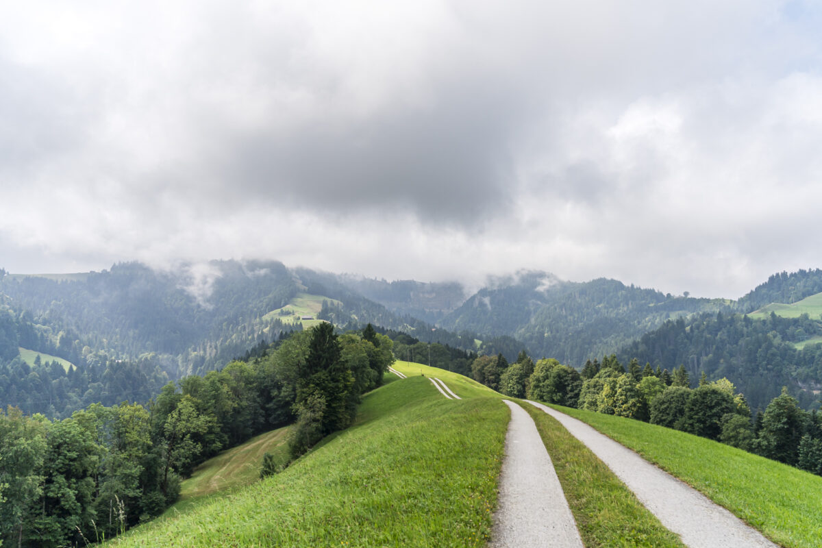

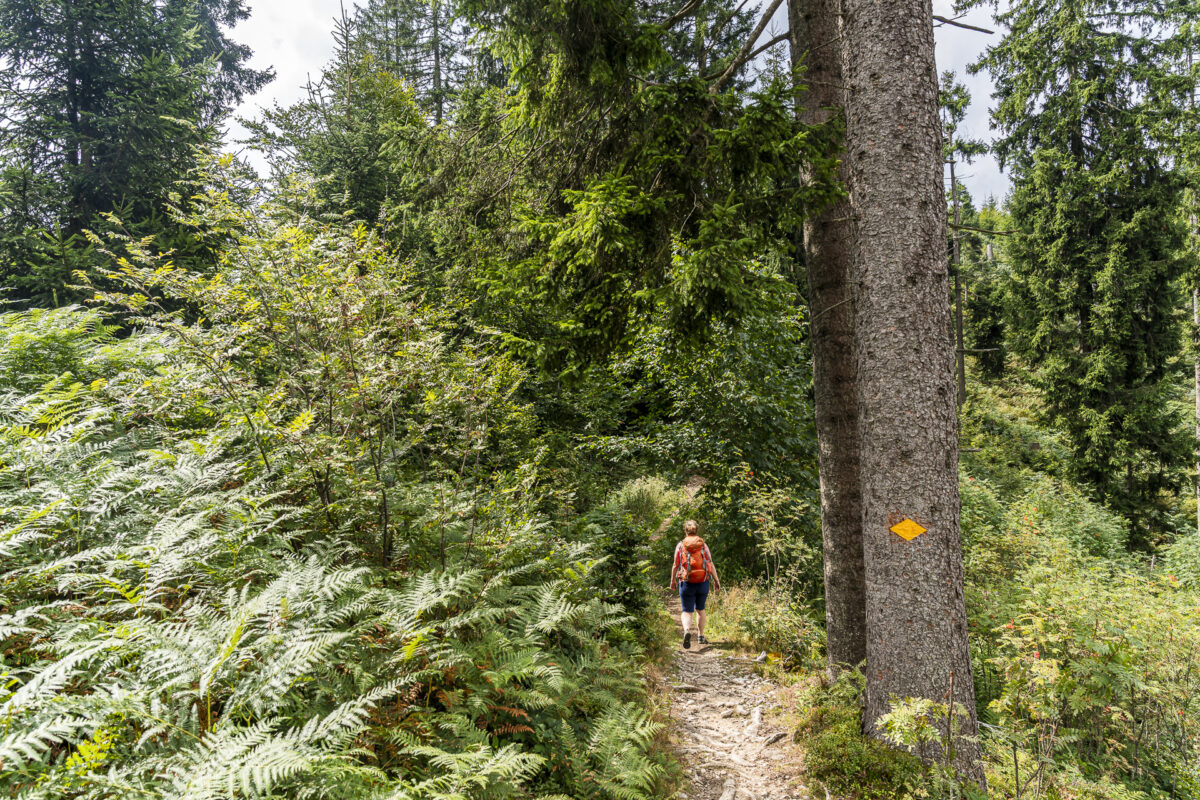
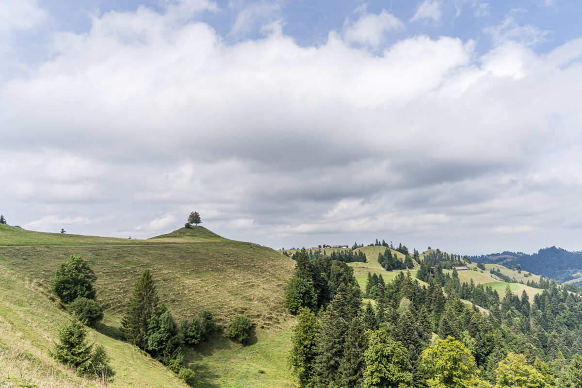
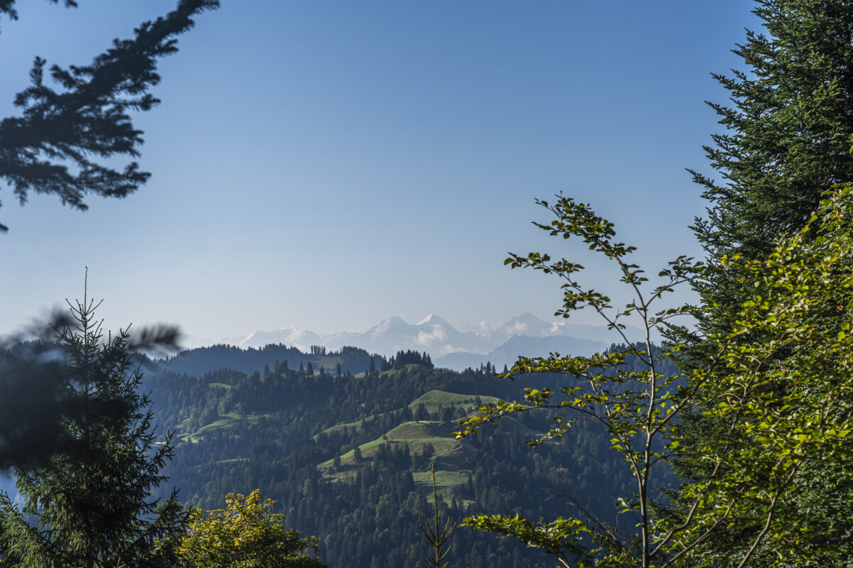
From here we could reach Napf in just 40 minutes, but after our break we head in the opposite direction. The ridge trail over Mättebergegg to Holzwäge is an easy stretch with nice views toward Romoos and Bramboden; on clear days you could even admire the Alpine panorama here. The final kilometers of this first day of hiking take us over a familiar route: Below Fuchsegg we join the Köhler Trail, which we follow to Schwesteregg.
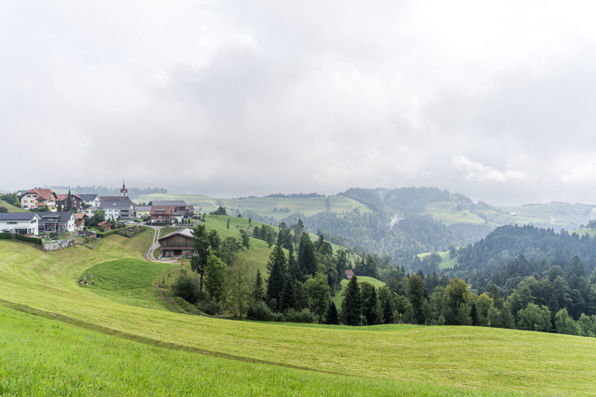
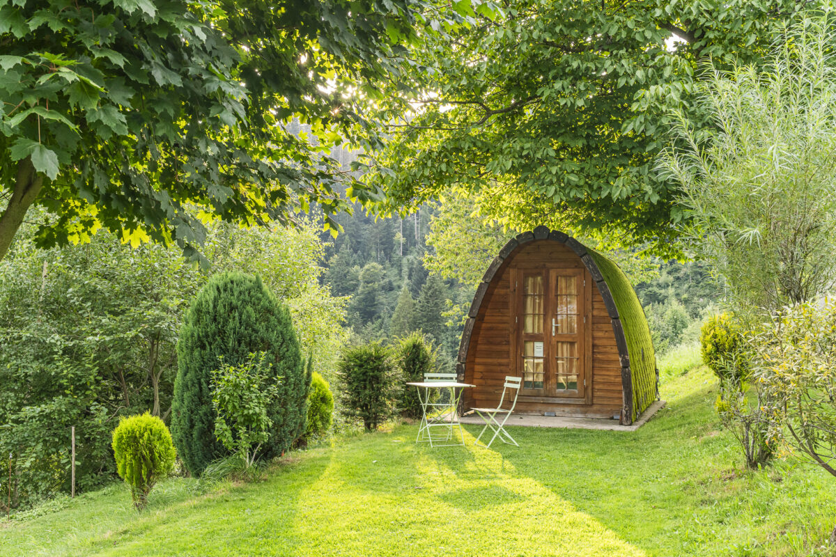
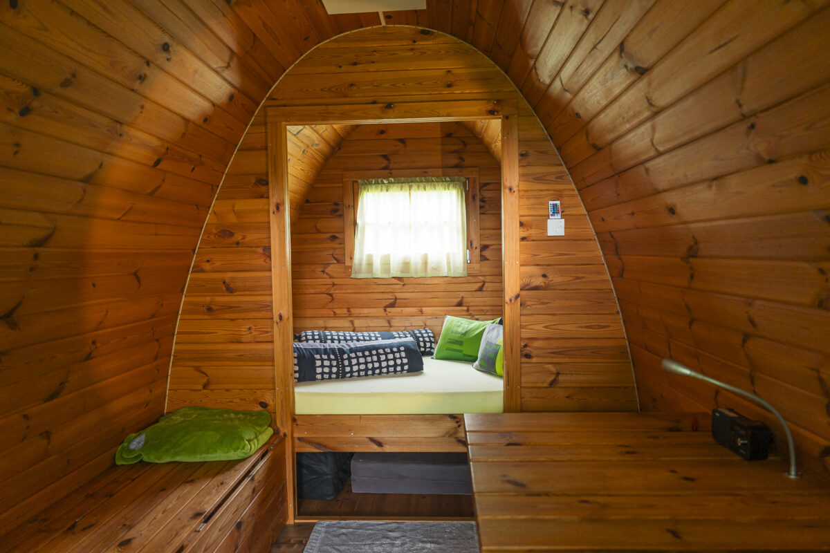
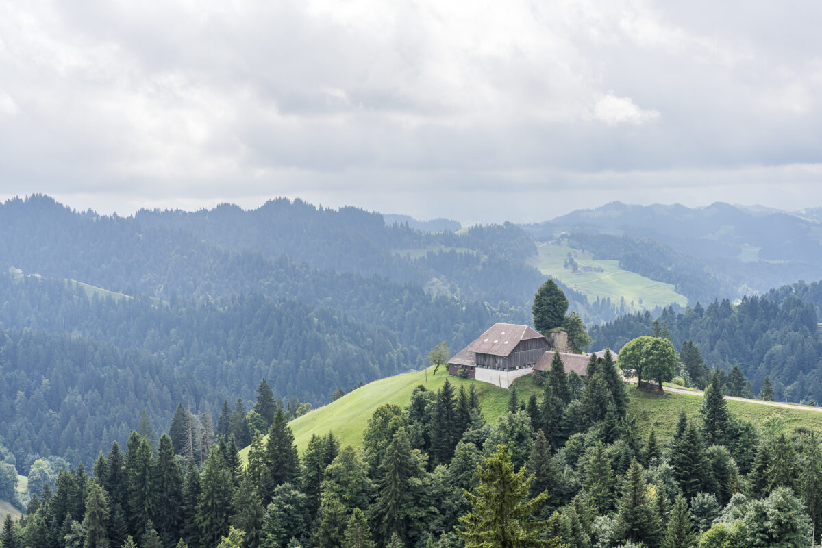
The Schwesteregg with its two cozy wooden igloos and small restaurant is a place we already know from our bike tour. For those seeking a special overnight spot in the heart of the Napf region with magnificent views over the rolling hills of Entlebuch, this is exactly the place.
Day 1 Details: Menzberg – Oberänzi – Holzwäge – Fuchsenegg – Schwesteregg
Using the map below, you can see the route of the hike from Menzberg via Oberänzi to Schwesteregg. It’s entirely on a yellow-marked hiking trail (T1/T2). Certain sections—particularly the descent from Menzberg to Wolf and the ascent from Ober Grosseberg to Oberänzi—are quite steep and, depending on the season, pass through deep grass where the trail isn’t always clearly visible. I therefore recommend sturdy hiking boots and possibly trekking poles. Apart from these sections, the trail contains no technically demanding or exposed passages. However, the hike is quite demanding conditioning-wise due to its length and elevation gain.
For overnight stays in the wooden igloo at Schwesteregg, you don’t need your own sleeping bag, and shower facilities are available. For more information about staying in the wooden igloo and current prices, visit the Schwesteregg website.
Starting Point Post bus stop Menzberg, Village Square (3,333 ft elevation) Accessibility Starting point accessible by public transportation Distance 10.9 miles Elevation Gain ↗ 3,881 ft ↘ 3,717 ft Duration 6 hours 15 minutes End Point Schwesteregg (3,510 ft elevation), nearest transit: Romoos, Schwändi Zyberlibahn Dining Options AlpBeizli Oberänzi
Day 2: From Schwesteregg Over Napf to Kuttelbad
The next morning brings cloudier weather than expected, but our anticipation for today’s stage remains high. It will take us over Napf and then onward toward Emmental. After breakfast at the restaurant at Schwesteregg, we can start hiking directly from the wooden igloo. Our route climbs from Schwesteregg via Breitäbnet on the opposite side of the Goldbach Gorge back toward Oberänzi, where we continue on the hiking trail up to Napf.
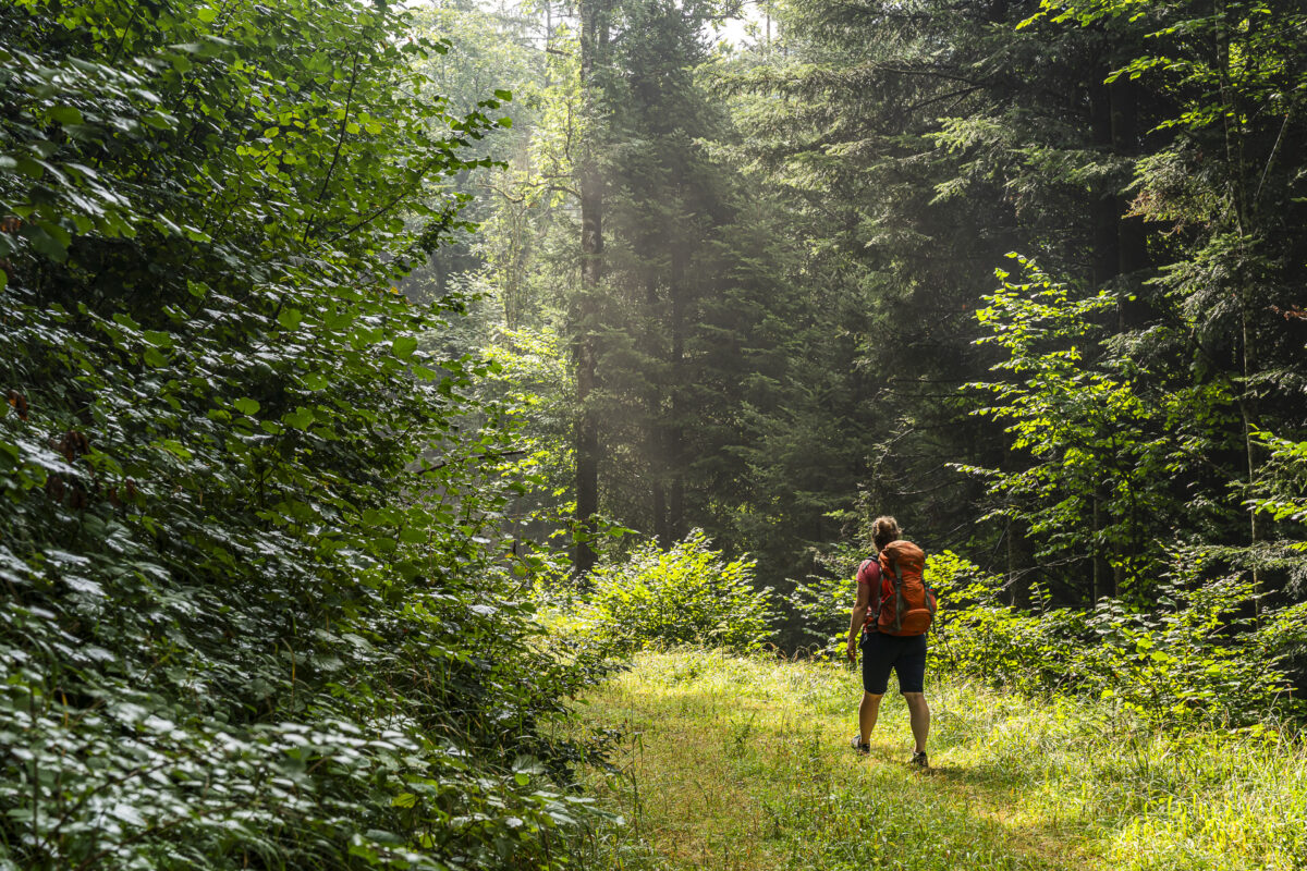
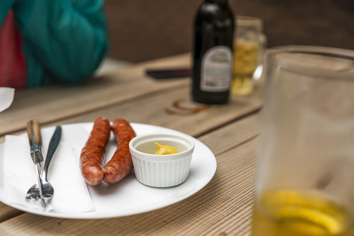
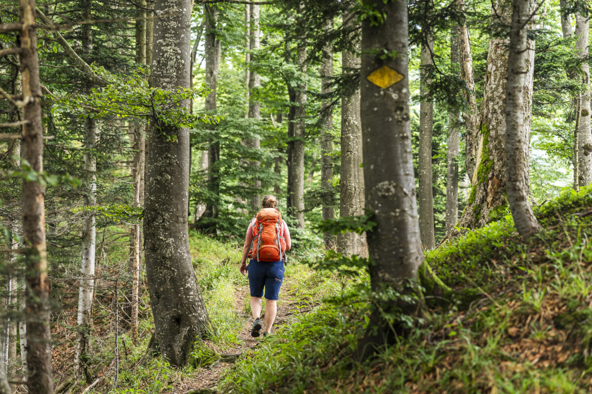
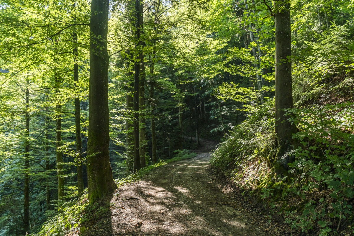
Today’s stage also shows the terrain from its varied side: sometimes we follow narrow, root-laced forest paths, then wide gravel paths or short asphalt sections. Just under two hours after starting from Schwesteregg, we reach the highest point of this three-day tour—Napf at 4,614 feet above sea level. The perfect moment for a second coffee of the day and a nut croissant.
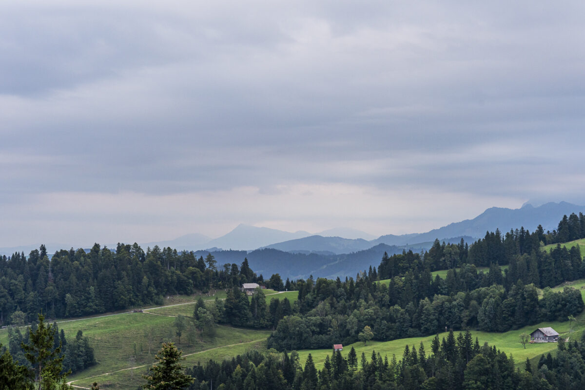


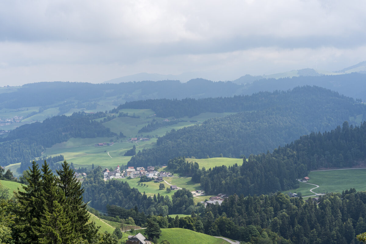
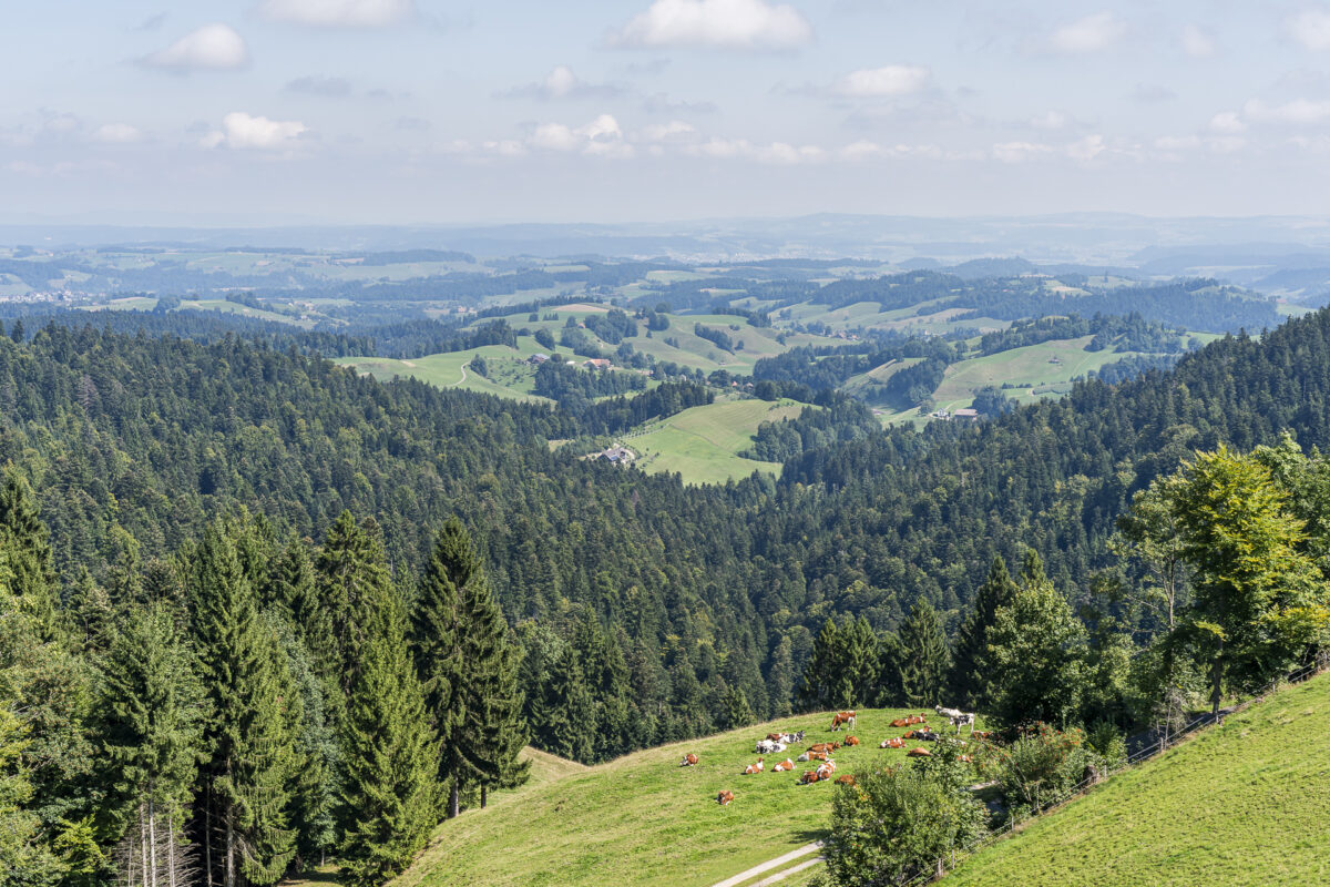
From the benches in front of the Berggasthaus Napf, on clear days you get a phenomenal panoramic view stretching from the Jura over the Bernese Alps to the Central Swiss Alps. The view is clearest on fall days or during föhn conditions. But even on cloudy days, the panorama has its appeal: my gaze sweeps over the forested rolling hills as we continue hiking toward Hochänzi.
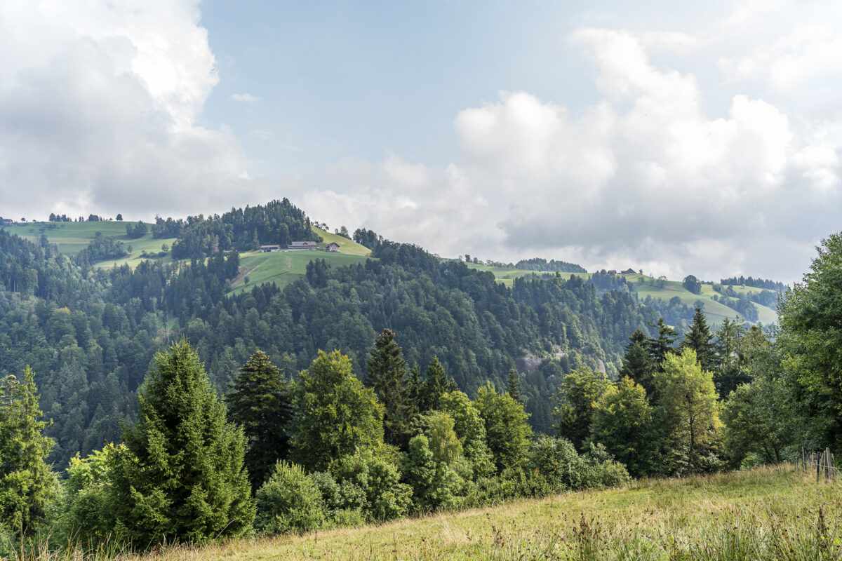
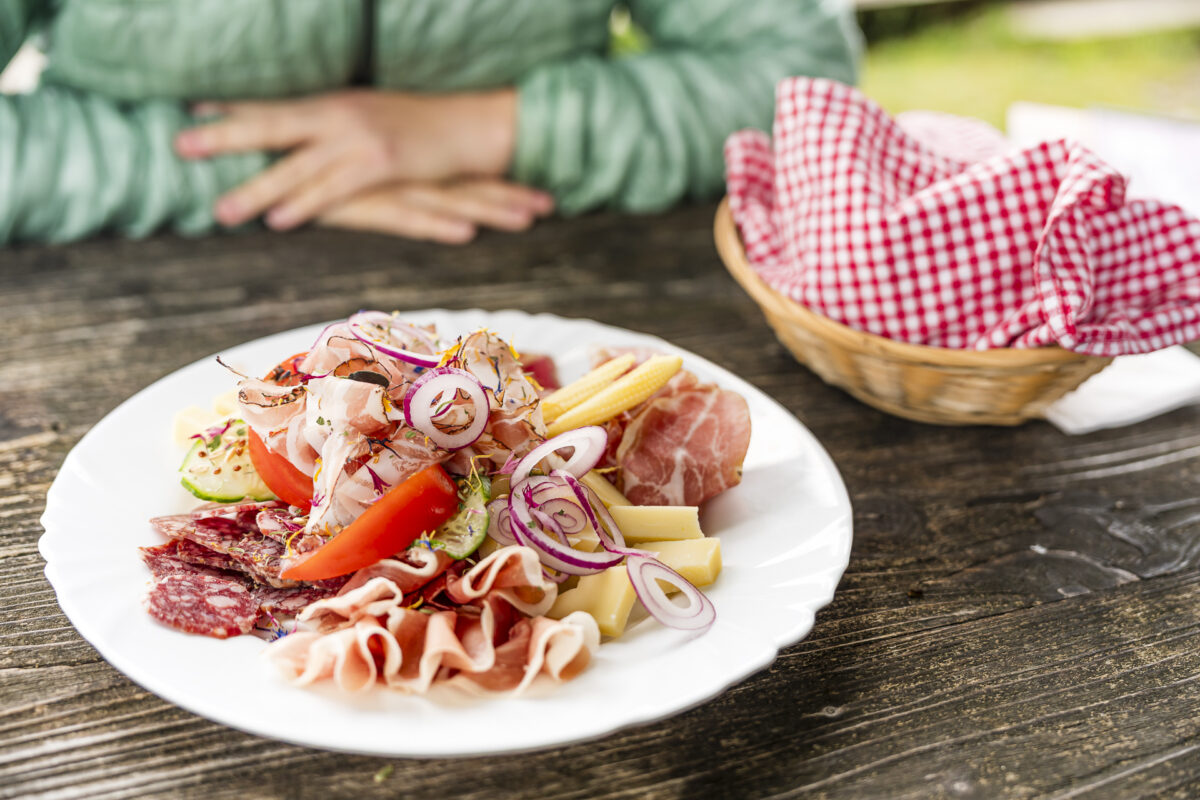
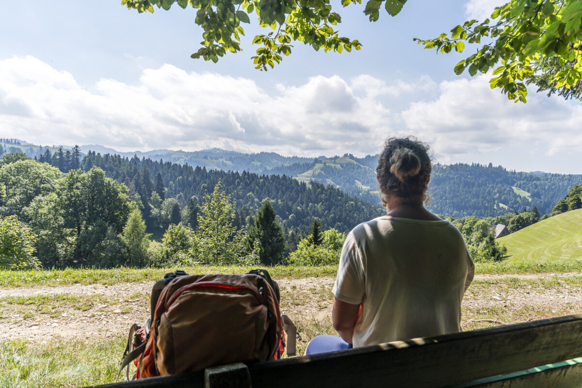
We’ve hiked this section of the Alpine Panorama Trail (Stage 14, Napf–Lüderenalp) once before in the opposite direction. On sunny spring or fall days, there’s usually more activity here, but on our tour we encounter only a handful of other hikers. At the popular and highly recommended Lushütte Alpine Restaurant, we easily find a shady spot under a gnarled linden tree. Among other offerings, they serve fine platters and legendarily large meringue portions.

We’ve conquered the most strenuous part of the second day of hiking at the Lushütte. On the remaining good three miles to our stage destination, the Kuttelbad Inn, it’s mostly a gentle descent. Only the final 1,650 feet prove challenging: a steep, narrow, and sometimes hard-to-spot forest path leads us directly to the secluded inn. Surrounded by dense forest greenery, Kuttelbad is a place far from the noise of the world. Its history dates back to the first half of the 19th century, and through the writings of Jeremias Gotthelf, the inn gained some renown.


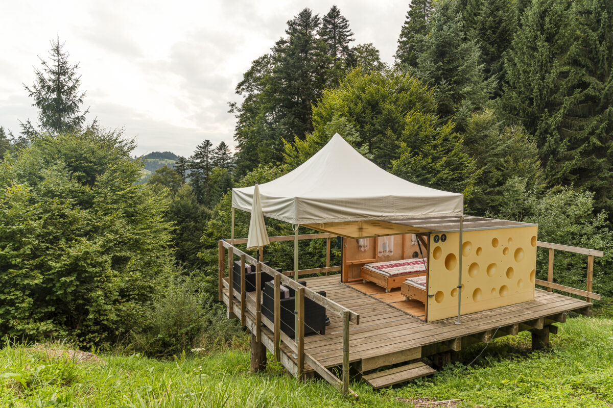
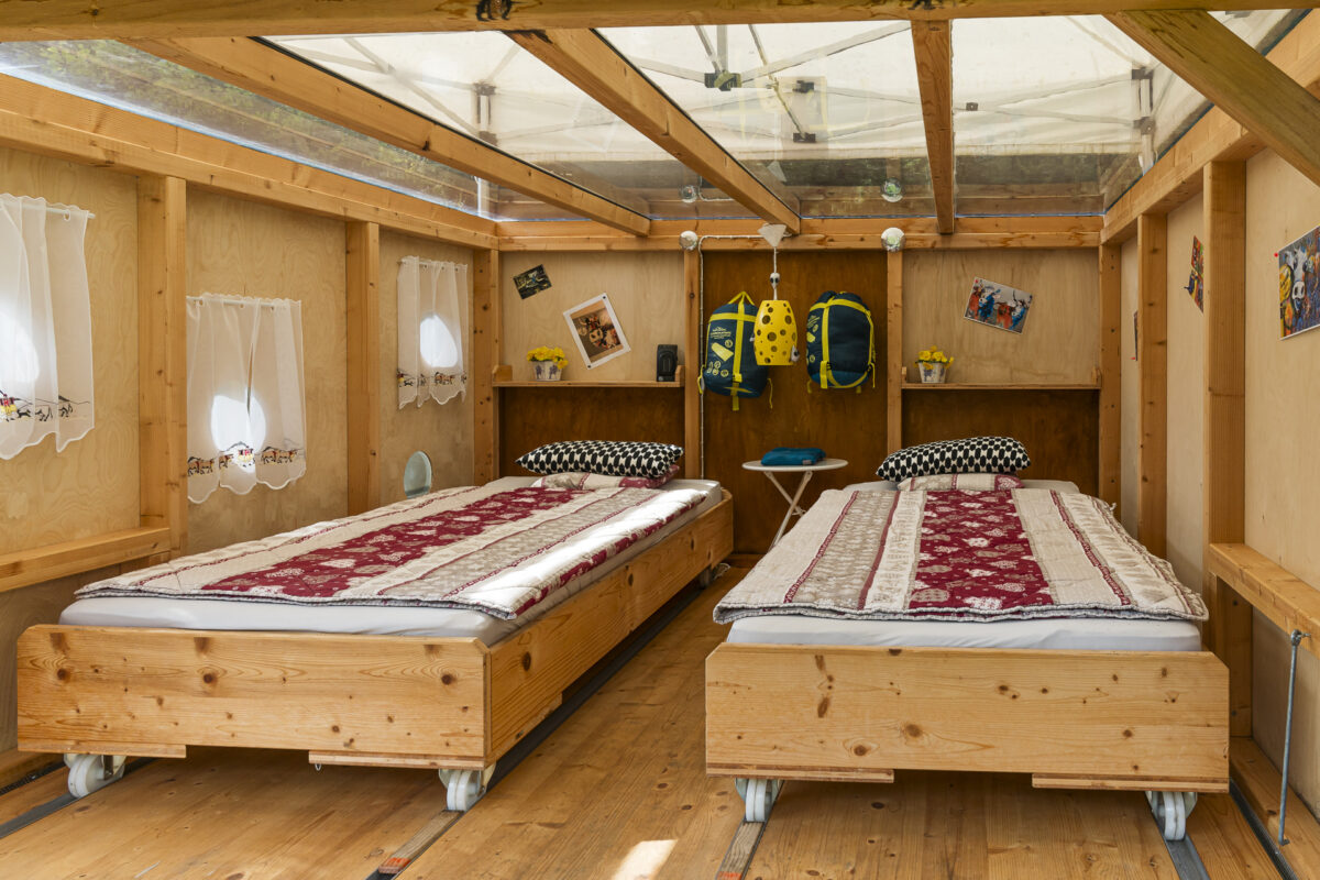
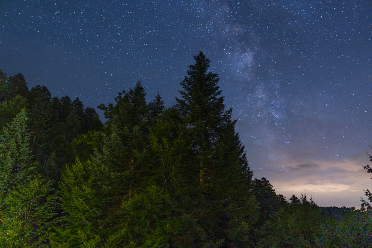
For about seven years now, the friendly hosts Ursula and Oliver have been serving hikers, bikers, and day-trippers who seek out the restaurant. Overnight guests have access to a cozy dormitory, two nostalgically furnished double rooms, two wooden barrels, and—as a special highlight—the Emmental Sleep Cheese. In this unique accommodation, you sleep in nature with a direct view of the starry sky—an unforgettable experience!
Day 2 Details: Schwesteregg – Napf – Lushütte – Kuttelbad
Using the map below, you can see the route from Schwesteregg over Napf to Kuttelbad Inn. It’s entirely on a yellow-marked hiking trail (T1/T2). In the section between Breitäbnet and Änzilegi, the trail runs close to the ridge and is somewhat exposed in spots. Apart from that, the route contains no technically demanding passages.
For overnight stays in the Sleep Cheese at Kuttelbad, you don’t need your own sleeping bag, and shower facilities are available. For more information about staying in the Sleep Cheese and current overnight prices, visit the Kuttelbad Inn website.
Starting Point Schwesteregg (3,510 ft elevation), nearest transit: Romoos, Schwändi Zyberlibahn Accessibility Starting point and destination not directly accessible by public transportation Distance 9.9 miles Elevation Gain ↗ 2,854 ft ↘ 2,907 ft Duration 5 hours 20 minutes End Point Kuttelbad Inn (3,445 ft elevation) Dining Options Restaurant Hotel Napf, Lushütte Alpine Restaurant
Day 3: From Kuttelbad via Wasen in Emmental to Ahorn Alp
The next morning, birdsong wakes us. Although the night was quite cool, I slept wonderfully outside in the Sleep Cheese—much better than expected. Today the sky shows itself cloudless for the first time in these three days, and snow-covered Bernese Alps gleam on the horizon. In the warm dining room of Kuttelbad, a lavishly spread breakfast table awaits us with all sorts of delicacies. A perfect start to our final day of hiking.
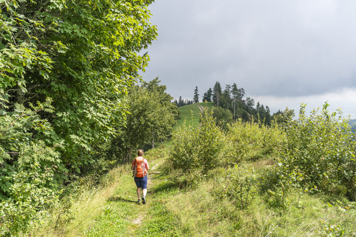
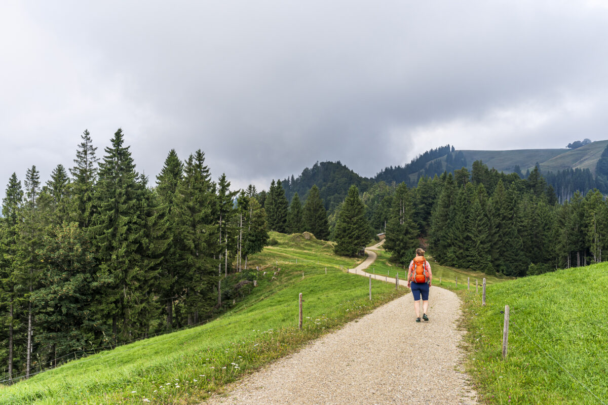
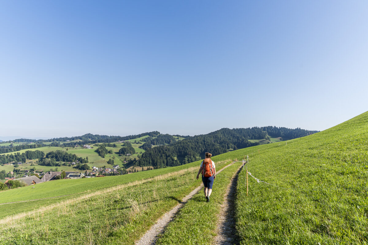
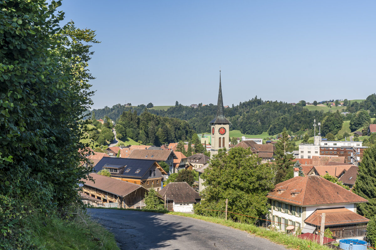
To get back on the actual route, we must first climb the steep 330 feet from Kuttelbad to the main hiking trail. After that, an enjoyable stretch takes us through a storybook Emmental landscape down to Wasen, a district of the Sumiswald municipality. Compared to the first two days with their numerous elevation gains, this section feels like a comfortable conclusion. However, the typical Napf region ups and downs don’t completely disappear. From Wasen onward, we follow signposts toward Hornbachegg and Fritzeflue with a steady climb, first on a paved road and later on nice forest and meadow trails. Magnificent views repeatedly open up toward the rolling hills we hiked through the previous day.


After about four hours, we reach our destination, Ahorn Alp. There a culinary surprise awaits us to conclude the trip. The menu features not only classic Swiss dishes but also authentic Persian specialties. Finishing the three days of hiking in the Napf region with homemade Mantu dumplings was definitely not something I expected!

Day 3 Details: Kuttelbad – Wasen in Emmental – Fritzeflue – Ahorn Alp
Using the map below, you can see the route from Kuttelbad via Wasen to Ahorn Alp. It’s entirely on a yellow-marked hiking trail (T1/T2) with no technically difficult or exposed sections.
From Ahorn Alp, there’s a hiking bus connection to Huttwil train station. Check the SBB schedule in advance (afternoon bus runs only once during regular hours) and remember to call ahead (ideally by 11:00 AM the day before—though it worked for us with a call just 1 hour before departure). Refer to the appropriate information in the SBB schedule. The hiking bus ride from Eriswil to Huttwil costs CHF 10.00 (GA/Half-price passes not valid).
Starting Point Kuttelbad Inn (3,445 ft elevation) Accessibility Destination accessible by local hiking bus (reservation required) Distance 7.7 miles Elevation Gain ↗ 2,231 ft ↘ 2,044 ft Duration 4 hours 10 minutes End Point Hiking bus stop Erishorn, Ahorn (3,657 ft elevation) Dining Options Panorama Restaurant Fritzenfluh (not directly on trail), Ahorn-Alp Mountain Restaurant (closed Mondays)
Practical Tips for Your Trip to the Napf Region
- Best Season: The hike described in this post is generally feasible from April through November. It’s especially atmospheric in autumn, when visibility is clear or when a persistent layer of high fog has formed over the Midlands.
- Opening Hours & Dining Options: Many mountain restaurants in the Napf region are only open seasonally. Definitely check their websites for current hours before your hike.
- Getting There & Leaving: The starting and ending points are accessible by public transportation. From Ahorn Alp, a hiking bus runs to Huttwil (definitely check the schedule and make a phone reservation, ideally by 11:00 AM the day before). If you prefer, you can also shorten the route or split it into stages thanks to various public transit connections along the way.
- Gear & Preparation: Good hiking boots are essential; trekking poles are recommended. Bring plenty of cash and be prepared for areas with no cell phone reception.
- More Info: Find an overview of all attractions and offerings in the Napf region on the napf.ch platform.

Leave a Reply