

Hiking in the Faroe Islands: what you should know
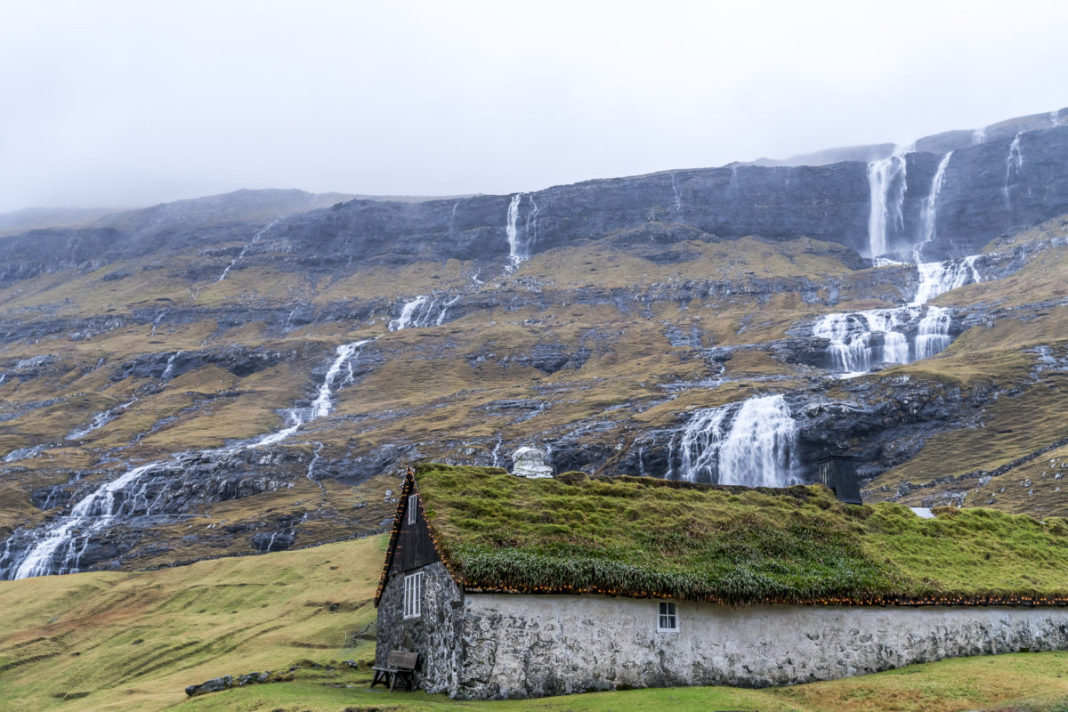
Steep cliffs, remote fairytale-like villages and far and wide no woods blocking the view of the furrowed mountain flanks crisscrossed by watercourses – located in the middle of the North Atlantic, the Faroe Islands form a Mecca for nature lovers and outdoor fans. Despite all the seclusion, it is also advisable to observe some – actually self-evident – principles when being out and about in nature.
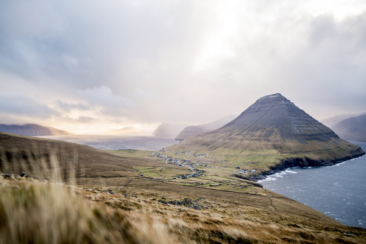
The small archipelago is one of the destinations whose popularity can be attributed to Instagram. The images of this imposing landscape floating around the internet have boosted tourism on the Faroe Islands in recent years – at a pace that many locals did not expect. In addition to the positive effects that tourism brings to the local economy, there is palpable scepticism in some places. The tourists not only bring money to the islands, but often also unabashedly trample cross-country on private property – why should you let yourself be confined by trail markings and fences in this wasteland?
But it is precisely this lack of respect that has led us to “run up” in some places on the Faroe Islands. Instead of simply ignoring the prohibition signs and also showing pictures that are only taken by illegally entering private property, we would like to pass on five important facts about hiking on the Faroe Islands with this article. At the end, we will also show you our personal hiking highlights – these are five routes, all of which are officially signposted and can be walked individually.
#1: Find out about the trail network
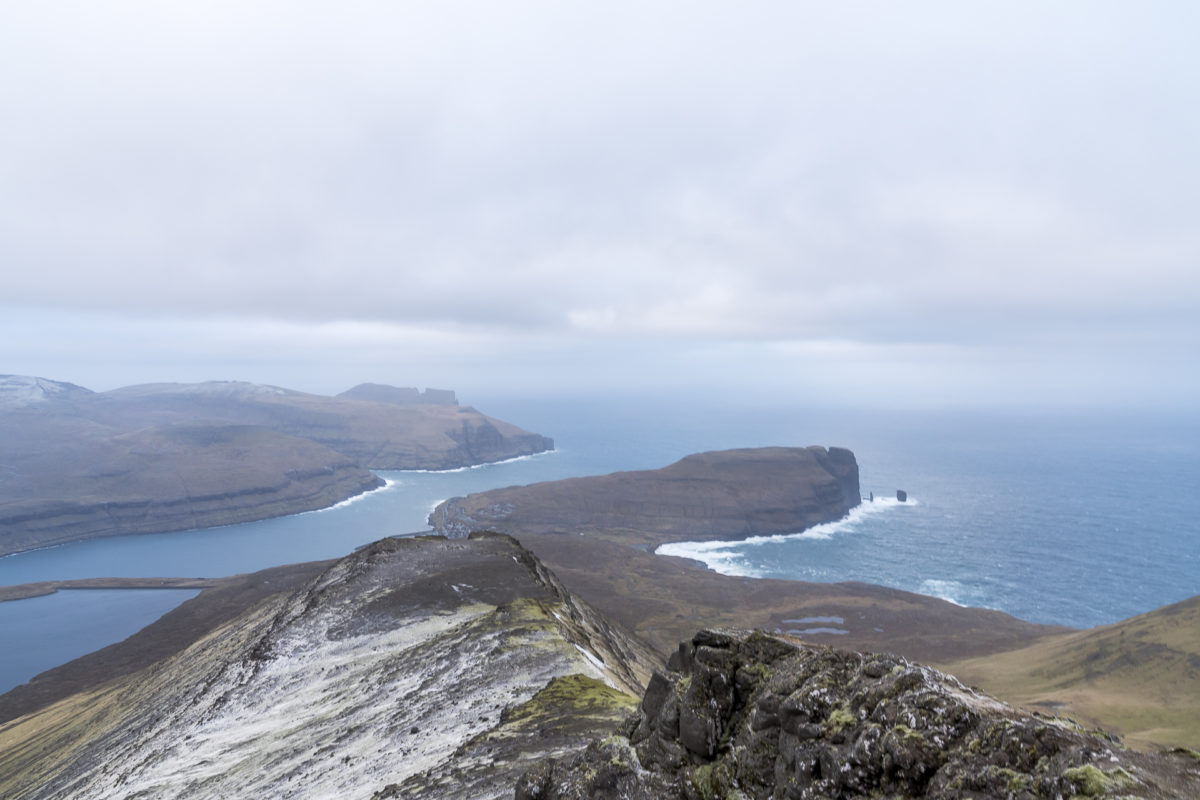
“You absolutely have to go to the Drangarnir,” tells us a Belgian we meet on the way. It’s “epic”, he enthuses, adding, “the hike, on the other hand, was extremely hard – I was on the road for seven hours and had to climb over several fences.” He proudly pulls out his smartphone and shows me the trophy: an Insta post with the famous Drangarnir as the main actor. I try not to pull a face and ask him if he doesn’t know that the hike to the Drangarnir leads over private property and that you can only do the tour with a guide (details here: Drangarnir Hike).
This short conversation with the Belgian exemplifies the points of conflict that emerging tourism brings to the Faroe Islands. Many photo-loving travelers almost blindly graze the photo spots they have seen on Instagram and do not take note of the general advice for hikers. Due to the strong growth in tourism in recent years, some of the most famous photo spots such as the Drangarnier are now only accessible as part of guided tours (if guided tours take place – which was not the case over New Year’s Day).
A solid basis for hiking planning is the official hiking guide of the Faroe Islands. The brochure presents 23 signposted hiking routes and gives many practical tips on hiking in the Faroe Islands. You can browse through the guide online or download it here: Hiking in the Faroe Islands
#2: Respect private property
Actually, it’s simple: don’t behave any differently on the Faroe Islands than you do at home. I don’t just trample cross-country on private property in the Alpine region, but stick to the signposted network of hiking trails. Do the same in the Faroe Islands. The islanders traditionally live from fishing and sheep breeding – out of consideration for the farmers and their livelihoods, you should not step on grass where possible, but stick to the marked gravel paths. Gates in field fences must always be closed carefully and no plants should be picked.
Also note that between November 2nd and December 31st, the hare hunt takes place. Hunting is allowed on all days. All the more reason to follow the official trail markings.
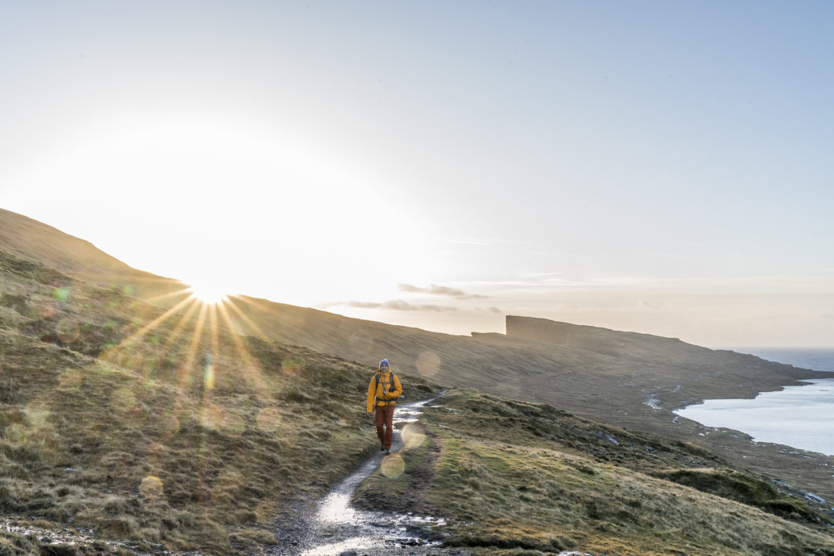
#3: Pay attention to the weather
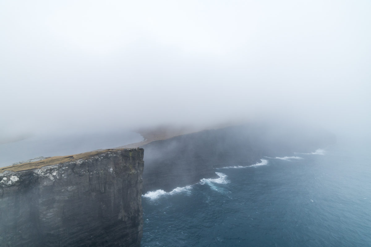
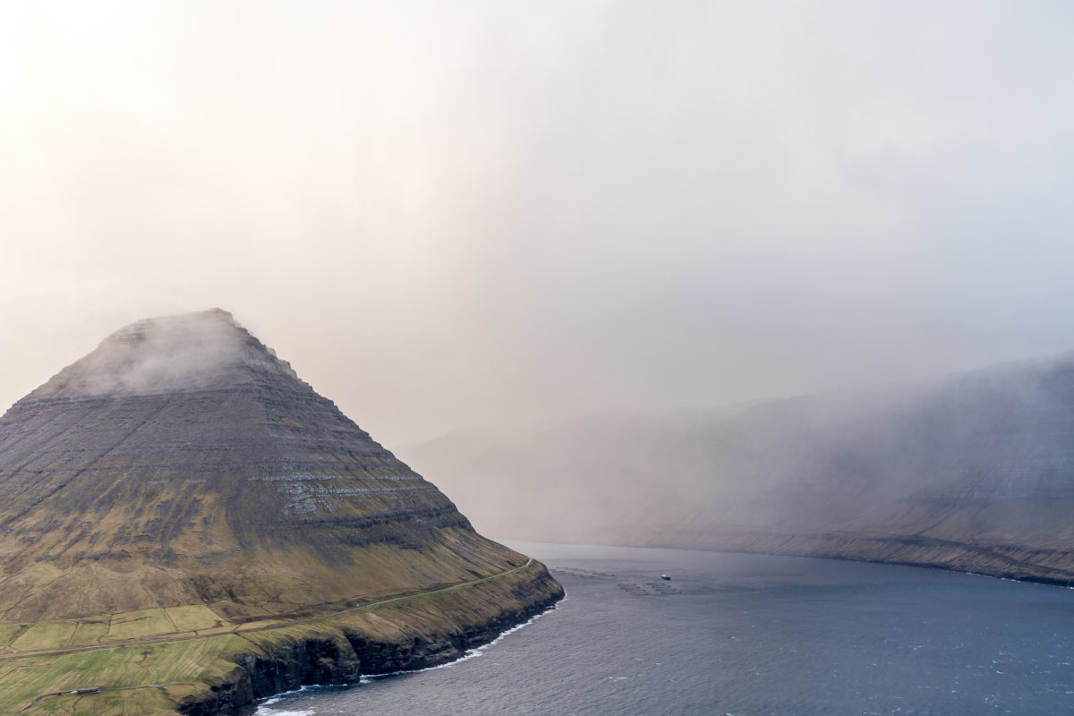
Regardless of the season, the weather in the Faroe Islands is unpredictable. The weather can change surprisingly and from one minute to the next. Nowhere else have I seen such wonderful rain fronts pass by as on the Faroe Islands. Almost more treacherous than the rain (which, by the way, patters down on you from all sides) is the fog; he even makes his own body parts disappear.
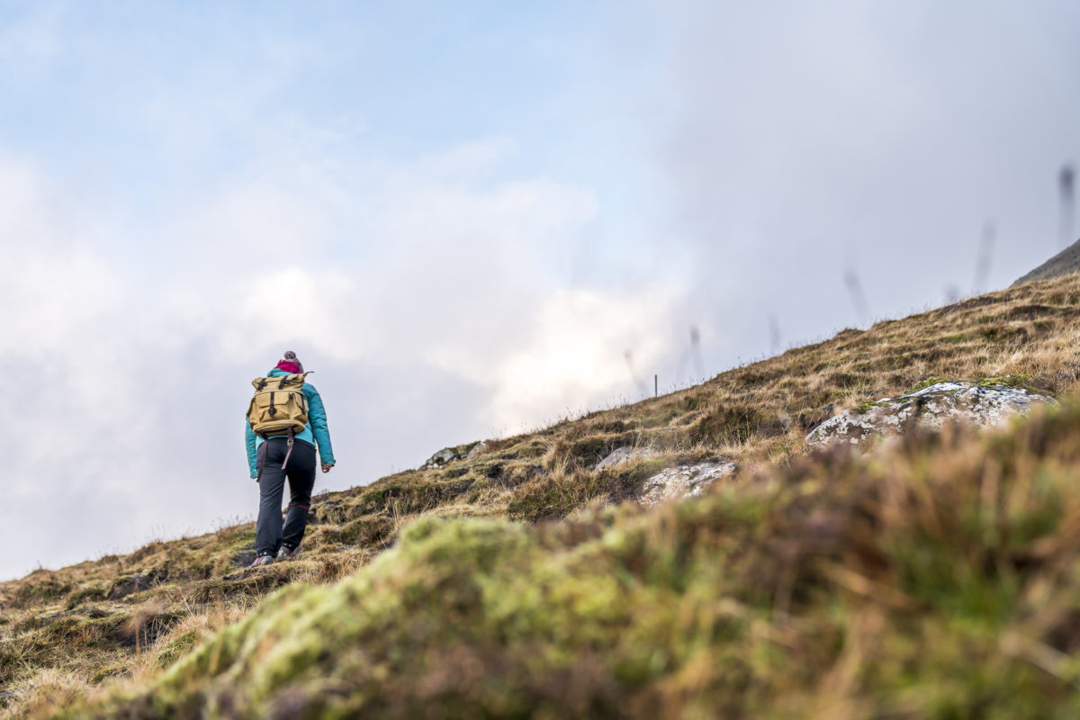
#4: Think in layers
With an average of 300 rainy days, a good rain jacket should not be missing in your luggage. On the other hand, I hadn’t packed the rain pants – functional hiking pants that dry quickly will do, too. The strong gusts of wind also have something good: they dry wet clothes quickly.
I had packed the following clothes for hikes
- Lightweight, functional and quick-drying hiking pants
- A merino wool shirt
- A fleece jacket
- A windstopper
- A down jacket
- A rain jacket
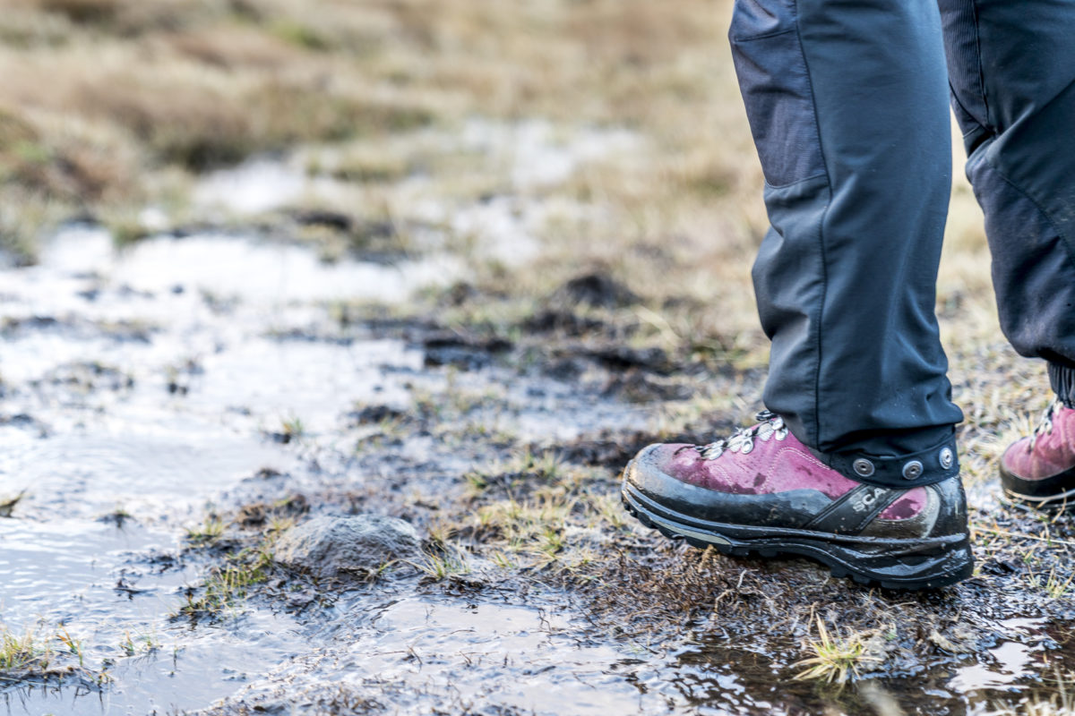
Although the Faroe Islands are located at 62° latitude, the temperature difference between summer and winter is relatively small. While the average temperature in summer is around 13°, the Gulf Stream provides a “mild” 3° to 5° in winter. So you can take about the same basic equipment with you in summer and winter. I also recommend not buying new hiking boots right before a trip to the Faroe Islands. The ground is often extremely damp and muddy.
#5: Pack provisions
I’m not really the picnic type, but on the Faroe Islands it’s worth packing provisions. Most of the hikes are designed as long-distance hikes between two villages – without any refreshments along the way. While many villages have a nice café or a small restaurant in the summer months, most places are closed throughout the low season.
5 recommended hikes in the Faroe Islands
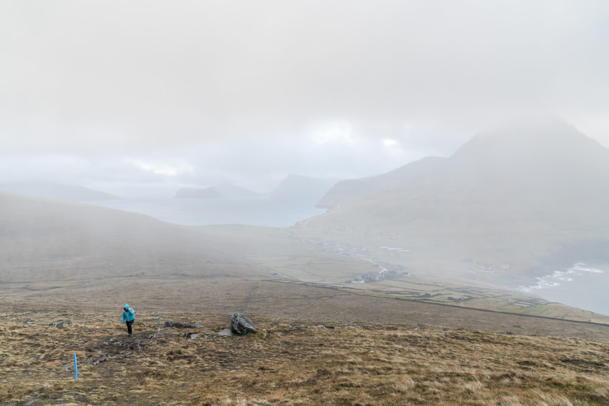
We followed the hiking recommendations of the Faroe Islands Hiking Guide brochure during our stay in the Faroe Islands. The tours are spread over the different islands and give a nice overview of the scenic diversity of the Faroe Islands. My only criticism of the 23 hiking routes is that the vast majority of them are long-distance hikes. If you explore the Faroe Islands by rental car like we did, you have to keep in mind that you have to make the way there and back. Below I show you our five hiking highlights. You can find the details of the route guidance in the linked brochure at the end of the article.
#1 To the highest peak of the Faroe Islands: Slaettaratindur
At 880 metres, Slættaratindur is the highest mountain in the Faroe Islands, making it a “must” for all summiteers. It is located in the north of the second largest island of Eysturoy. Since the road passes relatively close to the summit, the ascent is relatively short, but very steep in the first third (about 2.5 kilometers from the parking lot to the summit). The difficulty here is to find the right weather for the good visibility. We tried twice; On the first try, the sun was shining, but the wind was blowing so hard that I couldn’t make any progress at all. On the second attempt, there was almost no wind, but visibility was only moderate. Even if the climb looks harmless at first glance, it is not to be supported, at least in winter – we caught a relatively cool day and the wet ground was frozen – a rather slippery affair.

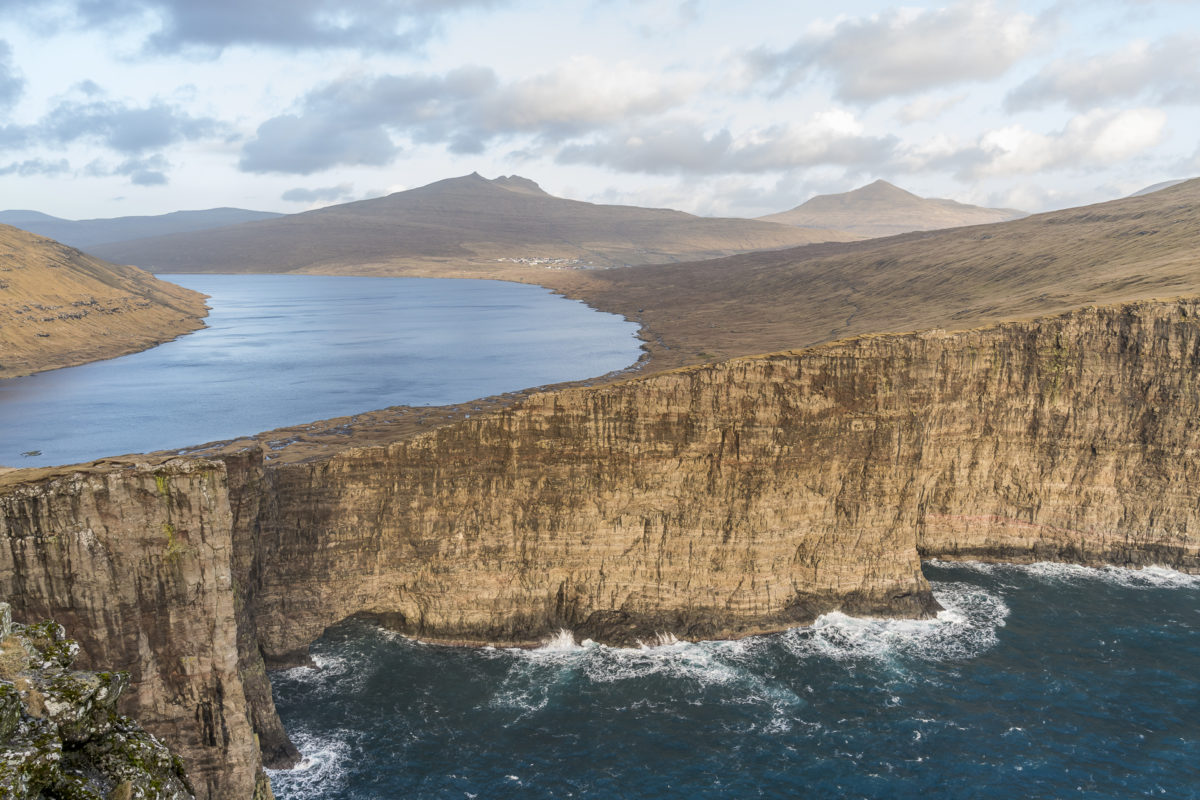
#2 The Classic: Midvagur – Bosdalafossur
This tour is one of the undisputed classics on the Faroe Islands and, according to the hiking brochure, would be feasible as a five-kilometer circular hike. During our stay, the section of the trail on the lakeshore was closed. So we kept to the signposted upper path both on the way there and on the way back. The view of Vatnið – the largest lake in the Faroe Islands – behind the steep cliffs is incredibly impressive.
At the entrance gate to this hiking trail there is a tin can, where a collection is requested for the maintenance of the trail.
Update: since April 2019, a hiking fee of DKK 200 has to be paid for the tour to the Trælanípa cliffs.
#3 Ascent of Villingardalsfjall
The ascent to Villingardalsfjall also offers a phenomenal view. The trail starts in the northernmost village of the Faroe Islands, Viðareiði, and leads to the summit in three kilometres. Due to the unsettled weather (we were rained out several times during the ascent) we did not hike all the way up. The scenery is also impressive further down!
Update: since April 2019 a hiking fee of DKK 200 must also be paid for this tour.
#4 To the most beautiful village in the Faroe Islands
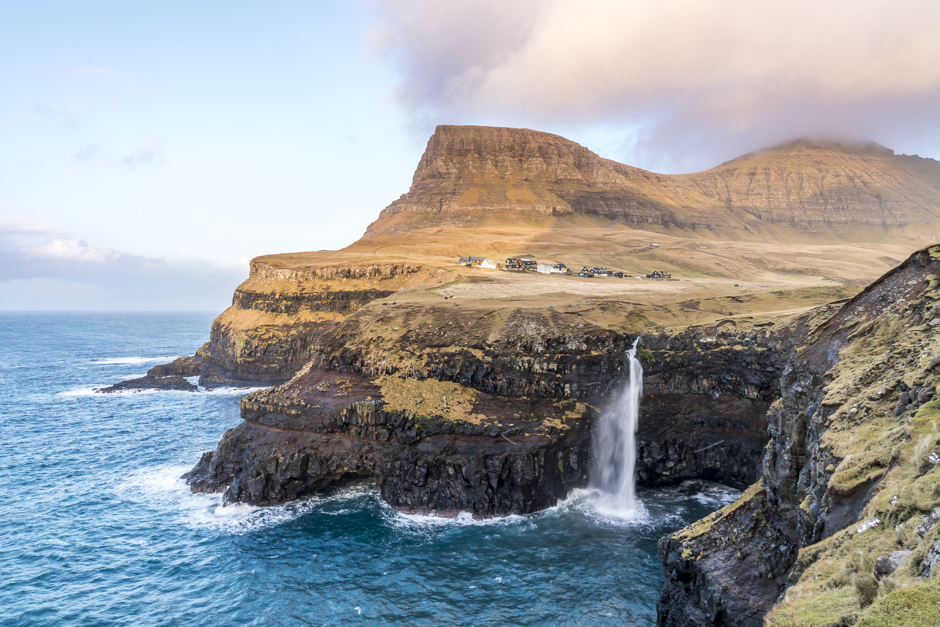
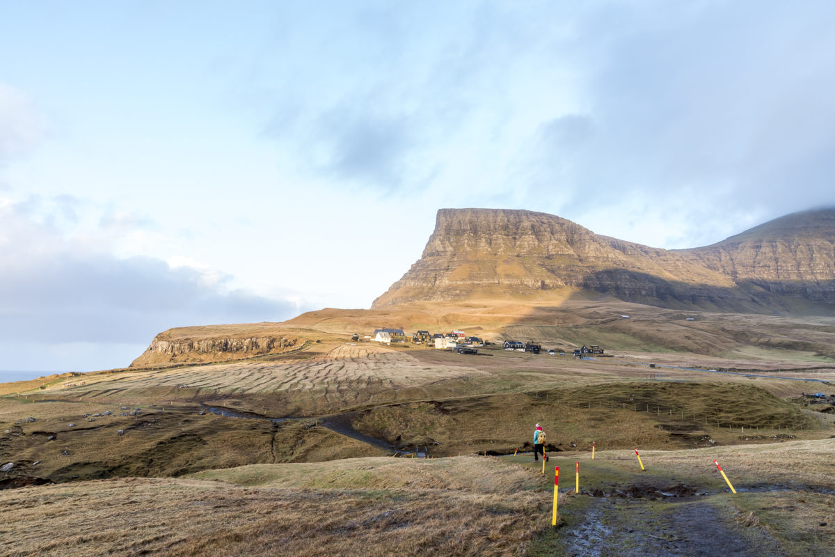
The view of Gasadalur in the west of the island of Vágar is one of the most popular photo subjects in the Faroe Islands. You can either drive comfortably by car to the officially signposted parking lot in the village and walk from there to the viewpoint in 10 minutes, or you can start the hike about one kilometer south of the tunnel that has connected the isolated place with “civilization” since 2003. The trail winds its way along the cliffs for 3.5 kilometres to the same viewpoint.

#5 from Torshavn to Kirkjubour
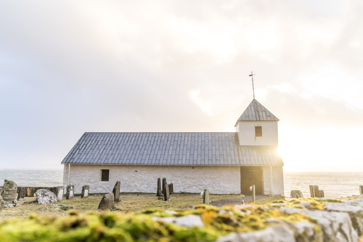
A tour that doesn’t follow the well-known photo hotspots of the Faroe Islands, and that’s exactly why I particularly liked it, is the hike from the capital Torshavn to the village of Kirkjubøur in the southwest of the island of Streymoy, seven kilometers away. The main attractions of Kirkjubøur are the ruins of St. Magnus Cathedral from the 13th century, the white Olav’s Church – the oldest surviving church building in the Faroe Islands – and the oldest Viking Age farm in the islands. A really worthwhile detour!

All hikes presented here are described in detail in the Hiking Guide of the Faroe Islands and signposted accordingly. You can find more information about hiking on the Visit Faroe Islands website. The updated list of routes with restrictions/fees can be found here: Hiking Guidelines
Leave a Reply