

City, Country, River: 3 Hiking Tips for Easter Explorations
With spring in the starting blocks and Easter almost upon us, it’s high time for a fresh batch of seasonal hiking tips. As the title suggests, the following lines present three diverse hiking suggestions. We’ll follow the Rhine downstream to the Rheinau Monastery Island, enjoy panoramic views from Chellenchöpfli over the Basel area, and embark on an entertaining circular route in the Canton of Vaud. Are your hiking boots ready?
The ViaRhenana from Schaffhausen to Rheinau
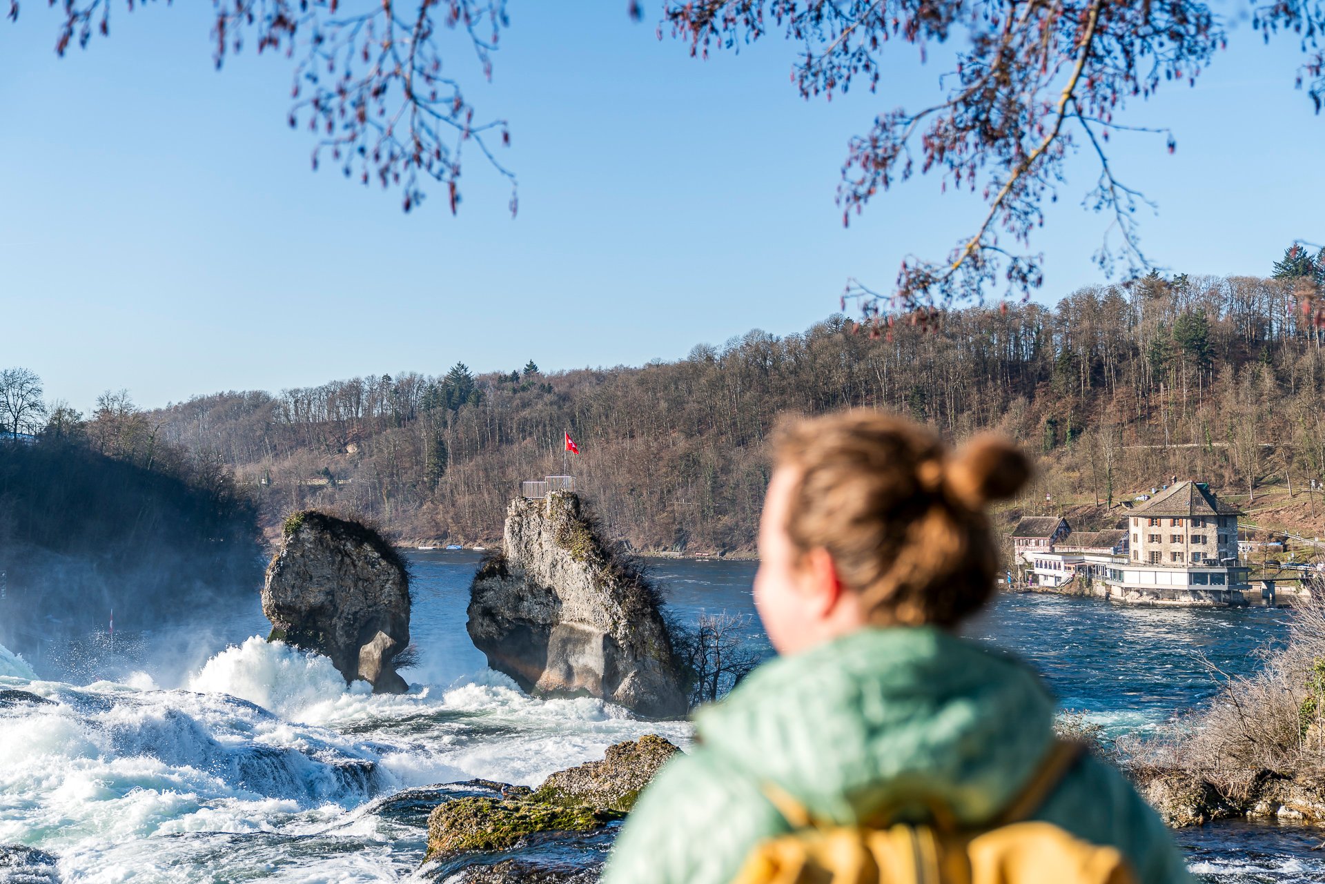
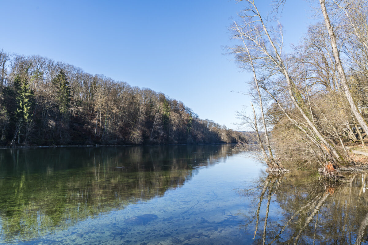
The ViaRhenana follows the once most important waterway of Switzerland from Kreuzlingen through Schaffhausen to Basel. The blue of the Untersee and the High Rhine is always in view from the hiking path. Among the sights is the Rhine Falls, the most visited tourist attraction in Switzerland. And it is this very attraction that the fourth stage from Schaffhausen to Rheinau passes by.
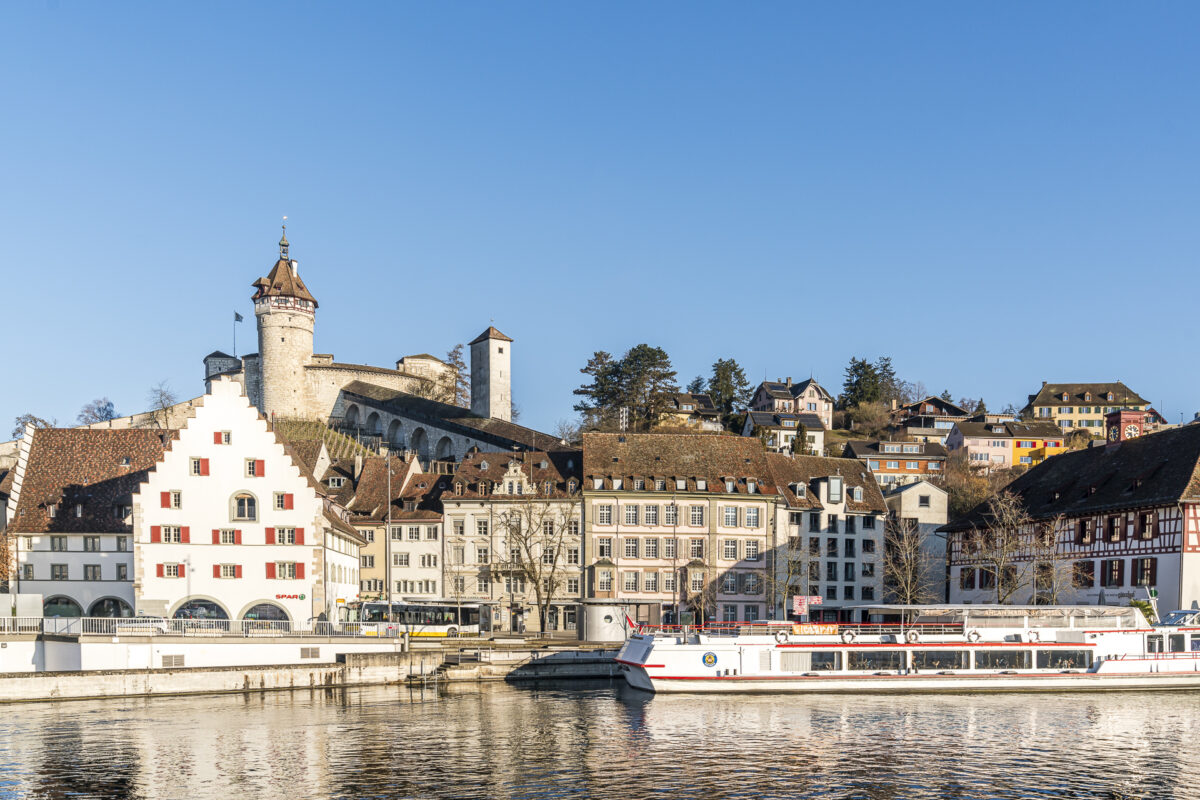
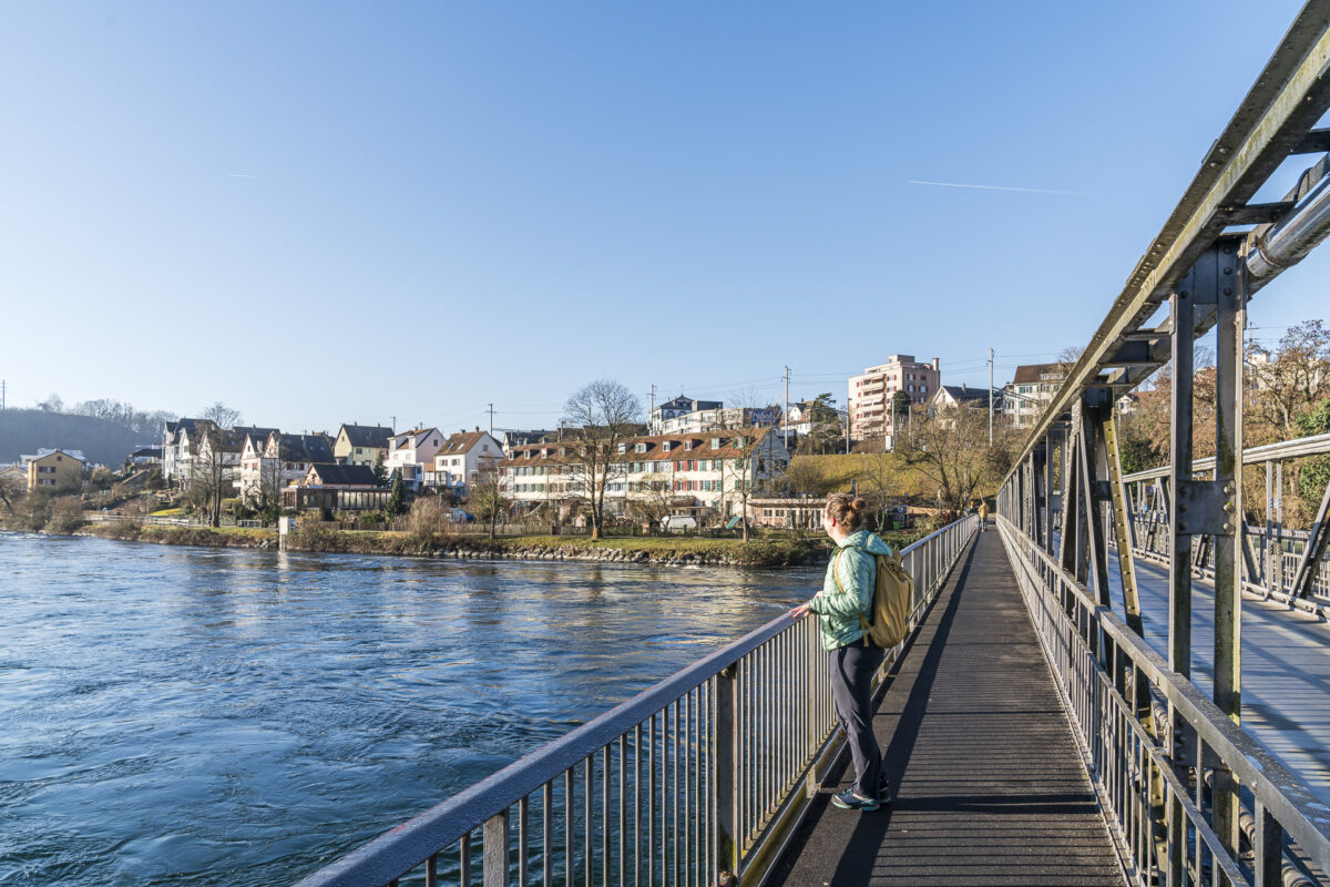
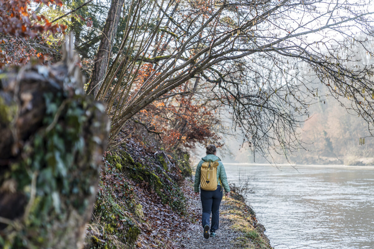
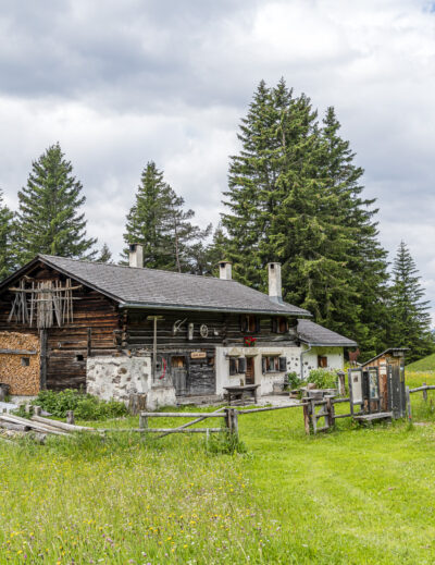
Starting at Schaffhausen station, the signposts lead us purposefully through the cobblestone streets of the old town, across the Rhine bridge into Feuerthalen on the opposite bank. Here, it’s worth pausing to admire the postcard view of the Munot. This landmark of Schaffhausen has dominated the city for 400 years and witnessed the city prosper as a medieval salt transshipment hub. The “white gold” arrived on ships traveling down the Rhine and was unloaded above the Rhine Falls for further transport by wagon. This landing stage was once a hive of activity. Imposing heritage buildings along the riverbank, such as the Güterhof and the Salt House, served as salt transshipment points.
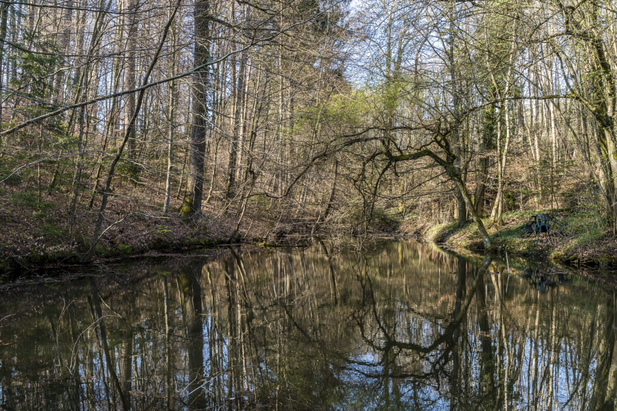
The trail continues through the picturesque village center of Flurlingen. Soon, the increasingly loud roar of water announces the Rhine Falls. In spring, this spectacle is particularly impressive due to the meltwater from the mountains.
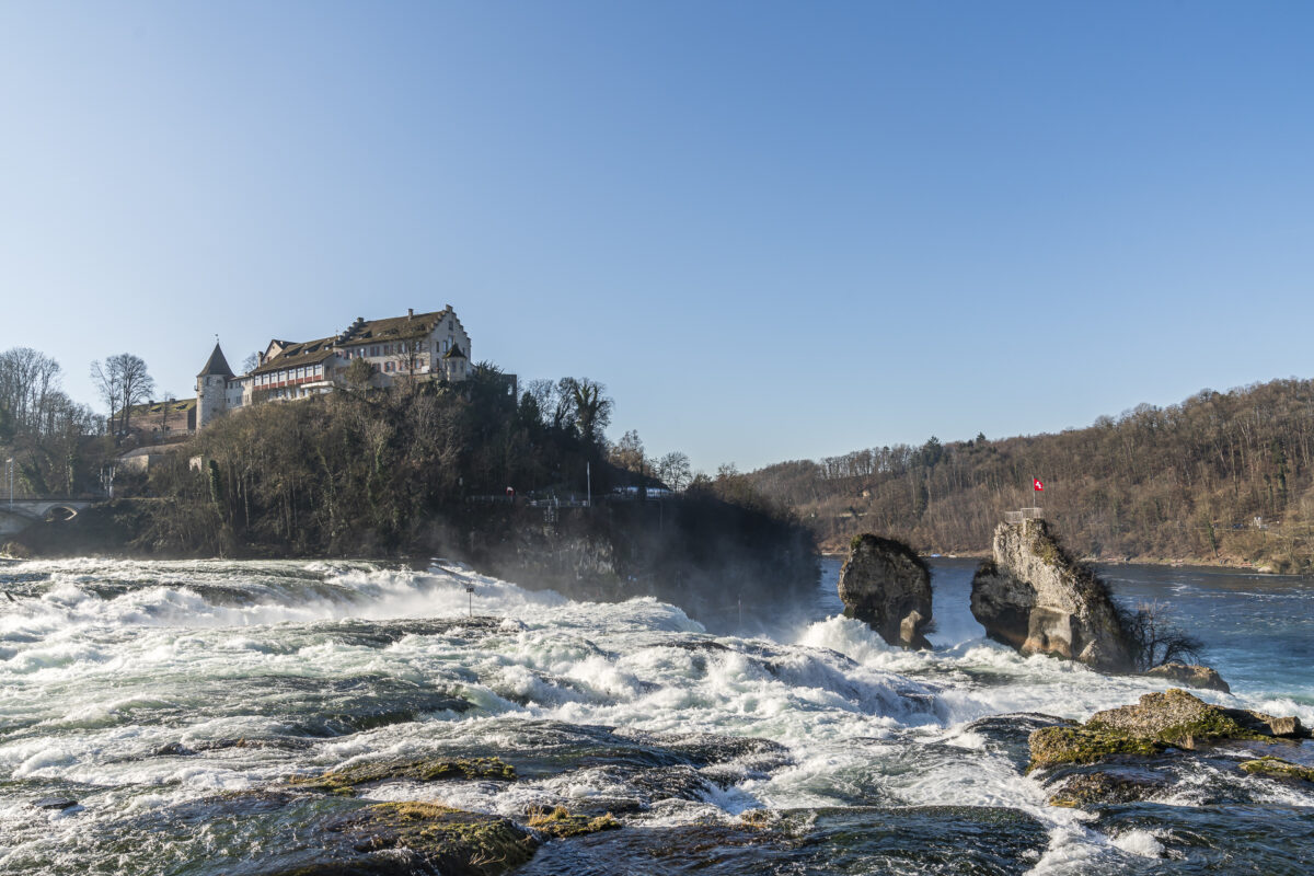
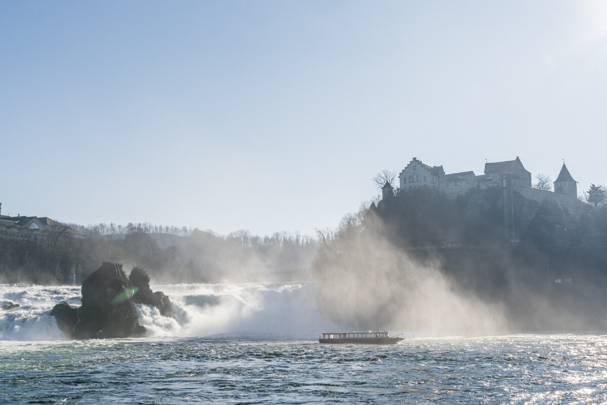
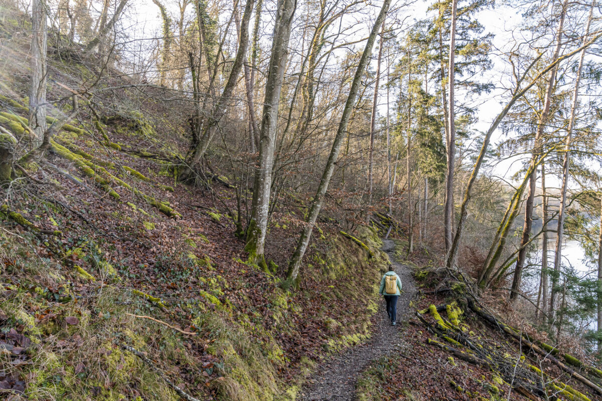
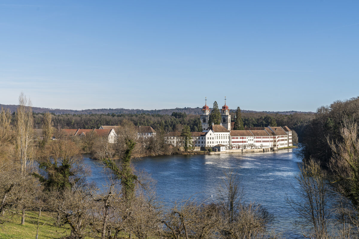
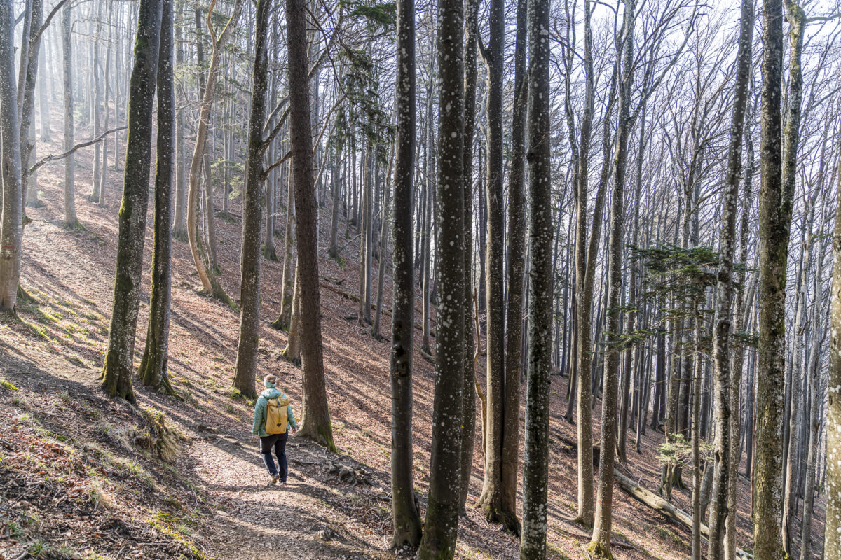
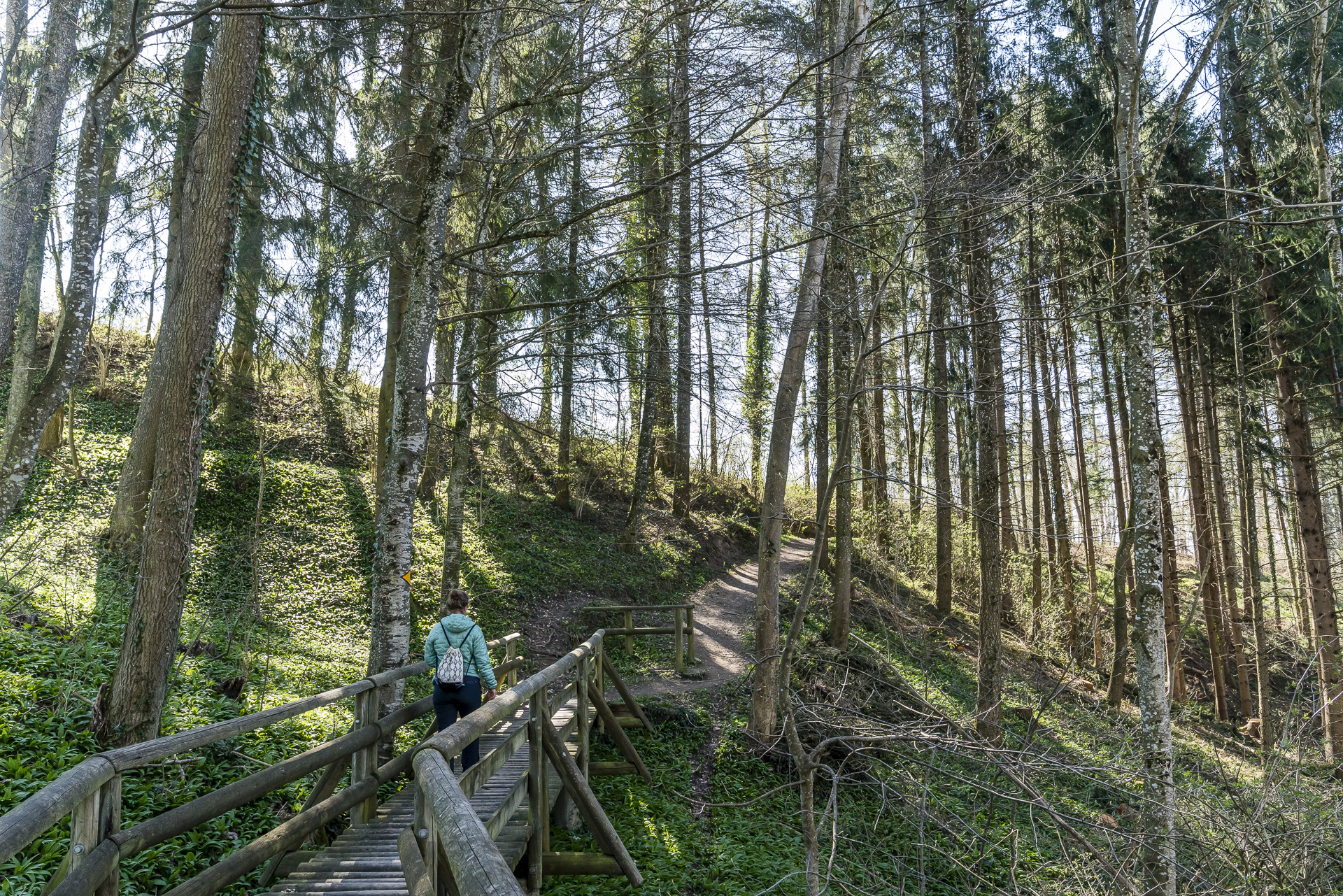
The second half of the fourth stage offers an exciting contrast with idyllic forest paths that meander gently up and down through the natural Rhihalden. The stage’s destination, Rheinau, is heralded from afar by the sight of St. Nicholas Church, perched above the oldest part of Rheinau – the lower town with its picturesque monastery island.
Key details of the Schaffhausen – Rheinau hike (Stage 4 ViaRhenana)
In the hiking map below, you can trace the route of our hike on the fourth stage of the ViaRhenana from Schaffhausen to Rheinau. It follows a yellow-marked trail (T1/T2) that runs downstream along the Rhine without significant elevation gains. Those who prefer not to walk 14 kilometers at a stretch can divide the stage into two shorter hikes: from Schaffhausen to the Rhine Falls (a more urban section) or from the Rhine Falls to Rheinau (predominantly wooded sections with nature trails).
| Starting Point | Schaffhausen Railway Station (404 m above sea level) |
| Accessibility | Accessible by public transport |
| Length | 14.6 kilometers |
| Elevation gain | ↗ 256 m ↘ 289 m |
| Duration | 3:45 h |
| Destination | Rheinau Bus Stop, Lower Town (375 m above sea level) |
| Options for food and drink | Augarten Brewery & Inn |
On the Waterfallen Circular Trail to Chellenchöpfli
Our next hiking tip takes us to the sleepy village of Reigoldswil in Basel-Landschaft. It is accessible from Liestal railway station with a 20-minute bus ride. At the very end of the village is the valley station of the Reigoldswil-Wasserfallen cable car, which comfortably takes us up to the local mountain of the Basel region.
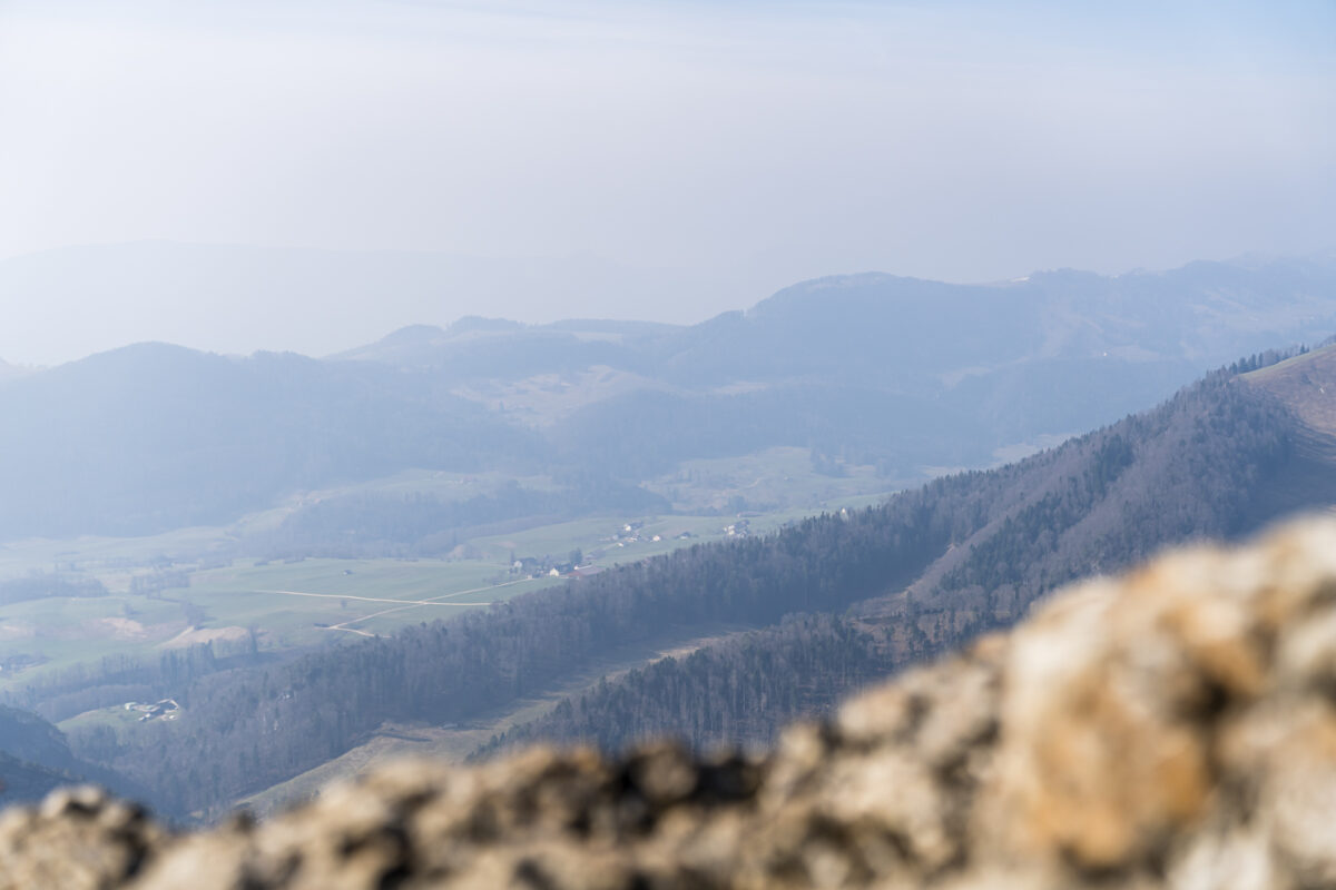
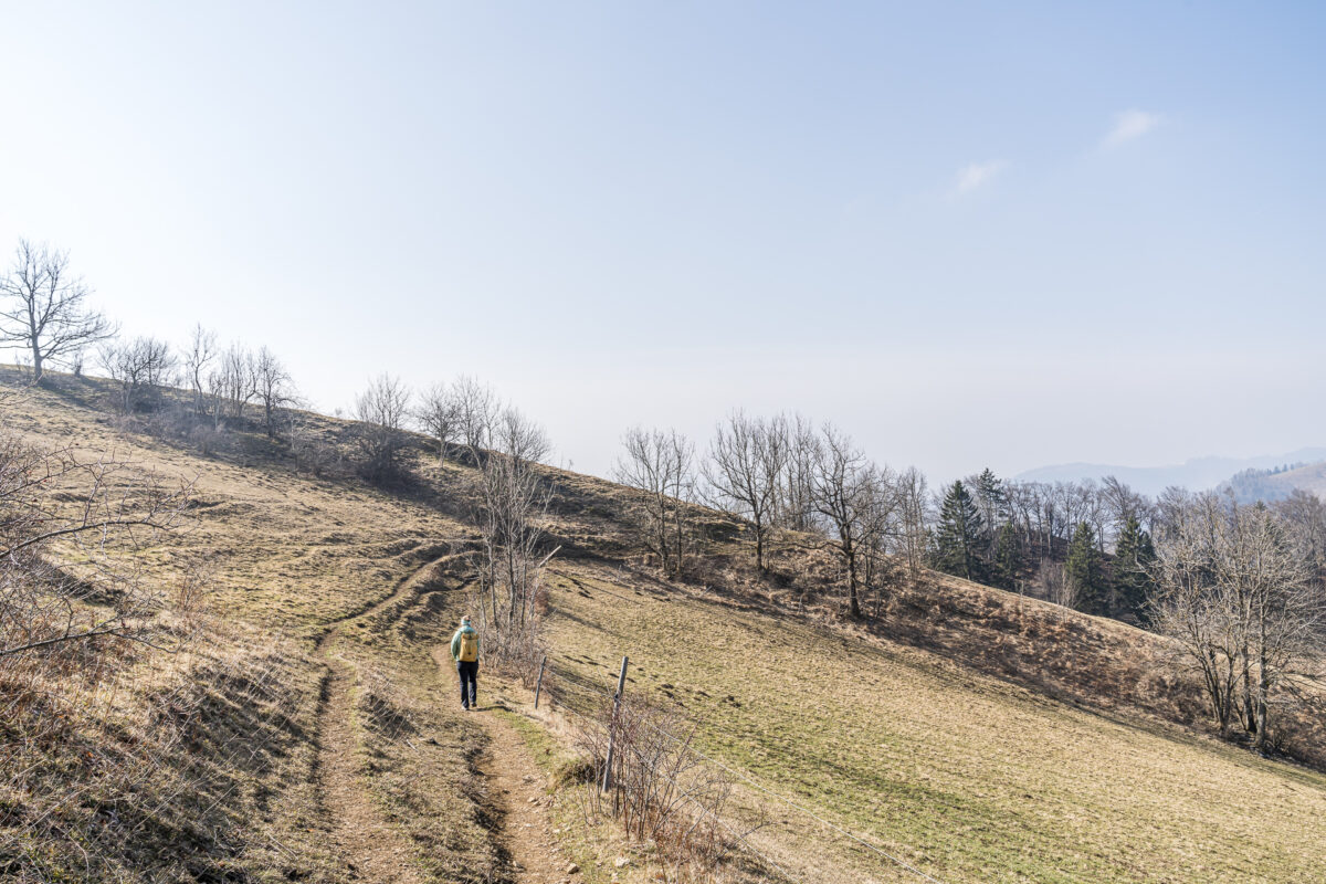
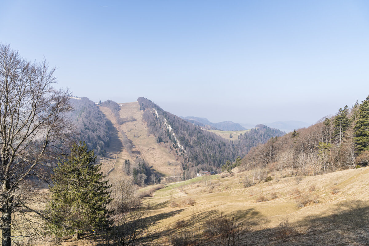
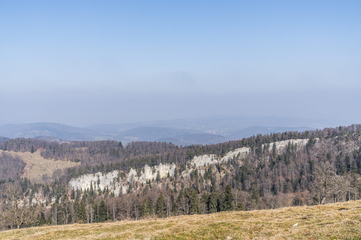
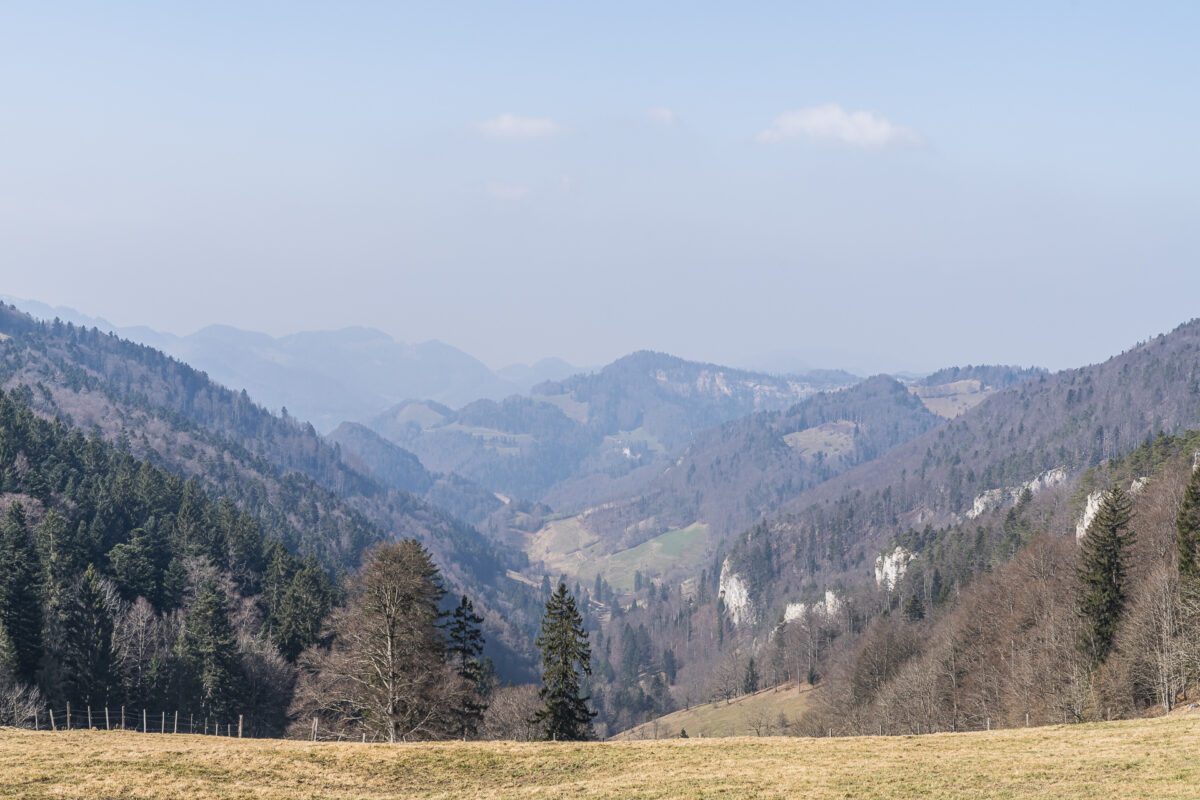
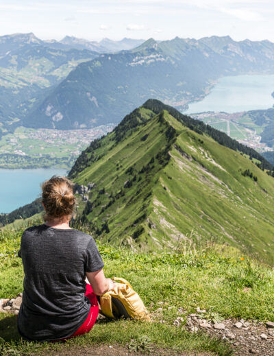
At the top, not only a splendid panoramic view awaits us – on clear days extending from the Black Forest across the Vosges to Mont Blanc – but also a quite cool circular hike on the Waterfallen Trail, where both the highest and the second highest peaks of the Canton Basel-Landschaft are climbed. Unfortunately, during our mid-March tour, it’s sunny but quite hazy. The distant view of the snow-covered Alpine chain eludes us. Otherwise, the Waterfallen Circular Trail fully meets our expectations. We follow the signpost clockwise to the Hinteri Egg barbecue area – at 1,168 meters above sea level, the highest point in the Canton of Basel-Landschaft.
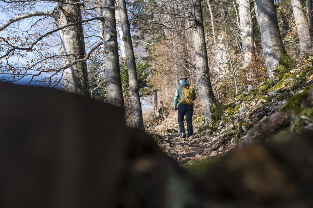
Then it’s straight on to the second highest point – the Chellenchöpfli. Here, for the first time, we are treated to an expansive view over the Mittelland. We take a short breather and then descend several meters through the forest following a zigzag path.
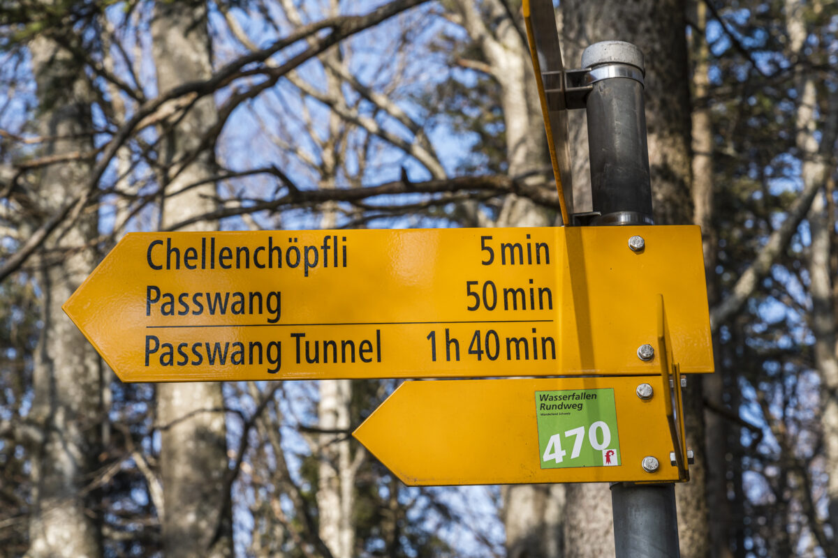
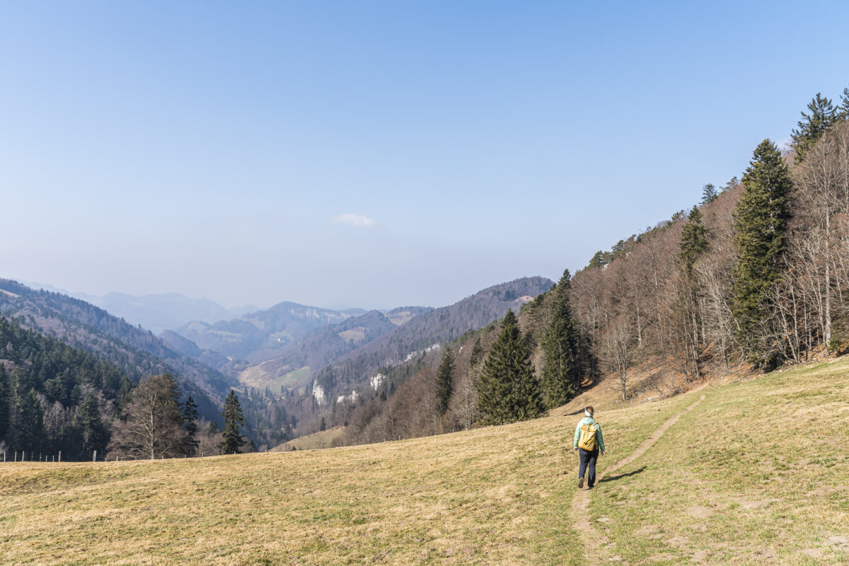
This gives us momentum for the most beautiful section of the tour. What follows is a marvelous ridge path up to Passwang.
The last third of the circular trail is no less scenic, taking us past two mountain inns back to the cable car mountain station.
Key Details of the Hike on the Wasserfallen Circular Trail
Below, you can find the route map of our hike on the Wasserfallen Circular Trail. It is a yellow-marked trail (T2) that leads through varied ascents and descents to the most beautiful viewpoints in Basel-Landschaft. At two or three places, it is somewhat steep, so wearing good shoes is recommended.
The Reigoldswil-Wasserfallen cable car operates from November to April, Tuesday to Friday from 10:00 to 16:30 and on weekends from 09:00 to 16:30. Monday is a day off. From May to October, it operates daily between 09:00 and 17:30. A round trip costs 24 CHF for adults. Half-fare and GA are not valid.
When planning, also note that the cable car operating times can be restricted during the week due to maintenance work. Current operational information and more tips about the region can be found here: Region Wasserfallen
| Starting Point | Wasserfallen Mountain Station (920 m above sea level) |
| Accessibility | Accessible by public transport |
| Length | 9.6 kilometers |
| Elevation gain | ↗ 545 m ↘ 545 m |
| Duration | 3:00 h |
| Destination | Wasserfallen (920 m above sea level) |
| Options for food and drink | Vogelberg Mountain Restaurant, Hintere Wasserfallen Mountain Inn, Heidi-Stübli Restaurant |
The Adventure Trail of Lucens
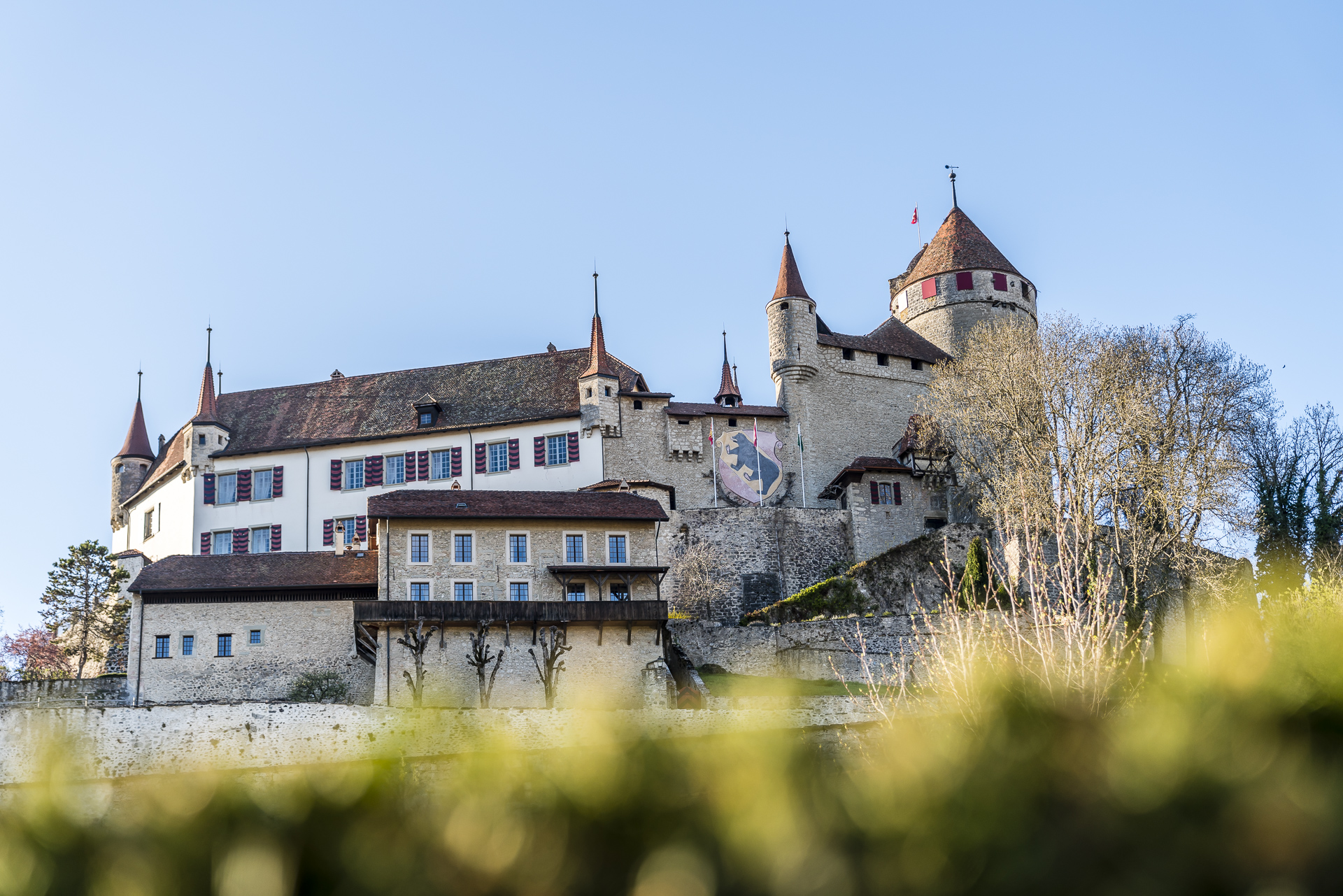
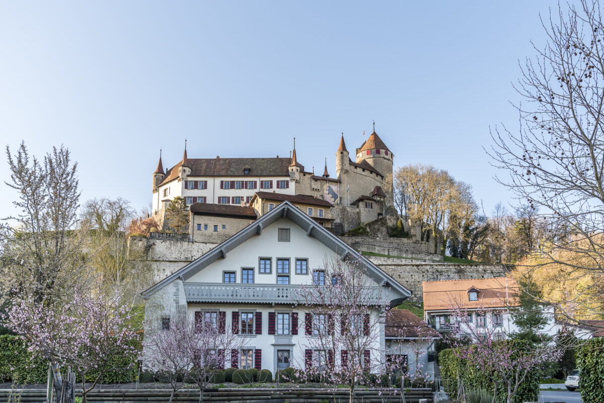
So, who has ever heard of Lucens? This village located in the Broye valley has captivated us with its intact historic village core and the impressive Château de Lucens perched on a rocky spur above. I think Lucens is something of an “insider tip” – at least for us German-speaking Swiss.
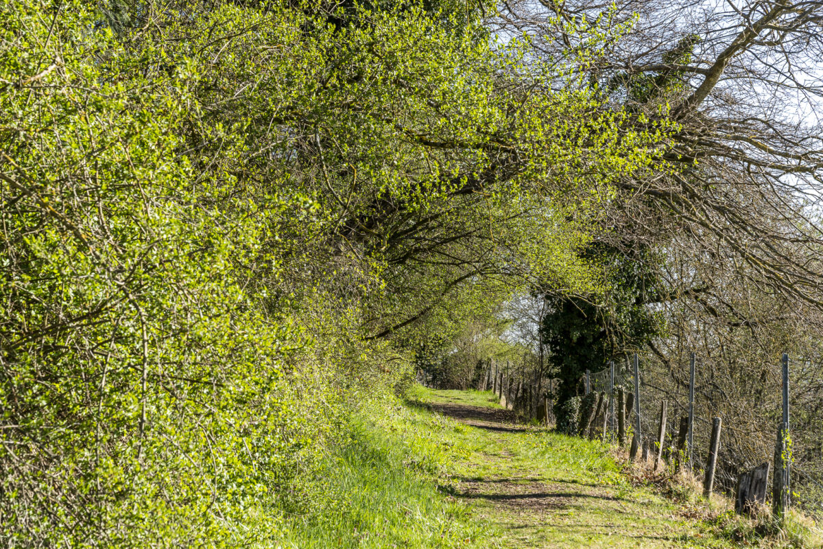
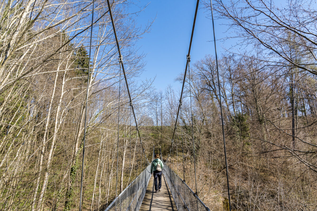
The technically simple and extremely entertaining adventure trail of Lucens is not only ideal for a spring hike but also offers a great opportunity to get to know Lucens and its surroundings. The seven-kilometer-long route is designed as a circular hike and leads from Lucens through a mixed deciduous forest to a plateau around the hamlet of Cremin. By the end of March at the latest, the unmistakable scent of wild garlic hits your nose as you ascend. Just before reaching the agriculturally dominated plateau, a suspension bridge adds a bit of thrill.
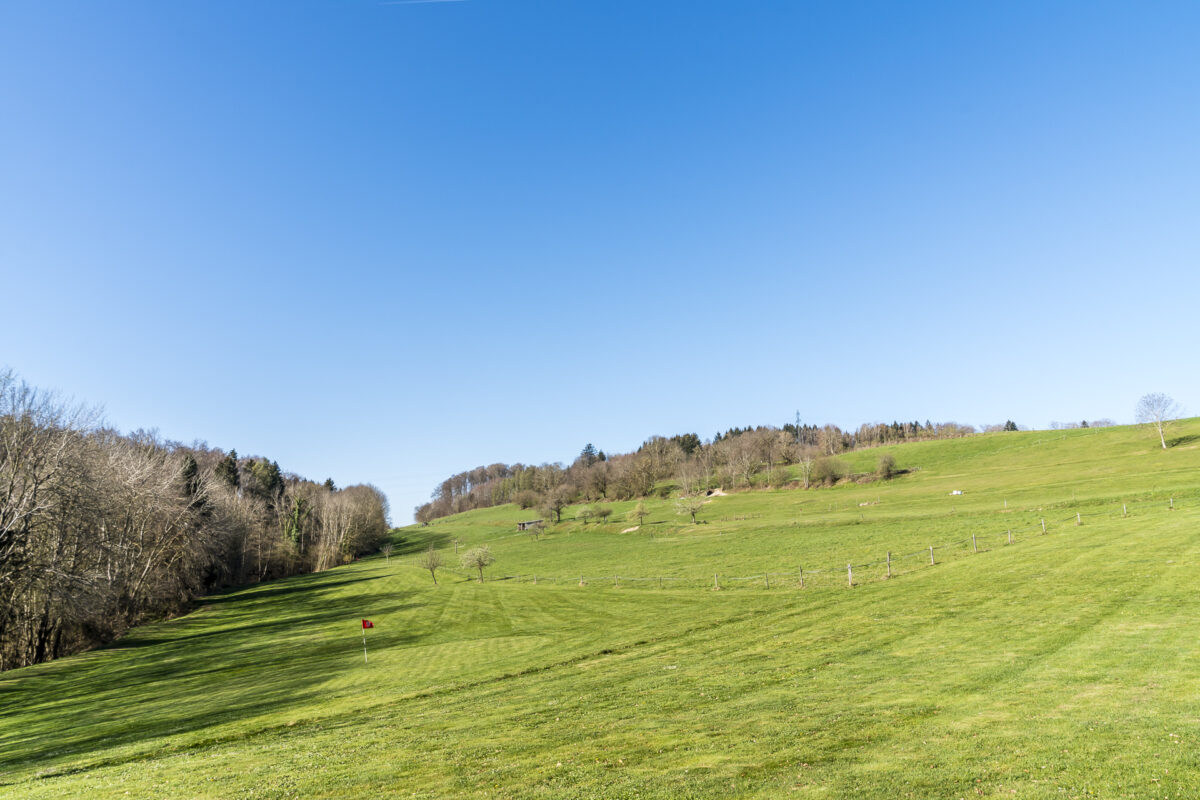
In Cremin, there’s an opportunity to make a stop at “Loisirs à la Ferme” and engage in a round of Swingolf. Especially in nice spring weather, this is a pretty cool activity that can be easily combined with the hike. More information can be found here: Loisors à la Ferme – Swingolf. The hiking trail passes right by it – so you can’t miss it.
Afterwards, the adventure trail leads past the castle back to Lucens railway station.
Key Data for the Circular Hike Lucens – Cremin – Lucens
Below, you can see the route of our hike on the Sentier Aventures Lucens. These are yellow-marked hiking trails (T1/T2). With a length of just under seven kilometers and a total of 225 meters of ascent/descent, both technically and physically, the route is not particularly challenging and can be easily completed in a maximum walking time of two hours.
| Starting Point | Lucens Railway Station (495 m above sea level) |
| Accessibility | Accessible by public transport |
| Length | 7.3 kilometers |
| Elevation gain | ↗ 225 m ↘ 225 m |
| Duration | 2:00 h |
| Destination | Lucens Railway Station (495 m above sea level) |
| Options for food and drink | Farmhouse Restaurant and Train Station Restaurant |
If the detour to Lucens is too far for a day trip or if you want to explore more charming places in the area (e.g., the neighboring historic town of Moudon), I can recommend staying at La Ferme du Château. We have also stayed here and were completely satisfied.
More Hiking Tips Around Easter
For even more seasonally appropriate hiking ideas, just click here: Spring Hikes
My favorite tours for late March/early April include these hikes:
- The Spring Hike around Lake Zug
- The Chemin de Mont Sujet with its Easter daffodil splendor
- The hike over Moosegg
Have you started the hiking season yet? And if so: What spring hikes have you already embarked on this year?

Leave a Reply