


Adelboden – Lenk region: Tip for an easy hike from the Metschstand to the Bergläger
Advertising: this article was created in cooperation with the Adelboden-Lenk region… Dänk!
The Adelboden-Lenk region has given us many beautiful hiking moments in recent years. We have already hiked here to the roaring Simmen Falls, explored the impressive crater landscape of the Gryden and found cooling off in the Choleren Gorge on hot summer days. Also this year we have scouted some hiking trails. My favourite: The panoramic tour from the Metschstand through the idyllic Bütschi valley to the Bergläger.
One hiking ticket – umpteen possibilities
Since this summer season, not only the gondola lift on the Betelberg has been in operation at Lenk, but also the Stand-Xpress Metsch 5 days a week. This makes the Metschstand – and all the hiking routes that pass by it – accessible without a previous sweaty ascent. At the same time, a new hiking ticket was launched this summer in cooperation with the transport companies involved. One ticket – train, bus and mountain railways all inclusive!
The hiking ticket includes the train and bus journey from Spiez via Zweisimmen and Lenk to the valley station of the Stand-Xpress, the journeys with the Stand-Xpress and the Sillerenbahn as well as the return journey by bus and train from Adelboden via Frutigen to Spiez. Pretty handy. Especially since it gives you maximum flexibility in terms of hiking route planning. How you get from the Metschstand to the Sillerenbahn is up to you. On the website of the Lenk mountain railways, three suggested routes serve as inspiration.
From Lenk to Metschstand
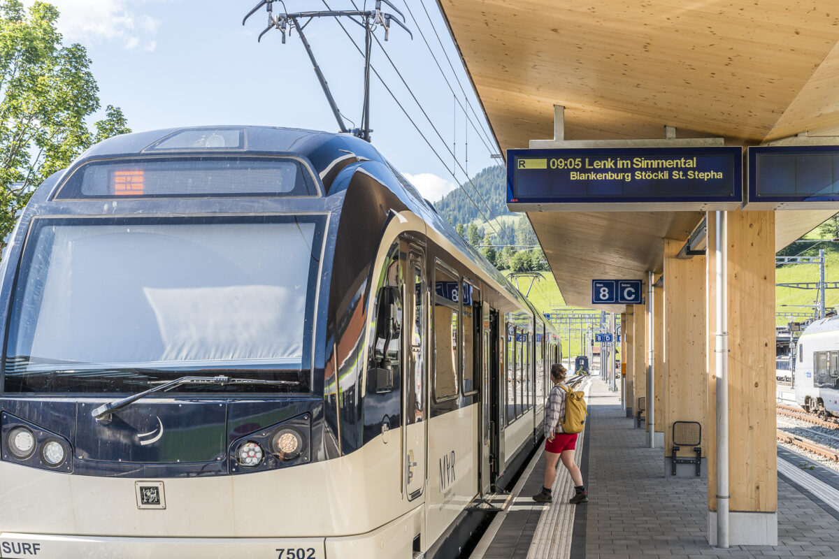
I was also inspired by the tour suggestions of the Lenk mountain railways. But more on that later. First we take the train via Spiez and Zweisimmen to Lenk. We have chosen a wonderfully sunny day for the tour and are not the only ones who change from the BLS to the MOB (Montreux-Berner-Oberland-Bahn) in Zweisimmen in the direction of Lenk. The connections here are perfectly coordinated. This is also the case at Lenk, where the AFA buses are waiting in line when we arrive.
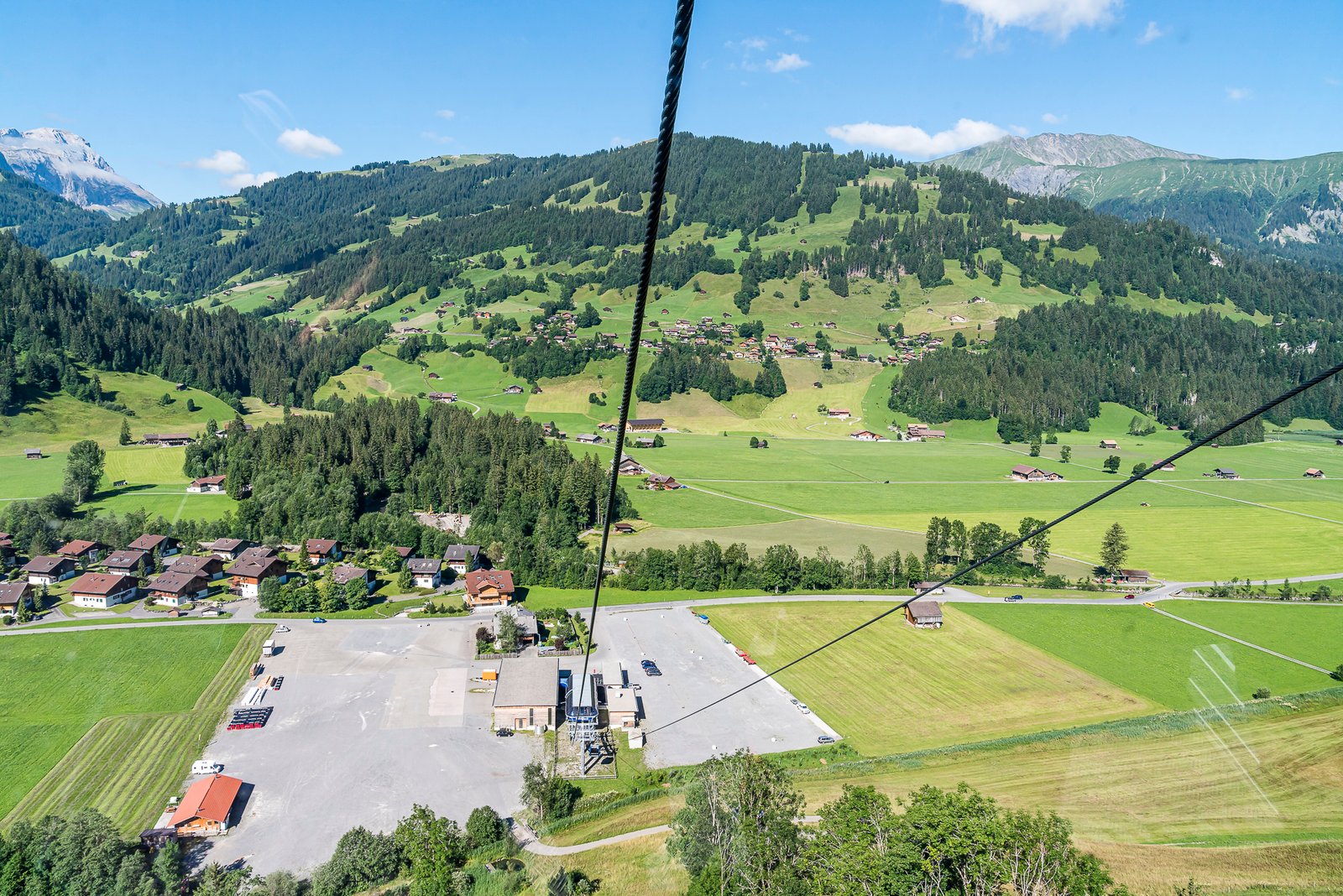
We get on the bus in the direction of Simmenfälle and after about five minutes of travel we press the stop button just before the “Lenk, Metschbahnen” stop. There is no longer any sign of the hustle and bustle of changing trains at Zweisimmen station. And the following ascent with the Stand-Xpress is also wonderfully decelerating. It is much slower in summer than in winter. For us, this means more time to enjoy the view.
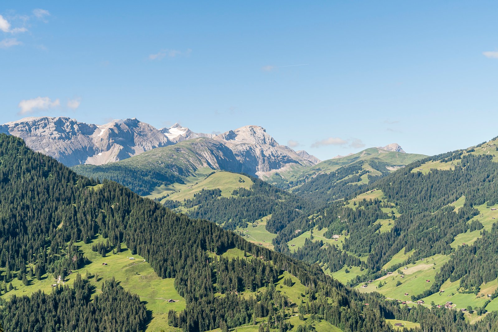
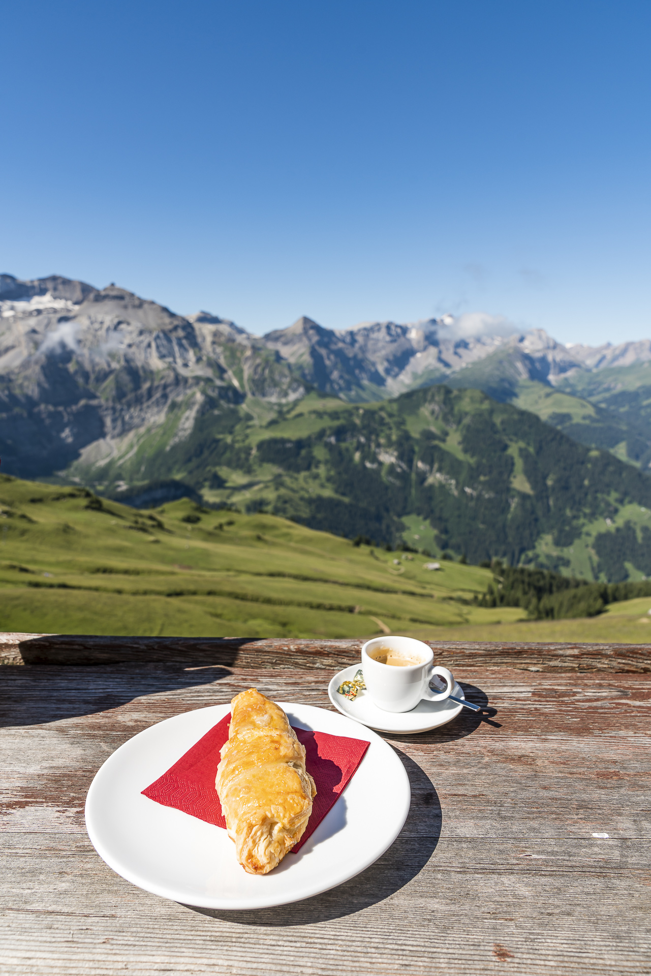
Once at the top, the “Welcome” sign of the Berghaus Standhütte lures us directly onto the panoramic terrace. The highest restaurant in the entire Adelboden-Lenk hiking and biking region offers a magnificent view of the surrounding peaks. And in addition, there are fine nut croissants, which are supplied by the Lenker bakery Kuhnen.


Out and about on the “Insider Tip Route”
Then it’s time to shoulder your backpack and march off. We follow the signposted mountain hiking trail along the ridge towards the Bummere Pass. On one side of the path there is a magnificent view of the striking “Rägeboldshore”. On the other hand, the view of the imposing Wildstrubel massif will remain with us for a while. It is worth making a stop or two to take in the panorama. At the Bummere Pass, a narrow (but not sloping) path leads in a good 20 minutes to the summit of the Rägeboldshore, which is about 140 metres higher. If you like, you can easily incorporate this extra loop with summit ascent into this tour suggestion. According to the locals, the view from the summit definitely compensates for the extra meters of altitude!


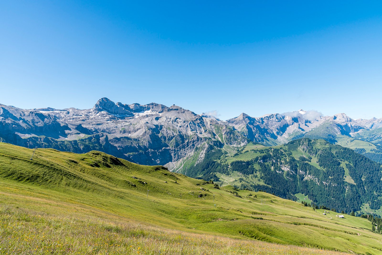


We opt for the more leisurely option and follow the hiking trail directly along the flanks of the Rägeboldshore to the Luegli. Here the view of the Bütschi valley opens up to us. This is idyllically nestled between rugged rock faces and lush green alpine meadows. In between, an exciting structure of larger and smaller boulders. The Bütschi Valley is also considered a good example of recent geomorphological processes. In addition to the special scenery, we quickly notice another special feature: the peace and quiet! No wonder the valley is also a popular spot to spot marmots. We follow the narrow hiking trail, which zigzags through the rock structures, over the alpine pastures down into the valley. But I don’t see any marmots – only their distinctive whistling is more audible through the valley basin.


Stopover at Alp Bütschi Stafel
It is only from the height of Bütschi Stafel that things get a little “busier” again. The broom pub run here by the Trachsel family on Alp Bütschi is widely praised. First and foremost, I’m looking forward to a sparklingly cool sip of non-alcoholic “Suure Moscht”. If you’re feeling peckish, there are homemade cheese specialties and dry sausages (individually or as platters) and also fine meringues. A stop for a bite to eat that is definitely worth it!


From Alp Bütschi to Bergläger, the hiking trail follows a wide gravel path for the most part, which is also used by bikers. Basically, however, you can get past each other here without any problems. On the last few metres, the road and the hiking trail separate again and we are guided on the “Direttissima” through a secluded and pleasantly shady piece of forest to the Bergläger.


At the Bergläger is one of the intermediate stations of the Silleren Railway with a connection to Adelboden Oey. Alternatively, you can hike the remaining distance downhill, or take a scooter to Adelboden. We decide to take the gondola lift and change to the bus connection to Frutigen at the Adelboden Mineralquelle stop. This is timed in such a way that there is a connection to the RegioExpress Lötschberger back to Spiez at Frutigen station. And while we review the hiking day on the way home, we come to the conclusion: Yes, the hiking route through the Bütschi Valley is rightly considered an insider tip!

Key data of the hike Metschstand – Bütschital – Bergläger
In the following hiking map you can see the route of our hike from the Metschstand via Bütschital to the Bergläger. It is a red-white-red marked mountain hiking trail (difficulty T2). The route measures 7 kilometres and it is recommended to allow for a hiking time of around two hours (without breaks).
| Starting point | Metschstand (2,087 metres above sea level) |
| Length | 7.1 kilometers |
| Elevation gain | ↗ 102 m 711 m ↘ |
| Duration | 2:00 p.m. |
| Destination | Adelboden, Bergläger (1,485 metres above sea level) |
More Hiking Options
The hiking route through the Bütschi Valley scores with a unique backdrop and its originality. Here, the focus is on the experience of nature. But as written in the introduction, the hiking ticket allows for an uncomplicated and multifaceted hiking excursion for almost every taste. Route no. 1 from the Metschstand via Hahnenmoos Pass and Sillerenbühl to the Bergläger offers a little more “action”. Highlights include the Caribbean-style Brenggensee, the Flower Trail in the Hahnenmoos Pass to Sillerenbühl section with information boards on the alpine flora along the way, and the Vogellisi Adventure Trail between Sillerenbühl and Bergläger. Thanks to the puzzle fun on the Vogellisiweg, this route is also very suitable as a family hike (recommended for ages 6 and up).
And if you don’t want to miss the altitude difference, you can of course also complete the round trip in the opposite direction and climb from the Bergläger, for example via Hüendersädel to the Metschstand and then take a leisurely gondola ride down into the valley.
Practical tips for your hiking tour through the Adelboden-Lenk region
- The hiking ticket can be booked directly online via the BLS website and costs CHF 84 for adults without a discount. Adults with Half-Fare travelcard pay 44.80 CHF. With GA travelcard, the hiking ticket still costs 25.20 CHF.
- The hiking ticket includes the journey with the BLS from Spiez, with the MOB to Lenk, with the AFA bus to the valley station of the Stand-Xpress, the Stand-Xpress Metsch and Sillerenbahn Adelboden mountain railways as well as the return journey with the AFA bus to Frutigen and from there with the BLS on to Spiez.
- The hiking ticket is valid from Wednesday to Sunday until October 16, 2022.
- Please note that the Stand-Xpress Metsch is not in operation on Monday and Tuesday – with the exception of August 1st.
- If you like, you can also jet down from the Bergläger to Adelboden on a scooter. Or if you are travelling in the opposite direction, you can take the “Mountain Carts” from the Metsch stand down to the Metsch middle station. However, the scooter rental (18 CHF) or the cost of the mountain carts (15 CHF) is not included in the hiking ticket and must be paid separately on site.
- You can find more impressions and regional hiking tips in my blog post about the glamping experience on the Hahnenmoss Pass

Leave a Reply