

Gryden high-altitude circular route: up close and personal with fascinating crater landscapes
Advertising: this article was created in cooperation with Lenk Bergbahnen
There are quite a few exciting hiking trails to discover in Lenk. In recent years, we have therefore found ourselves in these idyllic corners of the Bernese Oberland from time to time; from the hiking classic “Zu den Sibe Brünne” to more challenging mountain tours via the Schnidejoch into Valais, you can already find some regional hiking tips here on the blog. Recently, we have expanded our repertoire and taken a closer look at the Gryden high-altitude circular trail. This much can be revealed in advance: The detour to the fascinating crater landscape on the Betelberg offers veritable hiking pleasure.
With the adventure gondola to the Betelberg
When it comes to hiking, we tend to be early risers. I like to be on the mountain early and love the morning freshness as well as the clear view. And so I actually wanted to tackle the hike on the Gryden high-altitude circular trail in one morning. But just for that day a bad weather front was announced and since we arrived the day before anyway and extended the stay at Lenk to two days, we spontaneously decided to do the tour in the afternoon of the day of arrival. This is an example of the fact that the Gryden high-altitude circular trail is also a really great hike for all those of you who like to make plans at short notice and don’t want to plan their days off in advance.
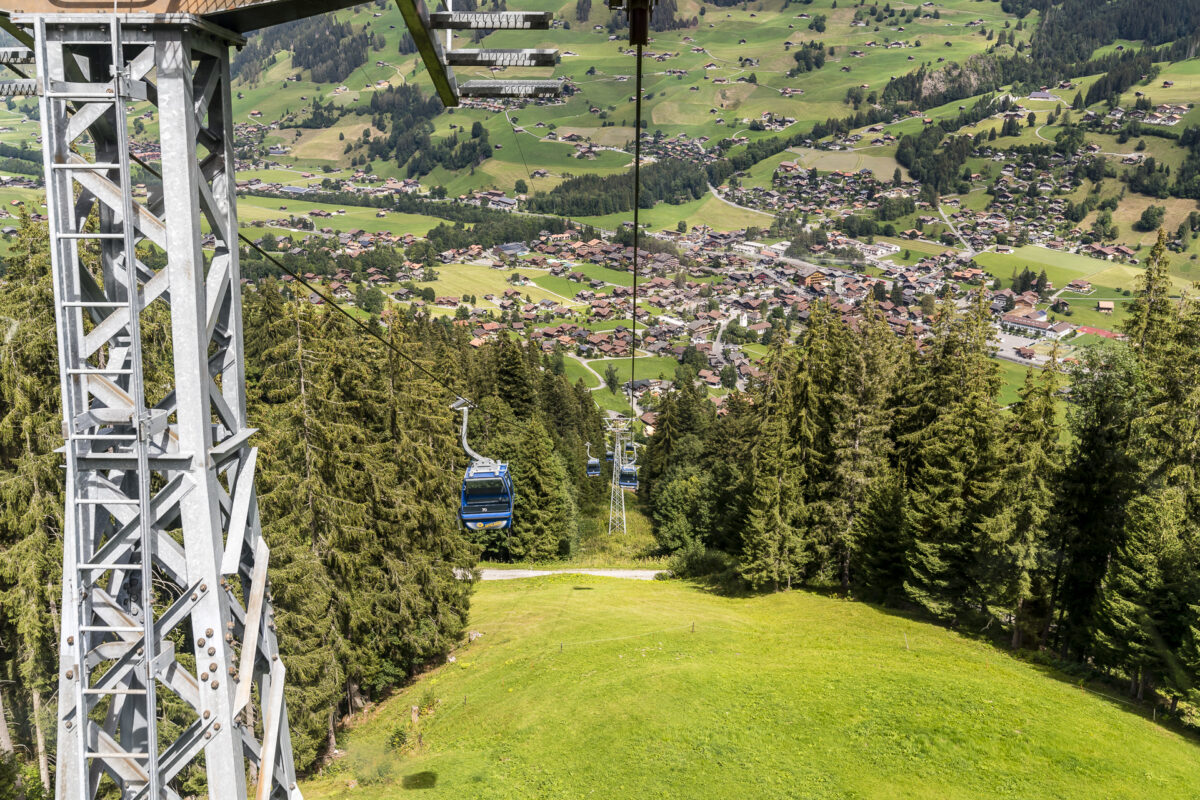
And so we march from Lenk train station directly to the valley station of the Lenk Betelberg gondola, where we can comfortably climb up to the Leiterli. If you are travelling with children or simply don’t feel like taking a 0815 gondola ride, you can watch one of the 12 adventure gondolas down at the valley station. In these 12 special gondolas, three animal inhabitants of the Betelberg – Mona the cow, Flöckli the goat and Moritz the marmot – contribute to the entertaining ride and at the same time ensure that you get to know the surroundings better.
On the ascent, we catch the “Mona”, which draws our attention to the various alpine farms in the 15 minutes drive to the Leiterli and also shows me the surrounding striking natural elements such as the imposing Rezligletscher, which seems incredibly close on this day – thanks to the Föhn.
On the AlpRundweg in the direction of Alp Steinstoss
We are up at the top of the Leiterli at an impressive 1,946 metres above sea level. As a starting point for various themed and circular trails, the Leiterli is the hub of summer activities on the Betelberg. In addition, right next to the Berghotel Leiterli (with a sun terrace for all those who need refreshments before the start of the hike) there is also a casual alpine playground and on weekends scooter bikes are rented. Even though the sun terrace of the Leiterli looks tempting, we curb our appetite a little and look out for the hiking trail signs.
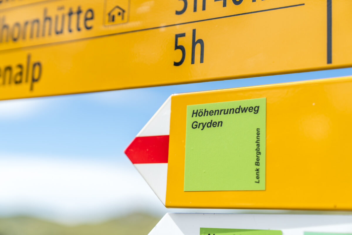
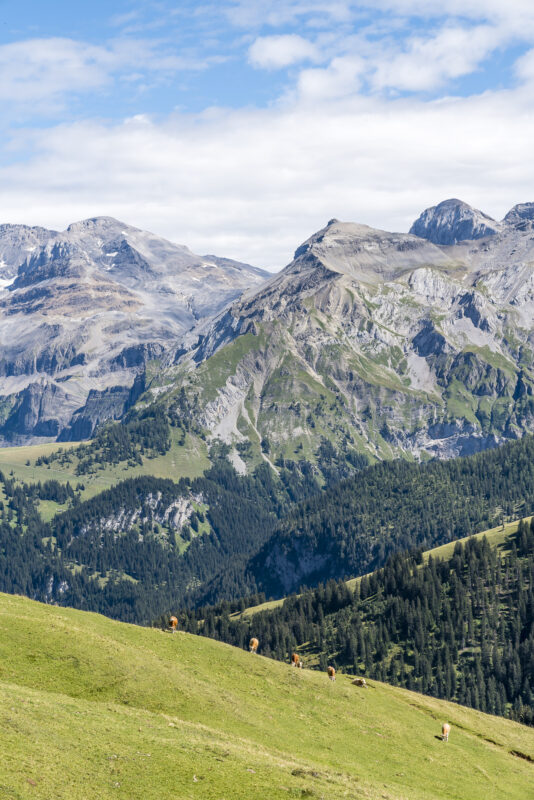
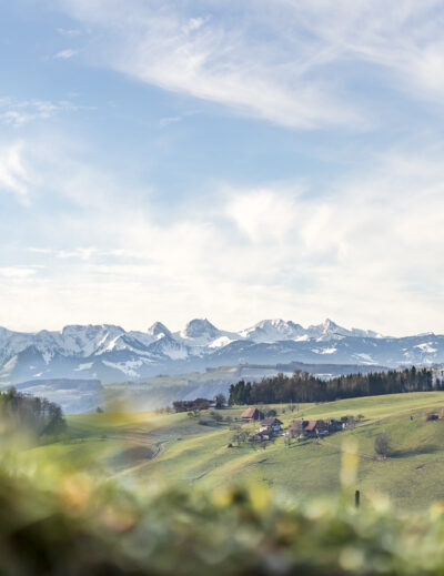
The Gryden high-altitude circular trail is signposted directly at the exit of the mountain station and runs parallel to the Leiterli Alpine Circular Trail in the first section. After just a few metres, we learn that we are on the edge of a protected moor landscape thanks to one of the information boards of the AlpRundweg. The area between Leiterli and Trütlisberg Pass is part of the Federal Inventory of Moor Landscapes of Special Beauty and National Importance. With this knowledge, we can now make out the peaty alpine meadows from a distance – wherever the yellow-brown to orange-brown colour dominates the terrain, there are flat or raised moors. And the further autumn progresses, the more succinct these splashes of colour appear.
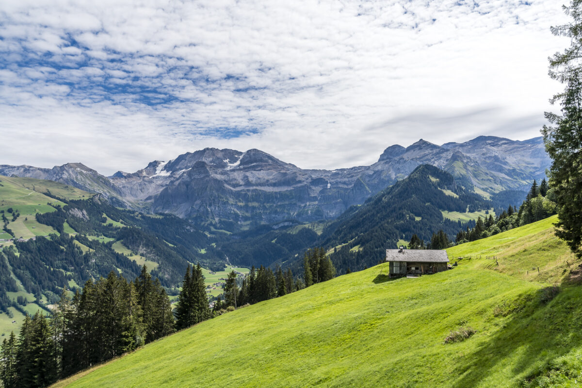
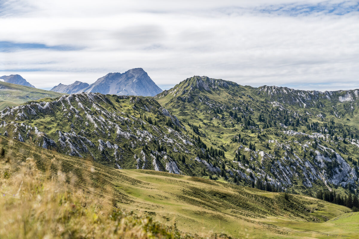
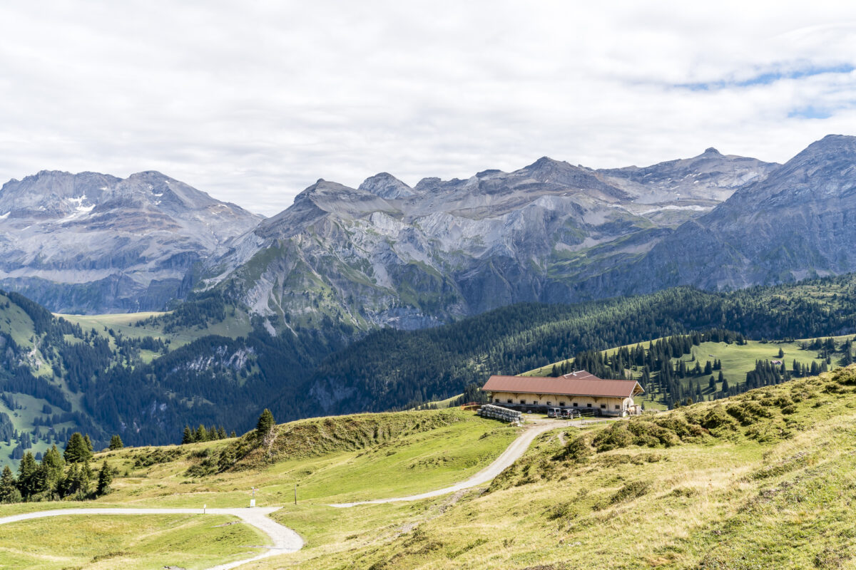
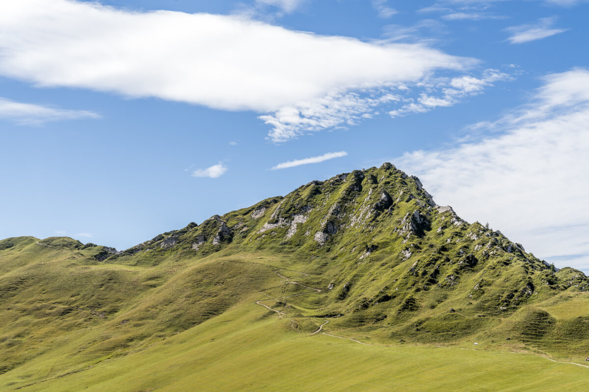
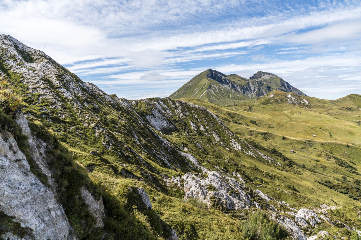
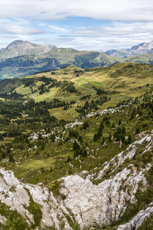
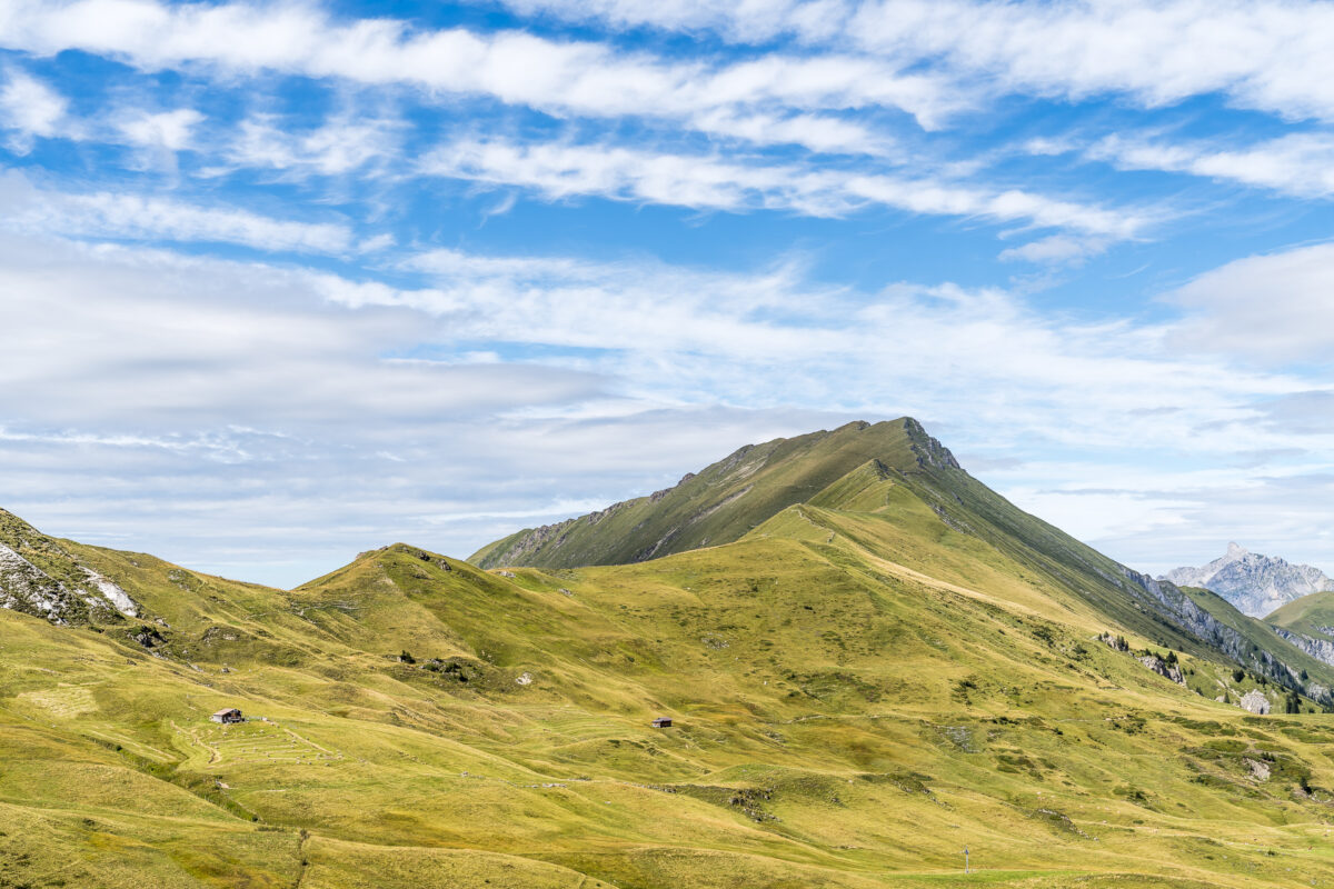
We follow the wide, easy-to-walk gravel path in the direction of Steinstoss/Stübleni. The striking slopes of the Gryden are becoming more and more imposing. The closer we get to this special rocky landscape, the more details we can glean from it. The ridge is somewhat reminiscent of the Schrattenfluh, but with its deeply furrowed structure of green alpine meadows and strikingly white, angular rock material, it is more mosaic-like than its Entlebuch counterpart. The two mountain ranges also differ geologically. While the Schrattenfluh is dominated by Schrattenkalk, the Gryden are a mixture of Rauwacke (a porous dolomite rock) and gypsum.
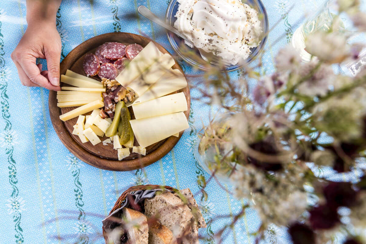
But before we get into the middle of this special rock formation, it’s definitely time for an intermediate refreshment. Not far from the high-altitude circular trail is Alp Steinstoss, where it is worth stopping for a bite to eat. A platter of locally produced mountain cheese and a portion of Merängge with Nidlä – all on a secluded meadow with the most beautiful view.
Cross-country to the fascinating Gryds
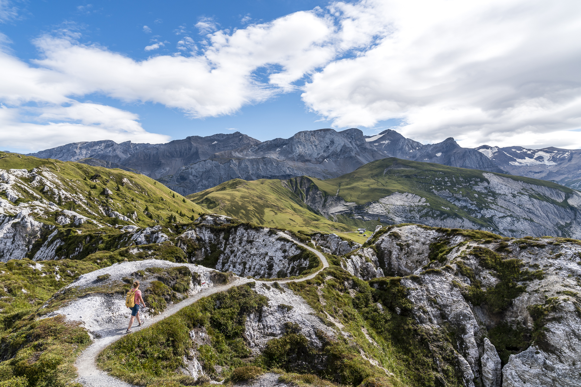
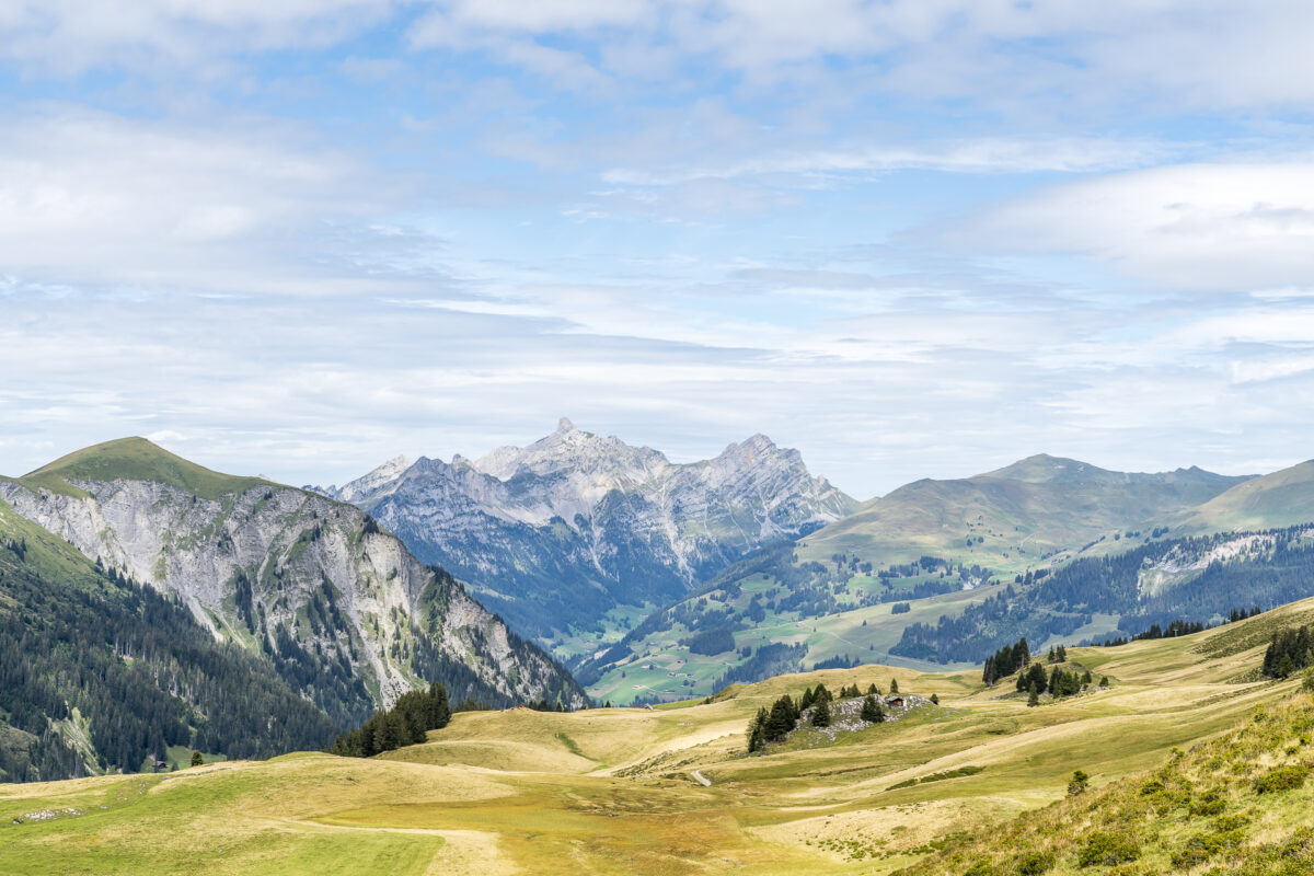
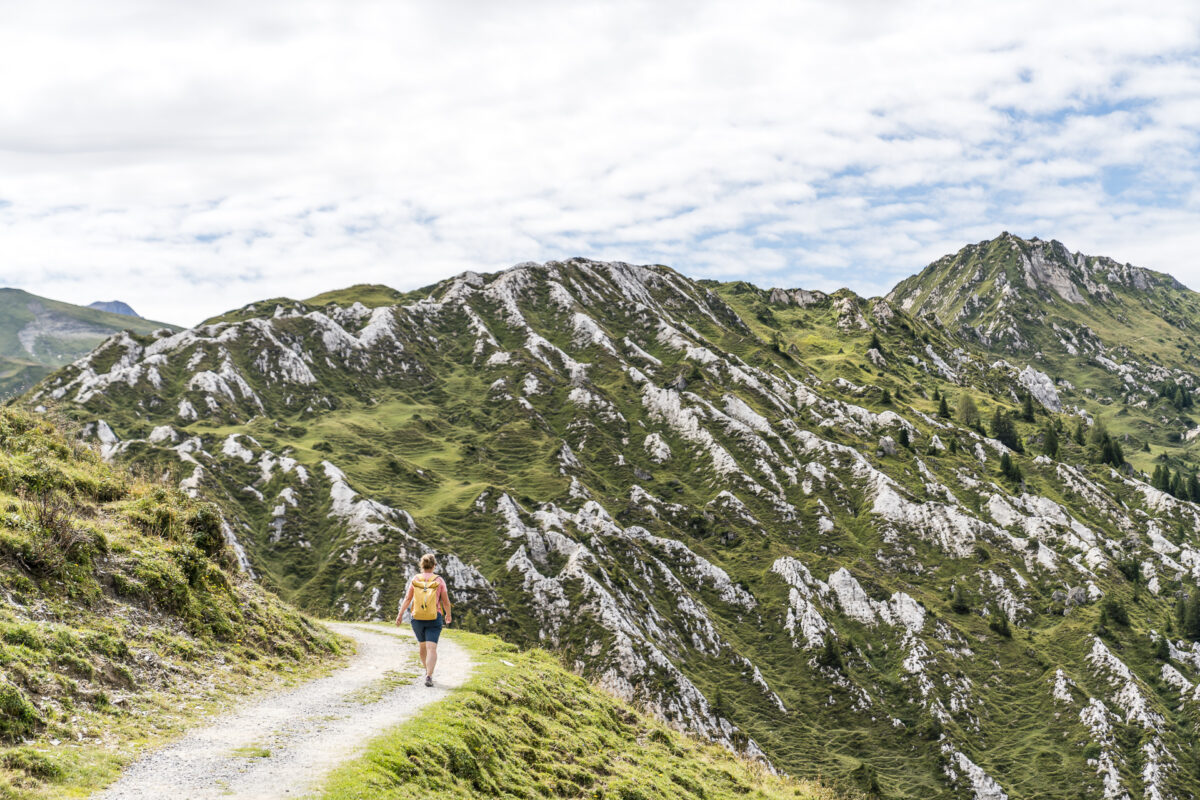
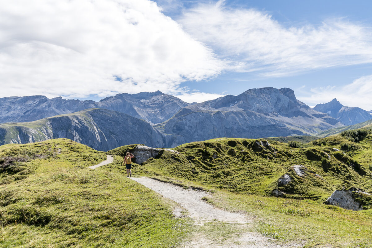
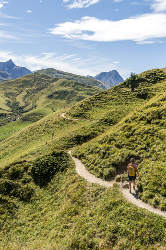
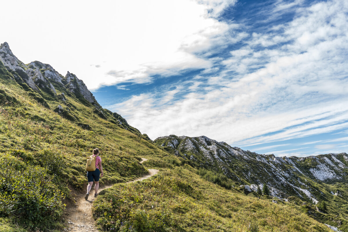
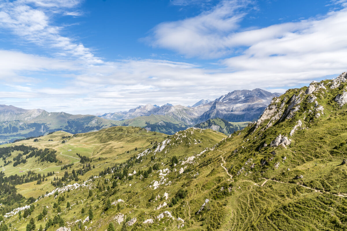
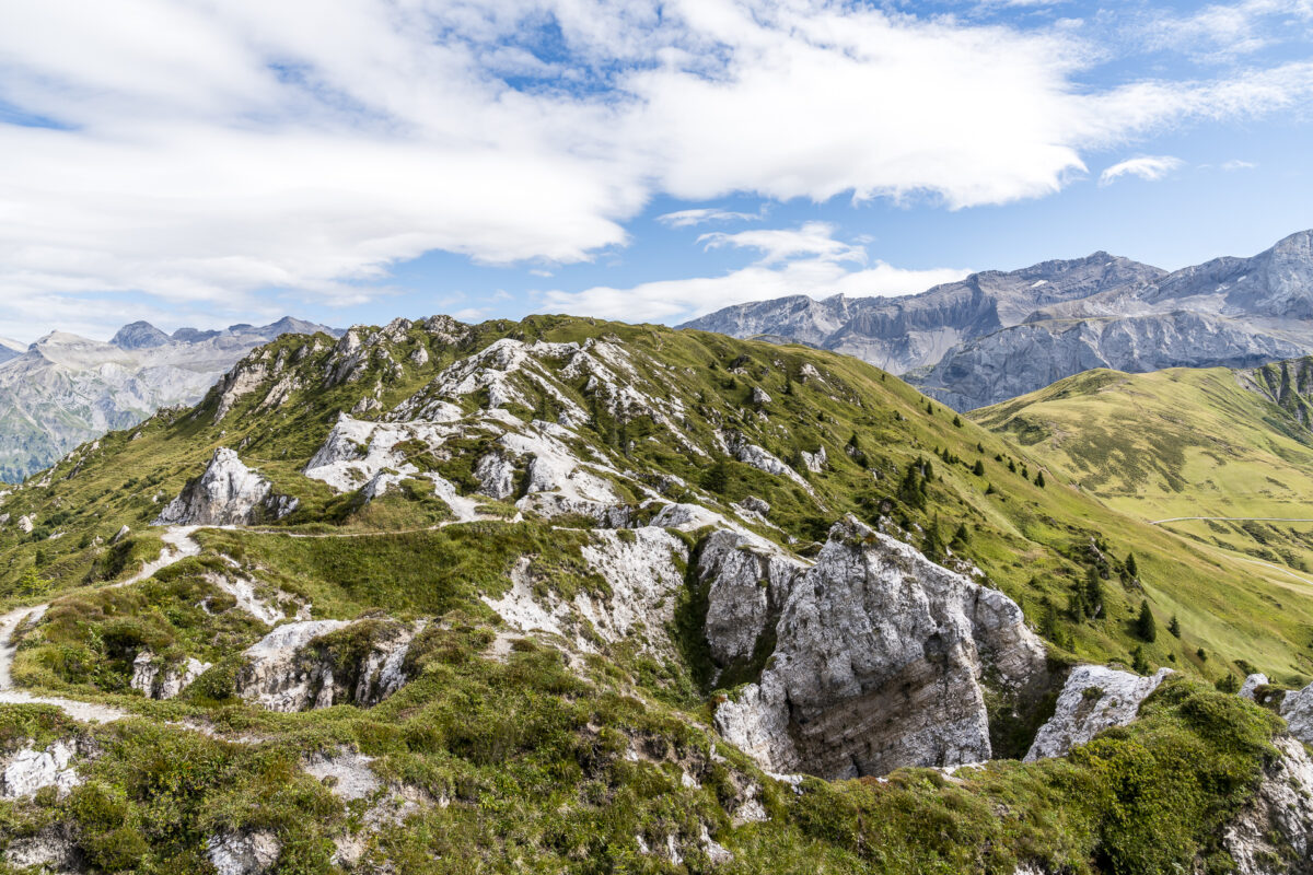
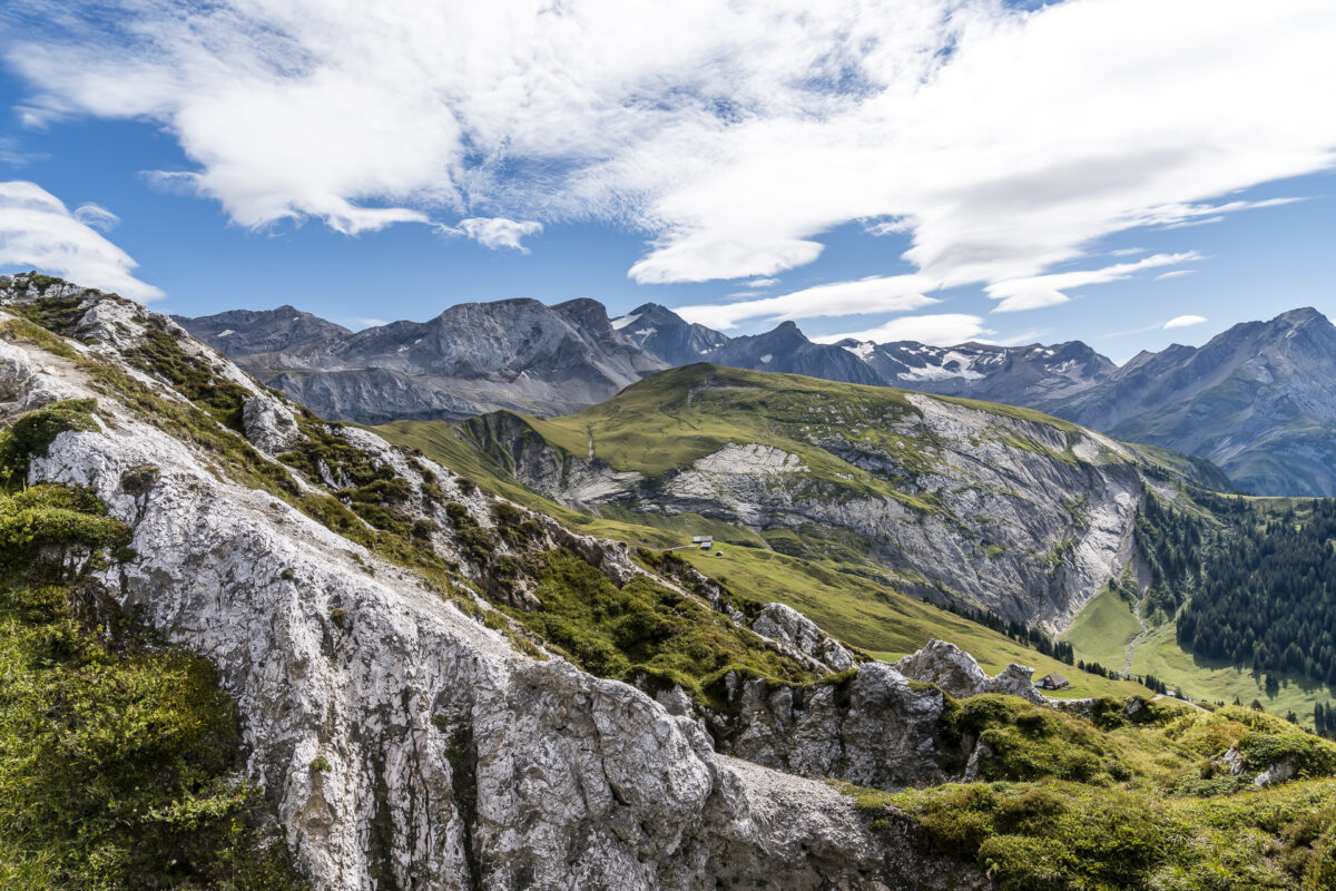
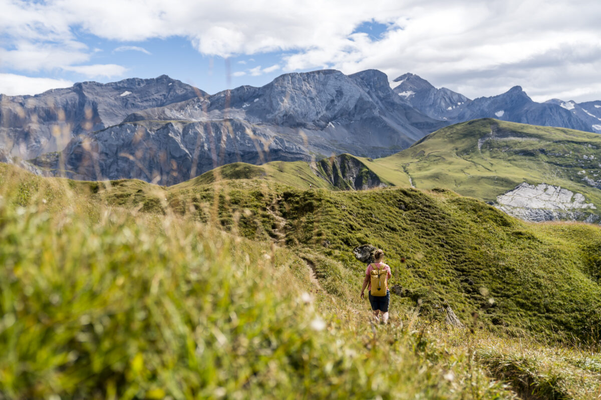
After this stop, I’m ready to climb the Gryden. The high-altitude circular trail leads around the rock formation and offers the possibility to extend the tour in the direction of the Trütlisberg Pass or over the Stübleni Pass to Lauenen/Wasserngrat. After a leisurely start on the AlpRundweg, it quickly becomes more alpine behind Alp Steinstoss. The gravel path turns into a narrow natural path that leads over hill and dale along the flanks of the Gryden. I enjoy the panoramic view towards the Wildstrubel massif and at the same time I am curious to see what deep views the furrowed Gryden will have in store for me.
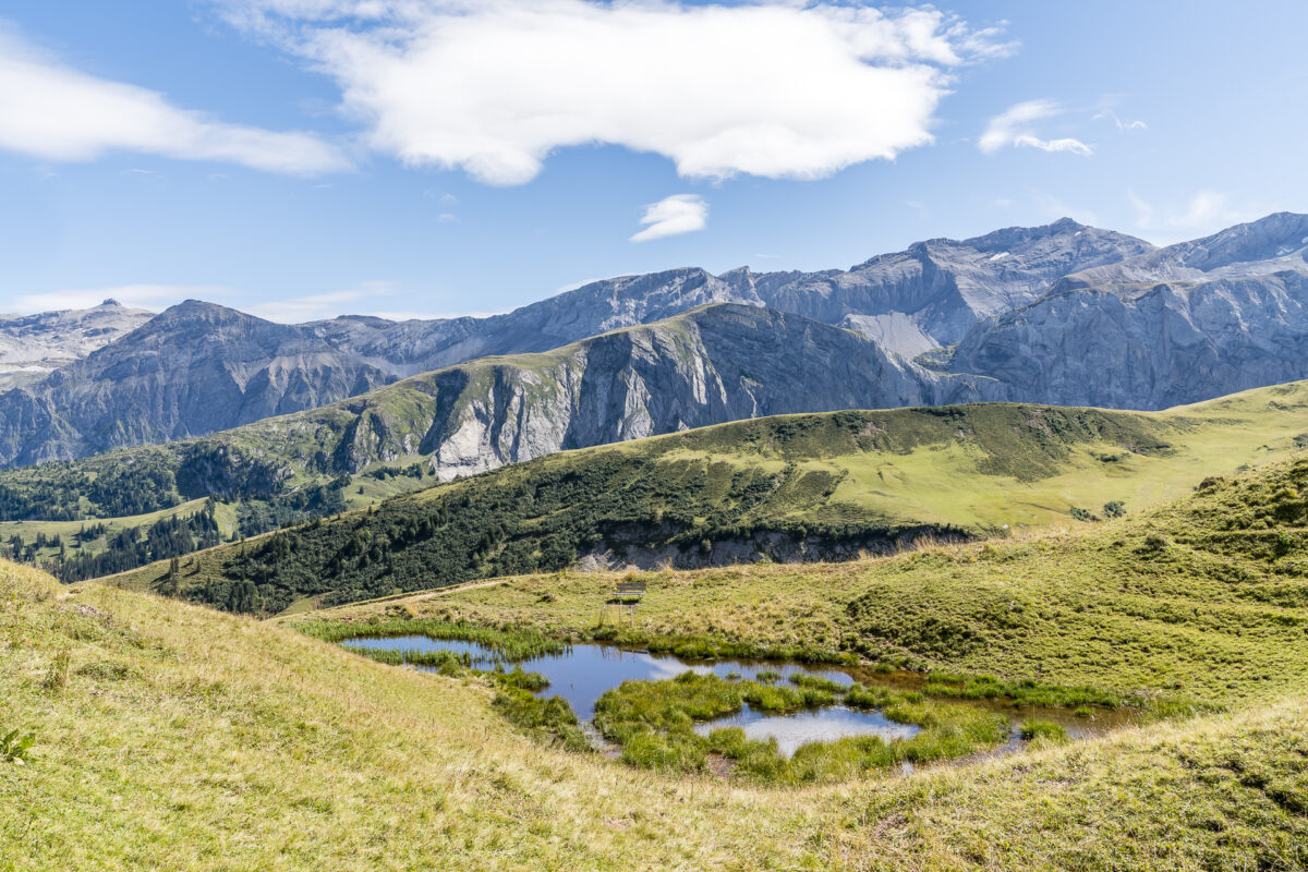
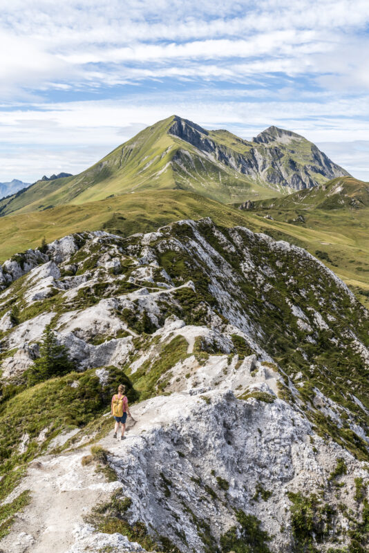
We follow the gently ascending circular path around the Stübleni in an anti-clockwise direction uphill to the signpost at 2,077 metres above sea level. Here we now have the opportunity to tackle the way back of the high-altitude circular trail, or – as we are also advised on the sign directly at the signpost – to tackle the almost 500 additional meters to the refuge.
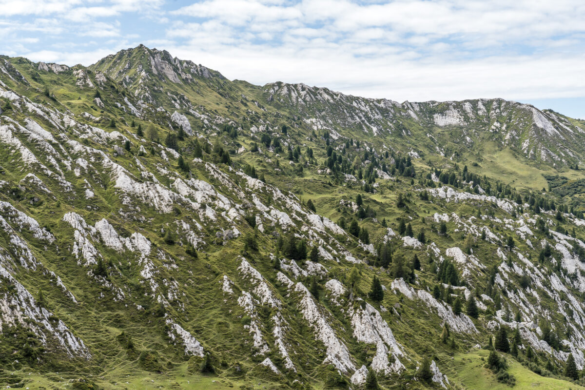
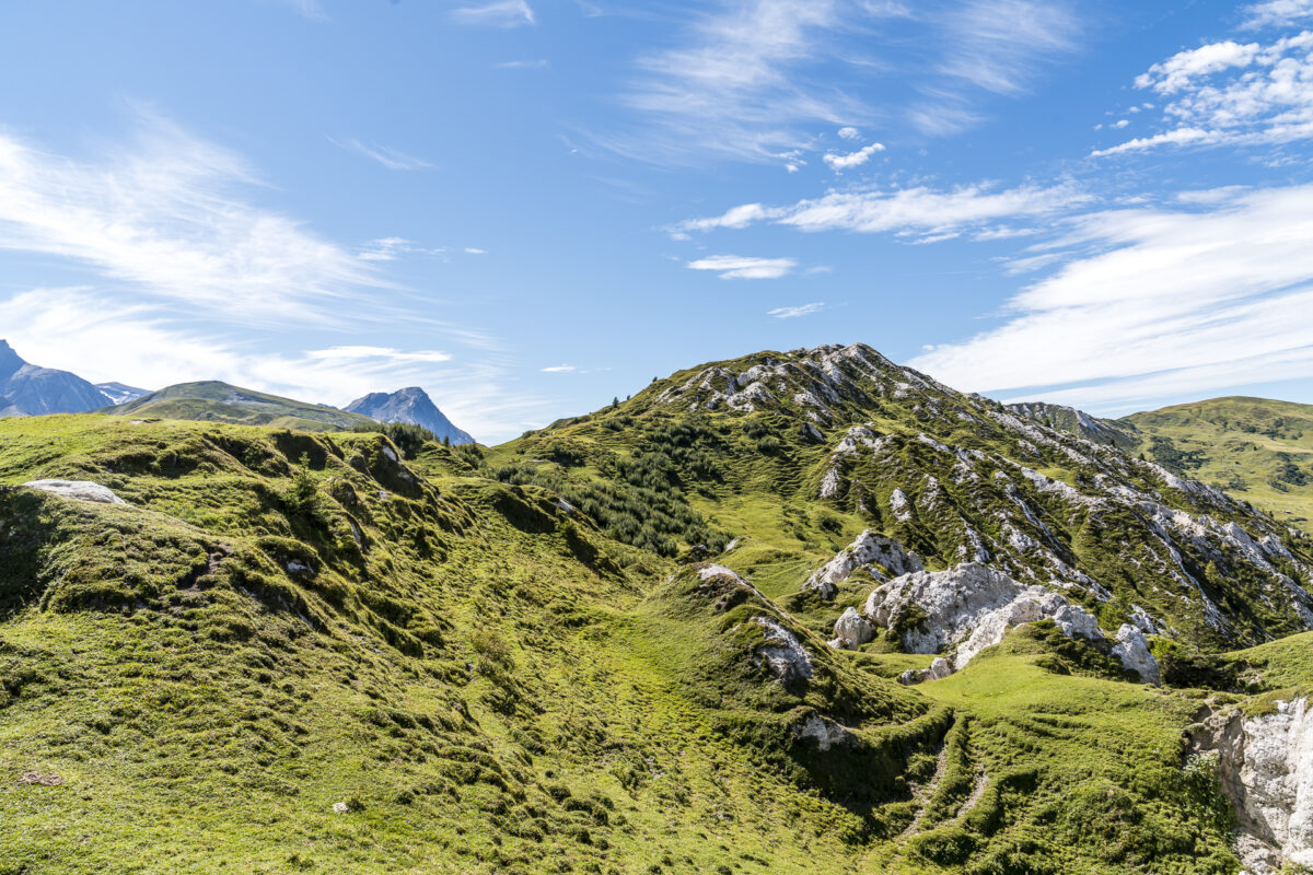
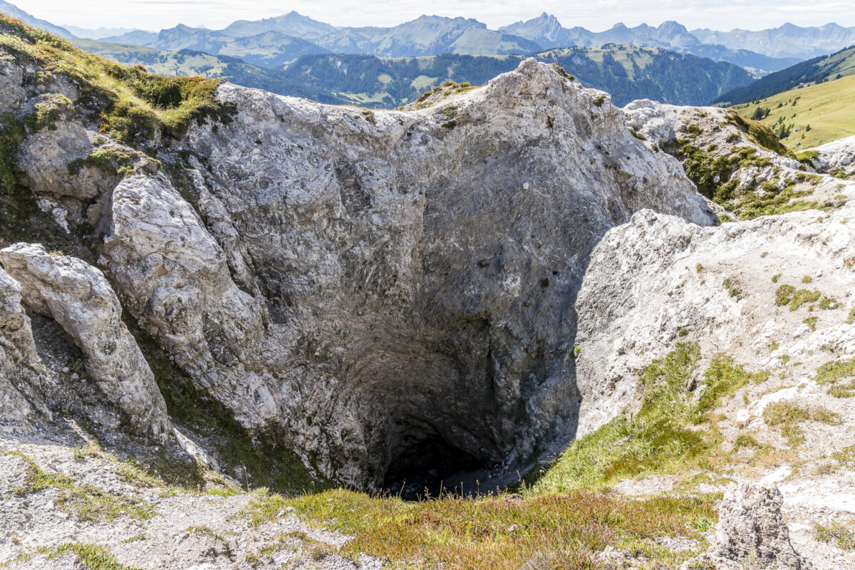
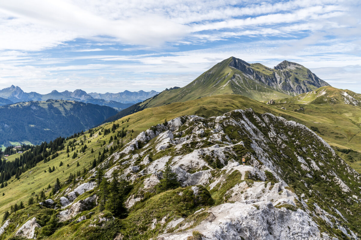
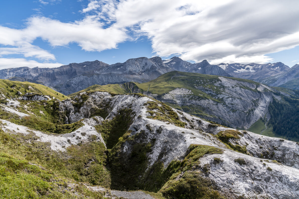
And it’s worth it! On a narrow path I navigate over the rugged ridge crisscrossed by deep sinkholes. In this section, you can see particularly impressively how rainwater has contributed to the slow dissolution of gypsum stone over thousands of years – and continues to do so.
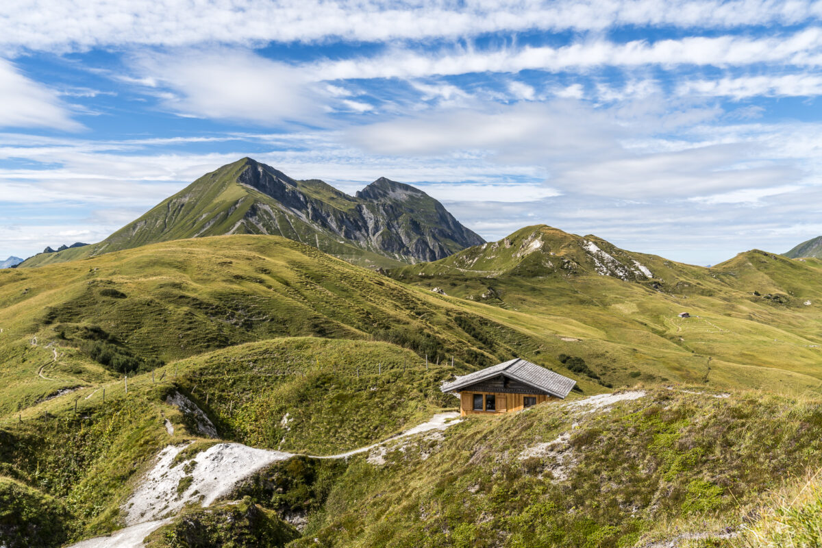
We linger for a moment at the refuge and enjoy the magnificent mountain panorama before we tackle the way back towards Leiterli on the high-altitude circular trail.
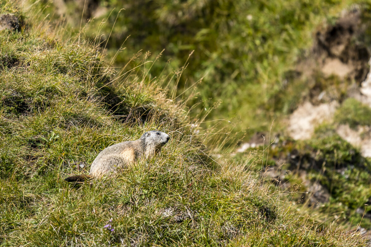
On the back side of the Gryden – right at the junction to the Stübleni Pass – we unexpectedly meet Moritz, the marmot. Like us, he savours the last warming rays of sunshine before the announced rain front.
Just in time for the last descent of the gondola, we are back at the starting point of the high-altitude circular trail, at the Leiterli, and we agree: This entertaining round trip has all the components for a successful hiking trip. Be it for a leisurely Sunday round in the fresh air or in combination with a longer tour for those who like it a little more challenging – the Gryden high-altitude circular trail can be combined in many ways.
Practical tips for your hike on the Gryden high-altitude circular trail
The route of our hike on the Gryden high-altitude circular trail can be found on the map below. It is a mountain path that is easy to walk in the first section (wide gravel path, difficulty T1). The terrain around the Gryden is a bit more challenging (natural path with partly narrow sections, difficulty T2/T3) and requires good, grippy footwear. The round has only a moderate ascent of a total of 345 meters in altitude and can be hiked in a comfortable 2.5 hours.
The starting point of the high-altitude circular trail at the Leiterli can be reached with the Lenk – Stoss – Leiterli gondola, which is in operation continuously from 8:30 a.m. to 5:00 p.m. during the summer months from the beginning of June to mid-October (October 18, 2020). The return trip to Lenk-Leiterli costs 34 CHF for adults, with GA/Half-Fare travelcard the price is 28 CHF. There are special rates for families. You can find the current price information here: Prices for single journeys
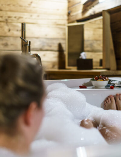
And if you want to combine the Gryden high-altitude circular trail with a short stay at Lenk (as I said, the hiking possibilities are diverse), I can recommend the Lenk Lodge as a base. Whether at Lenk Lodge or another participating accommodation; From one night you will receive the guest card and benefit from the free use of the Lenker mountain railways in addition to other inclusive services. Until 18 October, Lenk Lodge will also be hosting the Pop Up Restaurant Aplati of the two sisters Camille & Céline Rohn from Wednesday to Sunday. We have tested the cooking skills of the two and can warmly recommend a dinner there!
Key data of the high-altitude circular trail Leiterli – Gryden (refuge) – Leiterli
| Starting point | Mountain station of the Leiterli-Stoss gondola lift (Betelberg) |
| Length | 7.8 kilometers |
| Elevation gain | ↗ 345 m 345 m ↘ |
| Duration | 2:30 p.m. |
| Destination | Mountain station of the Leiterli-Stoss gondola lift (Betelberg) |

Leave a Reply