


Muottas Muragl & Via Albula: 2 beautiful lake hikes in the Engadine
At the end of August we spent a weekend in the Engadine. Among other things, this was to test the new gourmet restaurant in the Krone La Punt and, on the other hand, for the annual dose of “Engadine hiking happiness”. For the most part, the weather played along really well and gave us two great days of hiking. Below you will find the route descriptions of the two completed hikes. Both tours lead past beautiful mountain lakes.
Tip 1: from Muottas Muragl to La Punt
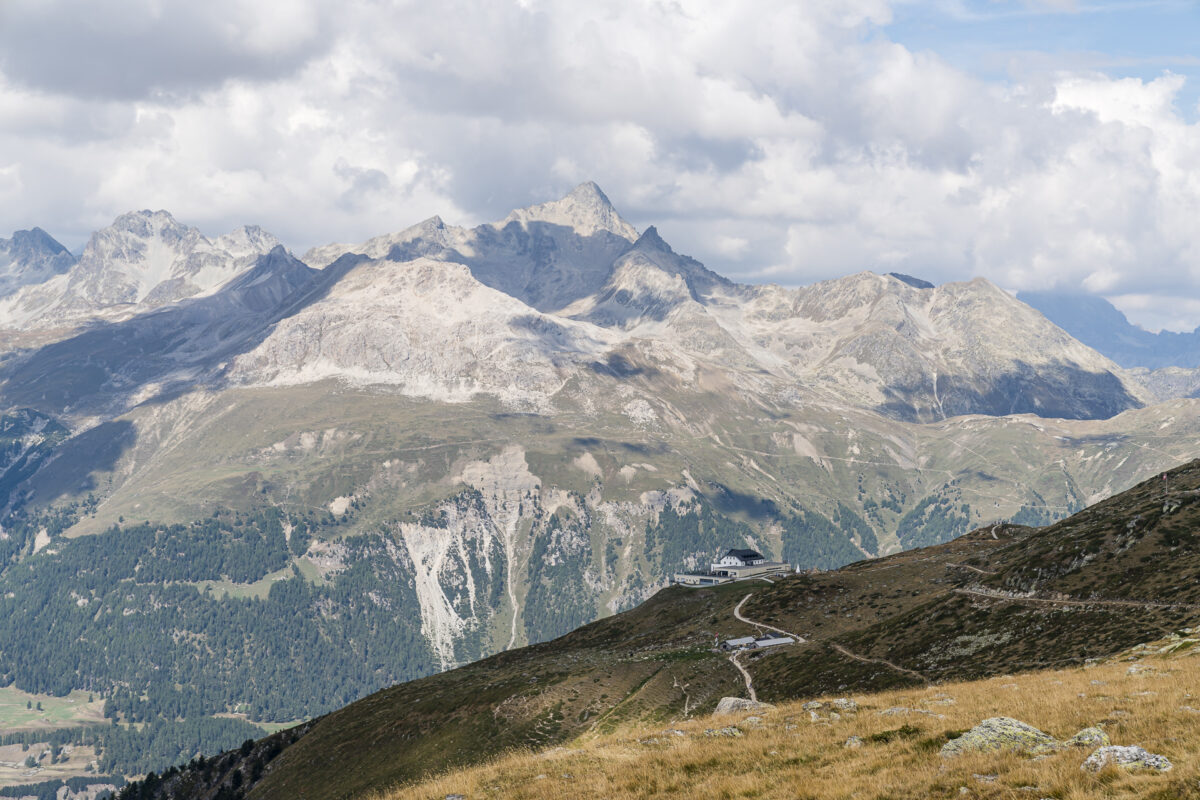
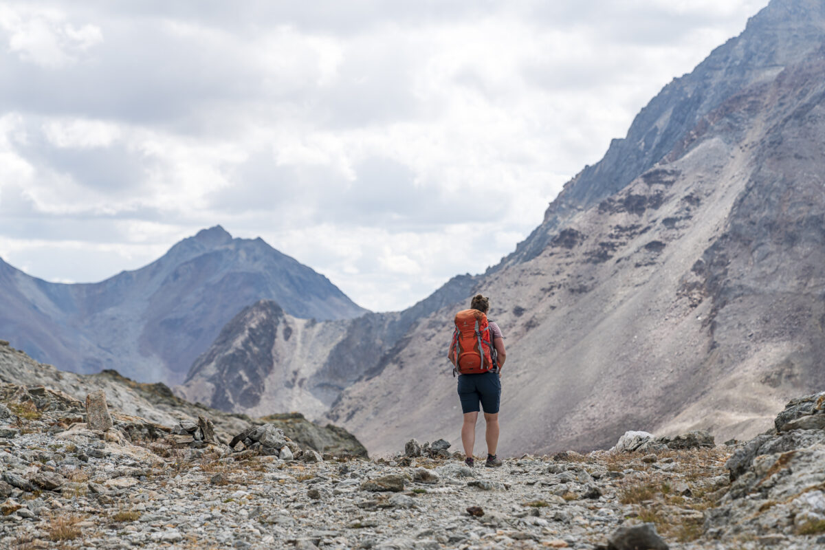
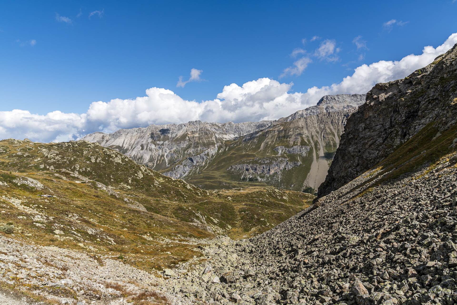
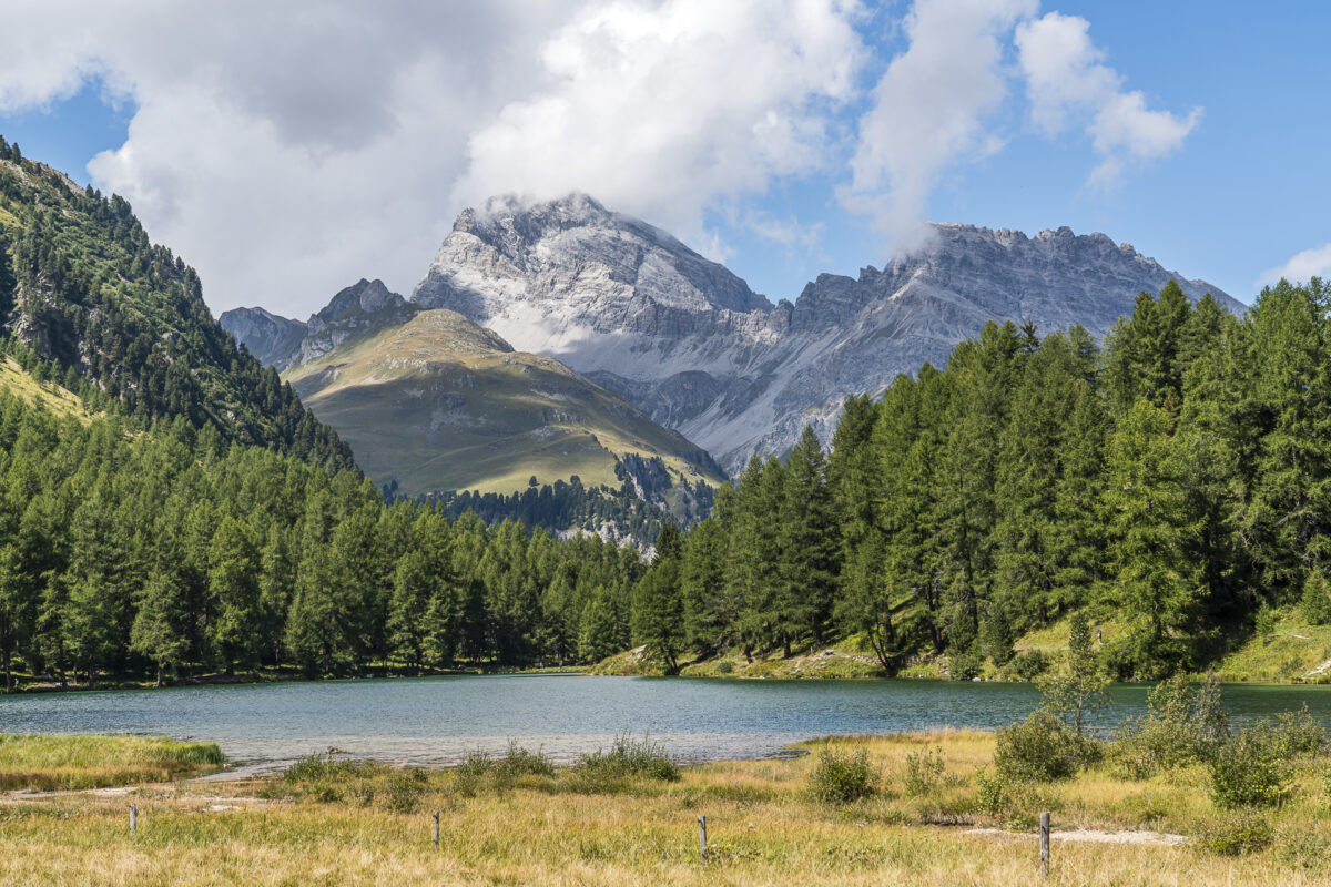
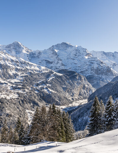
For the first hike, it’s first high up. You are heading for one of the most famous panoramic mountains in the Upper Engadine – the Muottas Muragl. We chose this tour for the day of arrival, as it leads us directly (or over a stony 19 kilometers) to the Krone La Punt. For me it is the first detour to the Muottas Muragl during the summer season. So far, I’ve always been up in winter and wow – the view seems to me almost a little more impressive in summer than when you look down on the snow-covered Engadine Lake District.
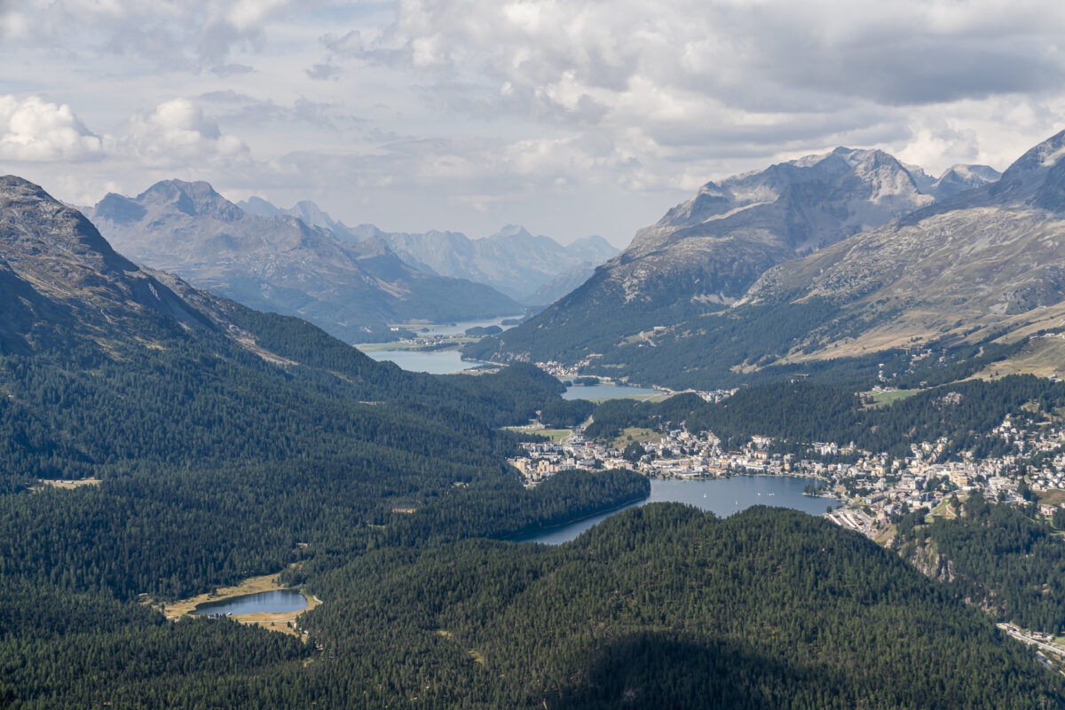
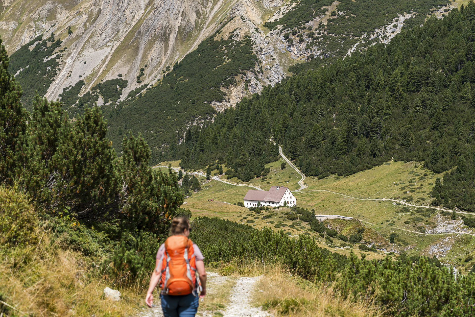
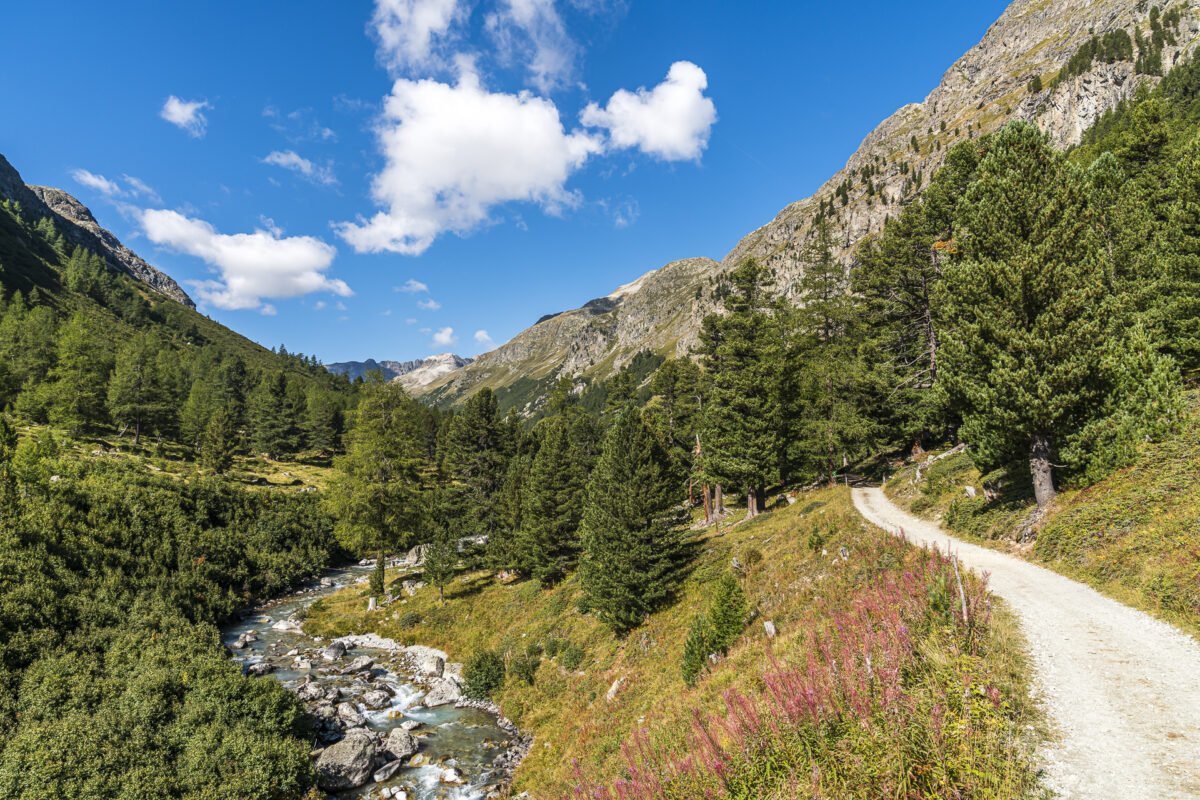
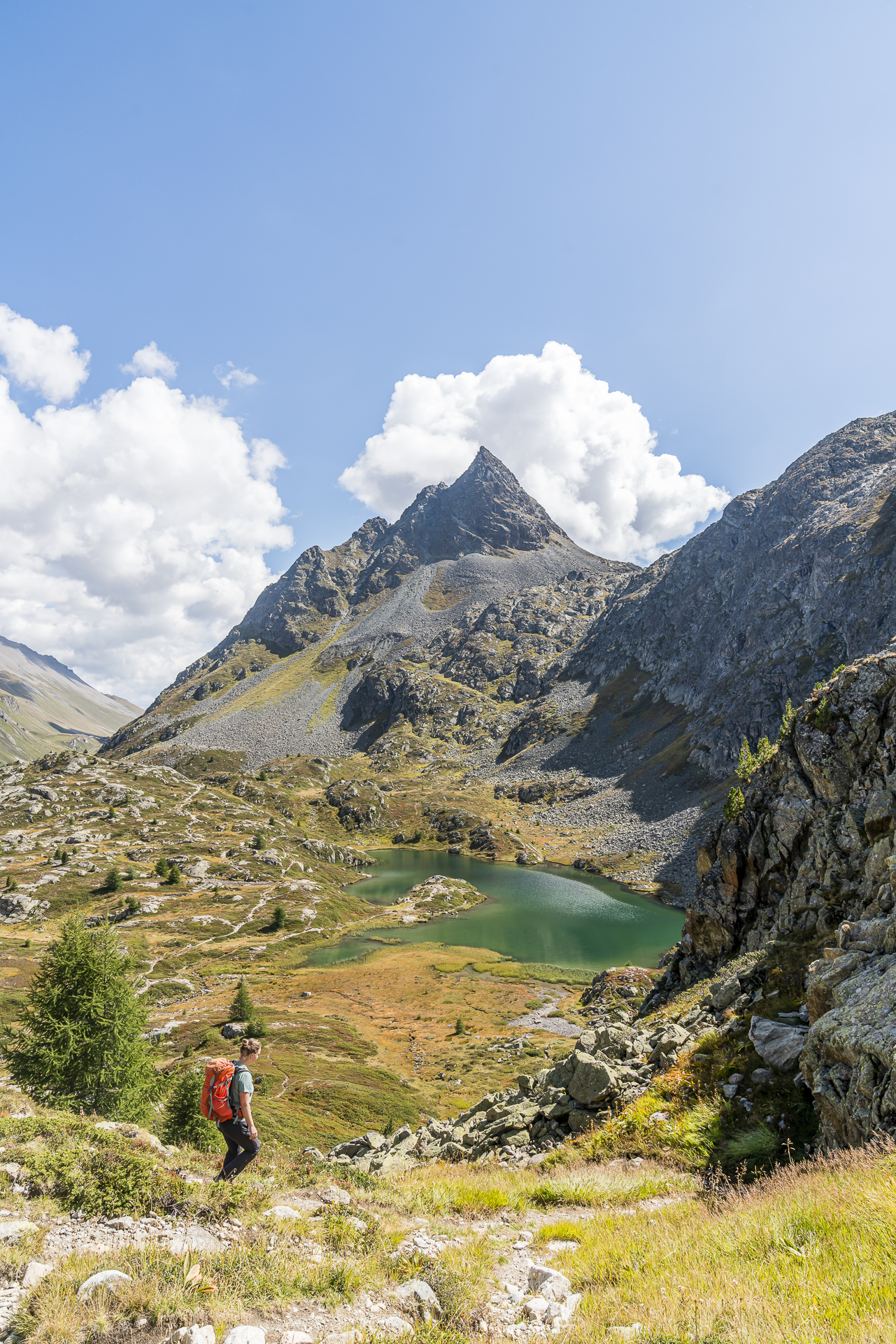
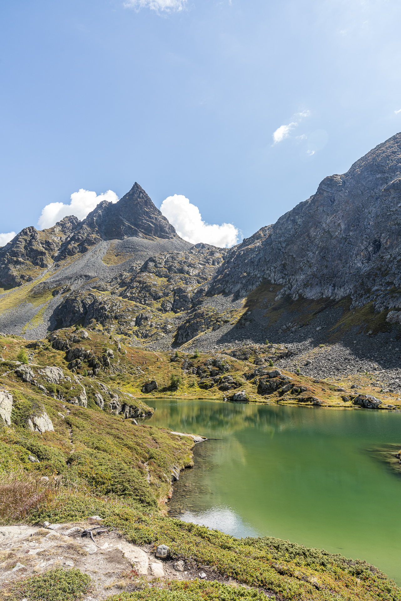
From the mountain station of the Muottas Muragl, we do not follow the popular Senda Segantini downhill towards Pontresina, but ascend following a pleasant path towards Lej Muragl. It takes just under an hour to reach the shore of the steel-blue shimmering mountain lake. From here we have a short, crisp ascent over scree fields to the Fuorcla Muragl pass pass. Apart from us, no one seems to be interested in this tour variation on this day. One reason is probably the length of the route. From the pass crossing it is almost 14 kilometers until you reach the first public transport stop in La Punt.
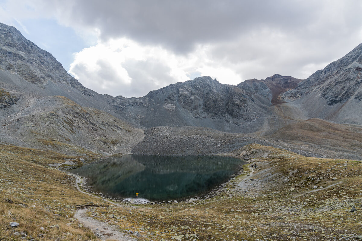
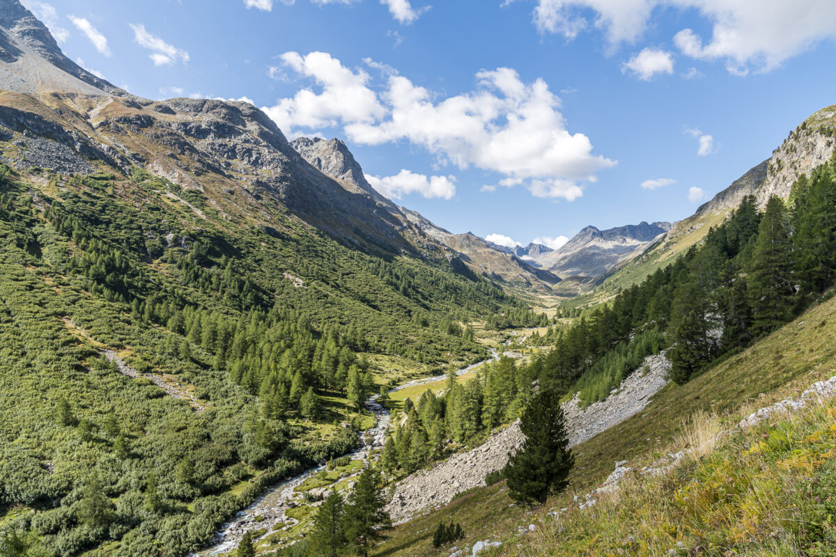
But we are aware of this and enjoy the vastness and seclusion that awaits us back here in Val Prüna in the next few hours. In the distance we see a few chamois – with luck you can also observe ibexes here. The descent takes us past Alp Prüna to Alp Serlas, where the impressive Maiensäss building from the 19th century catches the eye from afar. The building is a listed building, but as far as we have seen, it is empty.
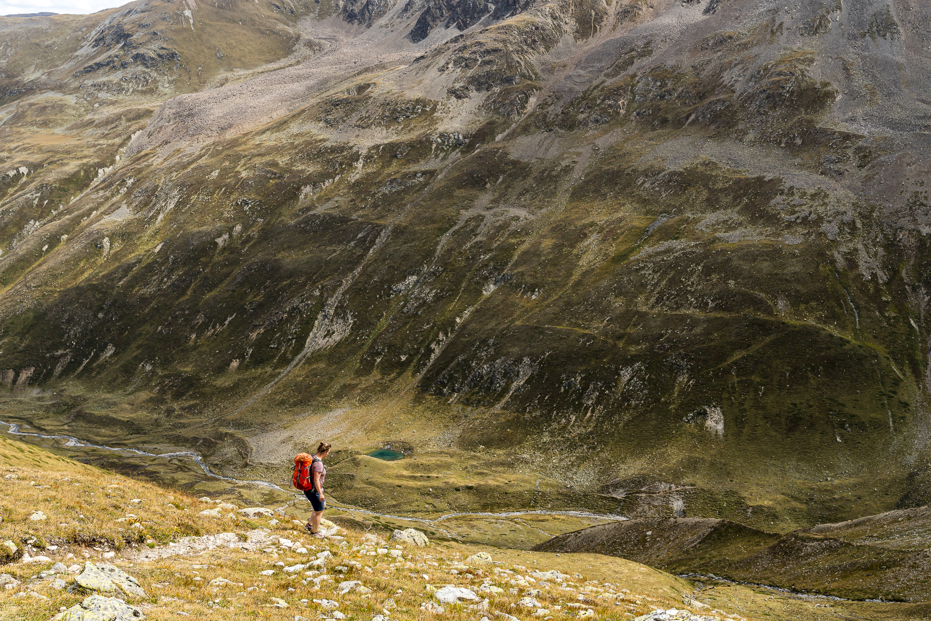
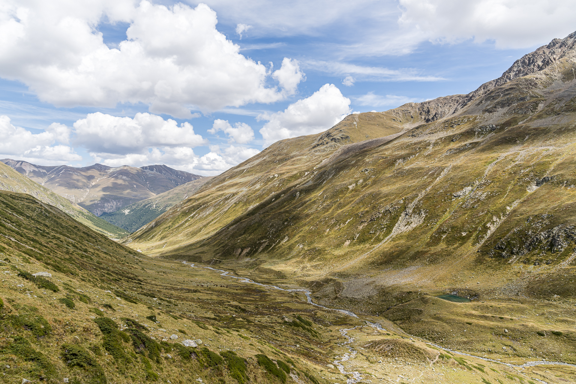
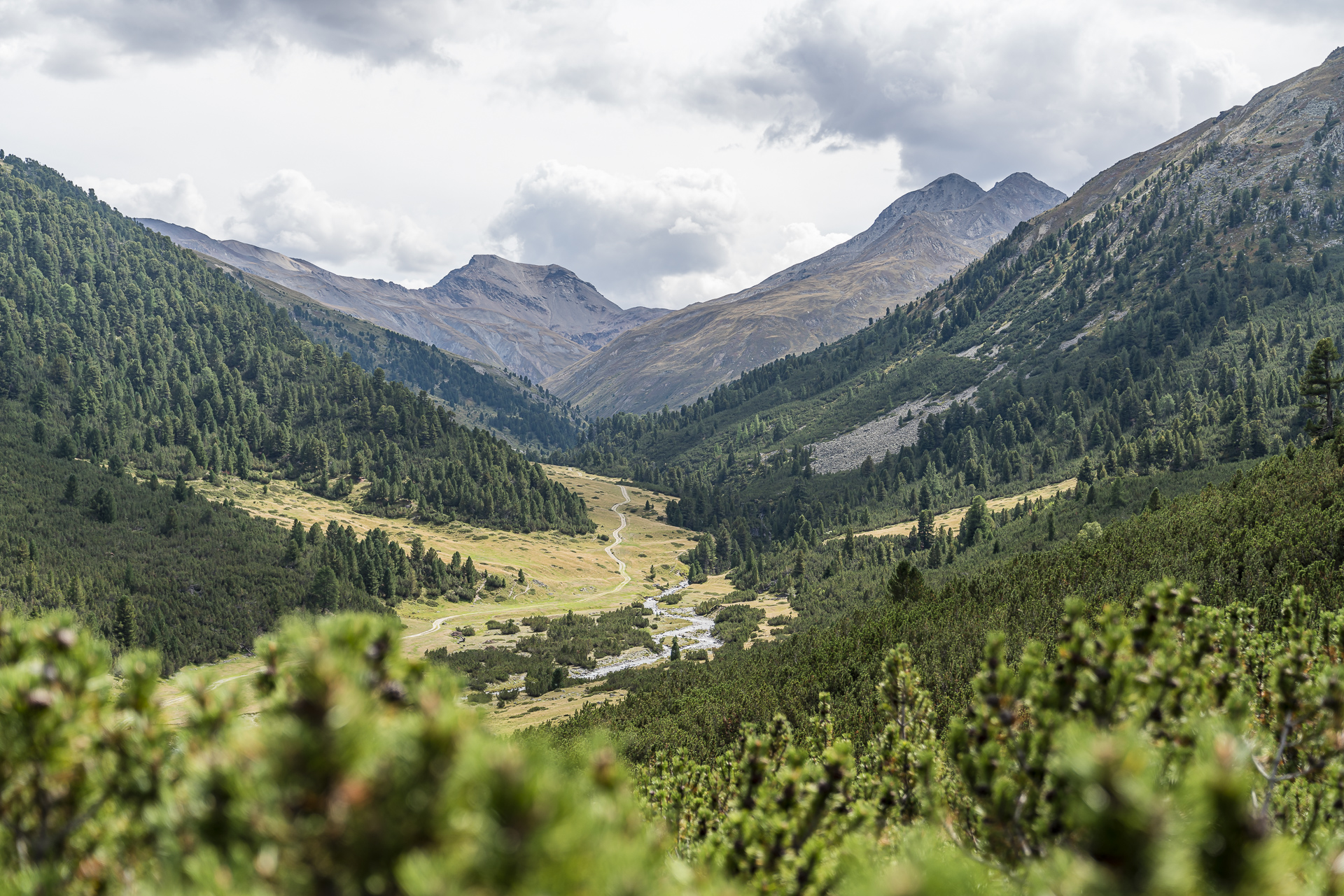
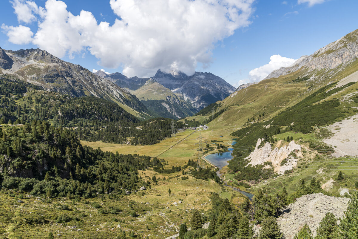
The last six kilometres from Serlas through the Val Chamuera out of the valley to La Punt require some perseverance. The mountain hiking trail turns into a rather wide and not particularly exciting gravel path. On the other hand, there are very nice fire pits with picnic tables at two places along this route (firewood is also available).
Key dates of the tour Muottas Muragl – Fuorcla Muragl – Serlas – La Punt
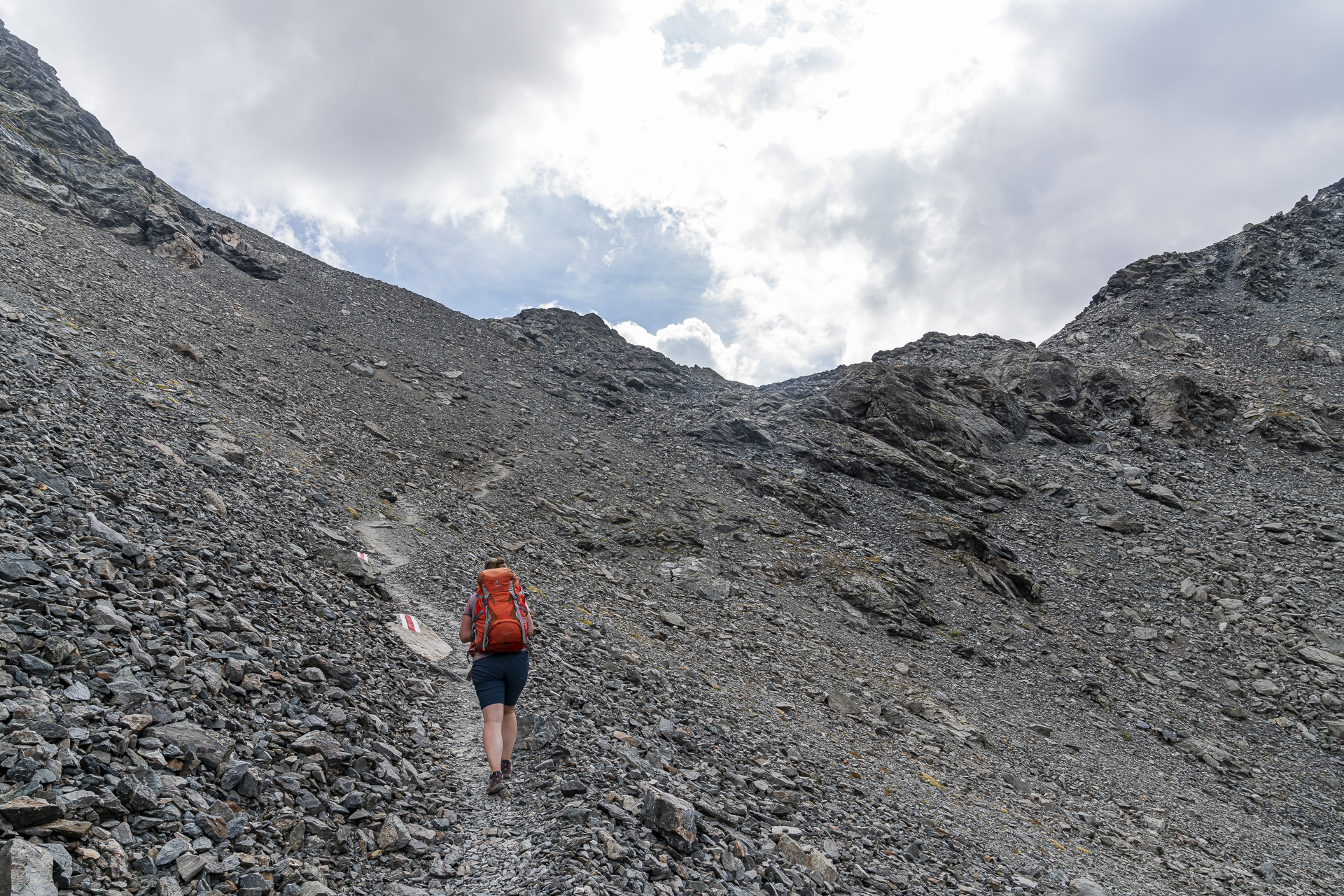
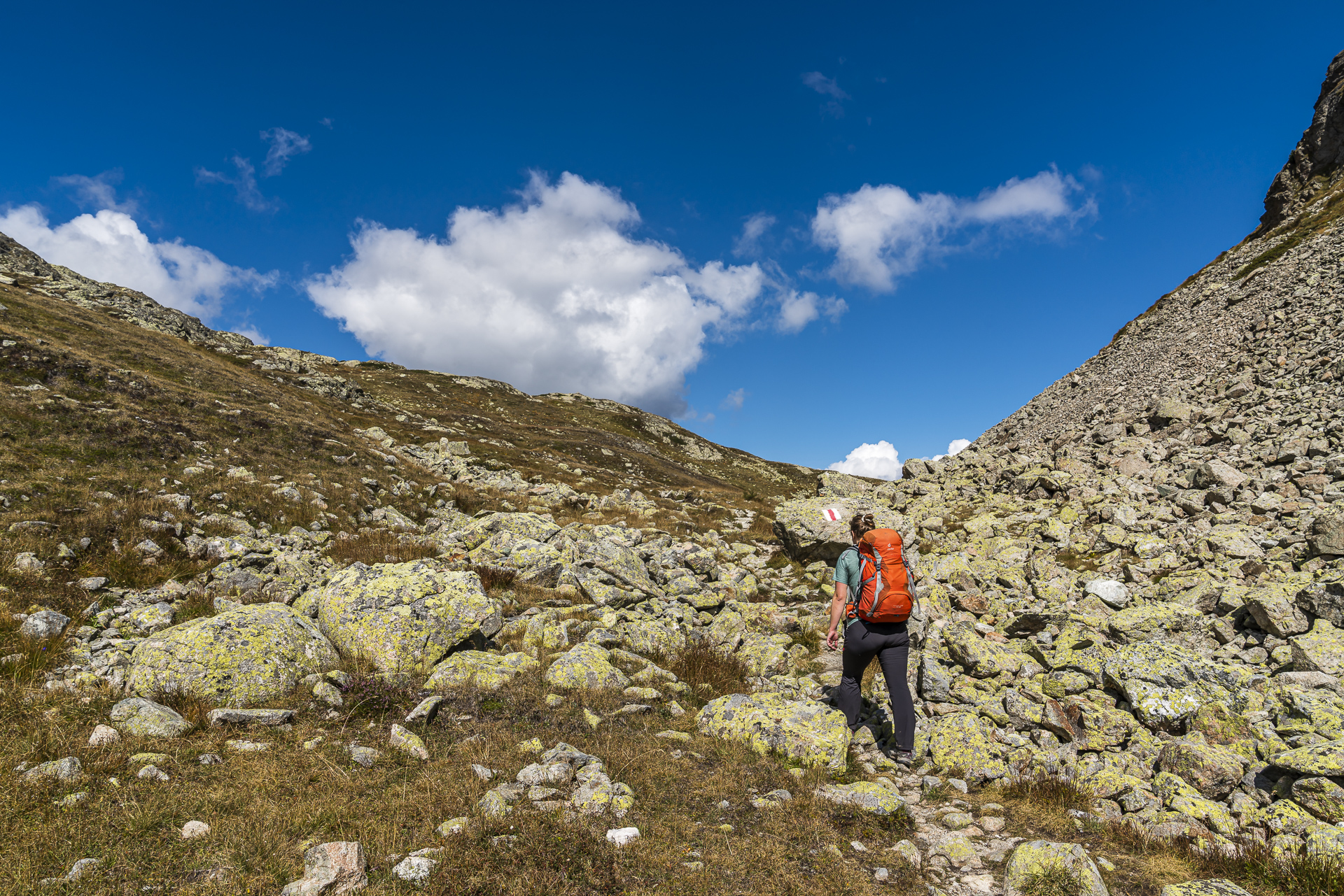
On the map below you can see the route of the hike from Muottas Muragl over the Fuorcla Muragl to La Punt. Up to the height of Alp Prüna, it is a white-red-white marked mountain hiking trail of difficulty level T2. The section from Alp Prüna via Serlas to La Punt is more of a yellow-marked hiking trail of difficulty level T1 (from la Punt to Serlas and back, the path can also be walked with a pram). Surefootedness is required at certain points on the ascent from Lej Muragl to the pass crossing. Otherwise, the trail is not technically demanding – it should be noted that due to the length of the route, a basic level of fitness is important.
The funicular to Muottas Muragl operates during the summer season from the beginning of June to the end of October (23 October). Unfortunately, GA and Half-Fare travelcards are not valid here. A one-way ascent costs CHF 28 for adults during the summer season (prices as of 2022).
| Starting point | Muottas Muragl mountain station (2,454 m above sea level) |
| Reachability | Accessible by funicular |
| Length | 19 kilometers |
| Elevation gain | ↗ 605 m 1,370 m ↘ |
| Duration | 5:45 p.m. |
| Destination | La Punt Chamues-ch railway station (1,685 m above sea level) |
| Catering | Picnic (except for the starting point on the Muottas Muragl, no refreshment stops) |
Tip 2: take Via Albula over Fuorcla Crap Alv
We have chosen a suitable hike not only for the day of arrival, but also for the day of departure. The starting point for this tour is in the neighboring village of Bever. Originally, we wanted to start the tour in Spinas. But since there are only a few fast connections from La Punt to Spinas and they don’t quite fit into our “timetable”, we simply decide to extend the tour by the 4 kilometers from Bever to Spinas.
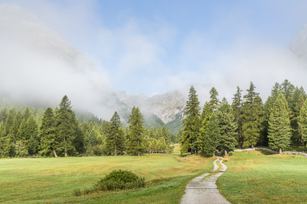
Something that I can recommend to you in any case: The so-called Fairy Tale Trail really more than lives up to its name, especially in the early morning hours. A great route to “warm up” and enjoy the nature all around. As autumn progresses and the larch trees turn yellow, this section of the route is sure to become even more spectacular.
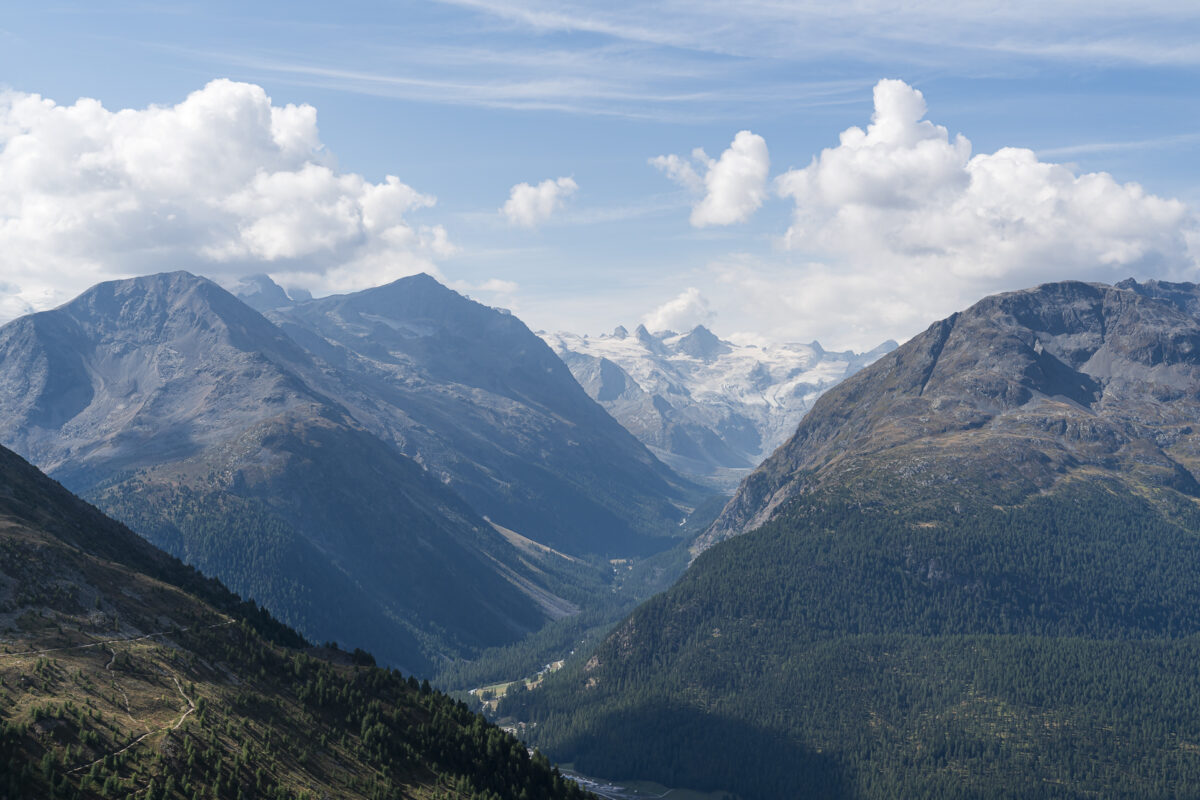
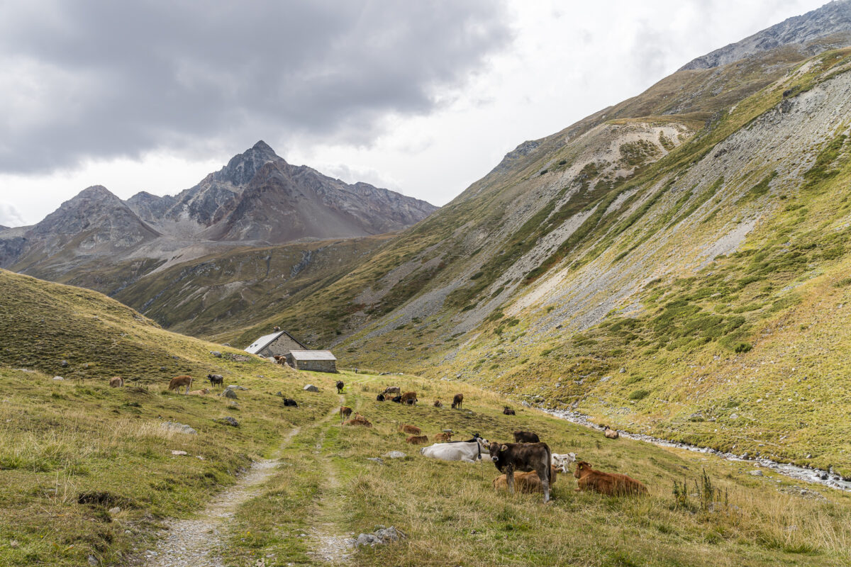
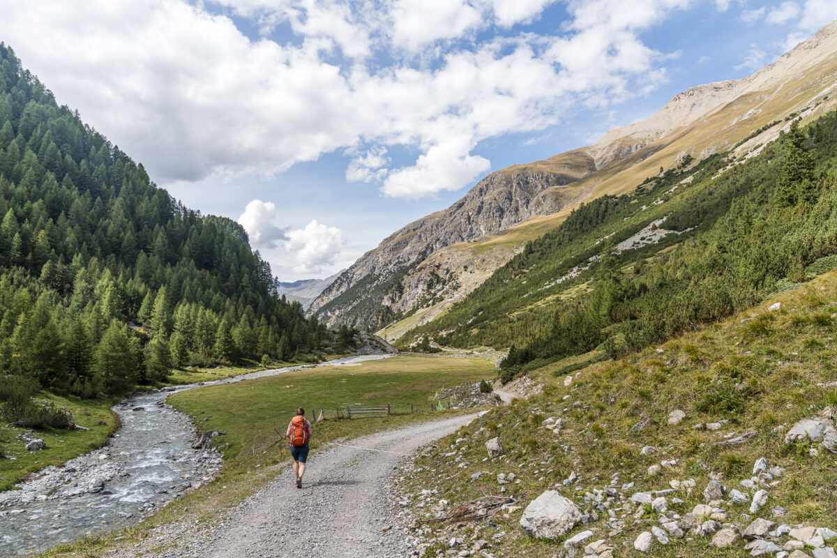
At the Spinas inn we take a short coffee break before continuing the ascent following the Via Albula towards Fuorcla Crap Alv. Over the next few kilometres, the beauty of Val Bever amazes me step by step. How beautiful it is here! Scenically definitely with one of the most beautiful hikes this year.
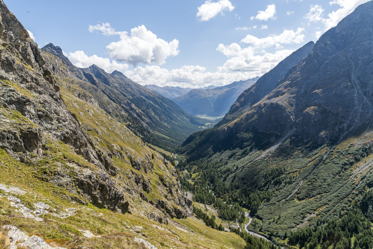
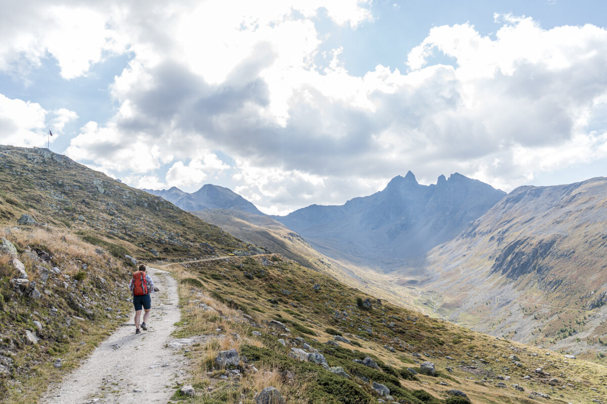
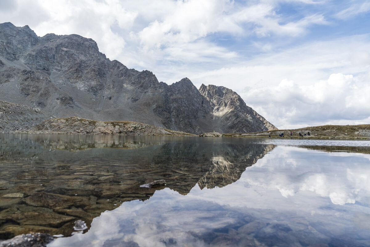
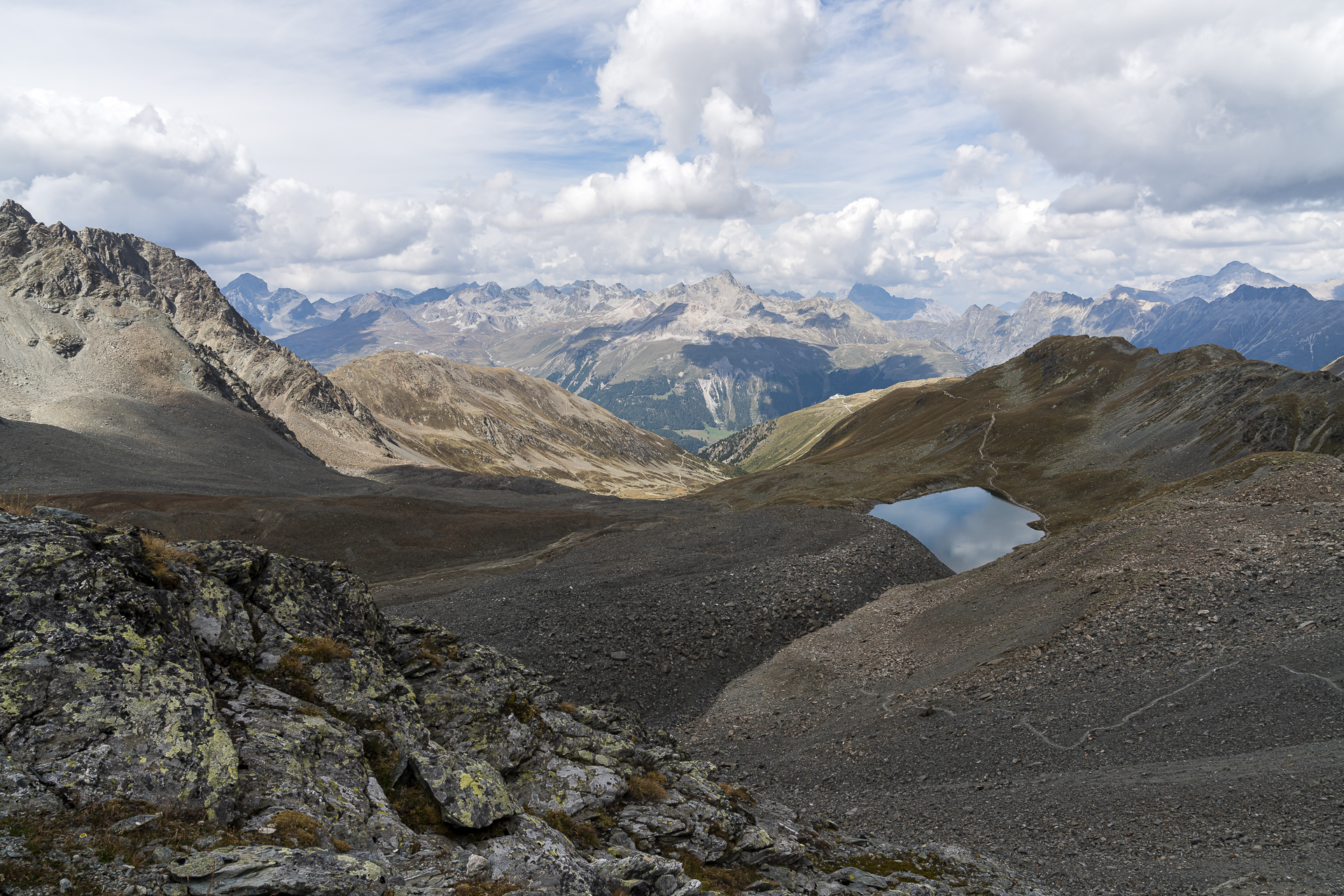
At the pass we are a bit amazed but the signposted time. It should only take 1 3/4 hours to reach the destination in Preda? This is definitely a very sporty time, as we will find out later at Preda station. Without a break and at a normal (or rather brisk) walking pace, you will need a good two hours. Apart from the strange time indication, a much more barren landscape and the deep view of the turquoise Lais digl Crap Alv await us on this side of the pass crossing.
We cross the Albula Pass road and follow the right edge of the slope down to the Crap Alv farm and from there through an enchanted pine forest to the shore of one of the most beautiful mountain lakes in Switzerland: the Lai da Palpuogna.
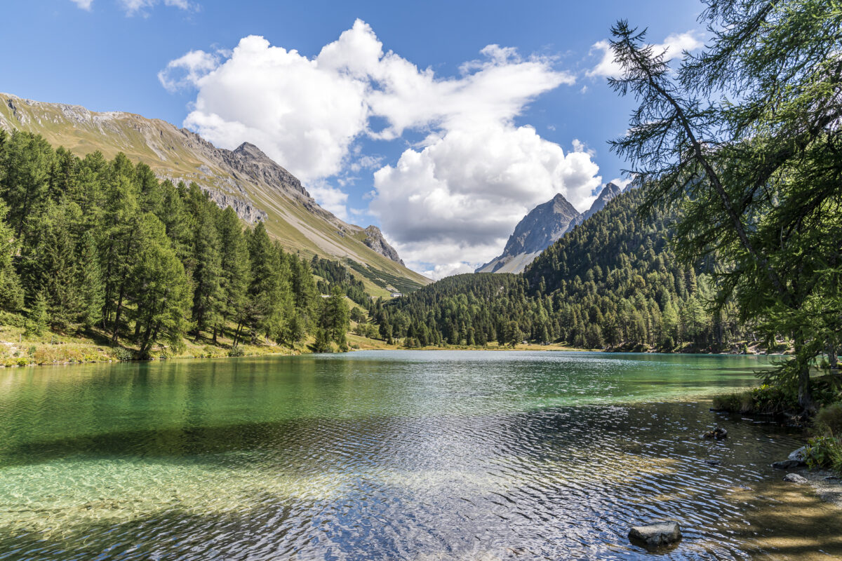
What a magnificent setting to end this tour!
ps. allows at least 30 minutes for the remaining distance to Preda station. The hiking trail zigzags around the station and with an hourly train connection, it’s stupid if you miss the train by 5 minutes. If you are still like us, then I can recommend you to look for a place on the sun terrace of the Hotel Preda Kulm to pass the time. We were pleasantly surprised by the selection of drinks and menus (as well as the quality).
Key dates of the tour Bever – Spinas – Fuorcla Crap Alv – Preda
On the map below you can see the route of the hike from Bever via Spinas to Preda. This is a stage of the Via Albula/Bernina (Route 33). The hiking trail is marked throughout as a white-red-white marked mountain hiking trail, with the first section (Bever – Spinas) having more of the character of a yellow-marked hiking trail. The ascent from Val Bever to the Fuorcla Crap Alv pass tends to be suspended. If you don’t have a head for heights, you might feel a little uncomfortable at points.
| Starting point | Bever railway station (1,710 m above sea level) |
| Reachability | Accessible by public transport |
| Length | 16.3 kilometres |
| Elevation gain | ↗ 958 m 880 m ↘ |
| Duration | 5:30 p.m. |
| Destination | Preda railway station (1,780 m above sea level) |
| Catering | Guesthouse Spinas |
You can find even more regional hiking tips here: Excursion destinations and hikes in the Engadine
Leave a Reply