

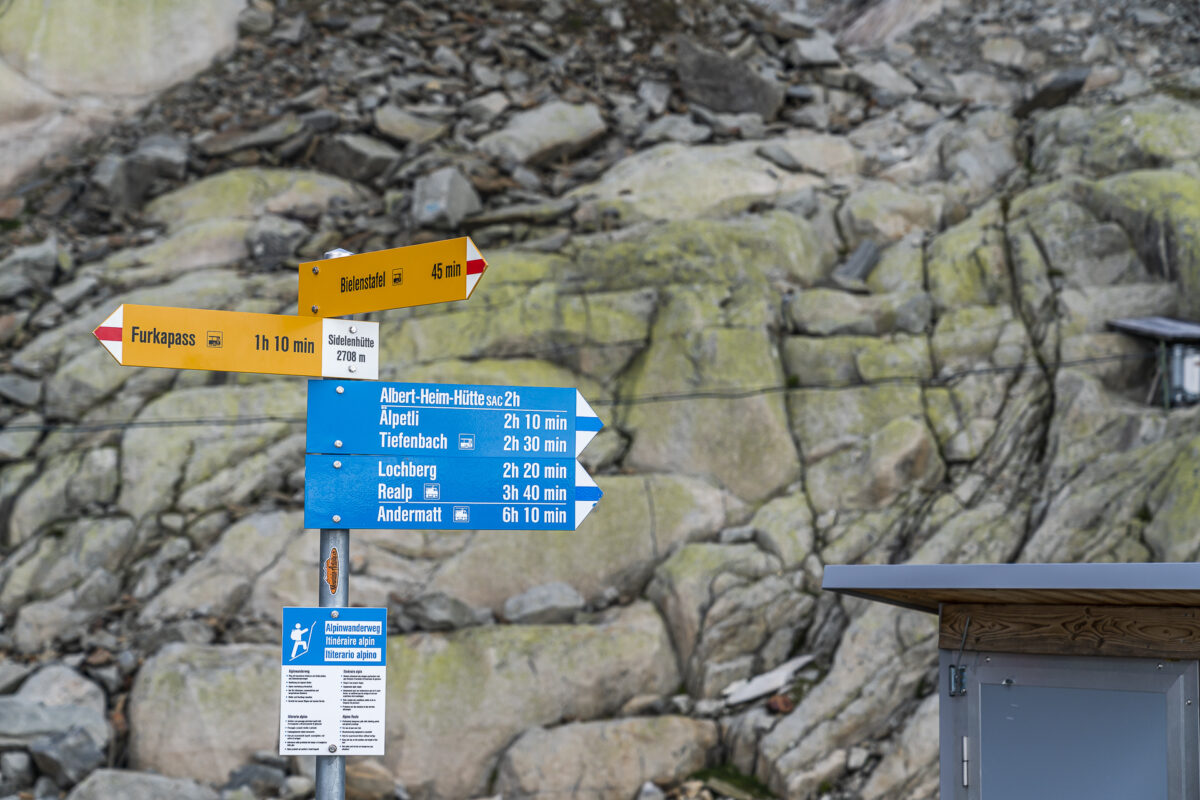
Nepali Highway: over hill and dale from the Sidelenhütte to the Albert-Heim-Hütte
Today’s hiking tip takes us to the Urseren Valley on the Gotthard. Here, between the Furka, Gotthard and Oberalp passes, an unparalleled alpine hiking paradise is waiting to be discovered. Two of the most popular hikes – the Nepali Highway between the Sidelenhütte and the Albert-Heim-Hütte as well as the Urschner Höhenweg – can be combined into a varied two-day hike. The perfect tour for all those who feel comfortable on red-white-red marked mountain hiking trails and want to challenge themselves with a white-blue-white marked route.
Alpine two-day hike from Furka Pass via the Nepali Highway to Andermatt
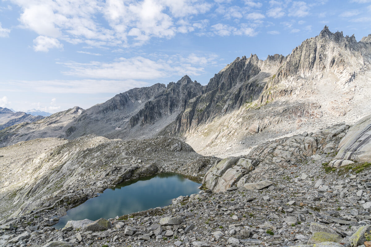
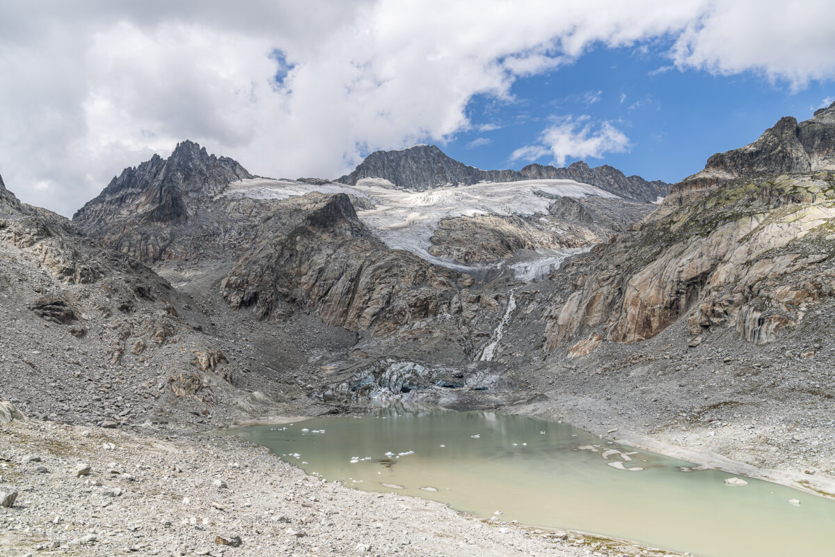
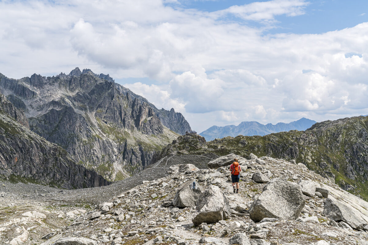
The Urschner Höhenweg is part of the Furka High Trail, which leads in two stages from Oberwald over the Furka Pass to Andermatt. This scenic hike can be combined with a detour into the rough, high alpine terrain around the highest peaks of the Uri Alps. The result: a versatile hut tour that includes everything from moraine landscapes and boulder terrain to lush green alpine meadows, deep blue shining mountain lakes and far-reaching views over the Urseren Valley. The details of the individual stages can be found in the following lines.
And if you are now wondering: “Is this tour suitable for me?” – then please read the practical tips at the end of the article.
1st hiking day: Ascent to the Sidelenhütte
If you are planning a long-distance hike starting on the Furka Pass, you will sooner or later find out that the post buses do not run very often on this route. From Andermatt, there are just two courses per day directly over the pass. And so – although we have a hiking distance of “only” 8 kilometers ahead of us on this first day – we have no choice but to ring ourselves out of bed shortly after 5 o’clock. Due to the thunderstorm fronts announced from noon, we are not so unhappy that we will probably reach our destination for the day between 12:00 and 13:00 due to Postbus. It’s better to spend a leisurely afternoon in a hut than to reach the stage destination rainy and soaked in the late afternoon.
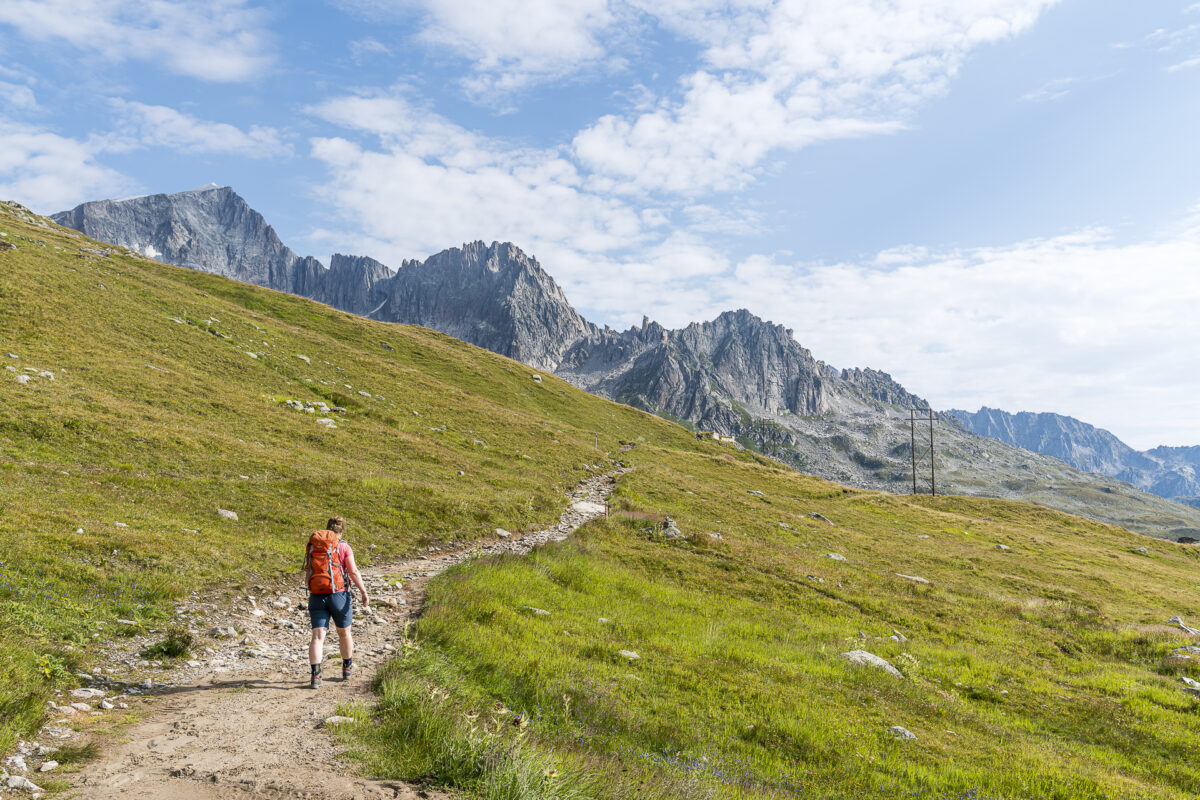
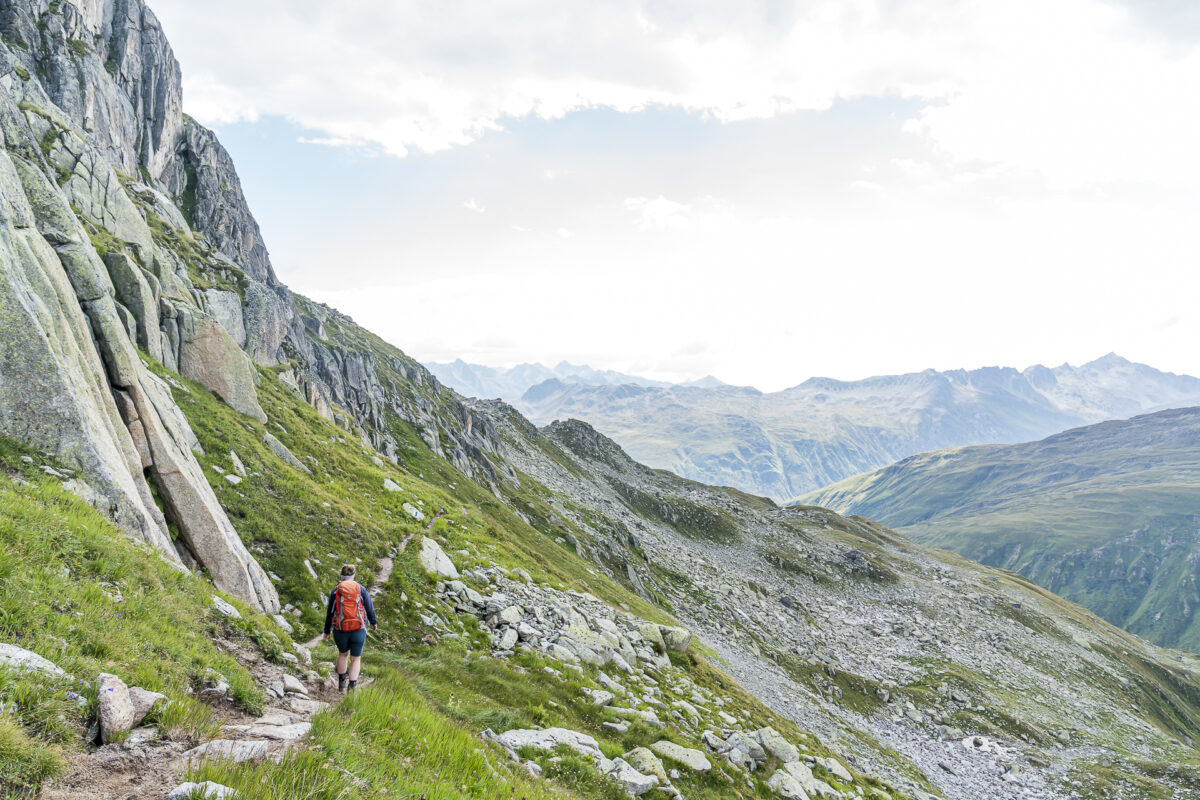
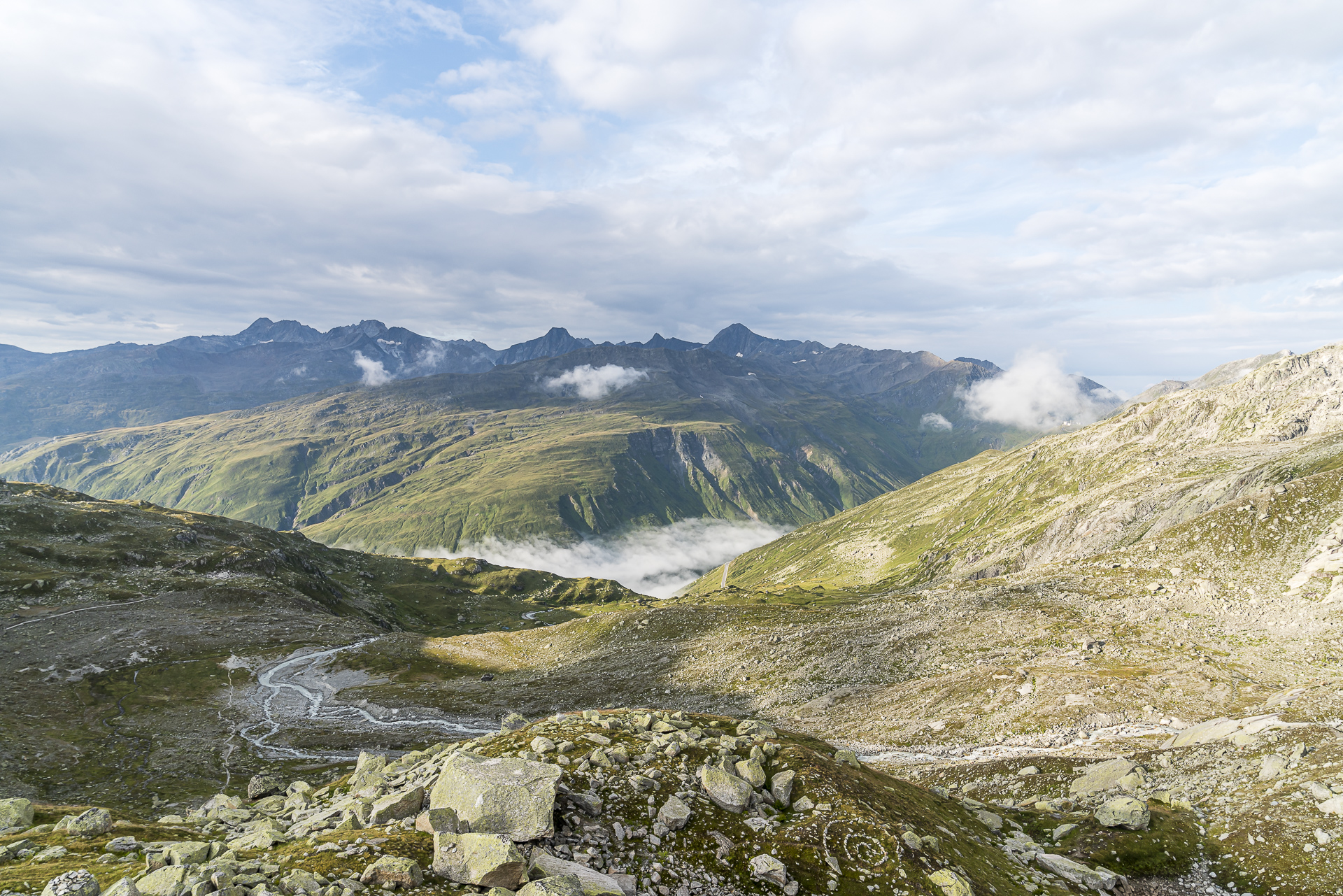
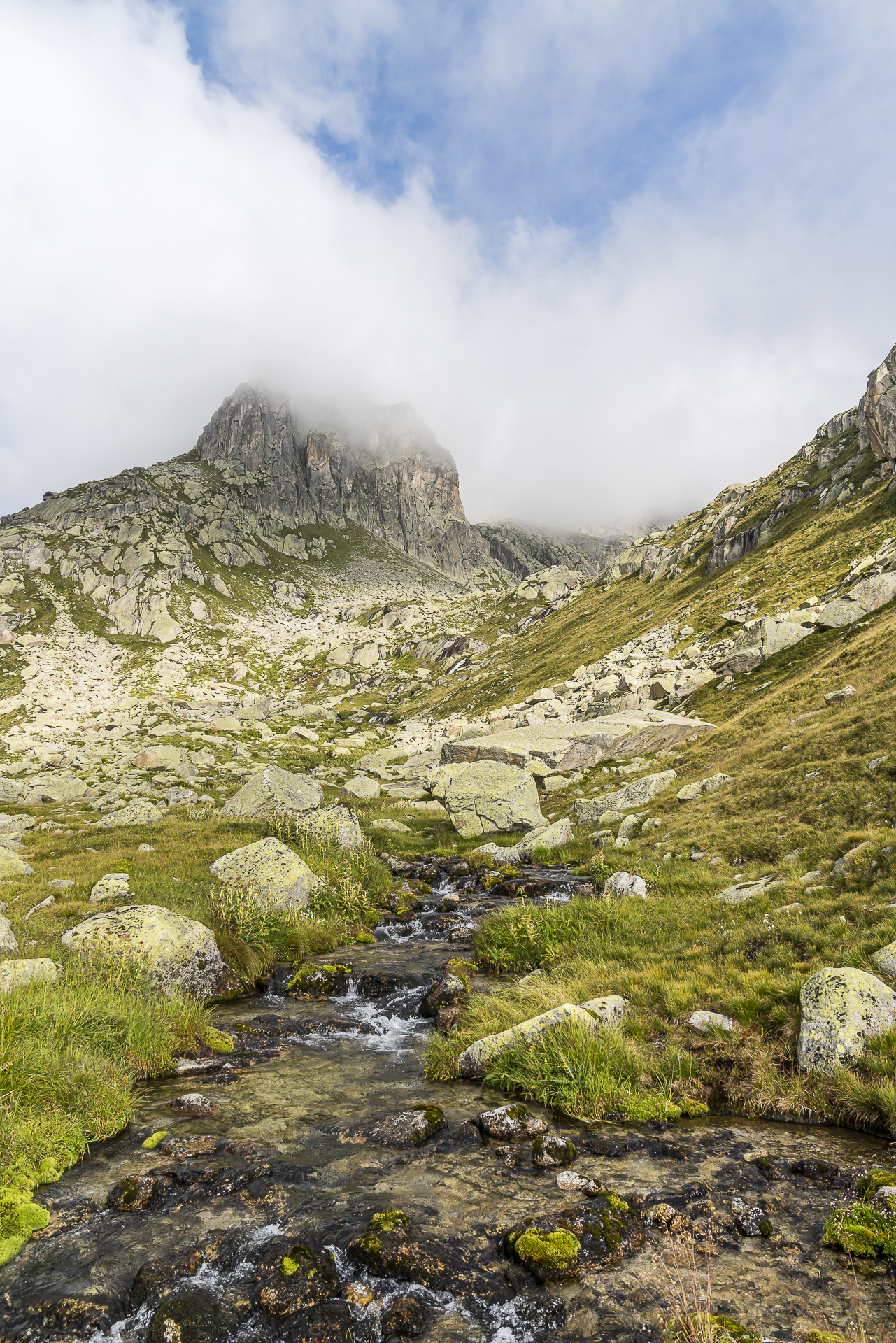
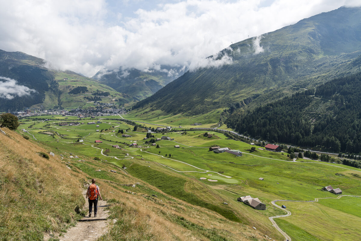
Shortly after 9:00 a.m. we reach the top of the Furka Pass and thus the starting point of our tour. Actually, the ascent to the Sidelenhütte would start one stop earlier – at the Hotel Furkablick. But since we have more than enough time anyway and I like the idea that we will walk through the entire length of the Urseren Valley – we are happy to accept these almost 500 additional meters. The route is ideal for “warming up” and ascending towards the Sidelenhütte “warmed up” at the Furkablick.
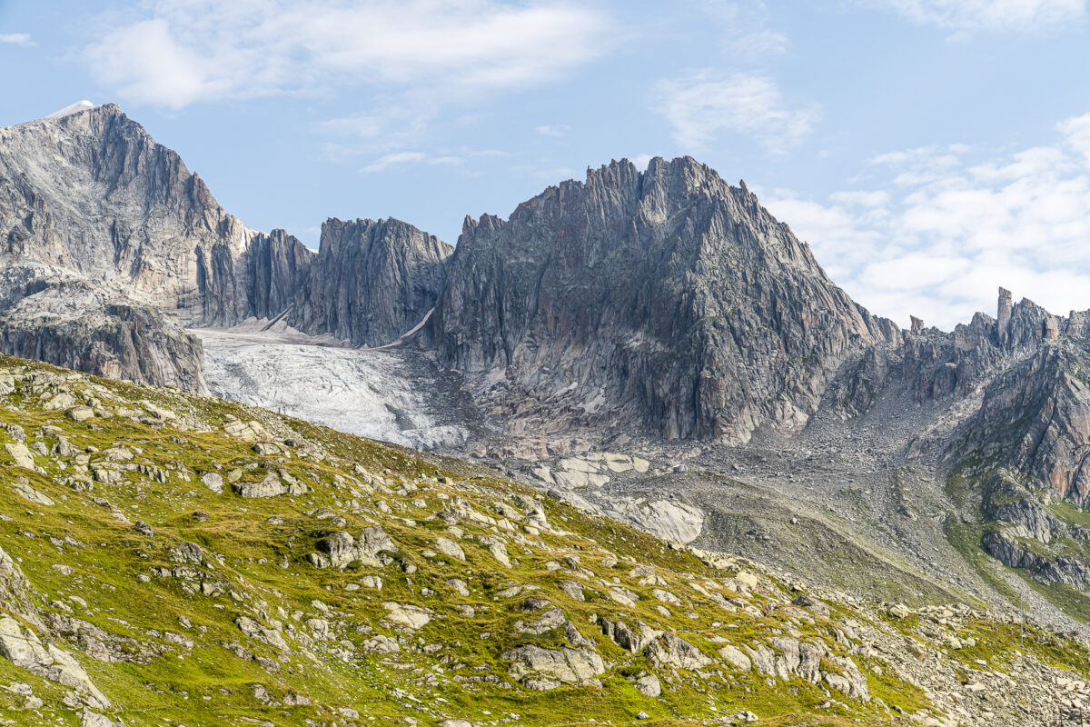
With a view of the mighty Galenstock, we follow the gently ascending path, first over meadows and after crossing the Sidelenbach uphill over steadily stony terrain. We make good progress and after about an hour we reach the Sidelenhütte with its striking A-shaped front that can be seen from afar. Of course, we have planned a cake stop here and admire the phenomenal view that presents itself to us from the highest hut in the canton of Uris.
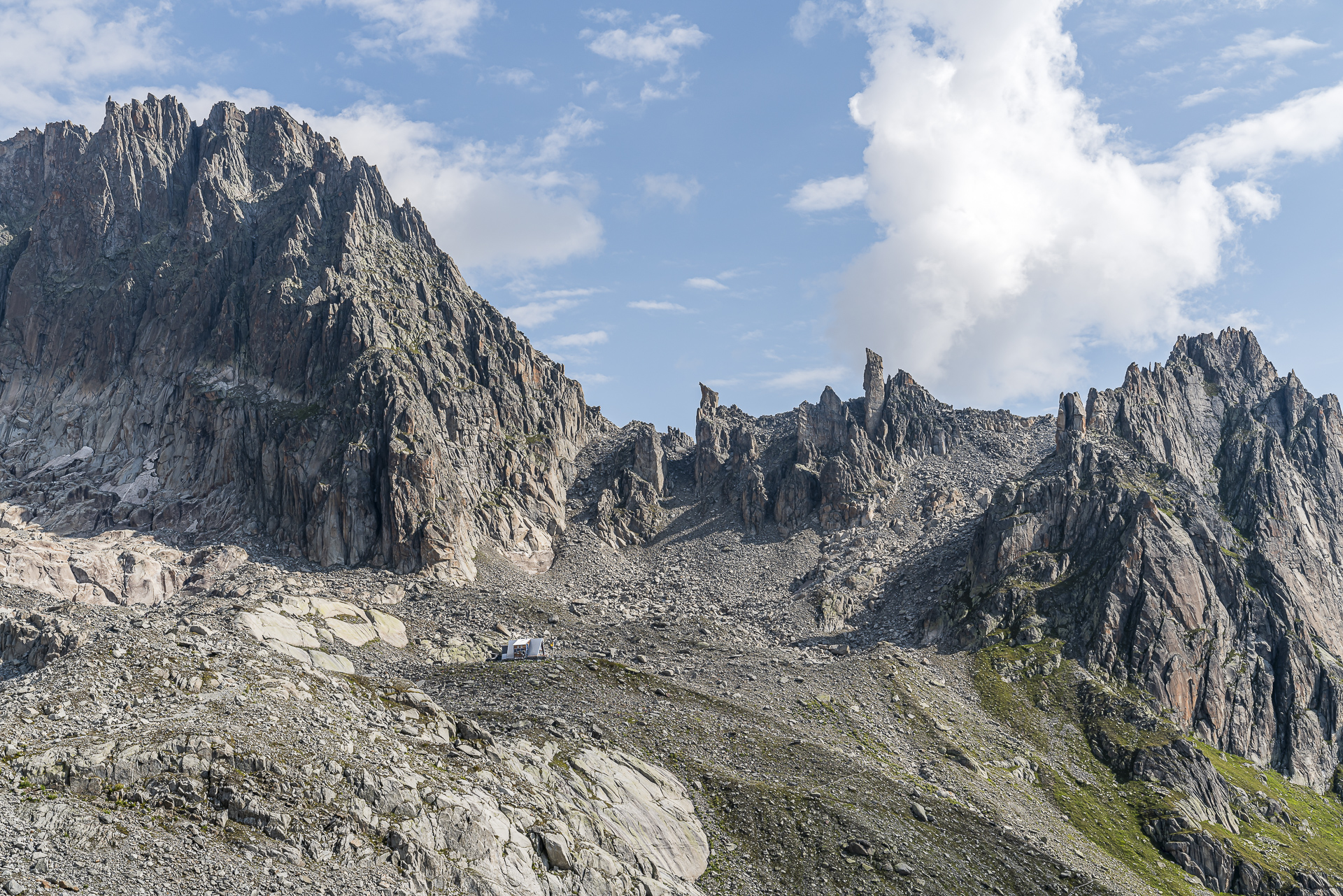
Continue on the Nepali Highway to the Albert-Heim-Hütte
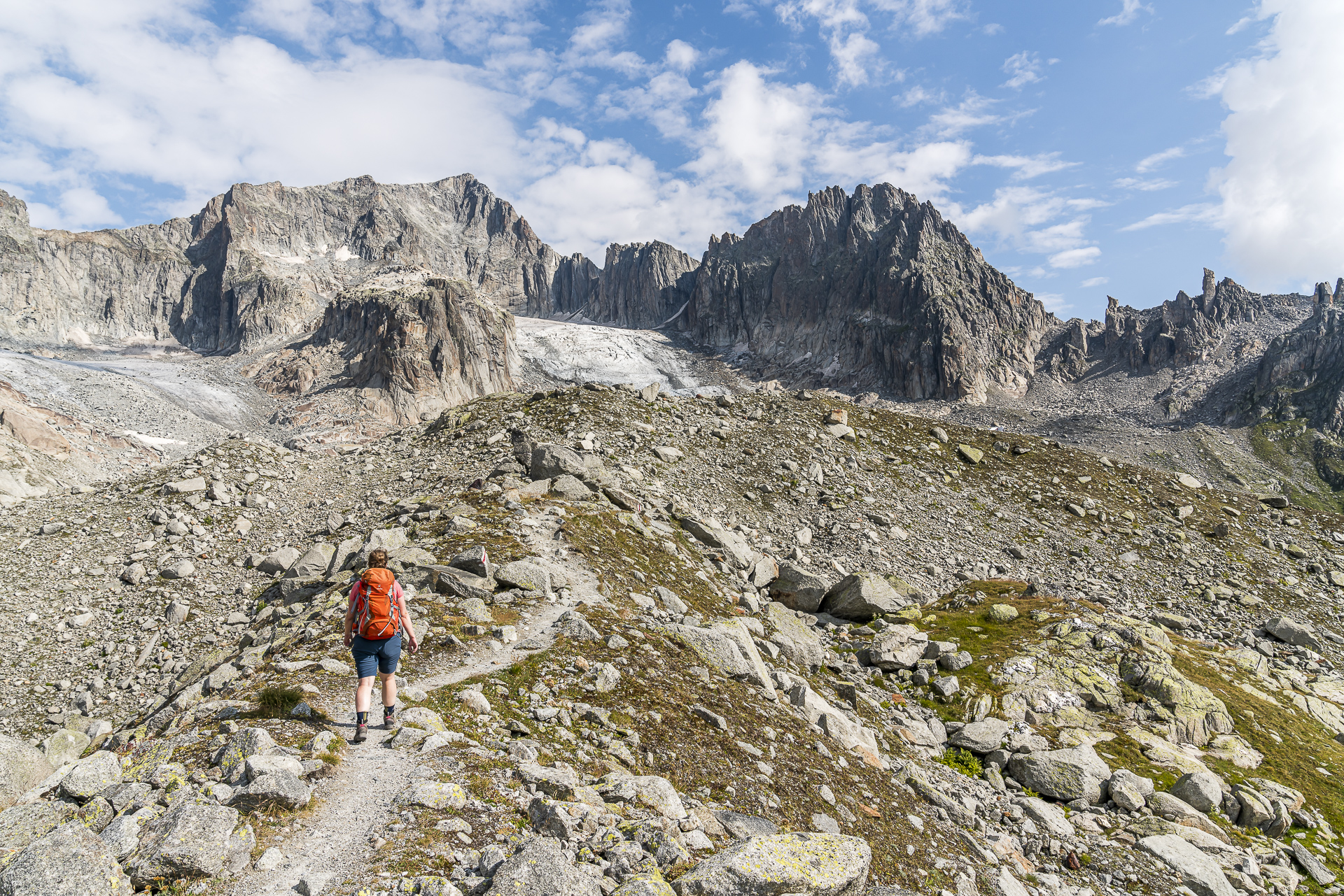
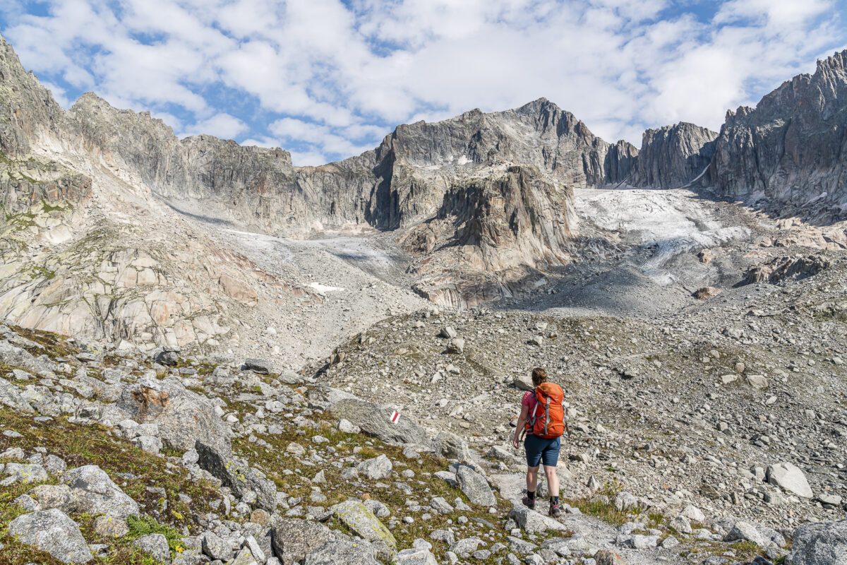
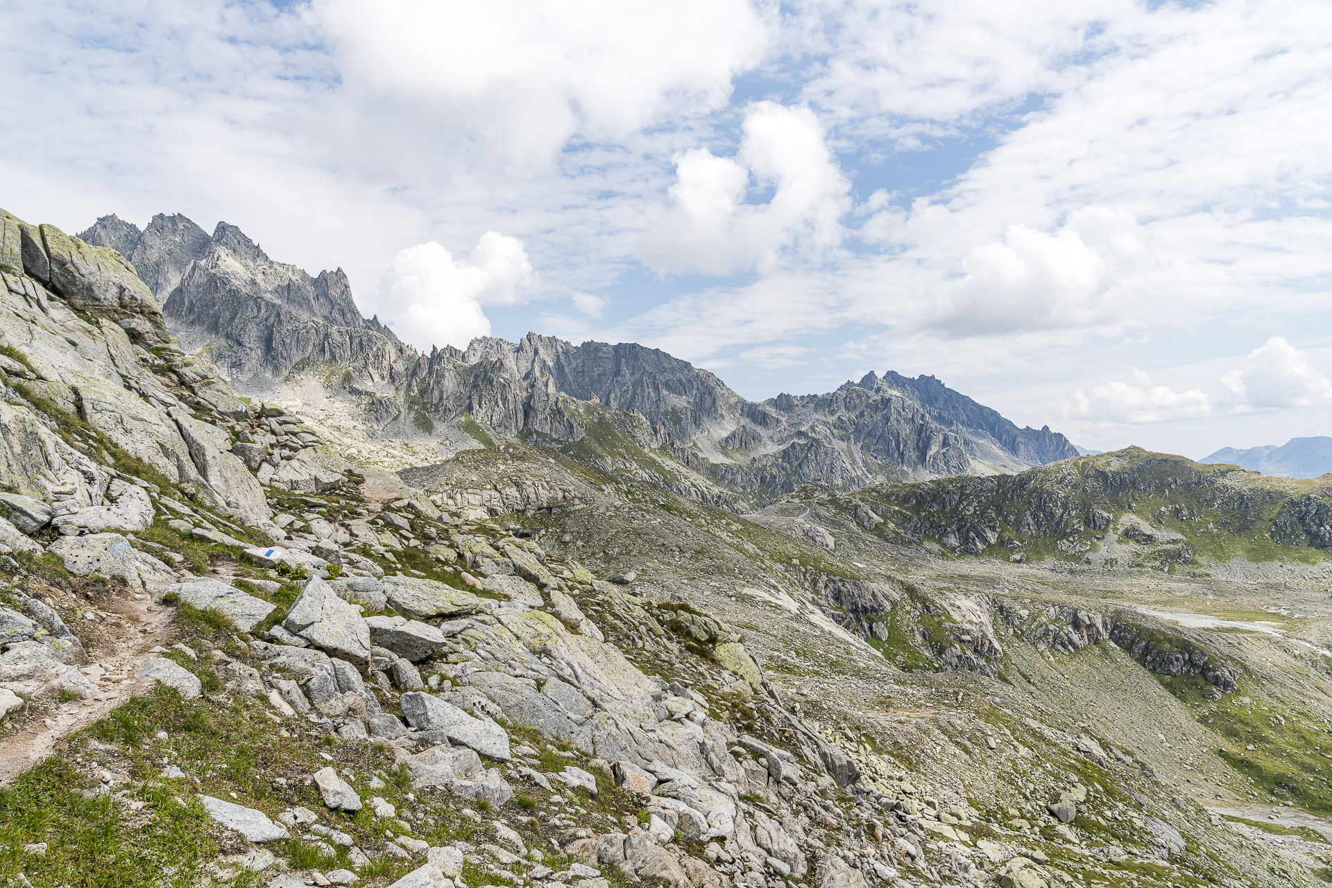
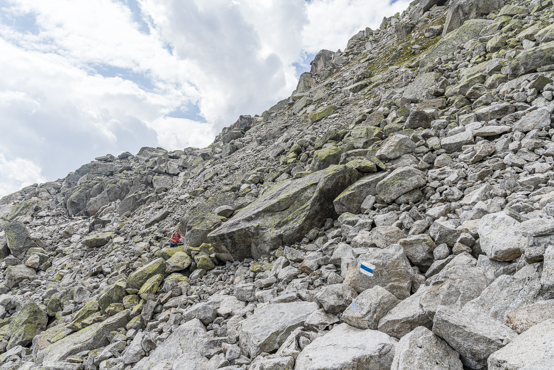
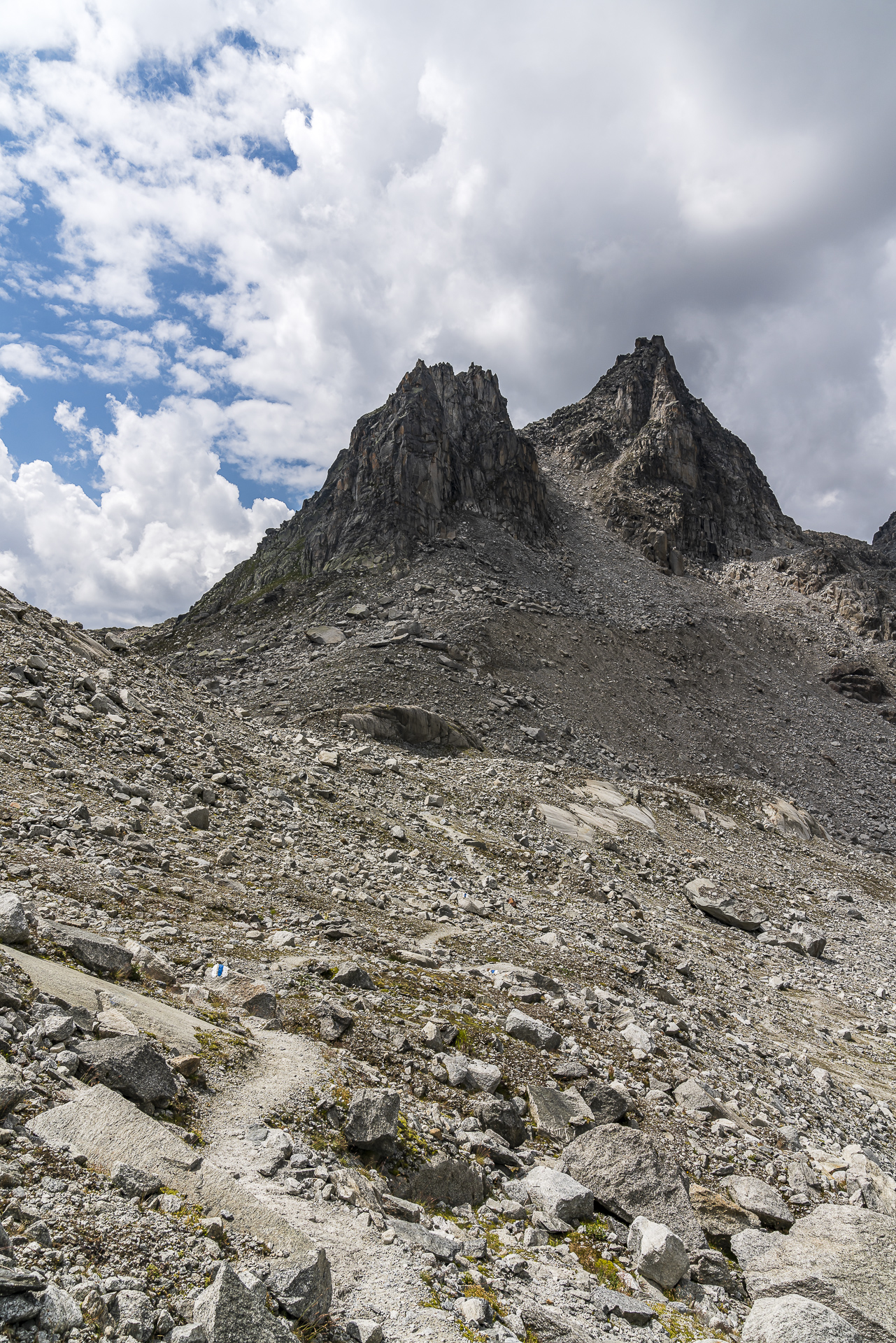
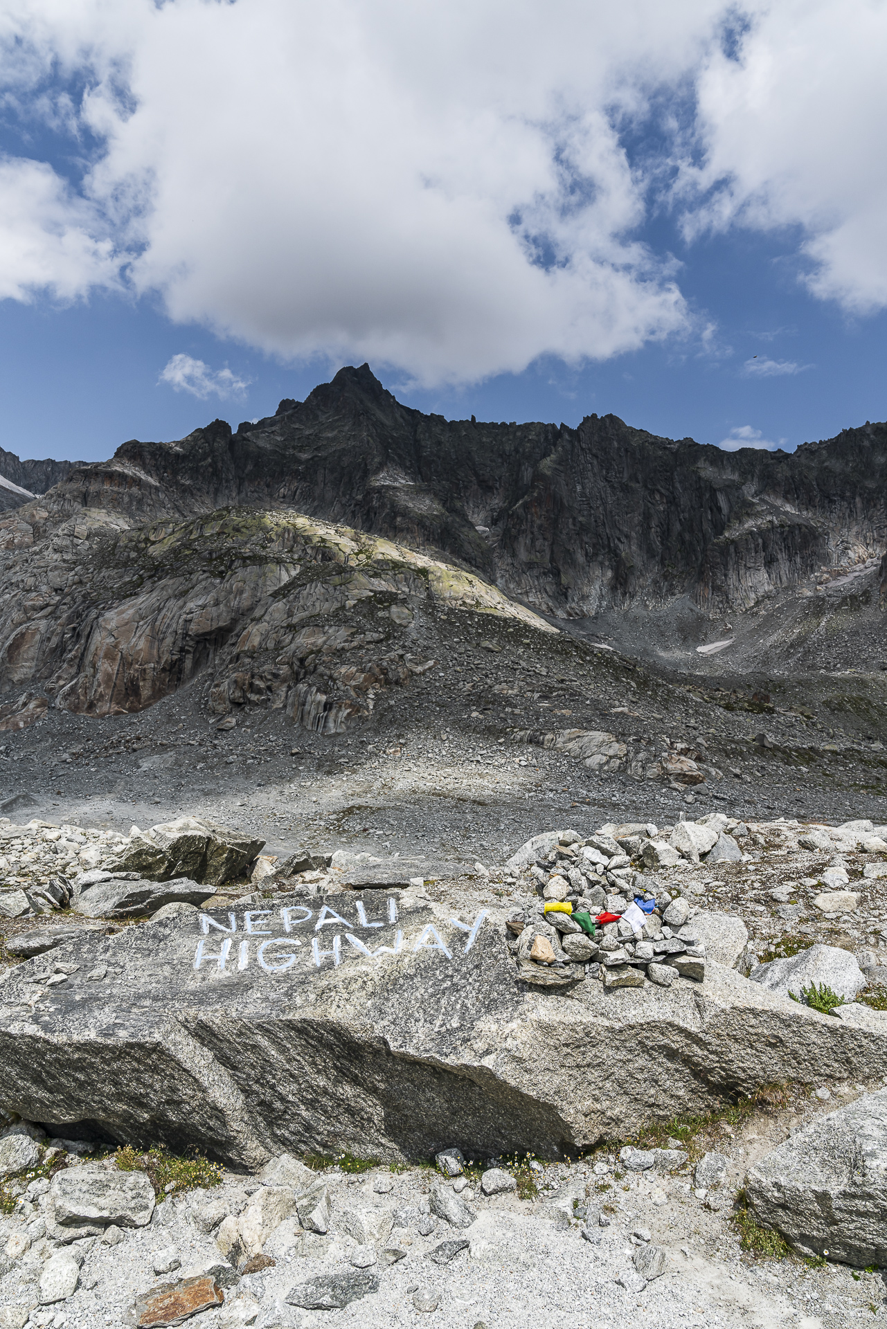
Strengthened, after a half-hour break for refreshments, we continue towards the Albert-Heim-Hütte. The Nepali Highway starts directly behind the Sidelenhütte and leads you along the flanks of the Bielenhorn in about two hours of hiking time to the Albert-Heim-Hütte without any significant inclines. According to the SAC, the trail owes its name to former Nepalese employees at both huts. They were looking for the quickest/easiest way to visit each other and established the route now known as the “Nepali Highway”.
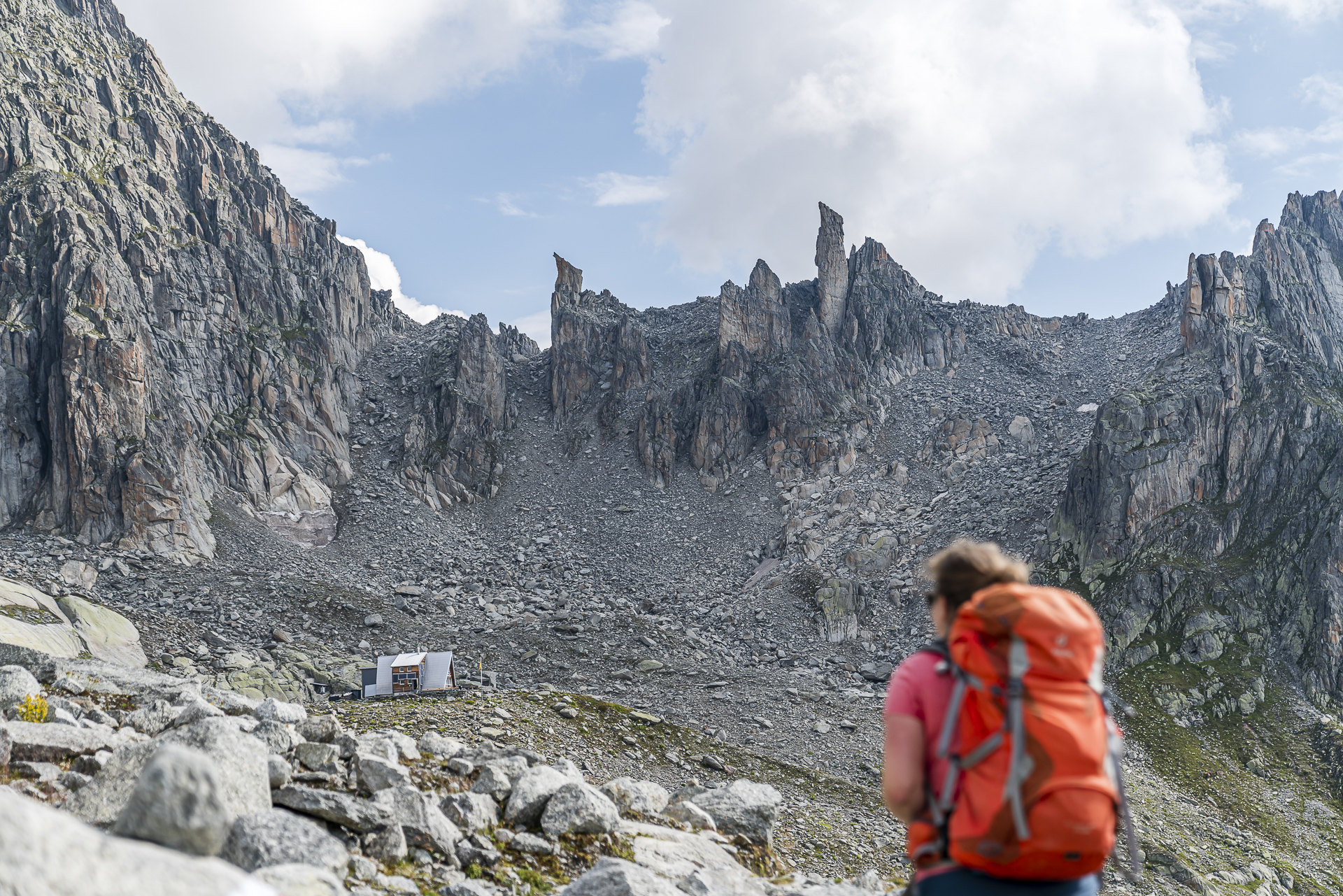
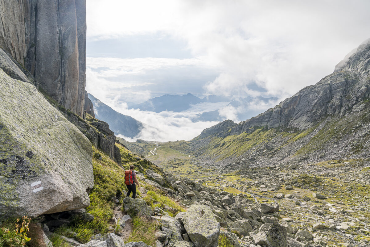
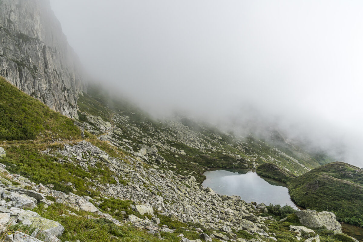
Thanks to less technically demanding sections, the white-blue-white marked route is a great introduction to alpine hiking for all those who dare to scramble and boulder terrain. In the first section, there are two rock steps that are not particularly exposed. The most technically difficult part is a 100-metre-long slope crossing over stacked boulders at the level of the “Seeleins” shown on the map. However, the basic direction of the route is always clearly legible thanks to clearly visible trail markings. Only the decision of how to balance from one block to the next is up to me. But this time I manage without any drama moments. Thus, the constant challenge of the personal comfort zone pays off, or the path is really easier compared to other white-blue-white routes completed in recent years. I suspect more of the latter.
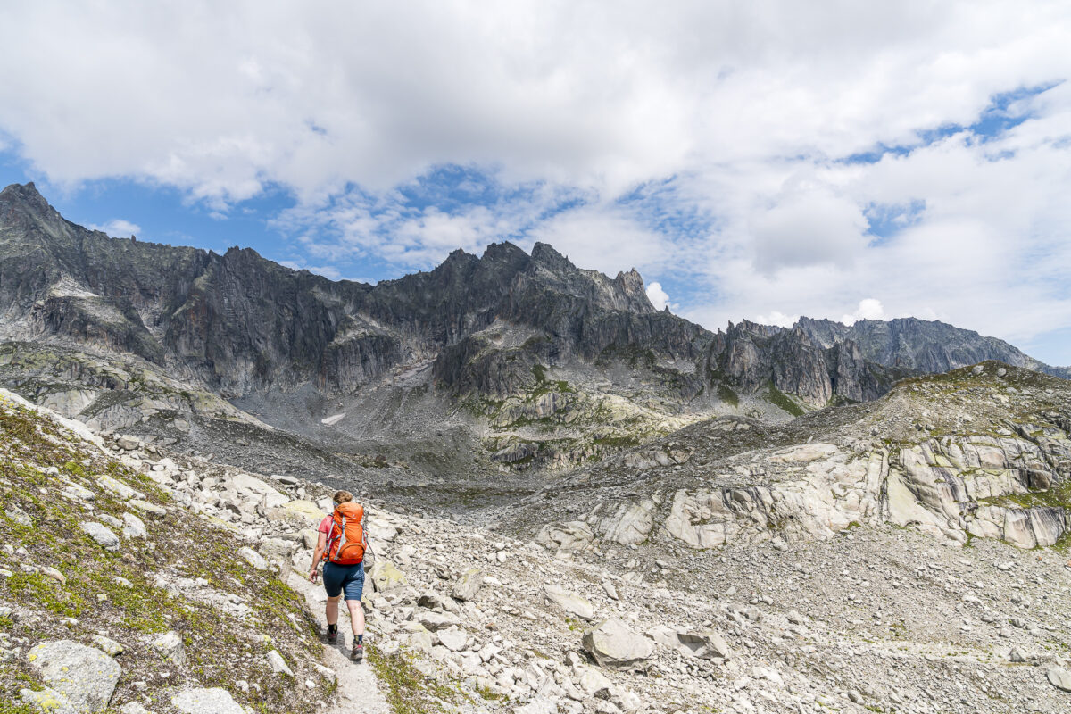
Before the short counter-ascent to the Albert-Heim-Hütte, which is enthroned on a rocky spur, follows, you have to descend a rock edge again. If you don’t feel comfortable here, you can also avoid it.
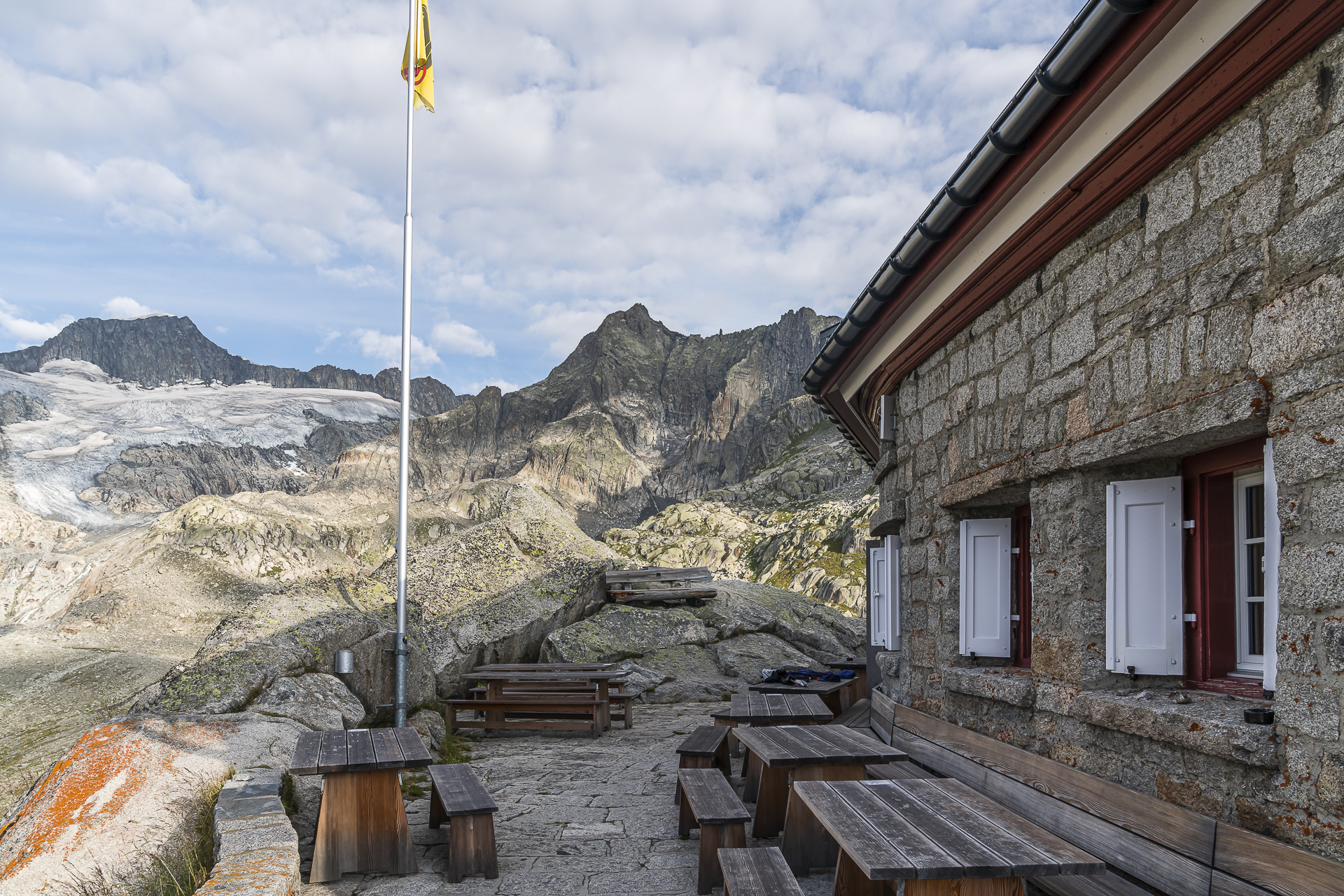
The rest of the afternoon we enjoy the impressive mountain scenery from the Albert-Heim-Hütte. The cabin was extensively renovated in 2018 and presents itself in a modern and correspondingly comfortable way. The shared rooms are divided into small units. Among them there is also a double room, which we had reserved early. The mix of guests is also exciting: the hut is popular with day visitors, families, climbers and alpine tourers.
Key data of the hike Furka Pass – Sidelenhütte – Albert-Heim-Hütte
| Starting point | Postbus stop Furka, top of the pass (2,429 m above sea level) |
| Reachability | accessible by public transport |
| Length | 8.0 kilometers |
| Elevation gain | ↗ 625 m 516 m ↘ |
| Duration | 3:00 pm – 3:30 pm |
| Destination | Albert-Heim-Hütte (2,539 m above sea level) |
| Catering | Sidelenhütte |
2nd hiking day: along the Urschner Höhenweg to Andermatt
While the alpine tourers set off at five in the morning the following morning, we turn around in our hut sleeping bags after a short look out of the window and continue dozing until 7:00 a.m. If the weather had been a little better, we would have climbed to the summit cross of the Schafberg right in front of the hut for the sunrise.
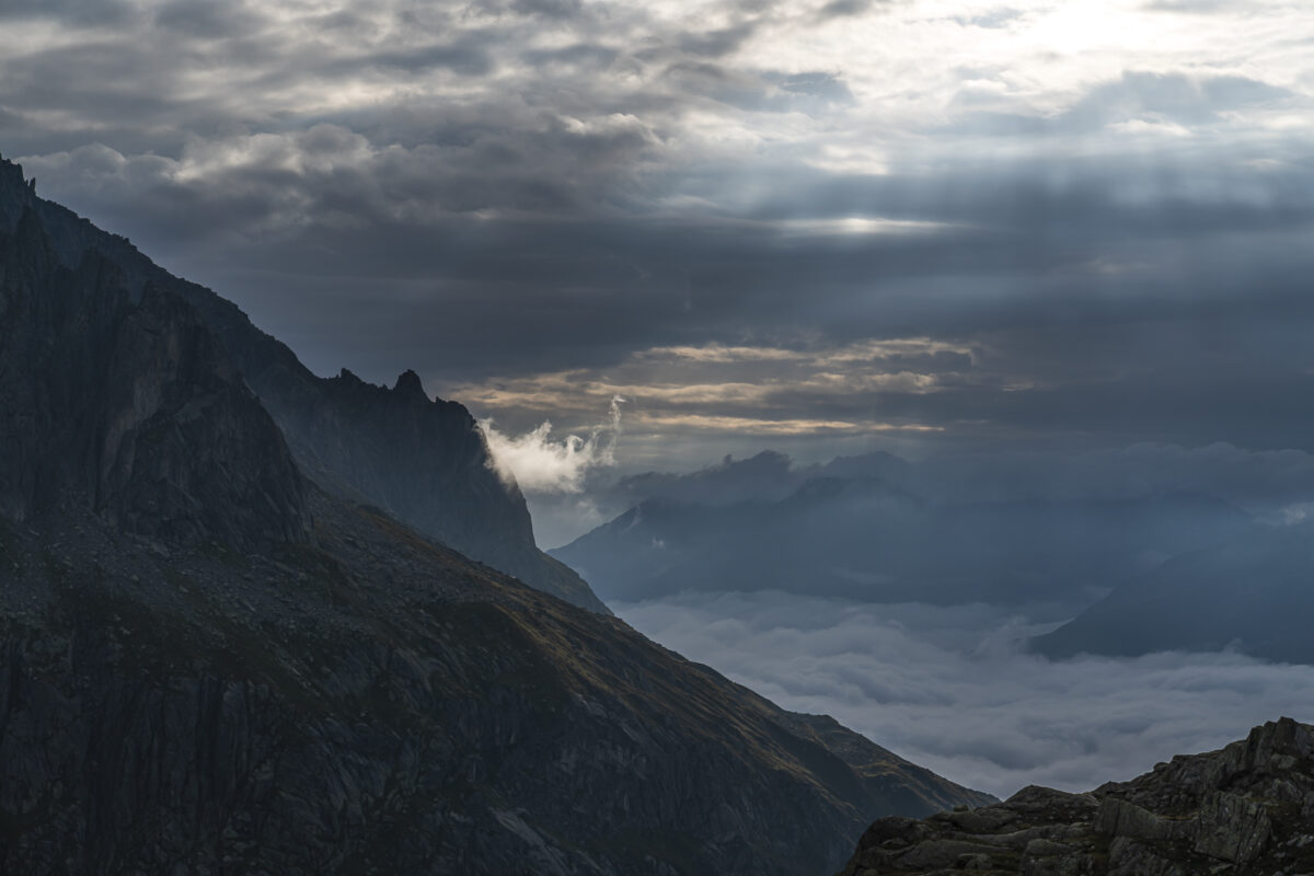
After breakfast, we are treated to some sun in combination with a mystical cloudy atmosphere for the descent towards Lochberg.
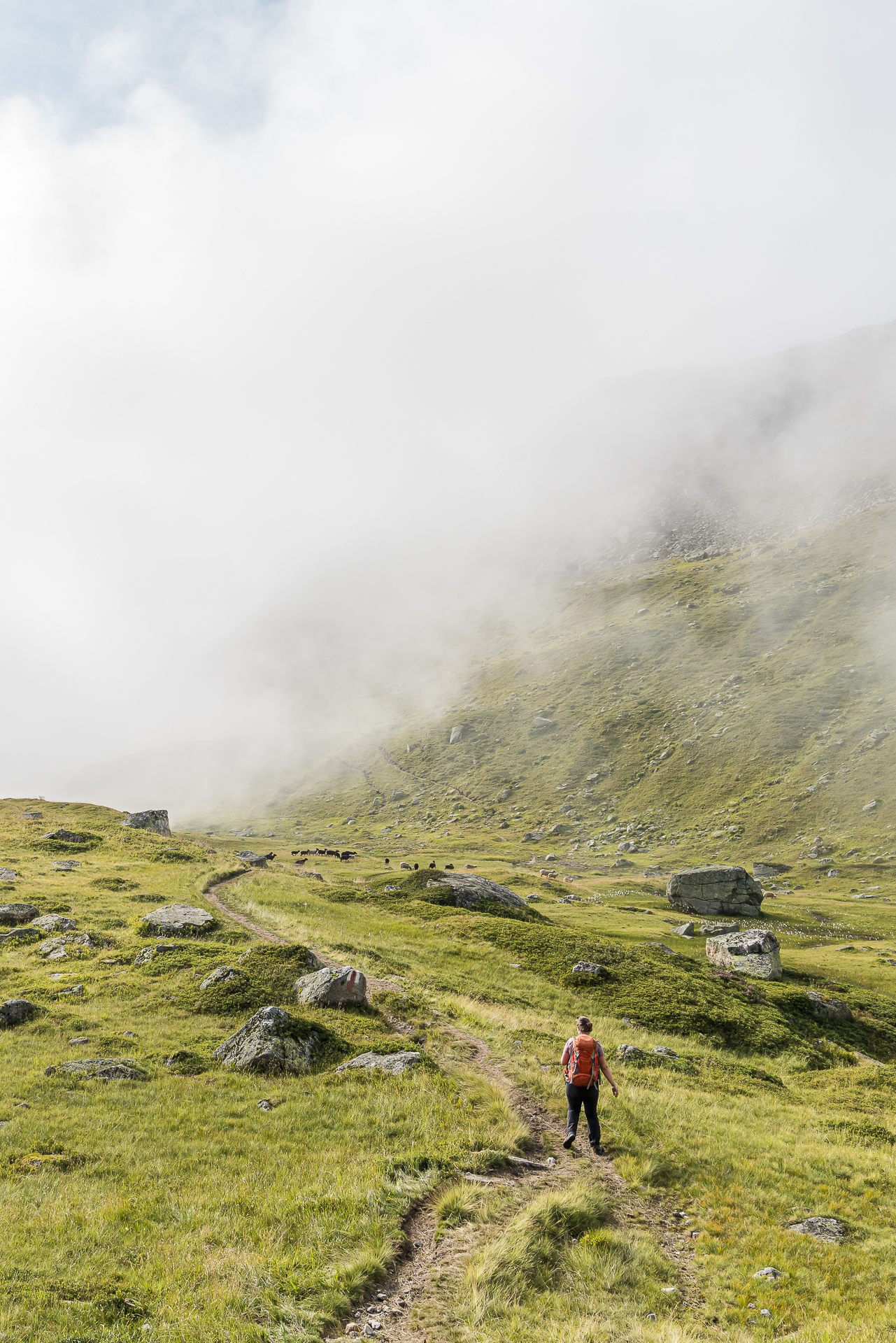
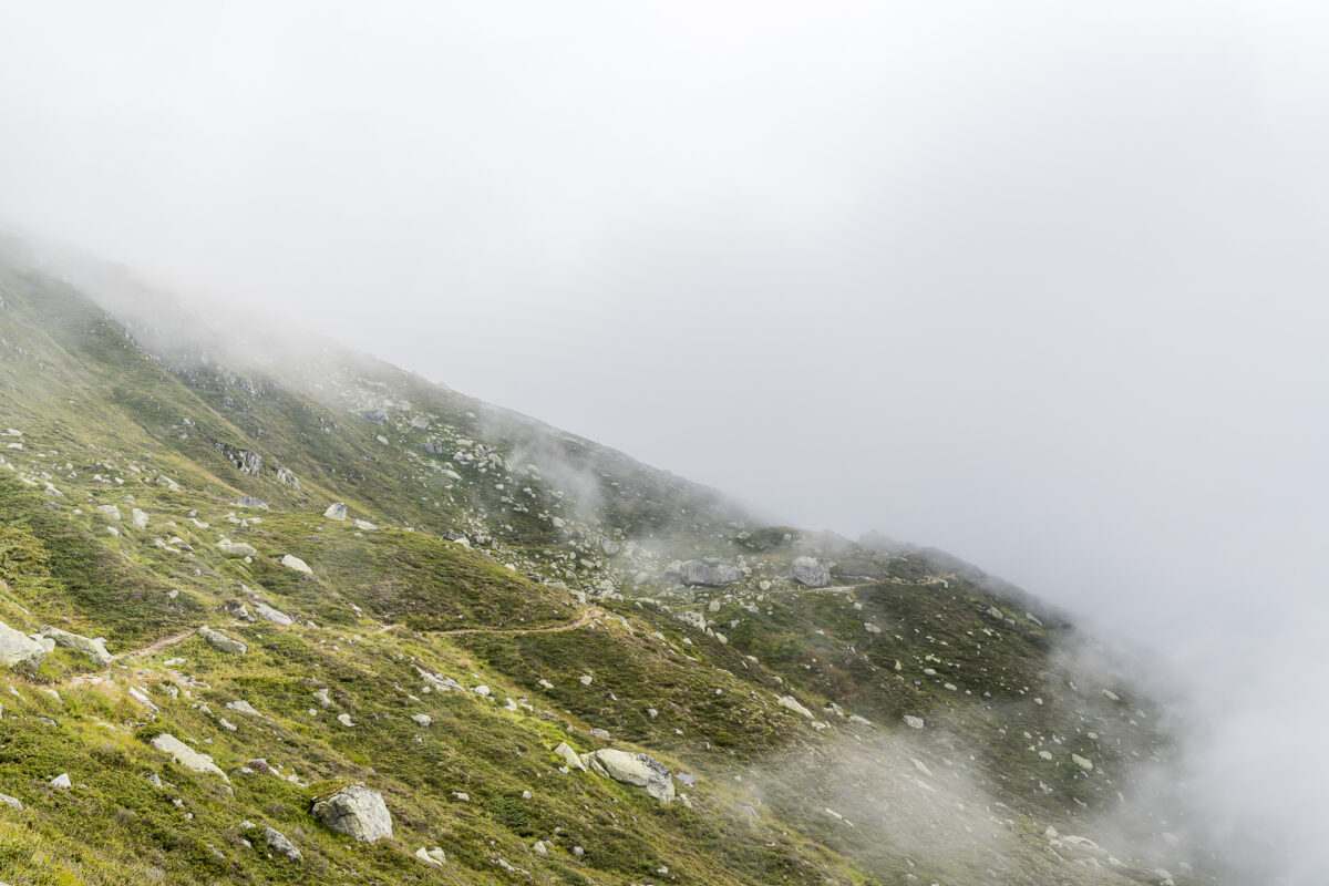
But as soon as we meet the Urschner Höhenweg, everything around us is swallowed up by the fog. Well, that probably won’t work out with the scenic pleasure hiking. Nevertheless, the ups and downs are fun even on cloudy valley flanks. Especially since in this weather there is hardly anyone else on the road except us. And for the last four kilometres from Hospental to Andermatt, there are still one or two beautiful views of the Urseren Valley as a reward for “perseverance”.
Key data of the hike Albert-Heim-Hütte – Andermatt
| Starting point | Albert-Heim-Hütte (2,539 m above sea level) |
| Reachability | Hut can only be reached on foot (fastest ascent from Tiefenbach) |
| Length | 15.4 kilometres |
| Elevation gain | ↗ 368 m 1,472 m ↘ |
| Duration | 4:30 p.m. |
| Destination | Andermatt railway station (1,435 m above sea level) |
| Catering | There are no refreshment stops on the Albert-Heim-Hütte – Andermatt route |
For me, even without a magnificent sunset and sunrise, it was an all-round successful hut tour. And if you book early, as we did, you can spend a really comfortable and cozy night in the “Chräiennest” (that’s the name of the only double room). Ideal for those who don’t want to let snoring spoil their well-deserved night’s sleep.
Practical tips for your hike on the Nepali Highway
- The ascent to the Sidelenhütte and the second day of hiking on the Urschner Höhenweg are red-white-red marked mountain hiking trails of difficulty T2.
- The blue-white-blue marked Nepali Highway is classified as T3+ according to the SAC mountain and alpine hiking scale (demanding mountain hiking/alpine hiking). During our ascent, the route was completely free of snow. If you are unsure at the beginning of the season whether there are still snowfields on the route, it is best to inquire in advance with the hut keepers of the Sidelen or Albert Home huts. With old snowfields, the boulder sections in particular are more difficult to pass.
- We met several families who do the Nepali Highway with their children. Again, the tour is feasible for children, as long as they have the necessary experience/fitness and surefootedness.
- The summer season of the Albert-Heim-Hütte lasts from mid-June to mid-October (depending on snowfall/onset of winter in autumn). Nightly rates vary depending on the room type. As non-SAC members, we paid 145 CHF per person including half board for a 2-bed room. Current price information can be found on the website of the Albert-Heim-Hütte.
- The Sidelenhütte is also open from mid-June to mid-October.
- Note that both huts are located at altitudes above 2,500 meters above sea level. The snow stays here for a longer period of time and in autumn fresh snow can quickly fall here again. In general, you should consult the weather forecasts in advance of the tour.
Leave a Reply