

2-day hike Juf – Septimerpass – Julierpass
When planning our first hike on the Parc Ela Trek, it quickly became clear: The exciting stages of this multi-day hike through Switzerland’s largest regional nature park can’t all be explored in one go – we simply didn’t have the time. All the more reason to continue where we left off this hiking season. This time, stages 5 and 6 were on the program. They lead from Europe’s highest year-round inhabited village – Juf – along old mule tracks over the Septimer Pass and onward to the Julier Pass. Two hiking days, five passes, and a cozy hut overnight stay – perfect for anyone looking for a scenic two-day hike in Parc Ela.
1st Hiking Day: From Switzerland’s highest village to the Septimer Pass
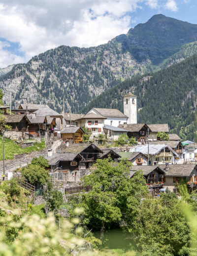
Even getting to Juf is a small adventure. The highest year-round inhabited village in Switzerland lies secluded in the furthest part of the Avers Valley. The roughly three-and-a-half-hour journey from Zurich takes us via Chur to Thusis, and from there by postal bus through Andeer on a winding but very scenic route almost to the end of the valley. Every seat in the bus is taken. The detour to Juf seems to be a popular summer excursion. Those traveling with younger children or simply looking for a leisurely stroll amid an impressive mountain backdrop will also find what they’re looking for here.
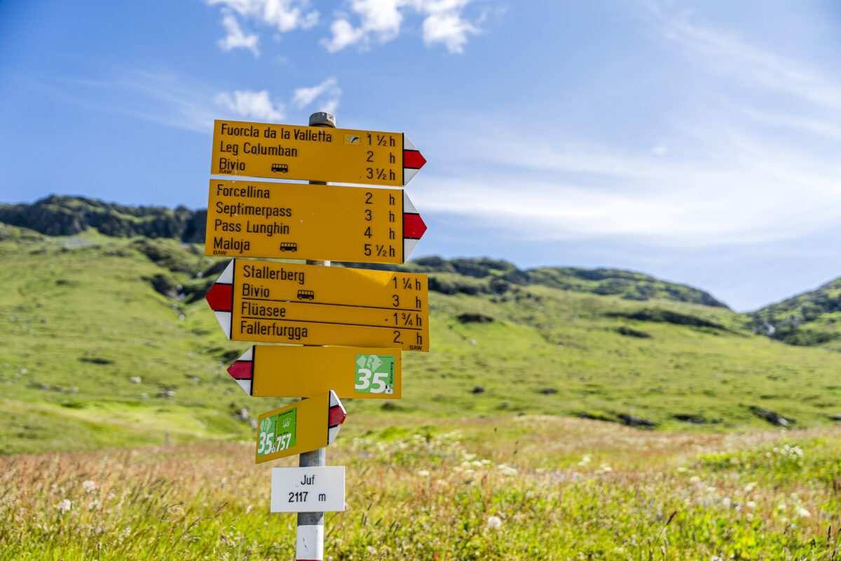
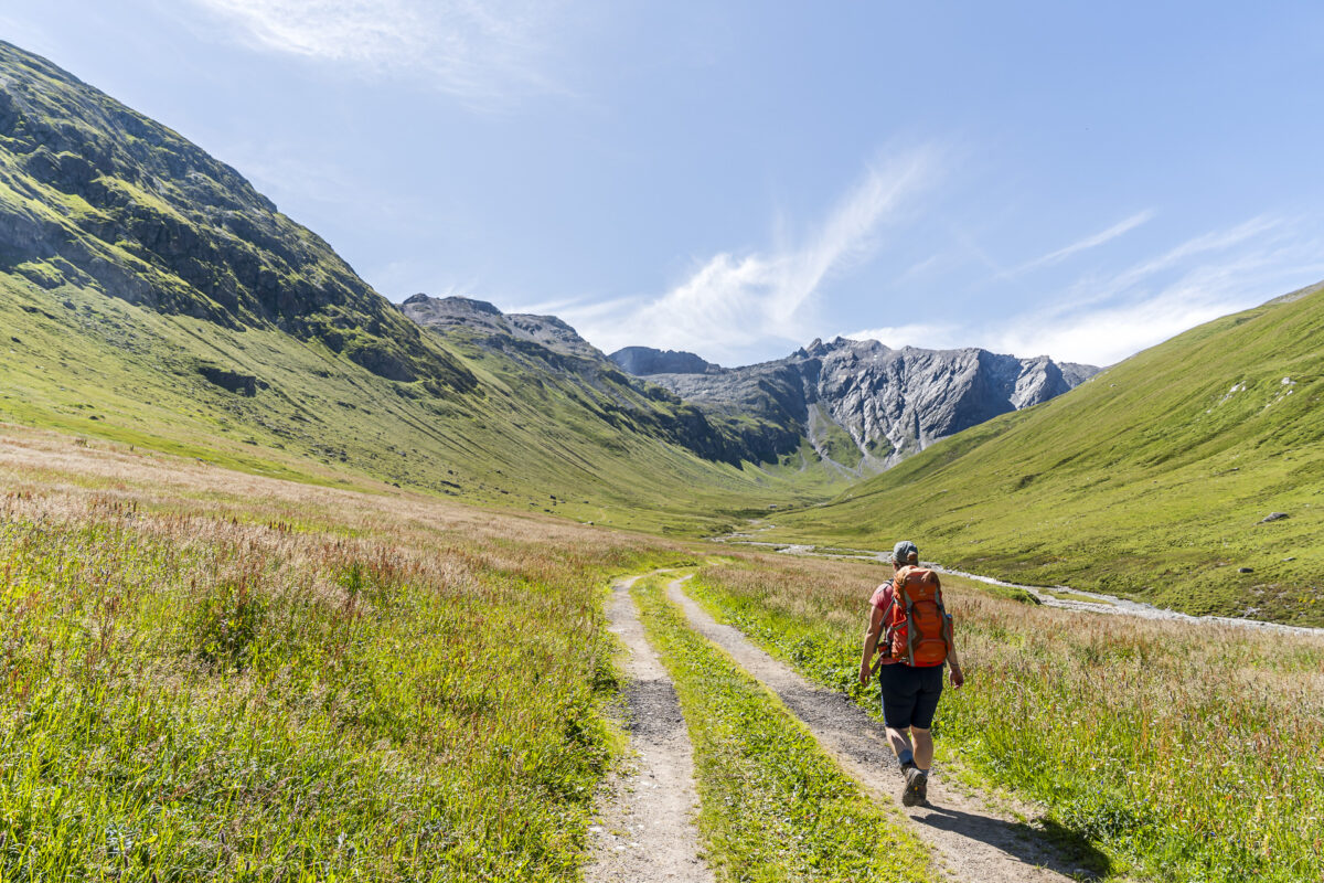
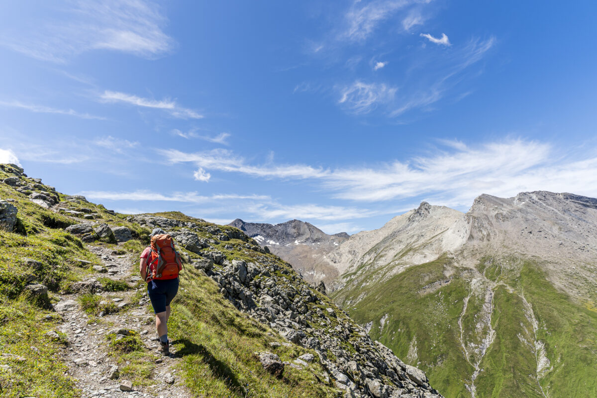
Like many of our fellow passengers, we follow the signpost pointing the path toward the valley head. For the first good thirty minutes, we walk leisurely along the valley floor – a relaxed and motivating start. Then the mountain trail branches off to the left and climbs about 300 meters in altitude in numerous switchbacks up to the Fuorcla da la Valletta. Thanks to the well-laid serpentine path, the ascent is pleasant, and we quickly gain altitude.
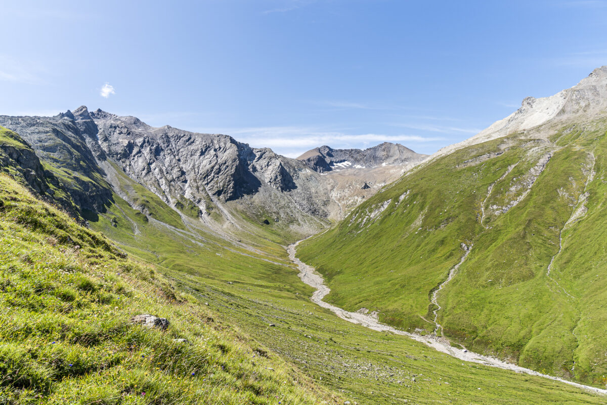
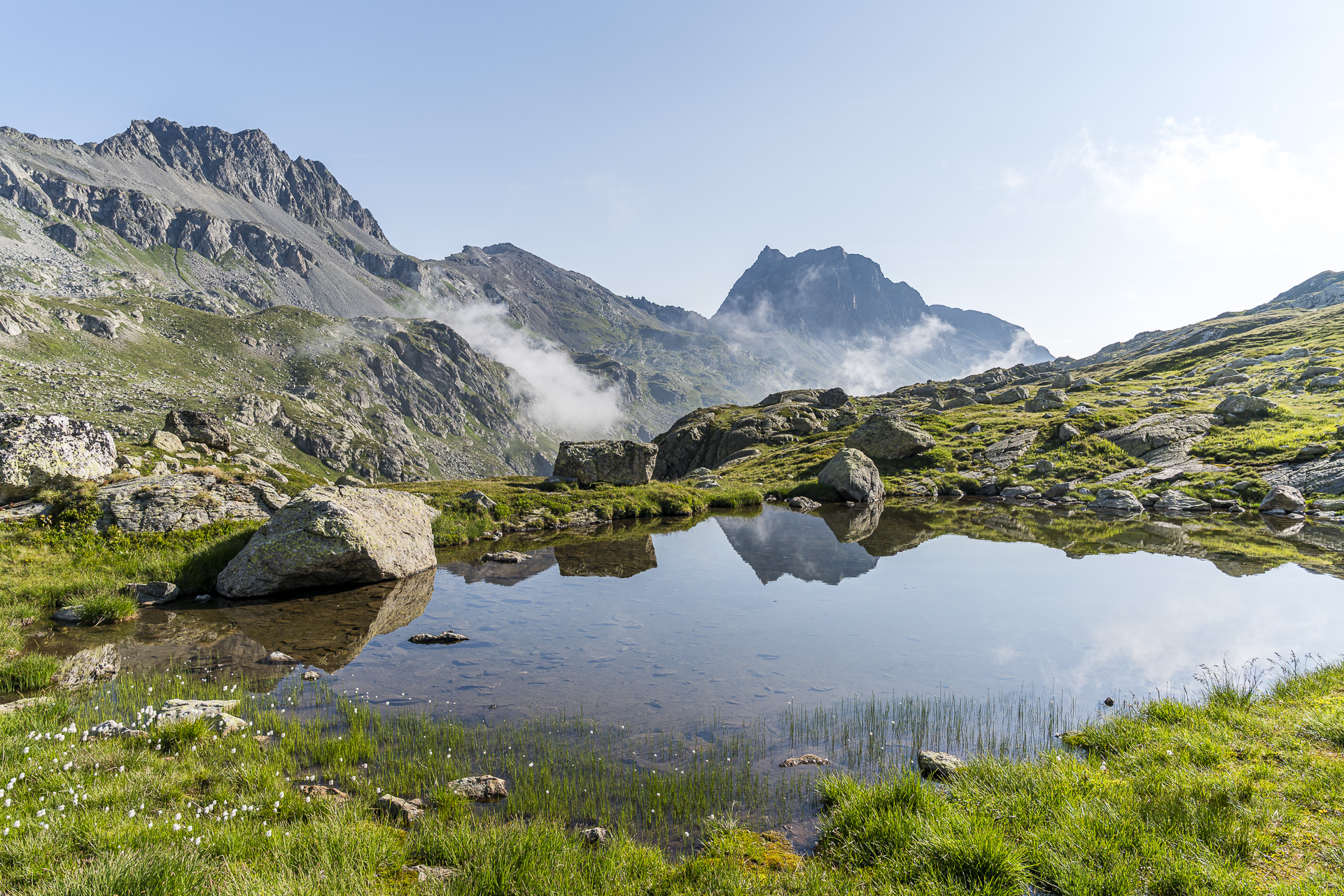
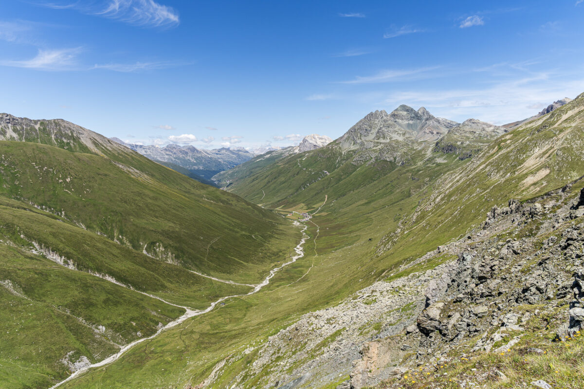
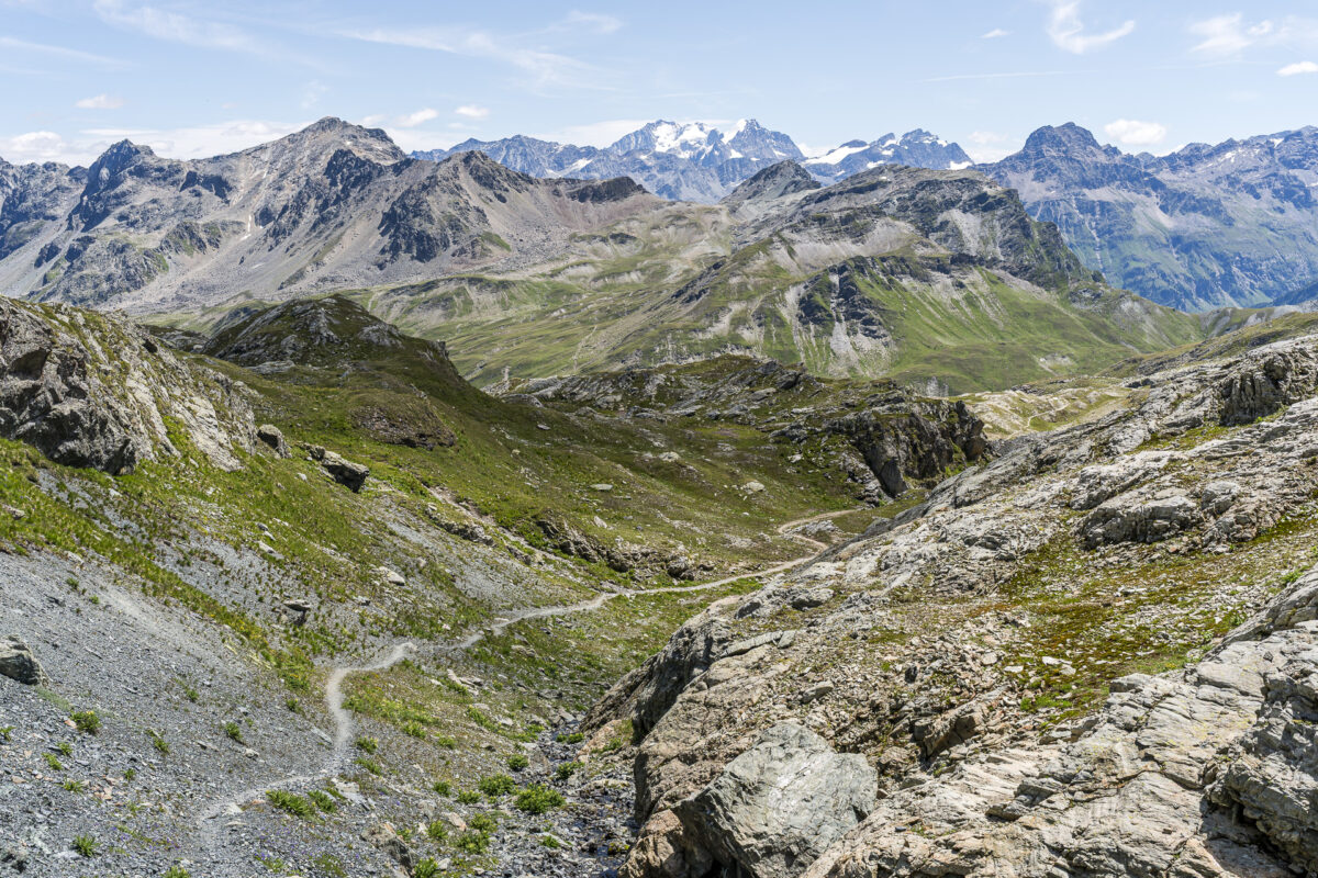
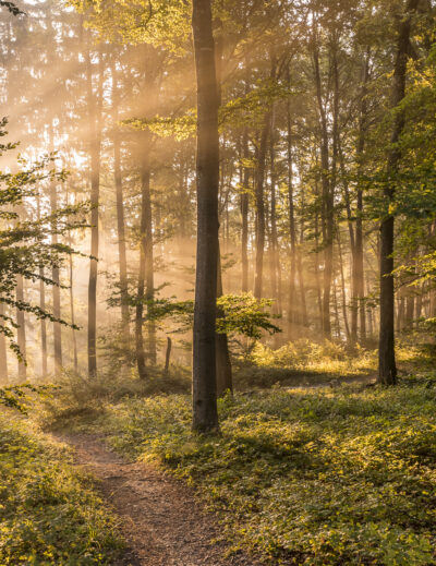
Before long, we reach rockier terrain and enjoy the wide panoramic view over the Jufer Alp. The hiking trail to the Septimer Pass now continues along the mountain slopes deeper into the valley before climbing another 170 meters to the Forcellina. With a bit of luck, ibex can be spotted here. Even without wildlife encounters, the high-alpine landscape impresses with its barren, tranquil beauty. Once at the top of the pass crossing, the view opens over the Alp da Sett down toward the Julier Pass and Bivio.
When planning our first hike on the Parc Ela Trek, it quickly became clear: The exciting stages of this multi-day hike through Switzerland’s largest regional nature park can’t all be explored in one go – we simply didn’t have the time. All the more reason to continue where we left off this hiking season. This time, stages 5 and 6 were on the program. They lead from Europe’s highest year-round inhabited village – Juf – along old mule tracks over the Septimer Pass and onward to the Julier Pass. Two hiking days, five passes, and a cozy hut overnight stay – perfect for anyone looking for a scenic two-day hike in Parc Ela.
1st Hiking Day: From Switzerland’s highest village to the Septimer Pass
Even getting to Juf is a small adventure. The highest year-round inhabited village in Switzerland lies secluded in the furthest part of the Avers Valley. The roughly three-and-a-half-hour journey from Zurich takes us via Chur to Thusis, and from there by postal bus through Andeer on a winding but very scenic route almost to the end of the valley. Every seat in the bus is taken. The detour to Juf seems to be a popular summer excursion. Those traveling with younger children or simply looking for a leisurely stroll amid an impressive mountain backdrop will also find what they’re looking for here.
Like many of our fellow passengers, we follow the signpost pointing the path toward the valley head. For the first good thirty minutes, we walk leisurely along the valley floor – a relaxed and motivating start. Then the mountain trail branches off to the left and climbs about 300 meters in altitude in numerous switchbacks up to the Fuorcla da la Valletta. Thanks to the well-laid serpentine path, the ascent is pleasant, and we quickly gain altitude.
Before long, we reach rockier terrain and enjoy the wide panoramic view over the Jufer Alp. The hiking trail to the Septimer Pass now continues along the mountain slopes deeper into the valley before climbing another 170 meters to the Forcellina. With a bit of luck, ibex can be spotted here. Even without wildlife encounters, the high-alpine landscape impresses with its barren, tranquil beauty. Once at the top of the pass crossing, the view opens over the Alp da Sett down toward the Julier Pass and Bivio.
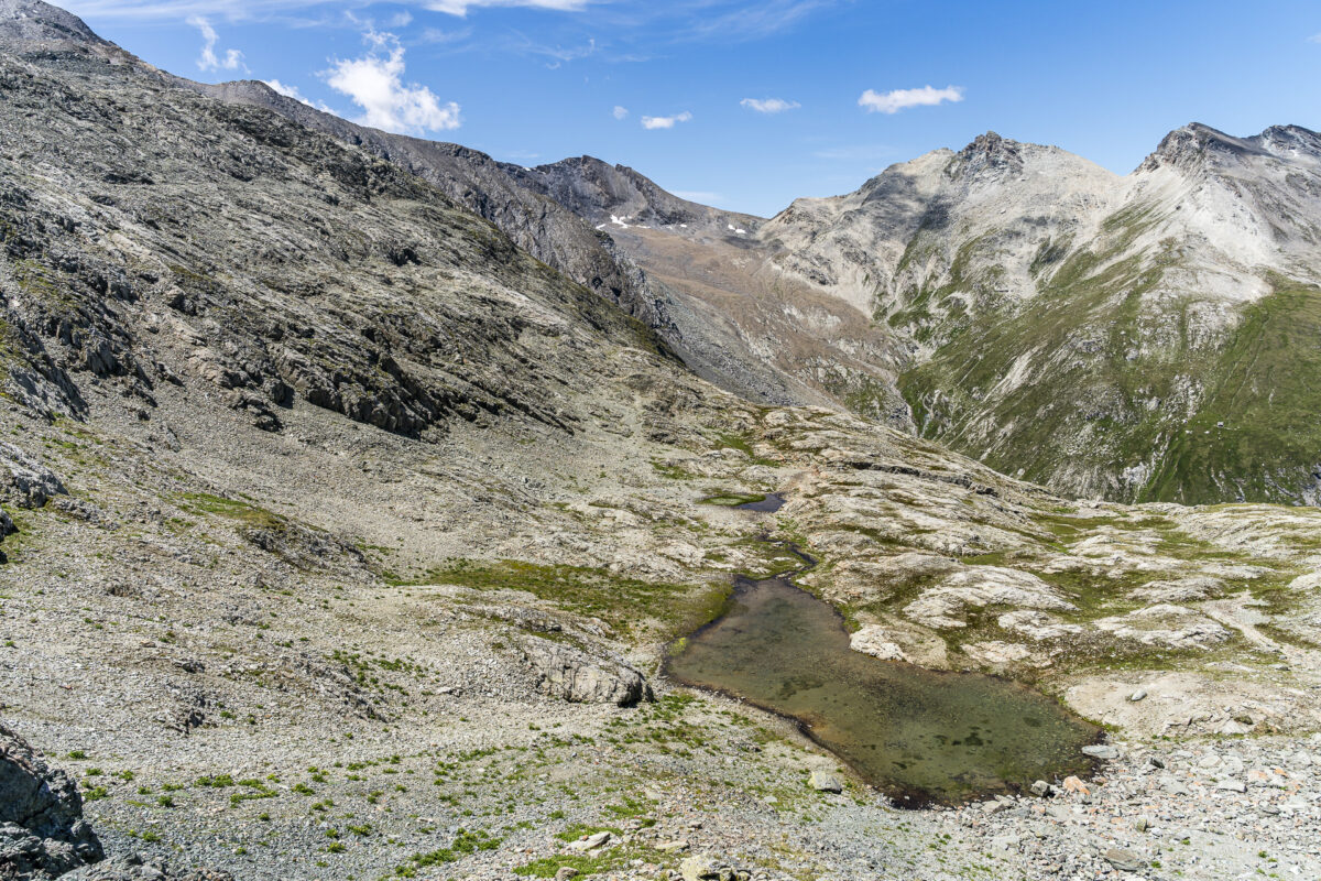
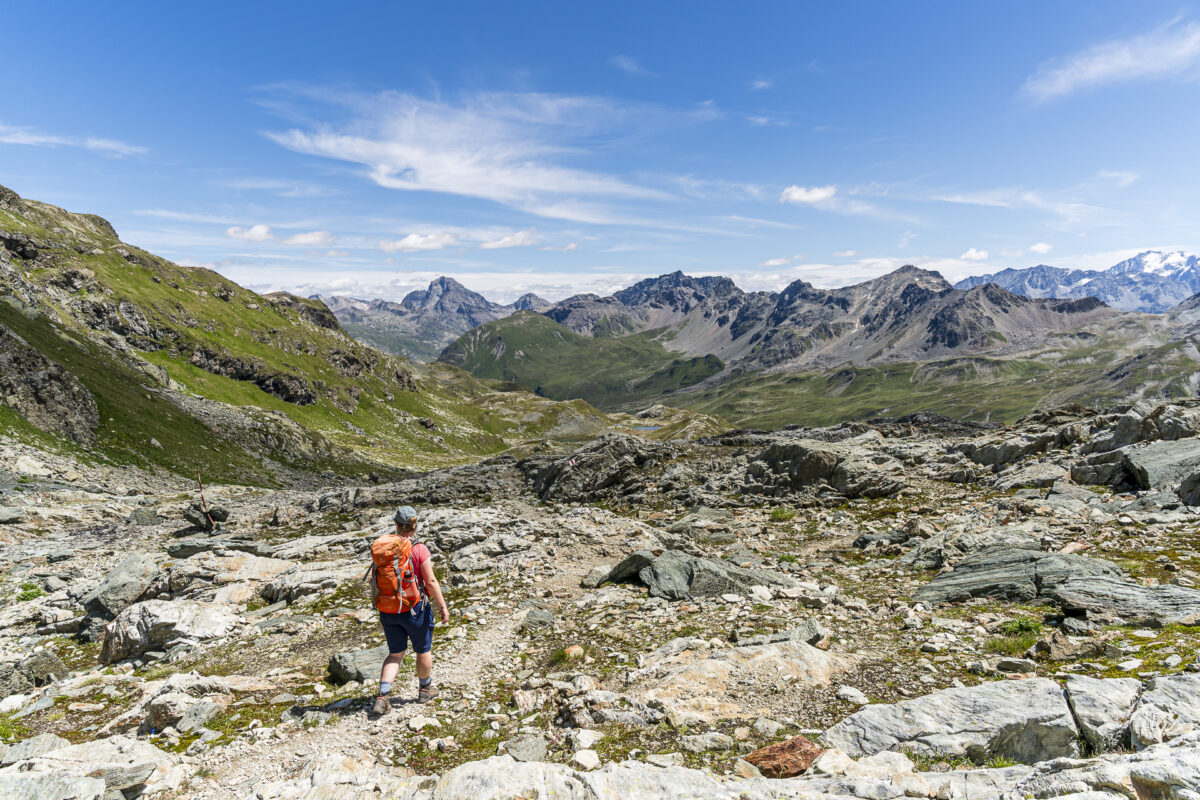
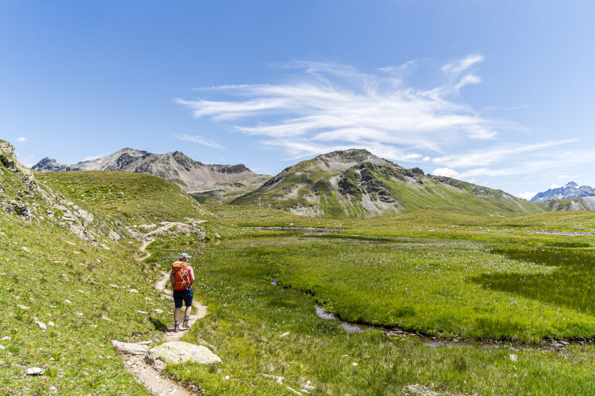
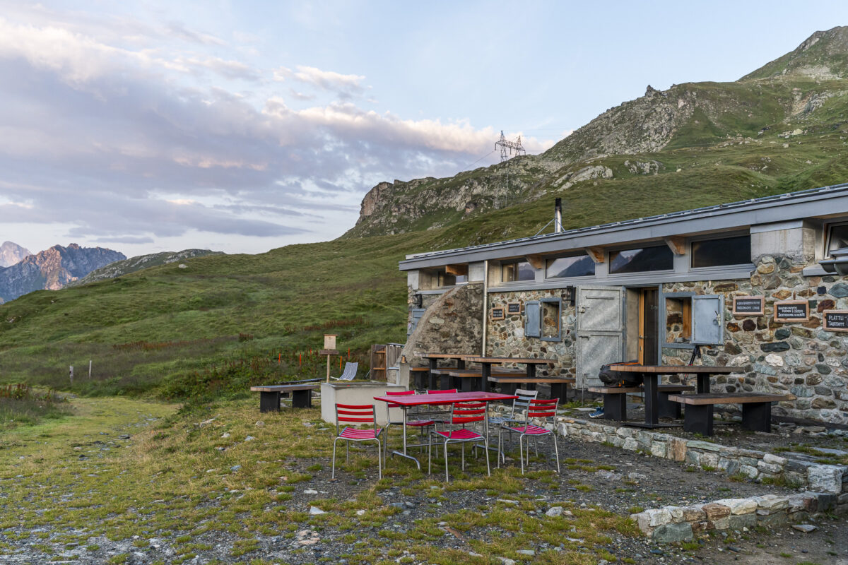
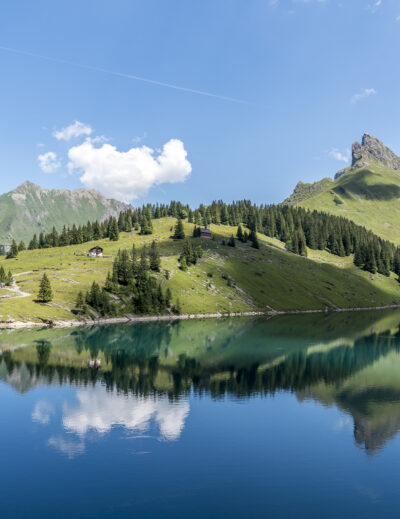
From the Forcellina, it’s just under an hour to our day’s destination, the cozy Cesa da Sett. The descent is pure joy: a narrow path leads through flower-filled alpine meadows, accompanied by a cheerful babbling brook, and past the idyllic Leg da Sett. Shortly afterward, we reach the historic Septimer Pass. From here, it’s just a short walk to the hut. We spend the rest of the afternoon enjoying the relaxed hut atmosphere with good reading material, delicious homemade lemonade, and an apéro platter with local alpine cheese.
When planning our first hike on the Parc Ela Trek, it quickly became clear: The exciting stages of this multi-day hike through Switzerland’s largest regional nature park can’t all be explored in one go – we simply didn’t have the time. All the more reason to continue where we left off this hiking season. This time, stages 5 and 6 were on the program. They lead from Europe’s highest year-round inhabited village – Juf – along old mule tracks over the Septimer Pass and onward to the Julier Pass. Two hiking days, five passes, and a cozy hut overnight stay – perfect for anyone looking for a scenic two-day hike in Parc Ela.
1st Hiking Day: From Switzerland’s highest village to the Septimer Pass
Even getting to Juf is a small adventure. The highest year-round inhabited village in Switzerland lies secluded in the furthest part of the Avers Valley. The roughly three-and-a-half-hour journey from Zurich takes us via Chur to Thusis, and from there by postal bus through Andeer on a winding but very scenic route almost to the end of the valley. Every seat in the bus is taken. The detour to Juf seems to be a popular summer excursion. Those traveling with younger children or simply looking for a leisurely stroll amid an impressive mountain backdrop will also find what they’re looking for here.
Like many of our fellow passengers, we follow the signpost pointing the path toward the valley head. For the first good thirty minutes, we walk leisurely along the valley floor – a relaxed and motivating start. Then the mountain trail branches off to the left and climbs about 300 meters in altitude in numerous switchbacks up to the Fuorcla da la Valletta. Thanks to the well-laid serpentine path, the ascent is pleasant, and we quickly gain altitude.
Before long, we reach rockier terrain and enjoy the wide panoramic view over the Jufer Alp. The hiking trail to the Septimer Pass now continues along the mountain slopes deeper into the valley before climbing another 170 meters to the Forcellina. With a bit of luck, ibex can be spotted here. Even without wildlife encounters, the high-alpine landscape impresses with its barren, tranquil beauty. Once at the top of the pass crossing, the view opens over the Alp da Sett down toward the Julier Pass and Bivio.
From the Forcellina, it’s just under an hour to our day’s destination, the cozy Cesa da Sett. The descent is pure joy: a narrow path leads through flower-filled alpine meadows, accompanied by a cheerful babbling brook, and past the idyllic Leg da Sett. Shortly afterward, we reach the historic Septimer Pass. From here, it’s just a short walk to the hut. We spend the rest of the afternoon enjoying the relaxed hut atmosphere with good reading material, delicious homemade lemonade, and an apéro platter with local alpine cheese.
Key facts about the hike Juf – Forcellina – Septimer Pass
On the hiking map below, you can see the route of the hike from Juf via Forcellina to the Septimer Pass. It is consistently a white-red-white marked mountain trail of difficulty level T2 to T3. The path has no special technical difficulties and is not exposed.
By the way: At the postal bus stop in Juf (starting point of the hike) there is a public restroom.
| Starting point | Postal bus stop Avers, Juf (2,117 m a.s.l.) |
| Accessibility | Starting point accessible by public transport |
| Length | 8.1 kilometers |
| Elevation gain/loss | ↗ 657 m ↘ 478 m |
| Duration | 3:10 h |
| Destination | Cesa da Sett (2,302 m a.s.l.) |
| Refreshments | Jufer shop at the starting point, Cesa da Sett at the destination |
Leave a Reply