

From the Oberalp Pass via Cadlimohütte to Airolo: fantastic mountain lake hike
12 mountain lakes in two days await you on this two-day hike from the Oberalp Pass via Cadlimohütte to the Leventina. Of the paths available to the Cadlimohütte, this is not the easiest in terms of fitness, but definitely one of the most panoramic. We were once again completely amazed by the wide, rugged mountain landscape between the cantons of Uri and Ticino!
Two-day hike Oberalppass – Cadlimohütte – Airolo
On last year’s hike through the Val Piora I became aware of the Cadlimohütte and the surrounding mountain lakes. The SAC hut, which belongs to the Uto section, can be reached via several access points. The shortest route starts at the mountain station of the Ritombahn. From there, after a good three hours of walking uphill, you reach the Cadlimohütte. But you can also climb from Airolo, the Lukmanier or the Oberalp Pass.
Our choice fell on the latter and we actually wanted to do the tour at the beginning of August. Due to a bad weather front, we had to postpone the project until September. But on the second attempt everything was perfect! We were able to do the hike in the most wonderful late summer weather.
Day 1: from Oberalppass to Cadlimohütte
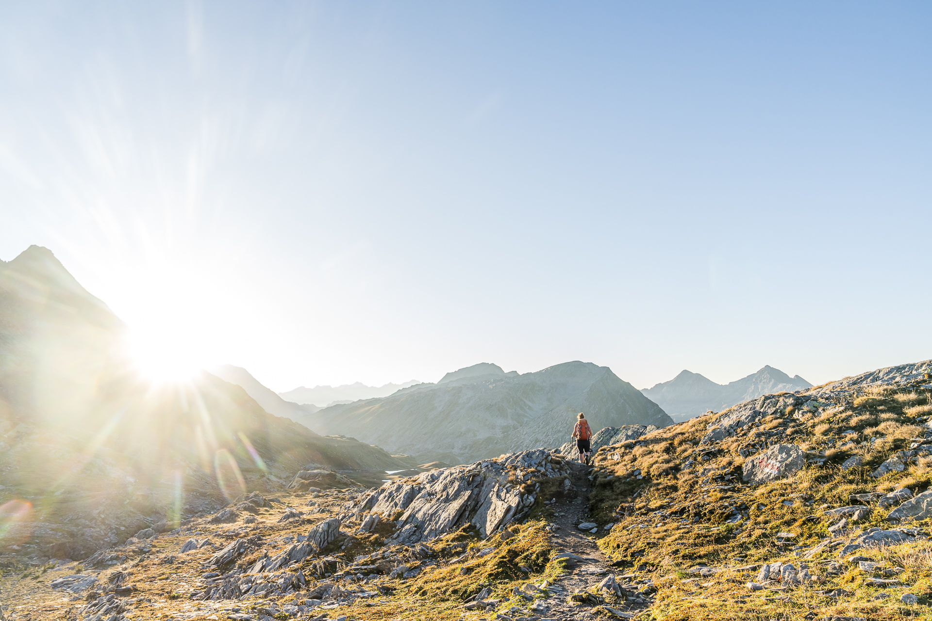
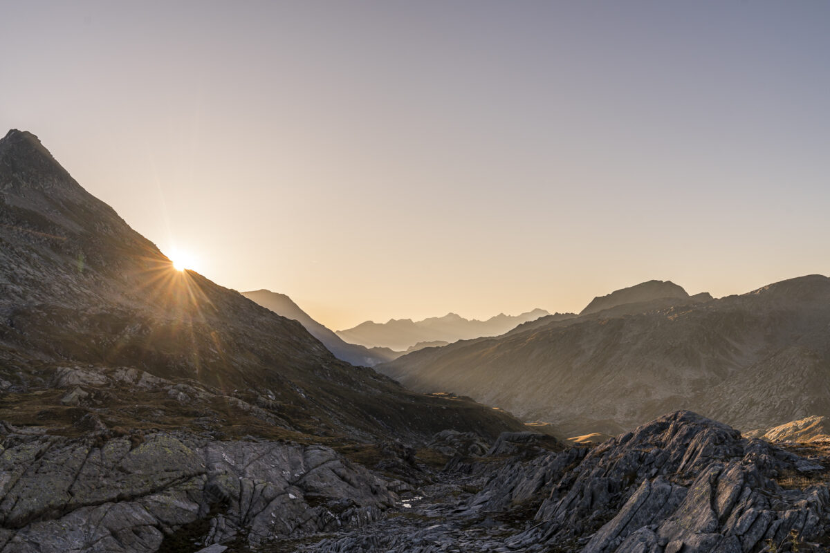
Whereby “the most wonderful late summer weather” also means: In my opinion it could have been a little cooler. The sun felt way too hot when we started hiking around midday. “This is going to be a sweaty thing,” I think to myself and set off purposefully. We already know the first part of this tour from a previous trip to Lake Toma. The first few kilometers go quickly. The pleasant path climbs slowly but steadily. After a little more than an hour we have reached the first 300 meters and are standing below the Maighelshütte. A quick stop at the hut would actually be nice, but we have calculated the hiking time to be rather tight and don’t want to arrive at the Cadlimo hut too late. So after a short break to drink we march on quickly.
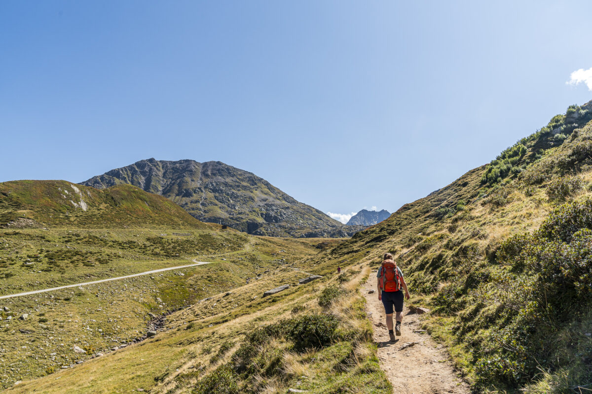
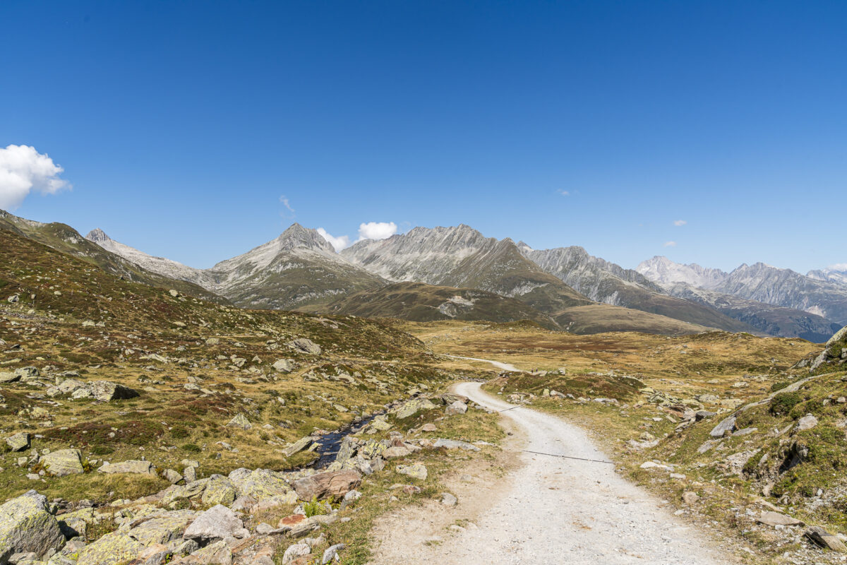
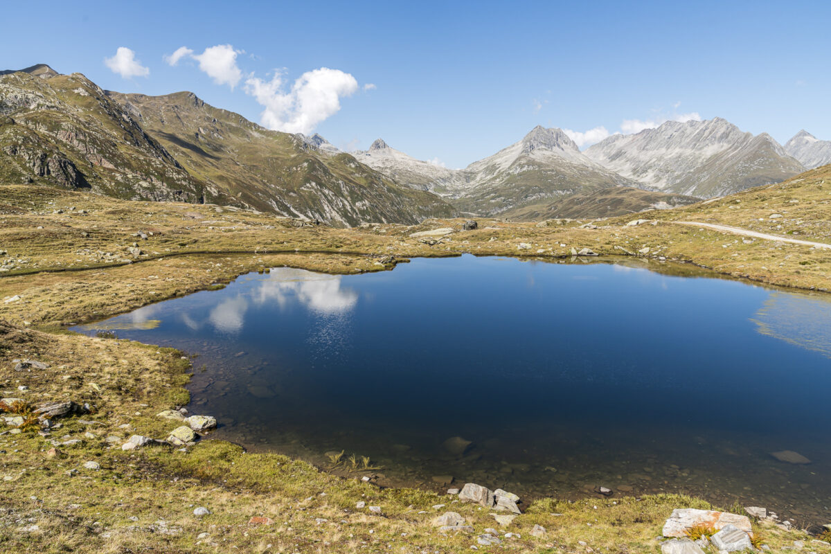
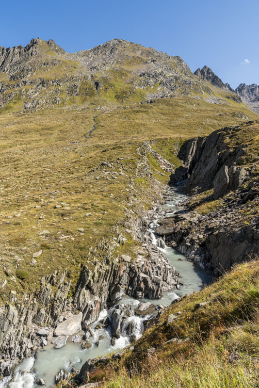
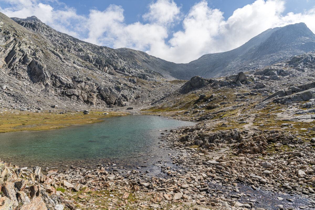
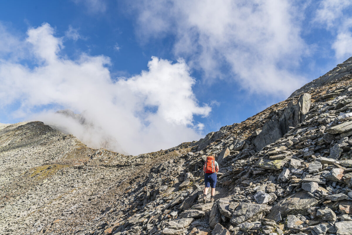
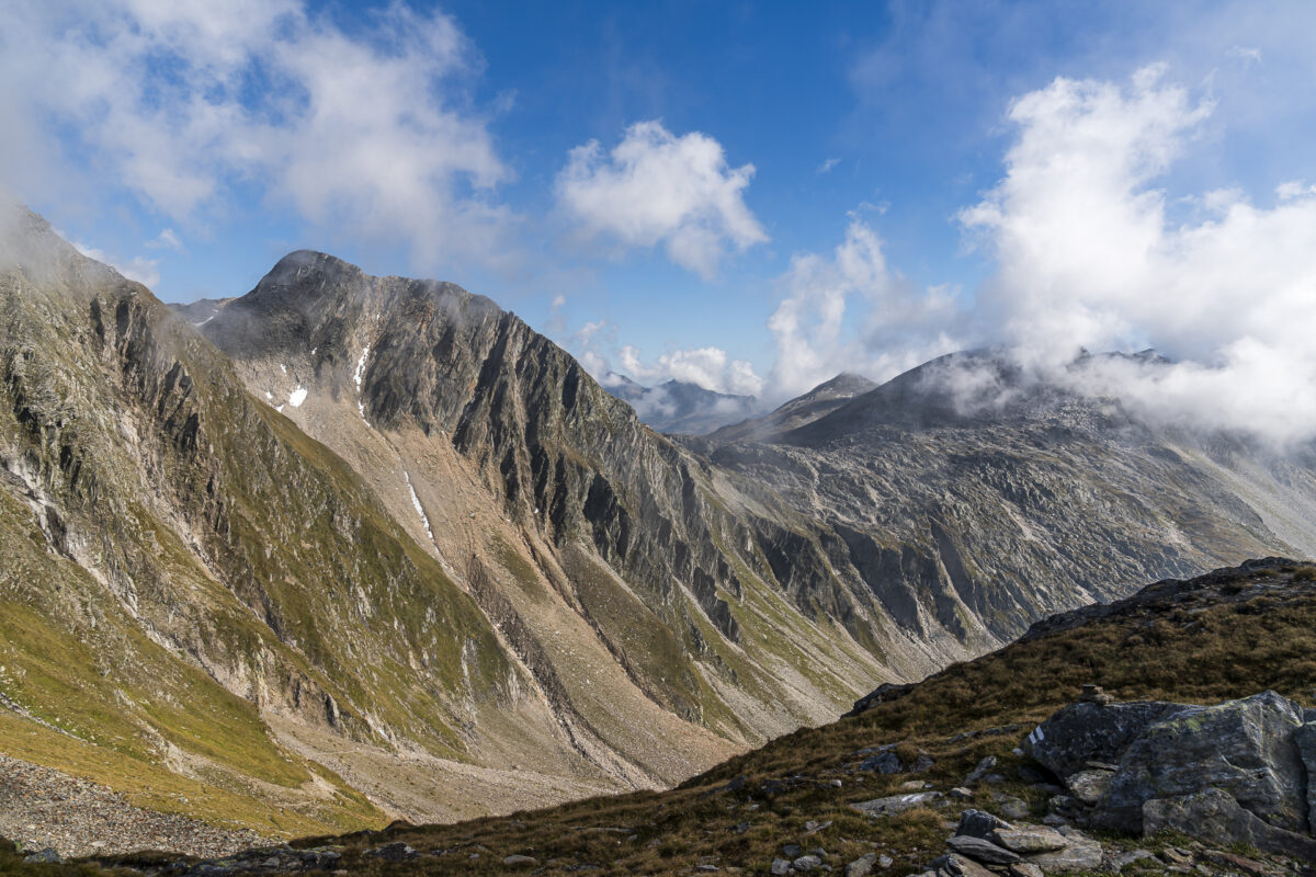
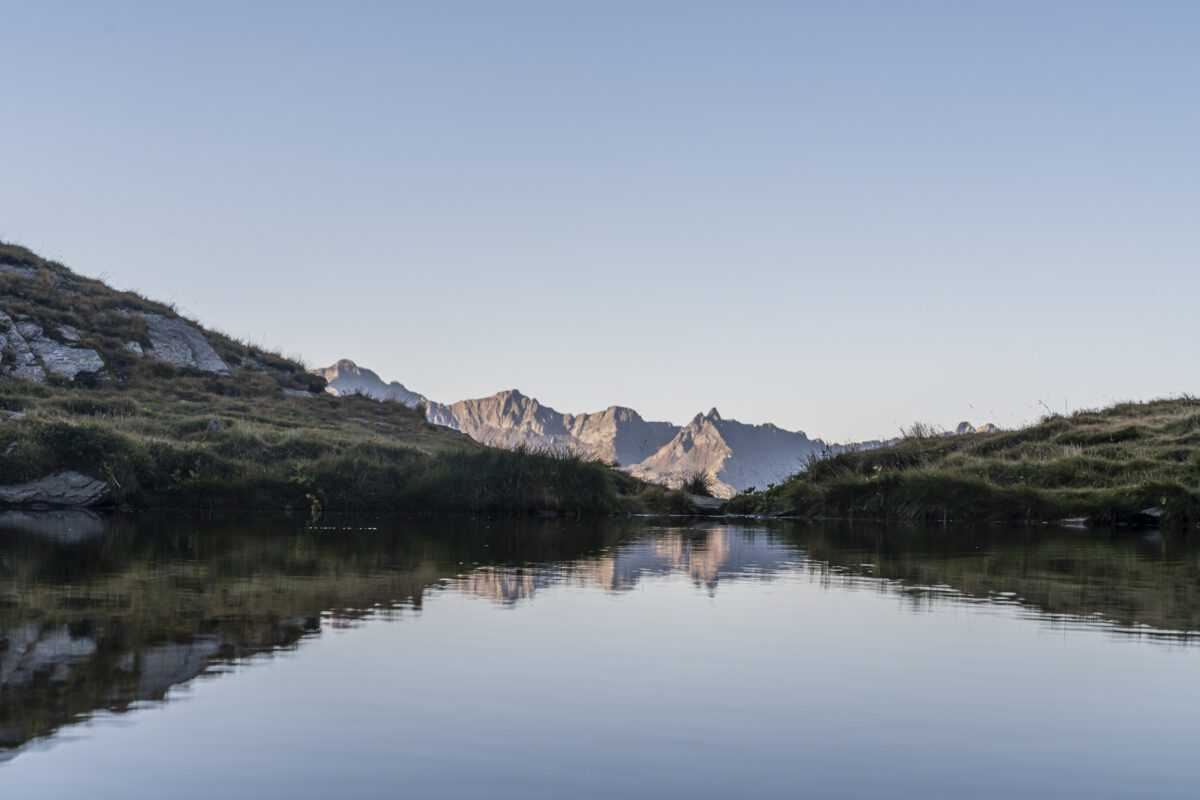
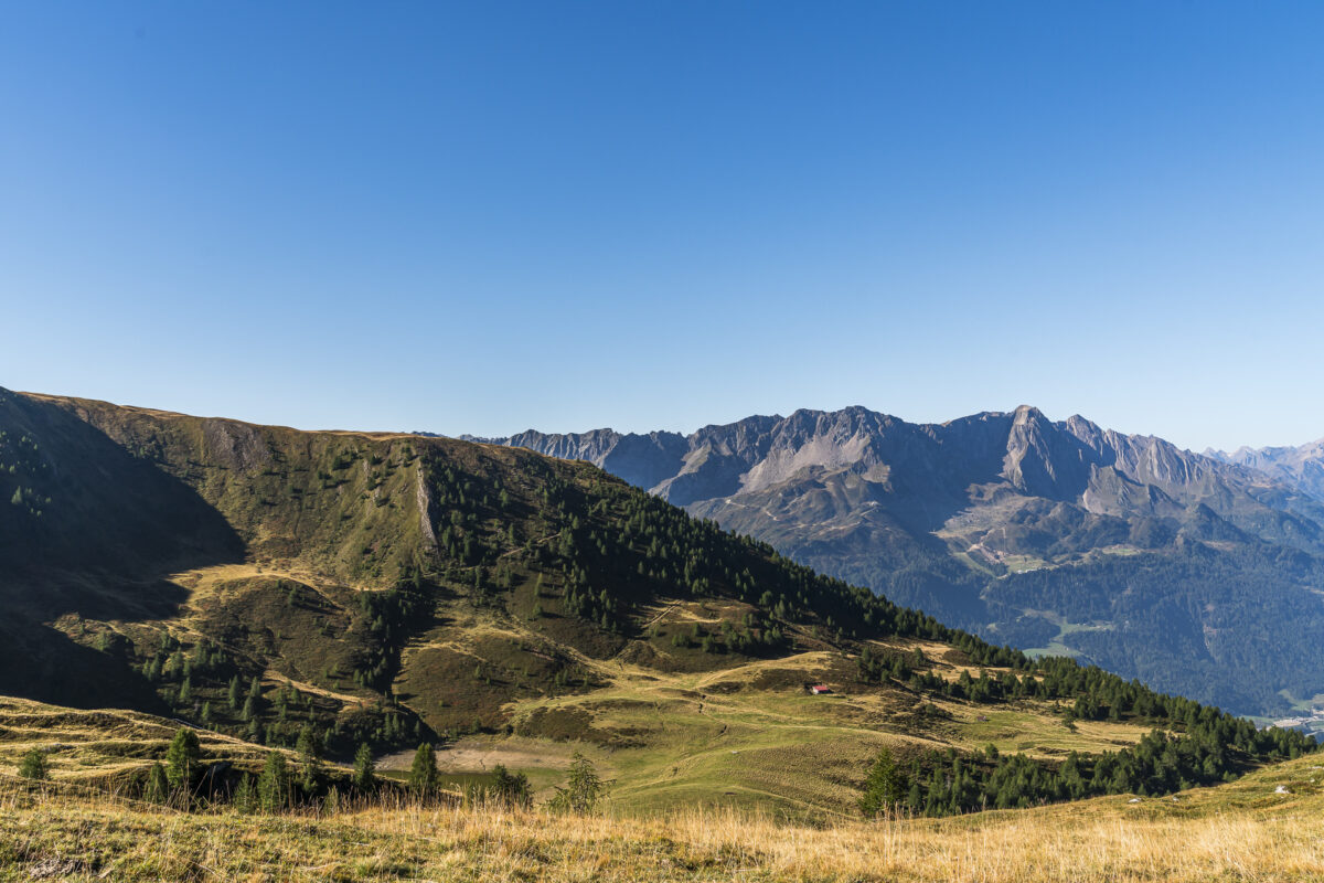
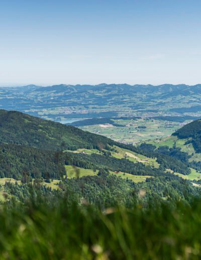
Now we follow a initially wide and then steadily narrowing gravel path further up the Val Maighels. It’s only a moderate climb up to the junction to the Maighels pass. But don’t get excited too soon – as soon as you leave the Four Sources Trail and climb up Passo Bornengo, you’ll really start to breathe. But the surrounding wild and barren mountain landscape easily makes up for this. This vastness, the watercourses and lakes shimmering in various shades of blue, as well as the fascinating rock formations – magnificent!
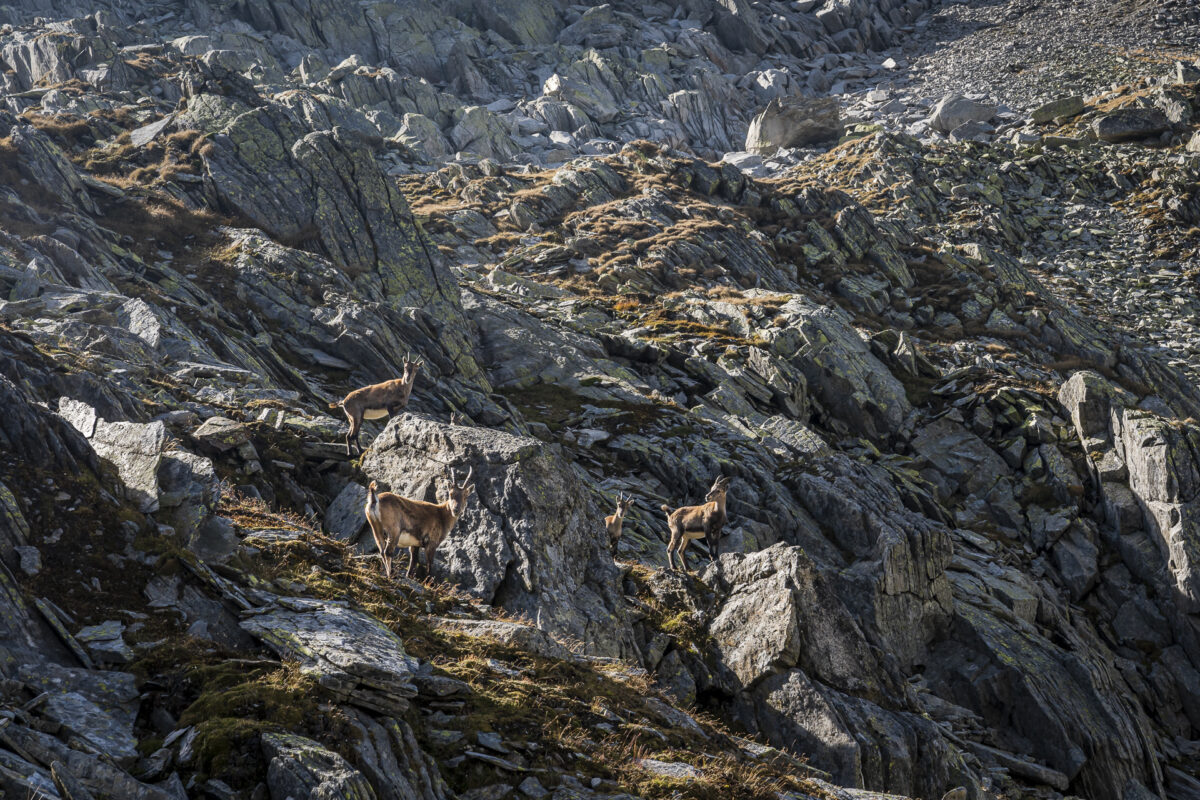
Mein absolutes Highlight ist aber das Aufeinandertreffen mit einer Gruppe junger Steinböcke.
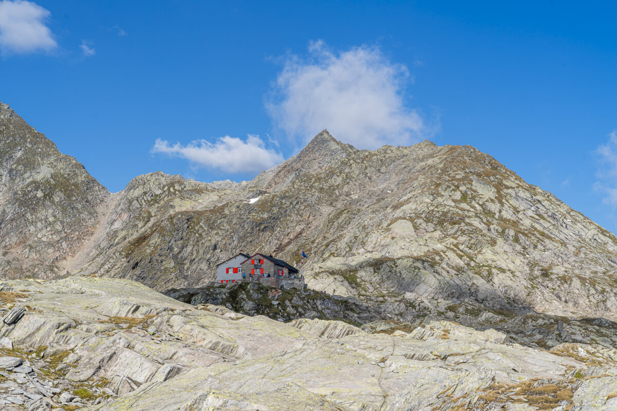
Once we reach the top of the pass, we spot our destination for the day – the Cadlimohütte – on the opposite side of the valley. Unfortunately, we don’t benefit from the altitude, but first have to descend 300 meters over rocky terrain. This essentially gives you the “shot” for the (really tough) final climb to the Cadlimohütte. It’s worth preparing mentally for this route – I admit: I struggled quite a bit here.
Key details of the hike Oberalppass – Passo Bornengo – Cadlimohütte
You can see the route of our hike from the Oberalp Pass to the Cadlimohütte on the following hiking map. We followed the most direct mountain hiking trail (white-red-white markings, T2/T3). Alternatively, you can also follow the route of the Vier-Quellen-Weg< up to Maighelshütte follow. If you choose this route, you will also pass Lake Toma – but you also have to allow for + 170 meters in altitude and approx. + 45 minutes of hiking time.
People who are free from giddiness, sure-footed and experienced in alpine terrain can choose from a white-blue-white marked ridge path as a further option from the Passo Bornengo. This is classified as a T5 on the SAC hiking scale (challenging alpine hiking with occasional, easy climbing areas). On this route you would pass two more mountain lakes. This path seemed a bit too challenging for us, both technically and physically.
| Starting point | Oberalppass train station (2,040 m above sea level)< /td> |
| Accessibility | Starting point accessible by public transport |
| Length | 13 .3 kilometers |
| Altitude | ↗ 1,000 m ↘ 474 m |
| Duration | 4:45 h |
| Destination | Cadlimohütte (2,570 m above sea level) |
| Refreshment option | Maighelshütte (approx. + 15 minutes walk, as not directly on the path) |
Day 2: from the Cadlimohütte to Airolo
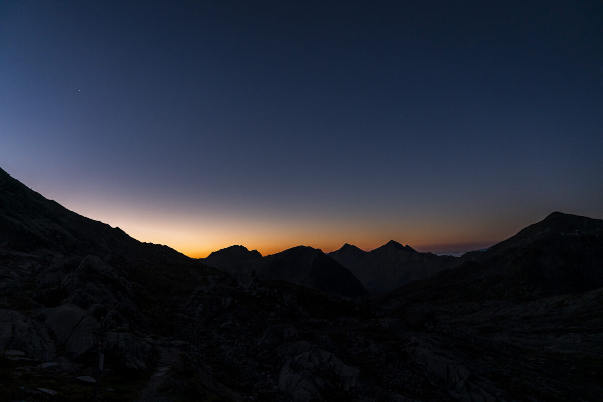
The next morning there is a hustle and bustle quite early (at least when compared to other huts that are also not high mountain huts). The prospect of seeing an ibex drives our roommates in the 8-piece group out of bed at dusk. The ibexes don’t show up this morning – but we are ready to leave at 7:00 a.m.
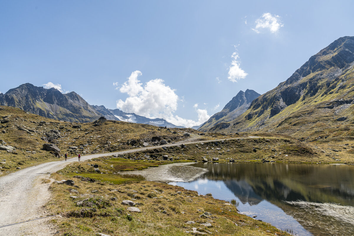
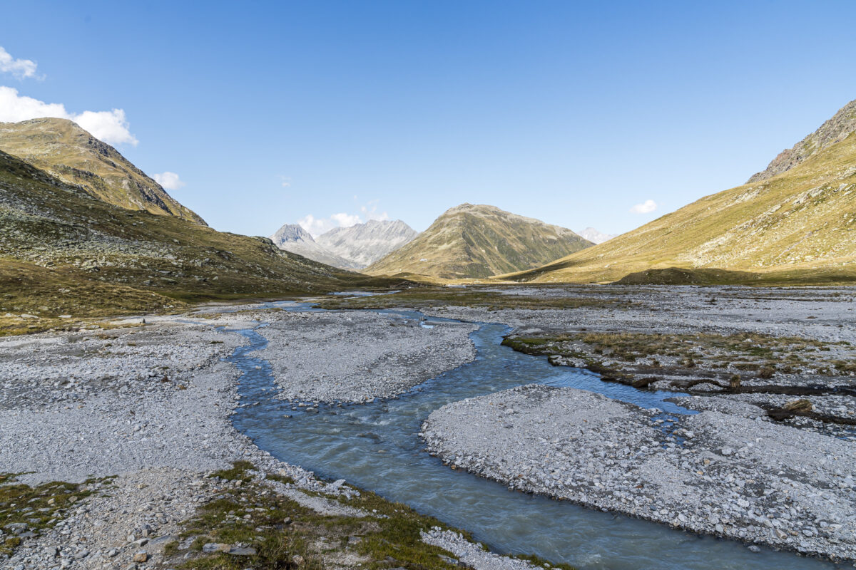
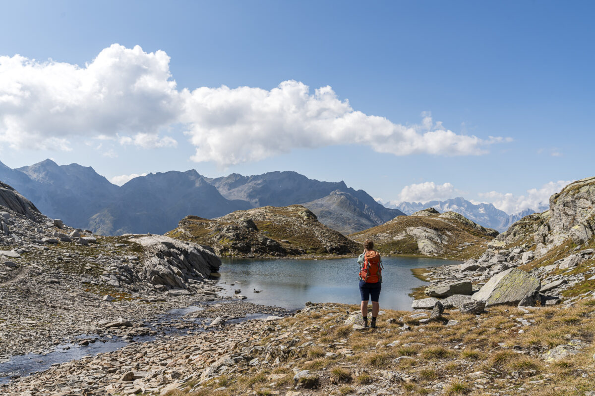
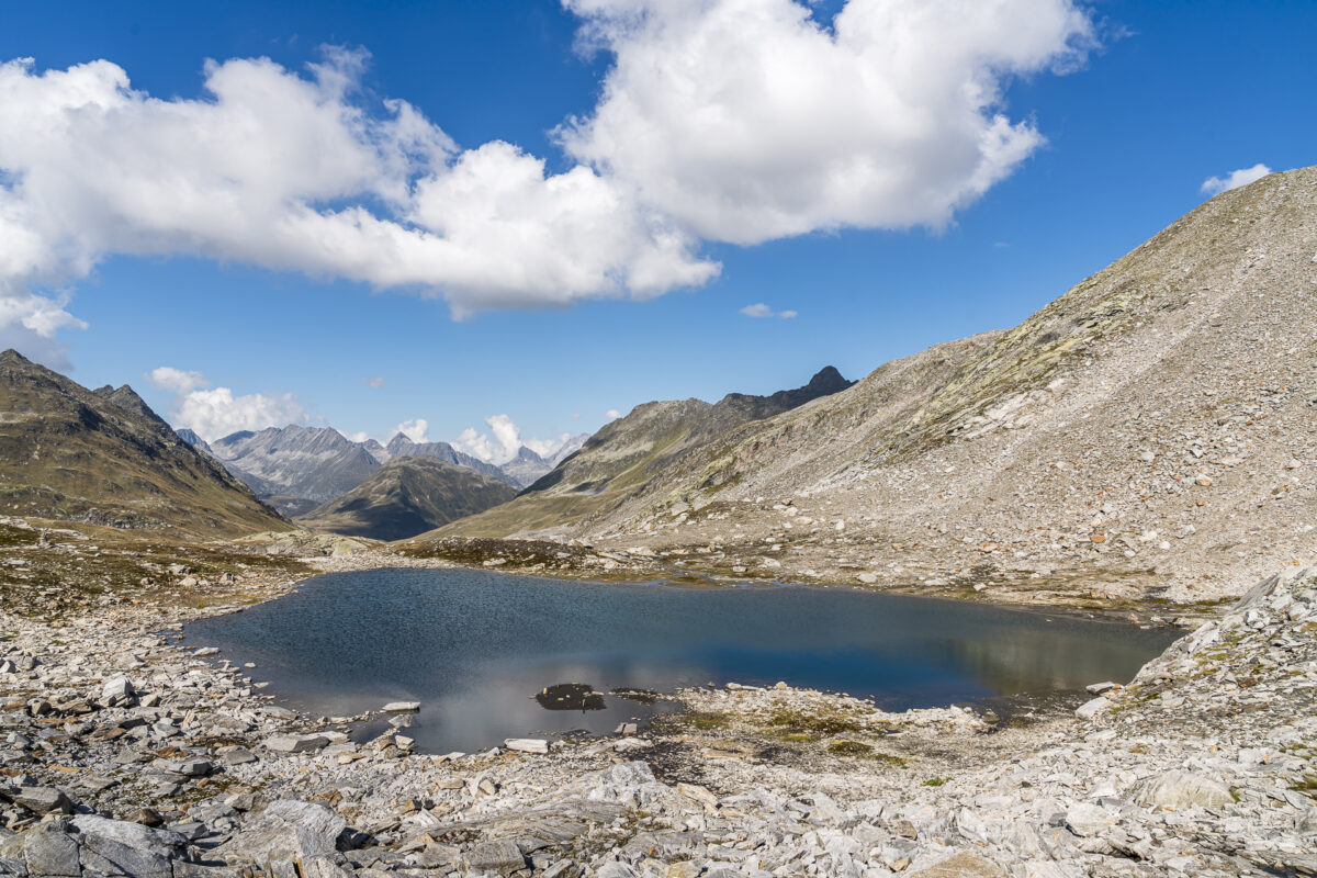
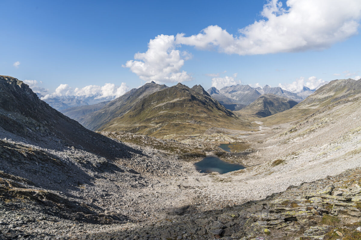
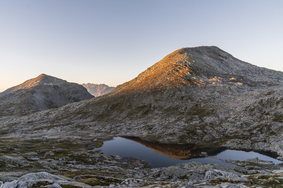
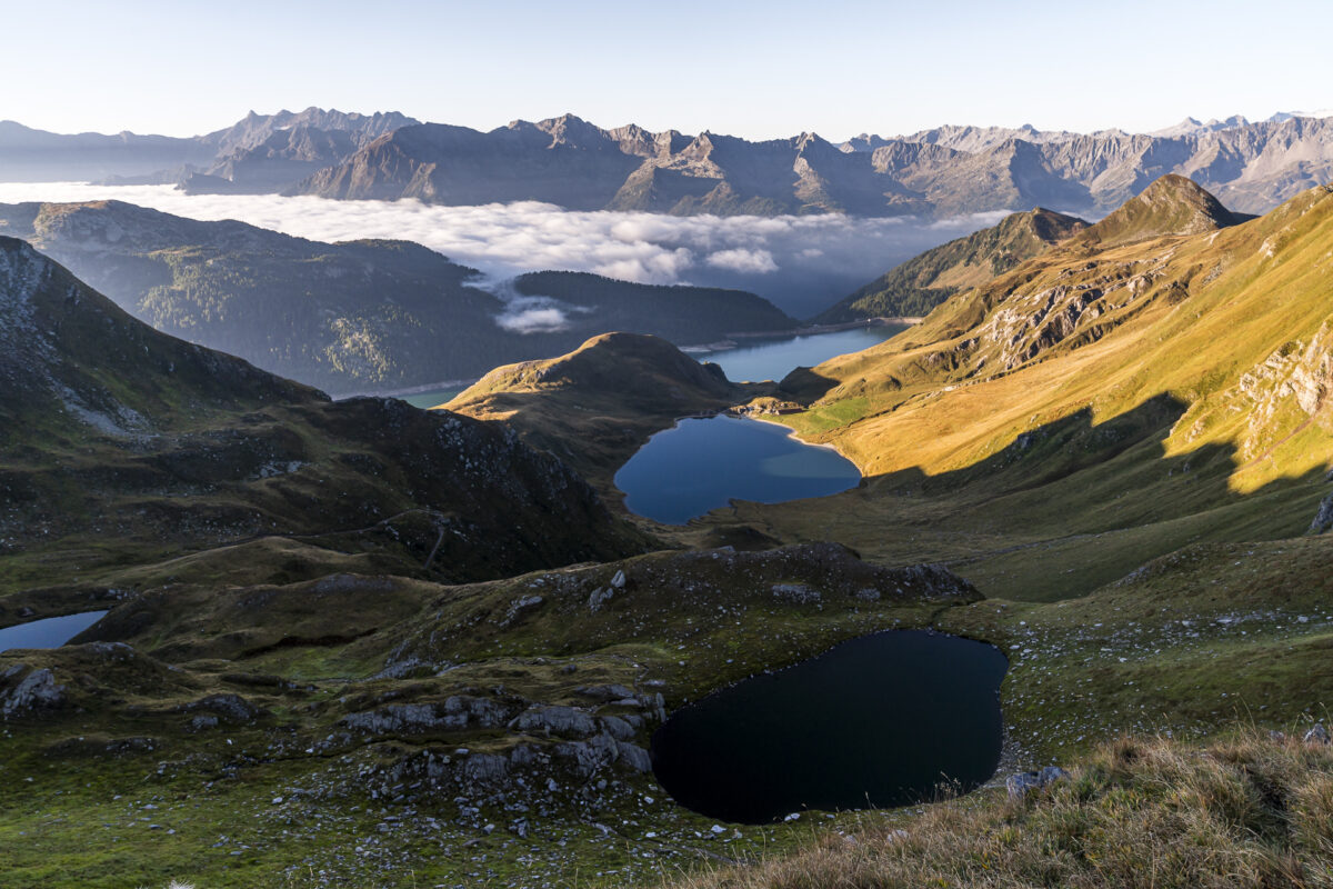
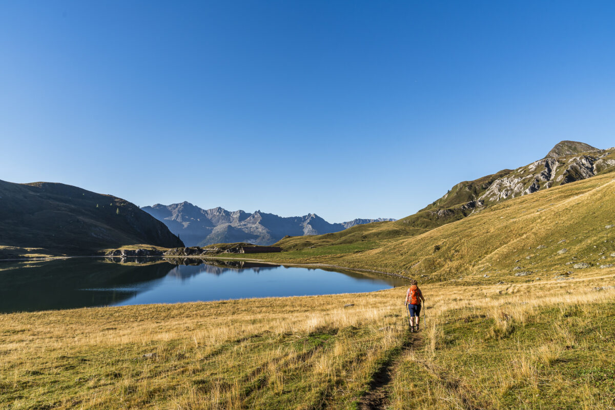
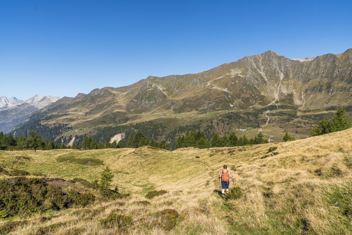
The most beautiful section of this tour awaits us – through the picturesque lake landscape over the Bassa del Lago Scuro to Lago di Tom. A dream! A wonderful backdrop that presents itself differently at every time of the day. Now in the early morning the lakes lie before us, shimmering darkly and as smooth as glass. The majestic panorama accompanies us on the approximately 1.5-hour descent to Alpe Tom.
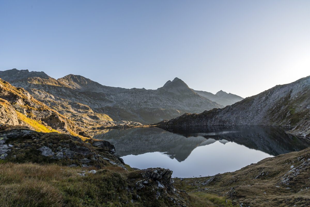
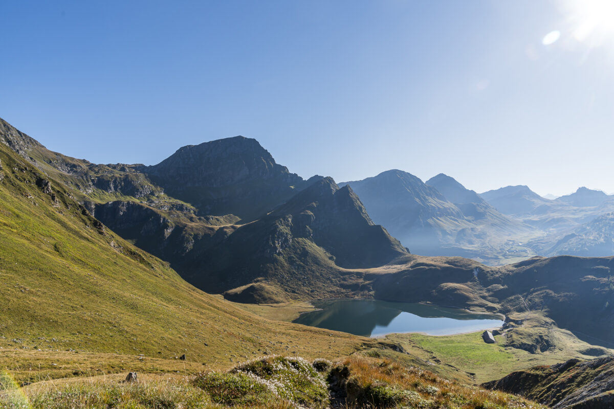
Here most people follow the hiking trail towards Ritom/Piora. It would still take about an hour to reach the top station of the funicular. Instead, we climb another 240 meters to the Bocchetta del Camogè. The path is not that easy to find – so keep a close eye out for the path markings. We are rewarded with another panoramic view of Lago di Tom.
The somewhat unclear route continues on the descent to Alpe di Lago. Markings are only present sporadically, and we orientate ourselves as we see fit along the path marked on the swisstopo map. In my Komoot profile you can track the exact route. At the latest from the “2’030” marker (near the Alphütte) everything is clearly signposted again.
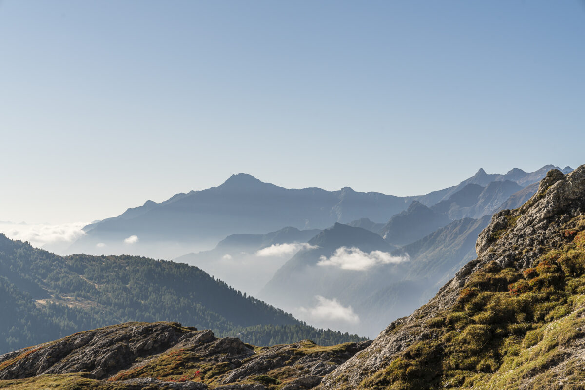
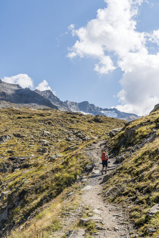
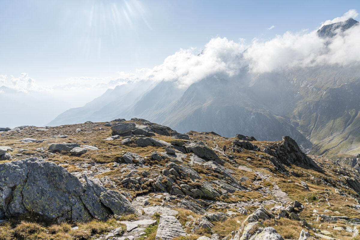
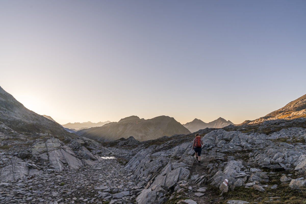
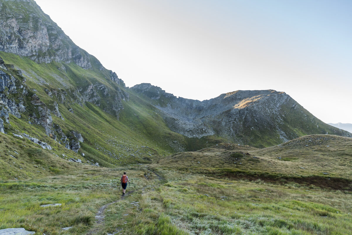
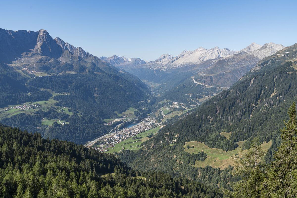
For the further descent we now dive into the forest. Fortunately! Although it’s not even midday yet, the sun is already shining mercilessly hot again from the cloudless sky. Things are now continually going downhill. However, the narrow forest paths are quite pleasant to walk and are largely in the shade. Shortly before midday, our destination – Airolo train station – is in sight. And thanks to the early hiking start, we make it onto the train before 12:00 p.m. I would think that this is a really efficiently divided two-day hike.
Our conclusion: Anyone who loves mountain lakes and is not afraid of tough climbs and descents will not be disappointed. My favorite scenic tour of this year’s mountain summer.
Key details of the hike Cadlimohütte – Bocchetta del Camoghè – Airolo
You can see the route of our hike from the Cadlimohütte to Airolo train station on the following hiking map. It is a white-red-white marked mountain hiking trail (T2/T3 – in the top section there are two or three places where you have to use your hands). The last section from Madrano to Airolo train station takes a long time. It looks quite short on the map, but when planning your time, keep in mind that you will need another thirty minutes for this route.
| Starting point | Cadlimohütte (2,570 m above sea level) |
| Accessibility | Destination accessible by public transport |
| Length | 14, 3 kilometers |
| Altitude | ↗ 411 m ↘ 1,838 m |
| Duration | 5:00 h |
| Destination | Airolo train station (1,142 m above sea level) |
| Refreshments available | During the Alpine summer you can get drinks & Alpine products |
Praktische Tipps für deine Zweitageswanderung zur Cadlimohütte
- The Cadlimohütte is manned from the end of June to mid-October. If conditions are good, there may be an extension to the season on weekends. You can find current information on the Cadlimohütte website.
- The overnight price for non-members is 84 CHF (including half board). Members pay 72 CHF. The hut can be booked via the alpsonline.org reservation tool.
- There are four 4-bed rooms. Anyone who books this pays a surcharge of 5 CHF per person/night. There is also another 4-bed room reserved for dog owners (“special room”). The costs for this are + 5 CHF per dog and + 5 CHF 4-bed room supplement.
- Right next to the hut there is a small swimming lake where you can refresh yourself briefly after the hike.
- Please note that the Cadlimohütte is located at an altitude of over 2,500 meters above sea level. The snow stays here longer and new snow can quickly fall here again in autumn. In general, you should consult the weather forecasts before the tour.
Other recommended hikes in the region
The following are a few alternative hiking tips in the region:
- From the Oberalp Pass you can take a beautiful circular hike to the source of the Rhine at Lake Toma (approx. 11 km / 590 m uphill / 3.5 h walking time). This follows the Four Springs Trail and then leads back to Maighelshütte via the route described here.
- The 5 Lakes hike on the Gotthard Pass (you can find a route description in the second part of this blog post)
- The Nepali Highway from the Furka Pass to Andermatt< /li>
- From Lukmanier Pass through Val Piora to Airolo
- On the Sentiero Cristallina from the Leventina to the Maggia Valley
Leave a Reply