

On the European Trail to Zermatt: multi-day hike between four-thousanders
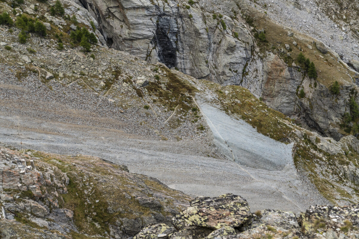
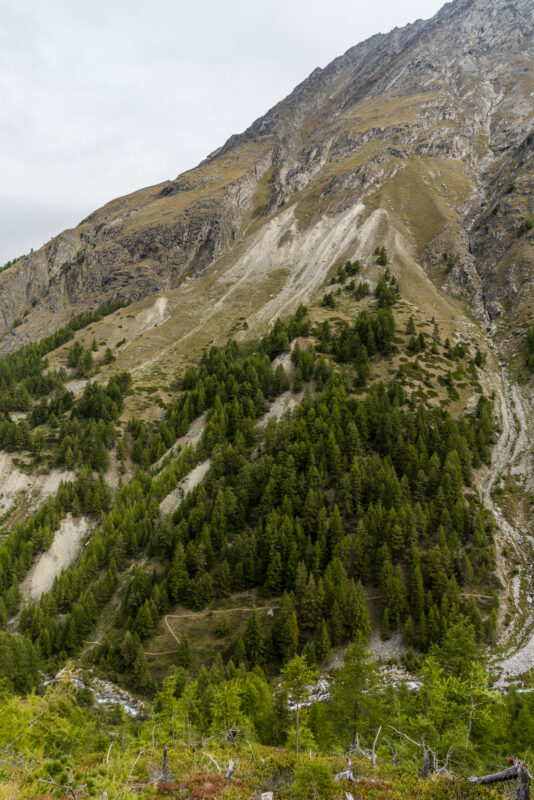
It is a hike of superlatives – measured by the difference in altitude between the highest point of a mountain peak and the lowest point of the valley floor, the Europaweg between Grächen and Zermatt leads through the “deepest valley in Switzerland”, over the longest suspension bridge in the world and offers an unobstructed view of the Swiss mountain icon par excellence – the Matterhorn – halfway along the route. So it’s no wonder that the Europe Trail is a hot contender for the title of the most beautiful multi-day hikes in Switzerland. At the same time, the ever-changing terrain at the foot of fragile four-thousand-metre peaks presents a number of challenges for both trail maintenance and trail conquerors.
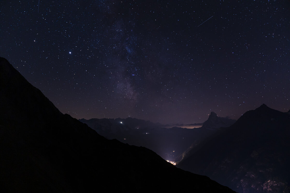
In September, we took a close look at two stages and brought you not only beautiful impressions, but also an insider tip for overnight stays. Because if you spend the night in the famous Europahütte, you miss out on the real highlight of the Europaweg – the starry sky above the Matterhorn.
If you want to skip my impressions of the tour and study the hard facts as well as the hiking map of the 2-day hike along the Europaweg – then click here: to the practical tips
Hike from Randa on the legendary Europe Trail
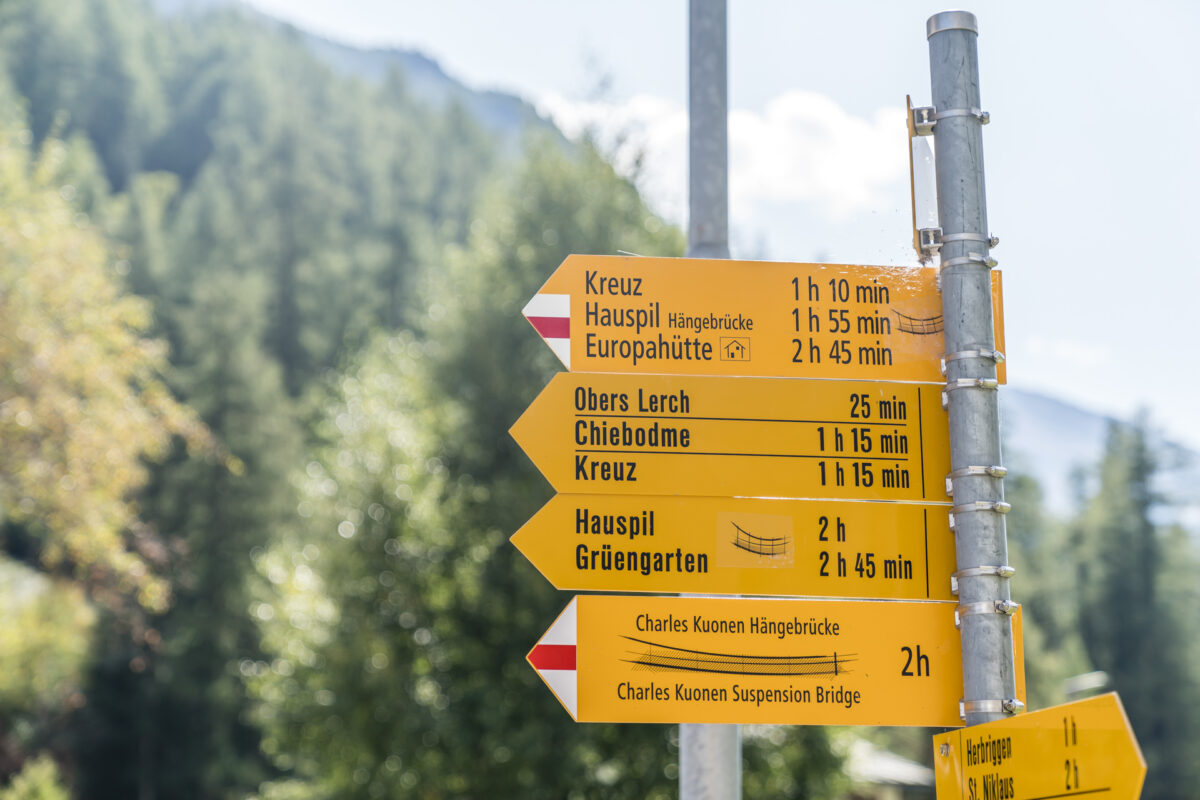
Actually, the Europaweg starts in Grächen and leads from there high above the valley floor via Europahütte and Täschalp to Zermatt. However, due to the risk of falling rocks, a section of the first stage has been closed for a long time and the diversion leads from Flüewald via Mattsand down to Herbriggen and from there back up to the Europa Bridge. There are some tough, additional meters of altitude. If you want to avoid them, you can start the hike further back in the valley and climb up to the Europaweg from there. Be it in Herbriggen or – as with our variant – in Randa.
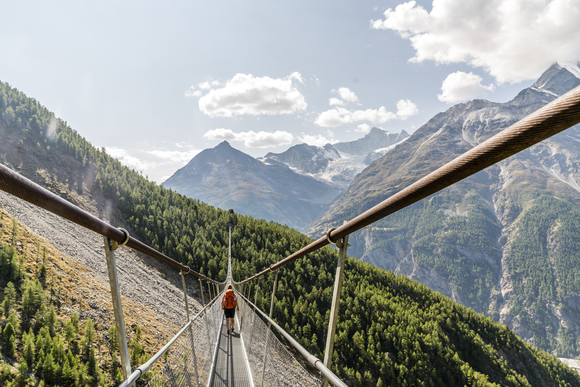
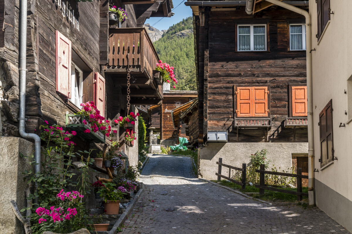
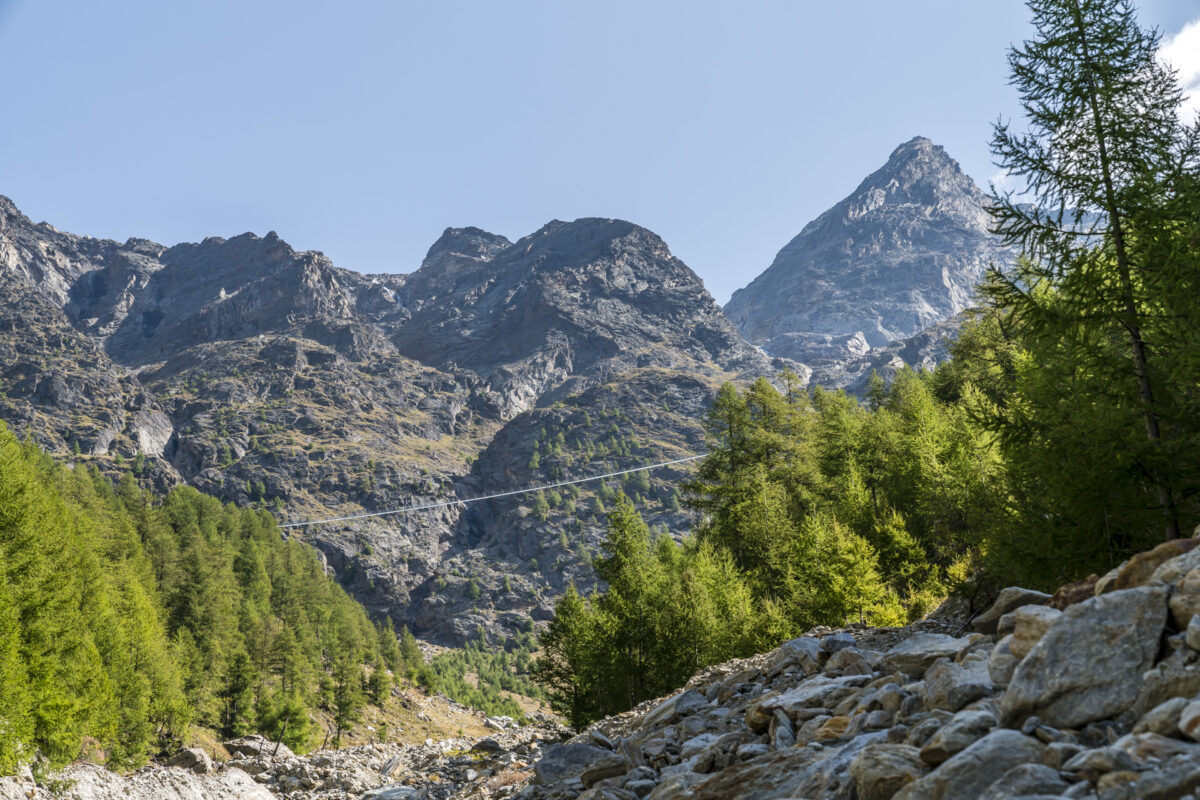
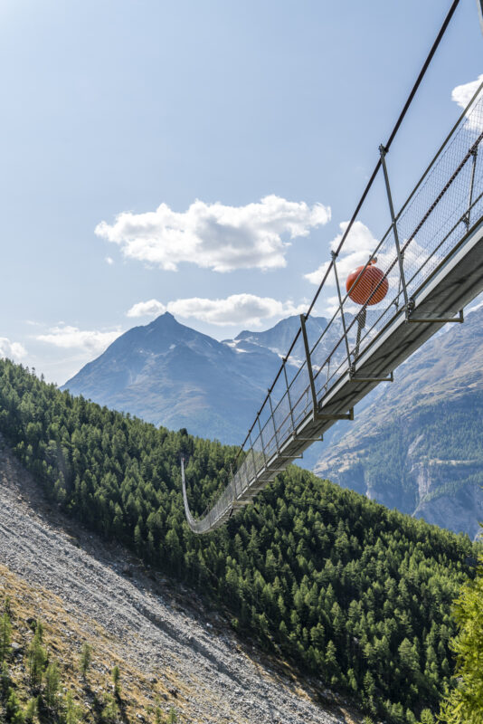
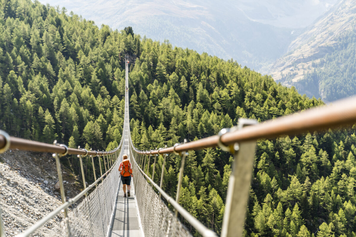
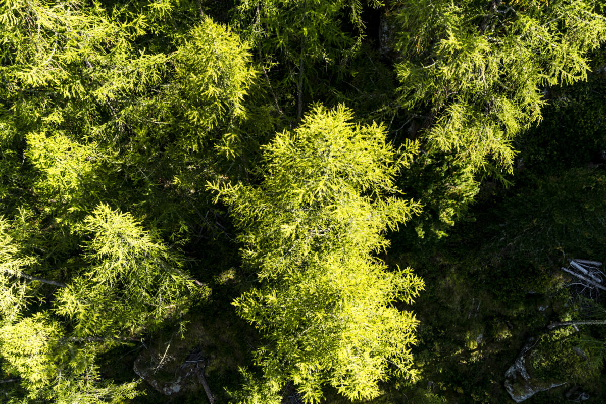
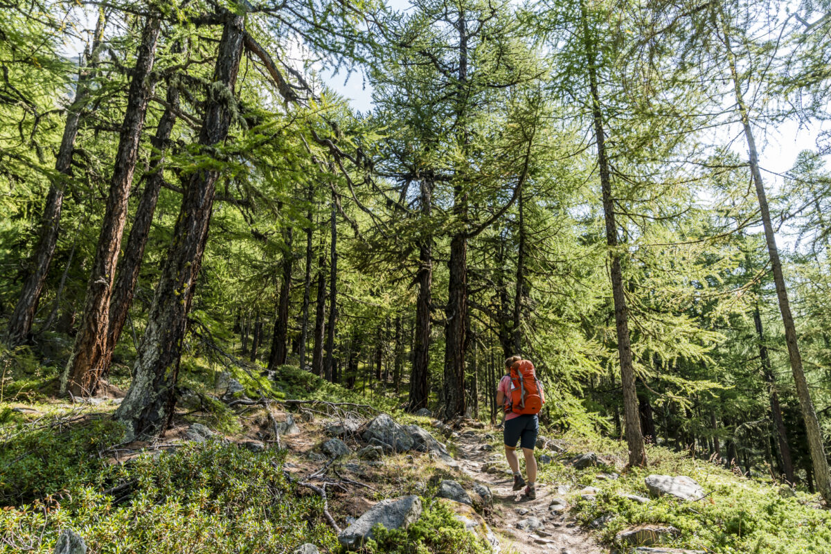
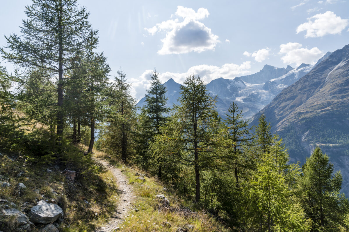
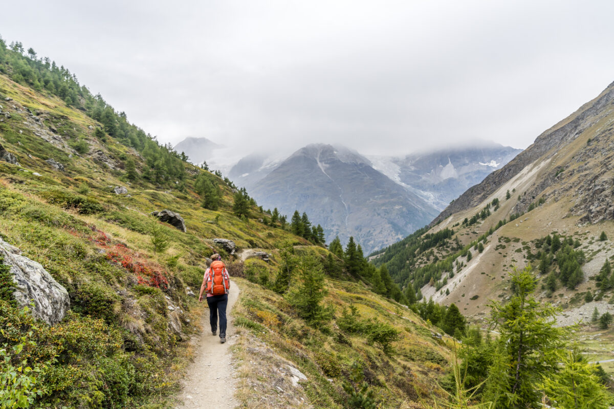
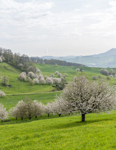
At Randa train station, we follow the signs for the Europahütte/Europabrücke past the sun-tanned chalets in the centre of the village until we reach the larch forest, which stretches along the valley flanks of the Matter Valley and covers it with a golden shimmer in the course of October. On the ascent, we keep to the left and do not follow the direct path to the Europa Bridge. This is because our destination for the day is to the right of the Europabrücke and we are therefore adapting our route to cross what is currently the longest suspension bridge in the world. I don’t just want to look at it from a distance, I also want to experience the lofty height.
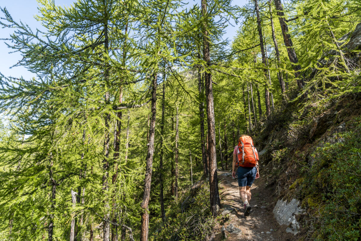
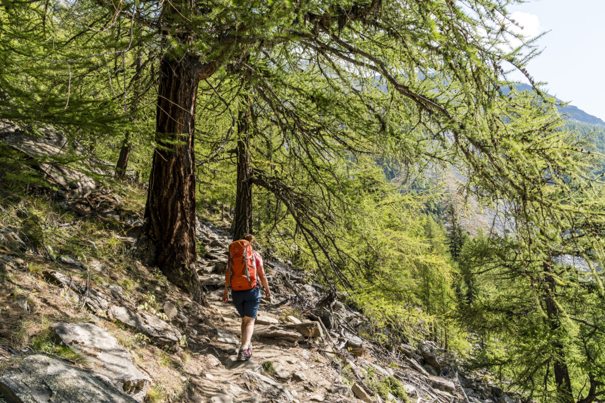
The ascent along the forest path is brisk – the path has a pleasant gradient ratio and also offers welcome shade almost throughout. Don’t be fooled by the early view of the suspension bridge. Even though this soon becomes apparent, it still takes a long time before we can set foot on the almost 500 m long suspension bridge.
Thrills on the longest suspension bridge in the world
The Charles Kuonen Suspension Bridge (as it is officially called) was opened in 2017 and has since become the longest pedestrian suspension bridge in the world with a length of an impressive 494 m. Previously, a bridge had already been inaugurated in 2010 – but it fell victim to a rockfall just two months after its opening.
The terrain at the foot of the Valais four-thousand-metre peaks should definitely not be underestimated. At various points along the way, the danger of falling rocks is pointed out. Thanks to the new suspension bridge, however, we can at least cross this ravine out of reach of the loose rock – at lofty heights. And even though I start marching at a brisk pace, in the middle of the bridge I get a sinking feeling for a short moment. “Wow, it’s really long!” Yes, it is – and therefore also a real highlight on the Europe Trail.
Übernachtungsgeheimtipp am Europaweg
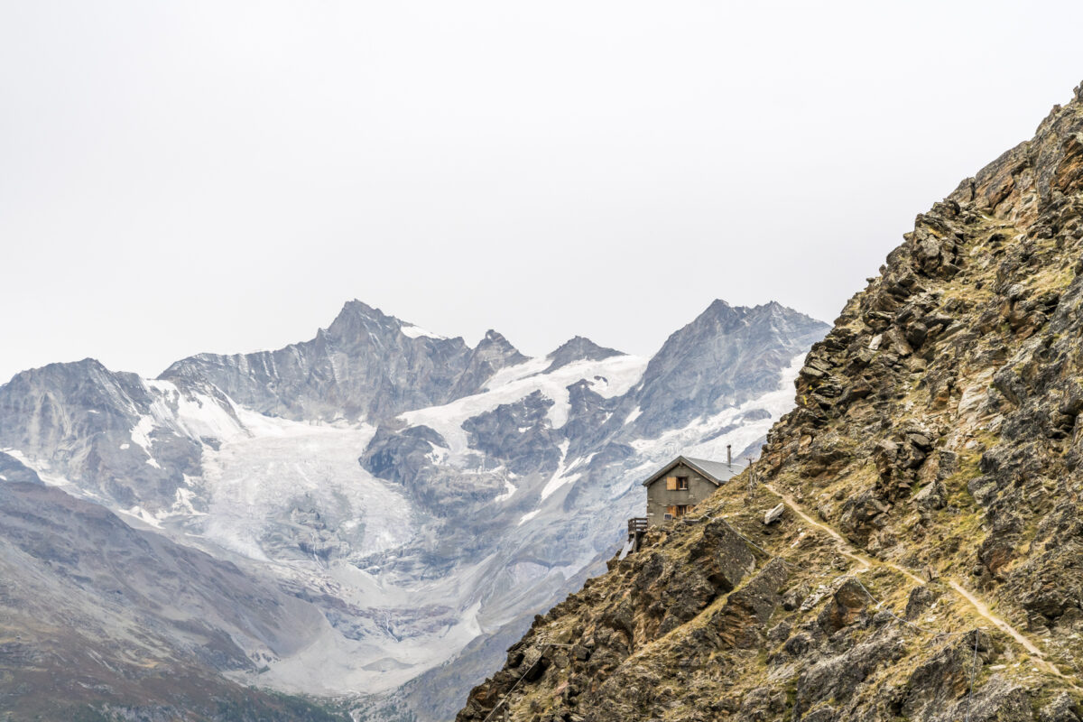
Most long-distance hikers plan their stopover on the Europaweg at the Europahütte. This SAC hut is located about a 30-minute walk above the Charles Kuonen Suspension Bridge. The Europahütte is practically located on the path and also offers an impressive view of the Weisshorn, but the view of the Matterhorn is denied here.
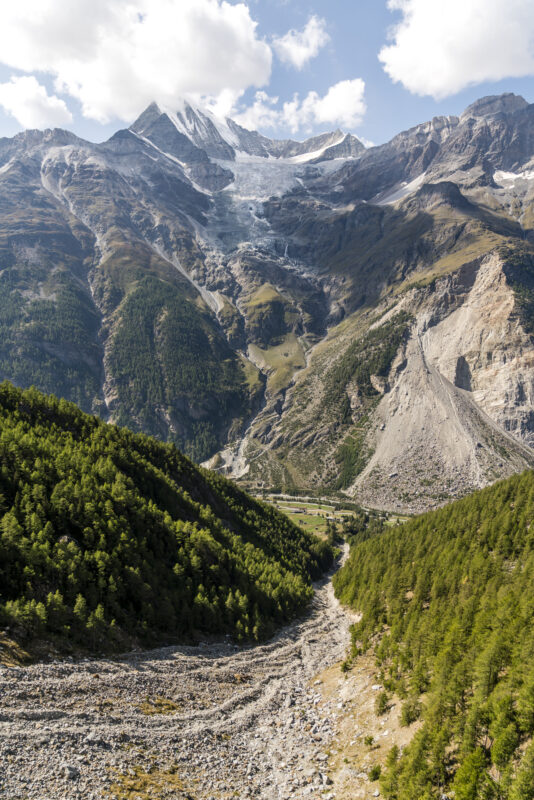
The Kinhütte, which is located 300 metres higher, can score points with this. This is located about 1.5 hours from the Europabrücke (in the direction of Zermatt) at 2,584 metres above sea level at the foot of the Täschhorn. The ascent requires perseverance (and also a bit of hard-boiledness when it comes to downhill games), but the effort pays off.

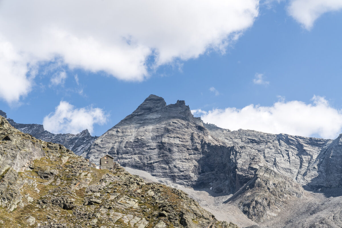
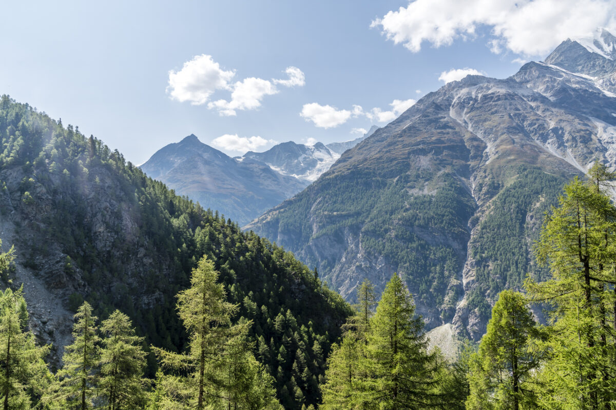
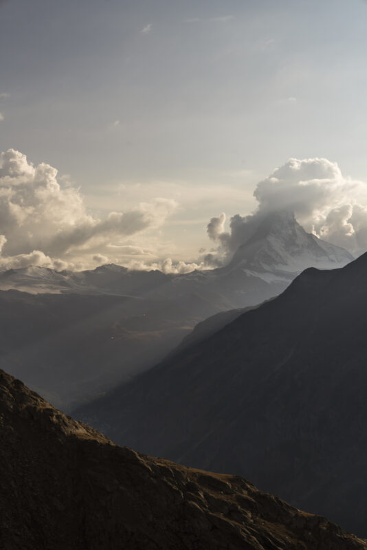
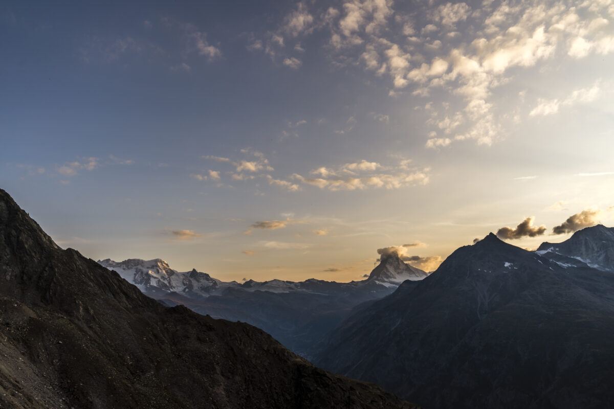
Once you have reached the hut, which is enthroned like an eagle’s nest on a small rocky outcrop below the highest peaks of the Swiss Alps, a phenomenal panoramic view opens up from the Weisshorn over the Zinalrothorn and Gabelhorn to the Matterhorn and the Monta Rosa massif.
Since the Kinhütte is a privately run hut (not a SAC member) and many people find the additional ascent on the map too arduous, you can often find a free spot here even on otherwise well-booked weekends. And even though I didn’t expect a big crowd, I am surprised when I realize that there are only four of us at the hut on this Friday evening. A nice side effect: Thanks to the privately used dormitory, sleeping comfort is not neglected.
Continue via Täschalp to Zermatt
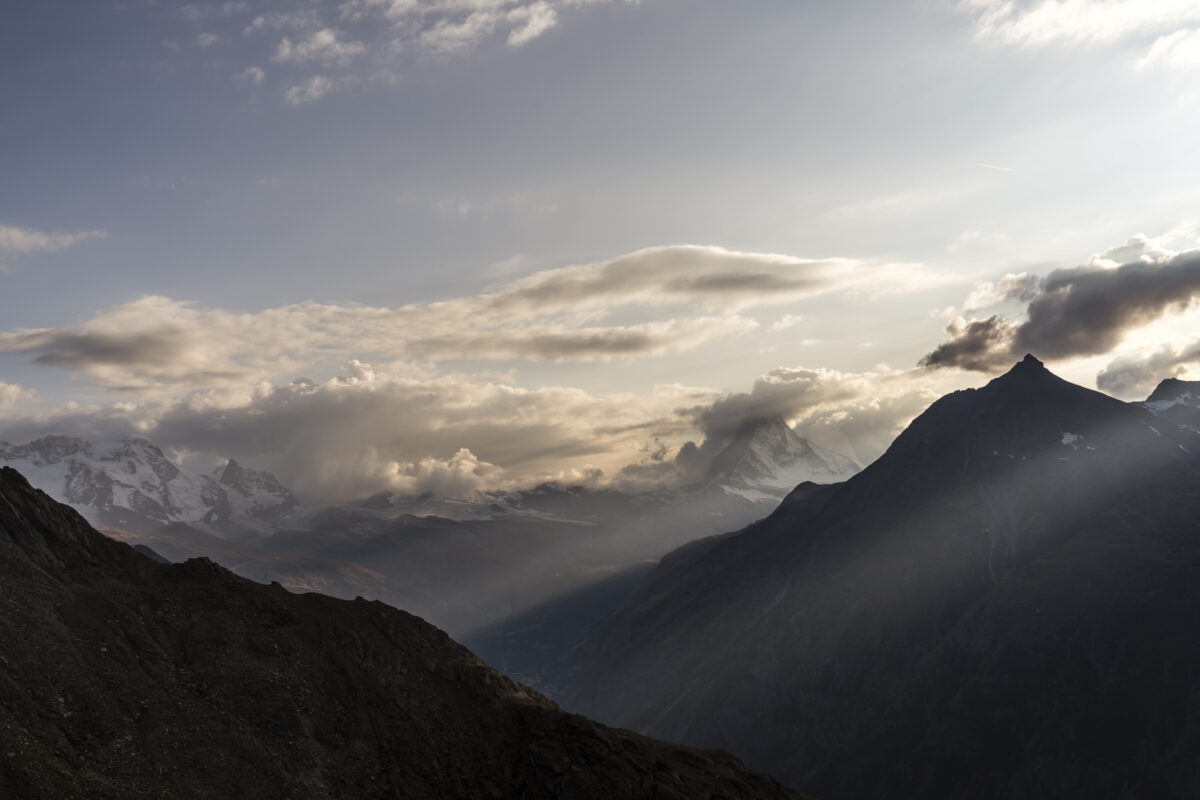
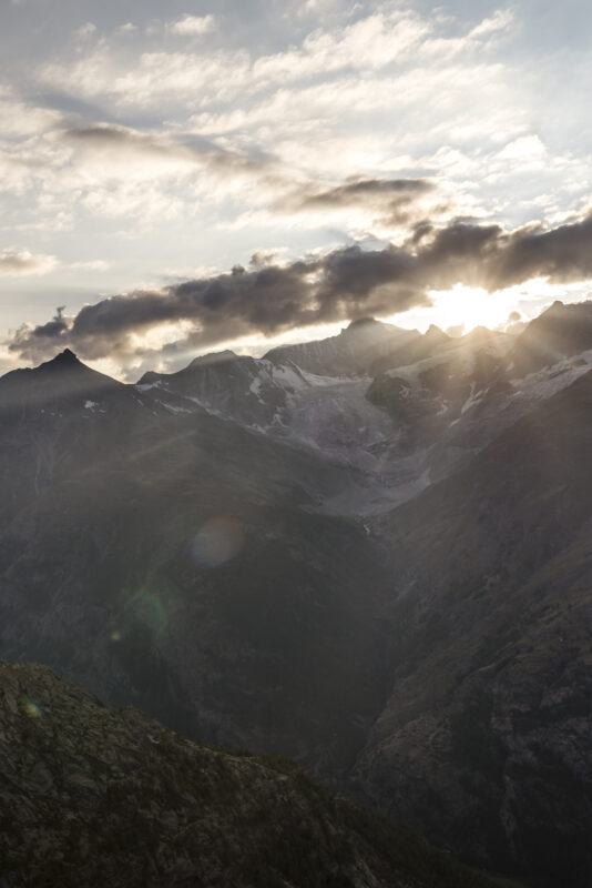
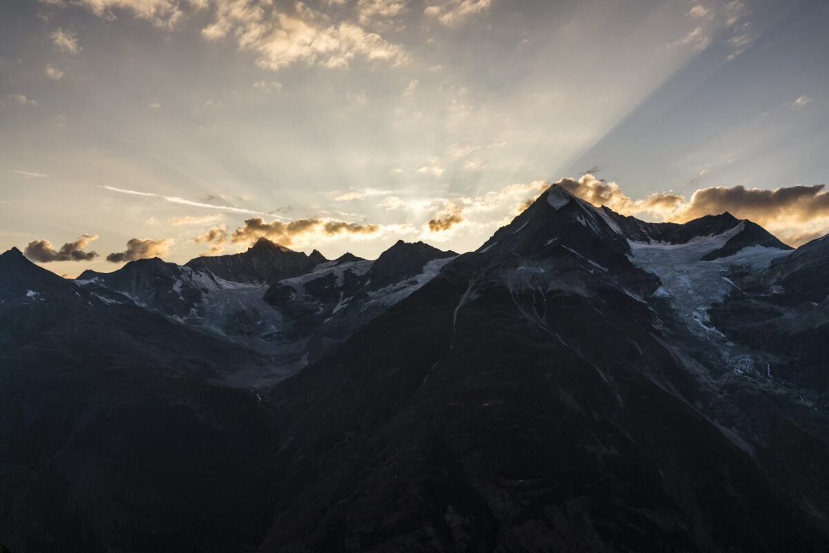
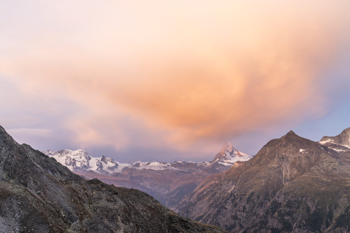
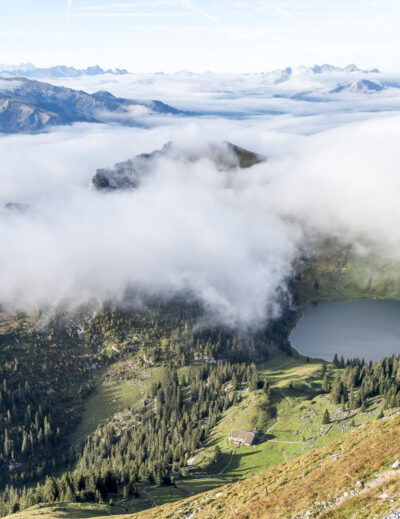
A change in the weather is announced for the second day of hiking. It was unclear in advance when the clouds would come up. We are lucky and at the start of the day we are allowed to admire the impressive mountain panorama around the Kinhütte – including a spectacle of colours. After that, the sky quickly closes in and when we shoulder our backpacks and start marching, there is not much left to see of the Matterhorn.
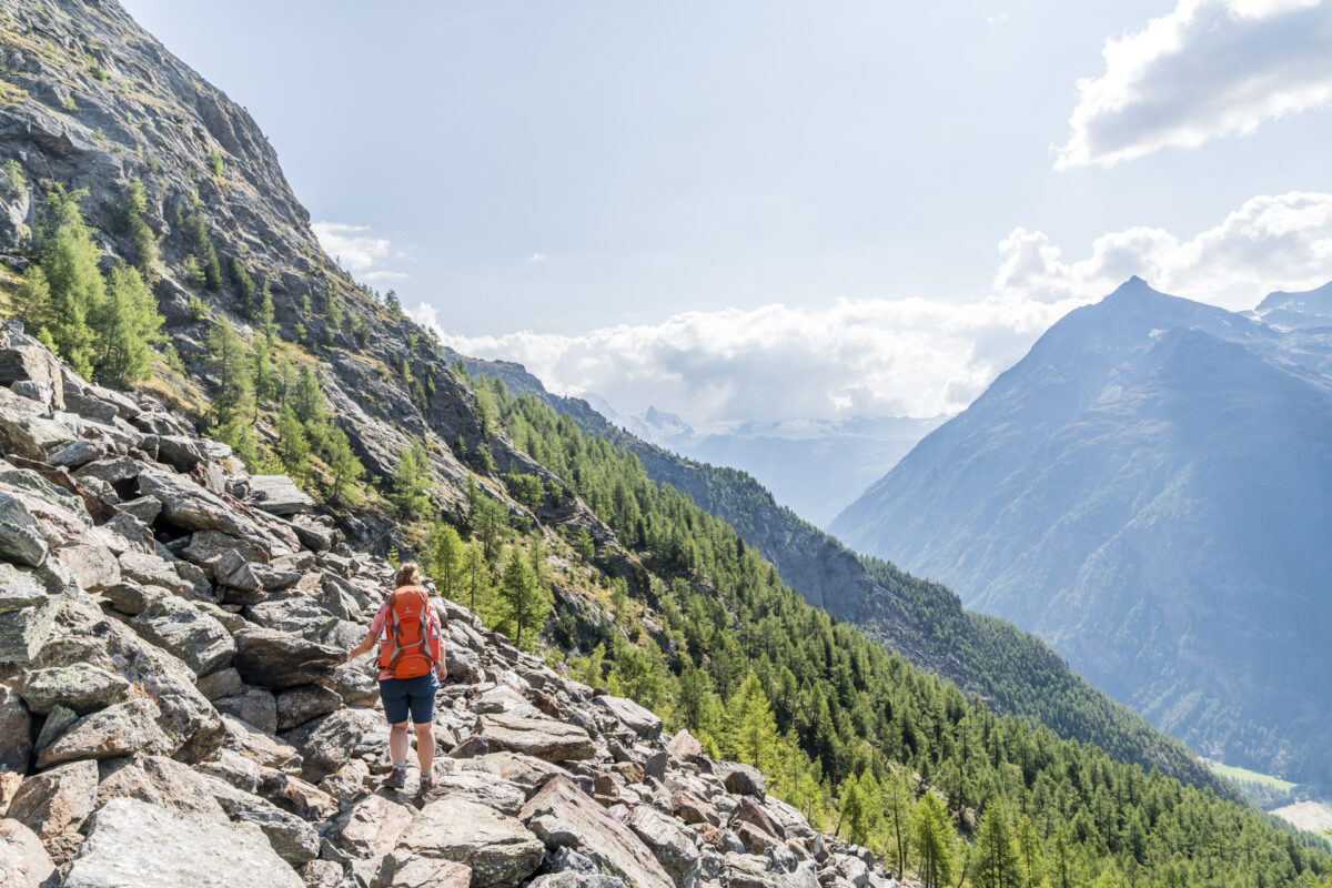
But we spot a group of ibexes far below us on the Edelweissweg, which leads from the Europaweg in a steep zigzag up to the Kinhütte. These can often be found in the rocky terrain around the hut, as hut warden Andreas Arnold told us the evening before. It is therefore worthwhile to pack binoculars and – if available – the telephoto zoom. Unfortunately, we had left ours at home and are content to observe the animals from a distance.
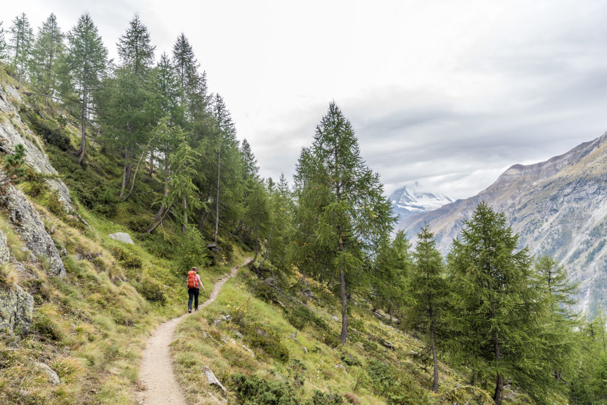
After a 45-minute descent, we are back on the Europaweg and follow the signs to Zermatt. When the weather is nice, the Matterhorn accompanies you almost every step of the way – which is one of the reasons why you should always complete the Europaweg in the direction of Zermatt and not in the opposite direction. But even on cloudy days, the varied route has its charm. On the Täschalp, it’s also worth stopping off at the “Täschalp Restaurant & Lodge” – the apricot cake tasted excellent here!

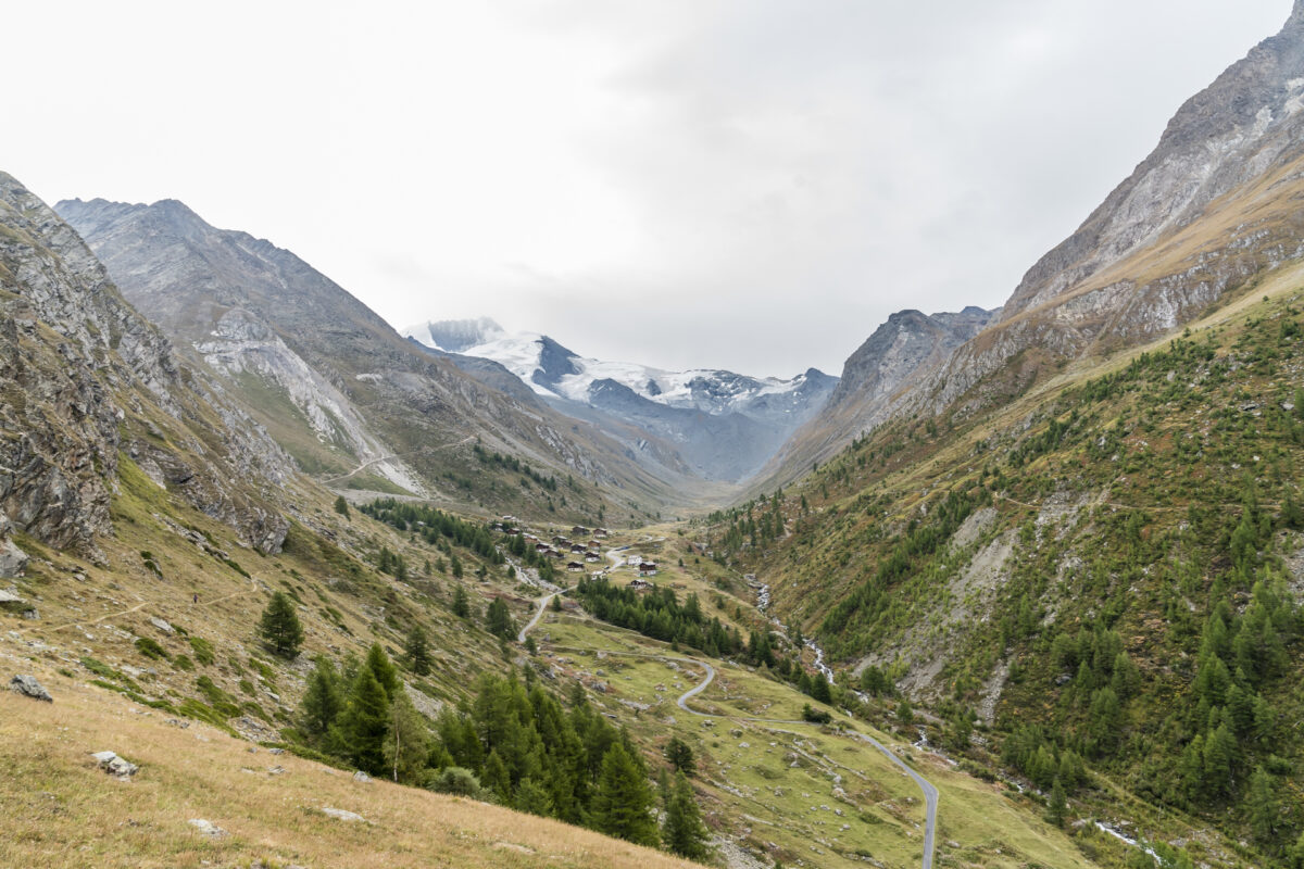
From the Täschalp to the Tufternalp (“Tuftra”) above Zermatt, another 1.5 to two hours of walking time have to be calculated. In this section, the path leads very pleasantly with a few ascents as a high-altitude trail into the valley. Since the Europaweg is signposted as both a hiking trail and a bike trail from the level of “Wenige”, you should be prepared to cross with bikers. The trail tolerance actually works quite well on this route. However, since most bikers are on the way downhill (and thus come towards us), it is automatically implied that we step to the side, which, depending on the number of bikers (and especially with larger groups), becomes a bit tedious over time. However, this certainly varies depending on the time of day and weather conditions.
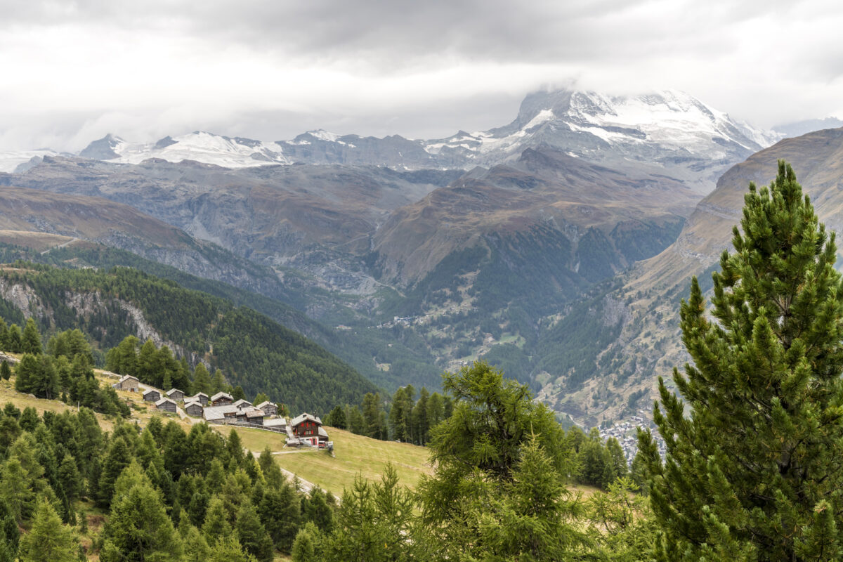
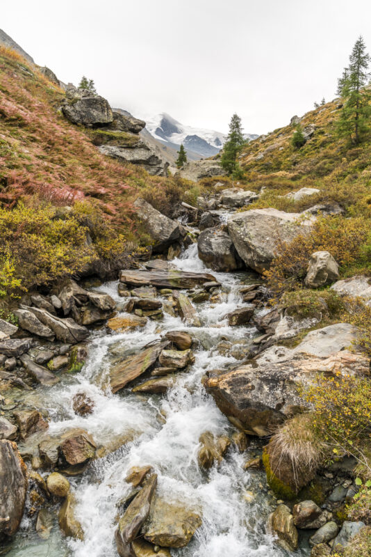
At the Tufterenalp there is another place to stop for refreshments. From here you can either hike to the Sunnegga mountain station in 30 minutes or descend directly to the village centre of Zermatt in just over an hour. We opt for the latter and follow the signposted hiking trail through the sparse larch forest down to Zermatt. Even though the weather was not great on this second day, this did not spoil the hiking experience – the Europaweg was able to meet our high expectations and is a worthwhile tour for late summer, both as a two-day hike and divided into partial stages.
Practical tips for your hike along the Europe Trail
First day of hiking: from Randa via Europabrücke to the Kinhütte
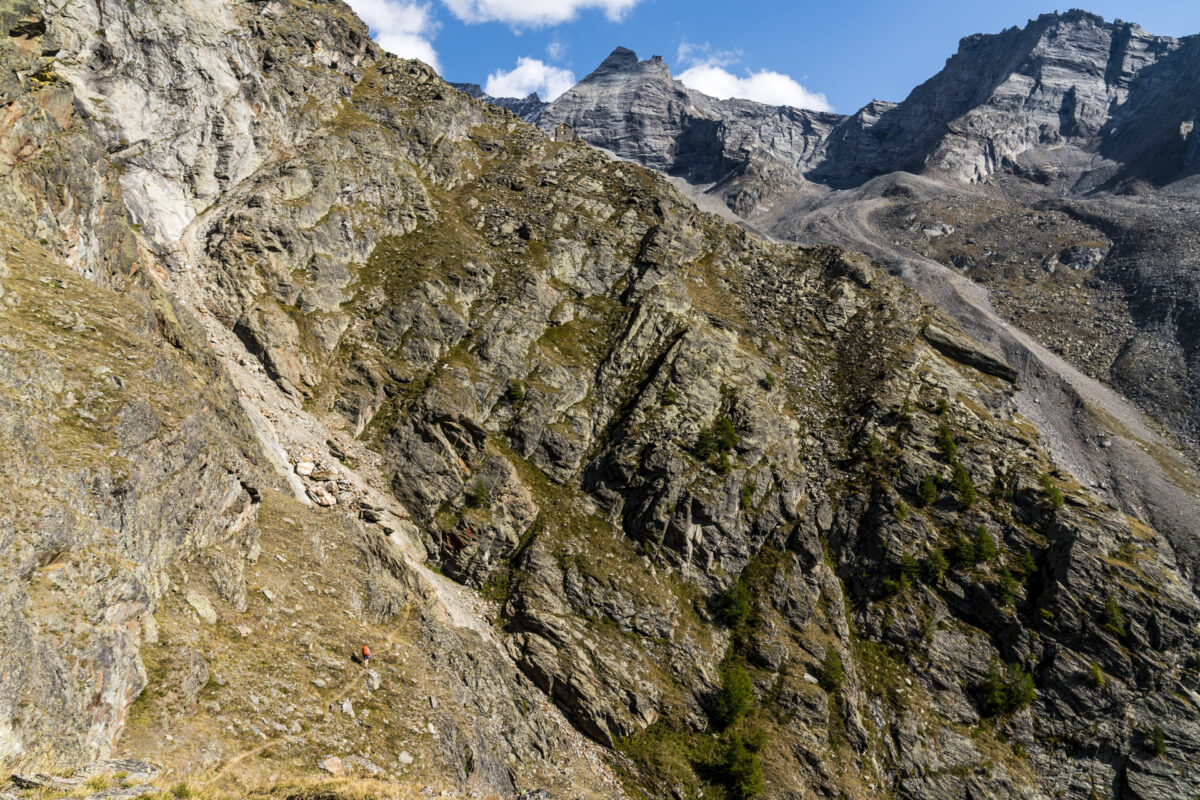
The first stage starts at Randa train station. From here, it’s a two-hour climb to the Europabrücke (which is not far from the Europahütte). We do not follow the classic signposted path to the Europa Bridge (as it approaches the bridge from the “wrong” side for us), but keep to the right. From the height of the Europabrücke we follow the Europaweg to Tierfäd. Here a white-blue-white marked, very steep, sloping approach branches off to the Kinhütte. It should be noted that you need your hands at certain points on this section of the trail and that a little “scrambling” is required here and there (not technically difficult, but stodgy, fragile terrain). Depending on the rockfall situation, it may happen that this hut access is closed and access is only possible via the “Edelweissweg” (white-red-white marked mountain path (T3) with narrow and sloping sections in places). No matter which approach you choose, this has no significant effect on the time required/altitude difference. On this first stage, there are around 1,355 metres of elevation gain over a distance of 6.9 kilometres. The pure hiking time is about 4 hours.
Important: if you don’t have a head for heights, follow the signs from Randa directly in the direction of the Kinhütte, so you don’t have to cross the suspension bridge!
The Kinhütte is a privately run hut that is open from the end of June to the mid/end of September. The overnight stay with half board costs 73 CHF. Current information as well as the contact details for a reservation can be found on the website of the Kinhütte.
Second day of hiking: from the Kinhütte to Zermatt
The second stage takes us first from the Kinhütte along the Edelweissweg back to the Europaweg. We then follow this road to Tufternalp, where we descend to Zermatt. This stage also includes sections with a risk of falling rocks – it is best to find out before the tour on the official website of the Europaweg about any closures of sections. The second day offers a distance of 17.5 kilometres with 710 metres of altitude uphill and 1,690 metres of altitude downhill. The pure hiking time is a good 6 hours. Refreshment stops are available on the Täschalp and on the Tufternalp.
Extratipp:
When the huts on the Europaweg are closed in autumn and spring, you can also make the detour to the suspension bridge as a circular hike from Randa (time required about four to 5 hours).
Key data of the tour Randa – Kinhütte – Zermatt
| Starting point | Randa Railway Station |
| Length | 24.5 kilometres |
| Elevation gain | ↗ 2,080 m 1:86 m ↘ |
| Duration | 10:00 h (divided into 2 stages) |
| Destination | Zermatt Railway Station |
Leave a Reply