


Hiking and Biking at Schwarzsee – 5 Ideas for Your Next Trip
Advertisement: Post in collaboration with the Fribourg Tourism Association.
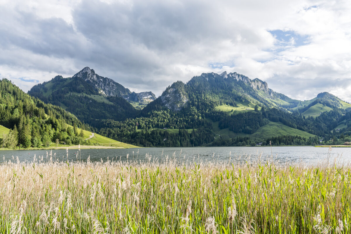
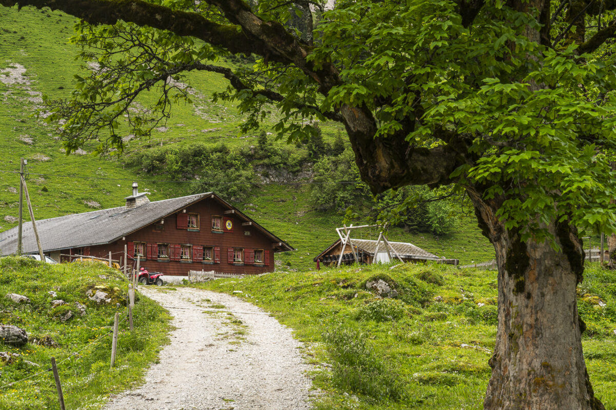
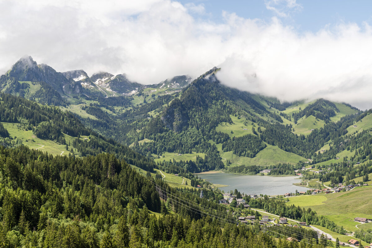
A visit to Schwarzsee in the canton of Fribourg has been on my bucket list for quite some time. Located in the most remote corner of the German-speaking Sense District, it offers not only the impressive scenery of the Fribourg Pre-Alps but also an extensive network of hiking trails and arguably the highest density of alpine taverns—a combination to my liking.
It’s all the more astonishing that despite three years of studying in the city of Fribourg/Freiburg and numerous excursions in the region, I had never managed to visit Schwarzsee. By mid-June, I finally addressed this gap. For a long weekend, we checked into the Hostellerie am Schwarzsee and explored the hiking and biking trails around the lake. I brought back five tips from our trip—from a cozy lap around the lake to a sporty summit ascent.
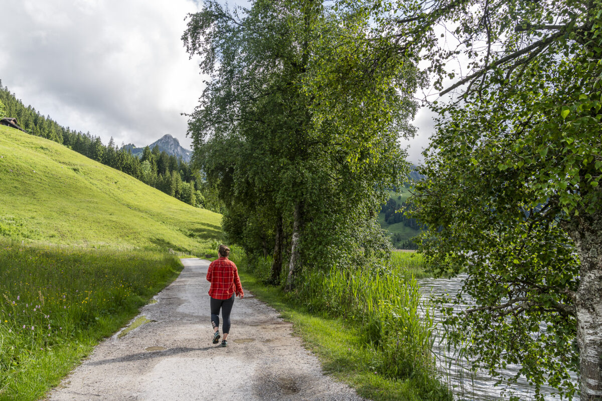
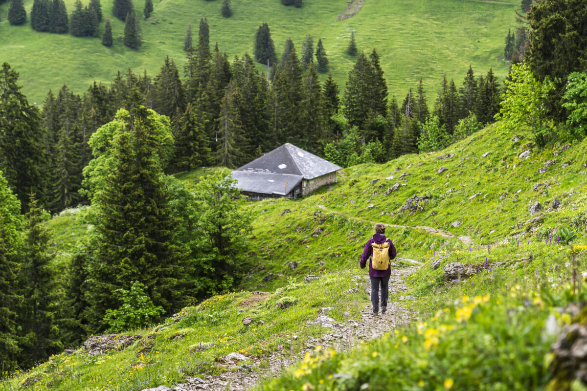
1. Simple and refreshing – Circular hike around the Schwarzsee
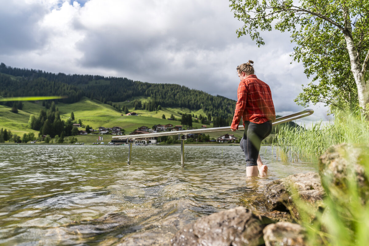
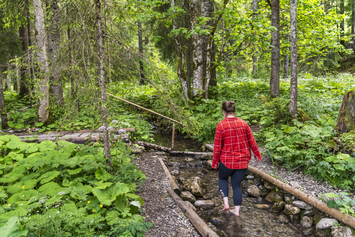
Various legends and fairy tales surround the origin of the Schwarzsee. Among others, the nearly four-kilometer-long Schwarzsee circular trail is dedicated to these tales. It takes a good hour to circle the Schwarzsee on the obstacle-free hiking trail, which is mostly guided along the shores. If you are doing the tour with children, you can get the “Häxeset” from the tourist office for 17 CHF. Only with it are you really well equipped to complete the various stations of the “Häxewääg”.
Alternatively, along the Schwarzsee circular trail, seven free Kneipp experiences invite you to refresh—a delight for all the senses. I dipped my feet into the cool waters of the Schwarzsee after the bike tour and highly recommend it.
Key Details of the Circular Hike around the Schwarzsee
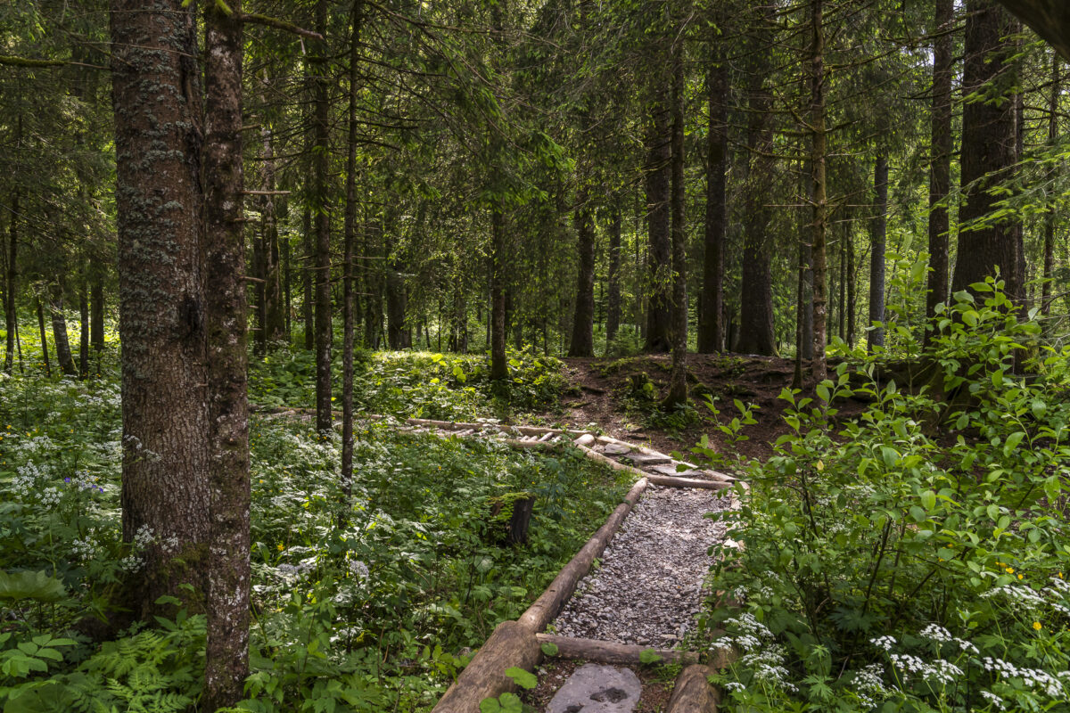
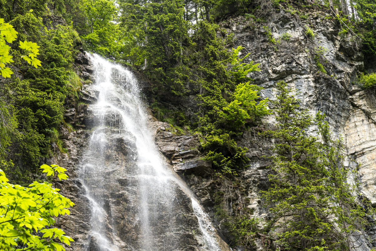
You can trace the route of the Schwarzsee circular trail, including a detour to the waterfall at Seeweidbach, using the following hiking map. It is an obstacle-free hiking trail (T1) that is also accessible with strollers. At the forest clearing where the Euschelsbach flows, you’ll find a nice resting place including a short barefoot path. More information about the individual theme paths can be found here: Häxewääg and Kneippweg.
| Starting Point | Bus Stop Schwarzsee, Gypsera (1,046 m above sea level) |
| Accessibility | accessible by public transport |
| Length | 5.3 kilometers |
| Altitude Gain | ↗ 84 m ↘ 84 m |
| Duration | 1:20 h (walking time including detour to Seeweidbach Waterfall) |
| Destination | Bus Stop Schwarzsee, Gypsera (1,046 m above sea level) |
| Places to Eat | SchwarzseeStärn, Hostellerie am Schwarzsee, and Restaurant Gypsera |
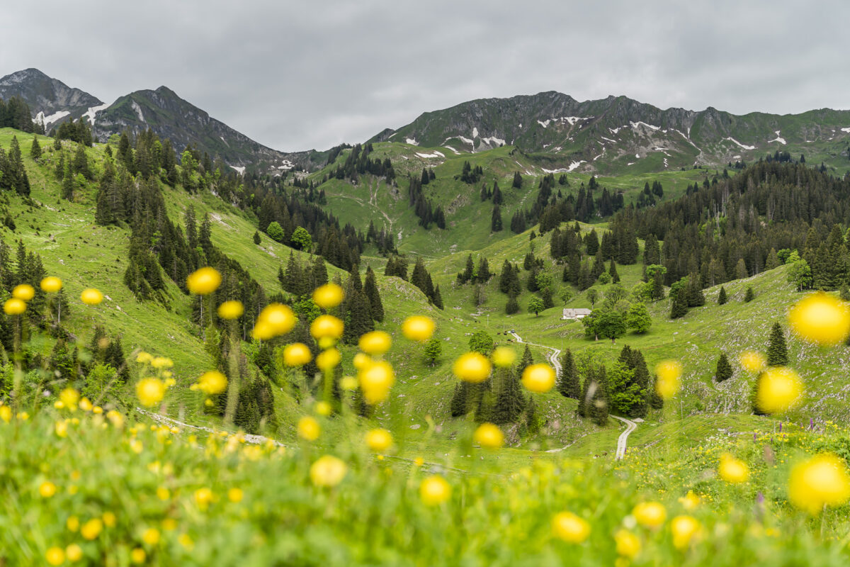
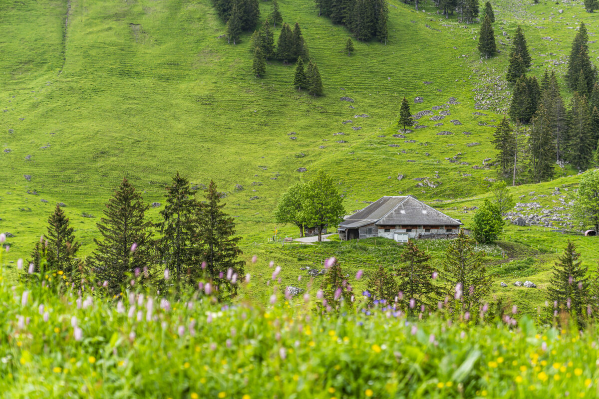
2. Fascinating and mysterious – Breccaschlund Panoramic Path
The hike through the Brecca, a primordial landscape south of the Schwarzsee shaped by glaciers, is a classic in the region. The Switzerland Mobil route (No. 267) starts at the Riggisalp mountain station and covers 14 varied kilometers back to the valley.
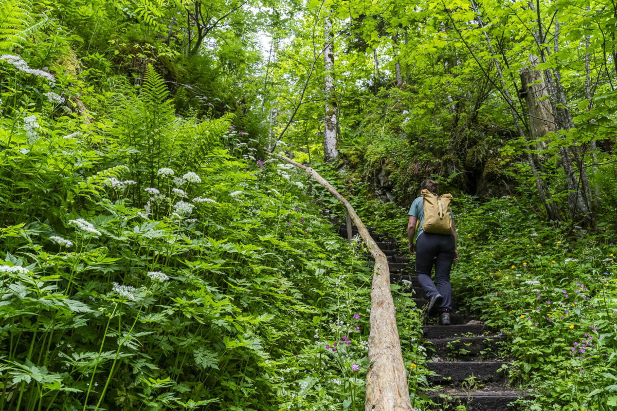
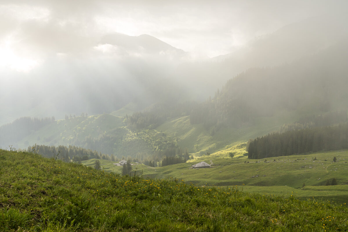
We approached the impressive limestone cliffs from the opposite direction and completed a shortened—but no less rewarding—version. Starting from the Hostellerie Schwarzsee, we first followed the Schwarzsee circular trail up to the level of Camping Seeweid. From there, the Breccaschlund Panoramic Path leads purposefully first over driveways and then over a beautiful forest trail in a zigzag up the “Schlund”. One advantage of the rainy June: the almost excessively lush green forest floor.
After a roughly one-and-a-half-hour walk, we reach the second alpine tavern on the route at the height of “Steinige Rippa”. As the anticipated rain still holds off, we continue walking, almost a kilometer in the dry, to the Alp Hut St. Antoni Brecca. Now the respite is definitely over. Fortunately, we find a dry spot where we satisfy our hunger with a delicious platter and amusedly watch the feisty goats.
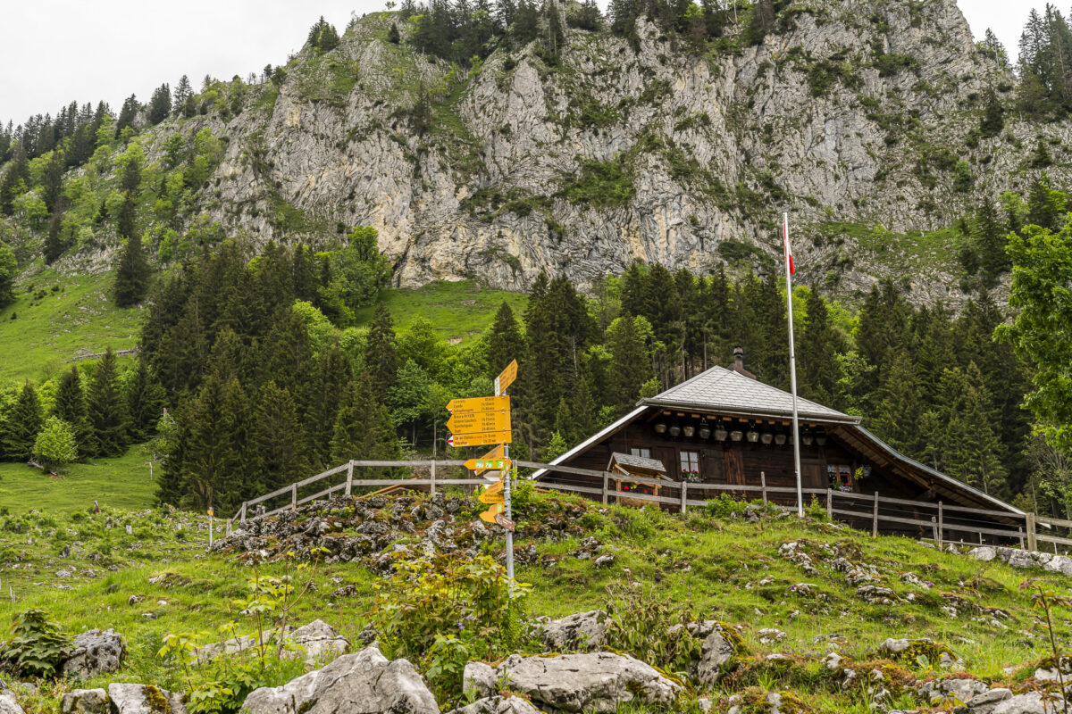
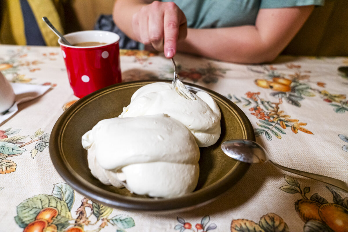
What follows, in my opinion, is the most beautiful part of the path via Rippetli and Stierenberg to the Lower Euschels Alp. The view of the Schwarzsee would be great—if you didn’t happen to walk through it when the heaviest rain front of the day passes. This brief moment of disappointment is quickly forgotten with a large plate of meringues with double cream in the cozy warm parlor of the Lower Euschels Alp.
Key Data for the Hike through the Primordial Brecca Landscape
You can trace the route of our hike on the Breccaschlund Panoramic Path using the hiking map below. It is a yellow-marked hiking trail (T1/T2). Due to the terrain, sturdy footwear is recommended for this (shortened) route as well. Further current information about this shorter version of the tour through the primordial Brecca landscape can be found on the website of the Fribourg Tourism Association: Short Tour
| Starting Point | Bus Stop Schwarzsee, Campus (1,053 m above sea level) |
| Accessibility | accessible by public transport |
| Length | 8.5 kilometers |
| Elevation Gain | ↗ 626 m ↘ 196 m |
| Duration | 3:00 h |
| Destination | Riggisalp Mountain Station (1,491 m above sea level) |
| Dining Options | Alp Hubel Rippa (250 m from the hiking trail), Alp Untere Rippa, St. Antoni Brecca, Alp Unterer Euschels, and Bärghuus Riggisalp |
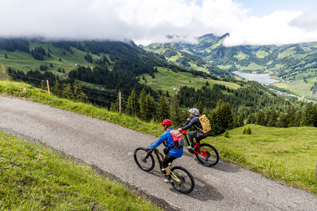
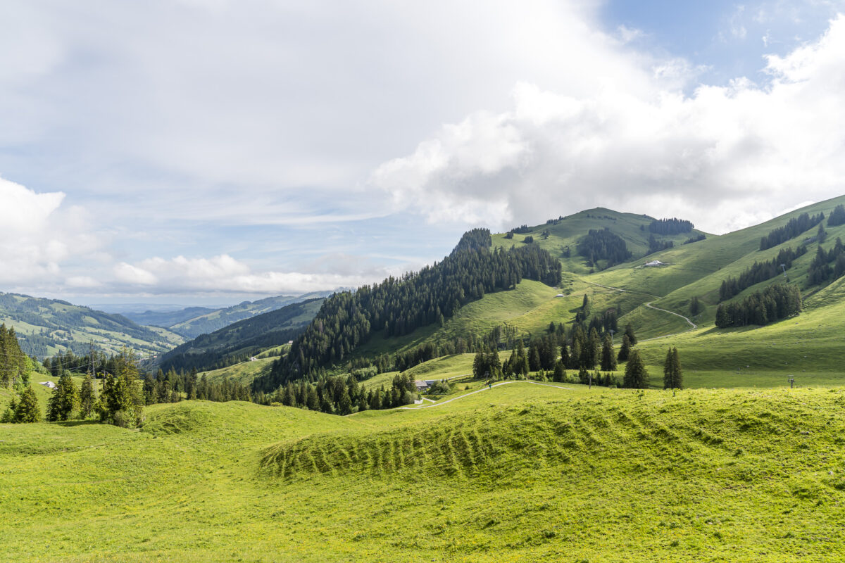
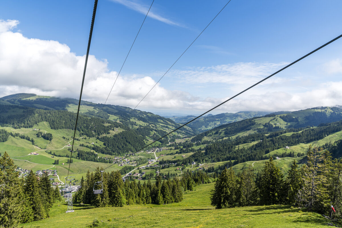
3. Scenic and Enjoyable – Panorama Beizli Bike Tour
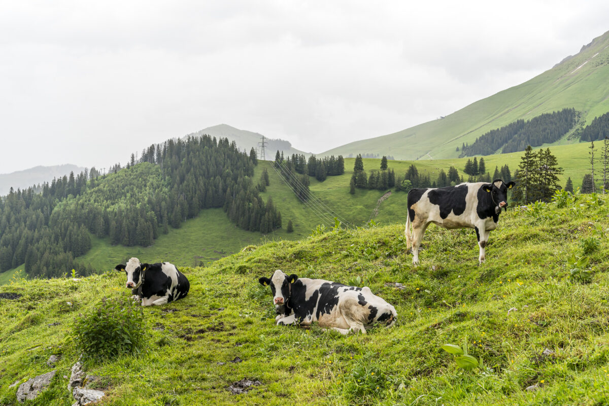
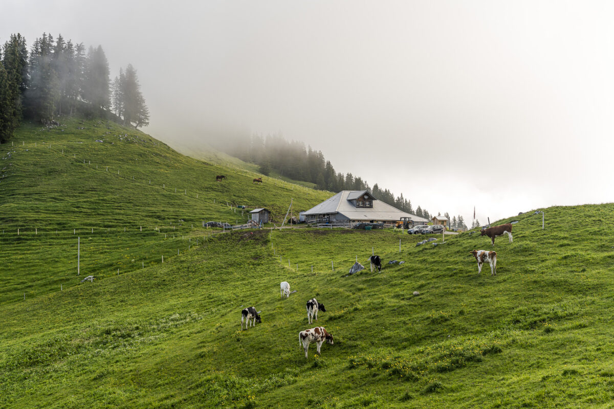
For mountain bikers, the Panorama Beizli Tour is the counterpart to the Breccaschlund Panoramic Path—at least in terms of mountain tavern density. The Schwarzsee region is continuously expanding its mountain biking offerings, as we learned from Philippe Jost. An employee of the Kaisereggbahnen, he is a passionate mountain biker and knows the Sense District like the back of his hand.
We started at the sports shop Side Cut Sports next to the valley station of the Riggisalp chairlift. Here, bikes and e-mountain bikes can be rented. Equipped with two top models, we began our round on the Panorama Bike Route (Stage 11 Thun – Schwarzsee) along the Sense towards Plaffeien.
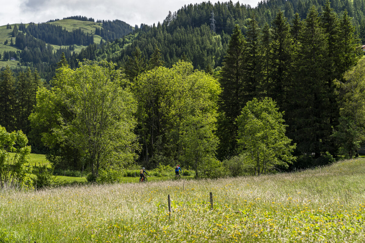
At the height of Mösli, we cross the cantonal roads and “work” our way up the mountain for the next hour over a little-used asphalt lane. At this point, I am very glad that we are on e-mountain bikes. Whether with or without assistance – with every gained meter of altitude, the view of the surrounding panorama becomes more impressive.
This is also true for the opposite Großer Schwyberg. A cool terrain for more experienced mountain bikers, Philippe tells us. Fortunately, only a few sections challenge me on our round.
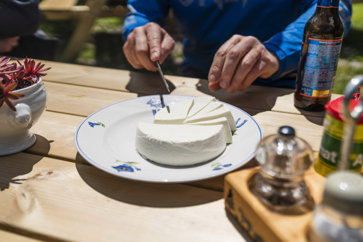
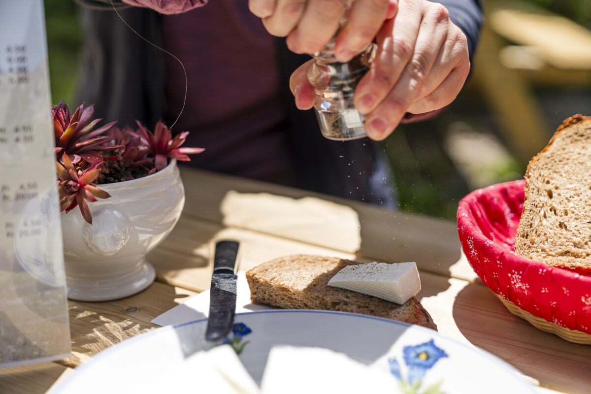
The bike tour leads us via Alp Salzmatt and Riggisalp back to the Alp Untere Euschels, where we enjoyed the meringues the day before. Today we follow Philippe’s recommendation and order fresh goat cheese. An excellent tip! And since we’ve been moving so quickly, there’s still time for an extra loop over the Euschelspass to the Ritzlialp. Here, the panorama is enriched by another perspective: From the Euschelspass, you enjoy an unobstructed view of the rugged peaks of the Gastlosen.
Key Data of the Panorama Beizli Bike Tour
The Panorama Beizli Tour is a technically simple mountain bike tour that, with the exception of two or three shorter single-trail sections, mostly leads over paved driveways and gravel paths. Due to the number of elevation meters and the length of the tour, a certain basic fitness is required even when using an e-bike. Bikes and e-bikes can be rented on a daily basis via an online reservation tool (cost of e-bike from 89 CHF/day). More information about the bike tour can be found on the website of the Fribourg Tourism Association.
| Starting Point | Bus Stop Schwarzsee, Gypsera (1,046 m above sea level) |
| Accessibility | accessible by public transport |
| Length | 22.5 kilometers |
| Elevation Gain | ↗ 994 m ↘ 993 m |
| Duration | 3:30 h (pure riding time with e-bike) |
| Destination | Bus Stop Schwarzsee, Gypsera (1,046 m above sea level) |
| Dining Options | Alp Salzmatt, Alp Riggisalp, Alp Unterer Euschels, Alp Oberer Euschels, and Ritzlialp |
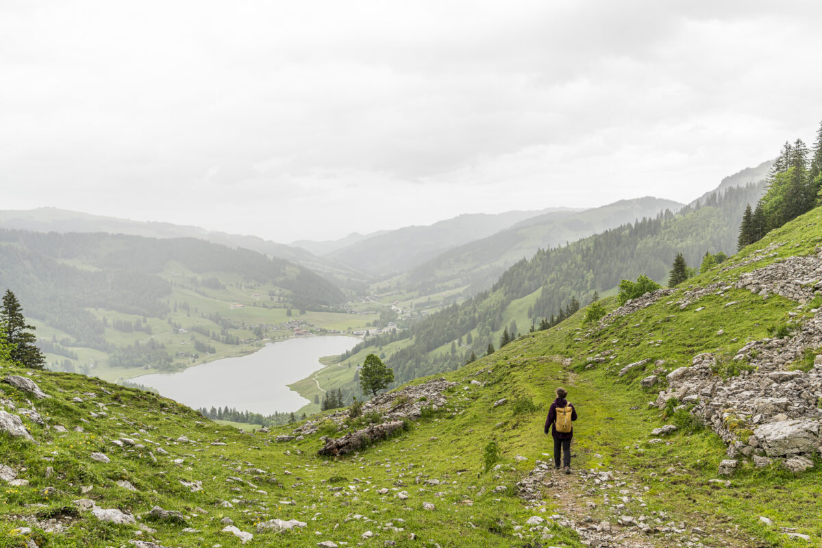
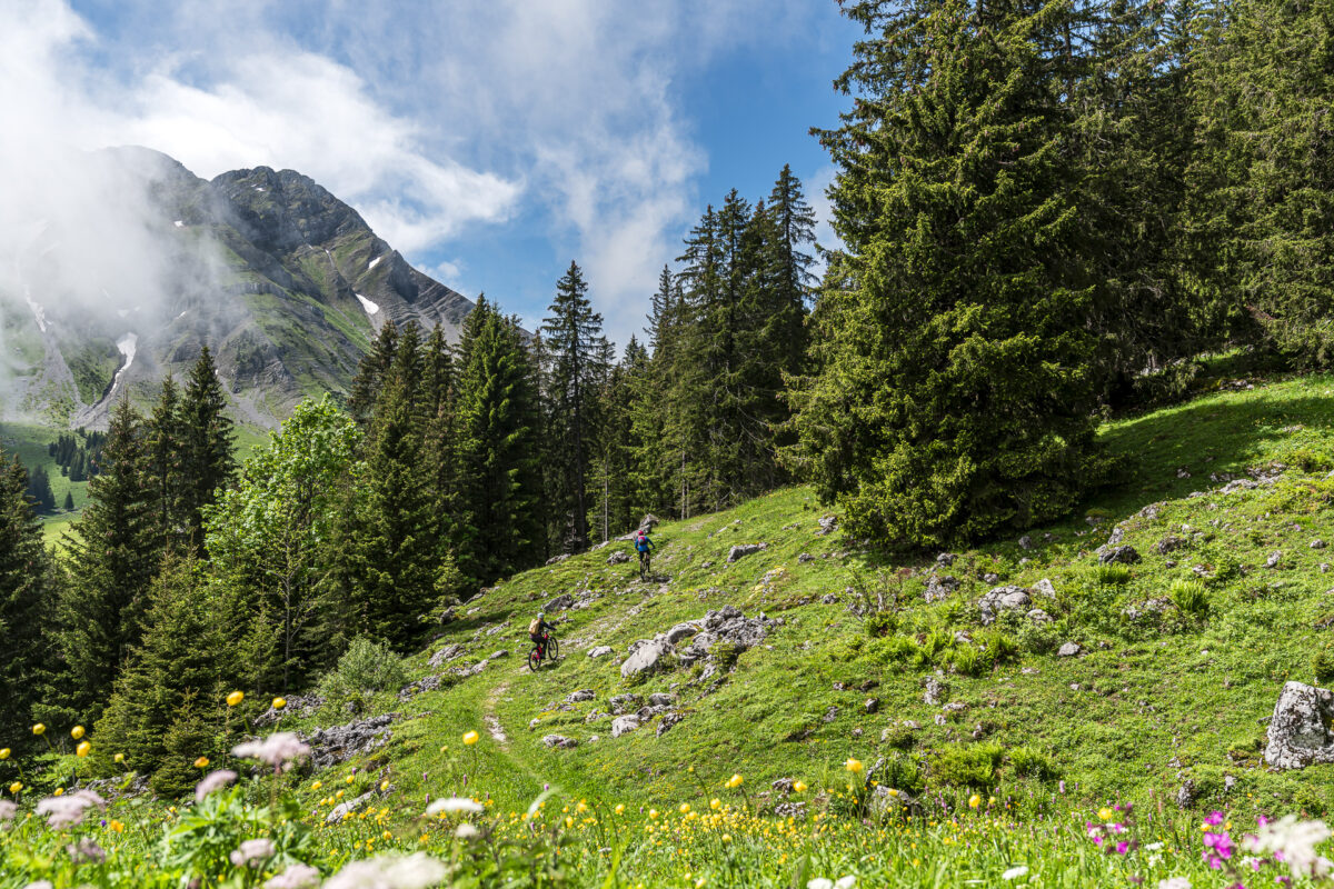
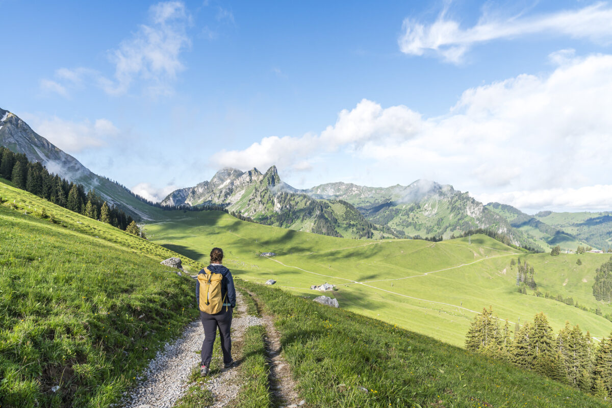
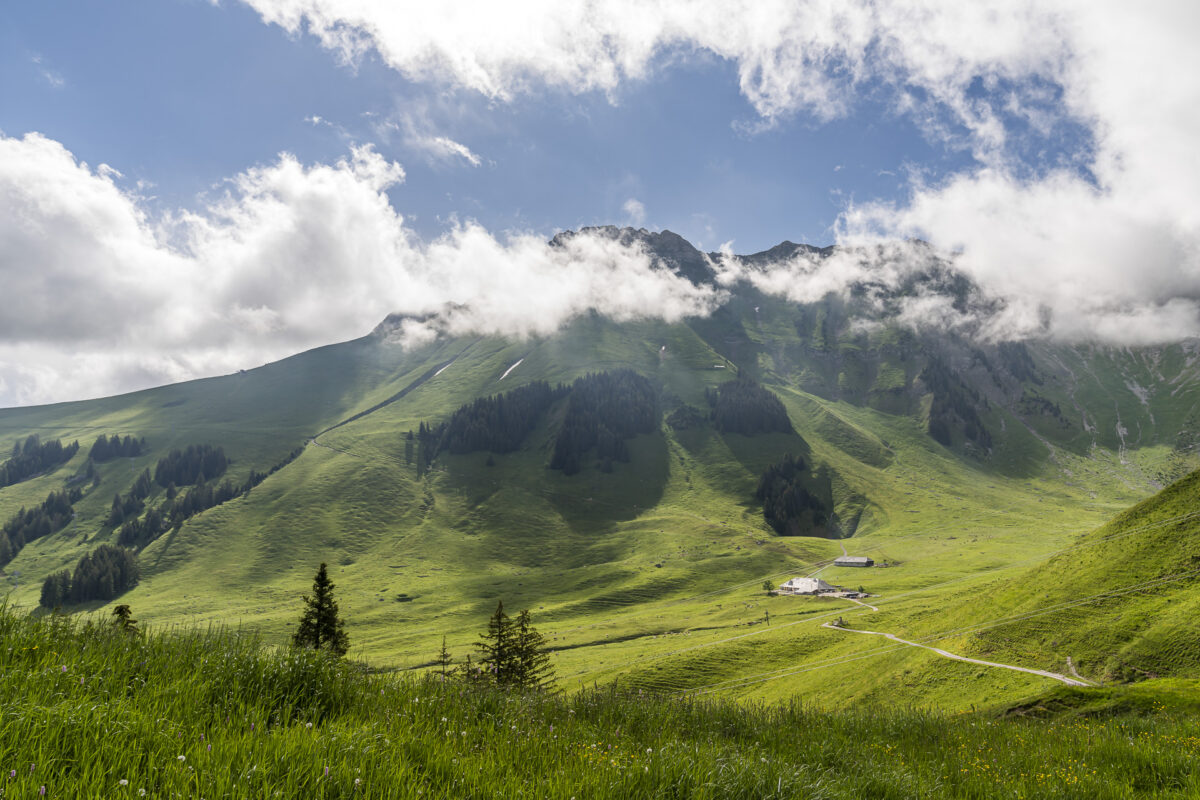
4. Unforgettable and Challenging: Sunrise Hike from Schwarzsee to Kaiseregg
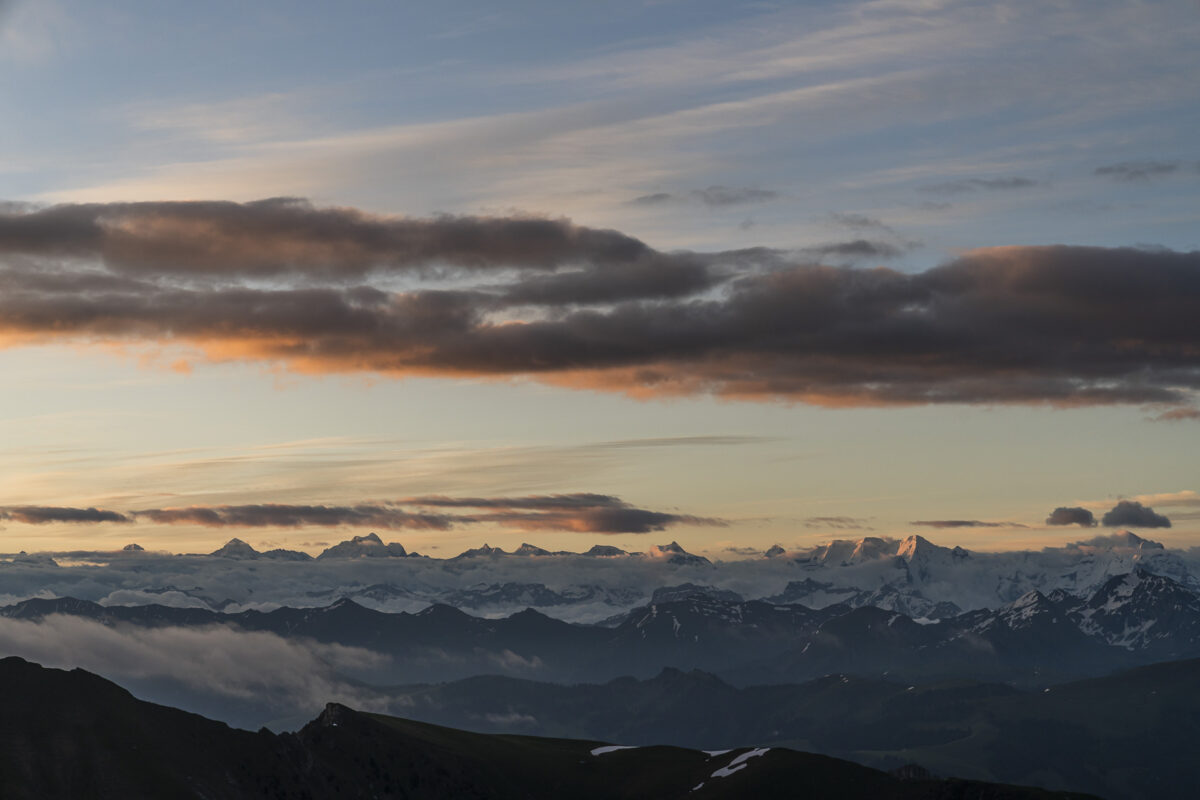
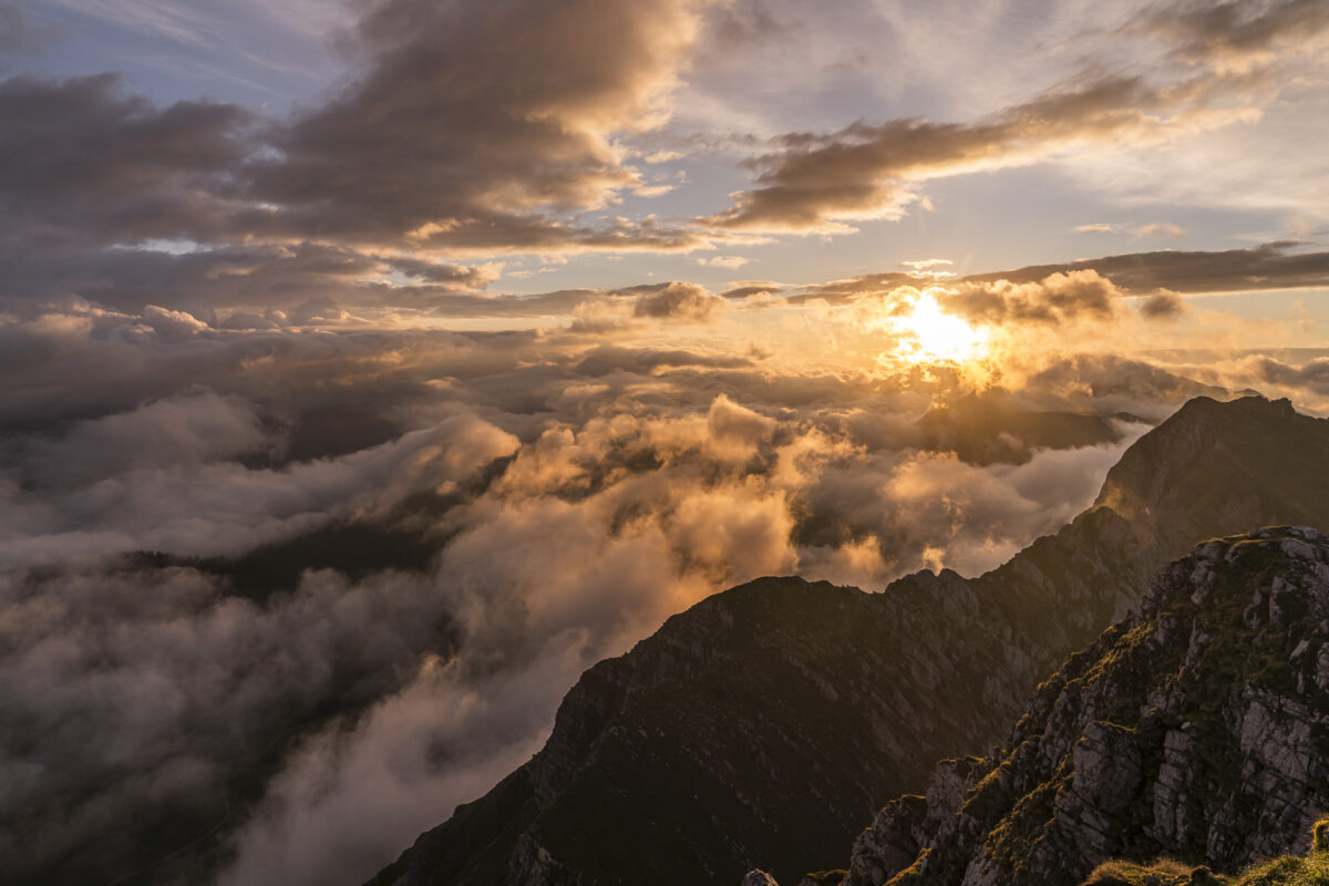
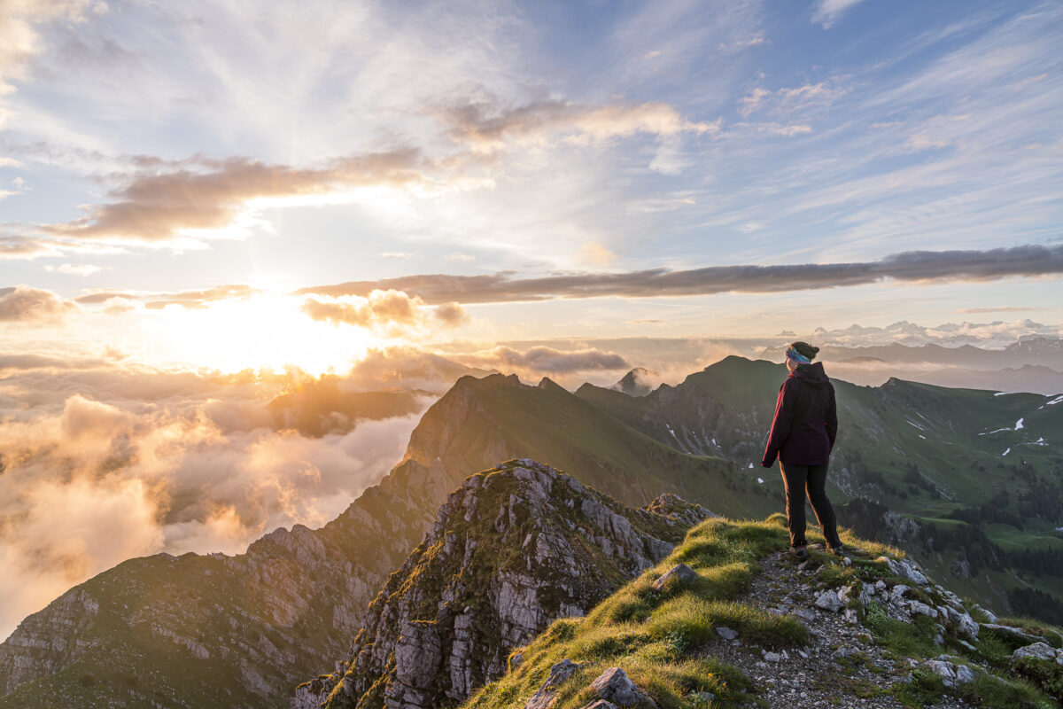
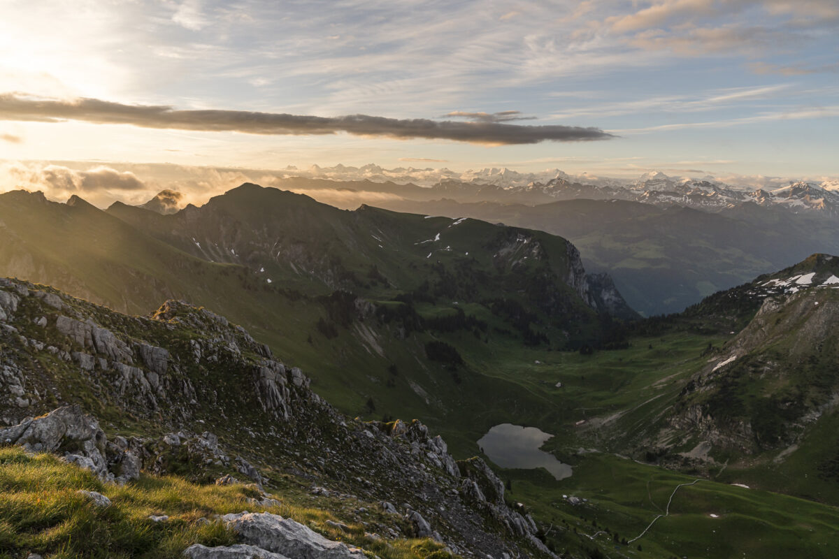
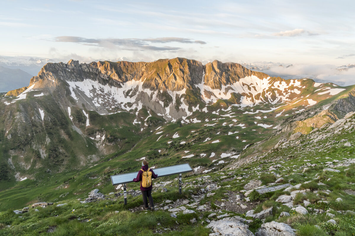
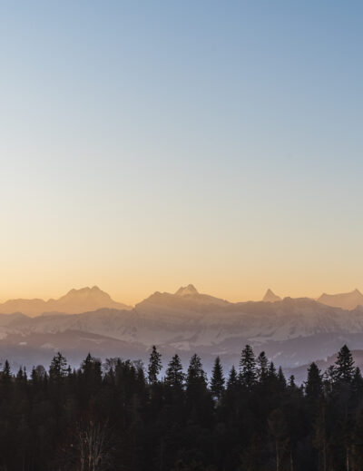
The 2,185 meter high peak of Kaiseregg looms mightily over the Schwarzsee. From here, weather permitting, you enjoy a phenomenal panoramic view that extends from the Jura to the Bernese Alps and all the way to Mont Blanc. A highlight is the summit climb at sunrise. A special experience that even local early risers wouldn’t want to miss.
Due to very uncertain weather forecasts, we were long undecided whether we really wanted to drag ourselves out of bed just after half-past two in the morning. After much back and forth, I decided to see the journey as the goal; as a good opportunity for an altitude training. Whether the sunrise would show itself or not – it didn’t matter!
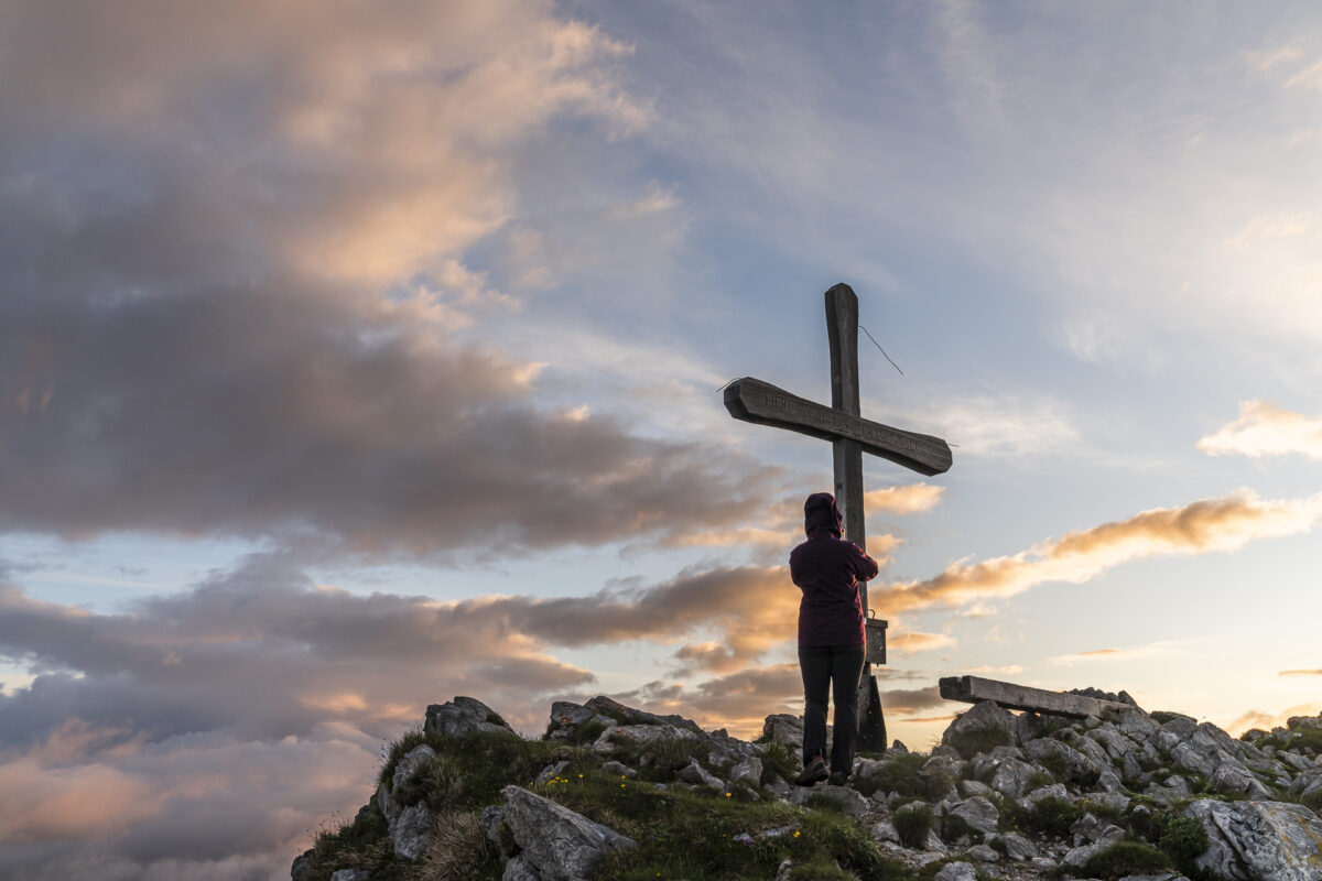
And once again, my expectation management paid off. The decision to start hiking just before three in the morning was never questioned. Not even when we trudged through drizzle shortly after passing Alp Salzmatt at dawn. Furthermore, when we reached the summit, one of those special sunrises awaited us that I will never forget.
I mean, look at the mood in the following pictures – isn’t it dreamy!
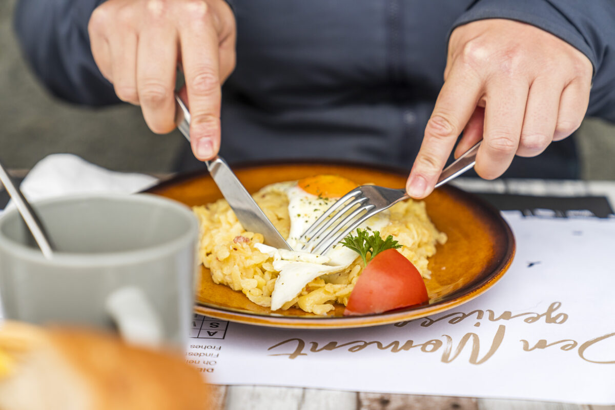
In addition to the training aspect, the prospect of a mountain breakfast at Alp Salzmatt also motivated me. And now I understand what my father meant when he told me as a child, “One day you will also appreciate a good Rösti.” It is the moment when it is served to you warm and steaming after a successful summit climb at 07:30 am. Simply delicious!
Key Data of the Hike to Kaiseregg
You can trace the route of our hike from Schwarzsee to Kaiseregg using the hiking map below. It is marked as a yellow hiking trail (T1/T2) up to Alp Salzmatt. The further continuation to the summit is marked as a white-red-white mountain hiking trail. Up to the Kaiseregg pass, the trail is well developed and secured. The last few meters to the summit are a bit exposed, but doable without using hands. The walking time from Schwarzsee to the summit is signposted at the height of the church with 3 hours and 13 minutes. We needed 2.5 hours without breaks and were on the summit just before sunrise at 05:30 am. Alternatively, you can start the summit ascent to Kaiseregg from the mountain station of the chairlift. This saves about 400 meters of altitude.
Good to know: If you want to let the summit experience on Kaiseregg at Rösi’s with fried eggs linger, it’s best to register by phone at least the day before. Contact information can be found on the website of the Fribourg Tourism Association.
| Starting Point | Bus Stop Schwarzsee, Gypsera (1,046 m above sea level) |
| Accessibility | accessible by public transport |
| Length | 12 kilometers |
| Elevation Gain | ↗ 1,204 m ↘ 767 m |
| Duration | 5:15 h |
| Destination | Riggisalp Mountain Station (1,491 m above sea level) |
| Dining Options | Alp Salzmatt, Alp Riggisalp (with a cheese dairy) and Bärghuus Riggisalp |
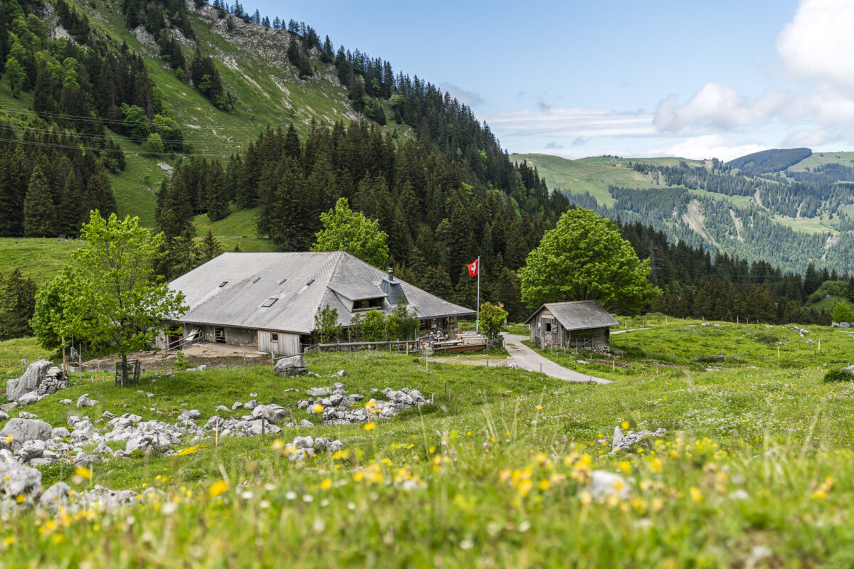
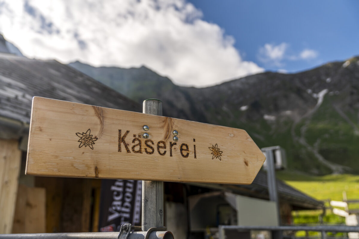
5. Cozy and Family-Friendly: Walk to the Alpkäserei Riggisalp
We completed this last hiking tip in reverse direction on the way back from Alp Salzmatt to Riggisalp. Alternatively, it is a comfortable, short hiking round starting from the mountain station of the Riggisalp chairlift, which is also suitable for small children or older people. Over a wide gravel path, you reach the Alp Riggisalp located about 50 meters lower. Here is also a show dairy, where you can watch traditional cheesemaking daily in the summer months in the morning. In addition, you can buy Gruyère d’Alpage, Vacherin Fribourgeois d’Alpage, Mutschli, Ziger, and alpine butter directly here. A true paradise for cheese fans.
Back at the Riggisalp, it is recommended to make a stop at the sun terrace of the Restaurant Bärghuus-Riggisalp before the downhill ride with the chairlift in good weather. From June to October, there’s a grill fun every Sunday here.
Key Data of the Hike from Riggisalp Mountain Station to Alpkäserei and Back
You can trace the route of the round hike from Riggisalp Mountain Station to Alp Riggisalp and back using the following hiking map. It is a yellow-marked hiking trail (T1).
You can find the route of our variant via Kaiseregg on the website of the Fribourg Tourism Association.
| Starting Point | Riggisalp Mountain Station (1,491 m above sea level) |
| Accessibility | The valley station of the Riggisalp chairlift is accessible by public transport (bus stop Gypsera) |
| Length | 2.5 kilometers |
| Elevation Gain | ↗ 98 m ↘ 98 m |
| Duration | 0:45 h |
| Destination | Riggisalp Mountain Station (1,491 m above sea level) |
| Dining Options | Bärghuus Riggisalp, Alp Riggisalp (with show dairy), and Alp Rainlihuus |
Practical Tips for Your Detour to the Schwarzsee
- From Fribourg/Freiburg station, there is an hourly bus connection (bus line 123) to the Schwarzsee.
- Most alpine huts are open from the end of May to the end of September. An overview including contact information can be found on the website of the Fribourg Tourism Association.
- The summer season of the Riggisalp chairlift lasts from early May to early November. The single fare for adults is 19 CHF (round trip). Dogs are transported free of charge. More info: Kaiseregg-Bahnen
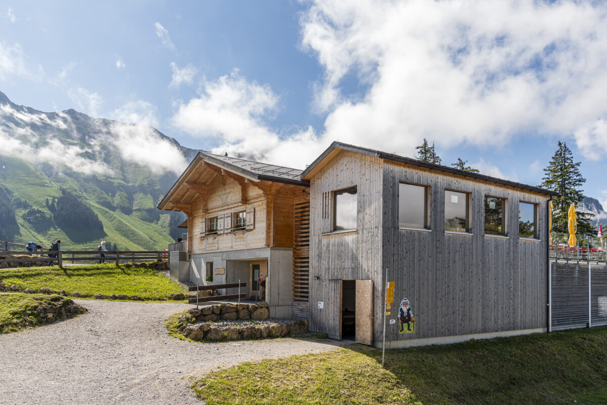
- The room rates at the Hostellerie am Schwarzsee start at 150 CHF per night. We really enjoyed the pizzas from the pizzeria belonging to the Hostellerie.
- If you’re craving creative market cuisine or a tasting menu, I recommend a detour to the Restaurant SchwarzseeStärn, located between the Hostellerie and the valley station of the Kaisereggbahnen.
- You can find even more inspiration for excursions around the Schwarzsee here: Welcome to Schwarzsee
You can find more regional hiking tips in this blog post. It profiles the circular hike around the Gastlosen, the ridge walk on the Moléson, and a gourmet hike in Les Paccots. Also recommended is the 12-kilometer hike on the Chemin du Gruyère from Gruyères to Charmey.

Leave a Reply