

On the Alpine Passes Trail from Mauvoisin via Cabane Brunet to Bourg-St-Pierre.
Before this year’s mountain summer introduces new spectacular multi-day hikes, we first need to fully document last season’s hut tours. In addition to our already blogged tours in the cantons of Graubünden, Uri, and Ticino we also spent a few hiking days in Lower Valais. In three scenic stages, we mainly followed the Alpine Passes Trail from Verbier to Bourg-St-Pierre on the pass road of the Great St. Bernard. A sporty 3-day hike that definitely doesn’t skimp on highlights!
1. Hiking Day: Detour via the Sentiers des Chamois
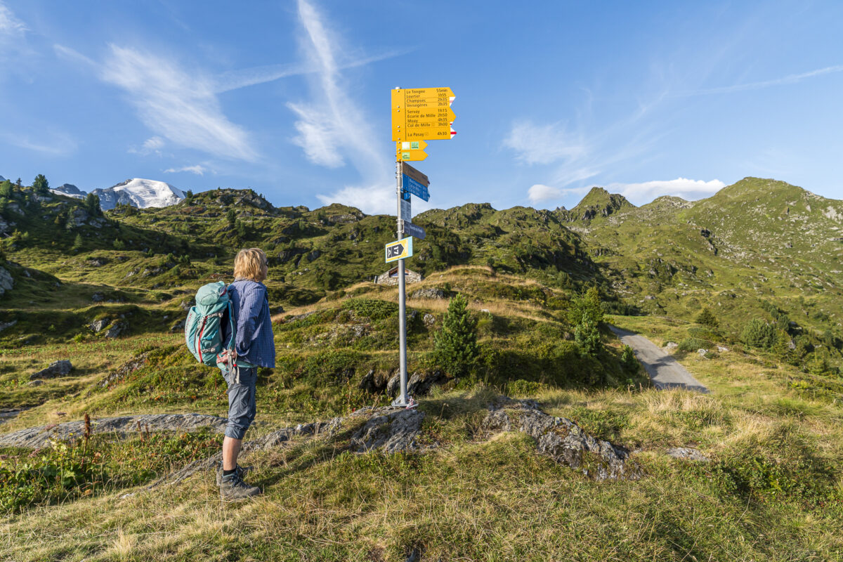
Exactly one year after our joint hike on the Alpine Passes Trail from the Blenio Valley into the Leventina, we meet up with my parents at Martigny Station. The weather forecasts are once again promising, and we are accordingly filled with motivation for three more unforgettable hiking days. From Martigny, we first take the train and then two cable cars until we reach the Bergstation Croix-des-Ruinettes high above Verbier.
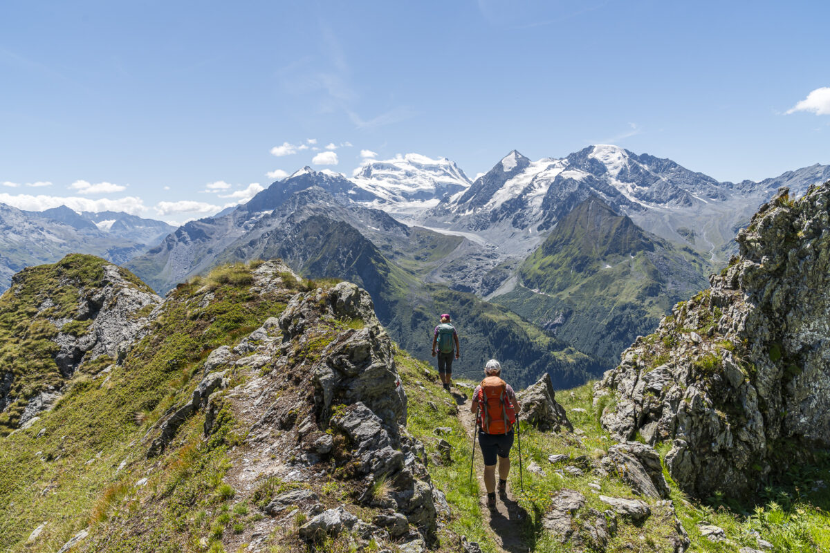
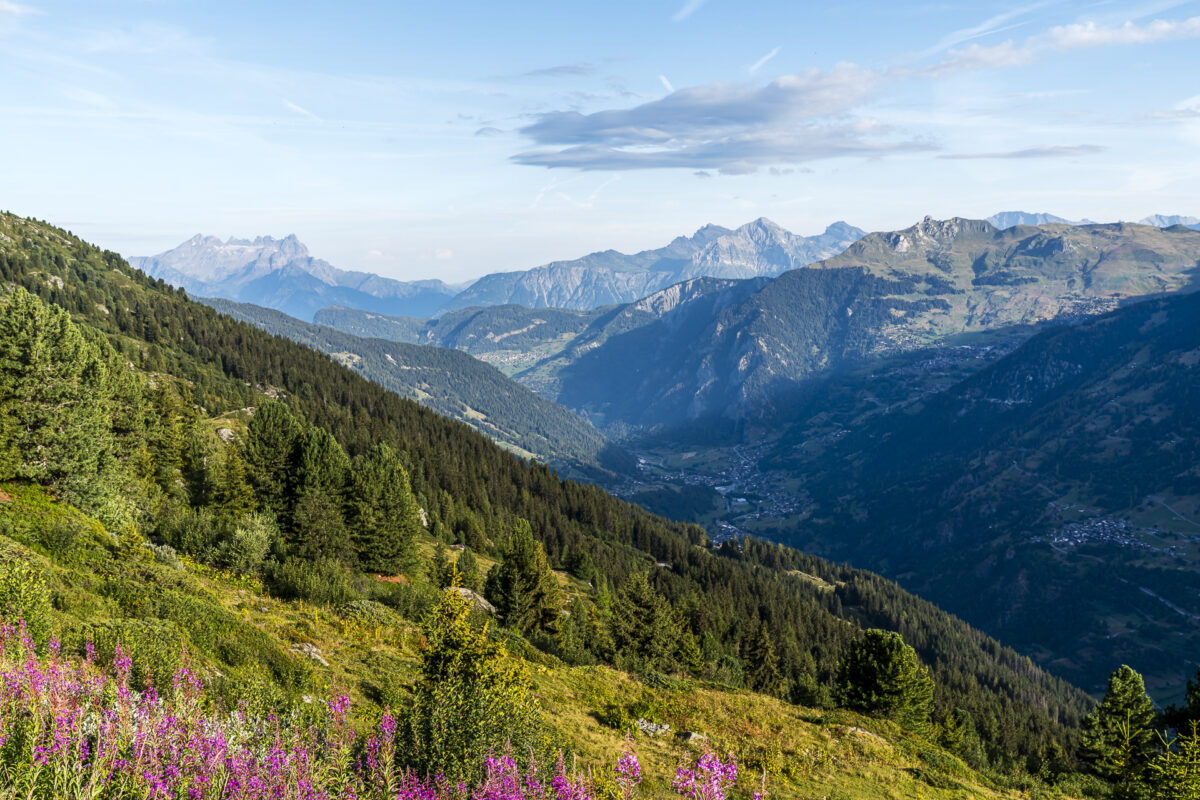
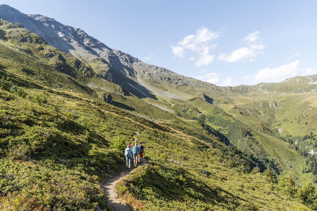
Here we start our first hiking stage, following the Sentier des Chamois to Fionnay. But before we set off, we first enjoy the obligatory start coffee, and of course, the fantastic panorama needs to be thoroughly admired. This view accompanies us almost every step of the next 14 kilometers! Particularly impressive is the snow-covered massif of the Grand Combin, which captivates my gaze. We will get considerably closer to it the next day.
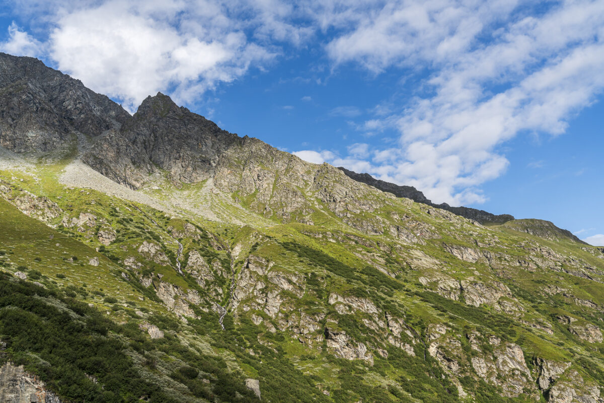
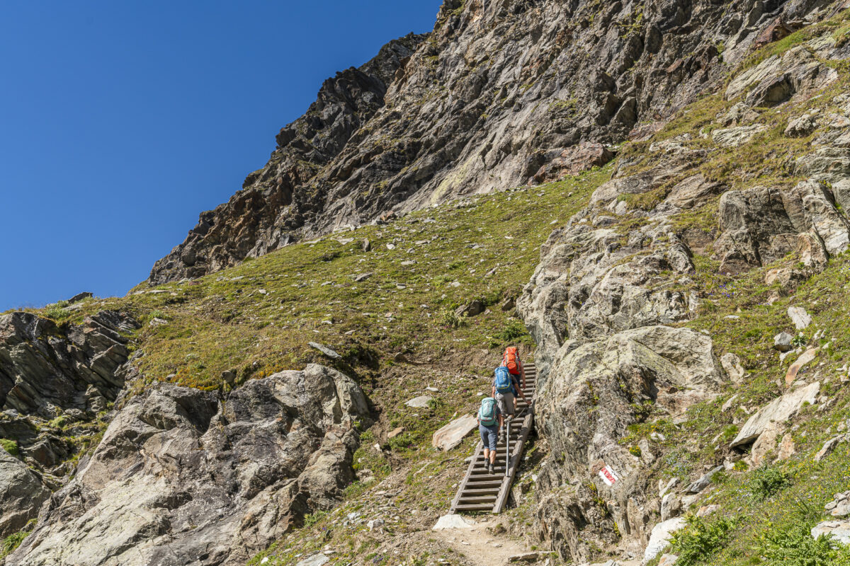
The entry into this tour is made easy. For the first hour, we follow the Bisse de Levron with no significant inclines until we reach Alpage la Chaux. Here, the marking changes from a hiking to a mountain trail, and the path becomes narrower and rockier. We are now on the Sentier des Chamois, which soon begins to ascend steeply and zigzags us over alpine terrain up to 2,648 meters above sea level. Surefootedness and a head for heights are beneficial here – and I can well imagine that chamois and ibex feel right at home in this exposed area. However, on this hot summer day, they seem to have retreated to shadier spots. Even the marmots find it too warm.
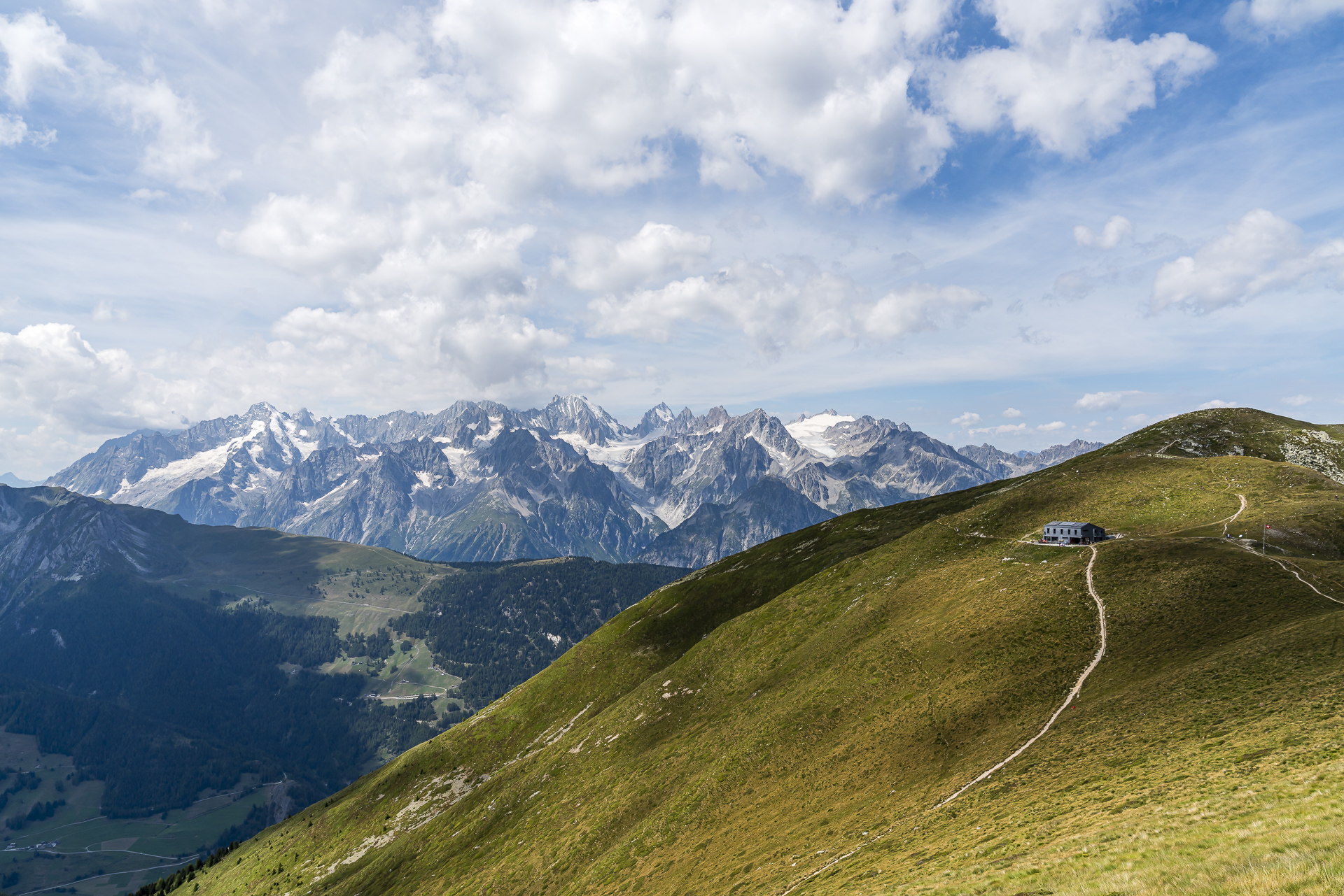
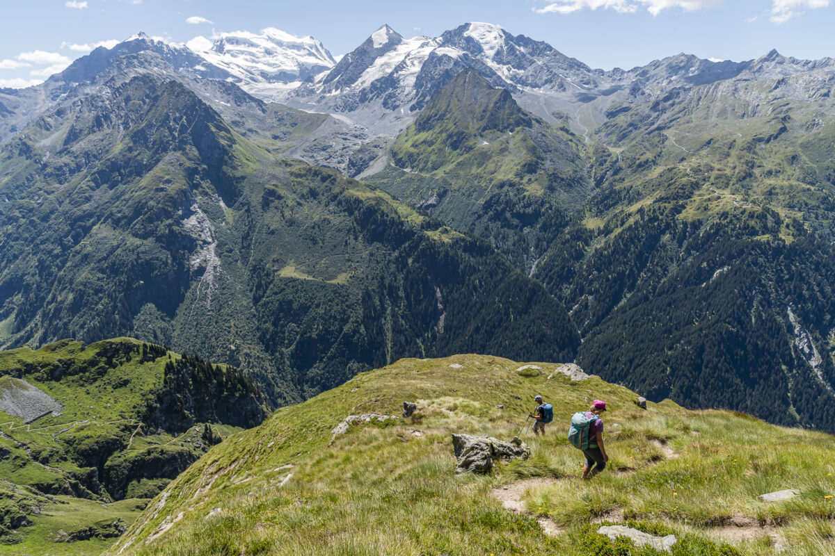
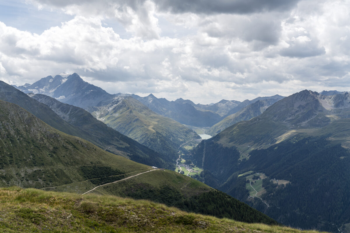
At the highest point of the tour – Col Termin – a fantastic view awaits us into the Nature Reserve of Haut Val de Bagnes and the sparkling Louvie Lake deep below us.
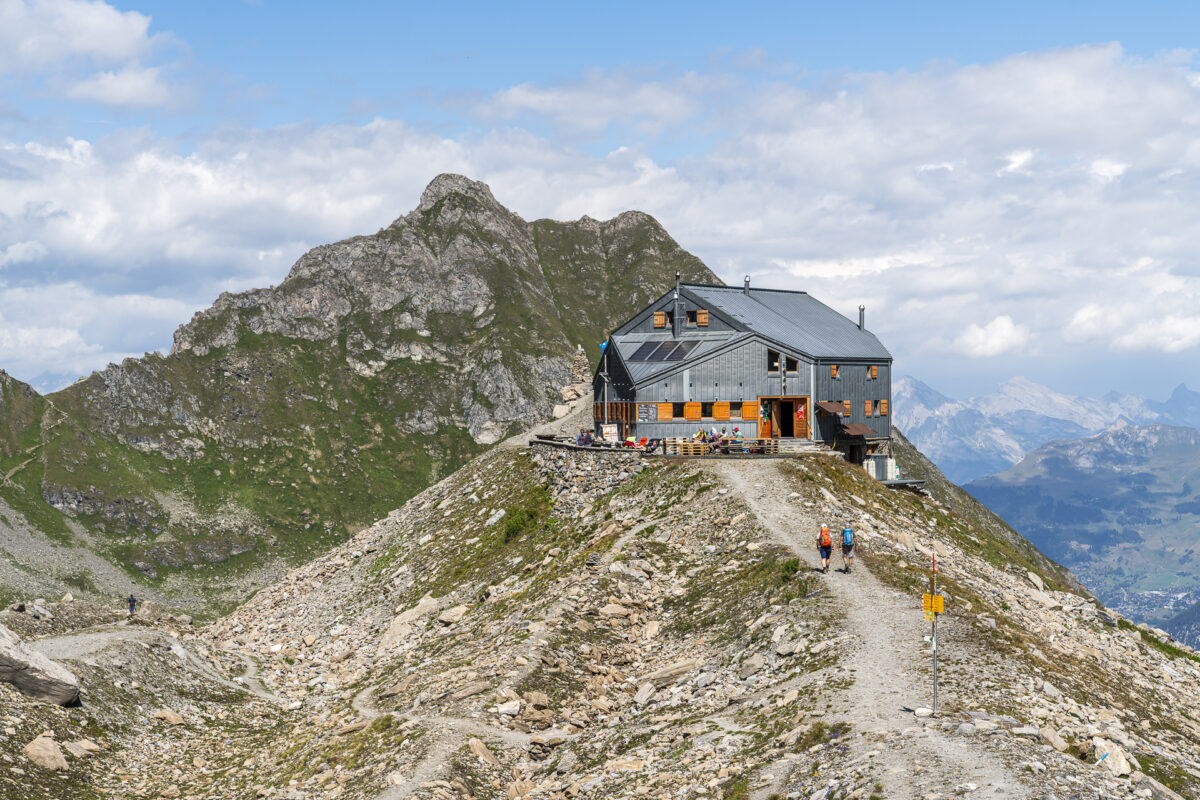
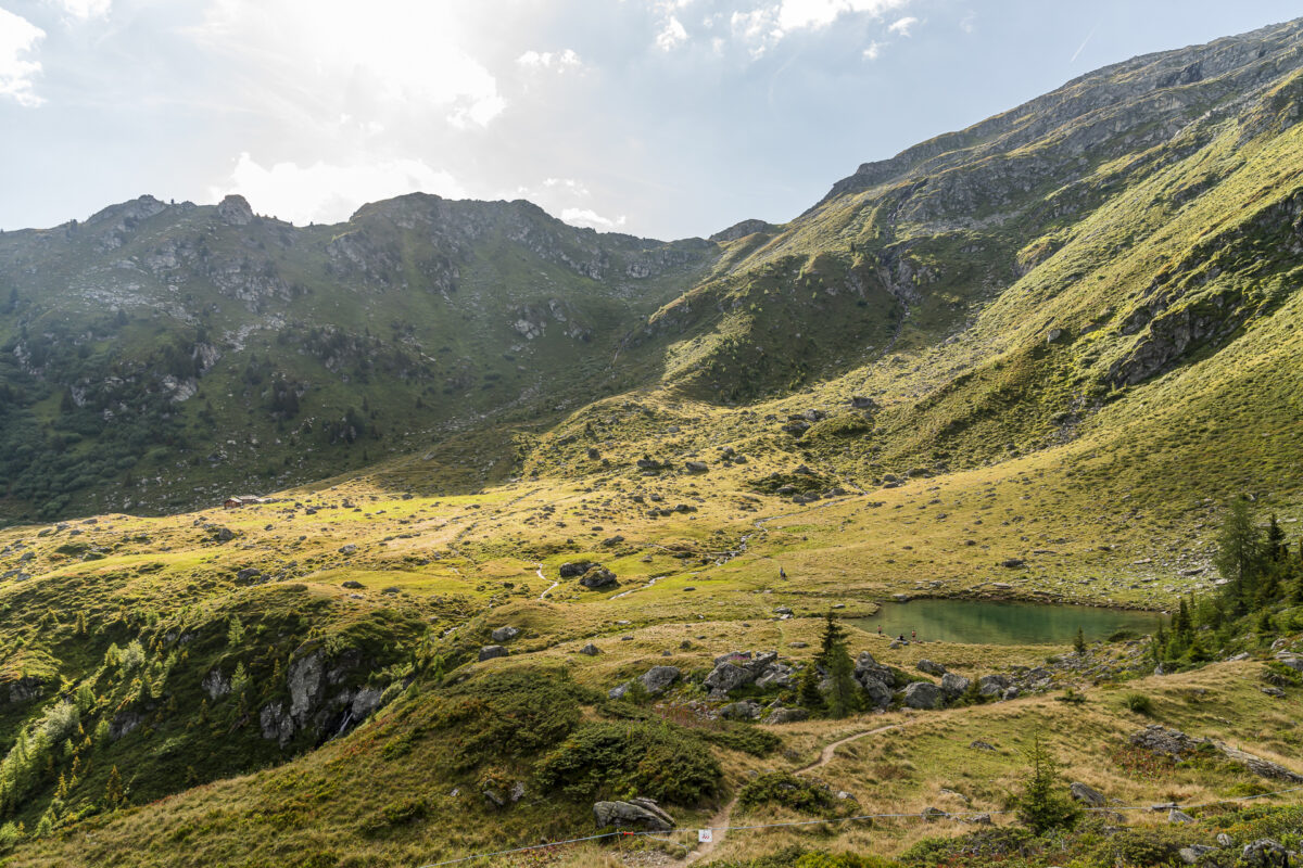
It’s precisely there that we now descend via an equally impressive path. At Lac de Louvie, we encounter the Alpine Passes Trail for the first time. This trail comes from the Cabane de Prafleuri and continues high above the valley floor from the Cabane de Louvie to Mauvoisin. Since we only have three days and not four, there’s just a brief stop for us at the Cabane de Louvie for a well-deserved cool soft drink and a slice of apricot cake; this followed by a steep descent to Fionnay, where we cover the remaining distance to Mauvoisin with the help of a postal bus.
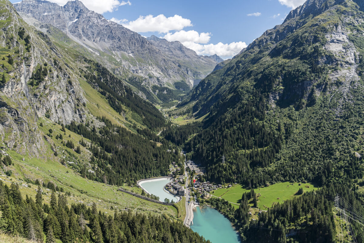
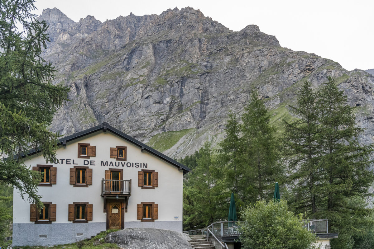
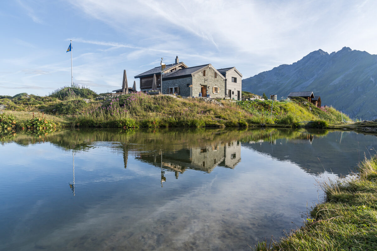
The first hiking day ends at Hotel Mauvoisin, where we stay in nostalgic, very cozy twin rooms.
Key Details of the Verbier – Cabane de Louvie – Fionnay Hike
From the following map, you can see the route of the hike from Verbier via Col Termin to Cabane de Louvie and on to Fionnay. Except for the first 2.5 kilometers along the Bisse de Levron, it is a white-red-white marked mountain hiking trail of difficulty level T2/T3. Parallel to the Bisse de Levron runs the obstacle-free Chemin des Ruinettes, which could also be easily navigated with a stroller. The ascent to Col Termin is partly exposed—as is the descent to Lac de Louvie. Here, a head for heights and surefootedness, as well as good footwear, are required. Poles may also be beneficial for the descent.
| Starting Point | Bergstation Luftseilbahn Croix-des-Ruinettes (2,191 m above sea level) |
| Accessibility | Accessible by public transport |
| Length | 14.2 kilometers |
| Elevation Gain | ↗ 744 m ↘ 1,445 m |
| Duration | 5:30 h (without breaks) |
| Destination | Bus stop Fionnay (1,491 m above sea level) |
| Refreshment Option | Cabane de Louvie |
2. Hiking Day: from Mauvoisin to Cabane Brunet (Alpine Passes Trail, Stage 31)
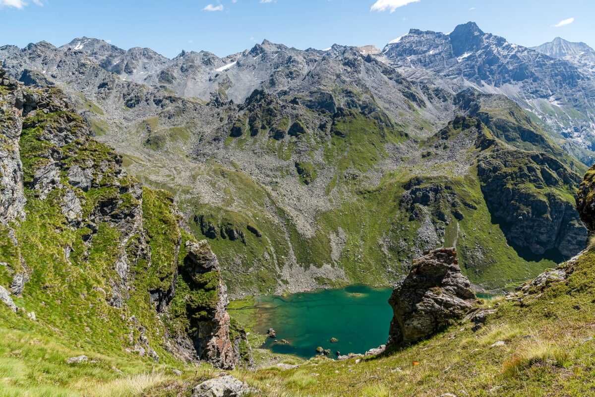
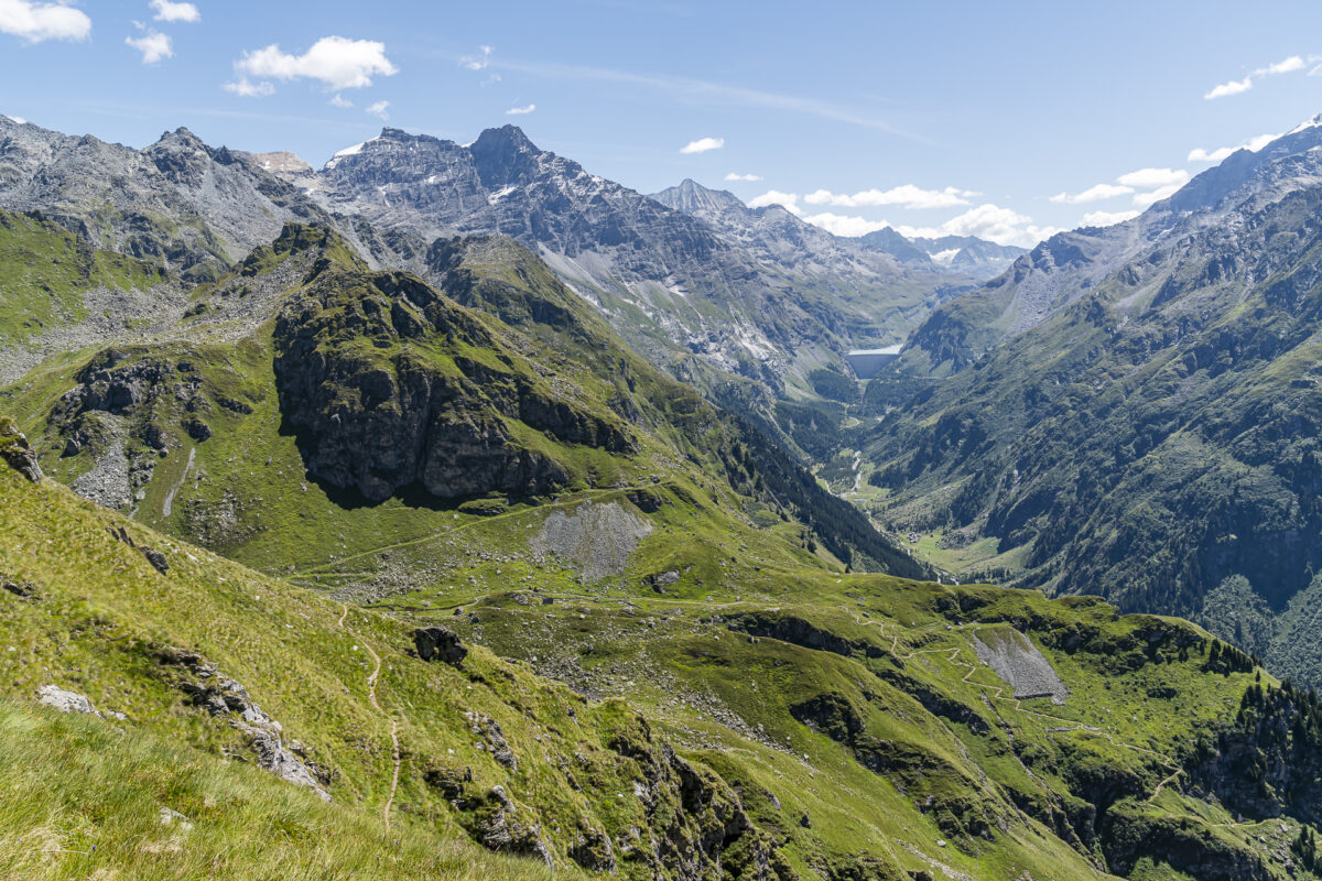
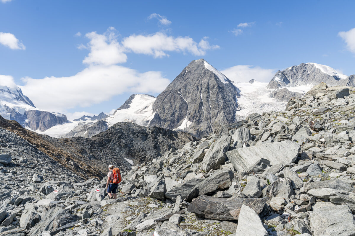
After a wonderfully quiet night, we start early into our second day of hiking. Today, we follow the 31st stage of the Alpine Passes Trail from Mauvoisin over the Col des Otanes to Cabane Brunet. The first nearly three hours, the path has only one direction: uphill! Step by step, we overcome the good 1,000 meters of elevation to the highest point of this stage. Along the way, we take a few breaks to catch our breath and enjoy the view of the shimmering turquoise Lac de Mauvoisin and the majestic Mont Fort.
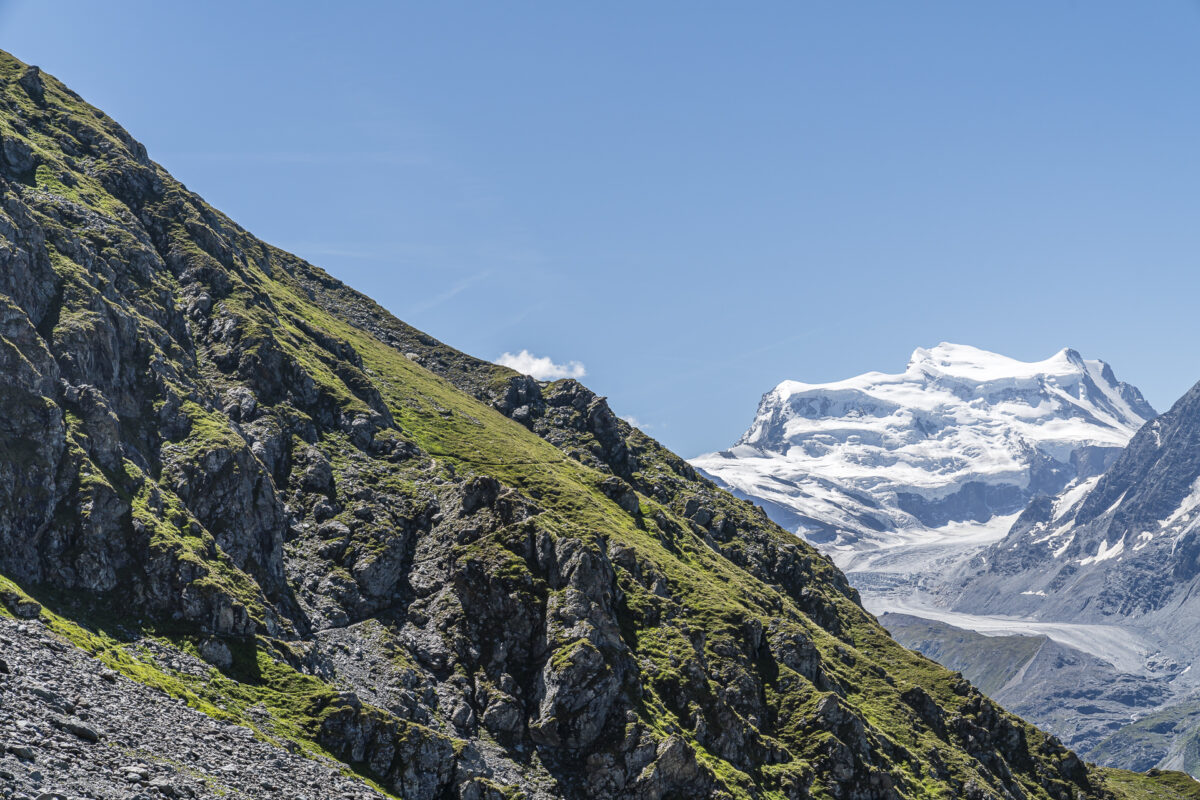
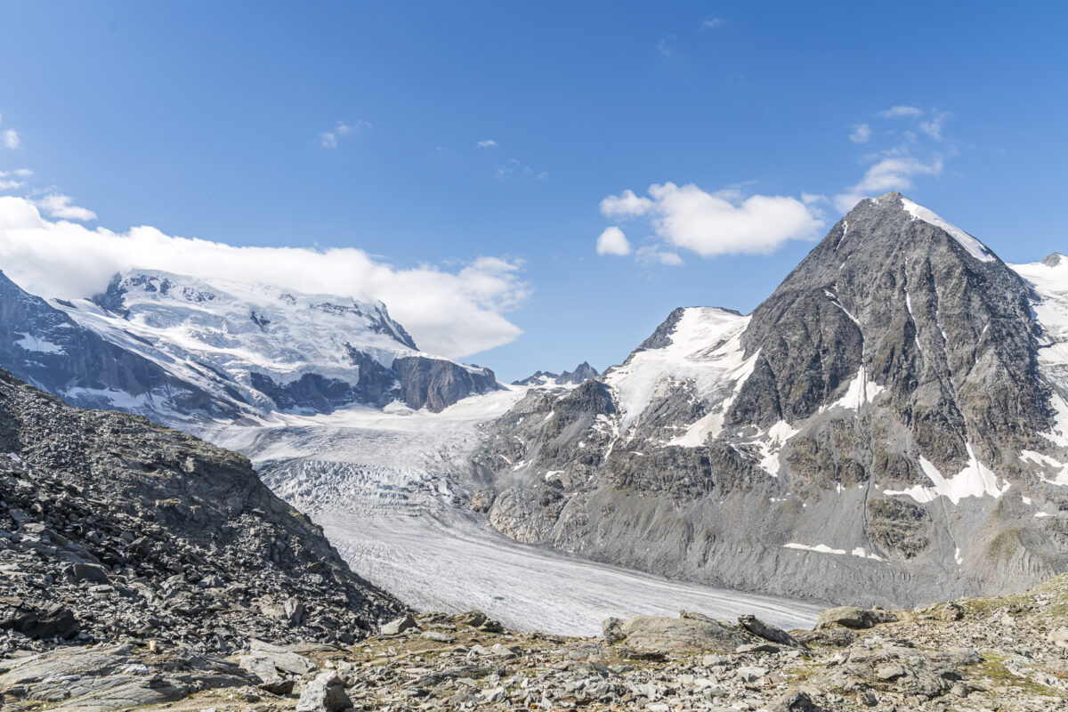
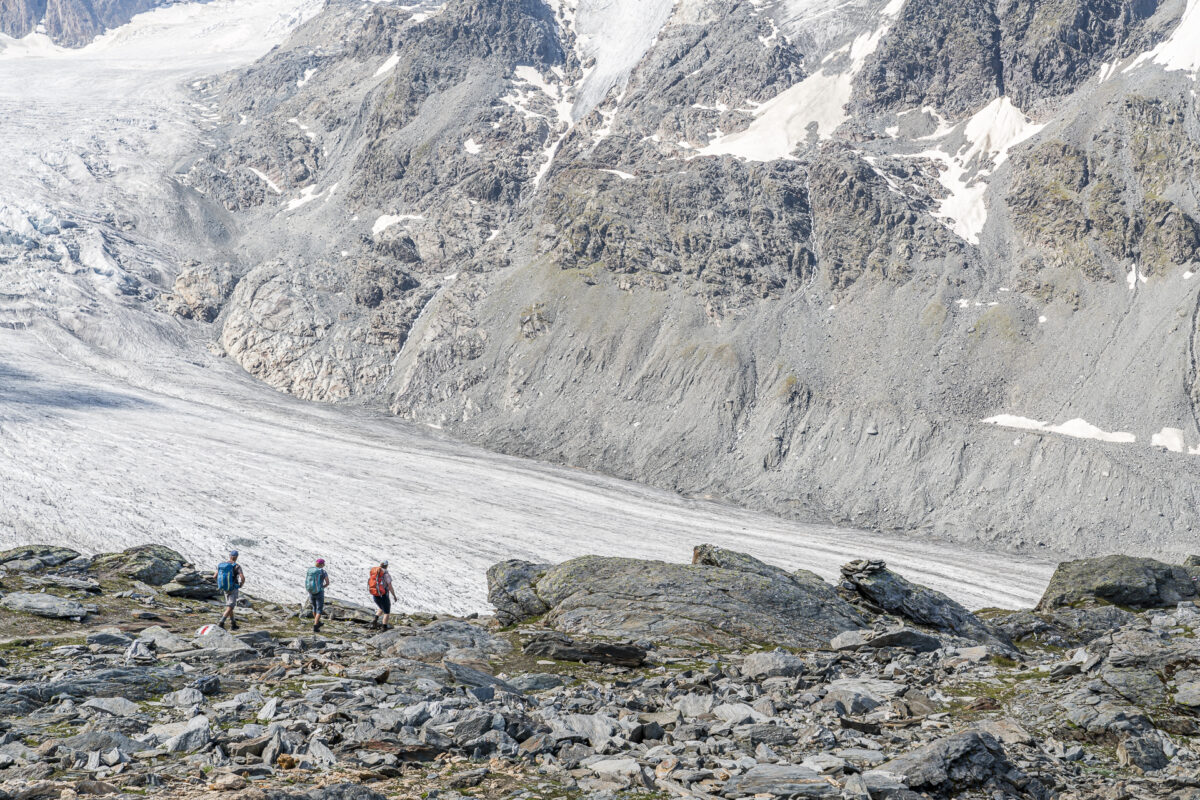
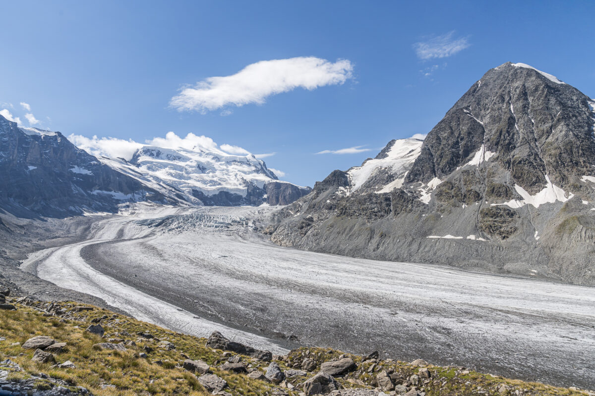
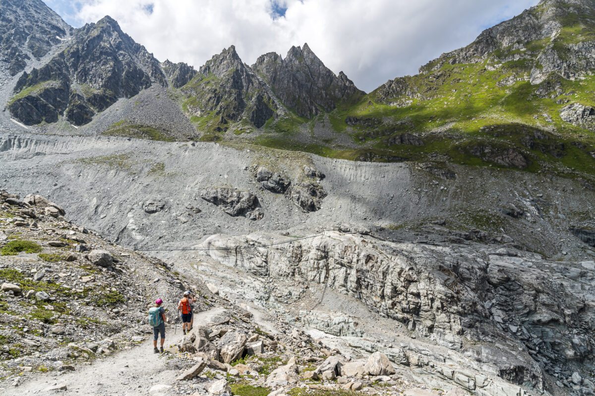
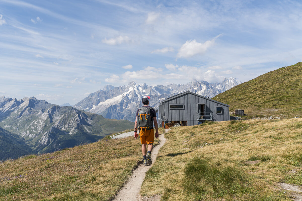
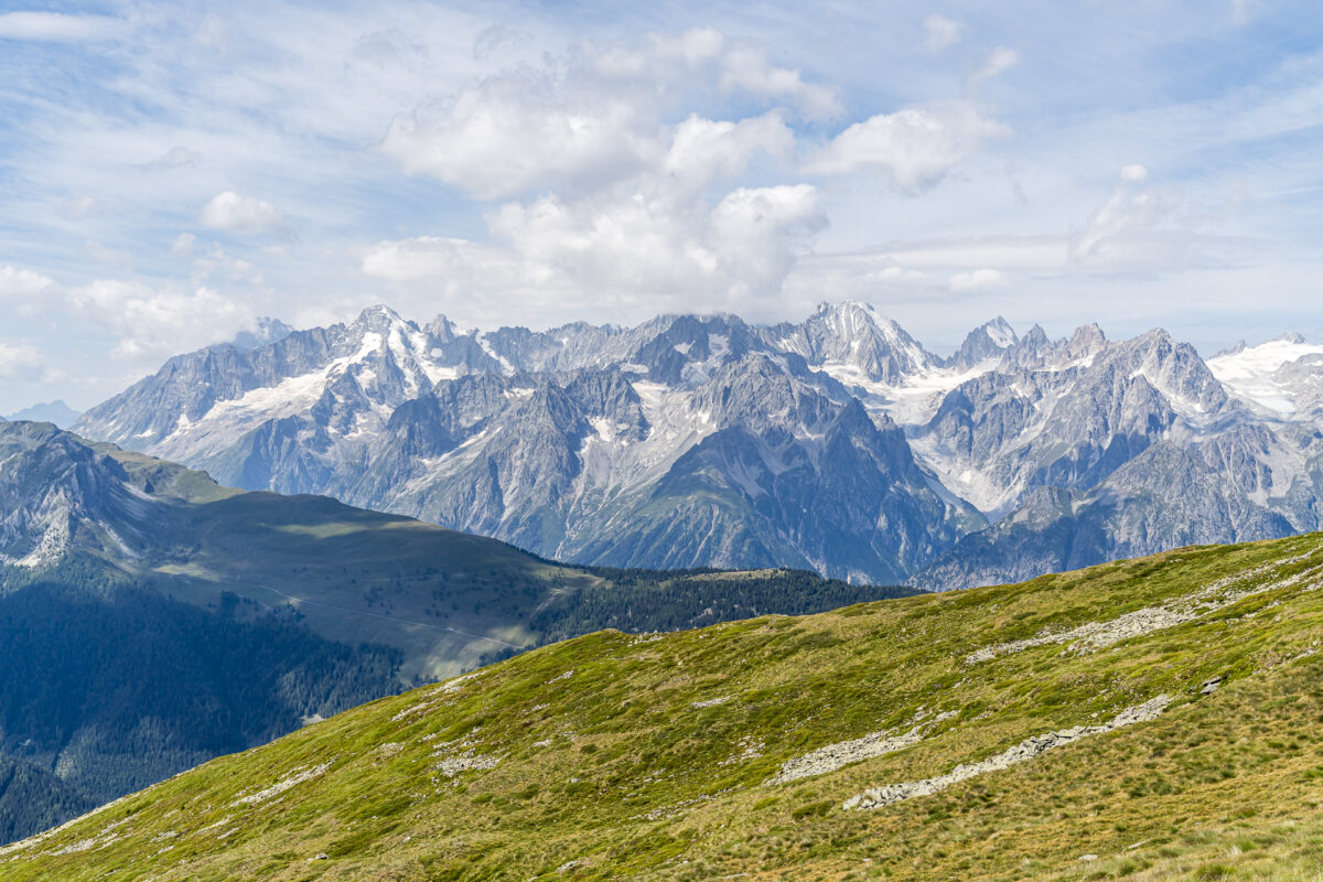
But the real spectacle is at the Col des Otanes. Here, an incomparable view opens up to us of the Corbassière Glacier, framed by the massif of the Grand Combin. Yes – the effort was definitely worth it! Once this peak is reached, it’s not too far to the Cabane FXB-Panossière. Here, we indulge in a soup to gather strength for the remaining seven kilometers to our day’s destination.
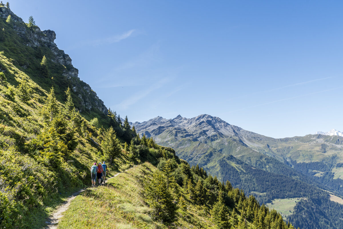
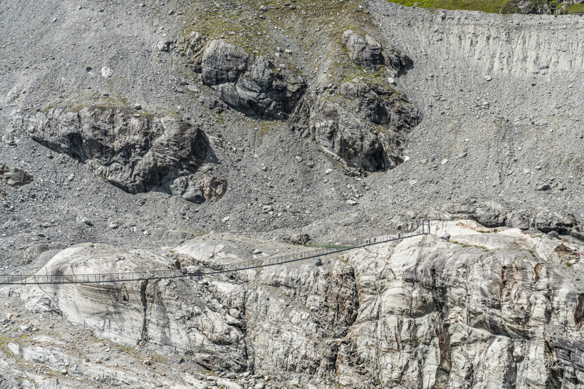
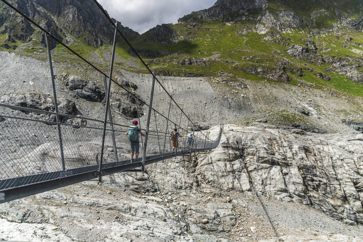
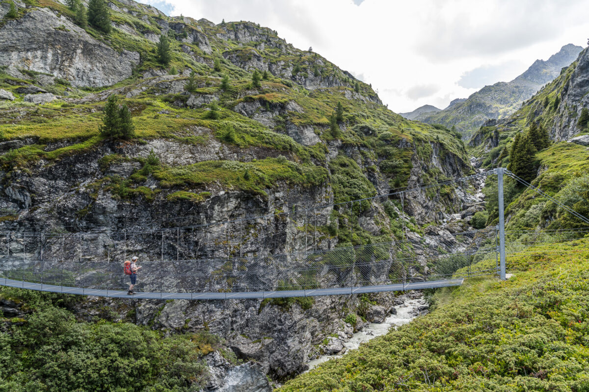
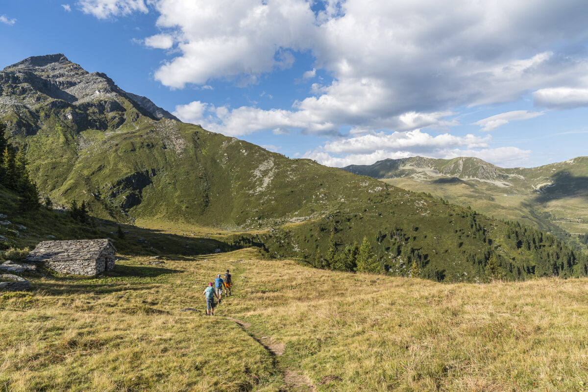
The remaining stretch to Cabane Brunet also holds more thrills, such as crossing the glacier moraine on a 190-meter long suspension bridge at a dizzying height of 70 meters. Once crossed, the landscape becomes gentler and greener. I find this segment of the trail, which follows the western flank of the Bagnes Valley and over the Torrent de Sery to Cabane Brunet, particularly charming.
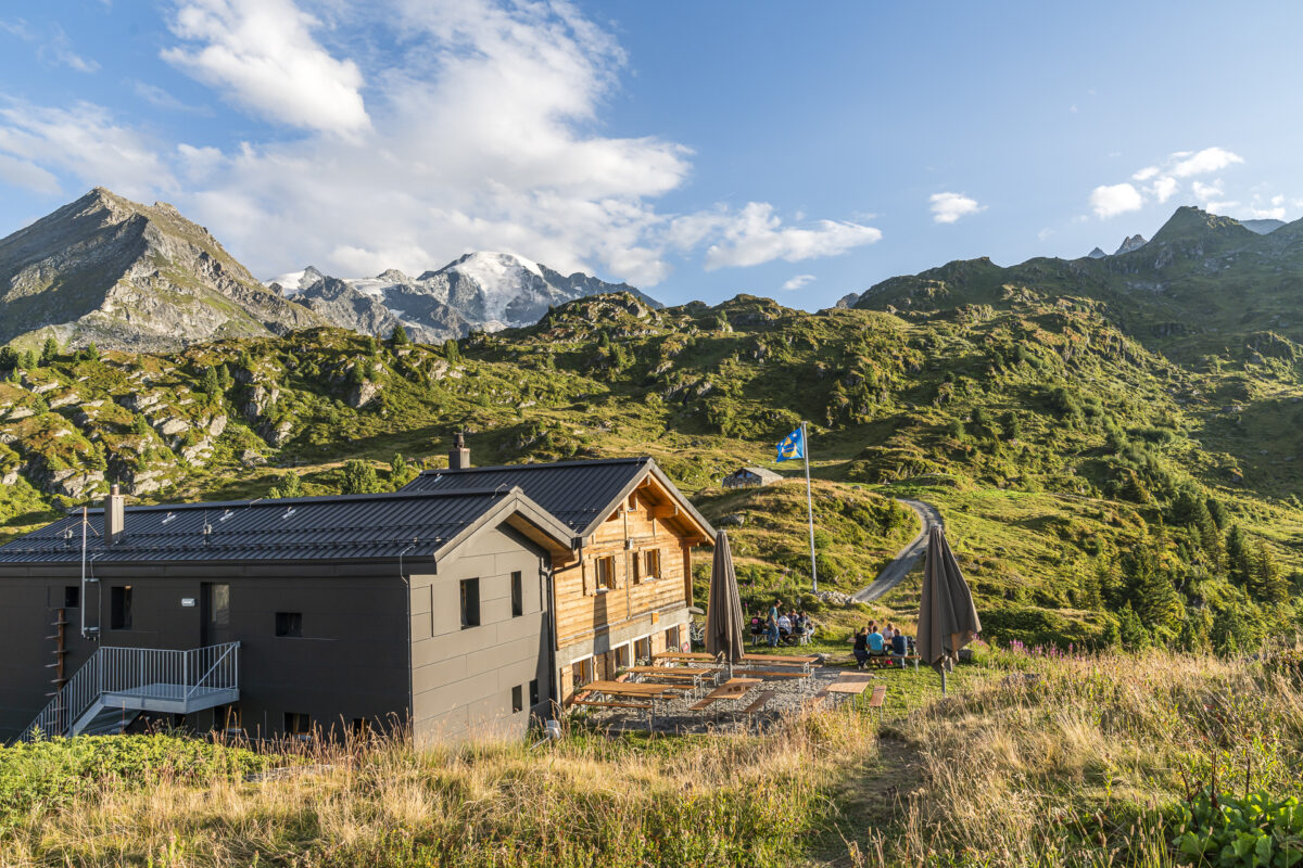
At Cabane Brunet, we are settled into a cozy 4-bed room. We enjoy the last rays of the day outside the cabin with an apéro platter and delight in the view over Val de Bagnes to the Dents du Midi. What a splendid conclusion to this second day of hiking!
Key Details of the Hike from Mauvoisin to Cabane FXB Panossière to Cabane Brunet
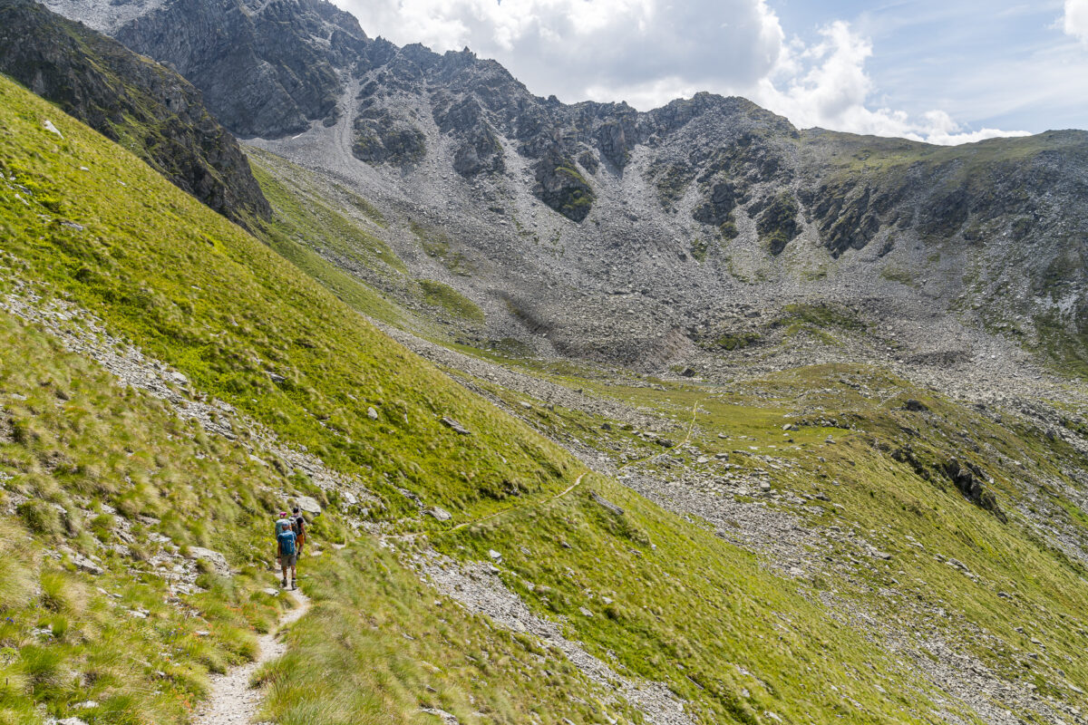
From the following map, you can trace the route of the hike from Mauvoisin via Col des Otanes to Cabane Brunet. The entire trail is marked with white-red-white signage and is classified as a mountain hiking trail of difficulty level T2/T3. Parts of the trail run through stone/scree fields – but it is consistently well-marked. Col des Otanes is located at 2,846 meters above sea level. Snow can be present at these altitudes well into the summer, which should be considered when planning your tour (equipment). The ascent is also physically demanding.
| Starting Point | Bus stop Mauvoisin (1,841 m above sea level) |
| Accessibility | Starting point accessible by public transport / Cabane Brunet accessible by road |
| Length | 13.8 kilometers |
| Elevation Gain | ↗ 1,239 m ↘ 979 m |
| Duration | 5:45 h |
| Destination | Cabane Brunet (2,102 m above sea level) |
| Refreshment Option | Cabane FXB Panossière |
3. Hiking Day: from Cabane Brunet to Bourg-St-Pierre (Alpine Passes Trail, Stage 32)
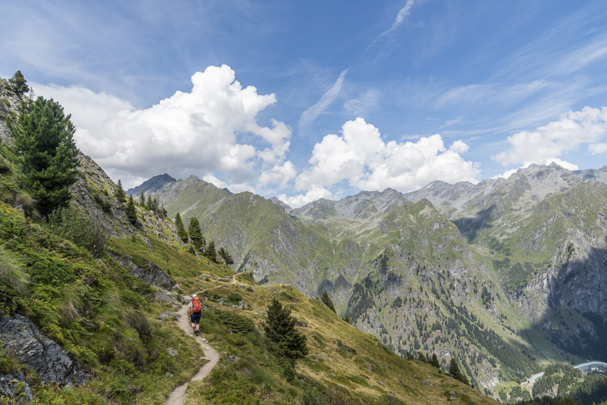
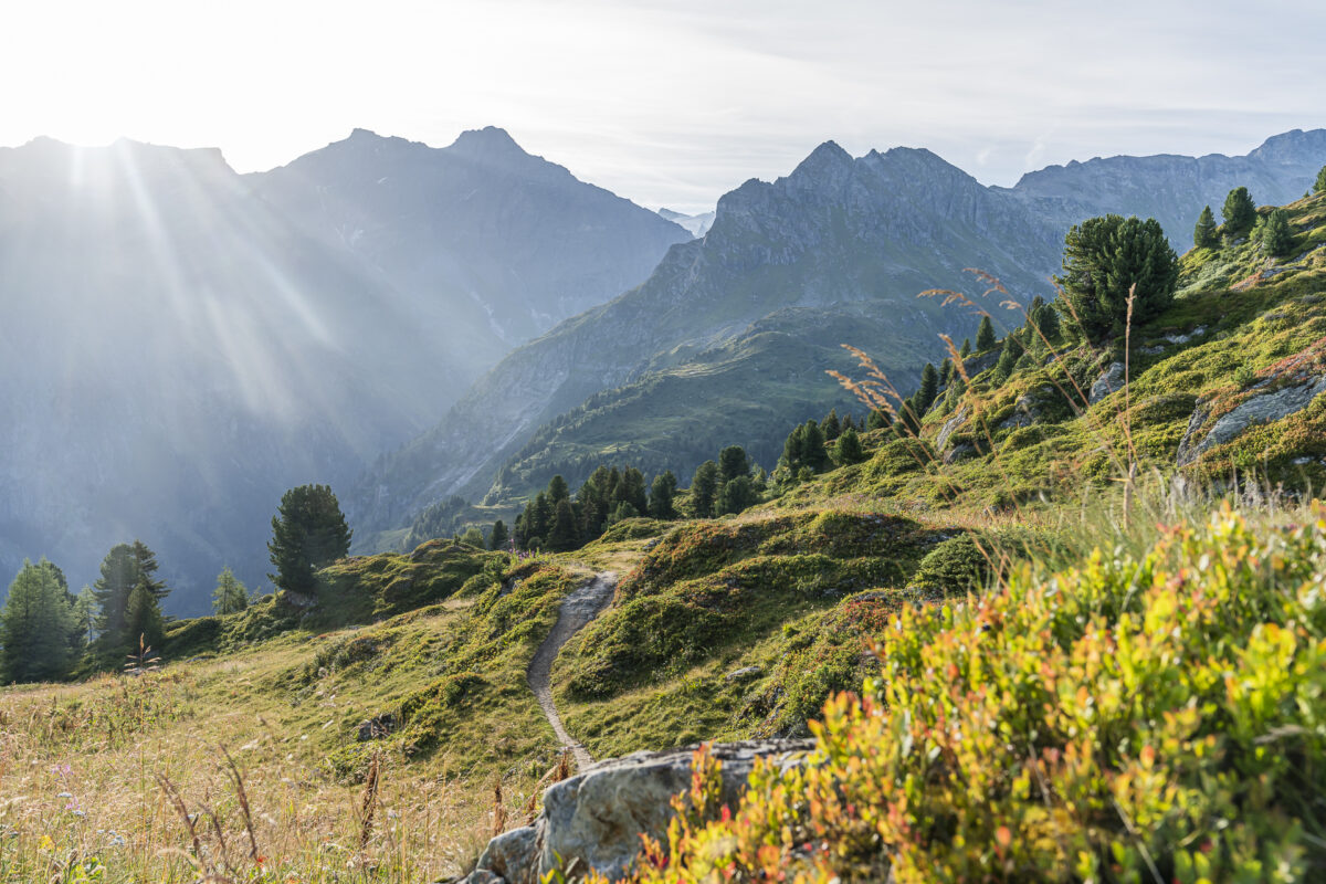
The third day of hiking also greets us with blue skies and perfect visibility. Today, we continue on the Alpine Passes Trail over the Col de Mille into the Val d’Entremont at the foot of the Great St Bernard. In the first kilometers, we enjoy the panoramic view over Val des Bagnes. The path here follows the contours with a gentle rise and fall up to the Alpage Chaux de Servay. What surprises us somewhat is the path’s condition – although this section of the trail is marked yellow, it presents several large boulders and root stocks and is by no means a boring, straight, paved path.
The relatively short but intense climb to Col de Mille starts after the alpage. Complicating matters for us was that our visit coincided with an E-Bike Festival, and the organizers had the brilliant idea to route the Mont-Blanc E-Tour over the hiking path. And let me tell you: a steep pass climb where you have to dodge an e-bike rider every 30 seconds (with practically no room to sidestep on either side of the path) is anything but fun.
At least the scenery at 2,473 meters elevation at the base of Mont Rogneux soothes us. The view of the Mont Blanc Massif is tremendous. Before the long descent to Bourg-St-Pierre, we fortify ourselves at the Cabane de Mille with soup and cake. Afterward, some perseverance is required—the hiking trail winds down over alpine pastures more than a thousand meters to the Val d’Entremont.
Key Details of the Hike from Cabane Brunet to Col de Mille to Bourg-St-Pierre
From the following map, you can trace the route of the hike from Cabane Brunet via Col de Mille to Bourg-St-Pierre. The first roughly six kilometers run along a yellow-marked hiking trail. However, I would classify this path more as a white-red-white marked mountain trail (T2) and would not recommend hiking it in sneakers. The section over Col de Mille to Alpage Boveire d’en Bas is actually marked as a white-red-white mountain hiking trail (difficulty level T2/T3). The last almost five kilometers run along a yellow-marked forest road (wide gravel path). This stage is significantly less alpine in nature than the first two stages, but with a length of 19 kilometers, it requires a suitable level of fitness.
| Starting Point | Cabane Brunet (2,102 m above sea level) |
| Accessibility | Cabane Brunet accessible by road / Destination accessible by public transport |
| Length | 19.3 kilometers |
| Elevation Gain | ↗ 906 m ↘ 1,386 m |
| Duration | 6:15 h |
| Destination | Bus stop Bourg-St-Pierre, Commune (1,632 m above sea level) |
| Refreshment Option | Cabane de Mille |
Practical Tips for Your Hike on the Alpine Passes Trail
- As this multi-day hike reaches altitudes up to nearly 2,900 meters, it is advisable to plan your tour from mid-July to mid-September. Depending on the winter, snowfields may linger longer on the northern slopes.
- The summer season at Cabane de Louvie and Hotel de Mauvoisin starts at the end of May.
- At Hotel de Mauvoisin (destination of the first day of the hike, online reservation possible), there are dormitory rooms as well as single, double, and triple rooms with shared toilets/showers. A double room costs 150 CHF. Half-board (dinner and breakfast) is 30 CHF per person.
- The summer season at Cabane FXB-Panossière starts at the end of June and lasts until the end of September. Lunch is served from 12:00 PM to 2:30 PM (those arriving before 12:00 PM will not get a hot meal).
- Cabane Brunet (destination of the second day of the hike, online reservation possible) starts its summer season in mid-June. An overnight stay including half-board costs 80 CHF for adults. In summer, Cabane Brunet is accessible by road and is thus very popular with families with children.
- The summer season at Cabane de Mille starts towards the end of June.
- From Bourg-St-Pierre, there are postbus connections towards Martigny. Check the schedule in advance to avoid long waiting times.
- If you don’t have time for a 3-day hike, the first stage can also be done as a day hike (return journey from Fionnay to Martigny) and/or stages two and three as a two-day hike.
More Hiking Tips for Lower Valais
In recent years, we’ve undertaken several other fantastic multi-day hikes and day trips in Lower Valais. Below are our favorites linked:
- The Tour du Saint-Bernard seamlessly continues this hike and leads from Bourg-St-Pierre over two additional stages (33 and 34) of the Alpine Passes Trail to La Fouly.
- The Tour des Dents du Midi is another highly recommended multi-day hike in the region.
- These hiking tips around Champex-Lac can be done either as a day trip or as a multi-day hike.
- A beautifully varied day trip into the lesser-known Vallon de Réchy is described here.
- Another easy loop hike is featured in this excursion tip around Lac d’Émosson.
- The Jardin Japonais near Nendaz is also worth a detour.

Leave a Reply