

Hike from Saxeten to Isenfluh: Perhaps the Most Beautiful Stage of the ViaBerna.
Advertisement: Post in collaboration with PostAuto AG
A varied route, magnificent panoramic views of snow-covered four-thousand-meter peaks, and sun terraces with enviable views—all of this is combined in the 13th stage of the ViaBerna from Saxeten to Isenfluh. The long-distance hiking trail through the Canton of Bern, opened in April 2022, has many scenic sections, but after our hike from Saxeten to Isenfluh, I dare say: this one is the most beautiful!
With the Saxeten Line and Isenfluh Line into Hiking Paradise
In collaboration with PostAuto, I present to you in this section selected excursion destinations in the Bern/Central Switzerland region that are located along various PostAuto lines. After our detour to the Gstaad Saanenland region, where we explored both the area around the mountain village of Abländschen as well as the family-friendly Turbachtal, followed by a spectacular ridge hike on the Melchsee-Frutt, a detour to the ultimate hiking paradise was on the agenda. How do you get there? Either from Wilderswil with the Saxeten Line or alternatively from Lauterbrunnen with the Isenfluh Line.
Starting the Hike in Saxeten
After a very unsettled June in terms of weather, we got really lucky with the weather for our excursion to the Bernese Oberland. “This is going to be a hot one,” I think as we arrive at Wilderswil station, considering the cloudless blue sky and the altitude gain ahead of us. Since the connections between Bern and Interlaken can be tight depending on the schedule, we deliberately chose the relaxed travel option with the IC 81 (Zurich – Interlaken direct). Another plus: thanks to the earlier arrival in Wilderswil, we have an advantage when it comes to choosing seats on the PostAuto. The minibus fills up to the last seat this Friday morning—no wonder, with such great hiking weather.
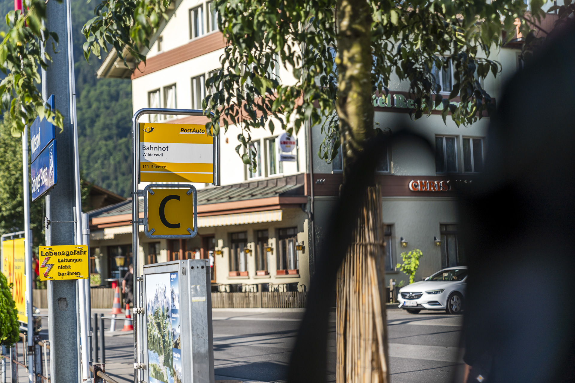
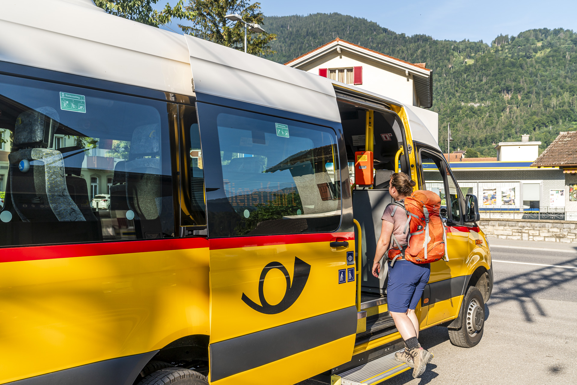
The PostAuto ride from Wilderswil station to the final stop Saxeten, Schulhaus takes about 20 minutes. Along the way, I catch glimpses of the surrounding mountains and the turquoise shimmering Lake Brienz—this will cross our path again later.
Upon arrival in Saxeten, the ViaBerna signpost guides us on our way. Admittedly, we have a bit of a home advantage, as we set off in the opposite direction from here two years ago. Back then, we followed the 12th stage of the ViaBerna from Saxeten to the Suldtal—including a sporty detour to the summit of the Morgenberghorn.
Up Pleasantly Shaded Paths to the Bällenalp
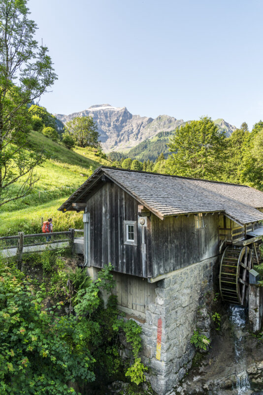
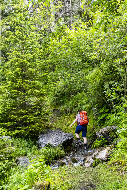
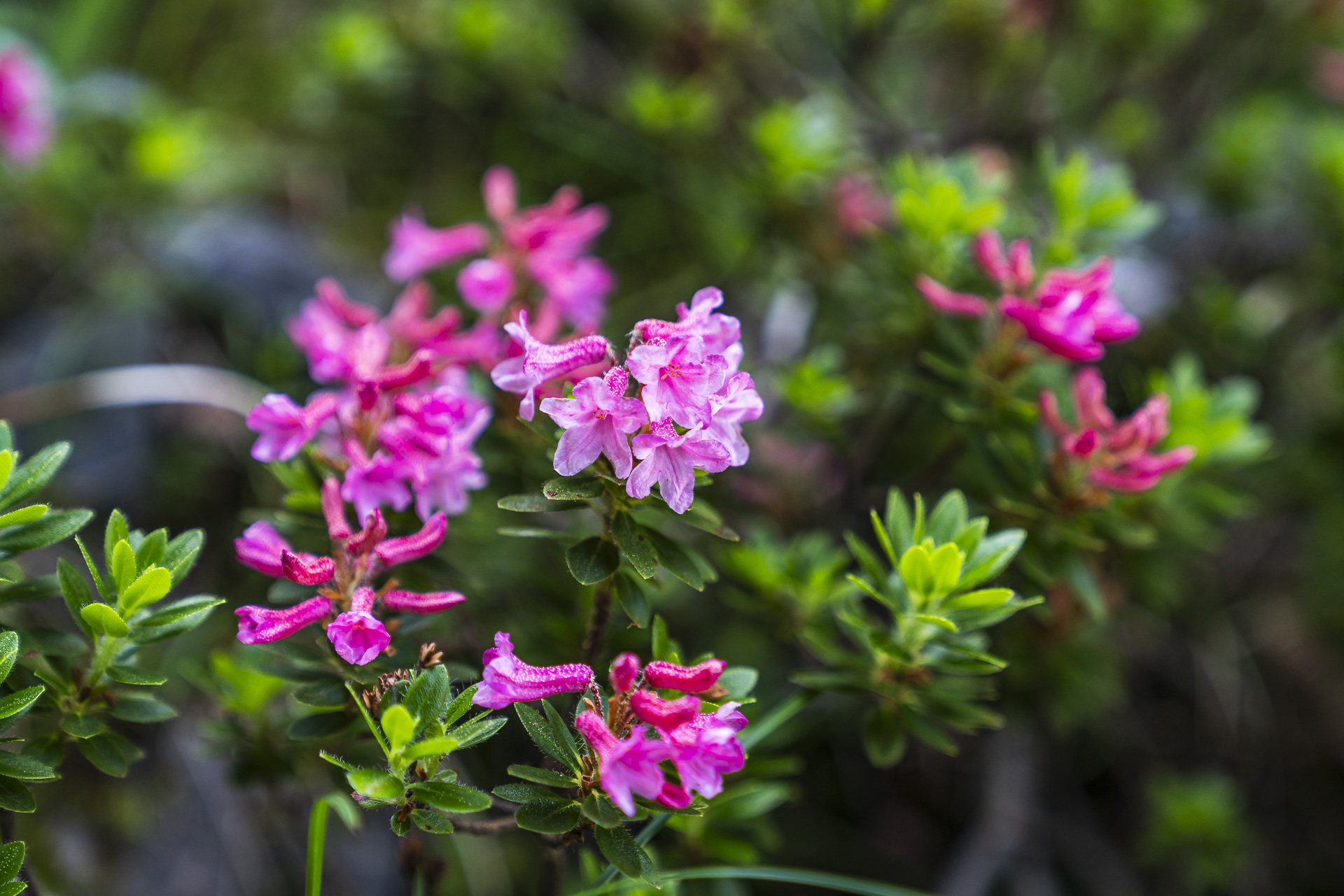
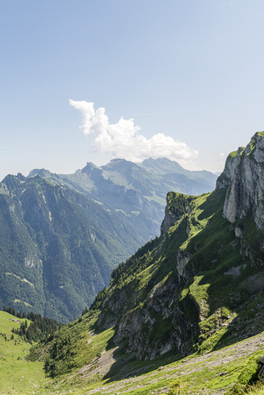
Just a few meters in, we immediately notice the clear advantages of the 13th stage. Unlike the ascent to the Morgenberghorn, which leads over sun-soaked and sparsely wooded southern slopes, we follow the Saxetbach stream into the shaded valley basin. The first kilometer runs along a moderately ascending gravel path. Then the trail gets more exciting. We hike over root-covered and rain-dampened forest paths from June, navigate through flower-rich pasture passages, and climb over steps and boulders ever higher towards the Bällenalp. With every meter of altitude gained, the view becomes more impressive.
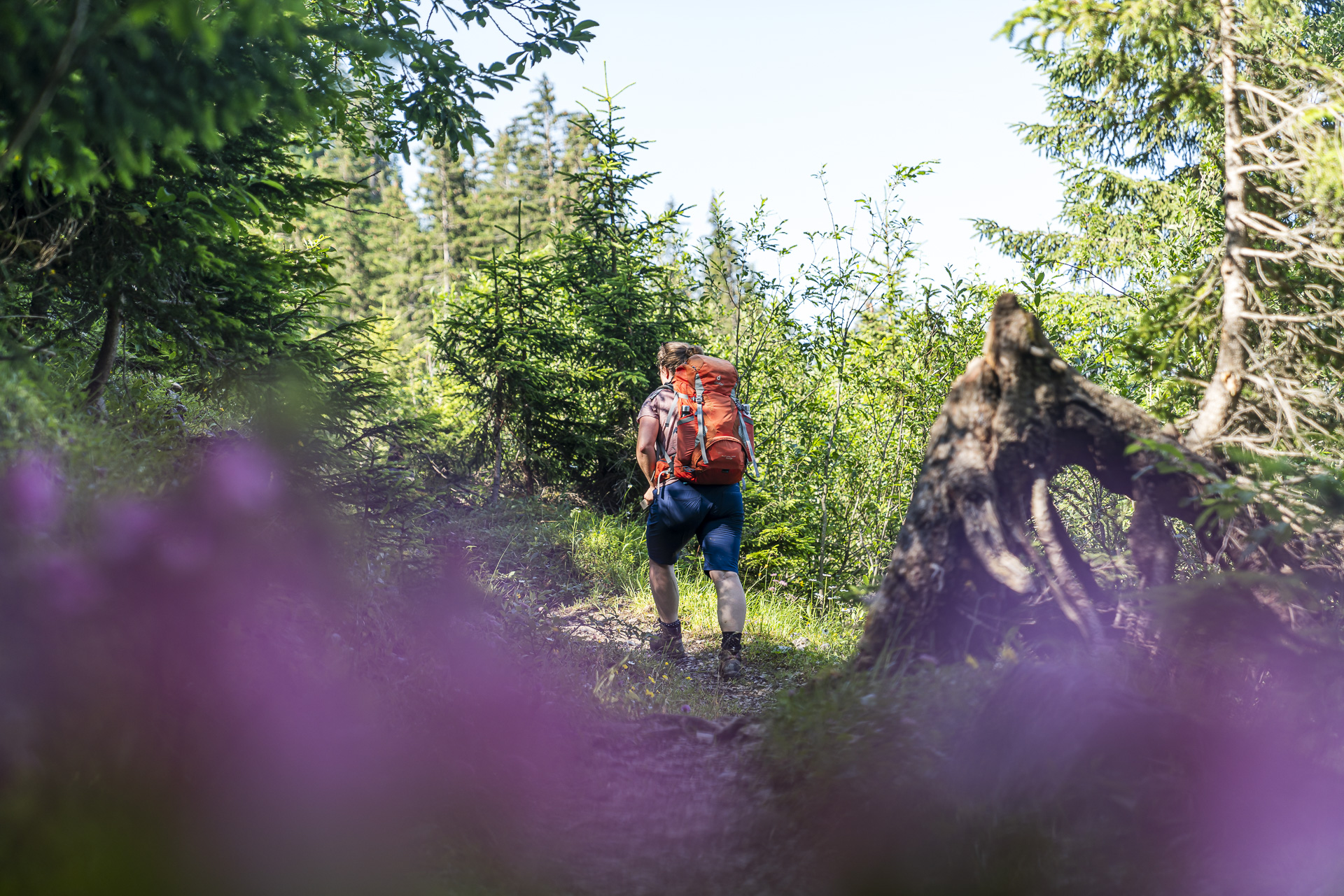
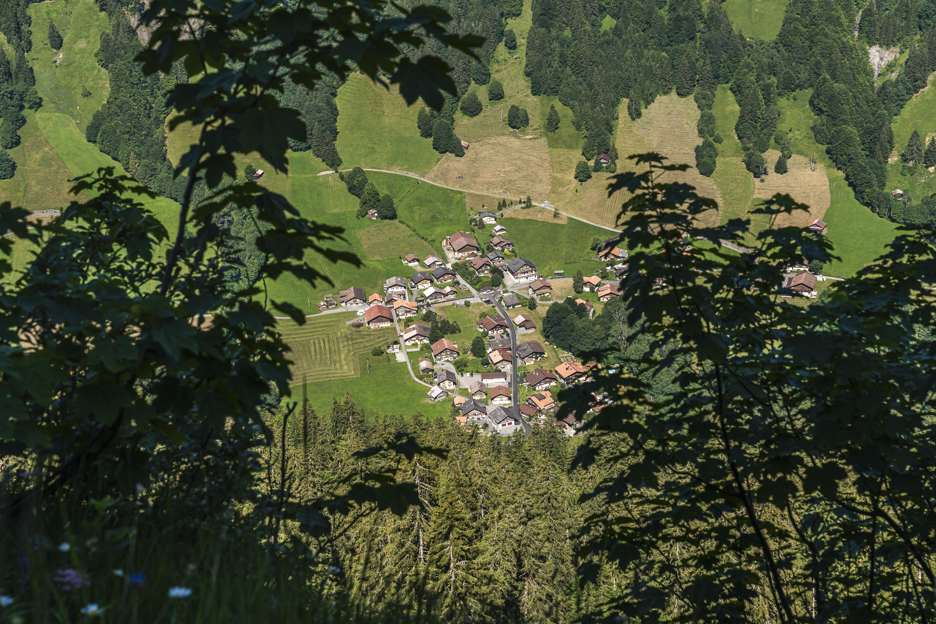
A good reason to take a break occasionally and enjoy the panorama. Especially impressive are the views down to Saxeten, which we catch through the thicket from time to time. Just over an hour ago, we were still down in the village, and now we’ve already completed almost half of the ascent.
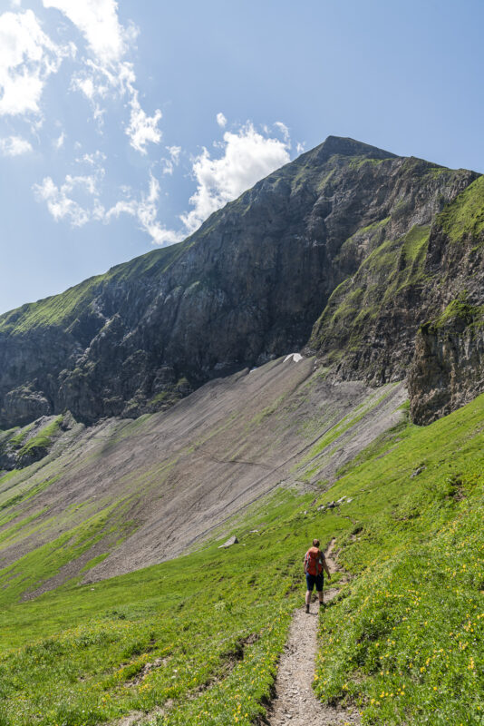
Between Schlipfwengen and Usser Bällen, we quickly gain more altitude thanks to high steps. However, these are also felt in the thighs, so I’m relieved when we reach the open karst landscape of the Bällenalp. The first intermediate goal—the Bällefurgge—is now in sight. The only downside: with reaching the treeline, we definitely leave the pleasant shade behind.
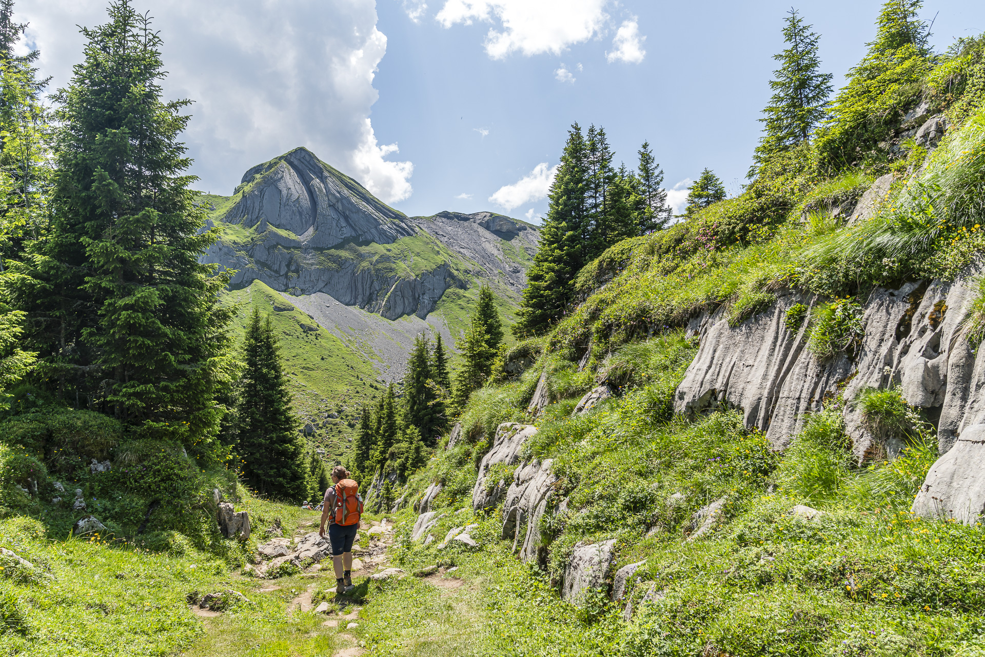
Through the Tschingel Rock Basin to the Schärihubel
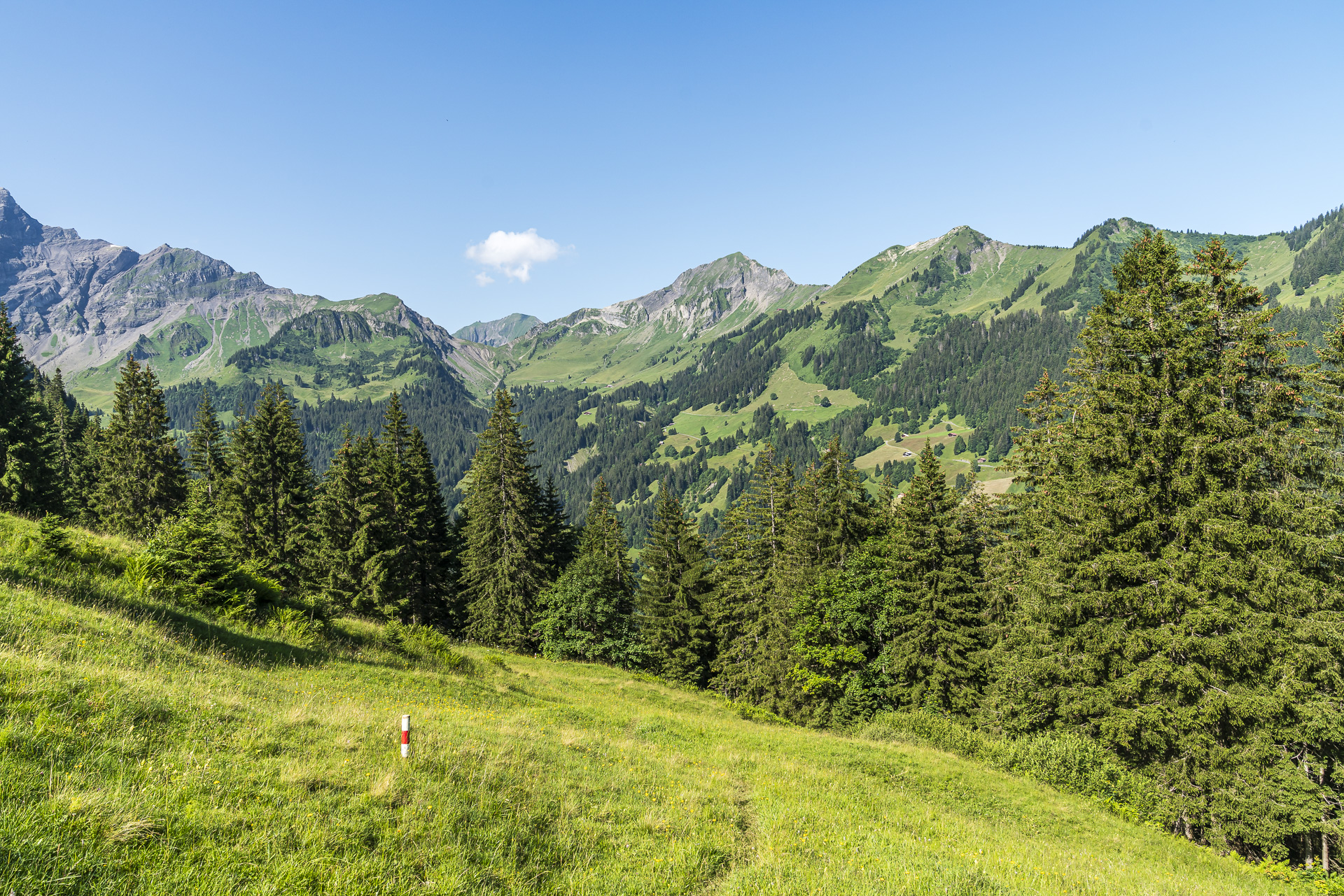
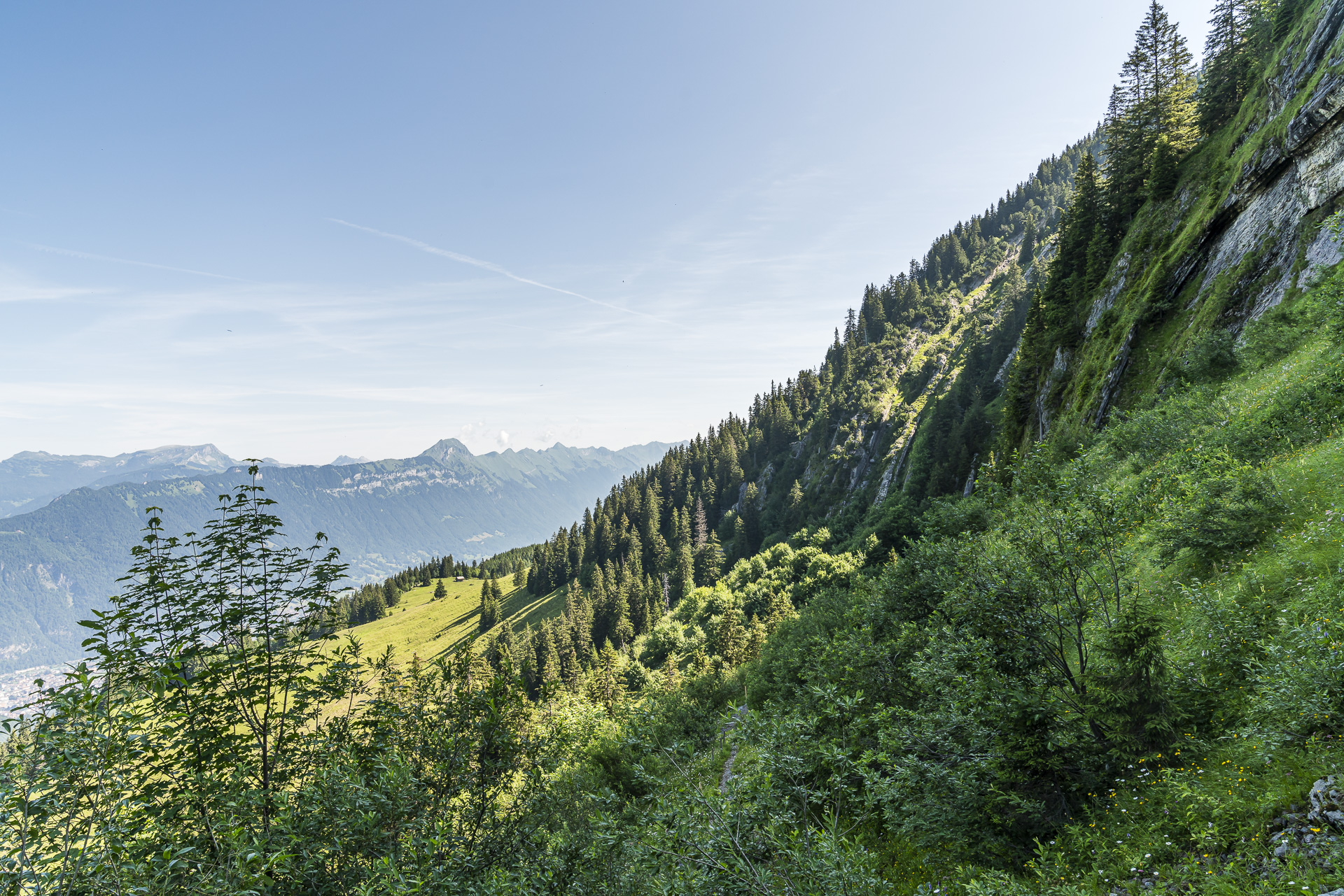
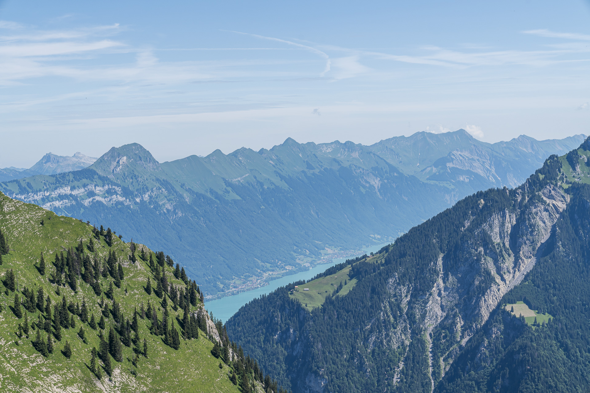
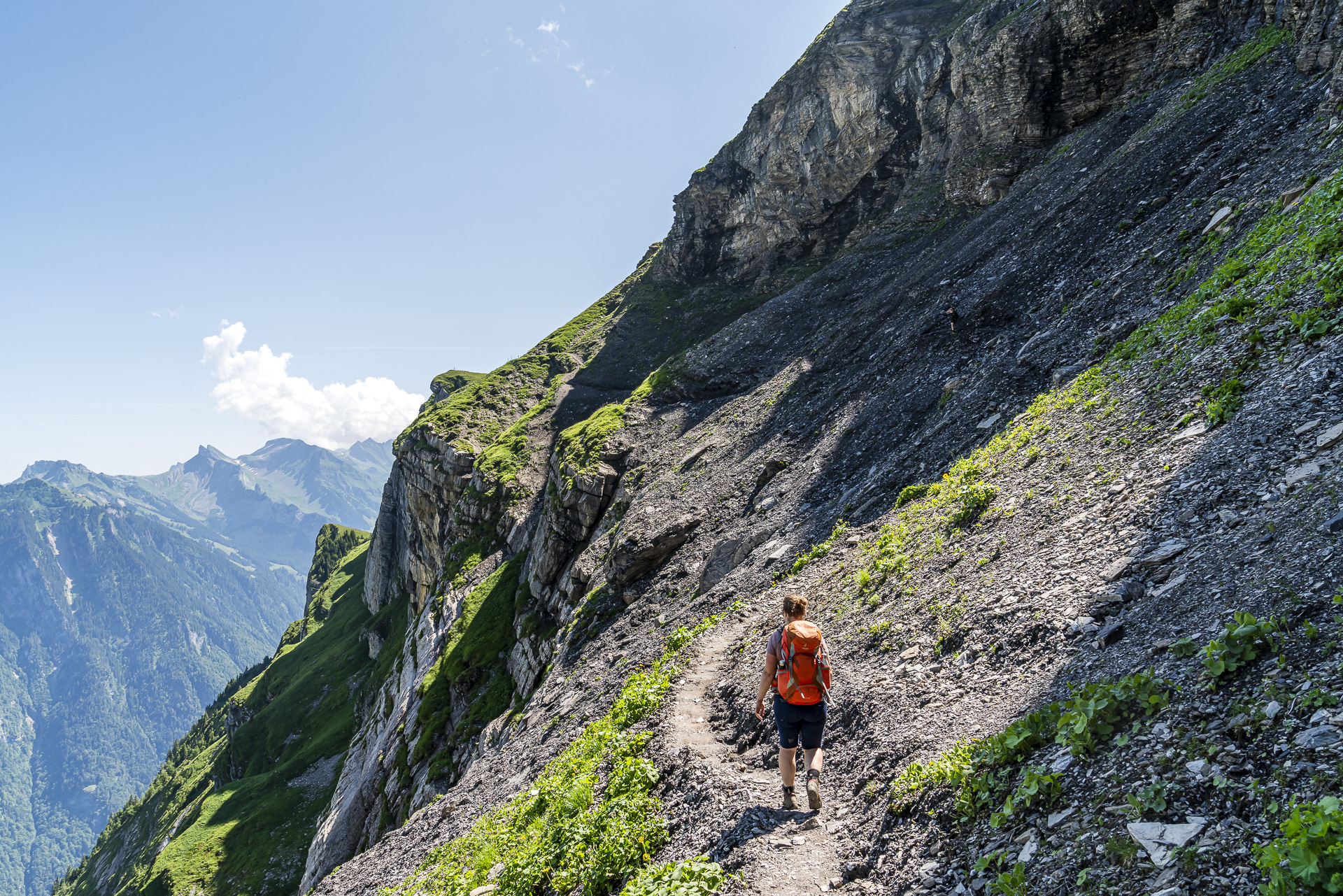
But the trail is about to get even more spectacular. From the Bällefurgge, we can view the rest of the route to the Schärihubel from a distance. The narrow path leads us purposefully through the Tschingel rock basin. The route is not particularly technical but requires surefootedness and a head for heights, as there are some steep sections (especially in the last third just before the Schärihubel). In return, the opposite side of the valley presents the Augstmatthorn and the Schynige Platte at their best—and yes: there’s another coveted view of Lake Brienz!
Deluxe Rest Spot – Break at the Lobhornhütte
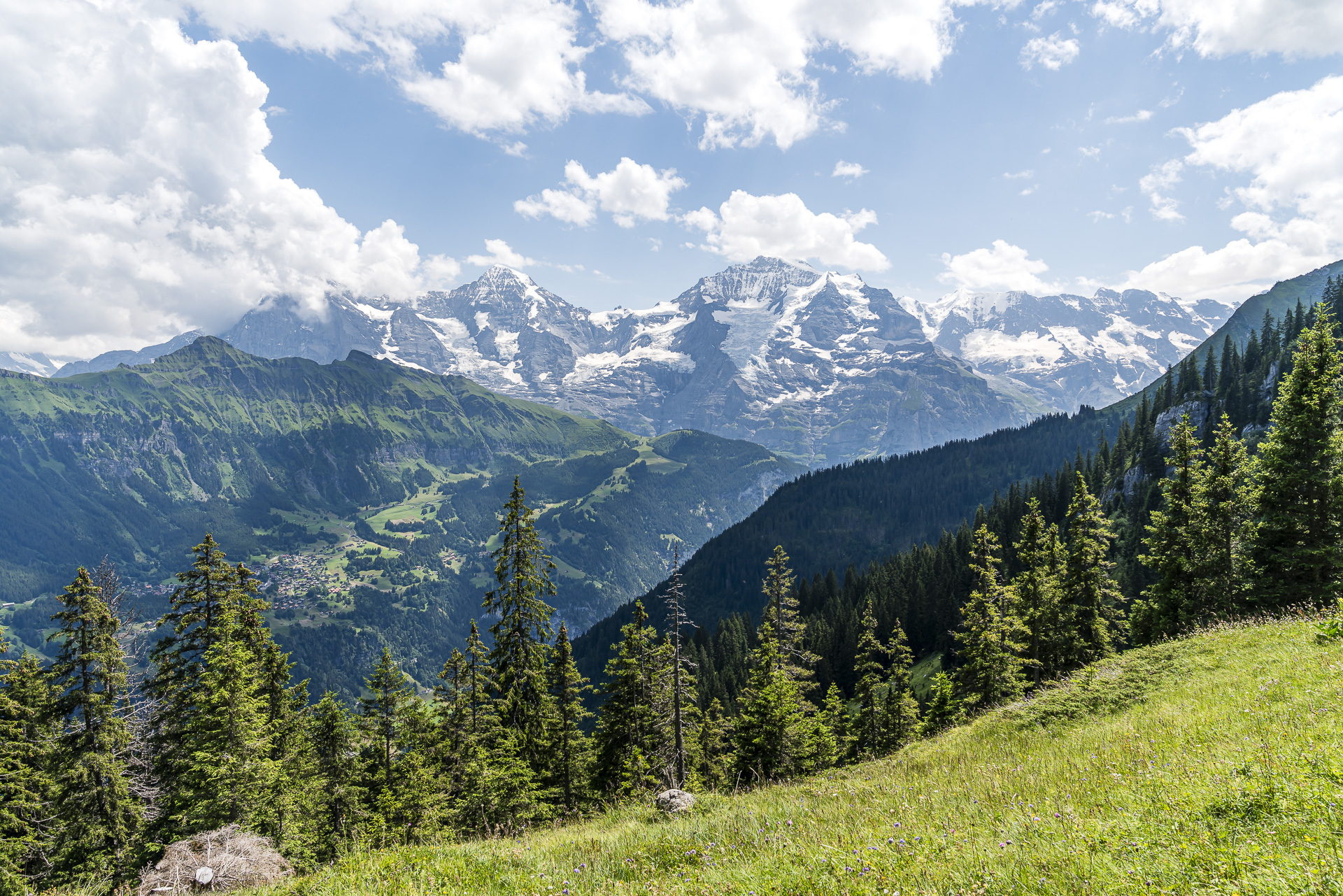
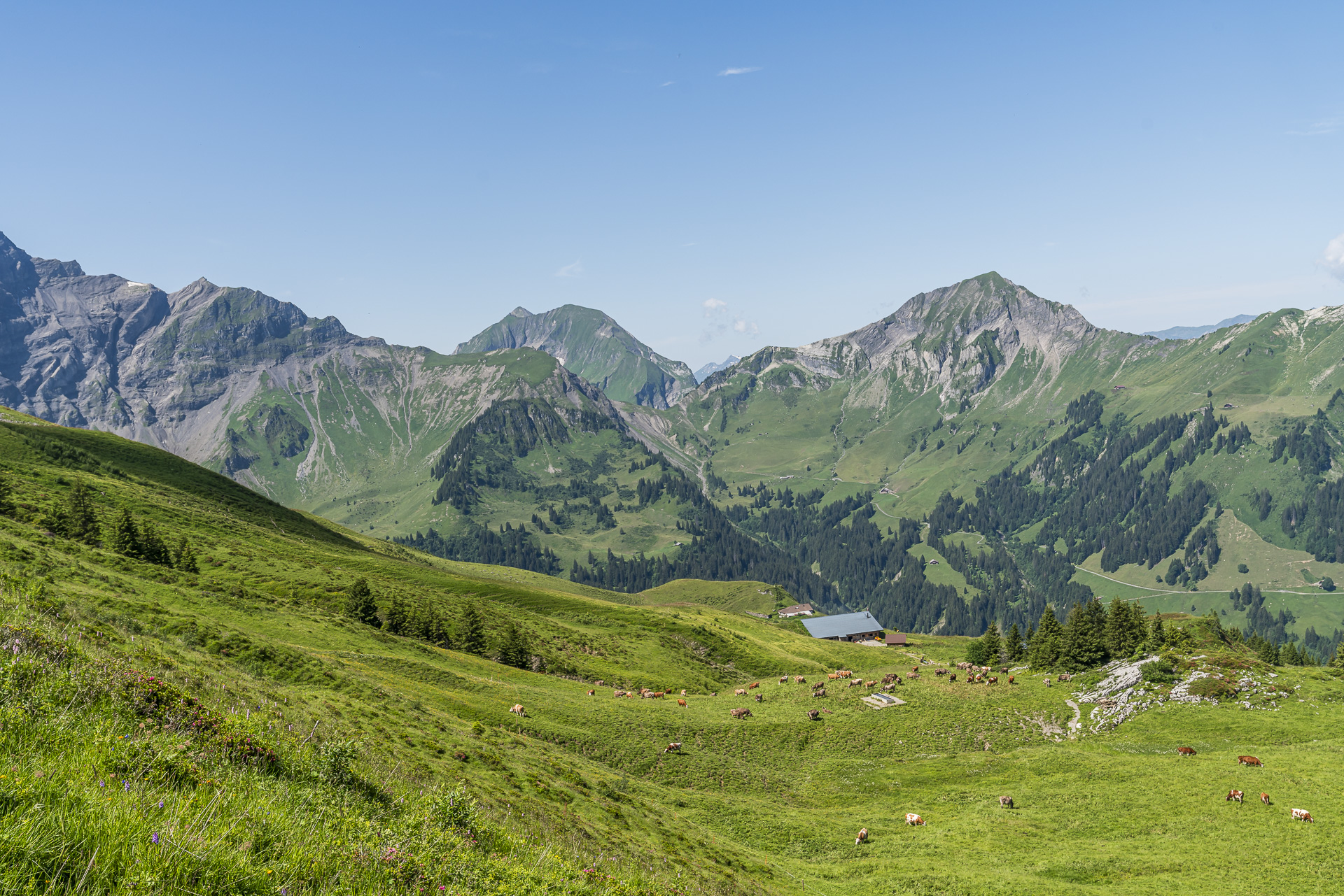
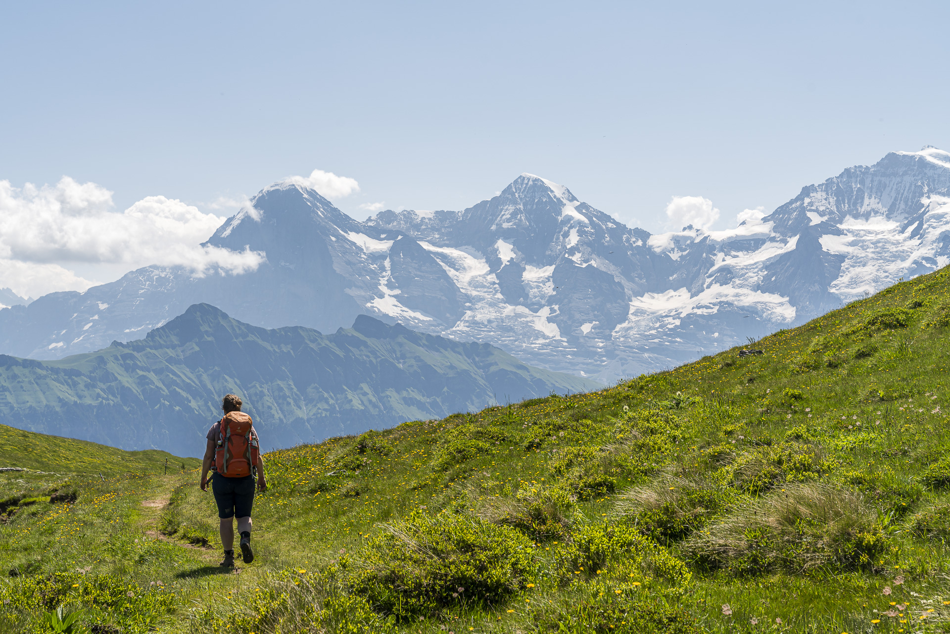
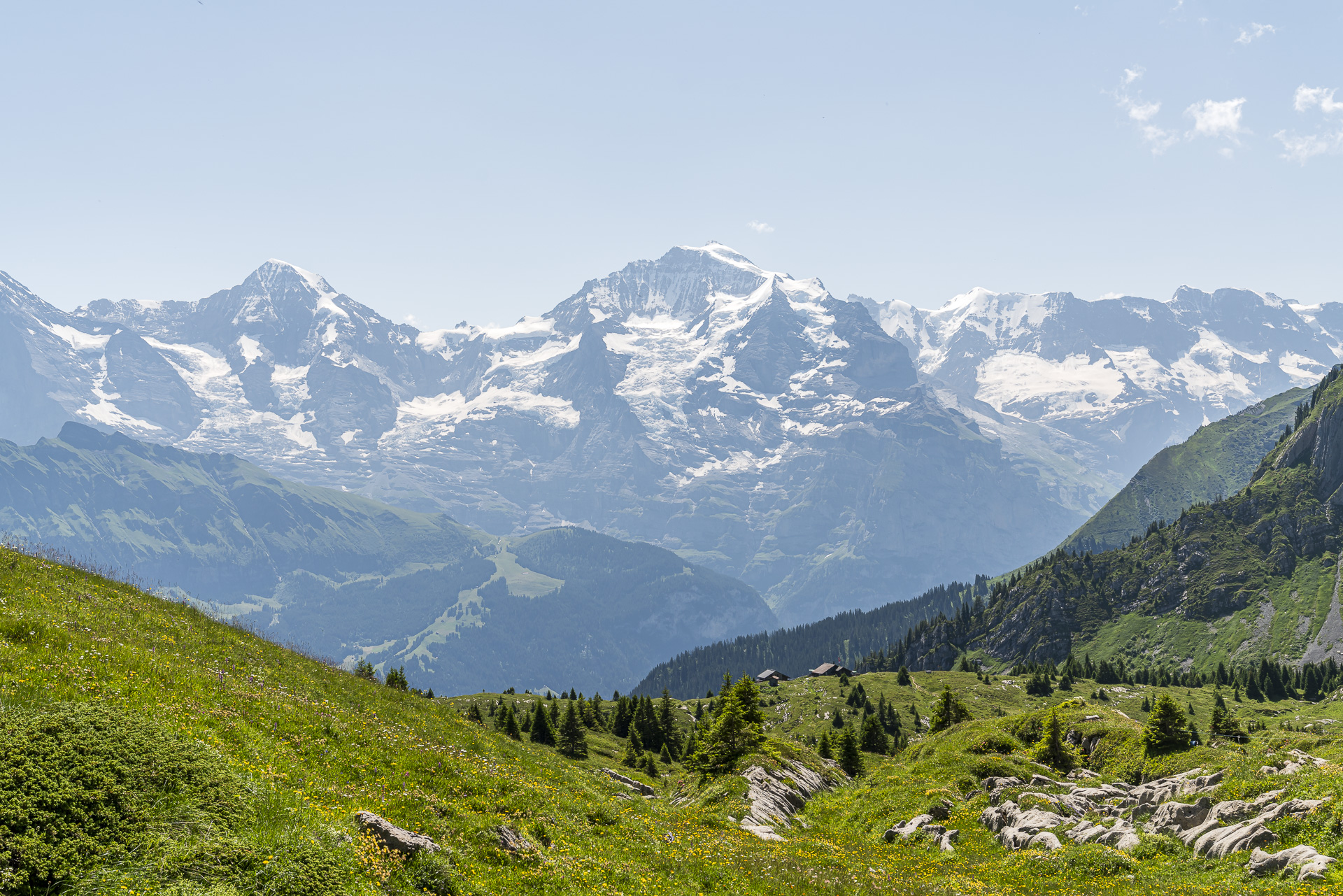
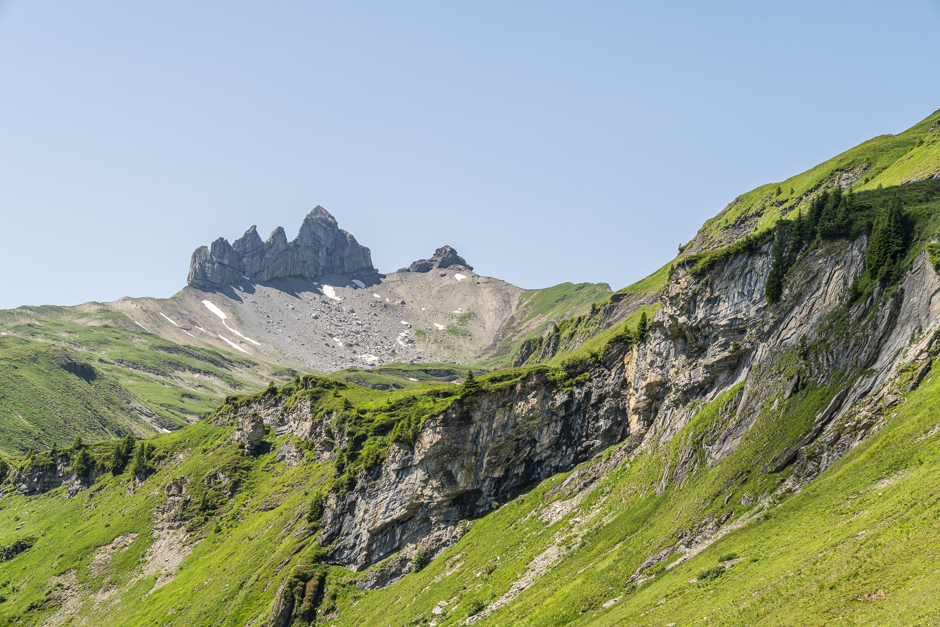
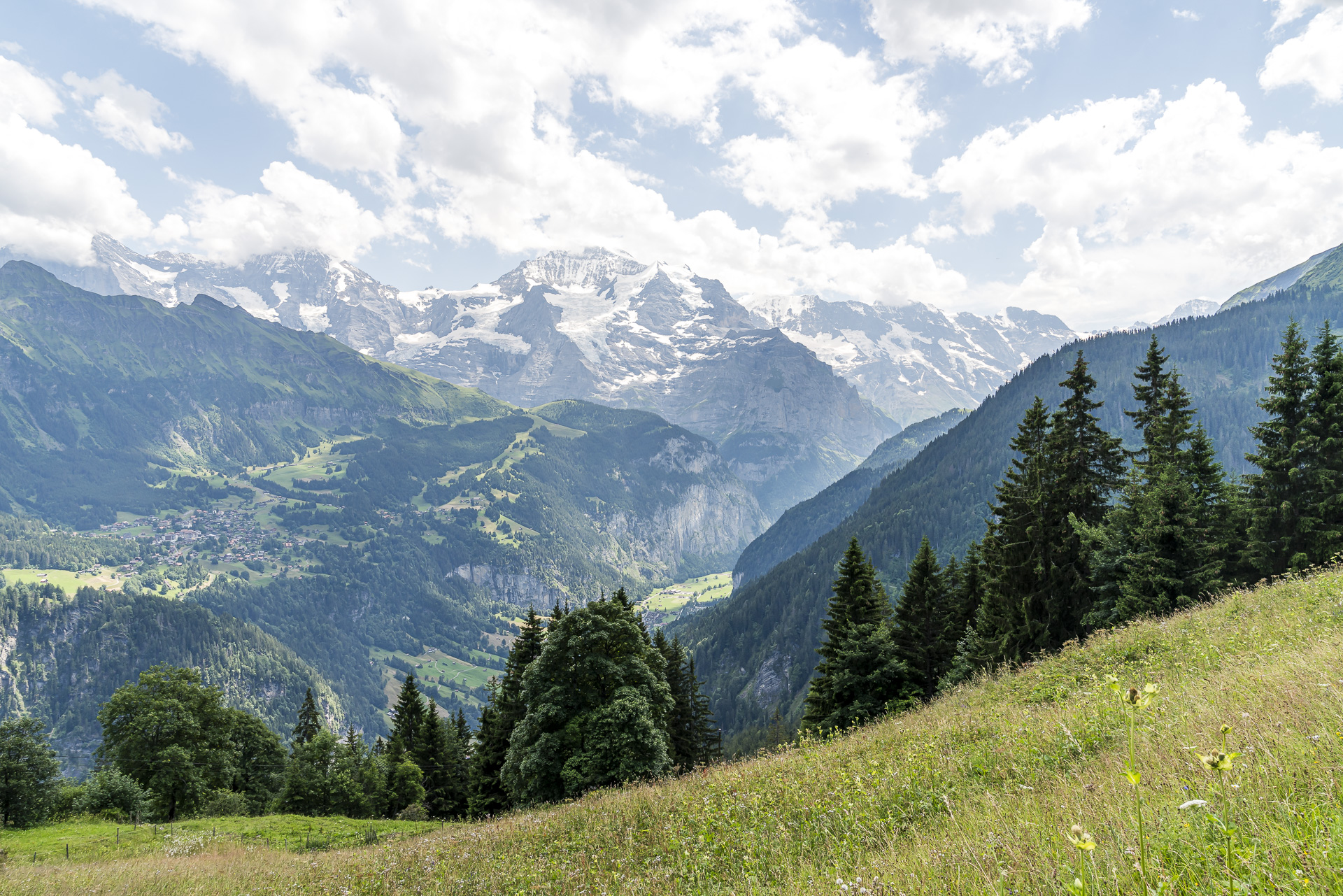
But the real highlight is still ahead of us. When we reach the high plateau of the Schärihubel, the Eiger, Mönch, and Jungfrau suddenly appear on the horizon. What a majestic sight. The famous trio of the Bernese Alps accompanies us on our descent towards the Lobhornhütte at every step. The rock towers of the Lobhörner, towering high above the Sulsseewli, are also impressive. If you like, you can take a short detour to the shore of the mountain lake and enjoy an extended picnic break there. Since we didn’t pack a picnic and are getting hungry, we head straight to the Lobhornhütte.
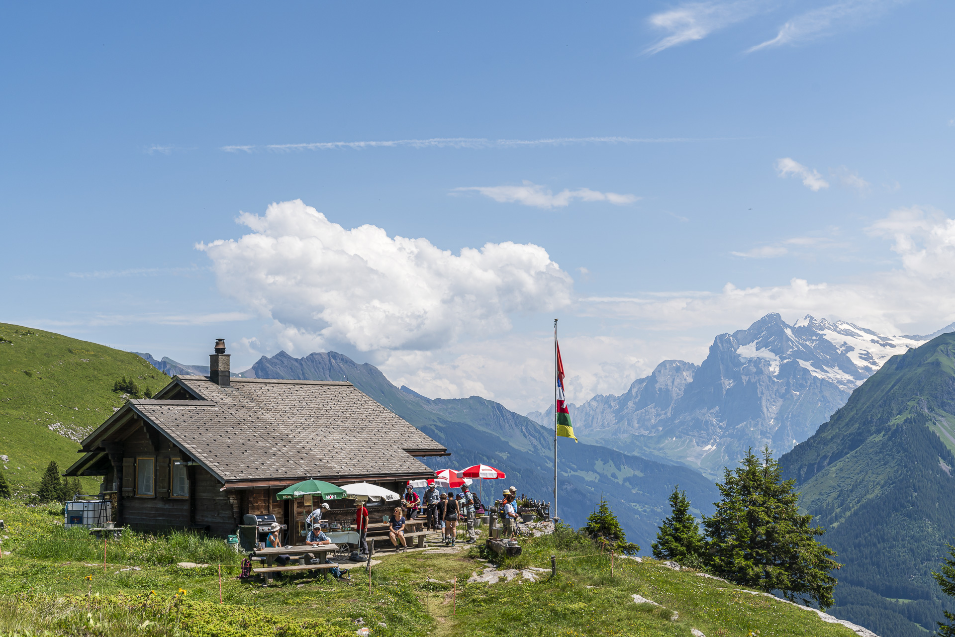
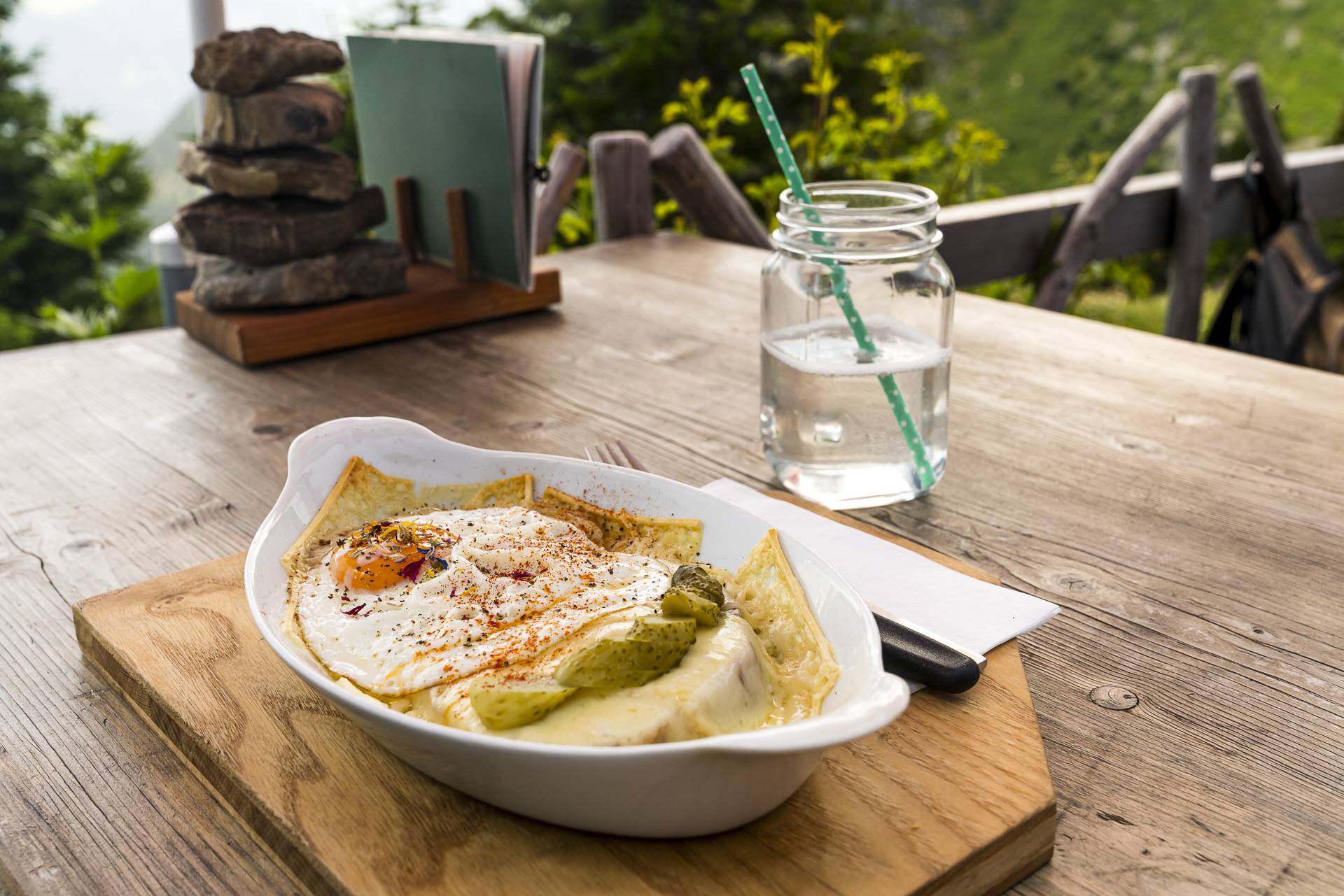
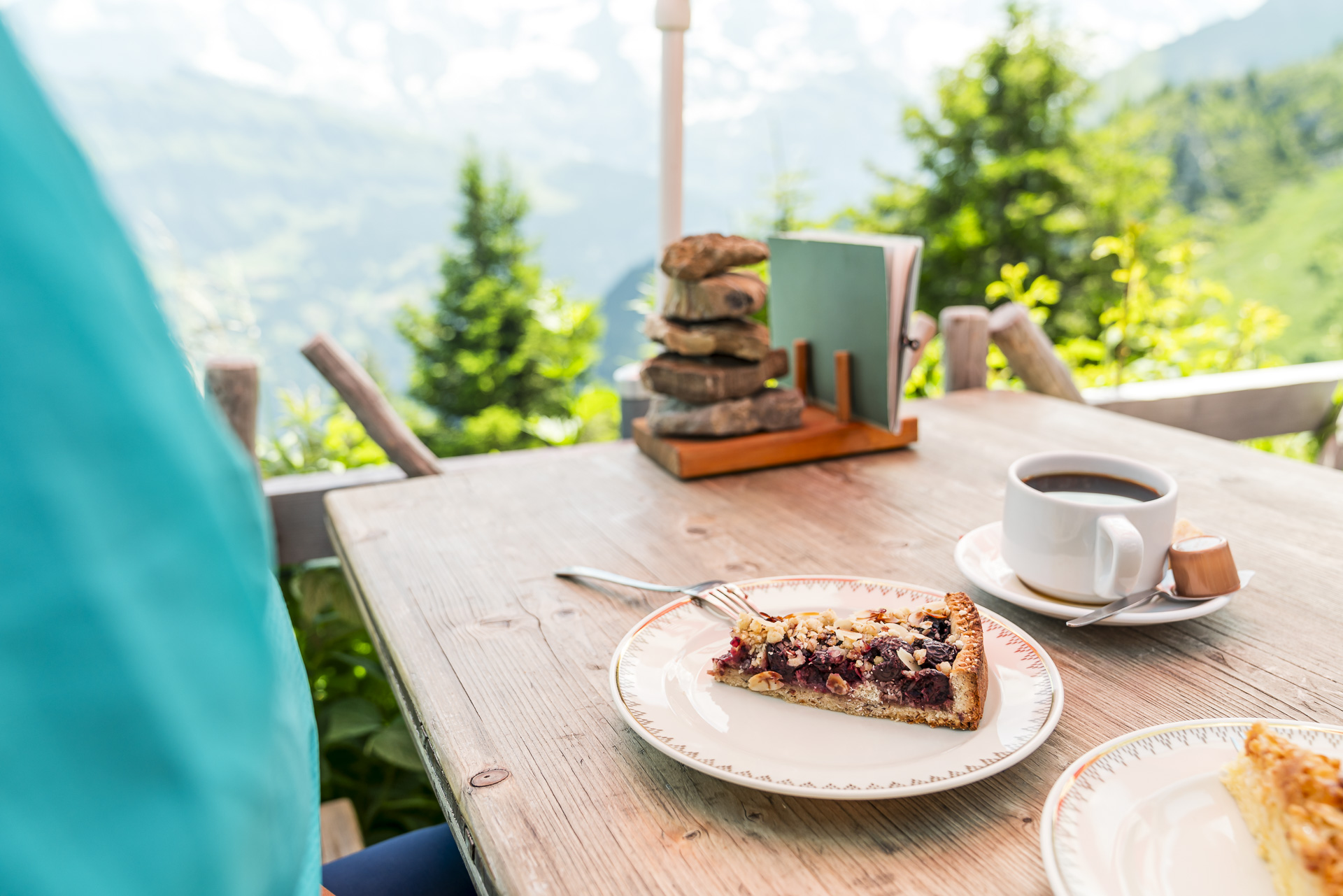
Thanks to its scenic location, this hut is also a popular hiking destination from Isenfluh, so the sun terrace is quite full. We’re lucky and snag one of the coveted tables with an unobstructed view of the alpine panorama.
Scenic Descent to Sulwald
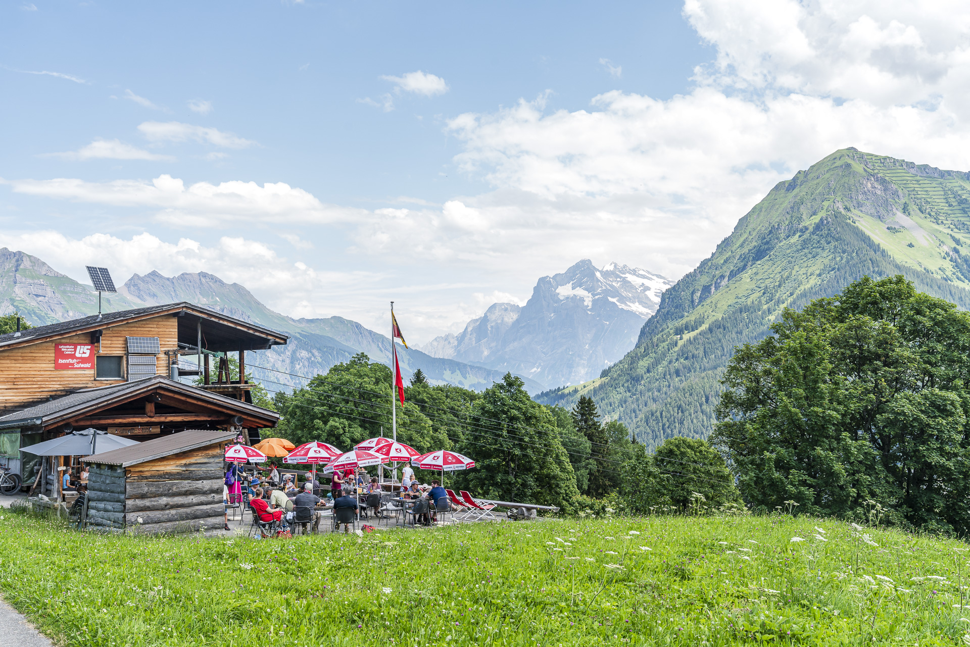
After a delicious Käseschnitte and a piece of cake (both excellent, no doubt!), we begin the descent towards Sulwald/Isenfluh. There are more people on the trails here than on the opposite side. Understandably so—the section from the Lobhornhütte to Sulwald is just as scenic as the route we’ve already completed. And thanks to the varied path of the mountain trail, the descent is surprisingly engaging. After about 45 minutes, we reach the Sulwaldstübli.
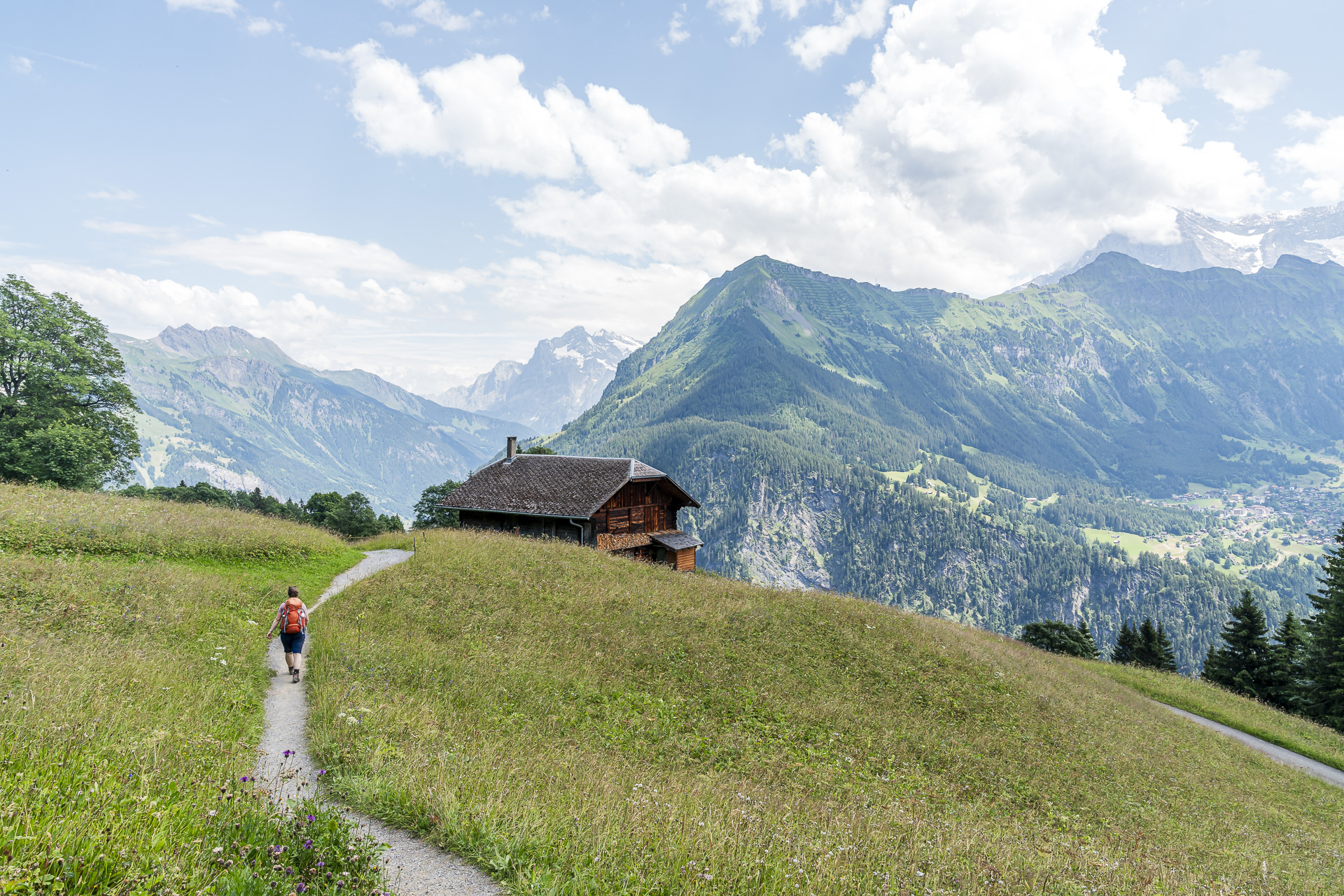
Before taking the cable car and PostAuto down to the Lauterbrunnen Valley, we treat ourselves to another refreshment here to conclude the hike. You might find yourself staying a bit longer—the deck chairs are just too temptingly placed. As you can see, the 13th stage of the ViaBerna has quite a few aces up its sleeve.
Key Data for the Hike Saxeten – Lobhornhütte – Suldwald – Isenfluh
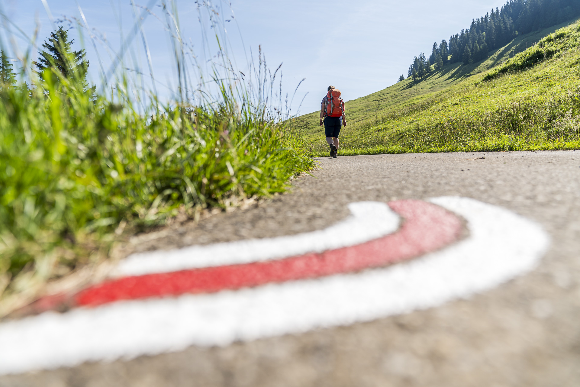
Using the hiking map below, you can trace the route of the 13th stage of the ViaBerna from Saxeten via Lobhornhütte and Sulwald to Isenfluh. The trail is consistently marked in white-red-white as a mountain trail (T2/T3). There are some more exposed sections during the ascent between Schlipfwengen and Bällenalp. However, the trail is well secured and in “good condition” throughout (some steps are a bit high). The passage through the Tschingel rock basin is also more exposed. But even here, we were positively impressed by the excellent trail maintenance.
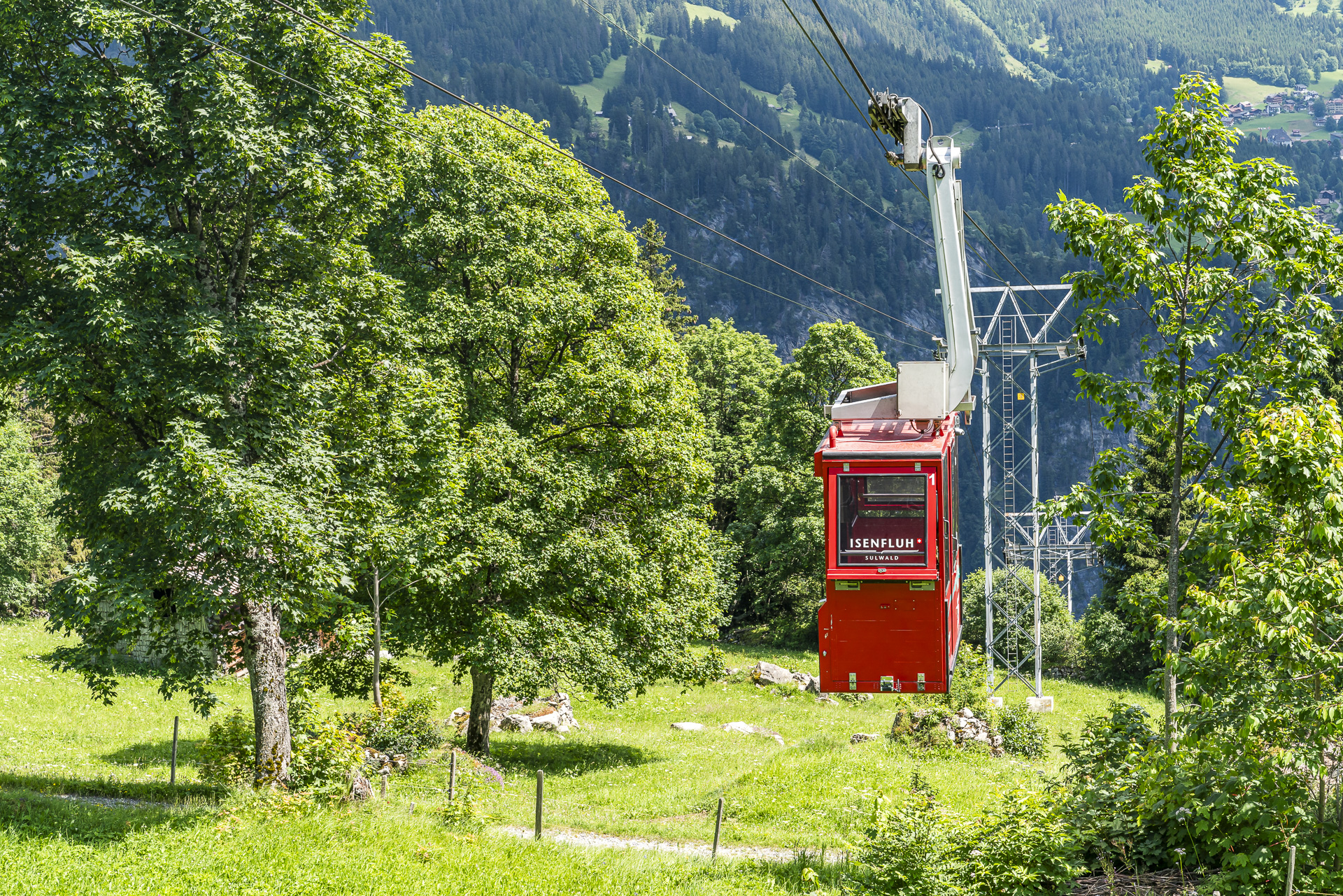
To save altitude and protect your knees, you can take the cable car down to Isenfluh at Sulwald. With this shortcut, the hiking distance is reduced from 13 to 11 kilometers. Additionally, you save a considerable 440 meters in altitude compared to the full route. We needed just under 4 hours of walking time for the shortened version.
| Starting Point | PostAuto Stop Saxeten, Schulhaus (1,102 m above sea level) |
| Accessibility | Start and end points accessible by public transport |
| Distance | 13.25 kilometers |
| Altitude Gain | ↗ 1,052 m ↘ 1,077 m |
| Duration | 5:20 h |
| End Point | PostAuto Stop Isenfluh, Village (1,100 m above sea level) |
| Refreshments | Lobhornhütte, Restaurant Sulwald Stübli |
If you prefer shorter hikes with less altitude gain, I recommend an alternative out-and-back hike from Sulwald to the Lobhornhütte. The ascent from Sulwald (cable car station) to the Lobhornhütte takes about 1.5 hours (2.8 kilometers, 450 meters uphill). Round-trip walking time is about 2 hours and 15 minutes (pure walking time).
Practical Tips for Your Hike on ViaBerna Stage 13
- The PostAuto line 111 from Wilderswil to Saxeten runs daily. In the morning, there are three departures—so it’s advisable to check the timetable when planning your hike to avoid a long wait in Wilderswil. Also, seating is limited as the route is served by a minibus (for groups of 5 or more, a reservation is required). According to the PostAuto driver, if demand is high, the route may be served twice in a row. This can occasionally lead to waiting times. For more information, click here: Saxeten Line
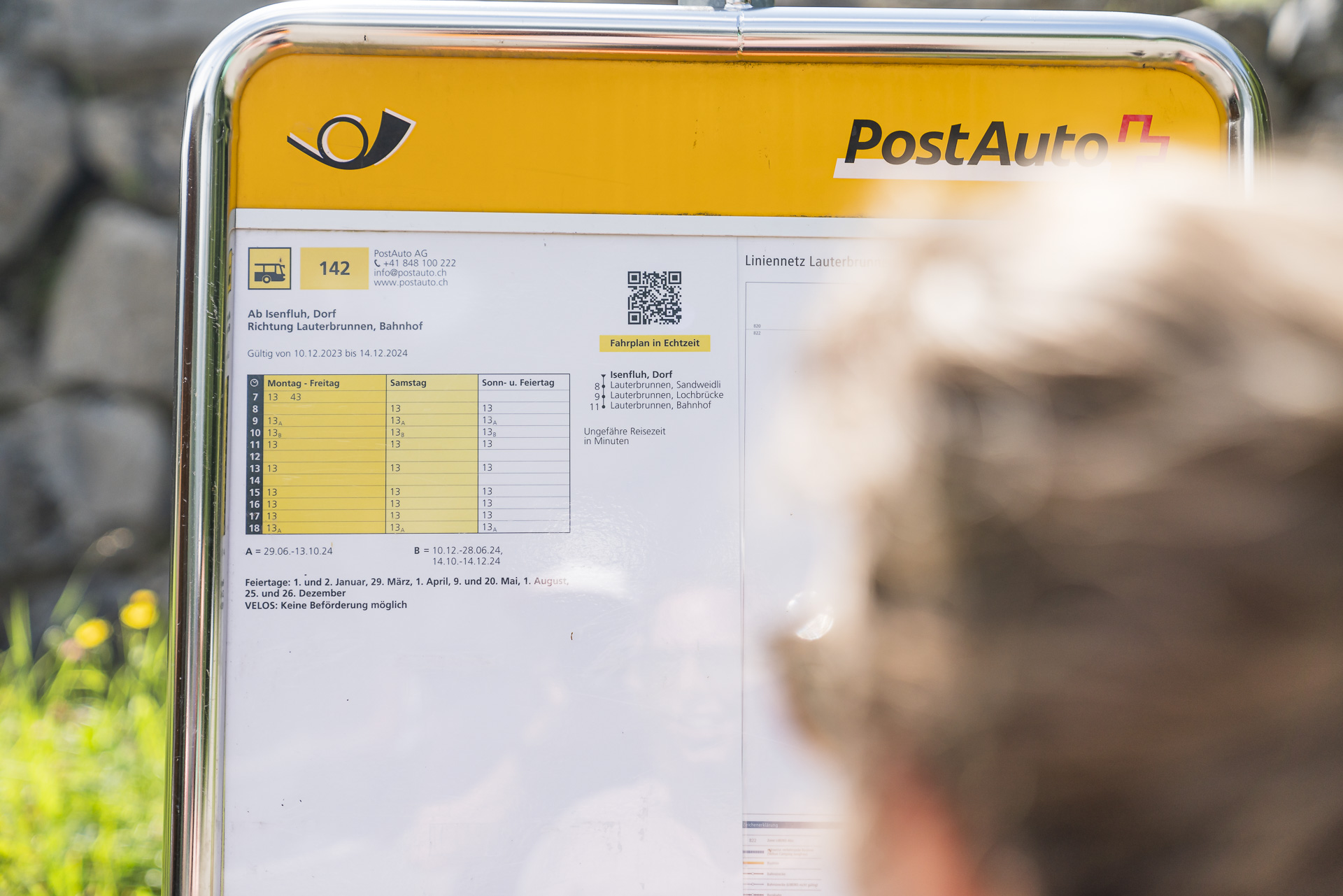
- The winding route from Isenfluh down to Lauterbrunnen is also served by a minibus. This route runs daily as well. In the afternoon, there are five departures in total. Note that there is no PostAuto service between 13:35 and 15:35. This means either aiming for an early start in Saxeten or taking the tour at a leisurely pace. For more information, click here: Isenfluh Line
- This year, the hiking route Saxeten-Isenfluh was only passable from the beginning of July. A hike on this route was not recommended before then. Depending on snow conditions, a tour can be considered from mid-June to the end of October. Current information can be found, among others, on the Lobhornhütte website.
- The Lobhornhütte is open and staffed continuously from June to mid/end of October. The Sulwaldstübli at the top station of the Isenfluh-Sulwald cable car is also open every day during the summer season from early July to mid-October from 09:00 to 18:00. Before that (May/June), it is closed on Wednesdays. The same applies in the week from October 13 to 20.
- The Isenfluh-Sulwald cable car operates daily from 07:00 to 18:15 (every 15 minutes). The small gondola can accommodate eight people. A single ride costs 10 CHF for adults. GA and Half-Fare cards are not valid.
- Extra tip: At the base station of the Isenfluh-Sulwald cable car, you can rent monster scooters on weekends (from Saturday at 13:00) and on public holidays. After a ride up to Sulwald, you can enjoy a thrilling 20-minute scooter ride down a well-maintained forest path back to Isenfluh. Information on rental prices for the scooters can also be found on the Isenfluh-Sulwald cable car website.
Leave a Reply