

9 beautiful hikes to castles and palaces
When the first days of autumn arrive, the leaves turn colorful and the air becomes clear and fresh, one of my favorite hiking times begins. It becomes particularly magical when you follow in the footsteps of queens and kings, knights and noblewomen. In this article I will introduce you to a selection of varied hikes to palaces and castles that I have explored in recent years. Of course, as usual, there is a map and the most important key data for every hike.
Autumn hike in the Seetal: From Hallwilersee to Heidegg Castle
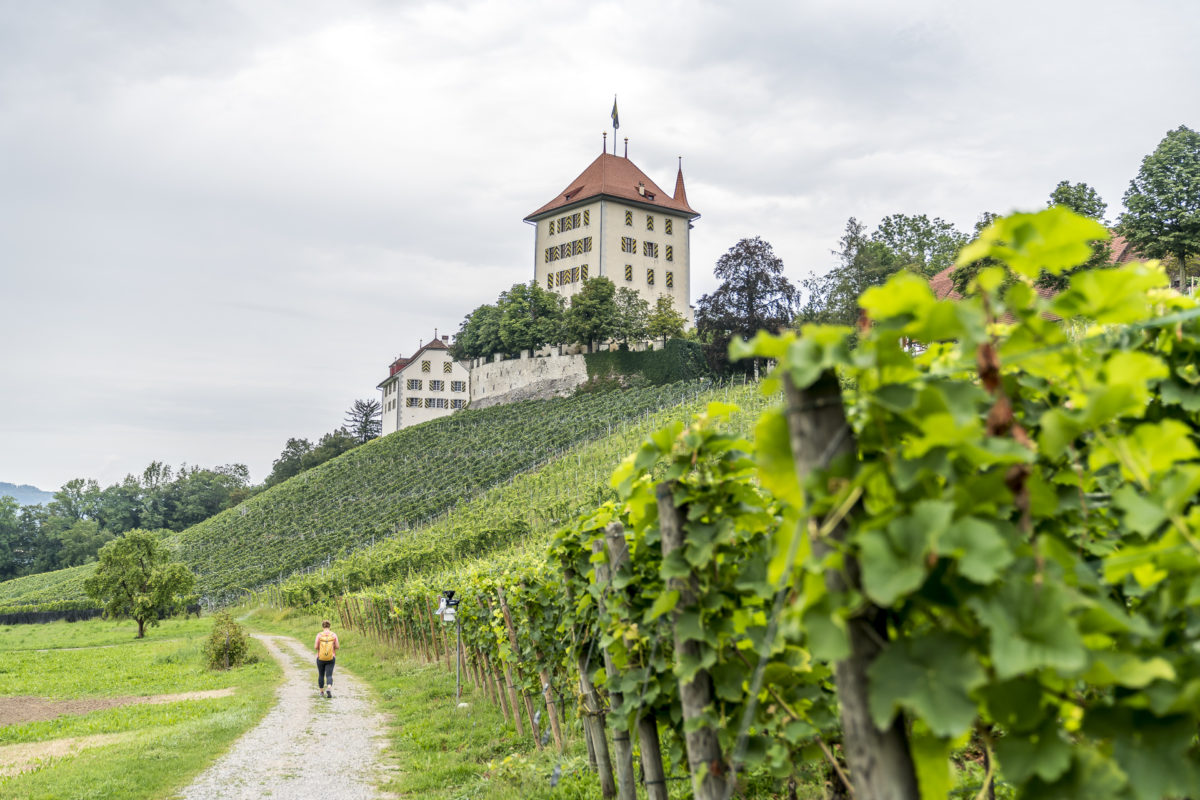
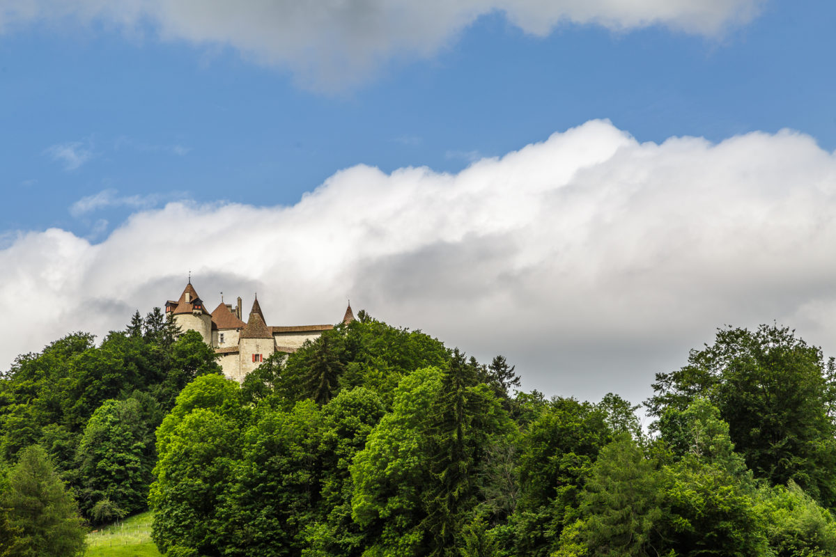
On the hike from Hallwilersee to Heidegg Castle you will discover the Seetal from its most beautiful side. The route takes you through idyllic landscapes, past grape vines and always offers beautiful views of Lake Hallwil. The sight of Heidegg Castle, which sits majestically on a hill and is surrounded by a magnificent rose garden, is particularly impressive. The castle museum and the associated museum café are open from Tuesday to Sunday from the beginning of April to the end of October. In autumn it is also worth stopping off at one of the wineries along the way.
Key information about the hike from Hallwil Lake to Heidegg Castle
| Starting point | Mosen (450 m above sea level) |
| Length | 10.53 kilometers |
| Elevation meters | ↗ 285 m ↘ 276 m |
| Duration | 4:30 h |
| Destination | Gelfingen (475 m above sea level) |
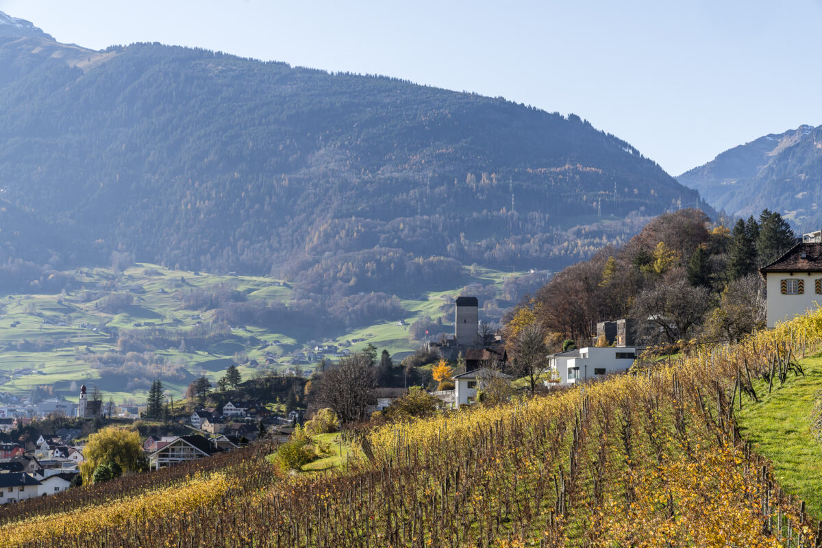
Castle path through the Rhine Valley: From Werdenberg to Sargans
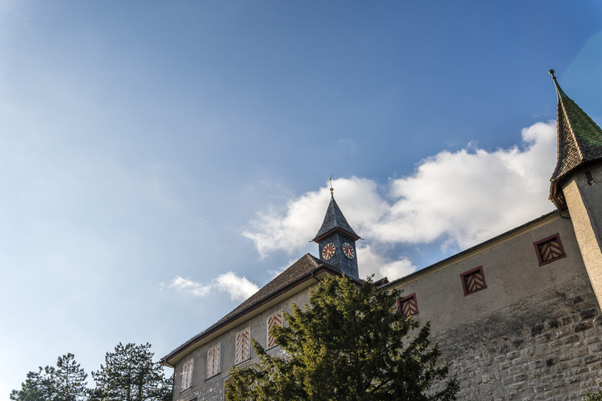
On the Schlossweg from Werdenberg to Sargans you go on a journey through time through the Rhine Valley. Your starting point is the picturesque Werdenberg near Buchs, where the medieval castle and the historic town are guaranteed to captivate you. Afterwards, an entertaining route awaits you with wonderful passages through colorful forests. The destination: The castle, which stands proudly above Sargans and offers you a fantastic view over the Sarganserland. An all-round perfect combination of culture, history and nature.
Key information about the hike from Werdenberg Castle to Sargans Castle
| Starting point | Bus stop Buchs SG, Werdenberg (445 m above sea level) |
| Length | 18.4 kilometers |
| Elevation meters | ↗ 633 m ↘ 602 m |
| Duration | 5:00 h |
| Destination | Sargans train station (480 m above sea level) |
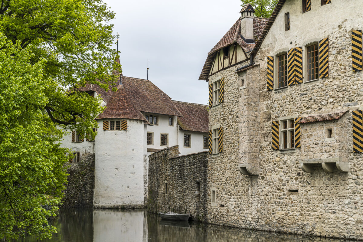
Easy hike at Hallwyl moated castle
The hike from Boniswil to Lake Hallwilersee is the perfect excursion for a few relaxing hours in the fresh air. From Boniswil train station, follow the signs to the impressive Hallwyl moated castle. From there we continue along the lake to Meisterschwanden. This almost 8 kilometer long path offers beautiful views of Lake Hallwil and the Central Swiss Alps. The route is mostly flat and easy to manage, making it an ideal hike for families and less experienced hikers.
Key details of the hike Boniswil – Hallwyl – Meisterschwanden
| Starting point | Boniswil train station (480 m above sea level) |
| Accessibility | reachable by public transport |
| Length | 7.6 kilometers |
| Elevation meters | ↗ 65 m ↘ 95 m |
| Duration | 1:50 h |
| Destination | Meisterschwanden, water lily (450 m above sea level) |
Chemin du Gruyère: Start at Gruyères Castle
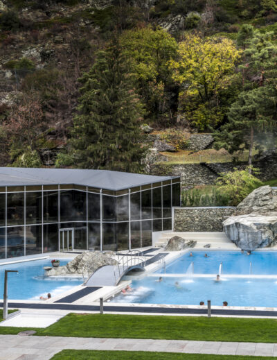
The Chemin du Gruyère is an enjoyable themed hike that takes you from the picturesque Freiburg town of Gruyère to Charmey. You hike through a picture-perfect landscape and roam the wild gorge of the Jaunbach. Along the way, you’ll have the opportunity to sample local delicacies such as the famous Gruyère cheese or a traditional fondue. After the hike you can relax at Les Bains de la Gruyère in Charmey. If that’s not a reason to go hiking even in foggy autumn weather!
Key information about the Chemin du Gruyère
| Starting point | Gruyères (830 m above sea level) |
| Accessibility | reachable by public transport |
| Length | 12.08 kilometers |
| Elevation meters | ↗ 530 m ↘ 394 m |
| Duration | 3:45 h |
| Destination | Charmey (Gruyère), village (880 m above sea level) |
Kyburg Castle: Hike through the Tätschtobel to Illnau
The hike from Sennhof-Kyburg train station to Kyburg Castle and through the romantic Tätschtobel to Illnau takes you with you a bit of luck not only over the thick Zurich high fog, but also gives you the opportunity to immerse yourself in the over 1000-year history of the Kyburg. From the Sennhof-Kyburg train station in the Leisental, you first go up a steep 150 meters to the Kyburg. Once the altitude difference has been overcome on the way to the cultural asset of national importance, the route continues along field and forest paths through the tranquil hilly landscape of the Winterthur region and the surrounding area.
Key information about the hike through the Tätschtobel
| Starting point | Sennhof-Kyburg train station (480 m above sea level) |
| Accessibility | reachable by public transport |
| Length | 10.9 kilometers |
| Elevation meters | ↗ 285 m ↘ 255 m |
| Duration | 2:45 h |
| Destination | Illnau train station (520 m above sea level) |
| Refreshment tip | Restaurant First |
Hike from Thun Castle to Oberhofen Castle
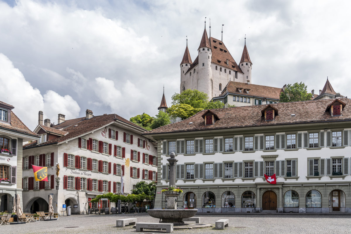
The starting point of this easy hike (which has the character of a Sunday walk) is Thun train station. From here we make our way through the lively old town. The narrow streets, listed buildings and cozy cafés give Thun a special charm. If you like, you can climb the steps from the Obere Hauptgasse to Thun Castle. We then follow the signpost along the Aarequai towards Oberhofen. Oberhofen Castle is not only a romantic photo subject, but also one of the most beautiful gardens in the Bernese Oberland. You can return either by boat or bus.
Key information about the hike from Thun Castle to Oberhofen Castle
| Starting point | Thun train station (560 m above sea level) |
| Accessibility | reachable by public transport |
| Length | 6.66 kilometers |
| Elevation meters | ↗ 123 m ↘ 121 m |
| Duration | 1:45 h |
| Destination | Oberhofen Castle (560 m above sea level) |
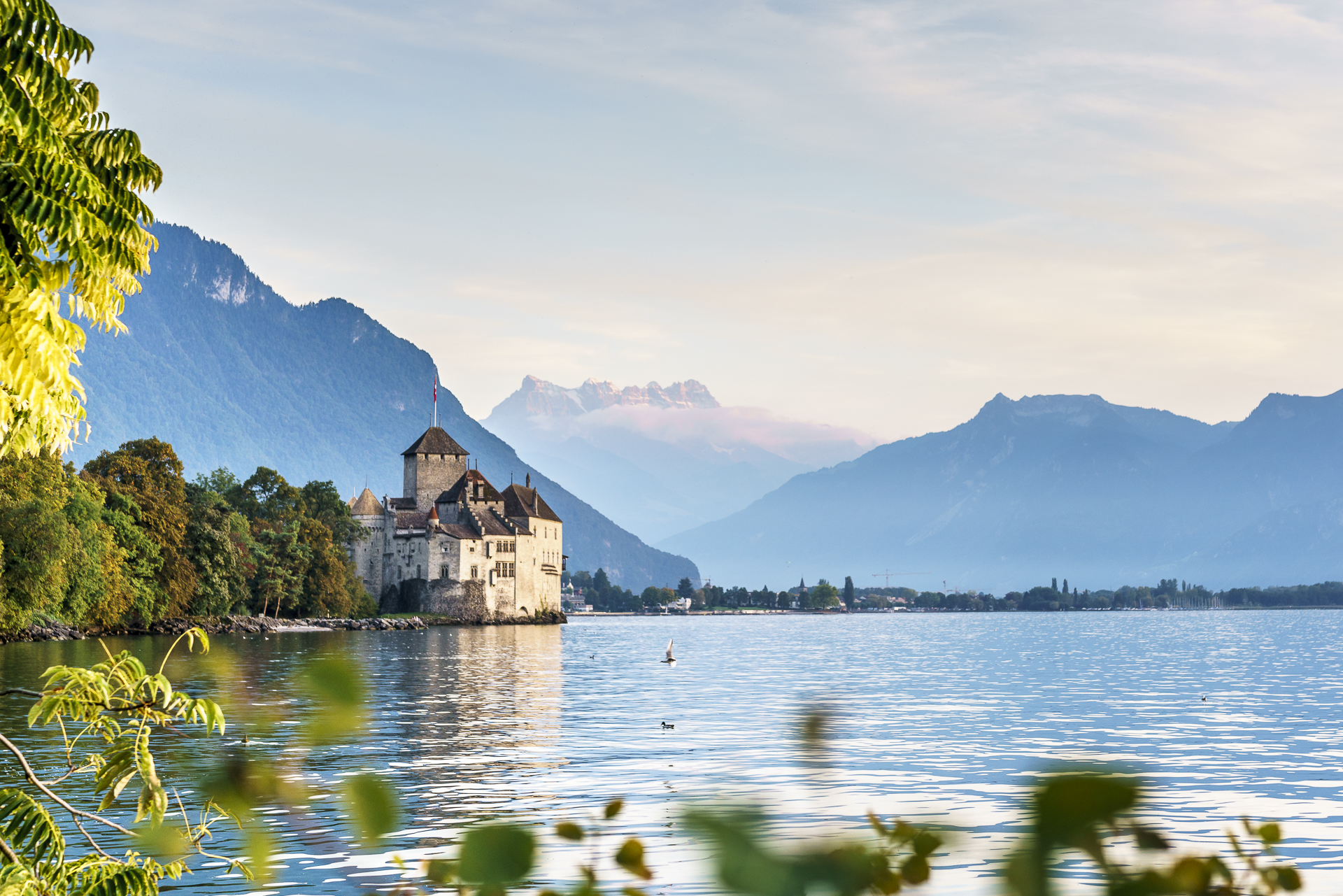
Past Chillon Castle from Montreux to Villeneuve
The hallmark of this flat hike? Spectacular views of Lake Geneva. The tour starts at Montreux train station and from there follows the Promenade de Montreux Riviera to Villeneuve at the southern end of Lake Geneva. A highlight of the hike is undoubtedly the world-famous Chillon Castle. It’s worth taking a long break here and visiting the jewel. Everything you need to know to plan your visit can be found on Chillon Castle’s official website . Then we continue comfortably to Villeneuve within sight of the shore.

Key information about the hike from Montreux to Villeneuve
| Starting point | Montreux (400 m above sea level) |
| Accessibility | reachable by public transport |
| Length | 5.98 kilometers |
| Elevation meters | ↗ 27 m ↘ 43 m |
| Duration | 1:30 h |
| Destination | Villeneuve VD (375 m above sea level) |
Through the Val Mingèr to Tarasp Castle
The hike through the Val Mingèr in the Swiss National Park leads through untouched nature and ends with an impressive view of Tarasp Castle. The tour begins at the Scuol post bus stop, Val Mingèr, leads through the wild and romantic forest uphill to Alp Mingèr and on to the “Sur il Foss” pass. The spectacular panorama of Val Plavna opens up here. After a refreshing break in the charming Alp Plavna shepherd’s pub, we head down the valley, past the Funtana da Suolper spring, until the majestic Tarasp Castle finally comes into view. If you are interested in a castle tour, it is best to consult the relevant in advance Website.

Key information about the hike from Val Mingèr to Tarasp Castle
| Starting point | Scuol, Val Mingèr (1,650 m above sea level) |
| Accessibility | reachable by public transport |
| Length | 16.25 kilometers |
| Elevation meters | ↗ 724 m ↘ 974 m |
| Duration | 5:00 h |
| Destination | Tarasp, Fontana (1,400 m above sea level) |
Hiking from castle to castle in Aargau
The Hike from the Habsburg to Wildegg Castle leads along varied paths to places steeped in history in the middle of the Aargau region Cultural landscape. The excursion starts at Brugg train station. There you follow the signposted Aargauer Weg through the Raiwald to the Habsburg ancestral castle. Then we continue via Schinznach Bad to the baroque jewel Wildegg Castle. A special highlight of this route is the colorful autumn forest, which bathes the castles in a particularly atmospheric light.

Key information about the hike from Brugg AG to Wildegg Castle
| Starting point | Brugg AG (350 m above sea level) |
| Accessibility | reachable by public transport |
| Length | 10.85 kilometers |
| Elevation meters | ↗ 409 m ↘ 407 m |
| Duration | 3:00 h |
| Destination | Wildegg (350 m above sea level) |
Which is your favorite castle? Or do you know of another special castle hike that I should try out soon? I look forward to your tips in the comments!
Leave a Reply