

Flugenspitz: promising snowshoe peak near Amden-Arvenbüel
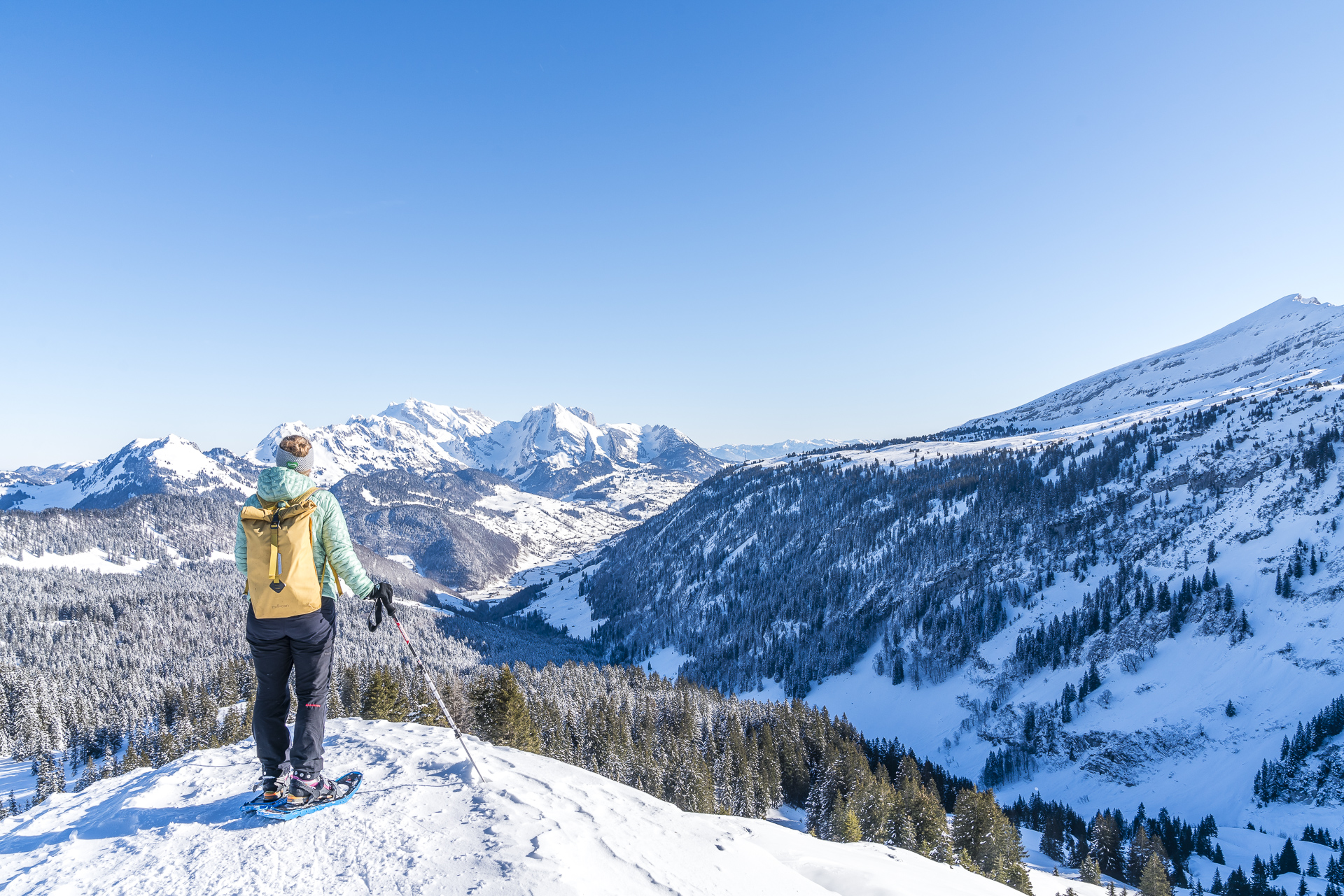
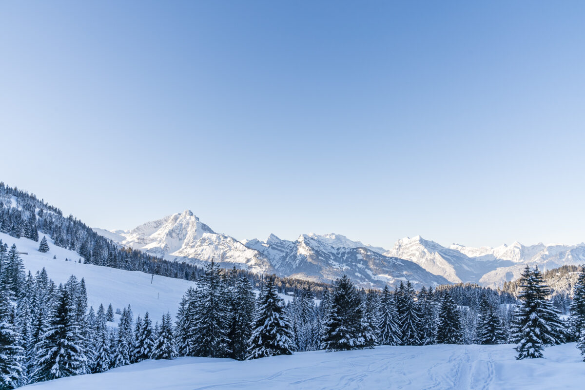
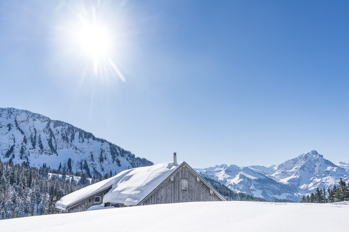
Amden-Arvenbüel, high above Lake Walen, scores not only with a family-friendly ski area, but also with varied marked snowshoe trails and sun-drenched, groomed winter hiking trails. On a beautiful winter’s day, we went on a round trip on the Schwarzenegg Trail including the Flügespitz; the perfect snowshoe hike for all those who don’t want to miss the moment of summit happiness even in winter after a sweaty ascent.
Three snowshoe routes in one fell swoop
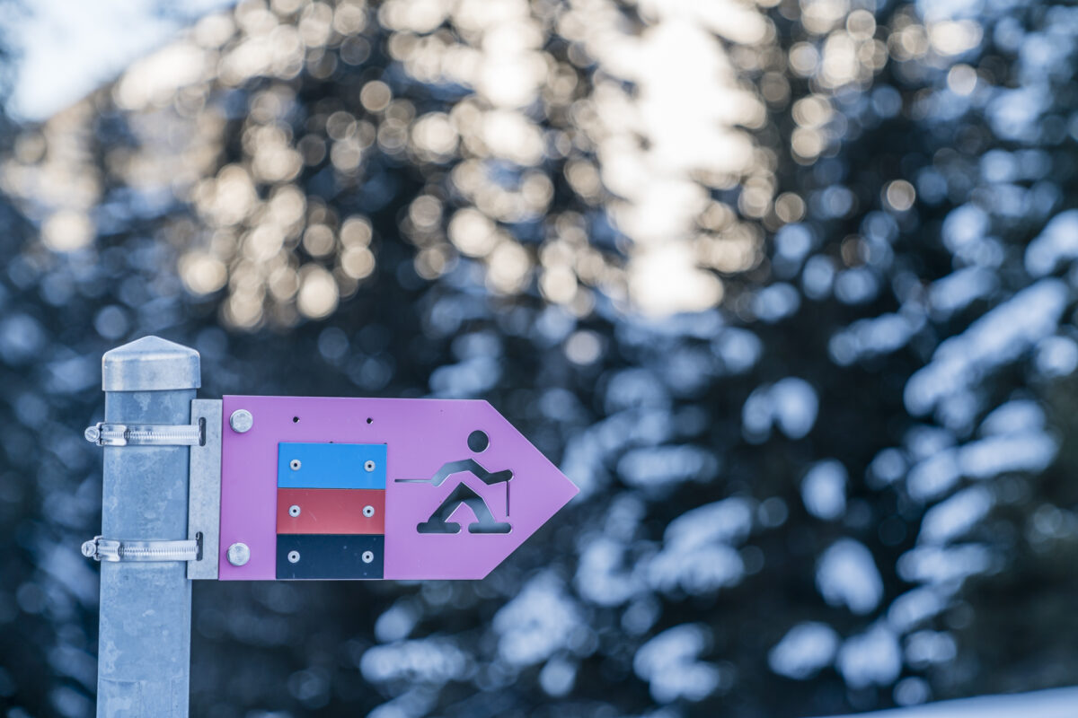
The village center of Arvenbüel is the starting point for three marked snowshoe hikes of varying difficulty, all of which are laid out as circular tours. The Altschen Trail (4.8 kilometers long, 140 meters in altitude) and the Egg-Rör Trail (5 kilometers in length and 260 meters in altitude) are the less demanding options. More challenging is the 8-kilometre-long Schwarzenegg Trail, which, depending on the variant (and snow situation), leads along or around the western flank of the Flügespitze.
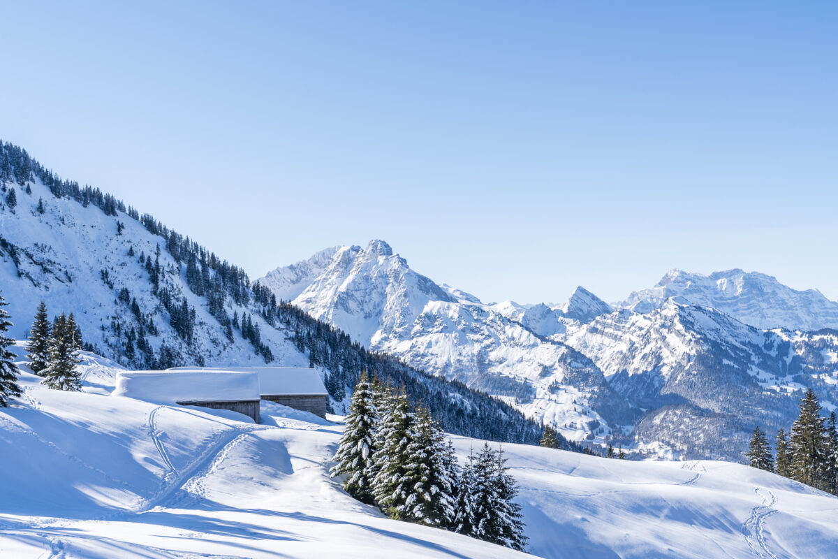
Since the option around the Flugspitz is not recorded on Switzerland Mobil, we had considered the first variant when planning the route. To do this, we follow the road down from the bus stop in the village center on foot into the ravine in the direction of “Schwiland”. Despite the bright blue sky, it is frosty cool down here, and it will take a little patience until the warming rays of the sun will make it over the northern flanks of the Leistchamm.
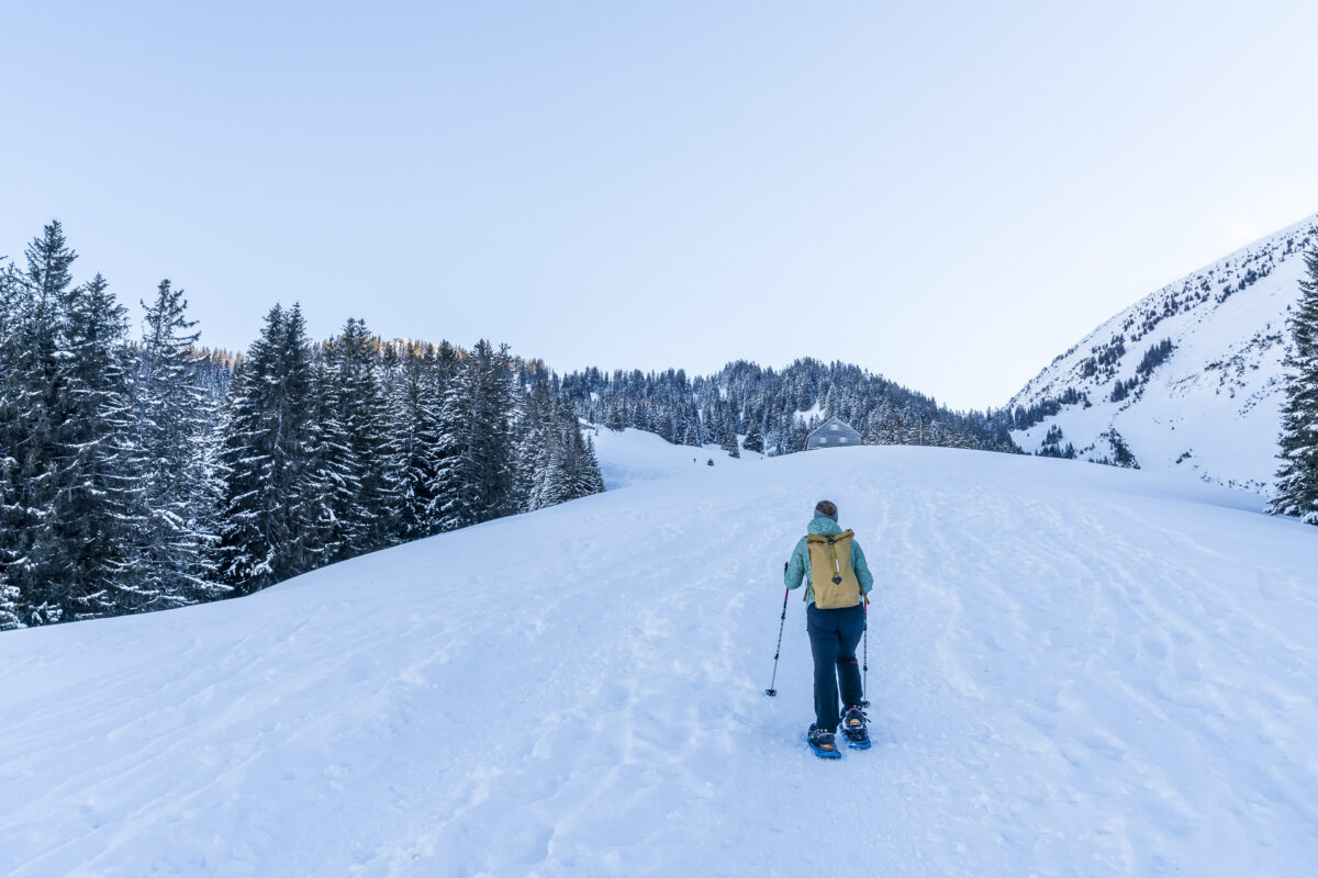
Shortly after the valley station of the two ski lifts, the snowshoe trails are signposted in three colors. Here we put on our snowshoes and start the ascent via Egg to Looch. Despite the icy temperatures, we get warm quickly.

Detour to the Flugspitz
In contrast to other snowshoe trails, the markings and signposts here in Arvenbüel are rather sparse. Luckily, the tracks in the snow show us the way – otherwise I would have to take a look at the GPS more often. However, it is not the lack of signage that leads us astray, but a signpost with the black trail symbol. This leads us uphill to the right at Looch. Somewhat irritated by these additional meters of altitude, I take a look at the map after a good 15 minutes of additional ascent and realize – we are no longer on the Schwarzenegg Trail, but on the direct path towards the Flügespitz.
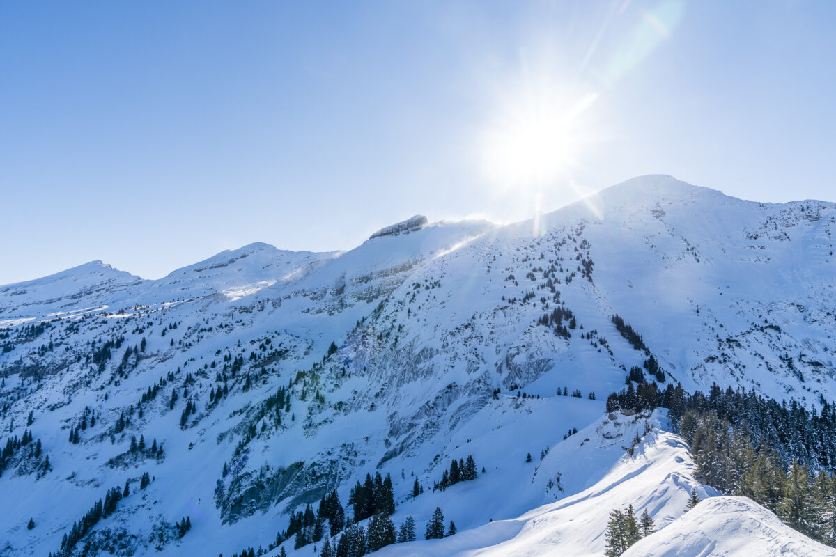
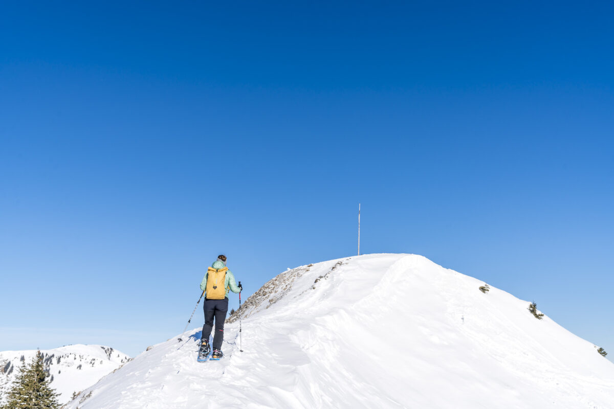
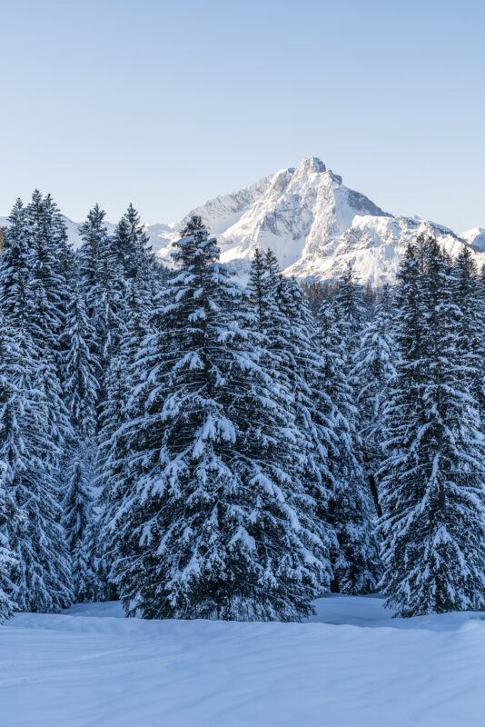
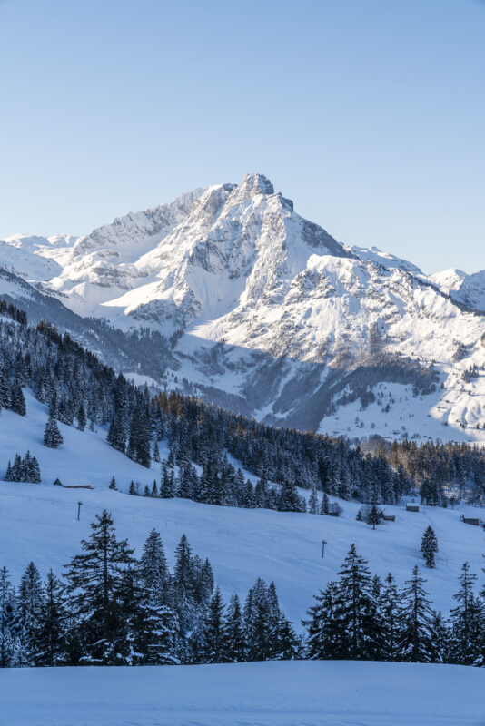
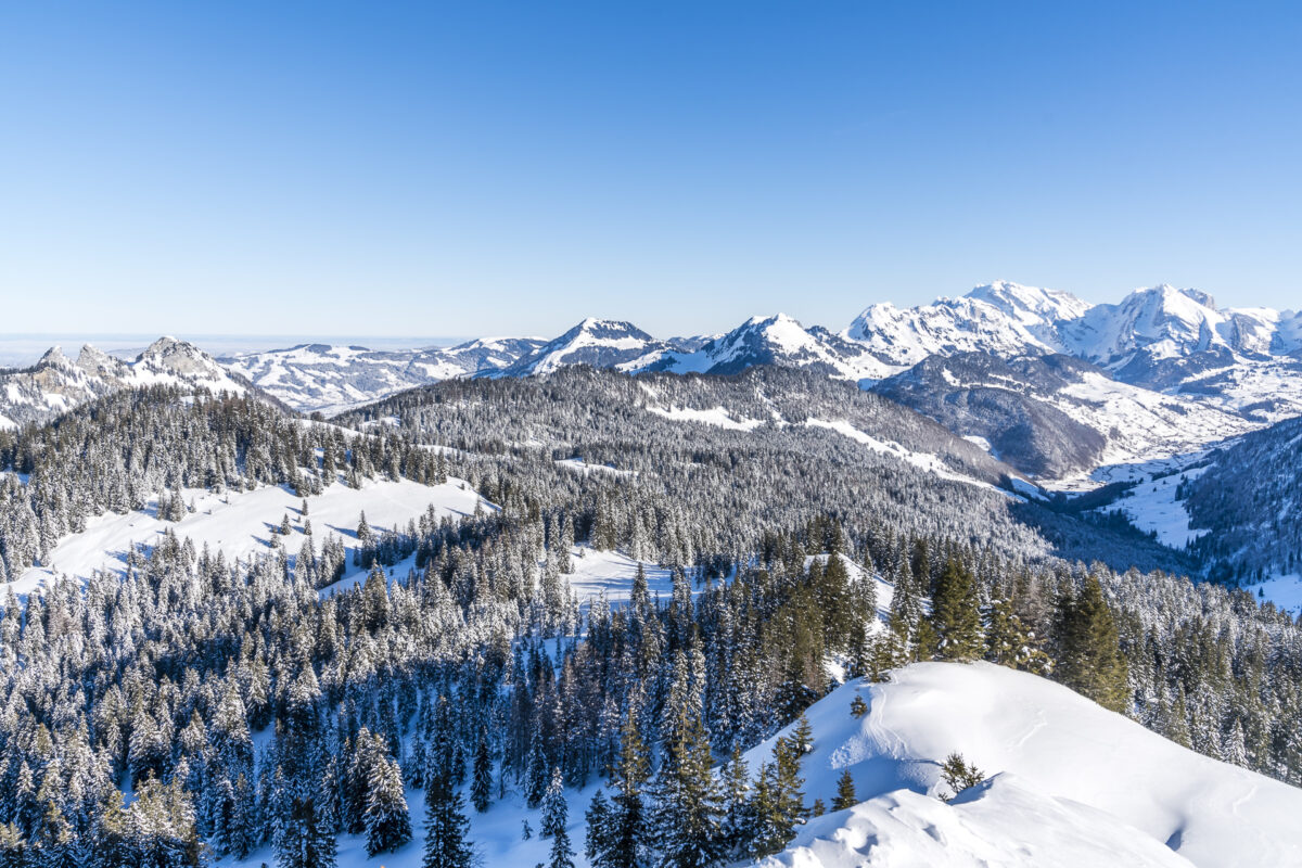
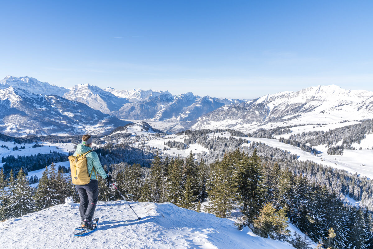
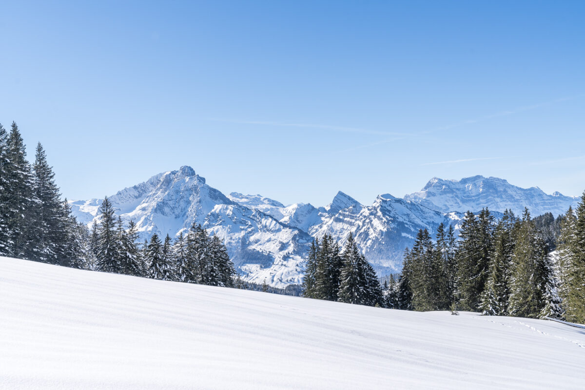
However, the unplanned altitude difference turns out to be a stroke of luck after another 10 minutes. After a short walk over the ridge, we stand on the summit of the Flügespitz and marvel at the 360-degree panorama that stretches from Toggenburg to the Glarus Alps. Splendid! However, this additional loop on the Flugspitz is not completely harmless. At Looch, a sign indicates that the route on the black trail variant should only be used in appropriate snow conditions (consult avalanche bulletin). Otherwise, follow the “red” signpost, which corresponds to the variant of the Vorder Höhi Trail shown on Switzerland Mobil.
On the sunny side, back to Arvenbüel
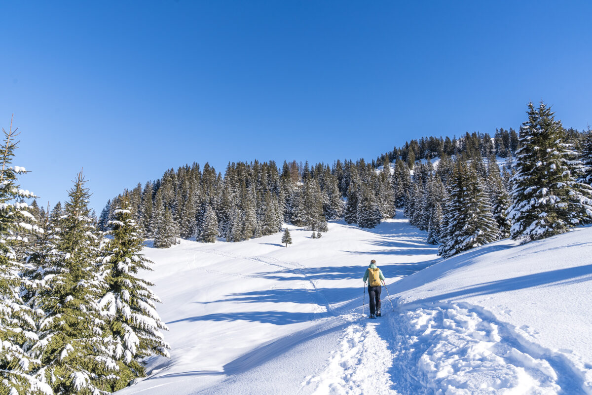
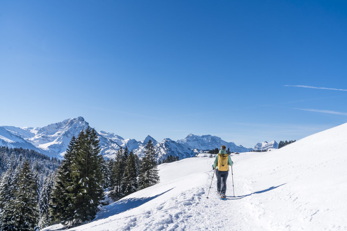
Theoretically, the black trail leads along the eastern flank of the Flügespitz in the direction of Bäregg/Saum to Alp Vorderhöhi (the alpine inn there is currently closed). However, this passage seems a bit tricky to us and so we return from the Flügespitz on the same path back to Looch and follow the red variant of the Vorder Höhi Trail through the forest to the Schiblerwiti viewpoint.
From here it goes in a leisurely up and down via Schwaderloch to the sunny side of Arvenbüel. And while we catch a glimpse of the wonderful mountain panorama here and there between the mighty fir trees on this passage, we trudge back to Arvenbüel on the last section of the trail (which runs parallel to the winter hiking trail) directly towards the Glarus Alps.

Before heading home, we treat ourselves to an extensive break here on this sun-drenched high plateau. I would think we really deserved it after this sporting round.
Practical tips for your snowshoe hike in the Amden-Arvenbüel area
You can see our route on the map below. The Schwarzenegg/Vorder Höhi Trail is signposted with signposts at the start as well as at forks in the road. However, the signs/markings are not always ensured, so it is advisable to take a look at the map (or the GPS track) from time to time. Thanks to the good public transport connections (direct bus from Ziegelbrücke), this snowshoe hike is suitable for travelling by public transport. Arvenbüel is a popular recreation destination in the Zurich agglomeration, and accordingly, the parking lot fills up quickly. If you are on the road early like us, you can avoid the crowd quite well, even on weekends.
The route variant via Flügespitz is suitable for advanced snowshoe hikers. If you don’t have that much experience, you can follow the red markings along the west flank at Looch and do without the steep and selectively exposed ascent to the Flügespitze.
The approximate time for the Schwarzenegg Trail is given as 3:20 h (without extra ascent to the Flügespitz). We needed 3:15 h for the entire round, including the ascent to the Flügespitz and short breaks.
Key data of the snowshoe tour Arvenbüel – Flügespitz
| Starting point | Bus stop Arvenbüel, Arven (1,272 m above sea level) |
| Reachability | Accessible by public transport |
| Length | 9.3 kilometers |
| Elevation gain | ↗ 556 m 556 m ↘ |
| Duration | 3:00 a.m. to 4:00 a.m. |
| Destination | Bus stop Arvenbüel, Arven (1,272 m above sea level) |
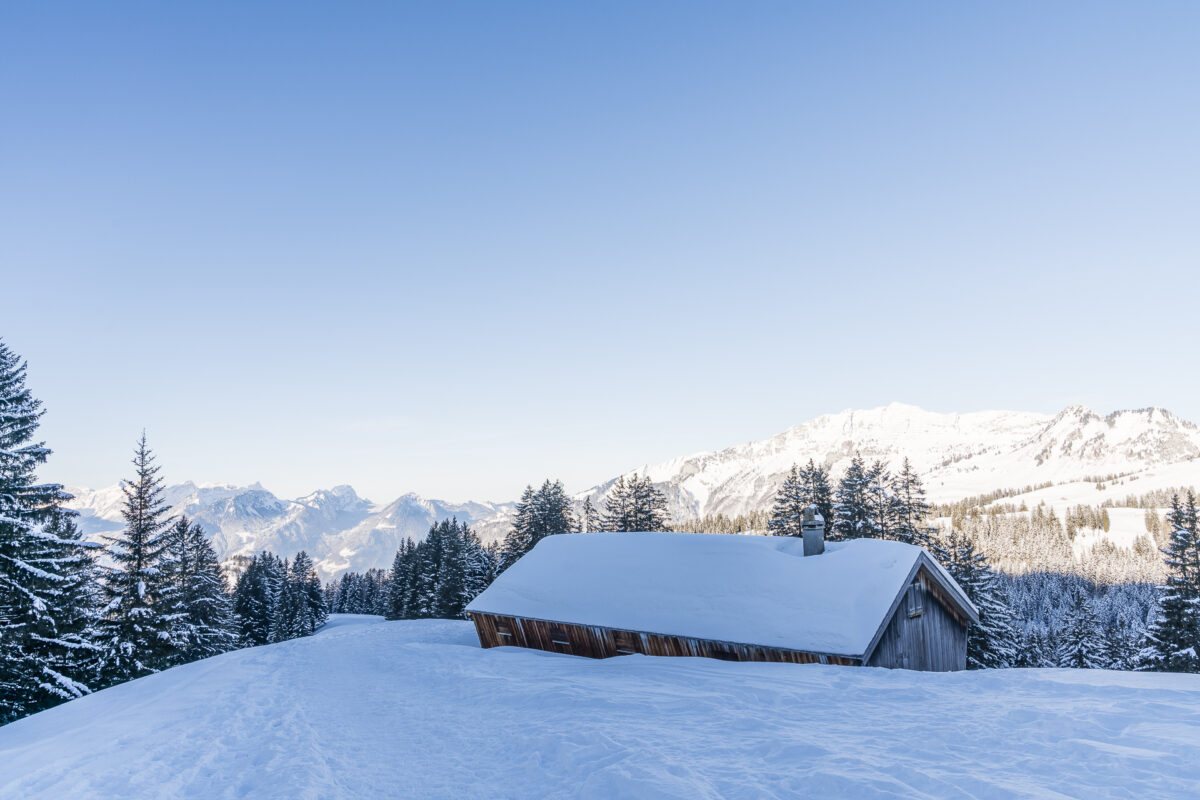
| Catering | Restaurant Monte Mio (on the ski slope Arven above Arvenbüel)(currently with take-away option) |
You can find more tips for beautiful snowshoe hikes in Eastern and Central Switzerland here: Snowshoe hike

Leave a Reply